High in the Thar Desert, where December nights can bite harder than many people expect and daylight burns like a furnace, three silent “kings” move under the radar. They do not follow a star, but satellite tags. They are not bearing gifts, but data. And they are not even human. Mission Magi, a quiet but ambitious conservation effort in India, is reframing an old story of three royal visitors into a very modern tale of three animal commandos testing how life survives at the edge of habitability. In a warming, drying world, these creatures are becoming frontline scouts, showing us what resilience really looks like when rock, heat, and scarcity are the rule, not the exception.
The Hidden Clues: Animals as Desert Commandos
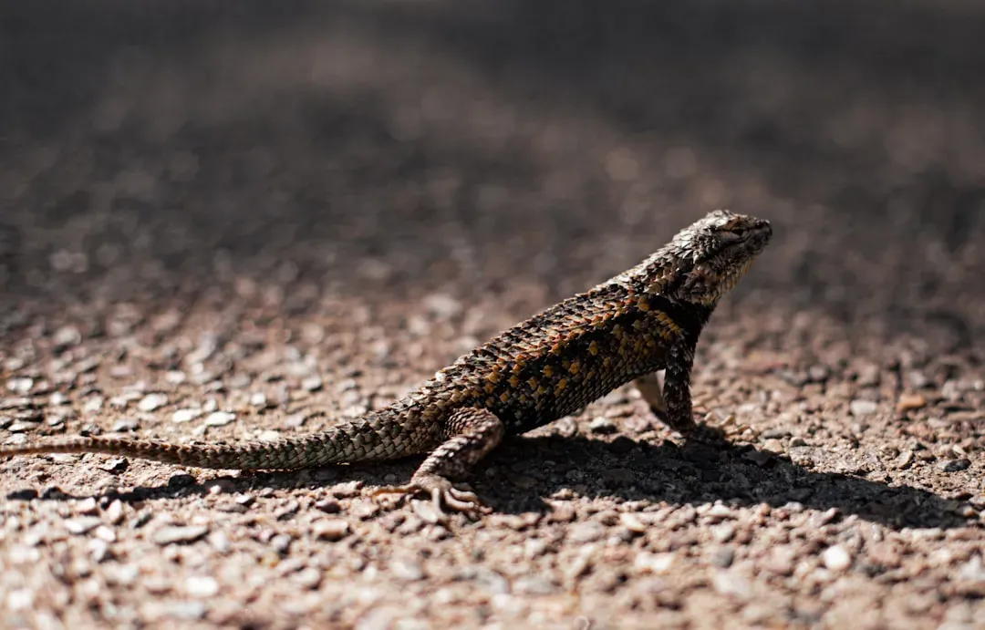
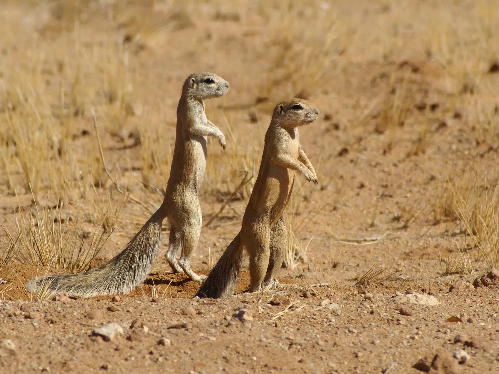
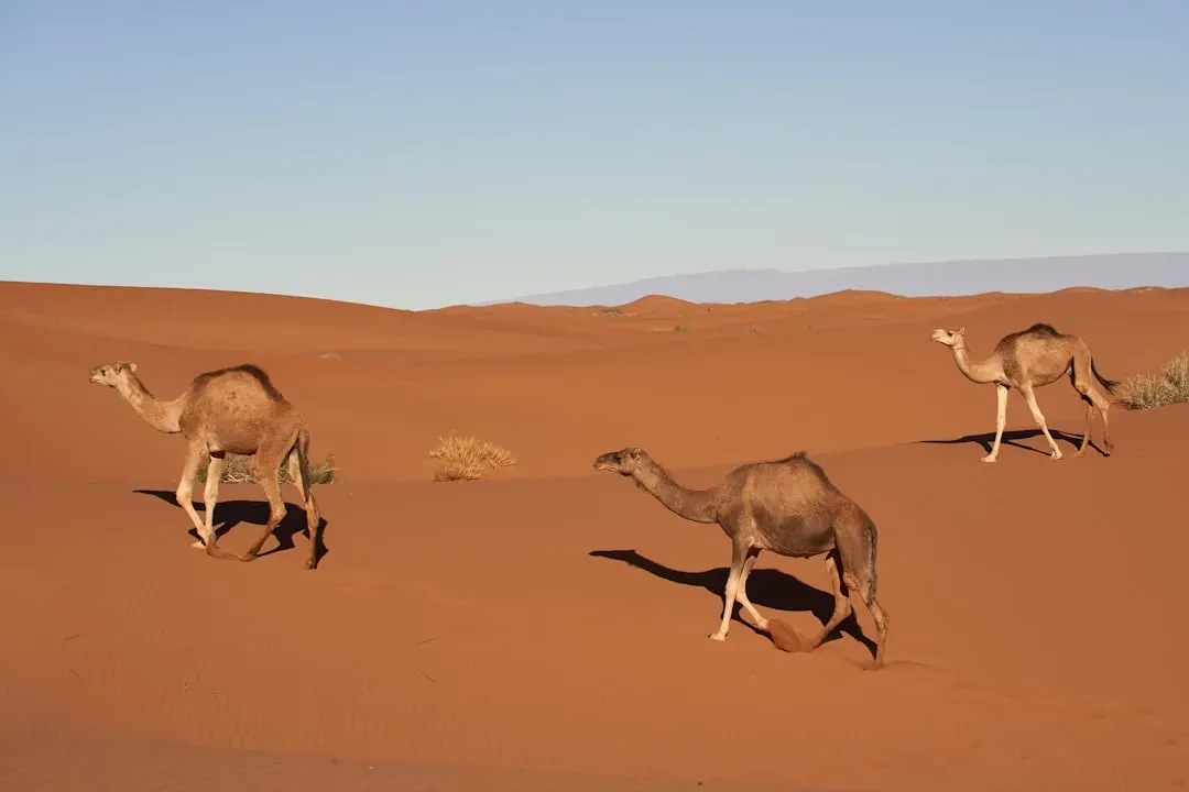
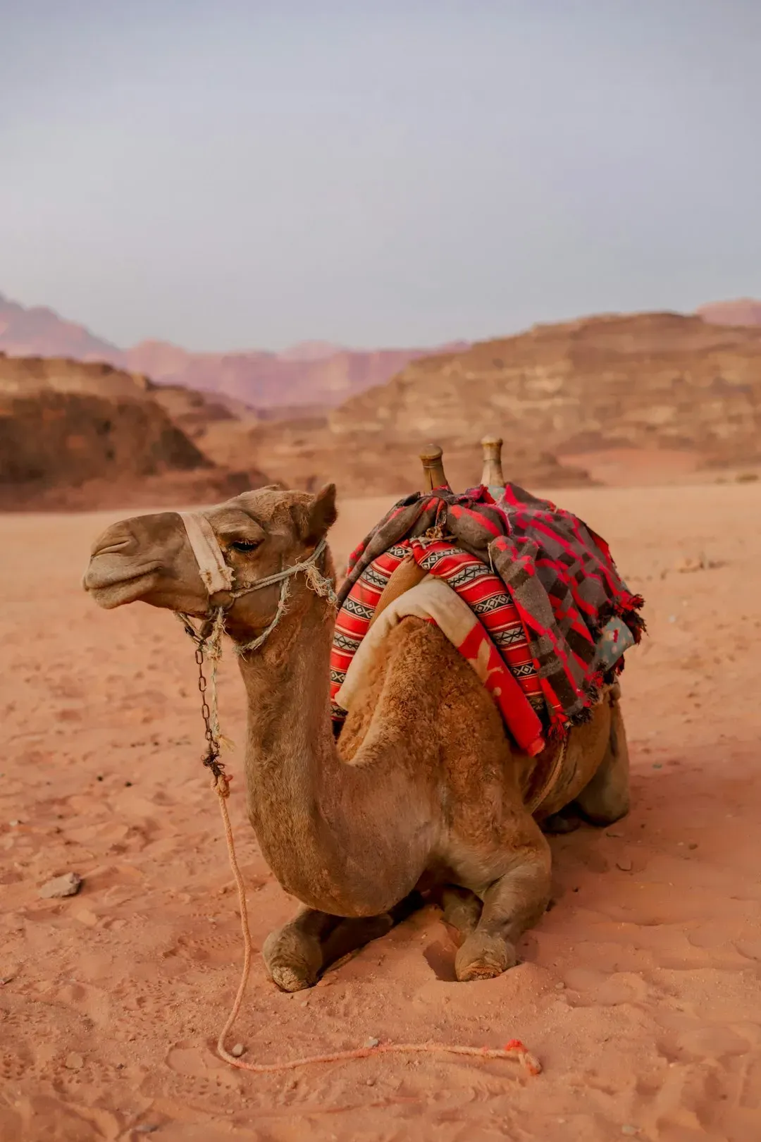
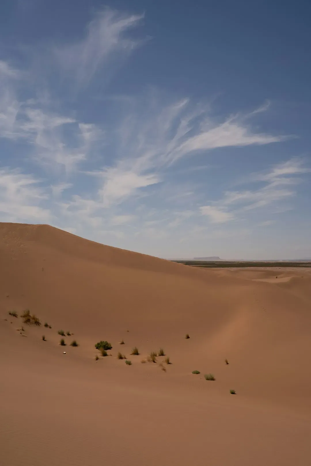
Think of the Thar Desert not as an empty wasteland, but as a live-fire training ground for evolution’s toughest recruits. Mission Magi focuses on three emblematic desert specialists that might as well be commandos: a nocturnal predator, a heat-hardened herbivore, and a ground-dwelling survivor that lives almost at sand level. Each of them carries biological tricks that would sound like science fiction if they were not already proven by physiology labs and field trackers. One can hunt when the air is still hot enough to ripple the horizon, avoiding dehydration with ultra-concentrated urine and precise activity windows. Another extracts moisture from tough shrubs and halts sweating at conditions that would send humans to the emergency room. Together, they are living dossiers on how to function when water is rare, shade is broken, and escape routes are made of dunes and cracked rock.
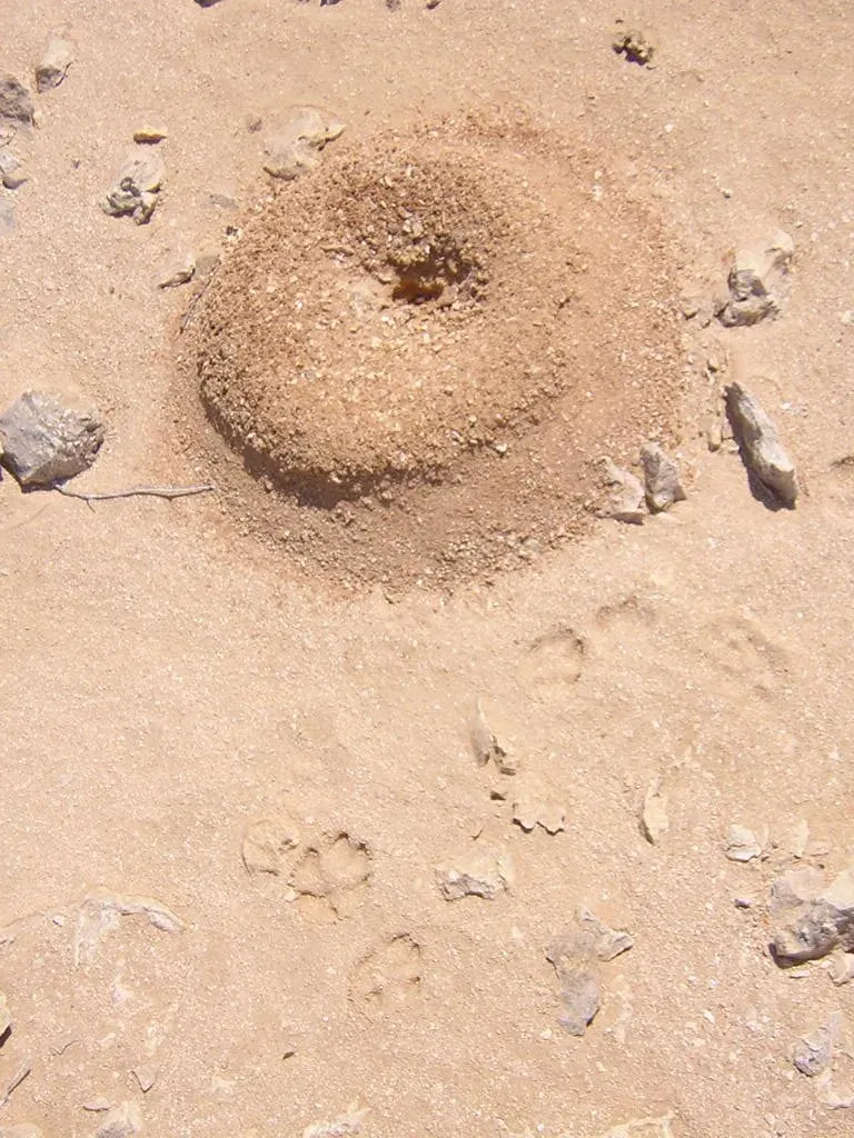
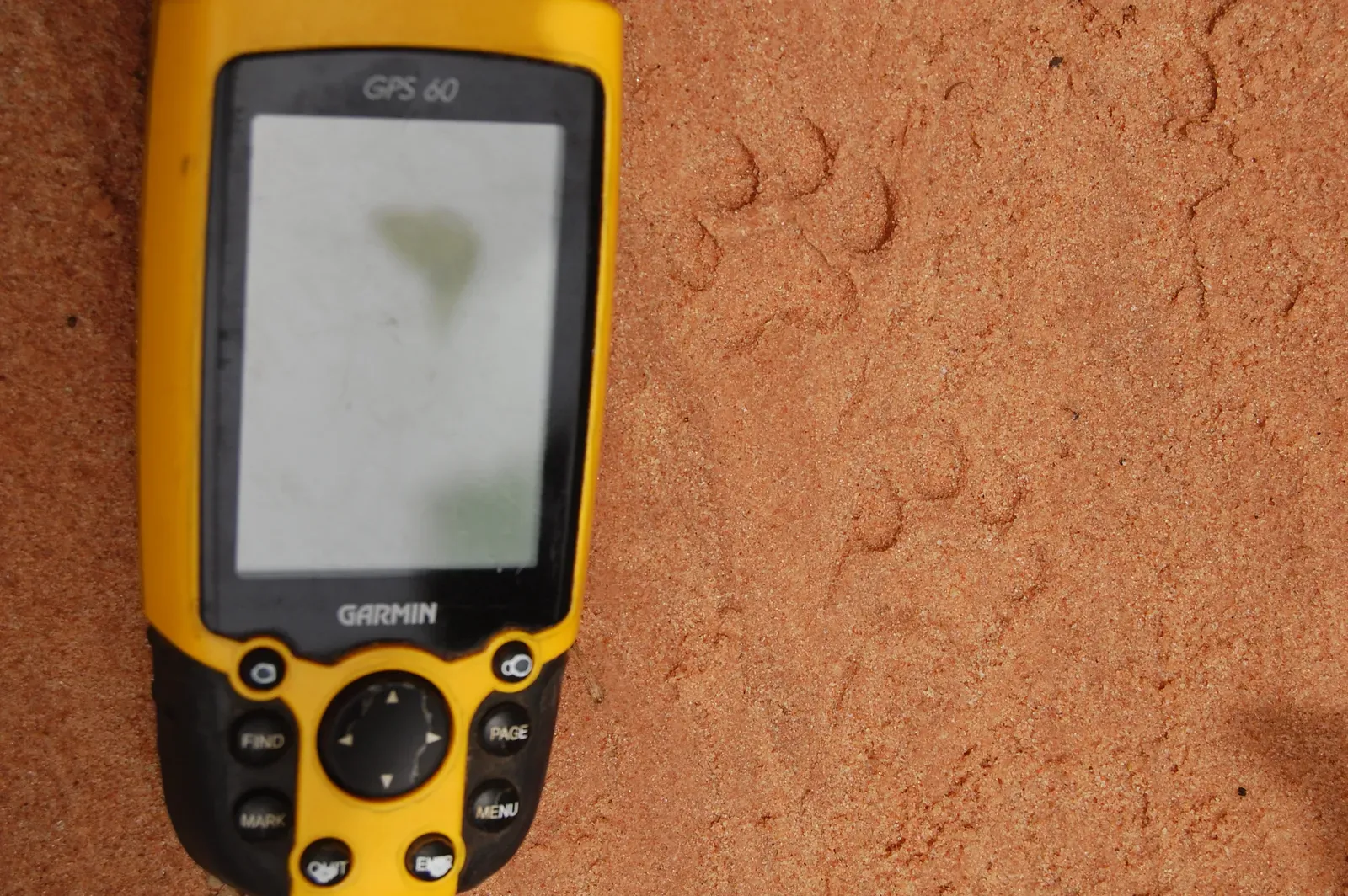
Mission Magi researchers are not just watching where these animals go; they are decoding how they survive. Tiny GPS collars, thermal loggers, and even accelerometers tucked into the harnesses record movement, body temperature, and behavior at minute-by-minute resolution. When overlaid on high-resolution satellite maps and ground-based climate data, these tracks reveal micro-refuges: shaded ravines a few meters wide that stay cooler, or crusted salt flats that hold faint traces of moisture deep below. The animals find and use these like elite soldiers navigating safe houses, and by tracing those paths, scientists can identify which parts of the desert are still habitable – and which are on the verge of collapse.
From Ancient Kings to Modern Magi: Stories Written in Sand and Stone
The name Mission Magi is a deliberate nod to the old tale of three wise visitors crossing hostile landscapes guided by celestial cues. Long before satellites, people watched migrating herds and nocturnal hunters and learned to read the land from their movements. In the Thar and surrounding regions, desert cultures have quietly relied on these animals as forecasters: when certain lizards vanish, sandstorms often follow; when antelope shift their grazing, people know the groundwater is changing. Today’s mission transforms that traditional awareness into quantified science, but the basic insight is the same: animals are the earliest, most sensitive reporters of environmental stress.
Geologically, the deserts these creatures roam are even older witnesses. Wind-carved dunes, gypsum crusts, and ancient riverbeds buried beneath sand hold a record of past wet periods and brutal droughts. By mapping animal routes over these features, geologists and biologists can see how life reoccupies old floodplains or abandons newly active dune fields. It is like comparing two layered manuscripts: one written by wind and water over millions of years, and the other by tiny claw marks and hoofprints in just a few seasons. The overlaps and gaps tell a powerful story about which environments rebound after climatic shocks and which do not, a question that now matters far beyond the Thar.
Extreme Adaptations: How Desert Wildlife Bends the Rules of Survival
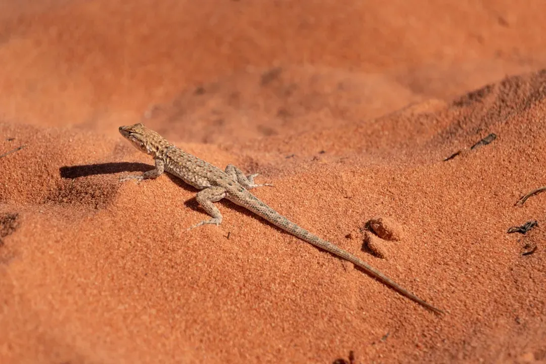
The three Mission Magi flagship species are not just tough; they are physiologically strange in ways that push the boundaries of what we assume mammals, birds, and reptiles can do. Some desert mammals can let their body temperature climb several degrees higher than typical homeotherms during the hottest hours, essentially “riding the heat” rather than wasting precious water on cooling. Certain reptiles bury themselves a few centimeters down, where temperatures and humidity shift just enough over the day to act like a natural life-support system. Ground-nesting birds may select spots where subtle color differences in the soil change how sunlight is reflected, shaving off just enough heat to keep embryos viable.
Researchers connected to Mission Magi are documenting these micro-strategies with tools sensitive enough to catch the smallest deviation. For example, miniature thermal cameras and infrared loggers strapped near burrow entrances can show exactly when an animal decides to surface. Heart-rate sensors reveal that some individuals time intense bursts of activity to short windows of slightly cooler air, then drop into near-total rest before the body overheats. From a human perspective, these behaviors look almost like tactical maneuvers: sprint, hide, cool, repeat. Each pattern is an adaptation honed over thousands of generations, and every deviation from it under climate stress is an early warning that the system is reaching its limits.
Reading the Desert’s Geological Pulse Through Animal Movement
Beneath the drama of individual survival, Mission Magi treats deserts like a living seismograph that records not only tectonic rumblings but climate pulses. Animal movements outline invisible boundaries between geologically distinct zones – stable rocky plateaus, loose dune seas, crusted pans, and fossil river channels. When satellite-tracked animals suddenly avoid a long-used corridor, it often coincides with subtle landscape changes: a dune front advancing after a sequence of high-wind years, or a crust breaking down after unusual monsoon floods. These are geological shifts that might escape human notice for years, but the animals register them immediately because their lives depend on it.
By layering decades of historical records, recent drone imagery, and the latest movement data, scientists can see whether animals are still able to outrun or outmaneuver the ground itself as it changes. In some places, wildlife are keeping up, shifting ranges by dozens of kilometers over a few seasons to chase shrinking patches of suitable terrain. In others, rock outcrops that once acted as cool refuges are becoming surrounded by hotter, barer sand plains, isolating populations like islands in a rising sea of heat. These patterns tell us where conservation corridors have a solid geological backbone – and where any refuge may only be temporary, doomed by the slow but relentless reshaping of sand and stone.
Why It Matters: A New Early-Warning System for a Hotter World
Mission Magi is more than a poetic concept; it functions as a climate and biodiversity early-warning system with teeth. Traditional monitoring often relies on weather stations, satellite averages, and occasional field surveys, which can miss the fine-grained reality animals experience. In contrast, these desert commandos offer continuous, behavior-based data that effectively says: this is what survival looks like, in real time, at ground level. When their activity windows shrink, routes fragment, or breeding attempts fail more often, those are concrete signals that the environment has crossed important thresholds long before mass die-offs or human emergencies appear.
Compared to classic conservation approaches that mostly map where animals are present or absent, Mission Magi emphasizes how and when they use the environment. That gives policymakers sharper levers to pull. Instead of vague warnings about rising temperatures, scientists can point to specific nights when a predator can no longer safely hunt, or particular dunes where seedlings used to establish but now consistently fail. These details translate into targeted options: protecting key shade corridors, adjusting grazing rules around sensitive zones, or prioritizing water infrastructure that aligns with natural wildlife routes. In a world where roughly about one third of land is already under some degree of desertification pressure, the precision and urgency of such signals could shape which regions remain habitable for both people and wildlife.
Global Perspectives: What Three Magi Reveal About Planetary Extremes
Although Mission Magi is tied to a specific landscape, its implications ripple far beyond one desert or one country. Polar scientists watch how penguins and seals respond to thinning sea ice; marine biologists track pelagic predators to understand shifting ocean fronts. The core idea is the same: when conditions reach extremes, animals embody the integration of climate, geology, and ecology better than any single instrument. By comparing data from desert, polar, mountain, and deep-ocean “commandos,” researchers can sketch a global map of where resilience still holds and where it is cracking.
Places like the Atacama Desert, the Namib, and the outback of Australia already host similar efforts tracking reptiles, small mammals, and birds that push physiological limits. As these data sets grow, patterns start to emerge. For instance, in many extreme systems, animals are not just moving poleward or upslope; they are increasingly pinched into odd, patchy mosaics of survivable microclimates. This mirrors what climate models predict but with more nuance and urgency. The three “kings” of Mission Magi thus stand in for a whole guild of planetary scouts, hinting at how entwined the fate of wildlife, weather, and the Earth’s shifting surface has become.
The Future Landscape: Tech, Ethics, and the Next Generation of Desert Scouts
The next phase of Mission Magi leans heavily on emerging technologies that might have sounded futuristic a decade ago. Lightweight solar-powered tags, for instance, allow years of continuous tracking without recapture, while machine learning algorithms sift through terabytes of movement and environmental data to spot patterns humans would miss. High-resolution thermal satellite imagery can now resolve temperature differences at the scale of individual dunes or rocky ledges, making it possible to predict where micro-refuges might form even before animals reach them. Combined, these tools turn the desert into a kind of open-air laboratory for testing how far life can be pushed before it breaks.
But there are hard questions, too. Every new tag, sensor, and drone carries potential stress for the animals being monitored and raises issues about data ownership and the surveillance of shared landscapes. Conservationists working on Mission Magi increasingly involve local communities, incorporating pastoral knowledge about migration routes and sacred sites to avoid intrusive monitoring in sensitive zones. Over the coming decade, the challenge will be to use cutting-edge tech without treating wildlife as mere hardware platforms. If done carefully, the same innovations that help predict species collapse could also guide climate adaptation plans, renewable energy placement, and corridor design in a way that respects both the animals and the people living alongside them.
From Desert Data to Daily Life: How You Can Be Part of Mission Magi
It is easy to see a story like Mission Magi as something distant and specialized, unfolding on remote dunes far from city streets or suburban backyards. In reality, the same forces sculpting those deserts – heat waves, shifting rainfall, and land-use change – are reshaping ecosystems everywhere. Supporting projects like this starts with paying attention to how animals around you respond to extremes: birds vanishing during heat spikes, insects appearing earlier in the year, plants browning faster after short dry spells. Many citizen-science platforms already allow people to log such changes, and those observations can complement the fine-scale tracking done in places like the Thar.
Concrete actions are surprisingly straightforward. Individuals can back organizations funding long-term wildlife telemetry and habitat protection in extreme environments, where research is expensive and logistically difficult. Sharing accurate, nuanced stories about projects like Mission Magi on social media or in classrooms helps shift the narrative from deserts as empty spaces to deserts as critical laboratories for planetary resilience. Even modest choices – reducing personal water and energy waste or supporting policies that limit habitat fragmentation – echo the same logic that underpins this mission: survival in extremes depends on every marginal gain. In the end, the three “commandos” of Mission Magi are not just fighting for their own species; they are quietly mapping out how all of us might weather the hotter, harsher chapters of Earth’s story.

Suhail Ahmed is a passionate digital professional and nature enthusiast with over 8 years of experience in content strategy, SEO, web development, and digital operations. Alongside his freelance journey, Suhail actively contributes to nature and wildlife platforms like Discover Wildlife, where he channels his curiosity for the planet into engaging, educational storytelling.
With a strong background in managing digital ecosystems — from ecommerce stores and WordPress websites to social media and automation — Suhail merges technical precision with creative insight. His content reflects a rare balance: SEO-friendly yet deeply human, data-informed yet emotionally resonant.
Driven by a love for discovery and storytelling, Suhail believes in using digital platforms to amplify causes that matter — especially those protecting Earth’s biodiversity and inspiring sustainable living. Whether he’s managing online projects or crafting wildlife content, his goal remains the same: to inform, inspire, and leave a positive digital footprint.