
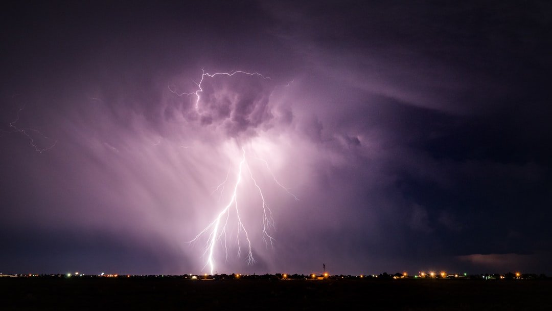
From Sweltering Days to Sudden Storms (Image Credits: Unsplash)
Houston – The metro area faces a turbulent shift after days of steamy conditions. Temperatures climbed into the upper 80s on Thursday amid rising humidity levels. A cold front set to arrive Saturday afternoon will spark scattered thunderstorms, heightening the threat of street flooding across the region.[1][2]
From Sweltering Days to Sudden Storms
Forecasters noted that Houston’s work week wrapped up under high pressure, delivering highs near 84 degrees Fahrenheit on Thursday and Friday. South winds gusted up to 25 miles per hour, fueling the muggy atmosphere with lows hovering in the lower 70s. This pattern held steady until the weekend pivot.[2]
Chief Meteorologist Anthony Yanez warned that Saturday night could turn problematic. “Saturday night is shaping up to be wet, stormy, and potentially problematic for anyone out and about,” he stated. The transition promises drama as instability builds ahead of the front.
Precise Timing for Saturday’s Threats
Storms hold a 30 percent chance by Saturday afternoon before surging to 60 percent after 6 p.m. Highs will peak at 84 degrees under mostly cloudy skies, with south winds easing to 5-10 mph. Overnight, showers and thunderstorms carry an 80 percent probability, pushing lows down to 58 degrees.[2][1]
Locally heavy rainfall rates could reach 2-3 inches per hour north of Interstate 10. Events like Ironman Texas in The Woodlands and Fleet Week face disruptions from gusty winds and downpours late in the day. Sunday brings relief with partly sunny skies and a high of 73 degrees.
Flooding Emerges as Primary Concern
A marginal risk of excessive rainfall covers areas north of I-10, where poor drainage spots invite rapid water rise. Street flooding threatens the Beltway, routes toward Pearland, and other low-lying zones prone to past issues. No formal watches stood as of Thursday, but officials eyed street-level impacts closely.[3]
Heavy bursts from training storms amplify the danger. Past events showed how quickly roads submerge here. Drivers received clear guidance to avoid flooded paths.
| Day | High/Low (°F) | Precip Chance | Key Hazards |
|---|---|---|---|
| Thursday | 84 / 71 | Low | High humidity |
| Friday | 84 / – | Low | Gusty winds |
| Saturday | 84 / 58 | 50-80% | Thunderstorms, flooding |
| Sunday | 73 / 59 | Low | Cooler, drier |
Steps Residents Should Take Now
Preparation starts with vigilance. Meteorologists stressed monitoring apps and local alerts for real-time updates. Those in vulnerable neighborhoods should clear drains and secure outdoor items against wind.
Travelers faced specific cautions. Evening plans demanded flexibility amid the front’s push. Emergency kits with flashlights and water proved wise backups.
- Watch roads near Beltway and Pearland for water buildup.
- Avoid driving through flooded streets – turn around, don’t drown.
- Charge devices and have a weather radio ready.
- Secure loose patio furniture before winds pick up.
- Check on neighbors in low-lying homes.
- Postpone outdoor events if possible Saturday night.
Key Takeaways
- Cold front triggers Saturday PM thunderstorms with 60-80% rain chances.
- Flood risk highest in poor drainage areas north of I-10.
- Temperatures drop sharply Sunday to the 70s, easing humidity.
Houston’s weather rollercoaster underscores the region’s unpredictable spring patterns – one day sapping energy with heat, the next testing resolve with rain. As the cold front clears, drier air offers a welcome reset, though more storms lurk midweek. Stay prepared to keep the city moving safely. What are your weekend weather plans? Share in the comments.


