Stand on the edge of a canyon, a rocky coastline, or a quiet hilltop, and you’re standing in the middle of a story that’s billions of years long. The strange part is that, even in 2026, geologists are still trying to decipher huge chunks of that story, and a lot of the “chapters” are missing, scrambled, or written in a language we’re only starting to learn. The surface of our planet looks familiar, but in many ways it’s as mysterious as a distant exoplanet.
What we see as mountains, rivers, deserts, or plains are really clues to deep processes: continents colliding, oceans vanishing, climates swinging from icehouse to hothouse. Some landscapes look brand new but are built on the scars of ancient cataclysms. Others seem old and worn, yet hide surprisingly recent events. Once you start to see Earth as a dynamic, restless machine rather than a static background, even an everyday road cut can feel shocking.
Landscapes as Time Machines: Reading Rocks Like Pages
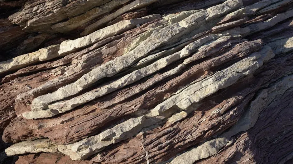
Every rock layer is like a saved draft of Earth’s long and chaotic autobiography, and landscapes are the parts where those drafts are peeled open for us to read. A sandstone cliff can tell you there was once a coastline here; a folded mountain belt whispers of continents crumpling together. The trick is that these pages are torn, overwritten, and sometimes reheated until the ink blurs beyond recognition.
Geologists use tools like radiometric dating, fossil analysis, and structural mapping to reconstruct what happened in a region – often starting with simple observations anyone can make: which rocks sit on top of which, where layers tilt, where they vanish. In a way, hiking through a canyon is like scrolling through deep time, thousands or millions of years per vertical meter. But some parts of that scroll are missing entirely, which leads to one of geology’s strangest ideas: vast “gaps” in time carved into the rock.
The Great Unconformities: Enormous Gaps in Earth’s Memory
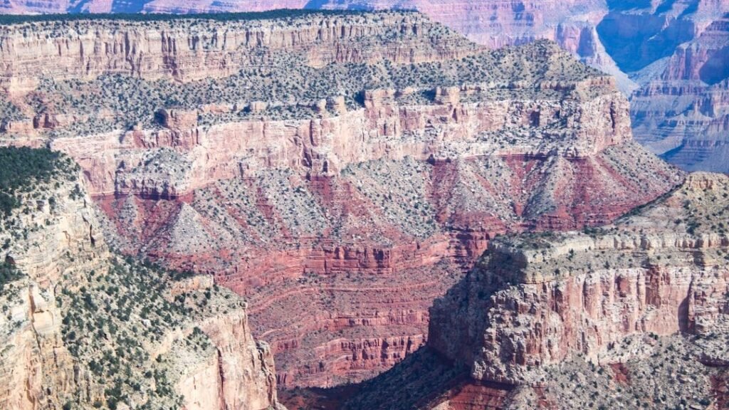
In several famous places on Earth, you can put one hand on rock that formed more than a billion years ago and the other on rock that formed only a few hundred million years later, with no trace of the missing interval. This kind of boundary is called an unconformity, and it means the record of everything that happened in between was eroded away or never deposited. It’s like opening a history book and finding that everything from chapter two to chapter twelve has been ripped out.
One of the most dramatic examples lies at the bottom of the Grand Canyon, where ancient crystalline rocks sit directly beneath much younger sedimentary layers. That missing chunk of time includes episodes like the buildup of oxygen in the atmosphere and possibly major glaciations, yet in that spot the rocks are silent about it. Scientists still debate what processes – global erosion, continental breakup, repeated uplift – created such sweeping erasures, and those debates matter because they shape how we imagine early Earth looked from space.
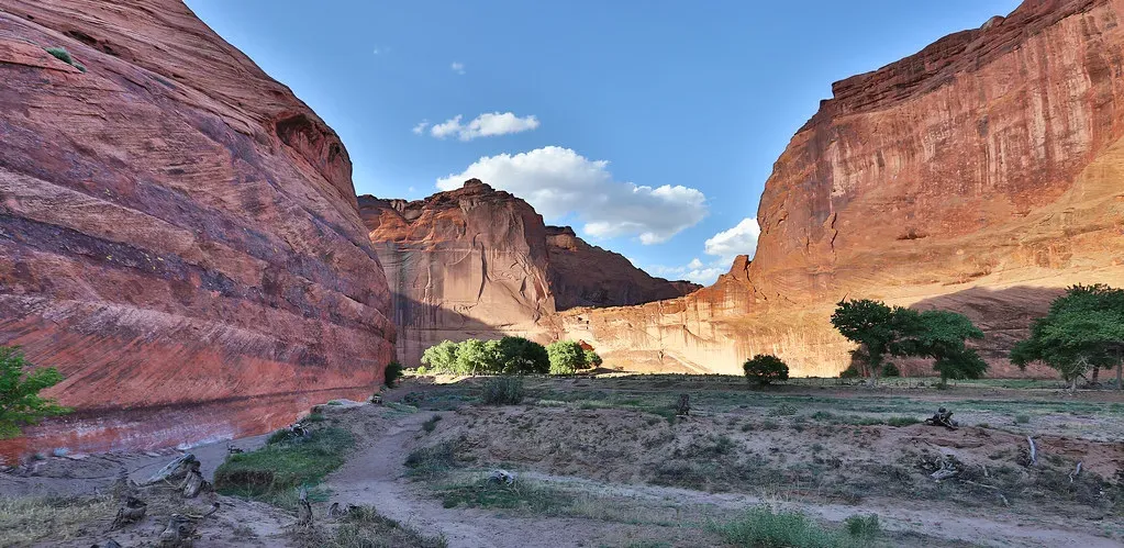
Canyons and Cliffs: Rivers as Relentless Sculptors
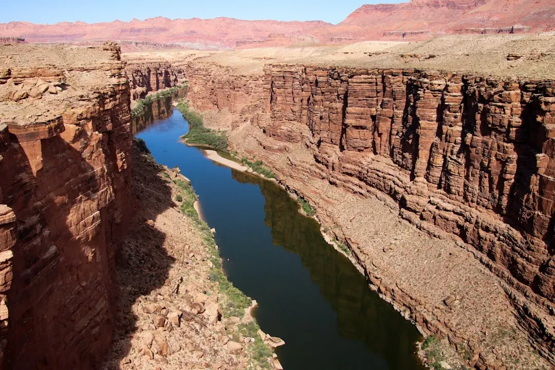
It’s easy to think of canyons as being “made by a river,” but that phrase hides a lot of complexity. A river is not a carving tool moving through soft butter; it’s more like a vast conveyor belt that only cuts downward when uplift and climate align just right. The iconic shape of a canyon records the tug-of-war between rising land, flowing water, and rock strength, and sometimes the outcome doesn’t match our expectations at all.
Take deeply incised rivers that slice across active mountain belts instead of simply flowing around them. In many cases the river was there first, wandering across a much gentler landscape, and then held its course stubbornly as the land rose around it over millions of years. The result looks almost impossible: water apparently ignoring towering walls of rock. When we map these patterns, we uncover ancient plate movements and long-vanished uplift events that would be invisible without the river’s stubborn persistence.
Mountains That Refuse to Die: Ancient Ranges Beneath Our Feet
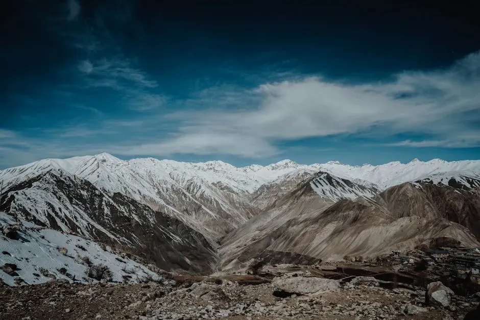
Some of the most striking mountains on Earth today, like the Himalaya, are relatively young in geologic terms. But scattered across continents are ghostly remains of far older mountain belts – stumps of once-colossal ranges that have been worn down to rolling hills or even flat plains. The rocks there still preserve the intense pressures and temperatures they endured deep within the crust, long after the peaks themselves have vanished.
What’s surprising is how long those buried signatures can survive and how little the surface sometimes reveals their dramatic past. You can drive across a seemingly ordinary landscape and pass over the roots of an ancient supercontinent collision without any obvious clue. Only detailed mapping and age dating of minerals reveal that this modest countryside once sat at the heart of mountains as tall as anything alive today. It’s like realizing that the quiet neighbor down the street once lived through a blockbuster saga and never talks about it.
Glacial Landscapes: When Ice Carves with the Power of Stone
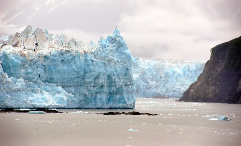
Today’s shrinking glaciers can seem small and fragile, but in the past, ice sheets have behaved like slow, unstoppable bulldozers, remodeling entire continents. U-shaped valleys, polished bedrock, and scattered boulders far from any mountain source are all fingerprints of ancient ice. The scars left behind let scientists track how far glaciers once spread and how quickly they retreated, which in turn reveals wild swings in climate.
What we still struggle to fully explain is exactly why ice ages start and end as sharply as they do and how ice sheets can reorganize drainage systems over huge regions. In some areas, rivers suddenly “flip” direction when ice sheets advance or melt, leaving abandoned valleys and stranded lakes as confusing clues. When you stand in a quiet glacial valley now filled with forests and farms, it’s hard to imagine that not so long ago – on a geologic clock – it was buried under ice thick enough to crush mountains and bend Earth’s crust.
Coastlines in Motion: Drowned Valleys and Rising Lands
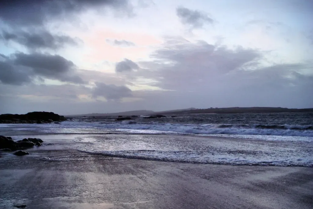
Coastlines might feel like steady, comforting boundaries between land and sea, but they are among the most restless places on the planet. Over tens of thousands of years, sea levels have risen and fallen by hundreds of meters, flooding river valleys into fjords and estuaries, then exposing them again as broad coastal plains. These dramatic swings are often tied to the growth and melting of ice sheets, as well as long-term changes in ocean basins and seafloor spreading.
Modern coastal landscapes often sit on top of older shorelines: ancient dunes buried beneath cities, fossil-rich marine terraces high above today’s waves, or coral reefs now stranded far inland. In some regions, the land itself is still rebounding from the weight of vanished ice, meaning the shoreline is creeping seaward even as global sea level rises. When scientists piece together these overlapping coastal stories, they’re not just reconstructing scenic views of the past – they’re also testing models that predict how today’s warming world will redraw the map.
Deserts and Dunes: The Strange Memory of Wind
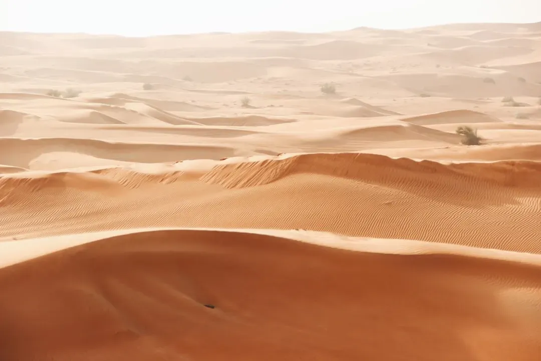
Deserts often feel timeless, as if their dunes have always been marching across the landscape. In reality, many dry regions have shifted between wet and arid states multiple times, and the sand itself can be surprisingly young or surprisingly old. Vast dune fields record patterns of wind and climate over long spans of time, but reading that record is anything but straightforward.
Layers within a single dune can show that it grew in pulses, advancing quickly under strong winds, then lying almost frozen during calmer, wetter intervals when plants took hold. Some buried dune systems now lie beneath fertile farmland or even cities, only revealed by drilling and geophysical surveys. When those hidden sands are dated, they sometimes show that what is now a productive landscape was once as harsh as the Sahara – and could be again under different climate conditions.
Karst and Caves: Landscapes Hollowed Out from Within
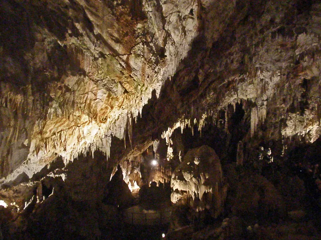
Areas underlain by limestone or similar rocks often develop karst landscapes: sinkholes, disappearing streams, and extensive cave systems that make the ground feel more like Swiss cheese than solid Earth. On the surface, karst can look gentle and pastoral, but underneath it may hold vast caverns, subterranean rivers, and enormous volumes of slowly circulating water. These hidden spaces can preserve delicate mineral deposits that act like tree rings for past climates.
We still have only a partial map of many of these underground worlds, and every new cave survey tends to complicate rather than simplify the picture. Intricate networks of passages record not just how water currently flows, but how it used to move before rivers shifted course or land uplifted. For scientists trying to understand groundwater resources, pollution pathways, and long-term climate cycles, karst landscapes are both invaluable archives and frustrating puzzles – half-visible books whose most important pages are still sealed.
Ancient Cratons and Hidden Roots: The Planet’s Oldest Landscapes
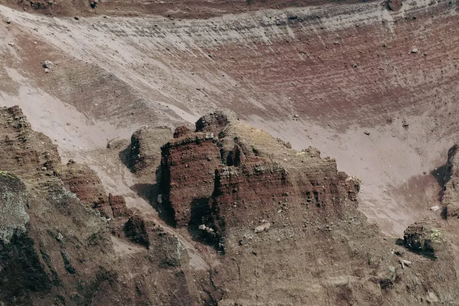
Earth’s oldest surviving crust is preserved in cratons – stable cores of continents that have survived for billions of years while other pieces were destroyed and recycled into the mantle. At the surface, these regions may not look dramatic: often low-relief shields of ancient rock, dotted with lakes and thin soils. But they sit atop deep, thick roots that extend far into the mantle, influencing how plates move and where volcanoes and mountain belts form.
What’s still murky is exactly how these cratons formed in the first place and how they’ve managed to stay intact through so many cycles of collision and rifting. Tiny crystals within them preserve isotopic signatures from a time when Earth’s interior was much hotter and plate tectonics may have worked differently. Walking across these landscapes is like strolling over a living fossil, yet the connection between those ancient processes and the modern scenery is anything but simple. The ground underfoot may be old, but the way it looks today is the product of countless younger overprints.
Alien Perspectives: Seeing Earth Through Other Worlds
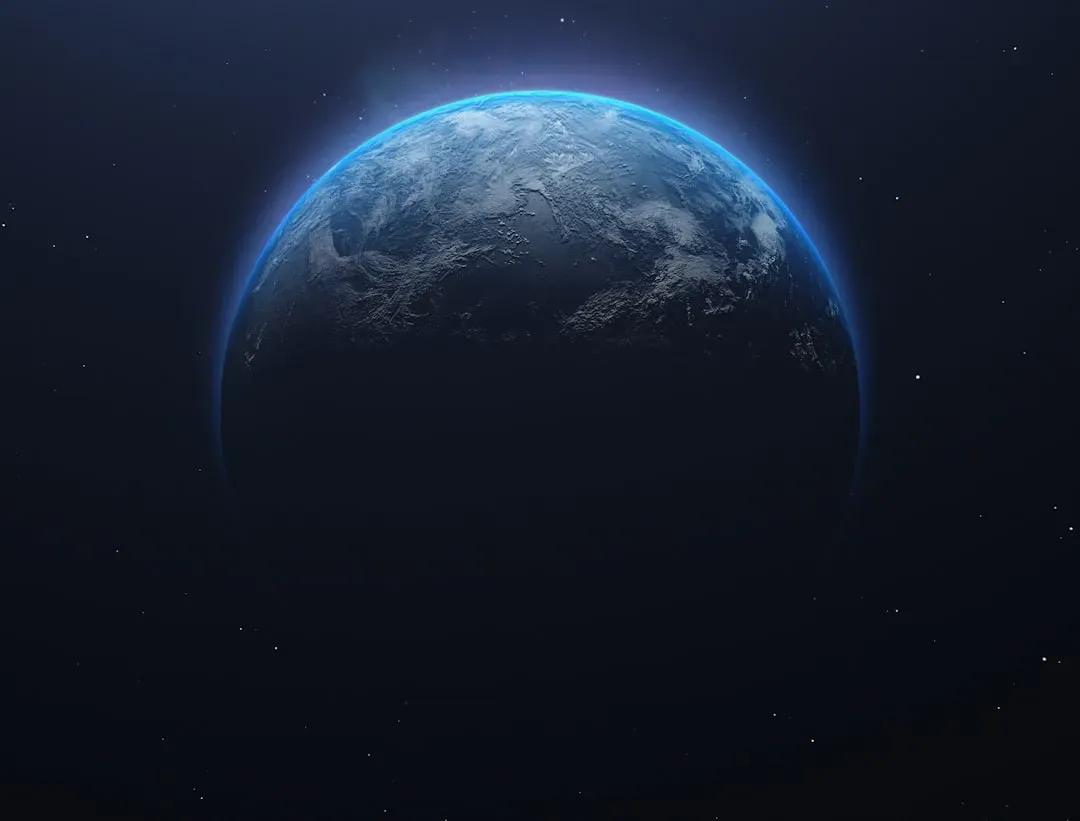
One of the strangest ways we’ve come to understand Earth’s landscapes is by looking away from them – toward Mars, Venus, and icy moons. Spacecraft images of Martian canyons, dried-up riverbeds, and dune fields force us to reconsider how similar landforms might have evolved on our own planet under different atmospheres and climates. If a dry river valley on Mars still screams “water” to our eyes, what Martian-style traces on Earth might we be missing or misreading?
At the same time, some Earth landscapes, like deep ocean trenches or subglacial environments, remain less well mapped than portions of the Moon. In that sense, parts of our planet are as alien to us as distant worlds. Comparing planetary surfaces has sharpened geologists’ instincts about what features truly require liquid water, plate tectonics, or thick atmospheres – and which can form in multiple ways. That comparison has made one thing crystal clear: even on our own world, similar-looking landscapes do not always share the same origin story.
Conclusion: Learning to Read a Restless Planet
When you start to see Earth’s landscapes as evidence instead of just scenery, the planet becomes both more beautiful and more unsettling. Cliffs, plains, dunes, and caves stop being background and turn into witnesses, each telling a partial, biased version of what really happened. The challenge, and the thrill, is that those testimonies rarely line up neatly; they contradict, overlap, and leave maddening gaps where we most want detail.
We may never reconstruct every twist in Earth’s geologic history, but each canyon measured, each cave mapped, each buried shoreline found adds another sentence to the story. Even a simple weekend hike can feel different once you realize you’re walking across the aftermath of vanished oceans, dead mountain ranges, and climates humans have never experienced. The landscapes we barely understand are not failures of knowledge – they’re invitations to keep asking better questions. Next time you look out over a valley or a coastline, what chapter do you think you’re standing on?


