If you grew up thinking the Americas were a wilderness dotted with a few pyramids and scattered villages, you’re in for a shock. In the last couple of decades, archaeologists have been pulling back the curtain on an older reality: sprawling urban landscapes, engineered forests, and city networks that rival anything you’d associate with the Old World.
What makes this story even more gripping is that much of it was hidden in plain sight beneath jungle canopies, farmland, and even modern towns. As new technology sweeps across the continent, you’re watching the map of ancient America being redrawn in real time – and it’s changing how you understand cities, nature, and what it means to build a civilization that lasts.
The Myth of Empty Lands: Rethinking the Pre-Columbian Americas
You’ve probably absorbed the old story without even noticing: before Europeans arrived, the Americas were supposedly thinly populated, wild, and mostly untouched. That picture is now crumbling. Archaeological surveys, ecological studies, and Indigenous knowledge all converge on a very different view – one where large parts of the continent were shaped by deliberate design.
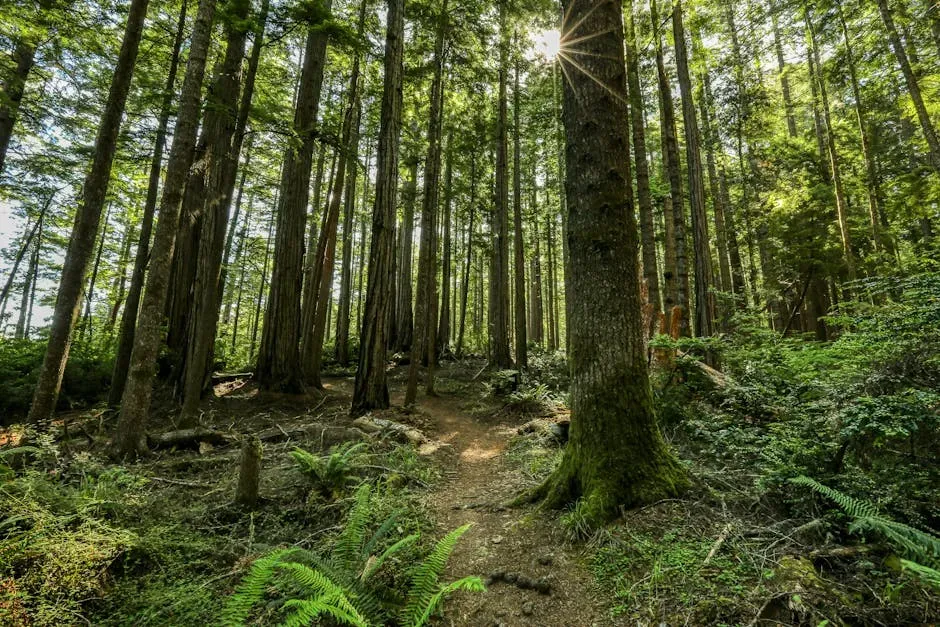
When you walk through a rainforest trail today or fly over a patchwork of fields, you might be passing over buried roads, city plazas, and engineered forests. Charcoal layers, unusual soil types, and distributions of useful trees reveal that people were managing landscapes at scale for thousands of years. You are not looking at a pristine world; you’re looking at the faded imprint of vast, long-lived societies.
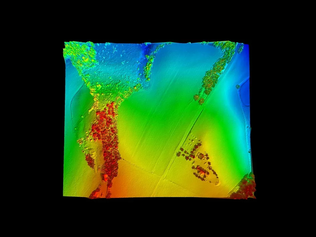
LiDAR: The Laser Eyes Peering Through the Jungle
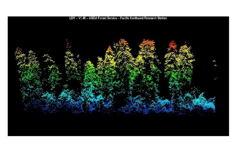
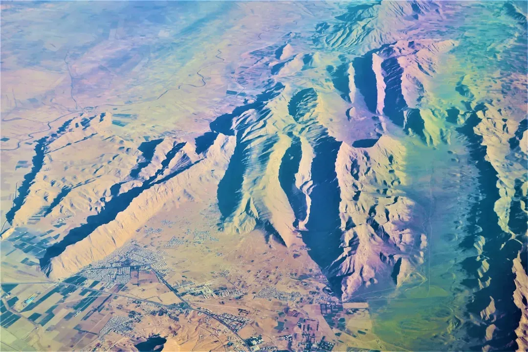
If you want to understand why so many “lost cities” seem to appear at once, you have to meet LiDAR. Picture a plane or drone firing millions of laser pulses toward the ground, then measuring the tiny fraction that bounces back from the surface. Clever software strips away the vegetation and leaves you with a bare-bones model of the earth below – every ridge, platform, causeway, and canal suddenly visible.
When archaeologists started applying LiDAR in dense tropical forests – from the Maya lowlands of Guatemala and Mexico to the Bolivian and Ecuadorian Amazon – the results were nothing short of unsettling. What looked like empty green chaos turned into carefully organized landscapes. You see straight roads cutting across hills, gridded platforms, defensive walls, and intricate water systems. It feels almost like switching from blurry analog TV to ultra‑high‑definition, only the “show” is an entire vanished world.
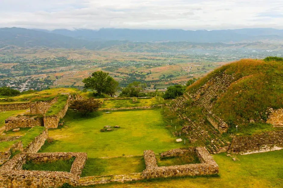
Garden Cities of the Amazon: Upano, Casarabe, and Beyond
For a long time, you were told that the Amazon basin could only support small, scattered groups living lightly on the land. Recent work is turning that idea upside down. In places like the Upano Valley in Ecuador and the Llanos de Mojos in Bolivia, LiDAR and excavation have uncovered what some researchers call “garden urbanism”: low‑density cities woven into agricultural landscapes instead of packed with stone towers.
In these regions, you find earthwork platforms, plazas, and long, straight causeways linking clusters of settlements that were occupied for many centuries. Populations may have ranged into the tens of thousands across extended networks, with raised fields, canals, and orchards sustaining them. Instead of skyscrapers, their architecture was mostly earth and wood, which rotted away – leaving just enough relief for lasers to pick up. You are looking at urbanism that chose to blend with the forest rather than bulldoze it.
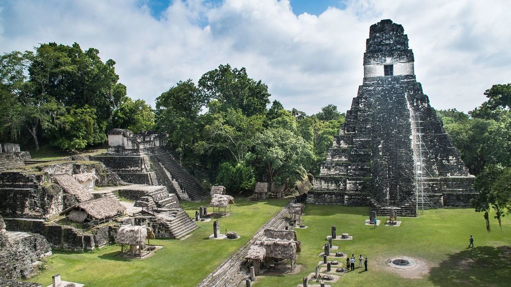
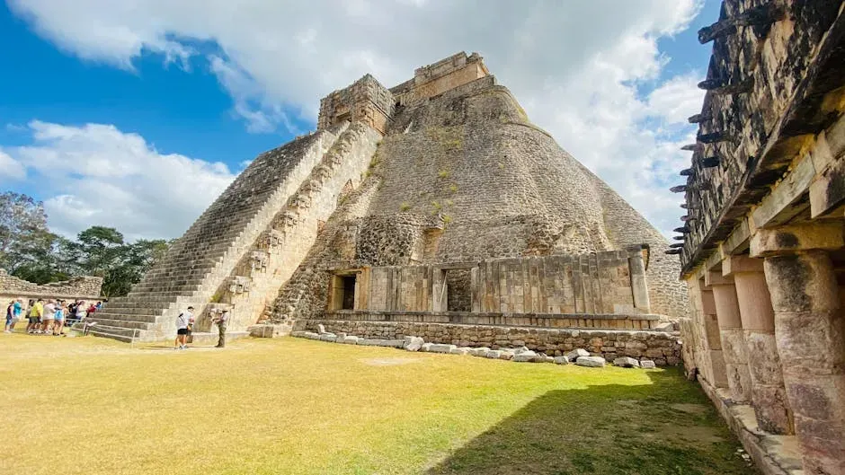
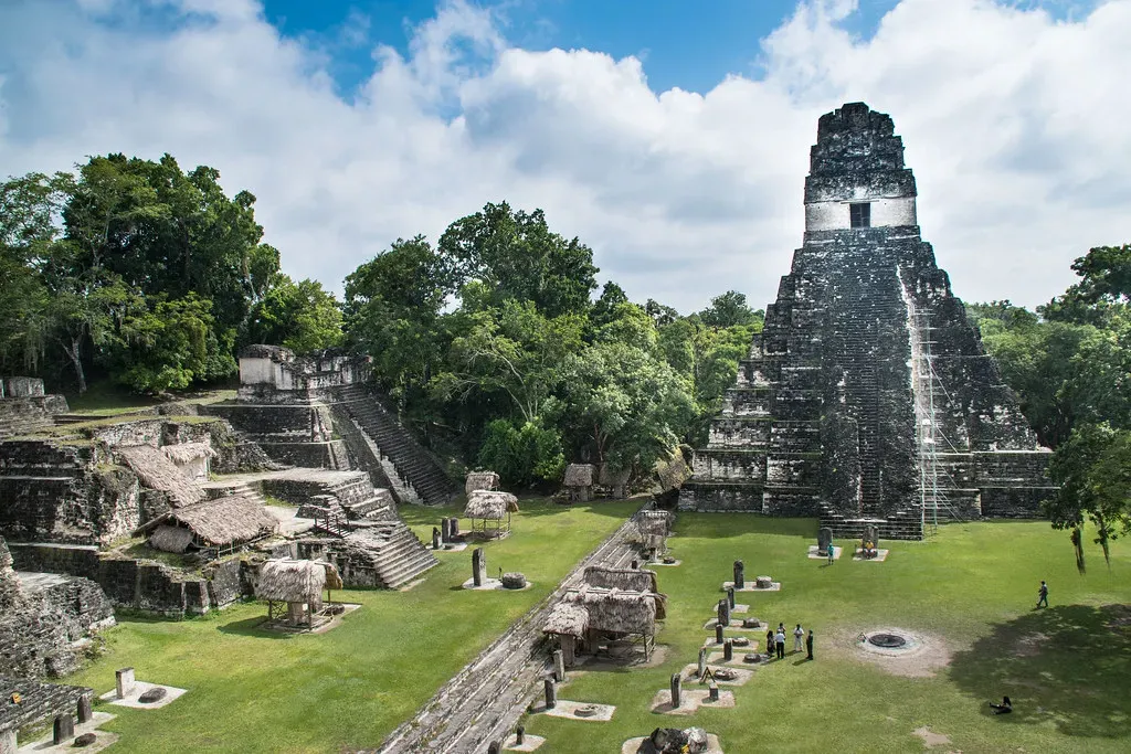
Maya Megacities: Networks Hidden Beneath the Canopy
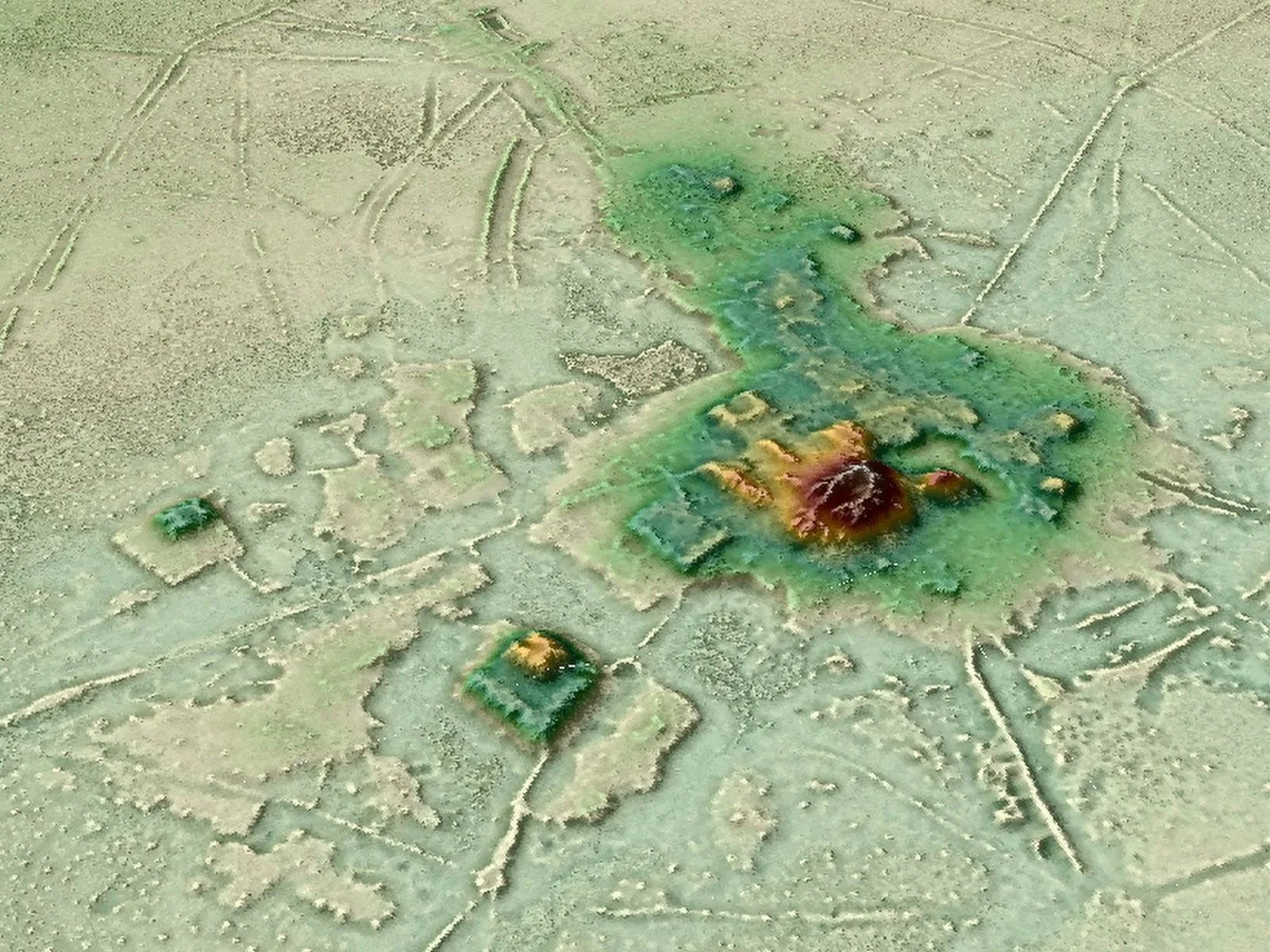
When you think about ancient cities in the Americas, you probably picture Maya pyramids at places like Tikal or Palenque. What you might not realize is that those famous sites are just the visible tips of massive urban systems, much of which stayed hidden until LiDAR mapped the regions around them. In northern Guatemala and parts of Mexico, aerial scans have revealed thousands of previously unknown structures: platforms, causeways, reservoirs, and defensive works sprawled across huge areas.
These findings suggest you should imagine Maya cities less as isolated temple centers and more as linked regions – webs of settlements tied together by elevated roads and water systems, with farmers, artisans, and elites all sharing a single urban landscape. New sites such as Ocomtún and others in Campeche have emerged from re‑examined LiDAR data, showing pyramids and plazas tucked under forest for over a thousand years. Once you see how dense and connected it all is, the idea of a quiet, empty jungle starts to feel almost absurd.
Engineered Forests: How Ancient Architects Designed Ecosystems
One of the most startling twists is that you can still see traces of ancient planning in living forests. In many parts of the Amazon, the distribution of fruit and nut trees is not random at all. Clusters of highly useful species line up with old settlement areas and earthworks, hinting that ancient communities deliberately planted and curated what you now think of as wild rainforest. Even the famous dark, fertile Amazonian soils known as terra preta are human‑made, built up over generations with organic waste and charcoal.
When you walk through these forests today, you’re moving through long‑lived cultural landscapes, not untouched nature. Ancient architects were not just stacking stones; they were designing ecological systems. They adjusted soils, water, and plant communities in ways that could feed large populations without stripping the land bare. That kind of landscape engineering forces you to rethink what “sustainability” really means – and whether modern cities are as advanced as you assume.
Not Really “Lost”: Indigenous Memory and Misleading Headlines
Every time a new LiDAR study hits the news, you see the same breathless labels: lost city, forgotten metropolis, ancient Rome of the Amazon. That language is catchy, but it hides a crucial truth. Many of these places were never “lost” to the people whose ancestors built them. Local and Indigenous communities often knew about ruins, mounds, or sacred hills all along; what was missing was outside recognition and systematic study, not memory.
When you call such places lost, you risk erasing centuries of oral histories and lived connections. You also turn complex research into a simple treasure‑hunt story, where outsiders swoop in and “discover” what others already knew. As you learn more about these cities, it’s worth asking yourself whose perspective you’re adopting: the explorer hungry for a headline, or the descendant who sees the ruins as part of an ongoing story of place, identity, and survival.
Lessons in Resilience: Water, Climate, and Collapse
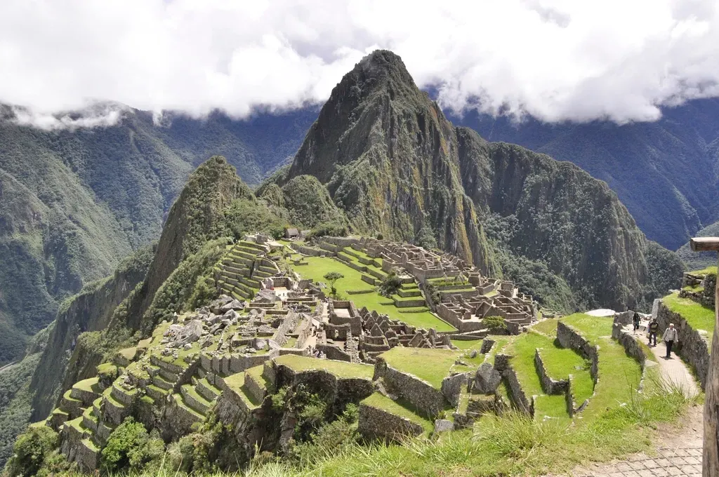
It is tempting to romanticize these ancient cities as perfect ecological utopias, but the truth is more complicated – and more useful. Many of them rose and fell in the face of climate swings, droughts, floods, or social strain. The Maya lowlands, for example, show signs of urban flourishing followed by partial collapse and reorganization. Amazonian cities appear to have persisted for centuries, then transformed or dispersed long before Europeans arrived.
What you can learn from them is not a fairy‑tale blueprint, but a set of strategies and warnings. You see societies building vast canal networks to manage water, creating flexible, low‑density settlements instead of rigid stone grids, and integrating food production into urban layouts. You also see what happens when political or environmental pressures push those systems beyond their limits. When you look at today’s megacities facing climate stress, those long arcs of rise, adaptation, and failure feel uncomfortably familiar.
How You Can See These Lost Landscapes for Yourself
You do not have to be an archaeologist to explore this hidden world. High‑resolution visualizations of LiDAR data, interactive 3D models of sites, and virtual reconstructions are increasingly available through museums, university projects, and documentary platforms. With a decent screen, you can “fly” over an Amazonian city, tracing roads and plazas that no human eye has seen clearly for centuries.
If you travel in person – to Maya regions, Andean valleys, or parts of the Amazon – you can bring this new perspective with you. When you stand on a mound that looks like just another hill, you’ll know it might be an engineered platform under your feet. When a local guide points out a ruin or an odd stand of trees, you can recognize that you are walking through a living archive of urban experiment and environmental design. You stop being just a tourist and start becoming a more attentive witness to a very deep past.
Conclusion: Rethinking What a City Can Be
Once you see the Americas as a continent of ancient architects, it becomes hard to go back to the old story of empty forests and scattered camps. You start to realize that cities do not have to mean concrete, steel, and crowded skyscrapers. They can also mean earthen platforms hidden in grasslands, gardened forests laced with roads, and low‑rise, long‑lasting communities that blur the line between town and countryside.
The newly revealed cities of the Americas are not just archaeological curiosities; they are alternative answers to questions you are still struggling with today: how to feed many people, how to live with forests instead of against them, and how to build places that can adapt when the climate shifts. As more of this buried urban world comes into focus, you might find yourself wondering not just what was lost – but what ideas you could still recover and use. Which of these ancient city‑builders would you most want to learn from if you could sit down with them today?