There’s something quietly mind‑bending about watching two rivers meet and then… stubbornly not becoming one. Side by side, different colors of water slide downstream like stripes on a flag, ignoring every instinct we have about how liquids should behave. It looks fake, like a digital filter someone dragged across reality.
These striking boundaries are not magic, and they’re not the result of editing tricks. They’re physics, geology, and chemistry made visible. Once you know what you’re looking at, you start to realize that these “rivers that refuse to mix” are like open‑air laboratories, revealing deep stories about climate, sediment, glaciers, forests, and even human choices upstream. Let’s walk through nine of the most fascinating places on Earth where rivers come together – but refuse to fully blend, at least for a while.
Confluence of the Rio Negro and the Solimões – Manaus, Brazil
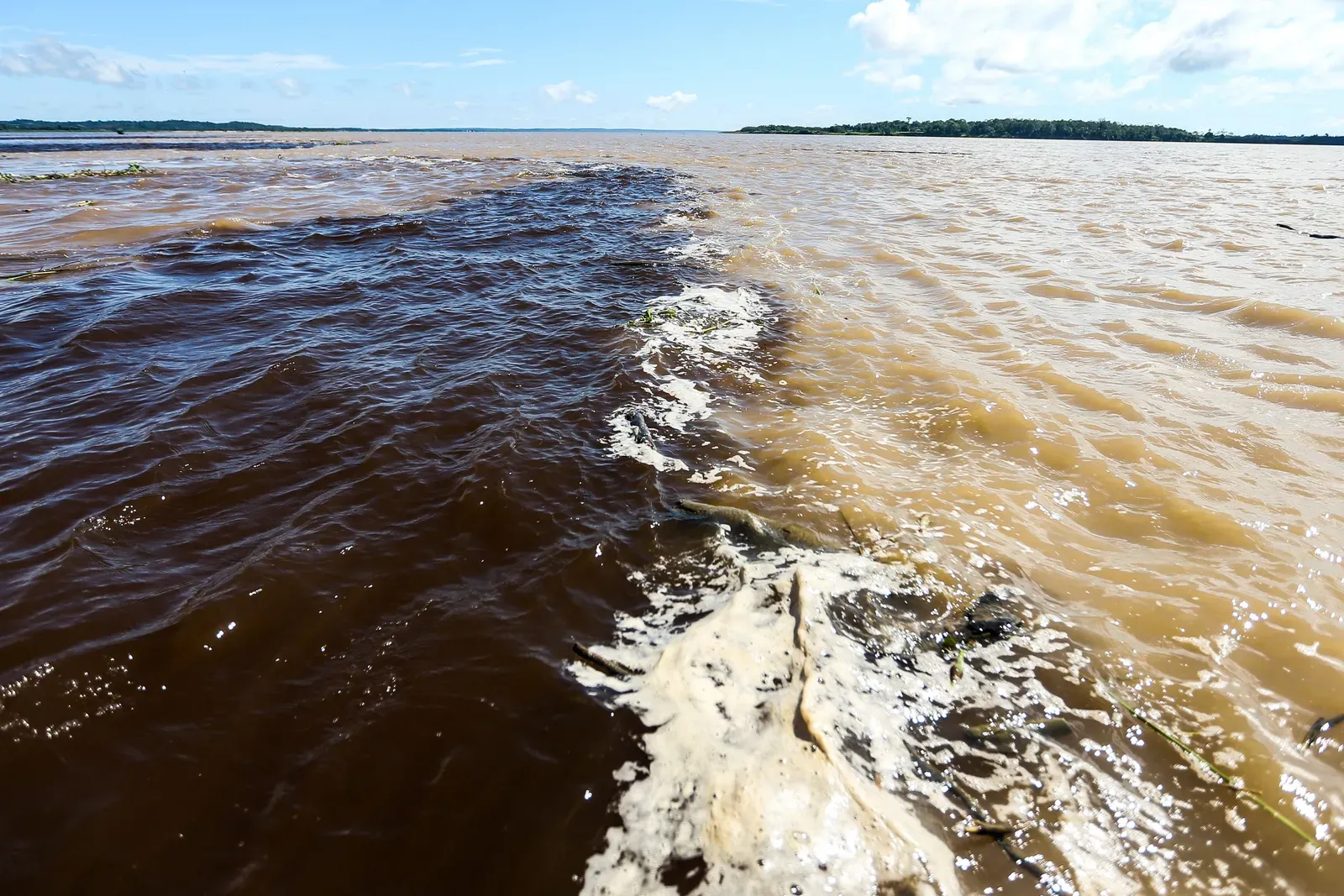
If you’ve ever seen a photo of rivers that look like dark coffee flowing beside milky chocolate, you were probably looking at the Rio Negro and the Solimões near Manaus. The Rio Negro’s water is nearly black, stained by dissolved organic material from decaying vegetation in the vast Amazonian wetlands. The Solimões, which is the upper stretch of the Amazon River, is pale and muddy, loaded with fine sediment from Andean glaciers and erosion far to the west.
When they meet, the two rivers run side by side for many miles with an almost comical refusal to blend. The big reasons are temperature, speed, and density. The Rio Negro is warmer, slower, and slightly more acidic, while the Solimões is cooler, faster, and heavier with sediment, so their waters move like two different fluids sharing the same channel. Turbulence and time eventually mix them, but you can still see their sharp boundary from boats, riverbanks, and even planes – a surreal reminder that even something as simple as “brown water” can have wildly different personalities.
The Rhône and the Arve – Geneva, Switzerland
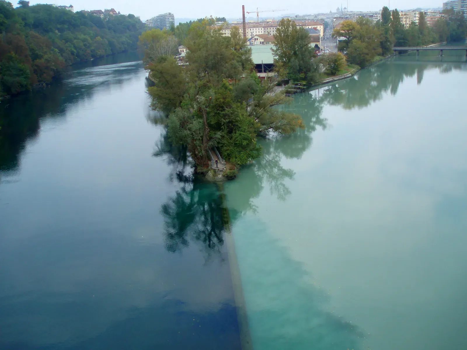
In Geneva, the Rhône and the Arve collide in a way that feels almost theatrical. The Rhône leaves Lake Geneva as a clear, turquoise‑blue river, its sediment mostly settled out by the time it flows through the lake. The Arve roars in from the Mont Blanc massif carrying glacial meltwater thick with fine rock flour, giving it a milky, gray‑beige appearance that looks almost like liquid stone.
At their confluence, the contrast is so sharp it feels like someone drew a line across the river with a ruler. The clearer Rhône and the silt‑heavy Arve hug their own sides of the channel for a surprising distance, separated by differences in temperature, density, and suspended sediment load. Standing on the footbridge there feels a bit like standing over a time‑lapse between mountains and lake: one side carrying the grind of ice and rock, the other the calm of a deep, settled basin. For a city that prides itself on international borders and blending cultures, it’s oddly satisfying that its rivers visibly resist that blending for a while.
The Mosel and the Rhine – Koblenz, Germany
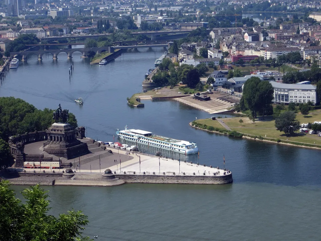
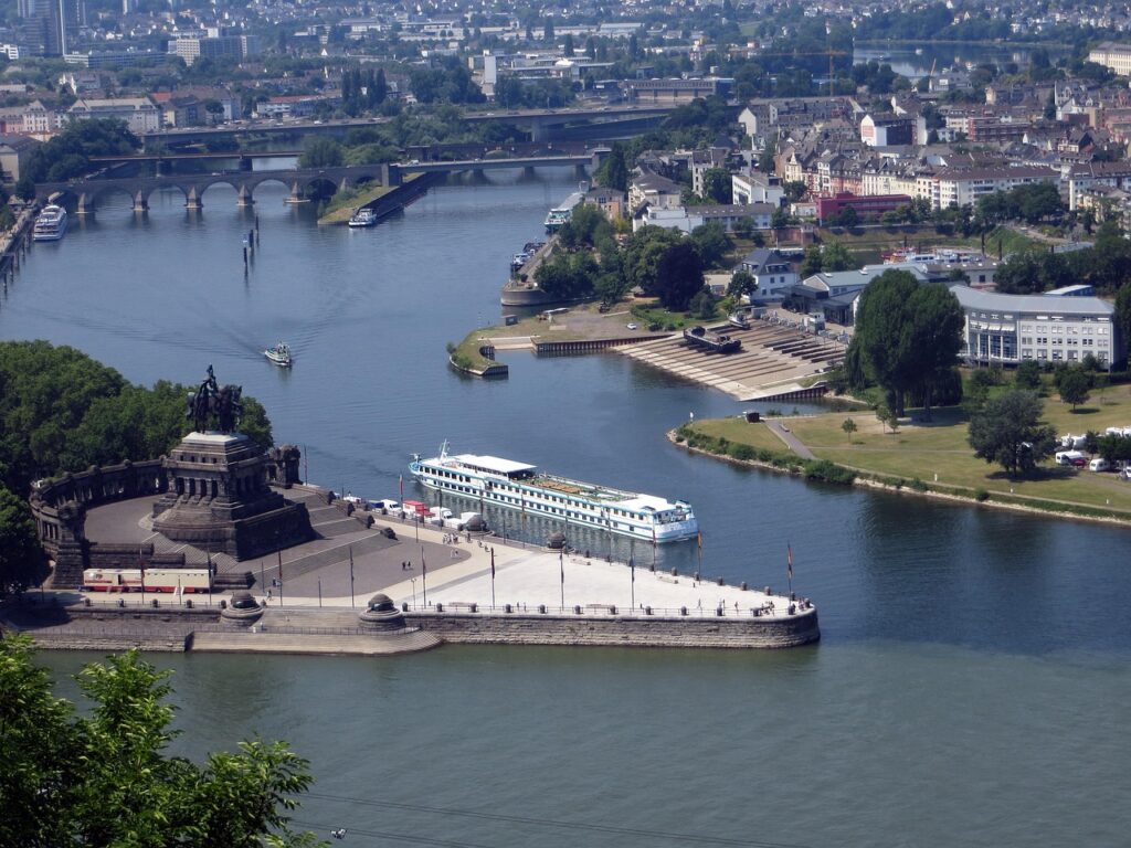
At the Deutsches Eck in Koblenz, two of Europe’s famous rivers meet: the wine‑valley Mosel and the powerful Rhine. The Mosel often carries a greener‑brown tint, influenced by agricultural runoff, vineyard soils, and the specific minerals eroding from its winding valley. The Rhine, by the time it arrives here, usually has a different hue and clarity shaped by its larger watershed, industrial regions, and its own tributaries upstream.
When they join, their waters do not instantly form a homogeneous Rhine “soup.” Instead, broad streaks and zones of different color can be seen downstream, especially when flow conditions highlight the contrasts. The difference may not be as visually shocking as some tropical examples, but to the naked eye you can still see bands and patches holding their character for a notable distance. I remember standing there on a gray day, watching those faint color differences slide past the monument, and thinking it looked less like a mixing bowl and more like a carefully layered cocktail that no one had stirred yet.
Alaknanda and Bhagirathi – Devprayag, India
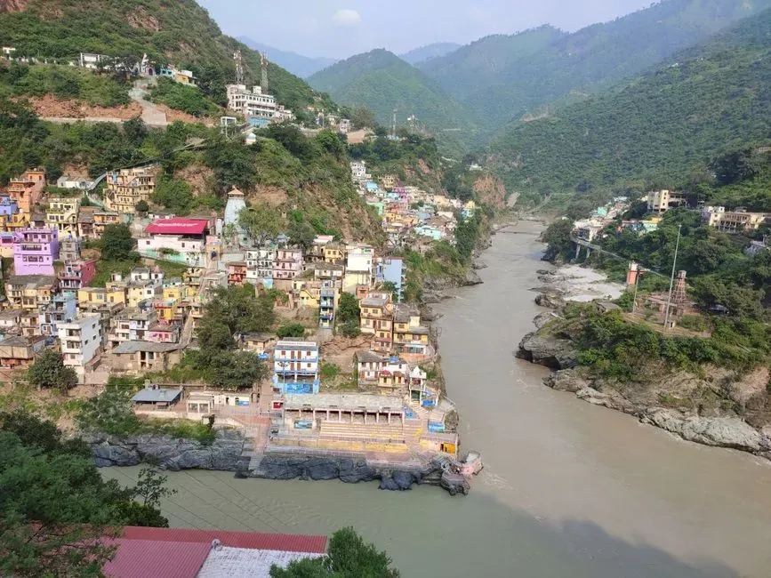
In the Himalayas, at Devprayag in Uttarakhand, two sacred rivers – the Alaknanda and the Bhagirathi – meet to form what is traditionally recognized as the Ganges. The Alaknanda typically arrives broader and more sediment‑laden, tinged in earthy browns and greens as it gathers tributaries from glaciated valleys and steep, eroding slopes. The Bhagirathi, emerging from the Gangotri glacier system, can often appear a bit clearer or of a different shade, depending on season and melt conditions.
At their confluence, those color differences are not just a spiritual symbol, they are physically visible in the water. The two branches can be traced downstream in parallel bands where their differing sediment loads, temperatures, and flow velocities prevent immediate mixing. The visual effect becomes even more gripping when framed by temples and steep mountainsides, as if the raw, physical processes of erosion and melt are arguing with centuries of mythology in plain sight. You do not need to be religious to feel something intense there; the river itself feels like a living debate between two origins.
The Jialing and the Yangtze – Chongqing, China
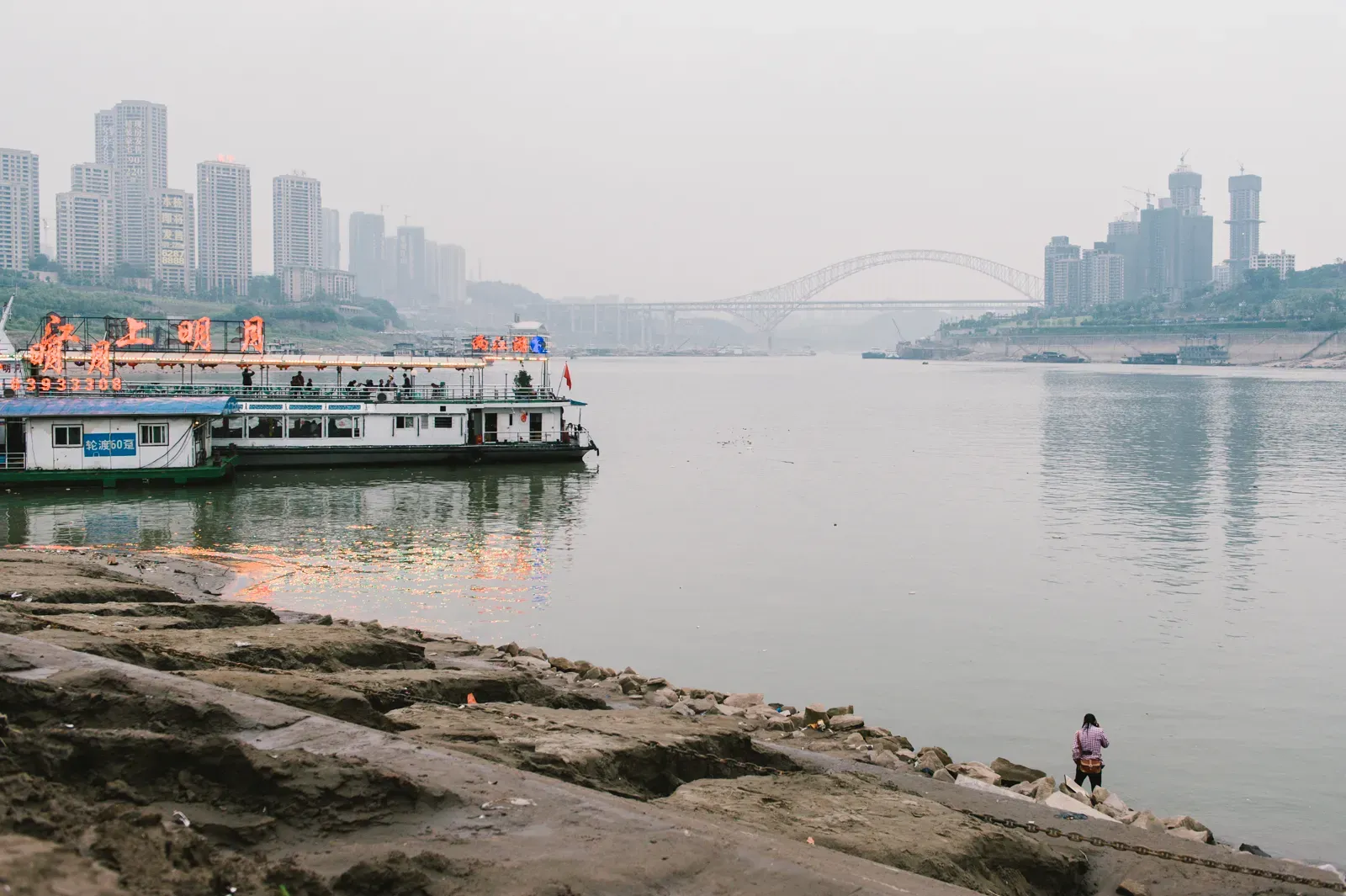
Chongqing sits at one of the most dramatic river junctions in Asia, where the Jialing River flows into the mighty Yangtze. The Jialing often appears greener or darker, reflecting its particular sediment and algae profile, while the Yangtze tends to run more yellow‑brown thanks to vast quantities of fine sediments carried from central and western China. The result is a meeting of noticeably different water masses right in front of a hyper‑modern, high‑rise skyline.
From viewpoints along the city, you can see swaths of different colors coursing side by side downstream, especially under certain seasonal flow conditions. The two rivers differ in sediment concentration, turbidity, and sometimes temperature, so the interface between them behaves more like a sliding seam than an instant blend. In a way, that visible line is a blunt reminder of everything happening upstream: deforestation, dams, monsoon rains, and shifting climate – all expressed as a simple color contrast that refuses to smooth out immediately.
The Ohio and the Mississippi – Cairo, Illinois, USA
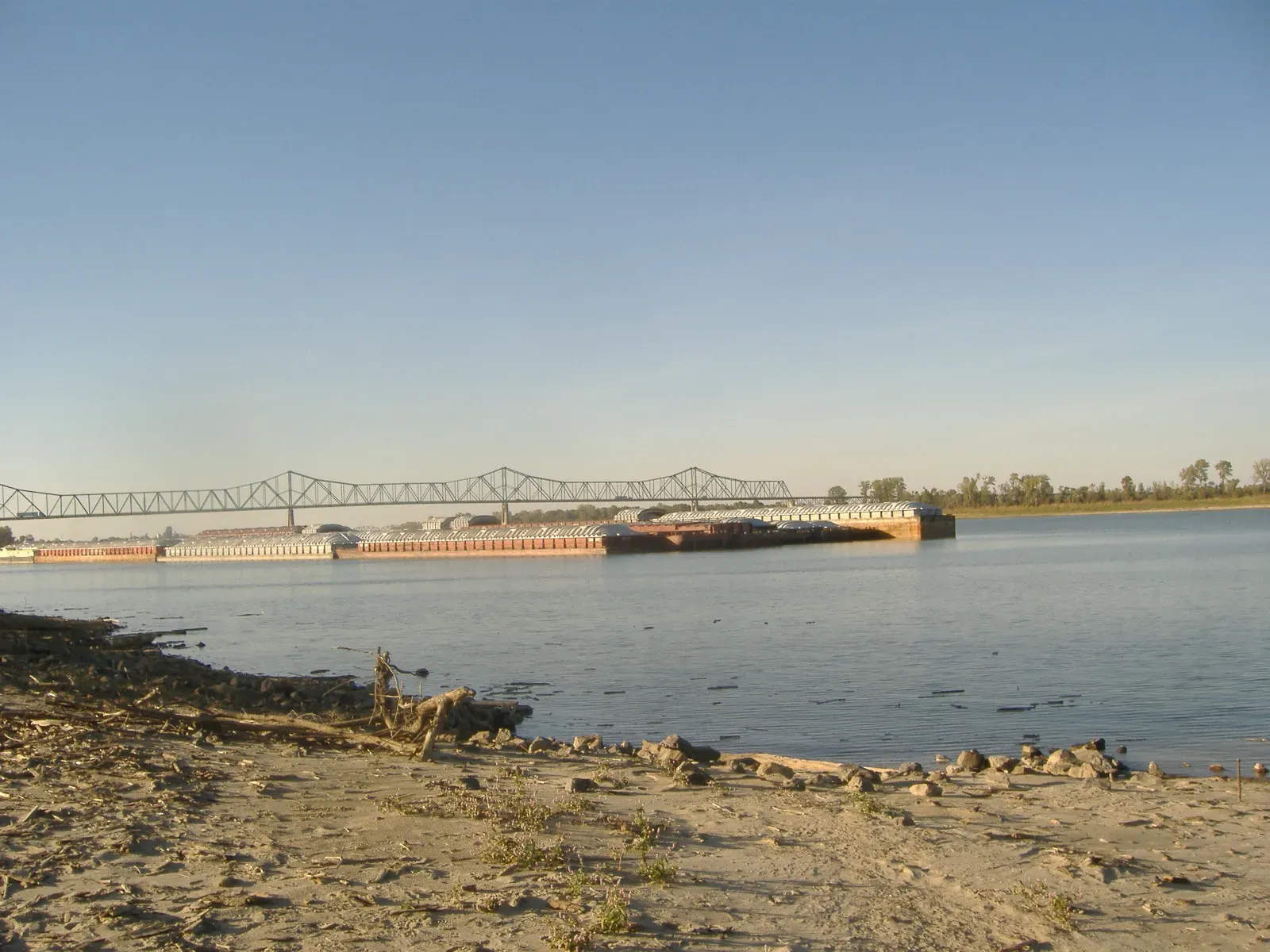
At the southern tip of Illinois near Cairo, the Ohio River and the Mississippi River come together in a massive confluence that you can feel as much as see. The Ohio often carries a somewhat different color and clarity, shaped by its path through the eastern United States, heavy rainfall patterns, and the kinds of soils and land use it drains. The Mississippi, by the time it arrives, is already a heavyweight, bearing fine sediments and organic matter from a huge swath of the interior.
When these two giants meet, the water does not instantly lose its former identity. Pilots, river workers, and careful observers have long remarked on the distinct bands and swirling tongues of differently colored water stretching well downstream of the merge point. The stubborn separation comes from contrasts in temperature, density, speed, and especially sediment concentration. Standing on the overlook, watching one river that looks more like chocolate milk slide past another that trends toward a different shade, you can’t help thinking that this is North America’s entire middle, poured into one uneven, slowly mixing line.
Irtysh and Ob Rivers – Near Khanty‑Mansiysk, Russia
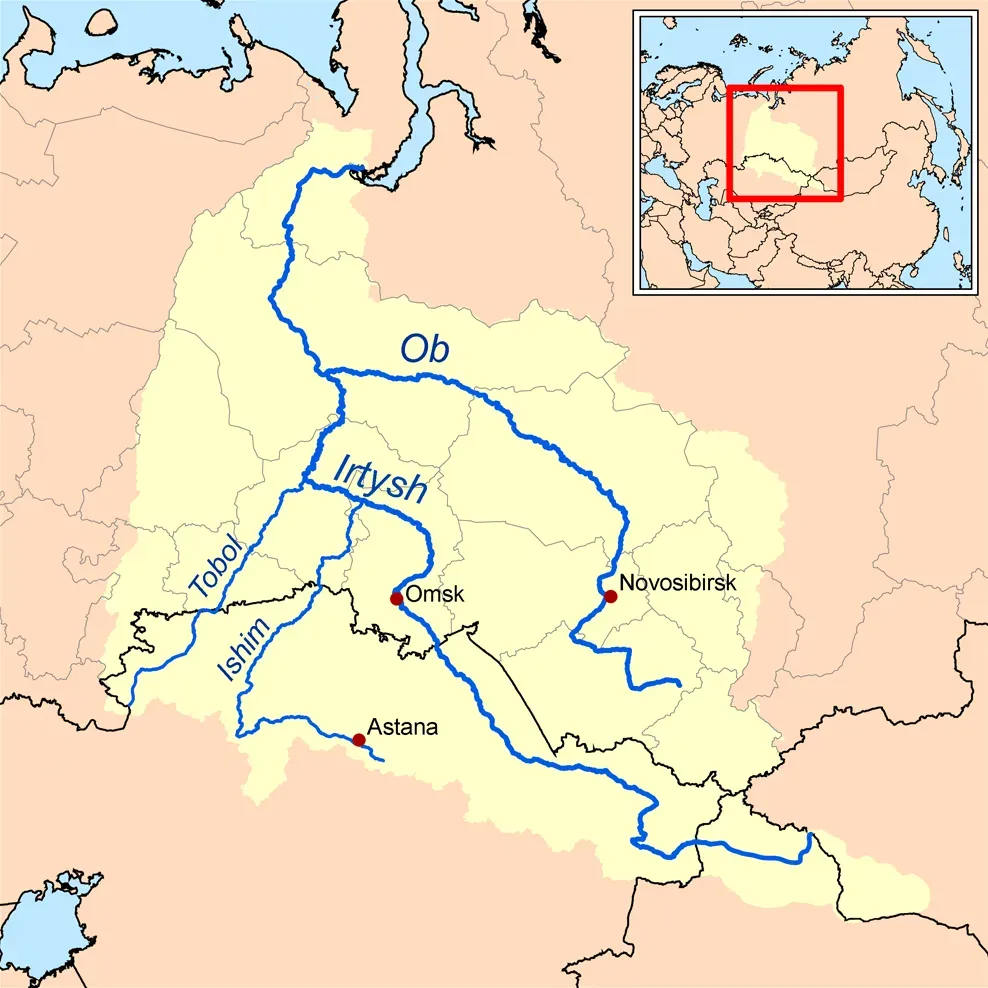
In western Siberia, the Irtysh River joins the Ob, forming one of the longest river systems on the planet. The Irtysh, having traveled from far in the south through steppe and semi‑arid regions, often brings a distinctive sediment and color signature. The Ob, draining vast taiga forests, wetlands, and permafrost‑influenced areas, typically carries another hue and a different cocktail of organic matter.
Satellite images and on‑site observations show long, sweeping bands of contrasting water stretching downstream of their confluence. Different mineral loads, organic content, and seasonal temperatures mean the Irtysh and the Ob initially behave like neighbors more than roommates, sticking to their side of the channel. From a scientific perspective, that shear zone between water masses is a gold mine: it shapes how nutrients, contaminants, and even tiny organisms are transported northward toward the Arctic. From a human perspective, it is simply eerie to watch a single river wear two faces at once.
Rio Solimões and Rio Japurá – Western Amazon, Brazil
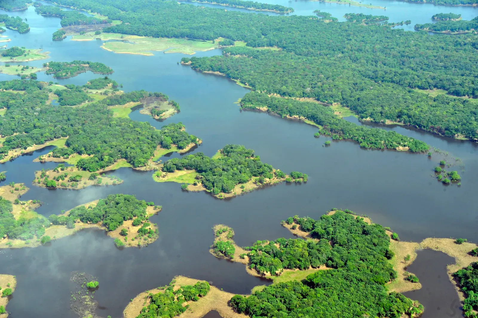
Deeper in the Amazon basin, the Rio Solimões plays the same color‑contrast trick with the Rio Japurá that it performs with the Rio Negro near Manaus, but with its own twist. The Solimões is still that sediment‑rich, light brown conveyor of Andean erosion, thick with suspended particles that give it a cloudy look. The Japurá, flowing from Colombia and cutting through dense forest and floodplains, can appear darker and sometimes greener, shaped by organic matter and different source rocks.
Where they meet, long tongues and panels of color stretch downstream like someone spilled different paints into the same moving canvas. Because these rivers are enormous and carry huge volumes of water, full mixing is not as immediate as people assume; the two water bodies can maintain separate identities for many kilometers. That persistence matters for aquatic life: fish, plankton, and even river dolphins experience sharp gradients in turbidity, light, and chemistry along that interface. It is one of those places where a helicopter photo looks like abstract art, but the “painting” is alive and constantly shifting with every flood pulse.
Where the Atlantic and Pacific Waters Meet – Near Cape Horn and the Southern Gateways
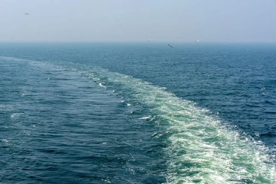
This one bends the rules a bit, because it is not two rivers in the classic sense, but it behaves in a strikingly similar way. Around the southern tip of South America and through straits like the Drake Passage and nearby channels, waters from the Pacific and Atlantic Oceans converge. They differ in temperature, salinity, density, and even in the types of plankton and nutrients they carry, which can create visible bands and fronts where two water masses refuse to mix quickly.
In satellite images and from ships braving those notoriously rough seas, you can sometimes see lines and swirls where one water mass curls past another with a different color or texture. The physics echo the river confluences: differences in density and momentum cause waters to slide along each other before turbulent mixing has time to do its job. I still remember the first time I saw a ship’s wake cut through two subtly different shades of gray‑blue on a documentary and realizing, with some surprise, that even the world’s biggest “rivers” – the ocean currents – have confluences that look remarkably like their smaller cousins on land.
Why These Waters Really Refuse to Mix
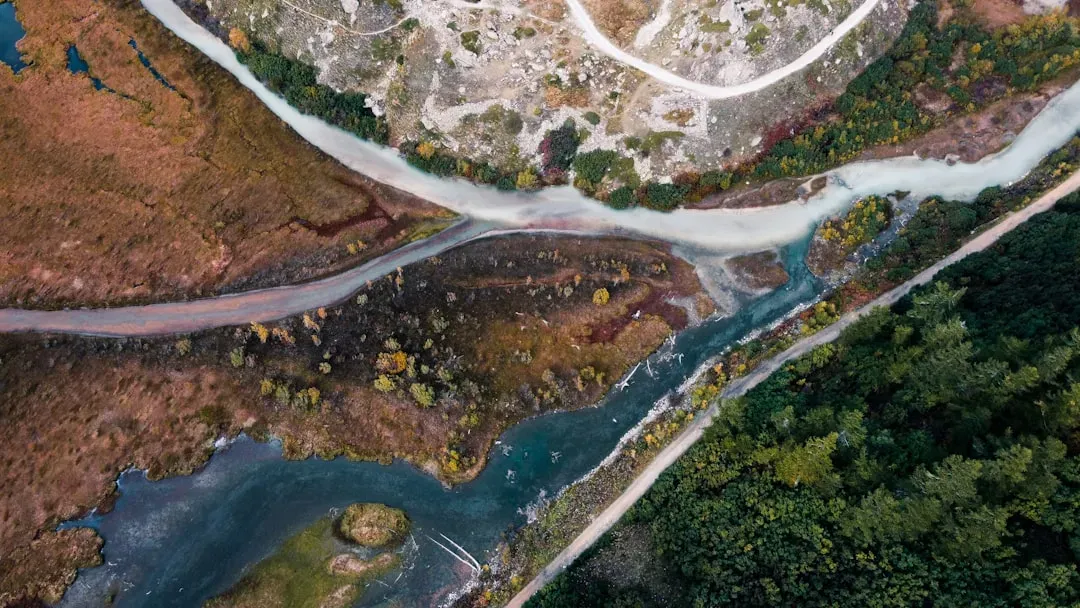
Despite how mystical it looks, the refusal to mix is not a violation of basic physics – it is physics on display. When two flowing water bodies meet, their different temperatures, speeds, sediment loads, and densities create what scientists call shear zones and density gradients. These act a bit like invisible barriers, allowing the waters to slide side by side while full mixing is delayed. Over kilometers, turbulence and diffusion win, but along the way we get those crisp visual boundaries that feel almost unreal.
Personally, I think these stubborn, striped rivers are one of the best antidotes to the idea that nature is simple or uniform. Every confluence in this list is a visible negotiation between mountains, forests, glaciers, cities, farms, and even oceans, all meeting in a channel that cannot immediately smooth those differences out. To me, that is the real takeaway: when we look at a river and see just “brown water,” we are missing the story. Once you spot where two waters refuse to mix, you realize the planet is full of frontiers hiding in plain sight – so next time you cross a bridge, will you look a little closer at the color line below?