You probably hear a lot about seas swallowing cities, but far less about the places where the ground itself is quietly lifting skyward. Along a handful of unusual coasts, the land is rising faster than the water, reshaping harbors, exposing new beaches, and forcing you to rethink what climate risk looks like on a map. These are not fantasy stories; they are very real, very measurable changes in Earth’s crust that you can already see in tide-gauge records and satellite measurements. As you explore these seven coastlines, you’ll notice a strange mix of reassurance and unease. On one hand, the local picture can look almost comforting: tide charts showing falling relative sea levels, new land emerging from the waves, old shorelines left stranded inland. On the other hand, you’re reminded that this is still a restless planet, where tectonic plates grind, ice sheets rebound, and nothing about the shoreline is ever truly fixed.
1. Northern Gulf of Bothnia (Sweden and Finland)
If you stand on the shores of the northern Gulf of Bothnia, between Sweden and Finland, the sea is literally retreating from you year after year. Here, you’re standing on land that used to be weighed down by the immense ice sheet of the last Ice Age; now that the ice has melted, the crust is springing back up like a mattress after you stand up. In some of the fastest uplifting spots near cities like Umeå and Vaasa, the land is rising on the order of nearly a centimeter per year, which is several times faster than the modern rate of global sea-level rise. You can actually see the long-term effects in the landscape: former bays that turned into lakes, old fishing harbors that are now stranded far from deep water, and shorelines that have to be mapped and remapped across generations. If you lived here for a few decades, you’d notice harbors silting up and new shallows appearing where boats once sailed, not because the water dropped, but because the land kept climbing. It’s one of the clearest places on Earth where you can feel that the ground under your feet is still recovering from an ancient weight.
2. Northern Norway and the Barents Sea Coast
Along parts of northern Norway and around the Barents Sea, you see a similar story of land rebound, but the setting feels wilder and harsher. When you walk the coast in Finnmark or along certain fjords, raised shorelines and old beach ridges sit like abandoned terraces, marking where the sea used to be. These are not fragile tropical beaches being gnawed away by storms; instead, they’re rugged coasts where Earth’s crust is quietly lifting faster than the ocean can climb. Because the land is rising so quickly, you get a strange contrast with global headlines about drowning coasts. Locally, tide gauges can show falling or stable relative sea levels, giving you the sense that the ocean is backing off. Yet you still face other climate stresses here, from shifting fisheries to changing sea-ice seasons, reminding you that a protective lift in land does not magically cancel all the other challenges. It just means that in this corner of the Arctic, the main enemy of coastal infrastructure may be uplift and changing navigation depths rather than creeping inundation.
3. Hudson Bay Region (Canada)
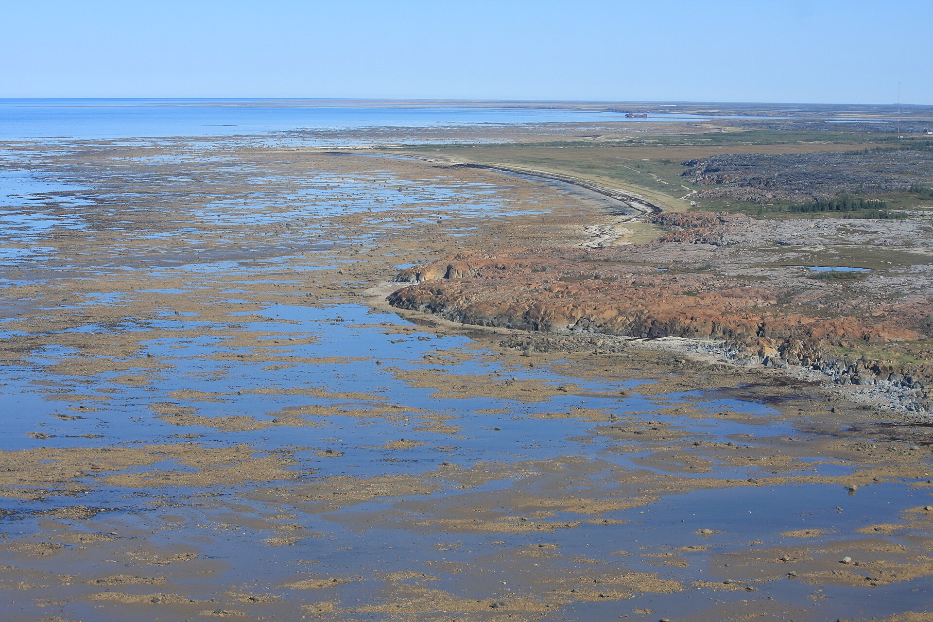
If you travel to the shores of Hudson Bay, especially in northern Manitoba or Nunavut, you’re walking through one of the most dramatic rebound zones on the planet. This is another place where an enormous ice sheet once pressed down so hard that the crust was pushed deep into the mantle. Now, long after that ice disappeared, the land is still rising faster than the seas, leaving old whaling stations and indigenous campsites marooned well inland from the modern shoreline. From your perspective, the coastline here is always in motion, but in a different direction than you might expect from climate-change stories. New mudflats, marshes, and coastal plains keep emerging as the land rises, reshaping habitats for birds, seals, and people alike. If you were planning infrastructure or mapping navigation routes in this region, you’d have to treat the coastline as a moving target, not only because of ice and storms, but because the actual ground is still slowly but relentlessly lifting out of the bay.
4. Parts of Alaska’s Uplifting Coasts
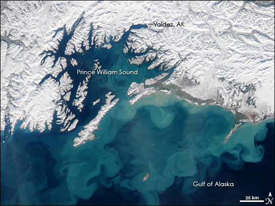
Alaska gives you a front-row seat to both extremes: some coasts are sinking and drowning, while others are rising so fast that relative sea level is actually falling. In parts of southeastern and south-central Alaska, especially near uplifting sections of the Pacific plate boundary and post-glacial rebound zones, the ground can rise rapidly between major earthquakes. You might see old tidal marshes stranded above high tide, or docks that need constant adjustment because the seafloor is effectively getting shallower every decade. Living or working along these uplifting coasts forces you to think of the shoreline as an outcome of both tectonics and climate, not just one or the other. Even if global sea levels climb, certain stretches of Alaskan coast will continue to gain elevation faster, at least for now, which can reduce local flooding risk but create new headaches for navigation and harbor design. You get reminded that the story of sea level is always a local tug-of-war between vertical land motion and the rising ocean, and in some Alaskan pockets, the land is currently winning.
5. Eastern Coast of Greenland
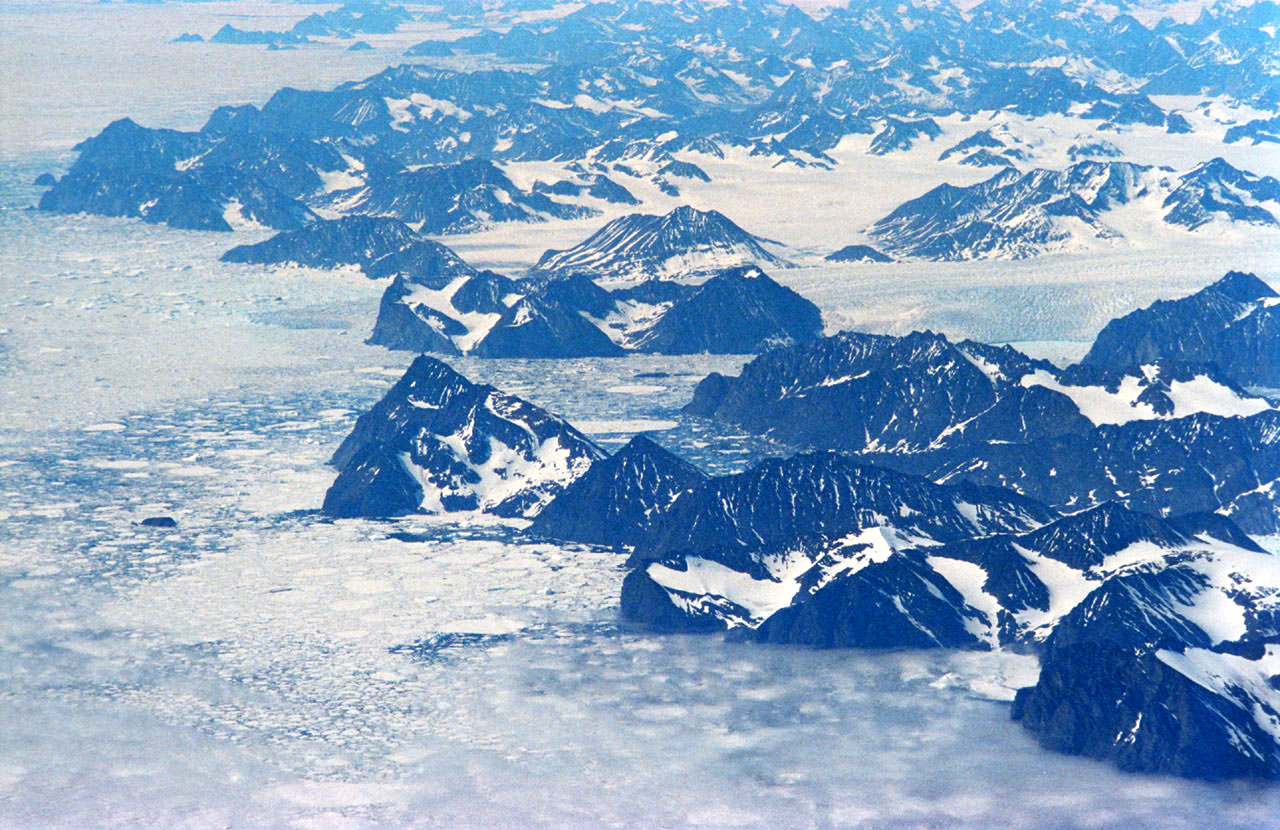
When you step onto the eastern coast of Greenland, you’re in a place where ice, rock, and ocean are locked in a complex dance. Massive ice loss from Greenland’s interior is changing how the crust and surrounding ocean behave, and in some regions, the land is rebounding or flexing upward faster than the local sea surface is rising. You might expect a warming Arctic to mean uniform coastal drowning, but instead you find places where the shoreline is effectively lifting in response to the redistributing weight of ice and water. For you, that means the phrase sea-level rise can be a bit misleading without context. Local communities and researchers here have to track not just how much ice is melting, but how the Earth’s crust and gravity field respond, because those shifts control how much water actually piles up along the coast. As land rebounds and currents adjust, certain fjords and inlets may see slower relative sea-level rise, or even drops, compared to global averages. It’s a powerful reminder that when you talk about sea level, you are really talking about a complex three-dimensional puzzle, not a simple bathtub filling evenly.
6. Scottish and Northern British Coasts
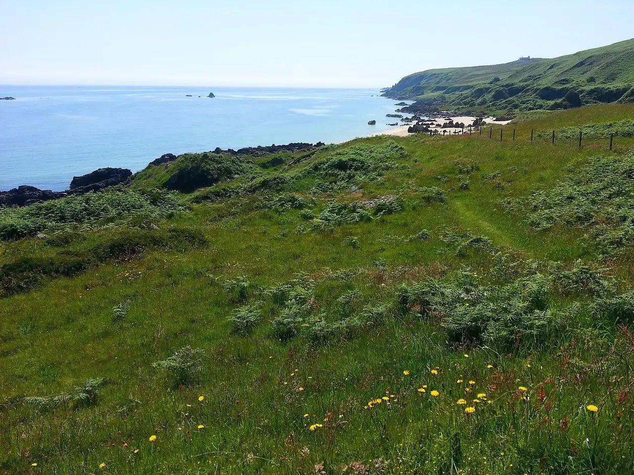
If you walk along parts of northern Scotland or the Orkney and Shetland islands, you can spot subtle signs that the land has been lifting relative to the sea for thousands of years. These coasts were once closer to the center of the British–Irish Ice Sheet, and the crust here is still enjoying the long, slow rebound from that missing weight. You see raised beaches, old cliff lines set back from the current shore, and archaeological sites that now sit high above the modern tide range. In contrast, parts of southern and eastern England are slowly sinking, which makes your experience of sea-level change very different depending on where you stand. If you live in the north, the upward motion of the land can partially offset or even outpace the rise in global sea level, at least over some timeframes. That doesn’t mean you can ignore flood risk altogether, especially in low-lying estuaries, but it does mean your local planning has to account for uplift as a real factor, not just a footnote.
7. Northern Baltic Coasts of Estonia and Nearby Regions
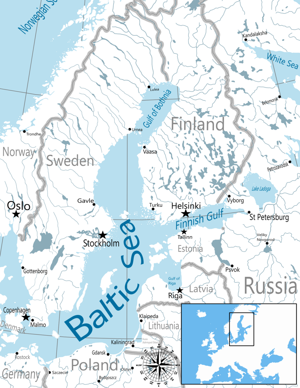
Around the northern Baltic, including parts of Estonia and neighboring countries, you encounter another quietly uplifting shoreline shaped by the legacy of the last Ice Age. If you visit these coasts repeatedly over decades, you’d notice that shallow bays grow narrower, rocky islets become larger, and piers that once sat in comfortably deep water may end up in awkwardly shallow channels. The land here is still flexing upward from the same glacial rebound process you see in Sweden and Finland, just at slightly different rates. From your point of view, that upward motion changes how you think about long-term coastal development. Instead of only fearing encroaching waves, you also have to reckon with harbors that may slowly lose depth and wetlands that may shift seaward as new land surfaces. It’s a rare situation where climate-driven sea-level rise and geological uplift are in a constant race, and for now, in many northern Baltic pockets, the land is still winning. That win, however, comes with its own set of engineering and ecological trade-offs that you can’t ignore.
Conclusion: A World Where the Shoreline Never Sleeps
When you put these seven coasts side by side, you start to see global sea-level change in a much more three-dimensional way. You’re no longer just picturing water creeping up a fixed wall; you’re watching the wall itself move, tilt, and rebound while the water level shifts too. In some places, like the northern Gulf of Bothnia or Hudson Bay, that motion works in your favor for now, helping to counteract the rise in the oceans. In others, the benefits are mixed, offering less flood risk but more complications for ports, ecosystems, and navigation. If you take anything away, let it be this: where you are on the planet matters just as much as how fast the global ocean is rising. Your local sea-level story is written not only by greenhouse gases and melting ice, but also by deep, slow processes in the crust beneath your feet. Understanding that tension between rising seas and rising land helps you plan smarter, worry more precisely, and appreciate just how alive the solid Earth really is. When you picture the future coastline you care about most, are you imagining the water moving, the land moving, or both at once?