
Most people assume the laws of physics are non-negotiable – gravity pulls down, water flows downhill, fire needs fuel to survive. Then you visit places like these, where balls roll uphill, rocks crawl across dry lakebeds with nobody pushing them, and waterfalls seem to vanish mid-air. Scattered across the planet are two dozen locations that have spent decades making scientists, tourists, and stubborn skeptics feel genuinely unsettled.
Some of these mysteries only cracked wide open in the last few years, and a couple still haven’t been fully solved. A few turned out to be nothing but clever tricks of light and geography. Others are the real deal – legitimate scientific puzzles that instruments only recently caught in the act. Here’s what’s actually happening at each one, starting with the illusion that fools thousands of drivers a year.
#25 – Spook Hill, Florida
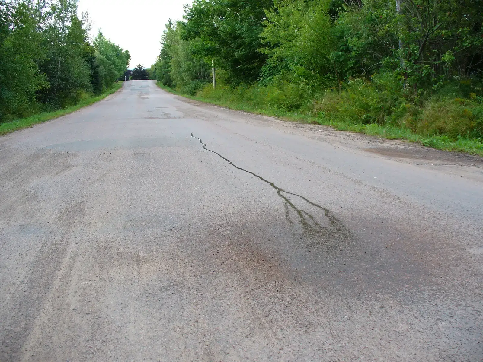
Park your car in neutral at this small-town Florida landmark, and it will appear to roll backward, uphill, toward a painted stop sign.
Locals have leaned into the legend for generations, claiming an old Native American chief and an alligator are somehow responsible for the pull. The real explanation is far less supernatural – it’s a textbook example of a “gravity hill,” where surrounding slopes, trees, and the horizon line trick your inner ear and eyes into misjudging which way is actually downhill. Your brain assumes flat ground based on what it sees around it, not what a level actually reads.
- The road is only slightly graded, not flat as it appears.
- Optical reference points like fences and rooflines are tilted just enough to fool depth perception.
Engineers have measured the actual slope and confirmed gravity is doing exactly what it should here. The mystery never lived in the road – it lived in your eyes the whole time.
#24 – Magnetic Hill, New Brunswick
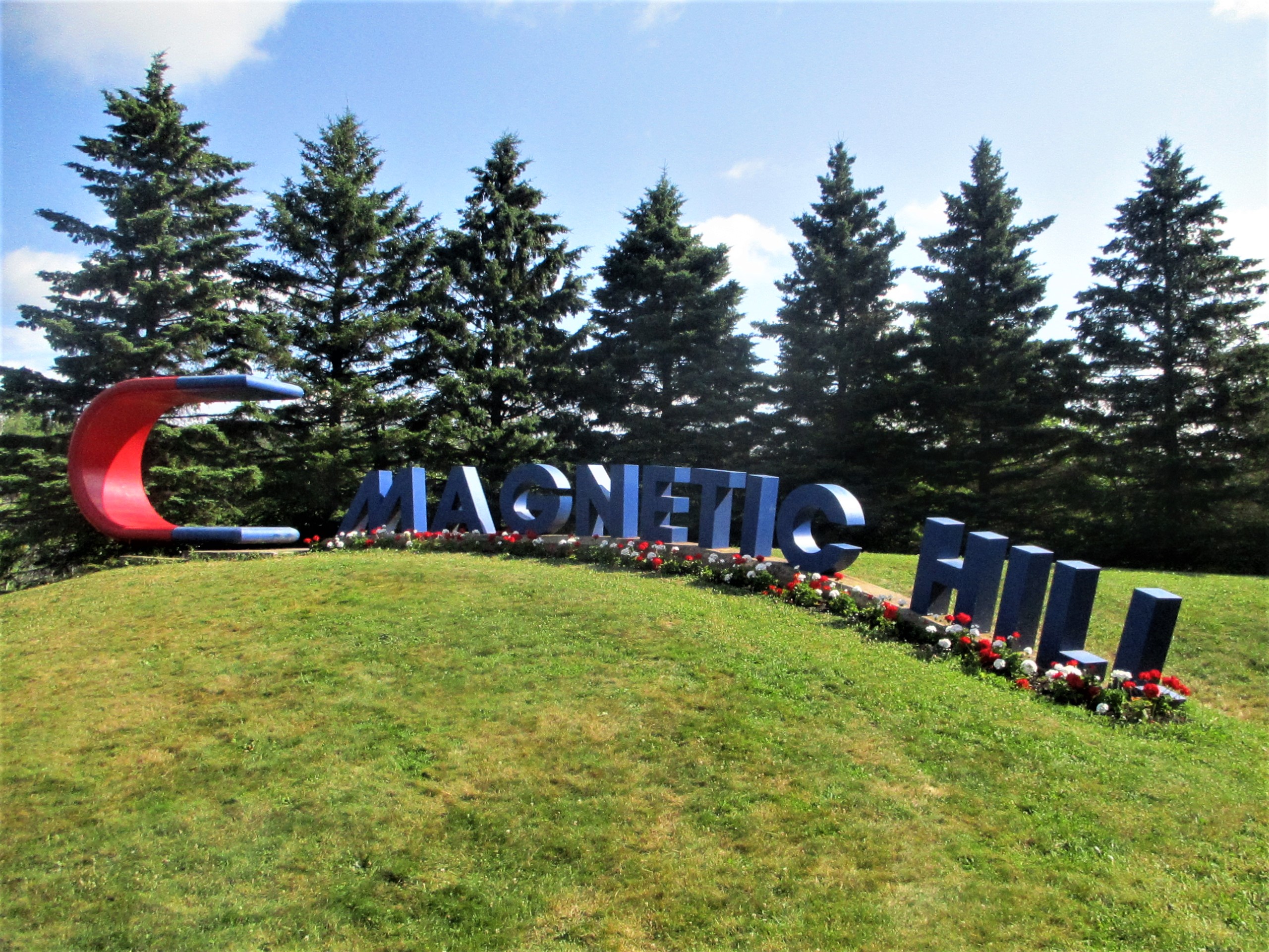
Canada’s most famous “anti-gravity” road has been pulling in curious drivers since the 1930s, all convinced their car rolls uphill on its own.
The trick works the same way it does everywhere else on this list: your eyes lie to you before your car ever moves an inch. The surrounding landscape is arranged so a downhill slope reads as an uphill one, especially because the “uphill” direction lines up with a horizon that appears to rise. Put a spirit level on the dashboard and the illusion collapses instantly.
Tourism boards rarely advertise that part, because “clever landscaping trick” doesn’t sell postcards the way “magnetic mystery” does. The hill still draws hundreds of thousands of visitors a year who want to feel the pull for themselves, illusion or not.
#23 – Magnetic Hill, Ladakh, India
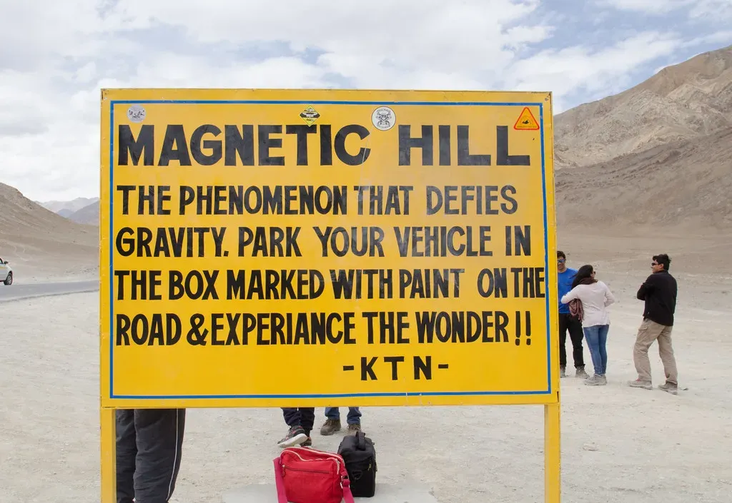
At over 11,000 feet in the Himalayas, this stretch of road near Leh is marketed as one of the most powerful gravity-defying spots on Earth.
Signs at the site tell drivers to put their car in neutral and watch it climb the hill by itself, and thousands of tourists do exactly that every season. Local folklore claims the road sits on a path that pulled ancient aircraft off course, and some visitors insist they feel a genuine magnetic tug on their vehicle. The optical illusion here is unusually strong because the mountainous terrain hides the true horizon almost completely, making it nearly impossible to judge slope by eye alone.
Quick Compare
| Location | What’s Claimed | What’s Really Happening |
|---|---|---|
| Spook Hill, FL | A ghost pulls cars uphill | Tilted horizon fools depth perception |
| Magnetic Hill, NB | A mysterious magnetic pull | Same horizon-tilt illusion, no magnetism |
| Magnetic Hill, Ladakh | A force strong enough to pull aircraft | Downhill slope disguised by mountain terrain |
Indian geological surveys have confirmed the road actually slopes downward in the “uphill” direction. That hasn’t stopped it from becoming one of Ladakh’s most photographed tourist stops.
#22 – The Oregon Vortex, Gold Hill
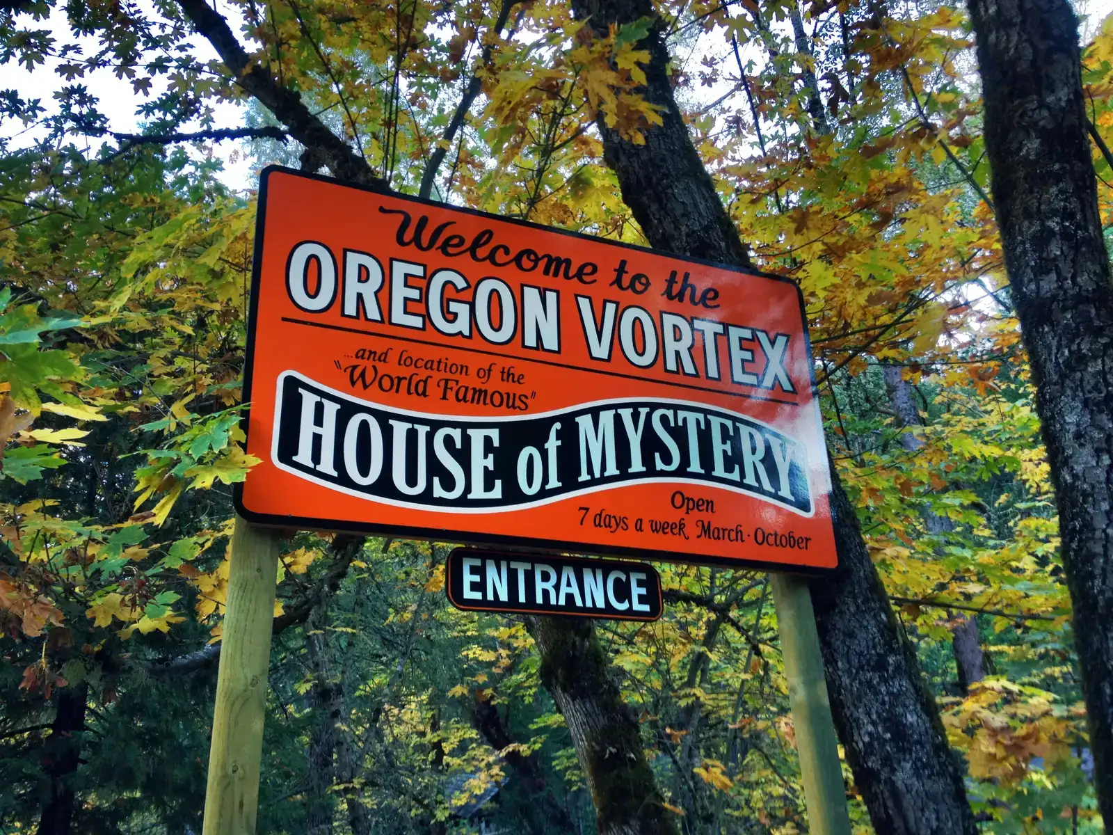
This roadside attraction has been baffling visitors since the 1930s, when a shack built decades earlier appeared to trap people at odd, tilted angles.
Owners have long claimed a genuine gravitational anomaly exists within a small circular zone, causing brooms to stand upright and people to shrink or grow depending on where they stand. Skeptics and physicists point instead to the tilted construction of the “House of Mystery” itself, built at a permanent slant on a hillside that has slowly settled over nearly a century. The tilt creates a forced-perspective effect almost identical to the famous mystery spots found in dozens of other American roadside attractions.
Despite skeptical explanations, the site still pulls in tens of thousands of paying visitors annually who want to see the “vortex” firsthand. It remains one of the longest continuously operating oddity attractions in the country.
#21 – Salar de Uyuni, Bolivia
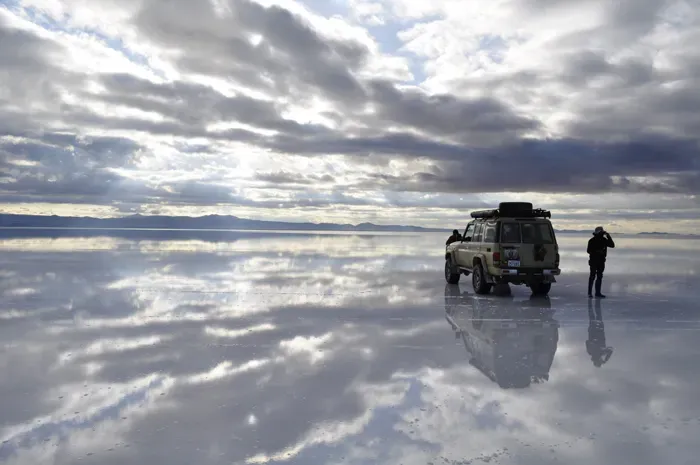
The world’s largest salt flat turns into the world’s largest mirror after even a light rainfall, blurring the line between sky and ground so completely that photographers lose all sense of horizon.
A thin sheet of water spreads across the crystallized salt crust, reflecting clouds so precisely that visitors report feeling like they’re walking on air. The flat itself holds an estimated 10 billion tons of salt, formed from prehistoric lakes that evaporated thousands of years ago, leaving behind a surface so level it’s used to calibrate satellites orbiting Earth. Locals call the phenomenon “the mirror of the sky,” and during the wet season, tourism spikes dramatically for exactly that reason.
Many argue the dry-season version, with its perfect hexagonal salt tiles, is actually the more scientifically fascinating half of the year.
#20 – Lake Hillier, Australia
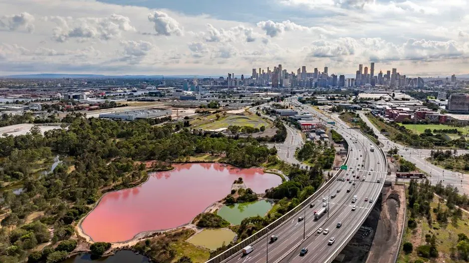
Off the coast of Western Australia sits a lake the color of bubblegum, and it stays that shade of pink no matter how much water you scoop out of it.
Researchers long assumed algae alone caused the color, but more recent sampling suggests a combination of salt-loving microorganisms and pigment-producing bacteria is responsible for the permanent hue. The lake’s extreme salinity, roughly ten times saltier than the ocean, creates exactly the conditions these organisms need to thrive and produce their signature reddish pigments. Unlike some pink lakes that fade when photographed or bottled, Lake Hillier reportedly keeps its color even in a sealed jar.
Tourists can only view it from the air or its edge, since swimming inside the lake itself is restricted. That hasn’t stopped it from becoming one of the most photographed bodies of water in the Southern Hemisphere.
#19 – Great Blue Hole, Belize
![#19 - Great Blue Hole, Belize (Source: [1], fetched September 2006. Caption on this USGS web page was, "Blue Hole: Aerial view of the 400-ft-deep oceanic blue hole (Lighthouse Reef Atoll Blue Hole) located east of Belize.", Public domain)](https://nvmwebsites-budwg5g9avh3epea.z03.azurefd.net/dws/8ae6d56db3b95aed5b0a6adb4ccea07a.webp)
From above, this perfectly circular sinkhole looks like someone poured black ink into the middle of a turquoise reef, and the color contrast isn’t a filter or an illusion.
The hole plunges more than 400 feet straight down, a depth that formed when a limestone cave system collapsed during past ice ages when sea levels were dramatically lower. Stalactites discovered deep inside prove the entire structure was once a dry cave, only flooding after the last glacial period ended and ocean levels rose. Divers who descend into it pass through distinct layers of water chemistry, including a toxic hydrogen sulfide layer where oxygen essentially disappears.
Marine biologists still debate how much oxygen-dependent life can survive in its lower reaches, since several species show up dead or dormant near the bottom. It remains one of the most dived – and most misunderstood – formations on the planet.
#18 – Eternal Flame Falls, New York
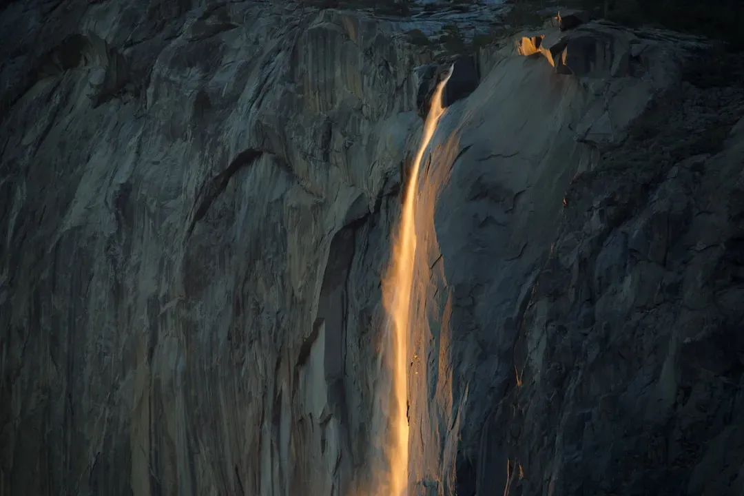
Tucked inside Shale Creek Preserve, a small flame flickers behind a waterfall, seemingly burning directly through falling water without ever being extinguished.
Unlike the waterfall itself, the flame isn’t powered by anything mystical – it’s fed by a thin natural gas seep escaping through a crack in the shale bedrock, ignited by hikers and kept alive by a steady trickle of methane rising from below. Geologists have long puzzled over why the seep produces gas at such unusually low temperatures, since most natural gas deposits require far more heat and pressure to form.
Visitors sometimes have to relight the flame themselves after wind or heavy rain snuffs it out, since it isn’t a constant, unassisted blaze. It’s a small phenomenon by global standards, but a genuinely strange one geochemically.
#17 – Devil’s Kettle Falls, Minnesota
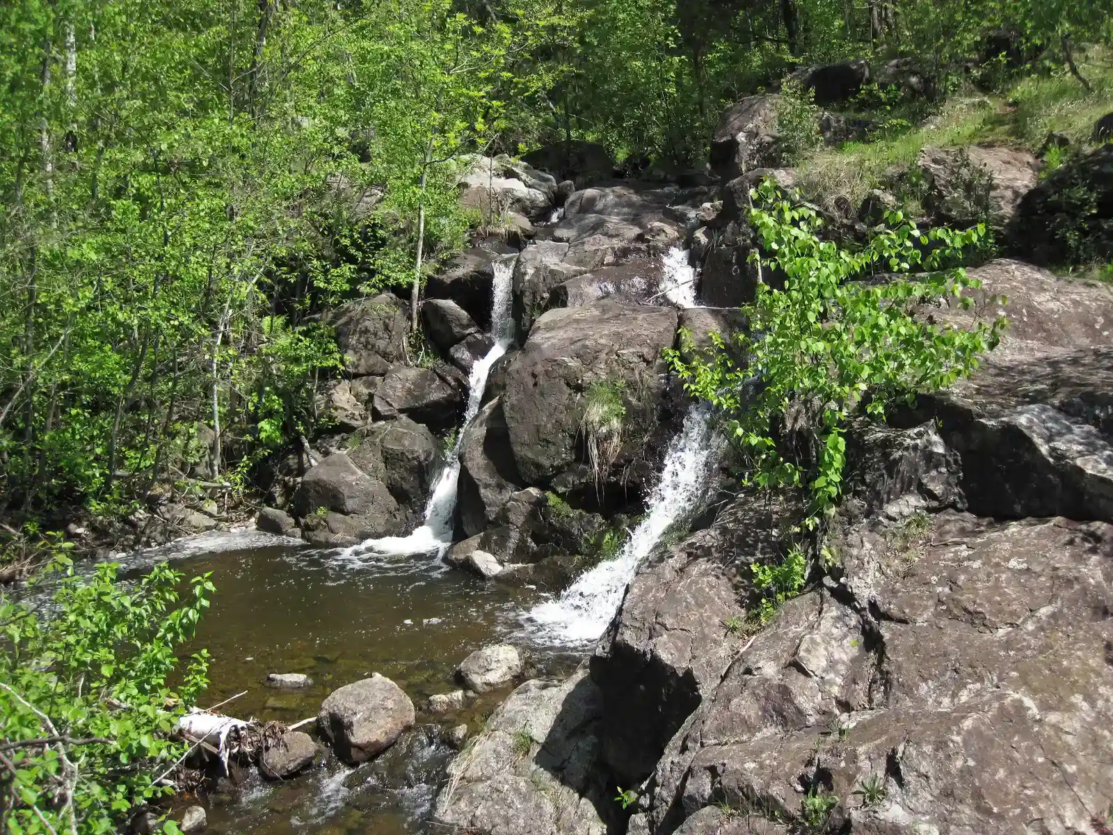
For decades, this waterfall was famous for a mystery nobody could solve: one half of the Brule River tumbles into a rock pothole and simply disappears, with no visible outlet anywhere downstream.
Kayakers, park rangers, and hydrologists all tried tracing the missing water using dye, ping pong balls, and even sensors, and for years nothing ever resurfaced. The mystery was finally debunked in 2017 when researchers used a flow meter and discovered the water actually reconnects with the river just downstream, hidden beneath turbulence and rock formations that made it impossible to see. Turns out the “disappearing” water was never disappearing at all.
Many longtime visitors were disappointed to learn the truth, arguing the legend was more fun than the physics. Either way, it remains one of the most visited waterfalls in the state.
#16 – Zone of Silence, Mexico
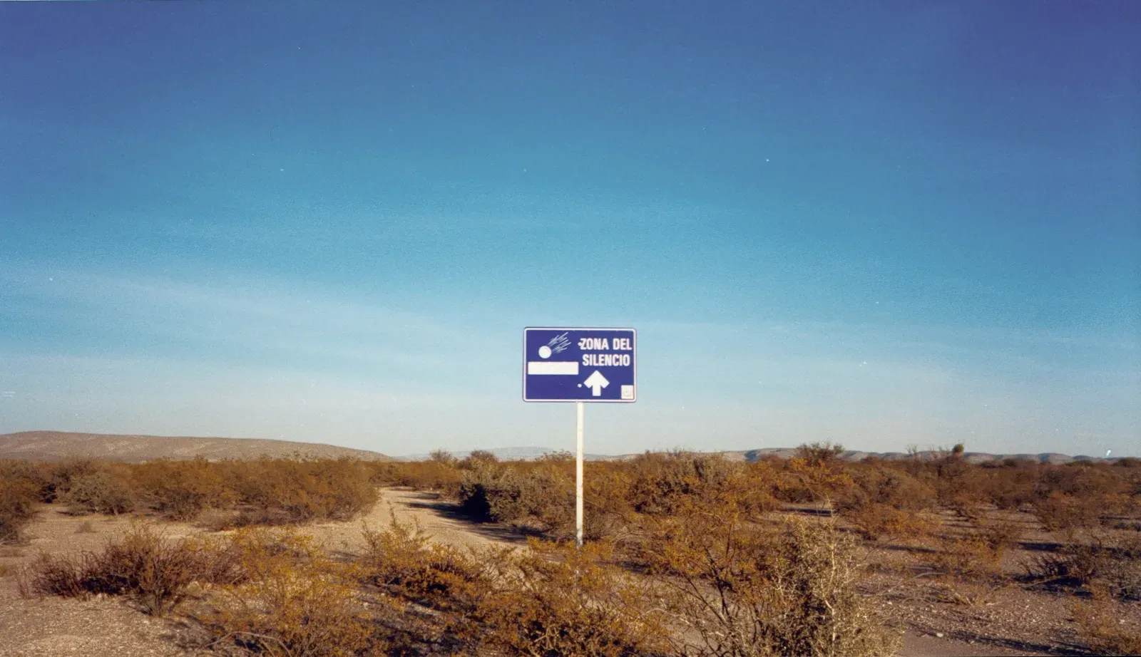
In the Chihuahuan Desert sits a patch of land locals call the “Zone of Silence,” where compasses supposedly spin wildly and radio signals mysteriously vanish.
The legend exploded after a rocket allegedly veered off course and crashed nearby decades ago, and ever since, tourists have flocked to the area expecting magnetic chaos. Most scientific investigations have found no unusual magnetic or electromagnetic anomalies at all – signal loss in the area is far more plausibly explained by the region’s remote location, mountainous terrain, and lack of nearby broadcast towers. Local guides, however, still insist compasses behave strangely on-site.
This is one of the more controversial entries on this list: many researchers now argue the “zone” is essentially a well-marketed myth built on ordinary desert isolation. Locals disagree, and the debate shows no sign of settling.
#15 – Socotra Island, Yemen
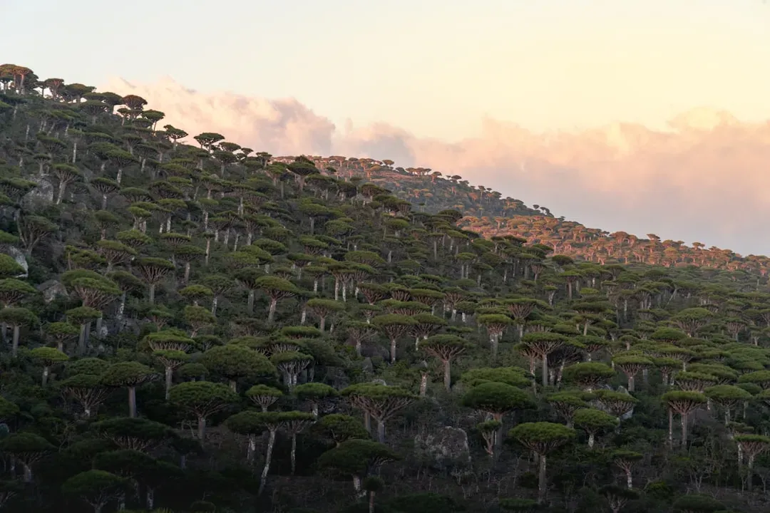
This isolated island looks like it was lifted from another planet, dominated by umbrella-shaped Dragon’s Blood Trees found nowhere else on Earth.
Isolated from mainland Africa and Asia for roughly 6 to 7 million years, Socotra evolved its own bizarre catalogue of plant and animal life almost entirely independent of outside influence. More than a third of its plant species exist nowhere else on the planet, giving it one of the highest concentrations of endemic biodiversity anywhere in the world. The trees themselves ooze a dark red resin once prized as dragon’s blood in ancient medicine and dye-making.
Conservationists now worry rising temperatures and increased shipping traffic threaten this fragile evolutionary time capsule. Few places demonstrate natural selection running its own separate experiment as clearly as this island does.
#14 – Cave of Crystals, Naica, Mexico
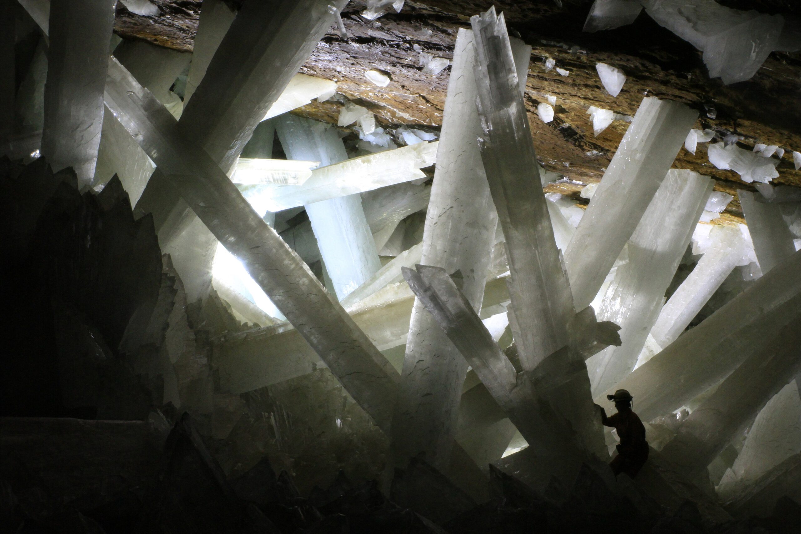
Hidden nearly 1,000 feet below a Mexican mining town lies a cave lined with crystal beams so massive they look computer-generated.
Some of the selenite crystals inside stretch over 30 feet long, formed over roughly half a million years in mineral-rich water that stayed at an astonishingly stable temperature near 136°F. The heat alone makes the cave nearly lethal to enter without specialized cooling suits, since human bodies can only survive brief exposure before suffering heatstroke or worse. Scientists studying the cave have to work in short shifts using refrigerated suits and breathing equipment just to collect samples.
Fast Facts
- Discovered in April 2000 by miners drilling for fresh ore deposits deep inside the Naica Mine.
- The largest crystals stretch over 36 feet long and can weigh up to 55 tons.
- Formed over roughly 500,000 years in water that stayed near a stable 136°F the whole time.
- Without protective gear, explorers can typically endure only about 10 minutes inside before the heat becomes dangerous.
Since the mine was drained for research purposes, the crystals have stopped growing and slowly begun degrading, a fact that troubles geologists who consider this one of the rarest mineral formations ever documented. Nature apparently needed total isolation and hundreds of thousands of years to pull this off.
#13 – Frozen Methane Bubbles, Abraham Lake, Canada
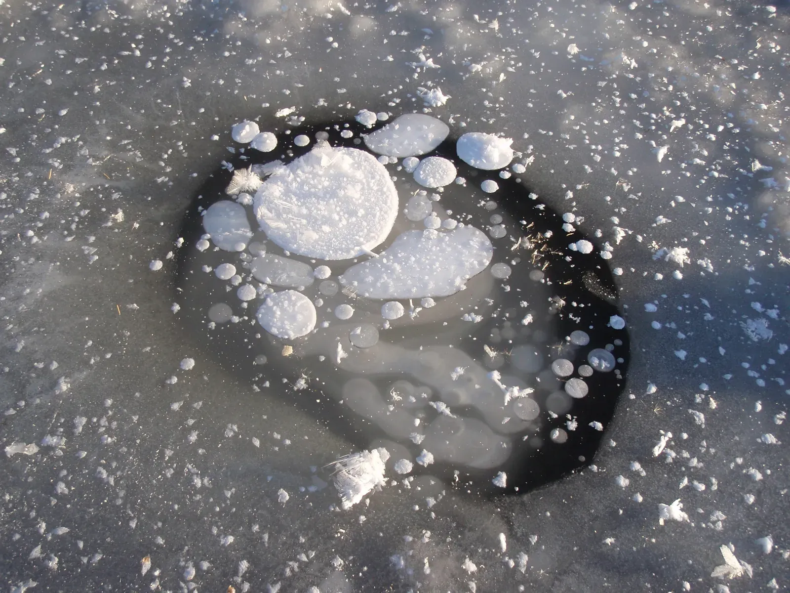
In winter, this Canadian reservoir freezes into a surreal, glass-like sheet trapping thousands of white bubbles that look permanently suspended mid-rise.
The bubbles are actually pockets of methane gas, released as dead plant matter decomposes on the lakebed, then frozen in place as each new layer of ice forms on top before the gas can fully escape. The methane trapped inside is flammable enough that it can be lit on fire if released and ignited, a demonstration occasionally shown by curious visitors and outdoor guides. Layer after layer of ice creates a stacked, almost sculptural effect unique to this particular lake’s depth and decomposition rate.
Photographers travel from across the world specifically for this effect, since few other lakes trap methane bubbles in such dense, visible clusters. It’s a rare case where a greenhouse gas becomes a tourist attraction.
#12 – Morning Glory Clouds, Burketown, Australia
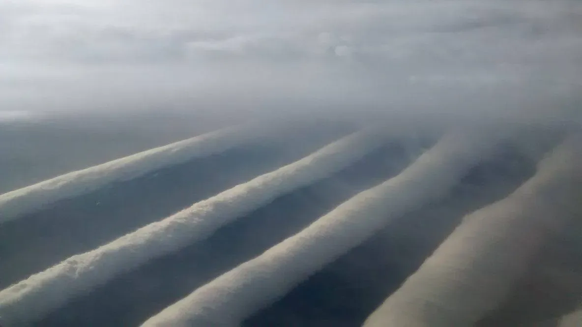
Each spring, pilots and cloud-chasers flock to this remote corner of Queensland to witness one of the only reliably predictable roll clouds on the planet.
These massive, tube-shaped clouds can stretch over 600 miles long, rolling across the sky at speeds gliders and pilots deliberately chase for the sheer thrill of surfing the air currents beneath them. Meteorologists still don’t fully agree on why this specific location produces such consistent formations, though sea breeze collisions and unique regional geography are considered the leading explanations. Similar clouds appear elsewhere on Earth, but rarely with this frequency or predictability.
Local pilots have built an entire niche tourism industry around “cloud surfing” these formations from the air. It’s one of the few atmospheric phenomena you can actually plan a vacation around.
#11 – Hessdalen Lights, Norway
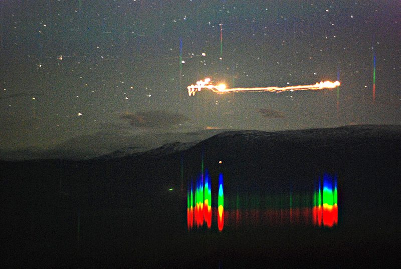
For decades, unexplained lights have flickered, hovered, and darted across a remote Norwegian valley, drawing serious scientific attention rather than just conspiracy theorists.
Researchers have installed permanent monitoring stations in the valley specifically to study the phenomenon, recording lights that sometimes last mere seconds and other times linger for close to an hour. No single theory has fully explained the lights, though leading hypotheses point to ionized dust, unusual battery-like effects created by minerals in the valley’s rock, or rare atmospheric plasma reactions. Unlike most reported anomalies, this one has actual instrumentation and decades of recorded data behind it.
Skeptics note the frequency of sightings has decreased over the years, while researchers continue camping out expecting new activity. It remains one of the only ongoing scientific investigations into an unexplained light phenomenon anywhere in the world.
#10 – Boiling Lake, Dominica
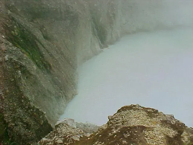
Deep in a rainforest crater sits a lake that genuinely boils, its grayish-blue waters churning and steaming as though a stove is running directly underneath it.
The lake sits above a fumarole, a vent releasing volcanic gases, meaning the “boiling” isn’t a figure of speech but the literal result of geothermal heat rising from magma below. Water temperatures near the center have been measured between 180°F and a near-boiling 197°F, making direct contact with the center genuinely dangerous for hikers. The lake occasionally drains and refills dramatically, sometimes disappearing almost entirely before slowly returning to its normal churning state.
Reaching it requires a grueling multi-hour hike through sulfur vents and volcanic terrain, which keeps visitor numbers relatively low compared to other natural wonders. It remains one of the largest actively boiling lakes documented anywhere on the planet.
#9 – Lake Natron, Tanzania
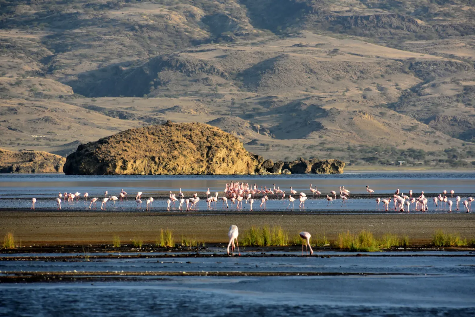
This East African lake looks like blood from above and has a well-earned reputation for essentially mummifying animals that die within its waters.
Extreme alkalinity, driven by surrounding volcanic deposits, gives the lake a pH that can rival ammonia, while surface temperatures regularly climb high enough to kill most organisms that touch it. The high salt and mineral content preserves carcasses in a calcified, statue-like state, a phenomenon photographers have documented for years using birds and bats that fell into the water. Despite this hostility, the lake is one of the only reliable breeding grounds on Earth for lesser flamingos.
Millions of flamingos depend on this seemingly deadly environment precisely because its harsh chemistry keeps predators away from their nesting sites. Few ecosystems demonstrate “one species’ hell is another’s safe haven” as literally as this lake does.
#8 – Danakil Depression, Ethiopia
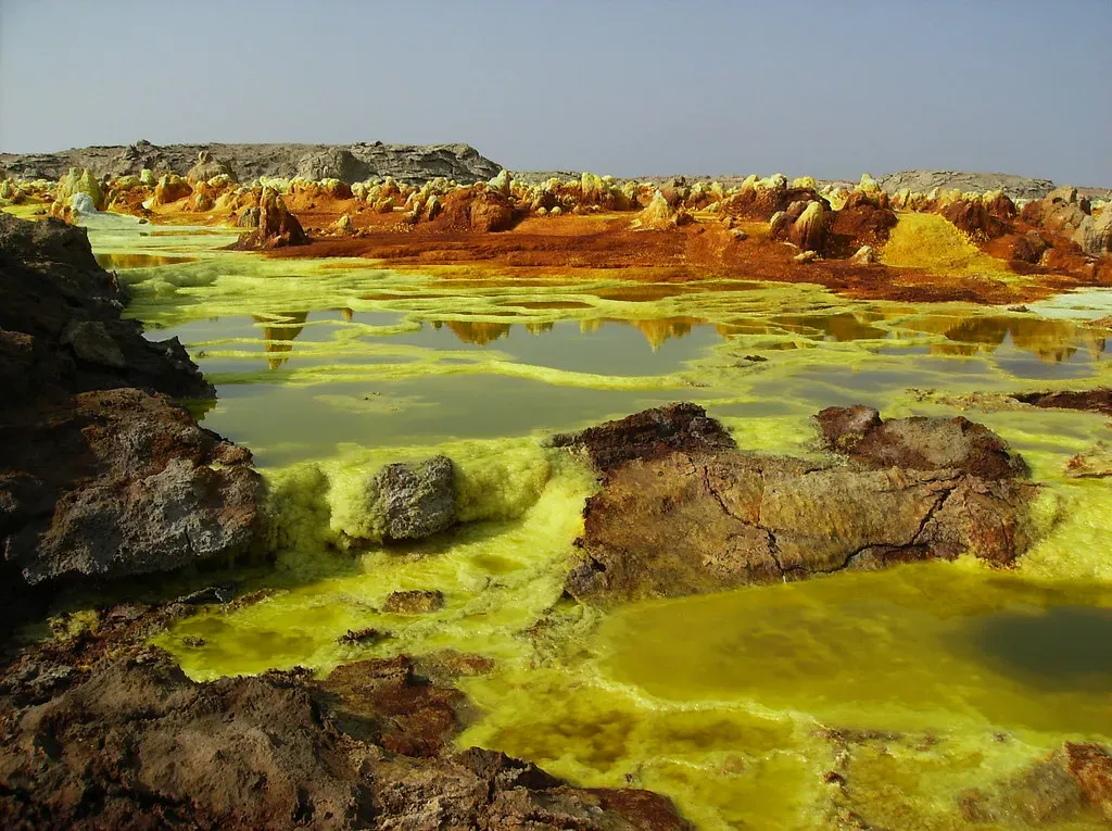
Widely considered one of the most hostile places on Earth, this region sits below sea level and regularly reaches temperatures that make it nearly uninhabitable for humans without serious preparation.
Acidic hot springs bubble in shades of neon yellow, orange, and green, colored by sulfur, iron oxide, and salt deposits reacting with active volcanic activity just below the surface. Average daytime temperatures frequently exceed 100°F for most of the year, giving it a reputation as one of the hottest inhabited places on the planet, home to the Afar people who mine salt here in brutal conditions. Active lava lakes nearby occasionally glow visibly at night, adding to its otherworldly reputation.
Scientists studying extremophile bacteria here believe the region’s chemistry closely resembles early Earth or even conditions found on Mars. Few landscapes make such a strong case for what alien terrain might actually look like.
#7 – Richat Structure, Mauritania
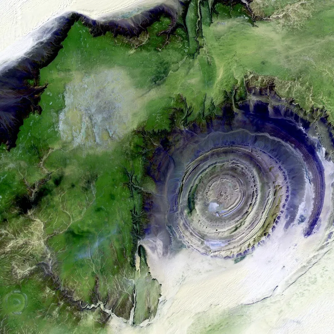
Visible clearly from space, this massive bullseye-shaped formation in the Sahara Desert was once seriously suspected to be an impact crater from a giant asteroid.
Geologists eventually determined the structure formed through slow, symmetrical erosion of layered rock domes, rather than any sudden violent impact, making it one of the largest and most striking examples of differential erosion on Earth. Its rings stretch roughly 25 miles across, a scale so massive it was originally used as a navigational landmark by early astronauts. Locally, it’s often called the “Eye of the Sahara” thanks to its uncanny, perfectly symmetrical appearance.
The debate over its origins lasted decades before satellite imaging and core sampling finally settled the question for good. It remains one of the best examples of how erosion alone can mimic catastrophic geological events.
#6 – Racetrack Playa, Death Valley
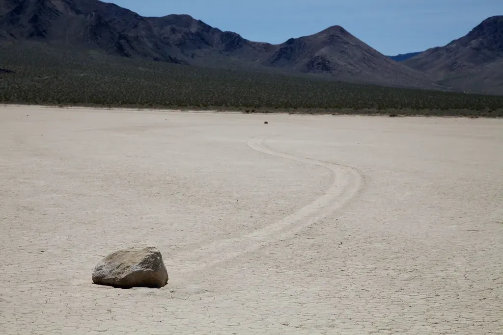
For decades, one of the strangest mysteries in American geology involved rocks that appeared to drag themselves across a dry lakebed, leaving long trails behind with no human or animal footprints anywhere nearby.
Theories ranged from strong desert winds to hoaxes, until researchers finally installed GPS trackers and time-lapse cameras directly on several rocks to catch the movement in the act. The rocks move when thin sheets of ice form after rare rainfall, then break apart under sunlight and light wind, gliding the rocks across a thin layer of water atop the mud below. The movement is so slow it had never been directly witnessed by a human being until scientists finally caught it on camera.
Worth Knowing
- The sailing stones puzzled researchers since the early 1900s, with theories ranging from hurricane winds to magnetic fields.
- A 2014 study fitted 15 rocks with motion-activated GPS trackers and set up dedicated time-lapse cameras.
- Some of the rocks weigh as much as 700 pounds, yet still glide across the flat mud.
- Ice sheets only a few millimeters thick were enough to shove the boulders forward.
This remains one of the most satisfying “mystery solved” stories in modern geology, since the explanation took nearly a century of speculation to confirm. It’s proof that some laws-of-nature mysteries just need better cameras.
#5 – Catatumbo Lightning, Venezuela
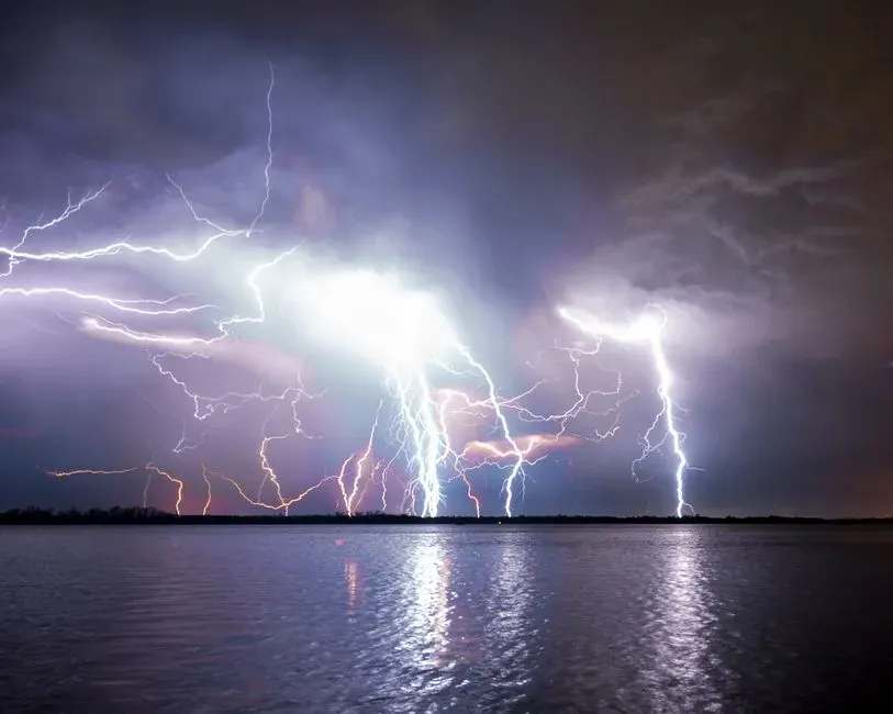
Where the Catatumbo River meets Lake Maracaibo, storms erupt with such consistent intensity that sailors historically used the lightning as a natural lighthouse, visible from dozens of miles offshore.
This single location can produce lightning activity on close to 200 nights per year, making it one of the most electrically active spots recorded anywhere on the planet. Some estimates suggest the region generates enough lightning strikes annually to set a world record for concentrated storm activity, driven by a unique combination of warm lake water, cold mountain air, and consistent wind patterns funneling through the valley. Unlike typical storm systems, this lightning display can continue for up to 10 hours straight in a single night.
Locals have used the phenomenon for navigation for centuries, long before anyone understood the meteorology behind it. It remains one of the most reliable natural light shows anywhere on Earth.
#4 – Blood Falls, Antarctica
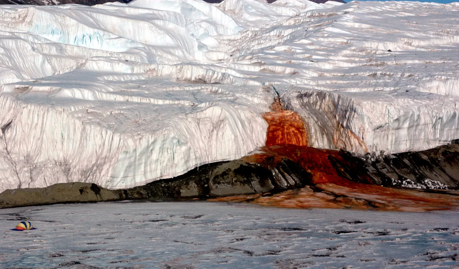
Flowing from beneath the Taylor Glacier, this waterfall stains the surrounding ice a deep, unsettling red, as though something violent happened just beneath the surface.
For years, researchers assumed algae caused the color, until further study revealed the true source: iron-rich brine trapped beneath the glacier for millions of years oxidizes and turns rust-red the moment it hits open air, essentially rusting in real time as it flows out. The brine comes from an ancient, sealed saltwater reservoir that’s been isolated from sunlight and oxygen for an almost unimaginable length of time, hosting microbial life that survives without either.
Scientists studying the site believe it offers direct insight into how life might survive in equally sunless, oxygen-starved environments elsewhere in our solar system. Few waterfalls anywhere carry this much scientific weight behind their color.
#3 – Movile Cave, Romania
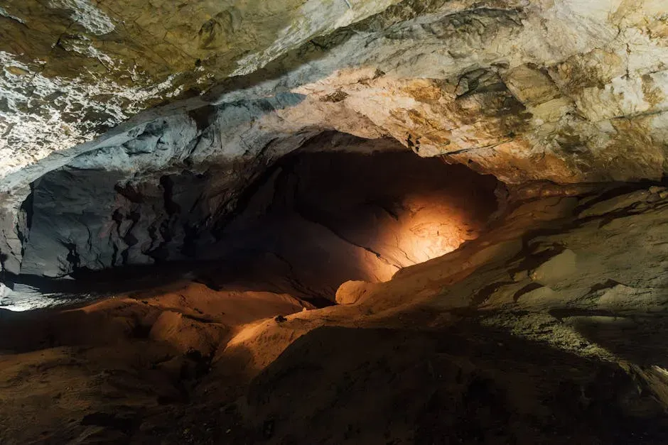
Sealed off from the surface world for roughly 5.5 million years, this Romanian cave hosts an ecosystem that shouldn’t be able to exist by ordinary biological rules.
That isolation sealed the cave behind thick clay and limestone layers, cutting it off from sunlight completely. With no photosynthesis possible, the ecosystem had to invent an entirely different power source: chemosynthetic bacteria that feed on hydrogen sulfide and methane instead of sunlight. This makes it one of the only known ecosystems on the planet that survives entirely without photosynthesis.
Researchers have documented 52 invertebrate species living inside, 37 of which are endemic and found nowhere else on Earth. Access is now tightly restricted specifically to preserve this fragile, self-contained biosphere. It’s one of the closest things scientists have to studying alien life without ever leaving Earth.
#2 – The Bermuda Triangle
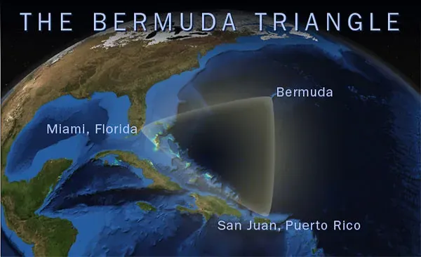
No location on this list has generated more books, documentaries, and wild theories than this stretch of ocean between Florida, Bermuda, and Puerto Rico, blamed for decades of vanishing ships and planes.
Popular legend claims disappearances here defy explanation entirely, pointing to everything from magnetic anomalies to methane eruptions from the seafloor. Most maritime insurers and the U.S. Coast Guard have stated the region shows no higher incident rate than any other heavily trafficked stretch of ocean, once you account for its high traffic volume, sudden Gulf Stream currents, and frequent, fast-forming tropical storms. Turns out, busy shipping lanes plus unpredictable weather explain most disappearances without needing anything supernatural.
This is genuinely one of the most controversial takes in maritime history: many researchers argue the “mystery” was manufactured by sensationalized reporting more than by actual missing-vessel statistics. The legend, however, refuses to die regardless of the data.
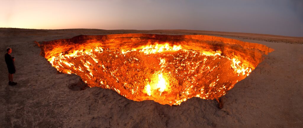
#1 – Darvaza Gas Crater, “Door to Hell,” Turkmenistan
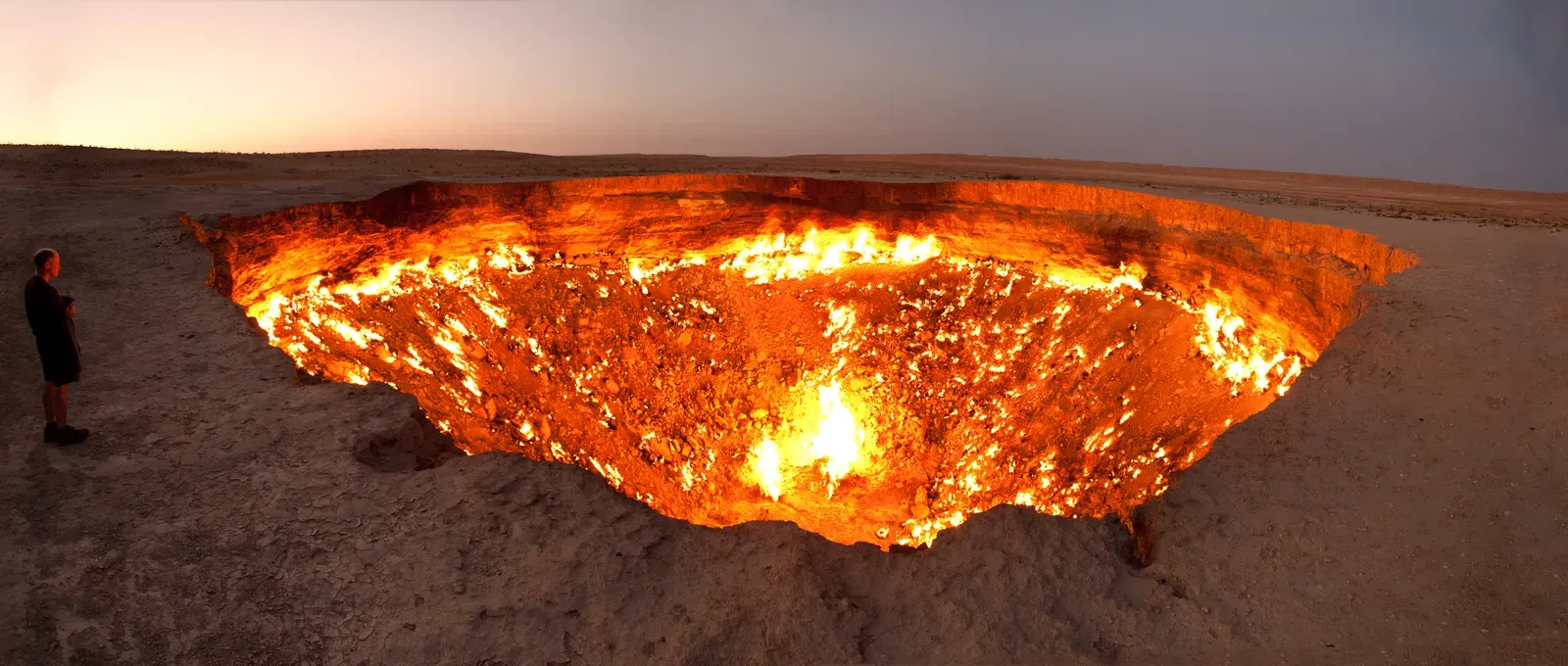
For over 50 years, this fiery crater in the middle of Turkmenistan’s Karakum Desert burned nonstop, earning its nickname as a genuine, permanent breach in the ground that simply refused to go out.
The crater was formed in 1971 when Soviet geologists accidentally collapsed a natural gas chamber while drilling, and fearing the release of poisonous gas, they set it alight, expecting it to burn out quickly. It never did. The crater measures roughly 69 meters wide and 30 meters deep, and for decades it looked like a literal eternal flame – until it wasn’t. Turkmenistan has spent the last several years actively draining the fire’s fuel source, and by August 2025 what had been the country’s top tourist attraction was down to a few pockets of small flames, with heat output dropping more than 75 percent over three years.
Fast Facts
- Formed in 1971 after Soviet drilling crews accidentally ruptured an underground gas chamber.
- The crater spans roughly 69 meters wide and 30 meters deep.
- Burned continuously for more than 50 years before official draining efforts began.
- Heat output has dropped more than 75 percent over the past three years alone.
Turkmengaz director Irina Luryeva confirmed at an energy conference that the reduction in fires is nearly threefold. The “unstoppable” flame turned out to be entirely dependent on a finite, controllable gas supply the whole time. It’s arguably the most fitting way to end this list: even the phenomenon that looked most permanent on Earth was never actually breaking any laws of nature – it was just waiting for humans to notice the off switch.
The Bottom Line
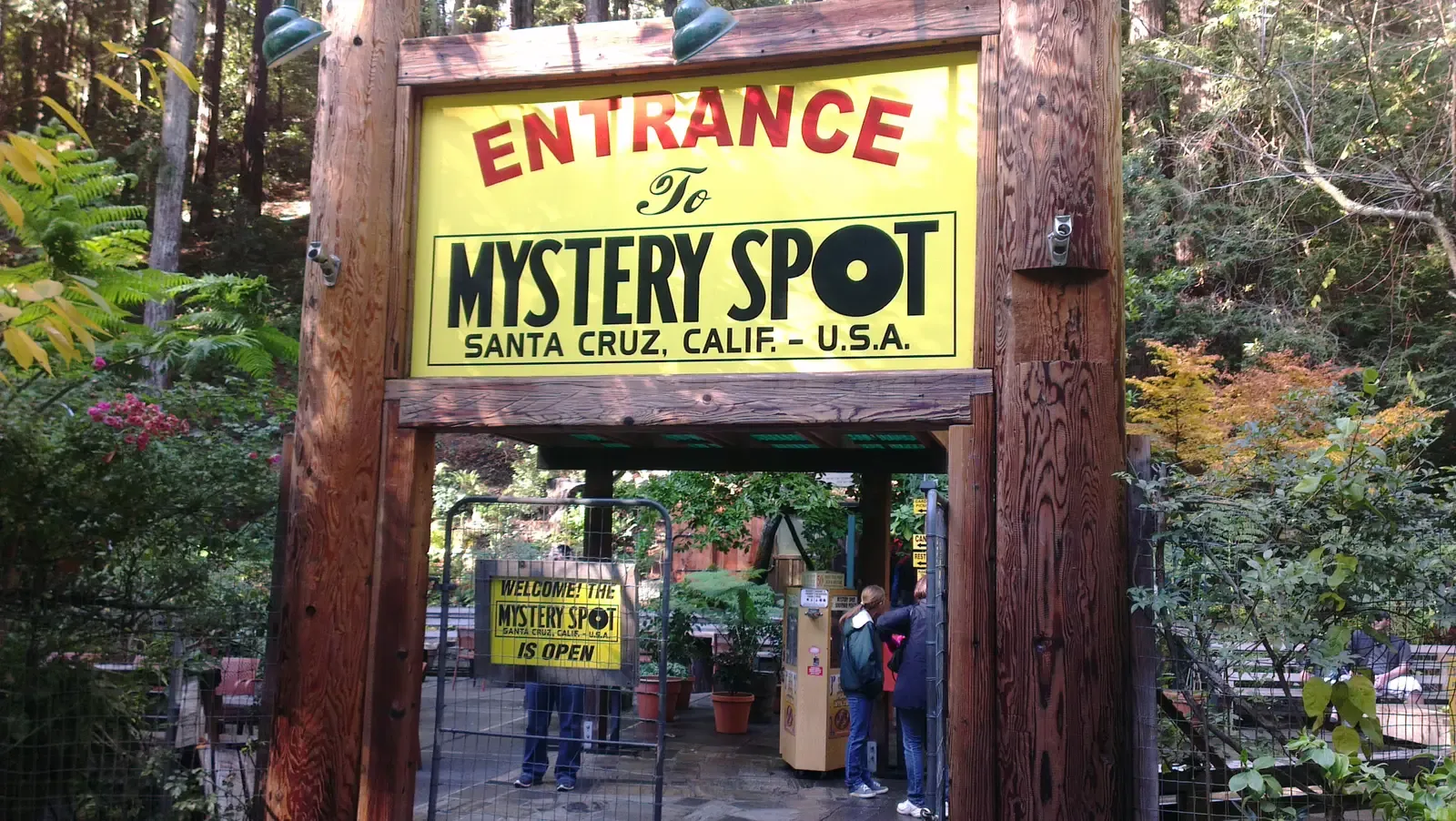
Here’s the uncomfortable truth after digging through all 25 of these locations: almost none of them actually break the laws of physics, biology, or chemistry. What they break is our assumptions. Gravity hills are optical illusions, sailing stones needed better cameras, and even a 50-year “eternal flame” turned out to have a finite fuel tank the whole time.
The genuine mysteries – Hessdalen’s lights, Movile Cave’s sunless ecosystem – are rarer and far more scientifically valuable than the manufactured ones like the Bermuda Triangle or the Zone of Silence. Nature doesn’t need to break its own rules to leave us speechless; it just needs better instruments than the ones we had a century ago. Which of these surprised you the most? Drop your pick in the comments.