Forget Atlantis. The real story is stranger, sadder, and a lot more recent than any myth. These weren’t lost civilizations swallowed by legend – they were ordinary towns with mail routes, school bells, and Sunday church services. People paid property taxes there. They fell in love there. And then, often within a single generation, someone in a government office decided the town was worth more as a reservoir than as a home.
What follows are 13 real places where dry land became lake bottom – some drowned on purpose for dams and drinking water, one swallowed whole by an earthquake in minutes. A few of them, strangely, keep coming back from the dead when the water drops. Stick around for #9, where divers found an entire ancient city sitting almost perfectly preserved 130 feet down, like someone hit pause on it in 1959.
#1 – Villa Epecuén, Argentina: The Town That Reappeared From the Lake
Most underwater towns stay underwater. Villa Epecuén didn’t get the memo. This was once a booming spa town on a saltwater lagoon in Buenos Aires Province, famous for mineral waters that tourists swore could cure everything from rheumatism to bad skin. Through the 1970s, hotels and resorts packed the tiny town with visitors chasing a cure in the water.
Then, in November 1985, heavy rains overwhelmed the containment works, and the lagoon simply pushed through. Water crept in over years, eventually climbing more than 30 feet and swallowing every building whole. Business owners fled with stock still sitting on their shelves. Entire streets vanished beneath a slow-moving, salty tide.
For nearly two decades, Villa Epecuén existed only as a name on old maps and a memory for the families who once lived there. Then, starting in the early 2000s, drought and shifting water policy caused the lagoon to recede – and the town clawed its way back into daylight.
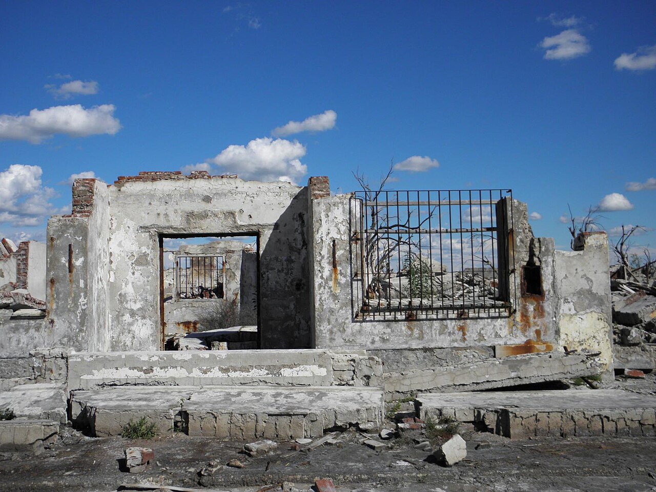
What emerged looked like a concrete graveyard: rusted car frames, twisted trees crusted white with salt, and hotel signs still bolted to crumbling walls. One former resident, Pablo Novak, actually moved back and lived alone among the ruins for years, becoming known as the town’s “last inhabitant.” It’s now a grim, magnetic tourist stop – living proof that underwater towns don’t always stay that way.
#2 – St. Thomas, Nevada: The Town Lake Mead Swallowed (Then Spat Back Out)
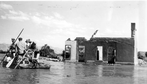
St. Thomas is the creepy reminder that “temporary” flooding can last almost a century. Founded in the 1860s by Mormon settlers where the Muddy and Virgin Rivers meet, it was just desert farmland – schools, general stores, orchards. Nobody there imagined their grandkids would watch the whole town vanish under America’s largest reservoir.
When the Hoover Dam was planned in the 1920s, officials warned residents that Lake Mead’s rising waters would eventually reach their doorsteps. The drowning was gradual and strangely intimate: people sold their homes to the federal government one by one, packed up, and left. By 1938, the last holdout famously rowed away from his own front porch as the water lapped at the windows.
Fast Facts
- Founded in 1865 by Mormon pioneers along the Muddy River
- Peak population reached roughly 500 residents, with a school, hotel, and ice cream parlor
- The town’s tallest building once sat about 60 feet below the surface of Lake Mead
- Fully submerged by 1938 after Hoover Dam construction began filling the reservoir
- Ruins have resurfaced repeatedly since 2002 as prolonged drought drops the lake’s water line
For decades, St. Thomas sat forgotten under dozens of feet of water. Then long-term drought and heavy demand on the Colorado River started dropping Lake Mead’s levels – and in the 2010s and 2020s, more of the old town resurfaced than anyone alive had ever seen.
Today you can actually walk through St. Thomas’s eroded foundations. Rangers have put up small signs marking where the general store and schoolhouse once stood. It’s an eerie, almost accusatory landscape – solid proof of how fast water can rewrite human geography in under a hundred years.
#3 – Potosí, Venezuela: A Lone Church Tower Rising From the Reservoir
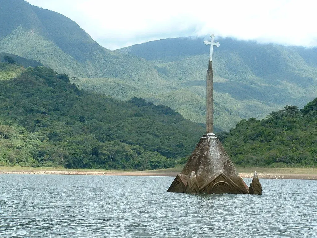
If you’ve ever seen a photo of a single church steeple poking straight out of a lake with nothing else around it, there’s a good chance it’s Potosí. This was a small Andean farming village built around a central plaza, with a church that anchored everything – baptisms, funerals, festival days.
In the 1980s, the Uribante-Caparo hydroelectric project needed a valley to flood, and Potosí was chosen. Houses were demolished or simply abandoned, families relocated, and the valley slowly filled behind the new dam. The church, too solid and too tall to knock down quickly, was left standing – and it ended up jutting out of the water like a gravestone for the whole town.
For years, that lone tower became the defining image of the sacrifice: electricity for millions, paid for with someone else’s hometown. Locals treated it as a controversial monument, equal parts progress and loss.
Then, like Villa Epecuén, drought intervened. Severe dry spells dropped the reservoir dramatically, and the streets of Potosí re-emerged from the mud. People walked again on the ground where they’d grown up, past a church now cracked and weathered by decades underwater – some finally able to mourn properly, others forced to relive old anger about broken promises.
#4 – Capel Celyn, Wales: A Village Drowned to Supply Someone Else’s Water
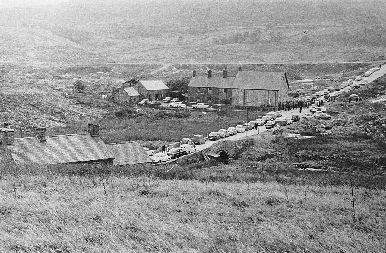
Capel Celyn isn’t just underwater – it’s still an open political wound in Wales. This tiny Welsh-speaking village in the Tryweryn Valley had farms, a chapel, and a tight-knit community where Welsh language and culture ran through everyday life.
In the 1950s, Liverpool Corporation in England decided it needed more water – and instead of finding a solution within its own borders, it pushed through a plan to dam the valley and drown Capel Celyn to build the Llyn Celyn reservoir. Here’s the detail that still stings decades later: every single Welsh Member of Parliament except one voted against the plan, and London approved it anyway.
Residents were forced to sell their homes. Graves were dug up and moved. In 1965, the chapel, post office, and farms all disappeared under rising water, replaced by a calm, man-made lake that tourists now photograph without a second thought.
But the memory never drowned. “Cofiwch Dryweryn” – “Remember Tryweryn” – is still spray-painted on walls and monuments across Wales today, nearly 60 years later. For many Welsh people, Capel Celyn remains the ultimate example of a community’s language, land, and voice being overridden by a decision made somewhere else entirely.
#5 – Old Adaminaby, Australia: The Ski Town’s Submerged Twin
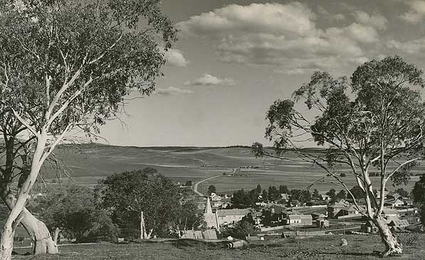
Lake towns near ski resorts sound glamorous – until you realize one of them literally replaced another town sitting on the lakebed beneath it. Old Adaminaby was a small rural community on the banks of the Eucumbene River in New South Wales, home to farms, a school, and a main street full of small shops.
When Australia built the Snowy Mountains Scheme – one of the largest hydroelectric and irrigation projects on Earth – Old Adaminaby sat squarely in the flood zone of what would become Lake Eucumbene. Residents weren’t just evicted; they watched bulldozers flatten their own homes and shops before a brand-new “New Adaminaby” was built on higher ground to replace it.
By the time the Eucumbene Dam closed and the lake filled, Old Adaminaby was completely gone – roads, fences, and orchards, all submerged. Locals had to adjust to a rebuilt town and new neighbors while their childhood streets slowly turned into fishing spots for tourists.
During severe droughts, the lake drops low enough that weathered foundations and fence posts poke through the mud again. Locals still walk out and point to exactly where their old house used to stand – a bittersweet reminder that a scenic lake view almost always has a buried cost underneath it.
#6 – The Sefid Rud Villages, Iran: Rice Fields Turned Into a Reservoir
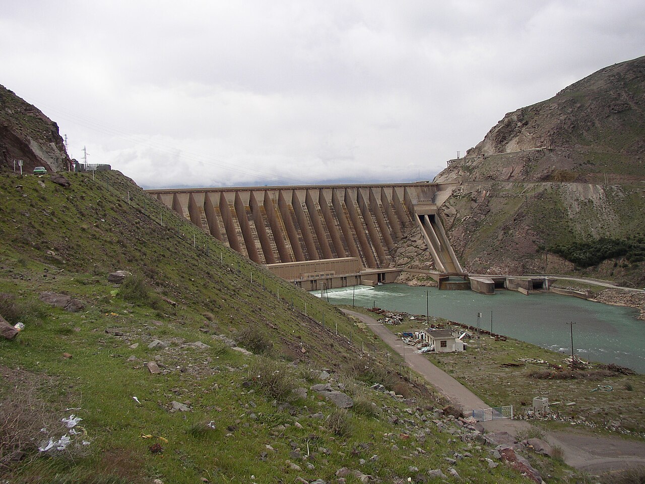
Some underwater towns never got famous – they were just quietly in the way. In northern Iran, the Sefid Rud Dam was built in the 1960s to power a rapidly modernizing country, flooding a valley of small agricultural villages that had grown up along the river for centuries.
These weren’t tourist destinations. People grew rice, raised livestock, and lived in traditional homes passed down through generations. When engineers mapped the expected water levels, entire micro-worlds of local dialects, customs, and family histories were marked for erasure beneath a rising artificial lake.
Compensation and relocation varied wildly, and not every family felt they’d gotten a fair deal. Today the reservoir looks like any other lake used for fishing and irrigation – unremarkable to a passerby.
But local elders still know exactly which ridgeline marked the edge of their childhood village, and where the mosque or marketplace once stood. When water levels drop low enough, old foundations occasionally reappear – a jarring reminder that the lake didn’t just “appear.” It took someone’s whole world to exist.
#7 – Vilarinho da Furna, Portugal: The Village That Walks Out of the Water
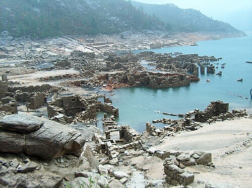
Vilarinho da Furna might be Europe’s most famous part-time village. Tucked in northern Portugal’s Gerês region, it was an ancient farming community with a unique communal system – villagers collectively managed fields and pastures together, a living time capsule of pre-modern rural governance.
In the late 1960s, plans for a hydroelectric dam on the Homem River sealed its fate. Residents fought the decision as hard as they could, but by 1972 the water had risen over the rooftops, taking centuries of communal culture down with it.
The story didn’t end there, though. In especially dry summers – the 1970s, 1990s, and 2000s – the reservoir’s water level has dropped enough to expose the stone skeleton of the entire village: houses, lanes, and low stone walls, suddenly visible again after years hidden below.
Descendants of former residents now hike down to walk streets their grandparents once knew by heart, and a small museum nearby preserves photos and documents from before the flood. It’s become trendy among photographers chasing a dramatic shot – but for locals, there’s still real debate over whether the electricity was worth what they lost.
#8 – Old Khairopar, Pakistan: A Desert Village Under a Surprising Lake
When you picture a submerged settlement, you probably don’t picture a desert – yet that’s exactly what happened near Khairopar. In Pakistan’s Sindh province, scattered villages in the Thar Desert region were built around seasonal water sources, with mud-brick houses and small farming plots dependent on erratic rainfall.
When a dam and related waterworks were developed to manage the region’s scarce water and control flooding, several low-lying desert villages found themselves destined to become permanent lakebed. For a community built around the assumption of drought, the idea of drowning felt almost absurd – but hydrology doesn’t care about intuition, only elevation.
As the works progressed, Old Khairopar’s homes and fields were slowly claimed by encroaching water, creating a strange, unexpected patch of blue in a landscape most outsiders picture as bone-dry sand. Residents were relocated, but the disruption to a lifestyle built around desert survival was enormous.
In dry spells today, a submerged tree line or a corner of an old wall sometimes breaks the surface. The photos look striking online – deep water against golden sand – but behind every one of them is a village that traded drought risk for drowning risk, and lost its original home to both.
#9 – Shicheng, China: The “Lion City” Sitting Underwater Like a Time Capsule
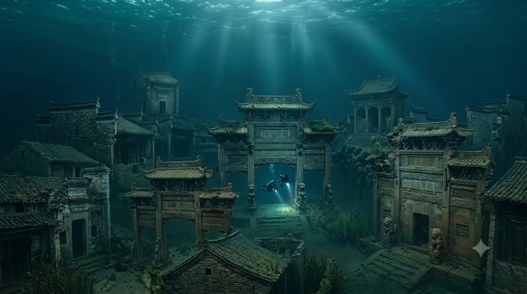
If any underwater town looks like a movie set, it’s Shicheng. Founded more than a thousand years ago during the Eastern Han period in Zhejiang Province, the “Lion City” later flourished with elaborate stone architecture, ceremonial arches, and detailed carvings that made it a regional showpiece.
In the 1950s, China built the Xin’an River Dam to create Qiandao Lake, or “Thousand Island Lake,” for hydropower and flood control. Shicheng and several nearby towns sat directly in the flood zone. When the reservoir filled in 1959, the entire city vanished under as much as 130 feet of water, along with its temples, homes, and streets.
At a Glance
- Original city dates back nearly 1,400 years to the Eastern Han and Tang dynasties
- Deliberately flooded in 1959 to build the Xin’an River hydroelectric station
- Around 290,000 people across more than 1,300 villages were relocated for the project
- Sits roughly 85 to 131 feet (26 to 40 meters) below the surface of Qiandao Lake
- Rediscovered by divers in 2001, nearly untouched after more than four decades underwater
For decades it was essentially forgotten, overshadowed by the scenic islands dotting the lake’s surface above it. Then divers went looking – and what they found stunned even seasoned archaeologists.
Thanks to calm currents and a stable freshwater environment, huge sections of Shicheng survived almost untouched: carved doorways, ornate façades, and intact gateways that look decades old, not buried for over half a century. Unlike most flooded towns, where only foundations remain, Shicheng offers a full three-dimensional city frozen in time – and it raises an uncomfortable question about how many other culturally priceless places we’ve simply chosen to sink.
#10 – Kurzon and the Doomed Villages of India’s Narmada Valley
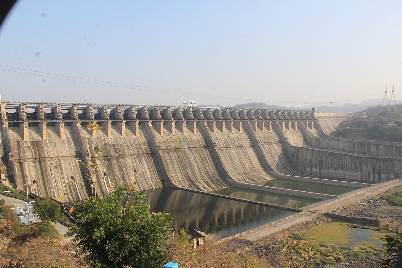
The Narmada River might be the most contested body of water on Earth when it comes to submerged settlements. A series of massive dams – most notoriously the Sardar Sarovar Dam – has driven decades of protests, lawsuits, and international scrutiny, with villages like Kurzon slated for submergence as reservoir levels rose behind new construction.
Here’s what often gets lost in the global coverage: these weren’t empty lands waiting to be improved. They were home to Adivasi (indigenous) communities, farmers, and fisherfolk with deep, generations-old ties to the river itself.
Entire villages were relocated – sometimes more than once, as water levels rose higher than originally projected or additional dam height got approved along the way. Some families accepted compensation and resettled quietly. Others resisted fiercely, fueling high-profile movements like the Narmada Bachao Andolan, or “Save Narmada Movement.”
Behind every flooded temple and every submerged farm along the Narmada is a family that never got a real vote in the decision that erased their home.
Narmada Bachao Andolan campaign literature
By the time the reservoirs filled, homes, shrines, and burial grounds were literally underwater. Some temples still reappear seasonally when levels drop, briefly becoming pilgrimage sites reached only by boat. This isn’t ancient history – it’s still unfolding, and it’s a live argument about who really pays the hidden price of “development.”
#11 – The Lost Towns of the Quabbin Reservoir, Massachusetts
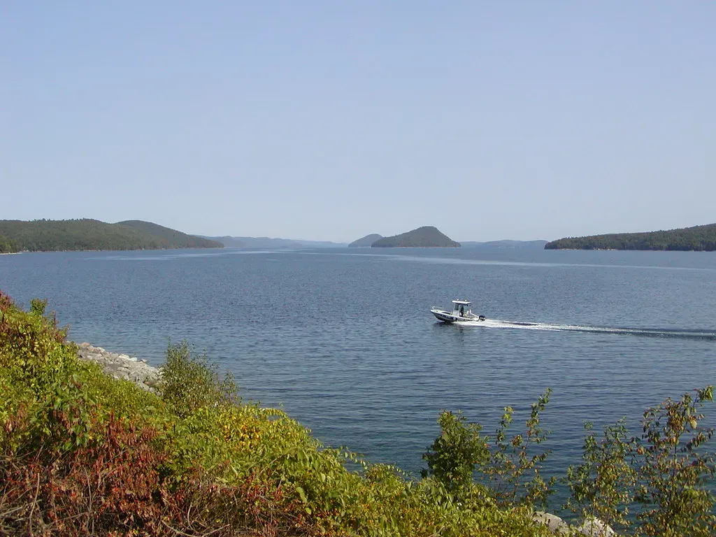
You don’t have to leave the U.S. East Coast to find entire communities sitting at the bottom of a lake. In the 1930s, Boston needed a reliable water supply, and engineers chose the Swift River Valley in western Massachusetts as the site for a massive new reservoir: Quabbin.
To make room, four towns – Dana, Enfield, Greenwich, and Prescott – were disincorporated and effectively erased from the map. Residents were relocated, cemeteries were dug up and moved to higher ground, and buildings were demolished or deliberately burned. Whatever couldn’t be cleared in time was simply left for the water to take.
Quick Compare
- Four towns disincorporated on the same day in 1938: Dana, Enfield, Greenwich, and Prescott
- Roughly 2,500 residents were forced to relocate, many with no job or housing assistance
- 34 cemeteries and hundreds of homes, schools, and churches were relocated or destroyed
- The finished reservoir holds about 412 billion gallons of water for Boston’s metro area
By 1946, the valley was largely flooded. Today those four town names exist only as labels on the Quabbin Reservoir watershed map – and most New Englanders drink water every single day that literally covers the land where people once lived, farmed, and ran businesses without ever thinking twice about it.
A few scattered foundations and old roads are still accessible on the shoreline, and historical societies keep detailed photo archives of what was lost. The Quabbin is now a favorite spot for bird-watchers and kayakers who have no idea that below the calm surface sits a network of old roads and forgotten town greens.
#12 – Old Vilar, Spain: The Galician Village That Keeps Coming Back
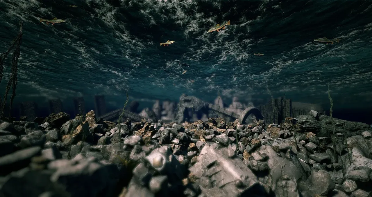
Galicia, in Spain’s rainy northwest, is dotted with reservoirs – and more than a few drowned communities hiding beneath them. One of the most striking is Old Vilar, a village that once sat in the floodplain of a hydroelectric project, its residents relocated and compensated much like the people of Vilarinho da Furna across the border in Portugal.
For years, Old Vilar existed as an underwater curiosity that locals could point to on a map but nobody could actually see. Then the droughts came – and started exposing its bones.
In particularly dry years, entire streets, houses, and even the old village church re-emerge from the receding water, drawing photographers, journalists, and nostalgic former residents back to a place they thought they’d never walk through again. Cracked lakebed mud frames stone doorways that once opened onto vineyards and fields, and the images spread fast online as dramatic “before and after” shots.
For locals, the feeling is complicated. Walking where their grandparents once walked is powerful – but each cycle of flooding and exposure is also a reminder that their hometown was turned into a seasonal ruin, a hydroelectric footnote that only reappears when the weather turns bad enough.
#13 – Port Royal, Jamaica: The Real Pirate City the Sea Swallowed Whole
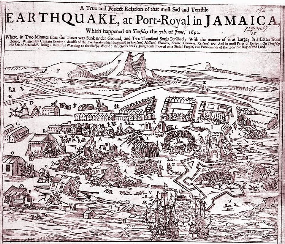
Every other place on this list was drowned deliberately, over years, by dams and reservoirs. Port Royal is the exception – it was a booming port that the sea itself swallowed in minutes.
In the 17th century, Port Royal sat on the tip of a sand spit guarding Kingston Harbour, infamous as a haven for pirates and privateers. English authorities looked the other way while raiders sacked Spanish ships, and rum, gambling, and brothels turned the city into one of the richest and most notorious ports in the entire Caribbean.
Then, on June 7, 1692, a massive earthquake hit. The shaking triggered liquefaction in the sandy ground beneath the densely packed city, and entire blocks simply slid into the sea. Eyewitnesses described streets folding in on themselves and people being swallowed alive as solid ground turned to liquid sand beneath their feet.
Worth Knowing
- The earthquake struck at about 11:43 a.m. on June 7, 1692, with an estimated magnitude of 7.5
- Roughly 6,500 people were living in Port Royal at the time of the disaster
- Two-thirds of the town sank into the harbor within minutes as the sandy ground liquefied
- About 2,000 people died instantly, with another 3,000 succumbing to injuries and disease afterward
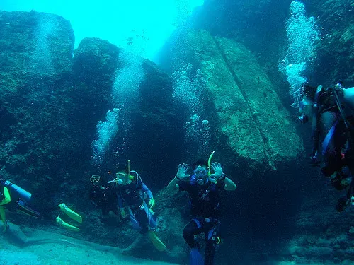
In a matter of minutes, roughly a third of Port Royal was gone. Survivors called it divine punishment for the city’s reputation. Today, divers explore the submerged ruins as an active archaeological site – bottles, tools, building remains, even human remains, remarkably preserved in a snapshot of daily 17th-century life that no other underwater city on Earth can quite match.
The Bottom Line
Look at these 13 places side by side and an uncomfortable pattern jumps out immediately. Most of them didn’t “vanish mysteriously.” They were deliberately sacrificed, usually by decision-makers who lived nowhere near the valley they were about to flood, in exchange for water, electricity, or a growing city’s convenience. Only Port Royal was taken by nature alone – and even then, in a single brutal moment that erased a third of a city before anyone could react.
What’s most unsettling is how recent all of this is. These aren’t ancient, half-mythical civilizations. These are grandparents who watched their actual schools, chapels, and main streets go under – people who still hold the deeds, still remember the smell of the bakery, still know exactly which patch of open water used to be their front yard.
My honest take: the lakes we treat as scenic amenities today are, in more cases than most people realize, quiet monuments to communities that never got a real vote in their own erasure. That doesn’t make every dam or reservoir wrong – some genuinely did save far more lives than they displaced. But it does mean the postcard view usually skips the part where somebody’s home is sitting a few meters below the waterline, waiting for the next drought to tell on us.
Did we miss a drowned town with a story that deserves to be told? Drop it in the comments.