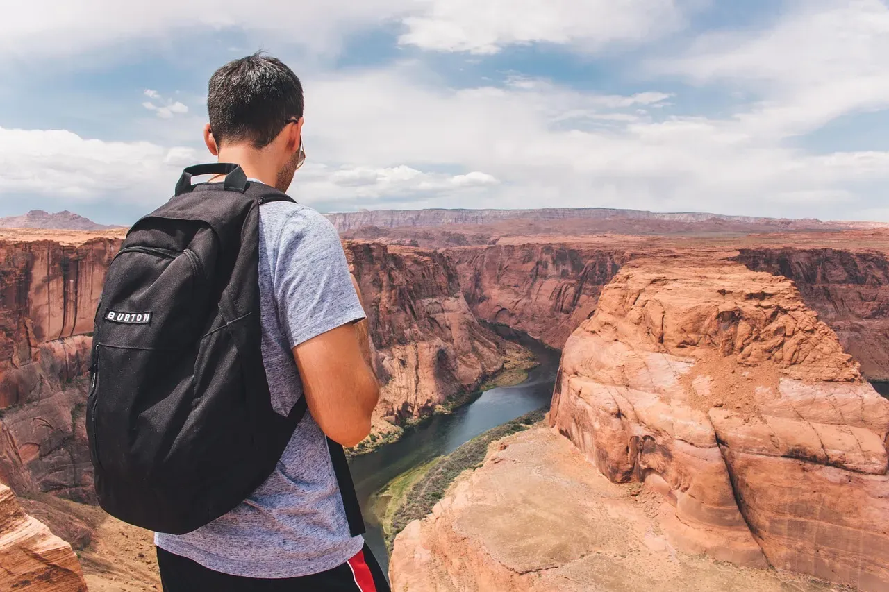
You probably think of the Colorado River as this rugged, relentless force that carved the Grand Canyon and now limps, overused and overheated, toward a shrinking desert delta. But there’s an even stranger story hiding in its past. For about five million years, the river simply disappears from the rock record. It is there in western Colorado around eleven million years ago, and then it reappears near the Grand Canyon about five to six million years ago. In between, the rocks go quiet. For geologists, that silence has been maddening.
Now, thanks to some very clever detective work using microscopic minerals and an ancient landscape in northern Arizona, scientists think they finally know where the missing Colorado went. You are not just looking at a river; you are looking at a waterway that once pooled into a vast lake, fed a thriving ecosystem, and then spilled over with enough power to help launch the Grand Canyon as you know it today. When you walk up to the rim or float a stretch of the river, you are standing on the aftermath of a mystery that has only just been cracked.
A River That Vanished From the Rocks
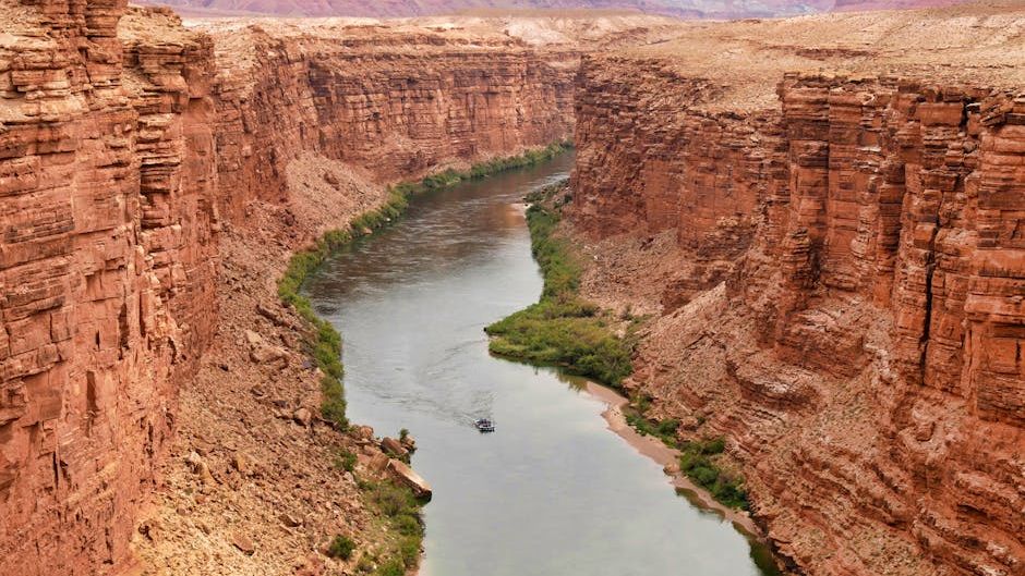
Imagine you are reading a novel and suddenly five chapters are missing. That is exactly what geologists were dealing with when they traced the Colorado River’s history. Evidence shows the river flowing through what is now western Colorado about eleven million years ago, but then for roughly five million years, there’s no clear sign of where all that water went before it shows up again exiting the Grand Canyon around five and a half million years ago. You are left with a geological cliffhanger: a major river that has to be going somewhere, yet leaves almost no obvious trace along the way.
For you, the strange part is that rivers this big do not just vanish. They carry immense amounts of sand, mud, and gravel, usually leaving thick packages of sediment in their wake. When that record is missing, it means the water was doing something unusual. That gap in the story pushed scientists to think beyond the simple idea of a river steadily carving its way west to the sea. Instead, you are dealing with a more dramatic scenario: a river that may have pooled, paused, and then suddenly broken free, reshaping the landscape in the process.
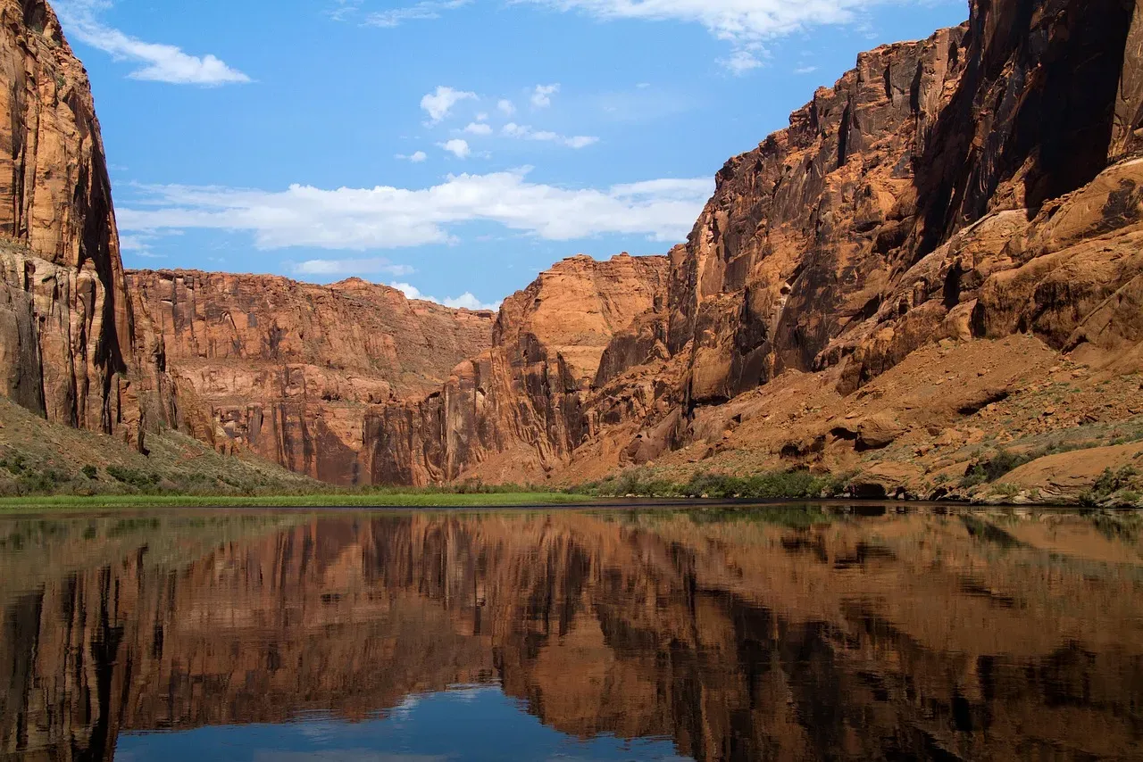
The Hidden Lake Just East of the Grand Canyon
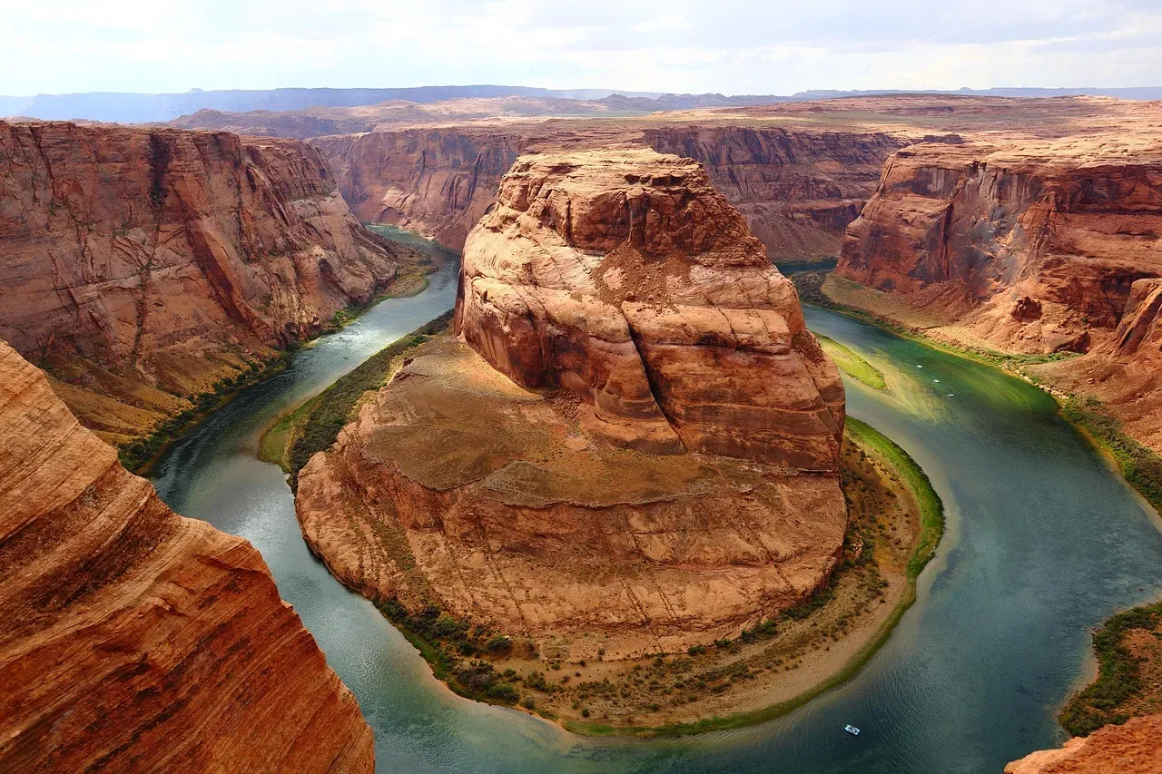
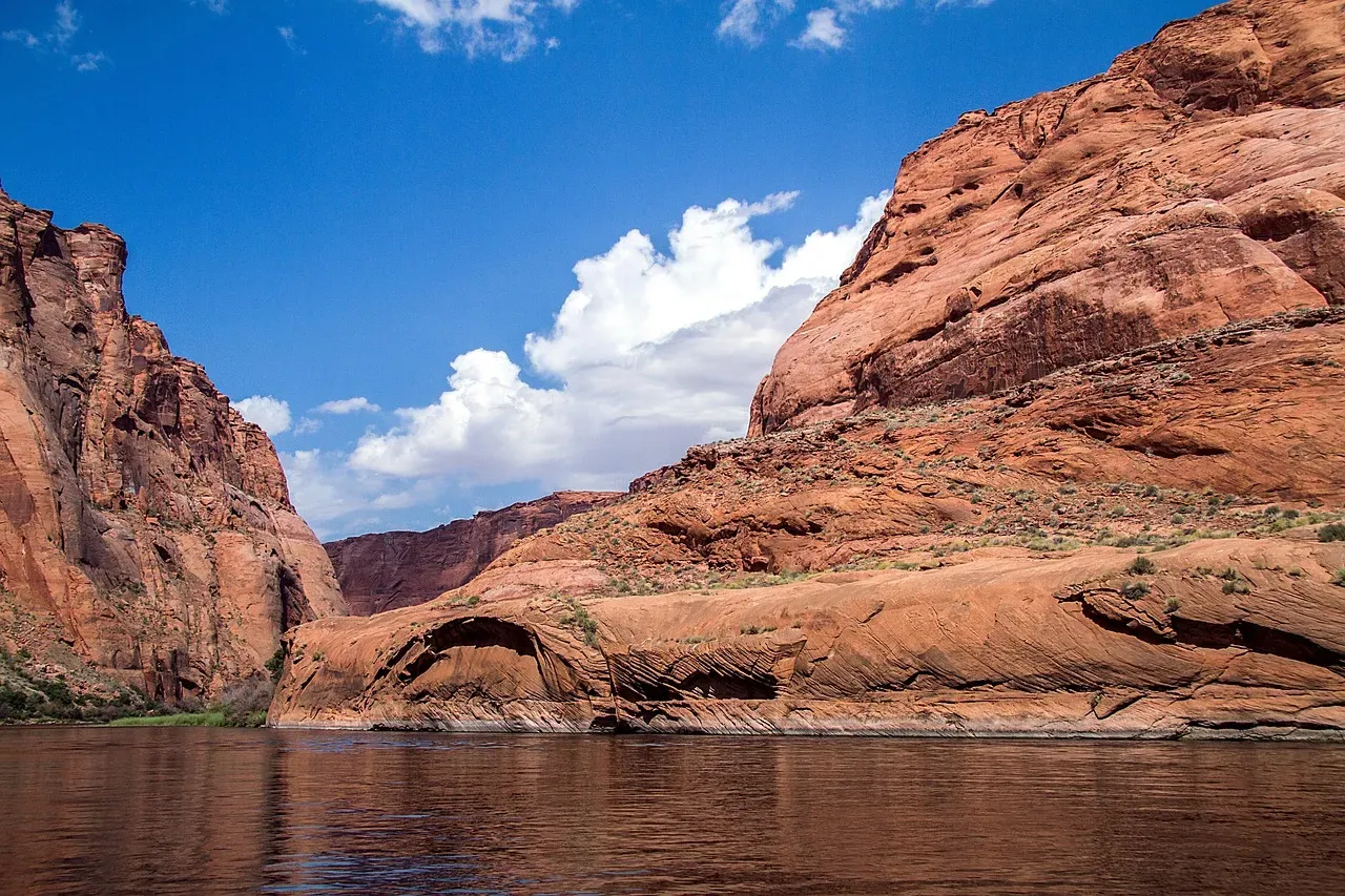
Here’s the twist you probably did not see coming: instead of racing straight toward the ocean, the ancient Colorado River seems to have ended in a giant lake tucked into what is now northeastern Arizona. You might know that area today as dry, high-desert country, but millions of years ago it held the Bidahochi Basin, a broad depression that collected water and sediments. According to new research, the Colorado River started feeding this basin about six to seven million years ago, slowly filling it over time.
If you could stand there back then, you would not see a narrow canyon yet. You would see a widespread lake system with shorelines, deltas, muddy shallows, and deeper pockets of water. Sediment carried by the river settled into the basin, building up layers of sandstone and siltstone that, until recently, just looked like anonymous rocks to most observers. That lake acted like a holding pen, catching the river long before it ever cut down through the Grand Canyon and reached the Gulf of California. The “vanished” river was not gone; it was sitting there quietly, disguised as a lake.
How Tiny Zircon Crystals Tracked the Missing River
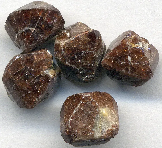
The breakthrough that lets you see all this comes from something incredibly small: zircon grains. These are hardy, sand-sized mineral crystals that form in igneous rocks and can survive being eroded, transported, and buried again and again. Each zircon carries a kind of birth certificate in its chemistry, telling you when and where it formed. Scientists collected sandstone from the Bidahochi Basin and analyzed thousands of these zircons to see where the grains originally came from.
When you match those zircon “fingerprints” to known source regions in the upper Colorado River watershed, a pattern jumps out: by about six and a half million years ago, zircons in the Bidahochi Basin match rocks in western Colorado and the broader upper basin. That means the sand in those ancient lake deposits was being delivered by something very much like the modern Colorado River. Instead of guessing where the river flowed, you are letting microscopic minerals trace the path for you, and they are pointing straight into that hidden lake east of today’s Grand Canyon.
A Vibrant Lost Ecosystem Fed by a Pooled River
When you picture that vanished chapter of the Colorado’s history, do not just imagine a static lake on a map. Sedimentary structures and fossils in the Bidahochi Basin tell you this was a dynamic, living place. Ripple marks in the rocks show that strong currents once surged into standing water, just like you would see where a powerful river meets a lake or inland sea. The basin holds remains of large fish that thrive in fast-flowing environments, which tells you the river arriving there was anything but feeble.
For you, that means the missing Colorado chapter is not an empty, geologic blank; it is a thriving ecosystem that wove together upland rivers, lakes, and wetlands. Plants, fish, and other organisms adapted to a world where the Colorado delivered fresh water and nutrients into this basin for millions of years. Before the river ever carved the Grand Canyon, it was already shaping life across the region by building this watery hub. The “mystery” you hear about in headlines is as much biological as it is geological.
The Moment the Lake Spilled and a Canyon Began
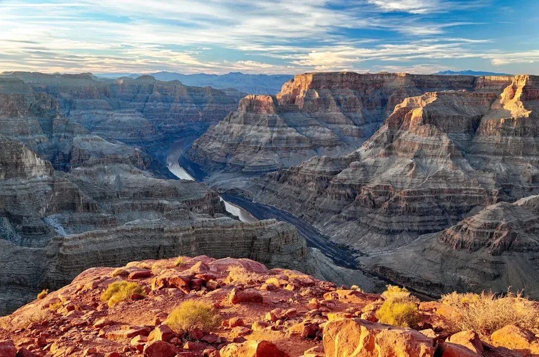
At some point, a quiet lake can become a loaded gun. As the ancient Colorado kept delivering water and sediment into the Bidahochi Basin, the level of the lake likely rose and spread into a series of connected basins. Eventually, that water had to find a lower path. The leading idea now is that the lake filled to the point where it spilled over a threshold to the west, sending water cascading into new channels that would become the early Grand Canyon. You can think of it like a natural dam breach on a timescale of millions of years.
For you, this spillover idea is powerful because it explains several puzzles at once. It shows how the river could suddenly appear below the Grand Canyon around five million years ago, and it fits with evidence that the river then stepped through successively lower lake basins on its way to the newly forming Gulf of California. Instead of a gentle, gradual connection, you get a more dramatic story: a giant lake system that finally overflowed, captured the river, and set it on a new path that would slice through the uplifted Colorado Plateau and deepen the canyon you see today.
Why the New Study Matters in a Sea of Competing Theories
If you have ever heard debates about how old the Grand Canyon really is, you know the story has been messy. Some research has argued that segments of the canyon might be tens of millions of years older than the river that runs through them today, carved by ancient, differently directed rivers. Other work suggested a more modern, river-driven origin in the last six million years. The new lake-and-spillover evidence does not erase all the earlier ideas, but it gives you a crucial missing piece in the timeline of how the modern Colorado system took shape.
What this means for you is that the river’s history is now less of a vague legend and more of a constrained story, anchored by hard data from zircons, fossils, and sediments. You can say with more confidence that the upper Colorado was flowing by about eleven million years ago, that it fed the Bidahochi Basin by roughly six and a half million years ago, and that it began exiting the Grand Canyon and reaching the Gulf region around five million years ago. There is still room for debate, especially about older canyon segments, but the “where did the river go?” piece is no longer just speculation – it is grounded in physical evidence.
How This Ancient Story Connects to Today’s Colorado Crisis
It might feel strange to jump from a vanished Miocene river to your current water bills, but the link is real. When you understand that the Colorado once filled lakes, shifted course, and carved entire canyon systems, you start to see how sensitive it is to changes in climate and topography. Today, you are living through another major turning point in the river’s story, only this time the driver is you and your society. Over roughly the last two decades, warming temperatures and steady or growing demand have drained storage in Lake Mead and Lake Powell to historically low levels.
For you personally, that ancient missing chapter can change how you think about the river’s future. The same basin that once pooled water into vast lakes is now grappling with the opposite problem: a shrinking supply trying to stretch across farms, cities, tribes, industries, and ecosystems. The revelation that the Colorado’s path has been anything but fixed over millions of years is a reminder that your current arrangement – dams, compacts, reservoirs, canals – is not permanent either. The river has outlived every past configuration, and it will outlive this one too; the open question is how gracefully your own chapter will fit into its much longer story.
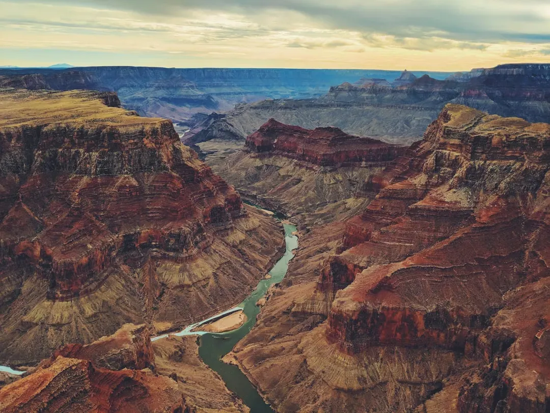
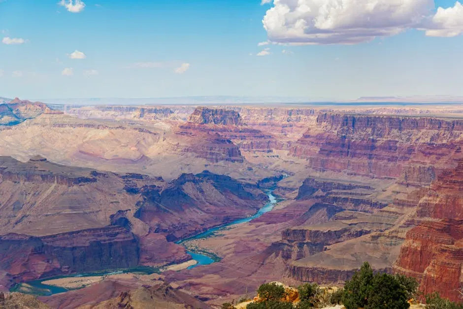
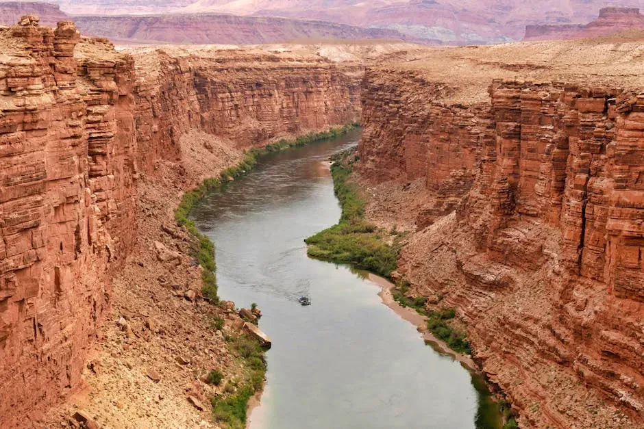
What You See When You Visit the Grand Canyon Now
The next time you stand on the edge of the Grand Canyon or raft a stretch of the Colorado, you will not just be seeing a river in a gorge. You will be looking at the aftermath of that hidden lake and the spillover that finally unlocked this route. Those flat benches and ancient shorelines around northern Arizona? They may be the ghosts of the Bidahochi lakes. The sand under your feet could hold zircon grains that once sat in mountain bedrock hundreds of kilometers away, rode down the early Colorado, settled in a lake, and then were reworked as the canyon deepened.
Knowing this, your experience of the landscape shifts. Instead of a simple tale of a river slowly gnawing its way down, you are part of a layered drama involving uplifted plateaus, captured streams, overflowing lakes, and evolving ecosystems. You are walking through the last act of a process that started long before humans were here to name any of it. That sense of deep time can be oddly grounding: your own lifetime, your own worries about drought and policy, are now woven into a river story that once literally disappeared and has only just been found again.
Conclusion: Living With a River That Refuses to Be Simple
When you hear that scientists have “solved” where the Colorado River vanished to, you are not getting a neat, final answer so much as a sharper, richer picture. The missing chapter turns out to be a lake-filled interlude, with the river pooling in the Bidahochi Basin, feeding a vibrant ecosystem, and then spilling over to carve its way toward the sea. Tiny zircon grains, quiet sediment beds, and scattered fossils all converge to tell you that the river’s path has always been more complicated, more contingent, than a simple line on a map.
For you, the most important takeaway is that a river you might think you know is still revealing new sides of itself, even in 2026. The Colorado is not just a troubled modern water supply; it is a restless, shape-shifting system that has changed course, vanished from the record, and reemerged over and over. As you face tough choices about how to share and protect its waters today, that deep-time perspective can be both humbling and motivating. Knowing what you know now, how differently do you see the river that carved the canyon and once disappeared into a hidden lake?