You usually think of landscapes as carved from solid rock, volcanic lava, or ancient granite. But in a few corners of the world, entire worlds are built from something you normally sprinkle on your dinner: salt. These places look so unreal that when you first see photos, you might assume they’re digital art. Then you realize they’re absolutely real, and in some cases still growing, dissolving, and reshaping themselves under your feet. In this tour, you’ll step onto mirror-flat plains, walk along razor‑edged crusts hiding liquid brine, stare into neon‑colored pools, and even stand on mountains made from ancient oceans that dried up hundreds of millions of years ago. As you go, you’ll see how water, climate, and time can turn a simple mineral into entire landscapes as dramatic as any canyon or volcano. You may never look at a grain of salt the same way again.
Salar de Uyuni, Bolivia: Walking on the World’s Largest Salt Mirror
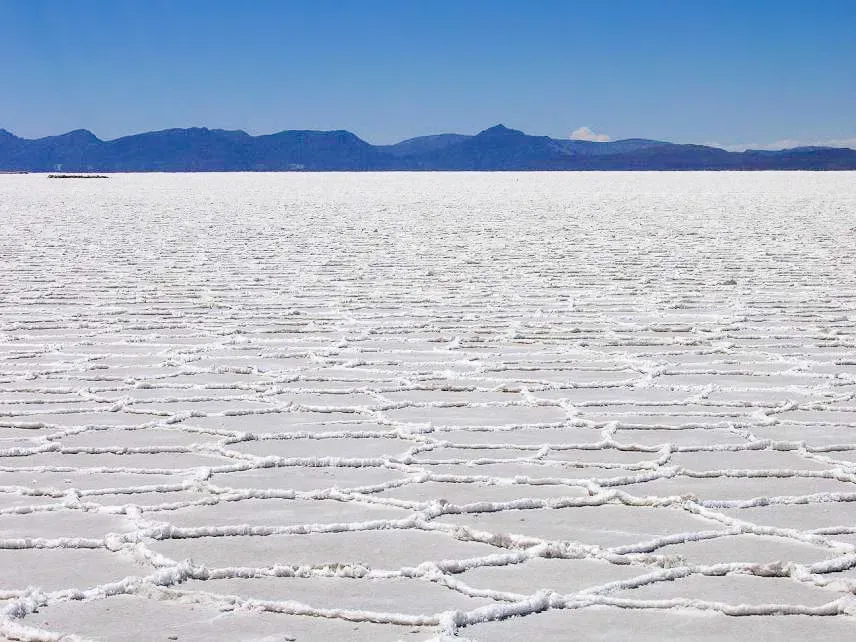
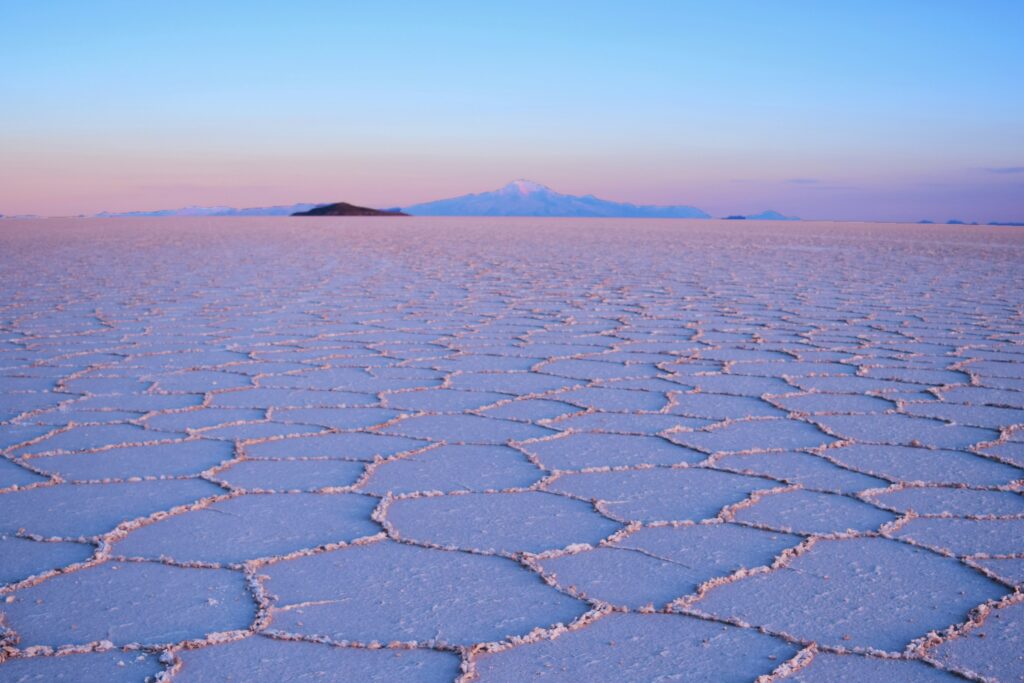
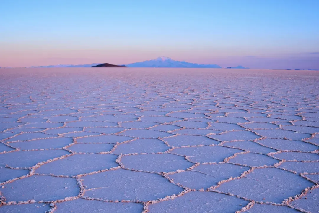
Imagine standing on a white, endless plain so flat that satellite missions use it to calibrate their instruments. That’s what happens when you visit Salar de Uyuni in Bolivia, the largest salt flat on Earth, spread across more than four thousand square miles of almost pure halite (rock salt). The surface is a solid crust, often many feet thick, sitting over a layer of highly concentrated brine that holds enormous lithium reserves. You’ll notice the surface isn’t just blank white; it’s tiled. As the crust dries and shrinks, it cracks into polygon patterns, like a dried mud flat made of salt instead of dirt. In the rainy season, a thin layer of water floods the crust and transforms the flat into a giant natural mirror, blending sky and ground into one. Underneath, dissolved salts continue to move and crystallize, quietly rebuilding the flat and keeping it astonishingly level over time.
Danakil Depression, Ethiopia: Salt Crust on a Rift Tearing the Planet Apart
If you ever wanted to feel like you’d stepped onto another planet, the Danakil Depression in Ethiopia might be your closest option. Here, the Earth’s crust is literally stretching and thinning where tectonic plates are pulling apart, creating a deep basin more than one hundred meters below sea level. Instead of filling with a normal sea, the basin holds salt flats, brines, and bizarre hydrothermal fields where new salt minerals crystallize in front of your eyes. When you walk on the broad salt pans like Lake Asale, you’re actually standing on a thick salt crust laid down by repeated flooding and evaporation. In some spots, that crust is strong enough for trucks and camel caravans hauling salt blocks; in others, a small crack reveals liquid brine just below. You’re effectively walking across the lid of a hidden salt lake, with the heat, sulfur smells, and multicolored pools of Dallol reminding you that magma and salt are interacting just beneath your boots.
Dallol Hydrothermal Field, Ethiopia: Acid Pools and Salt Chimneys
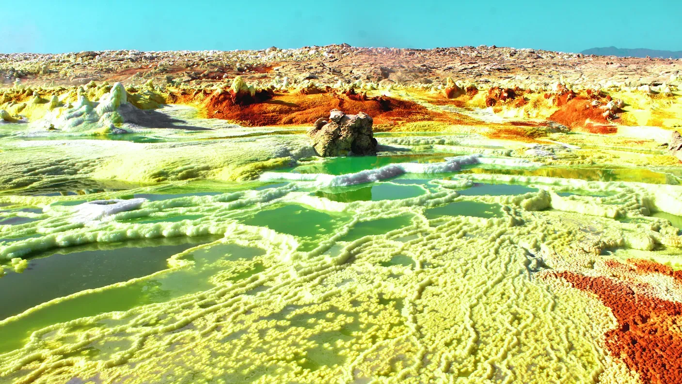
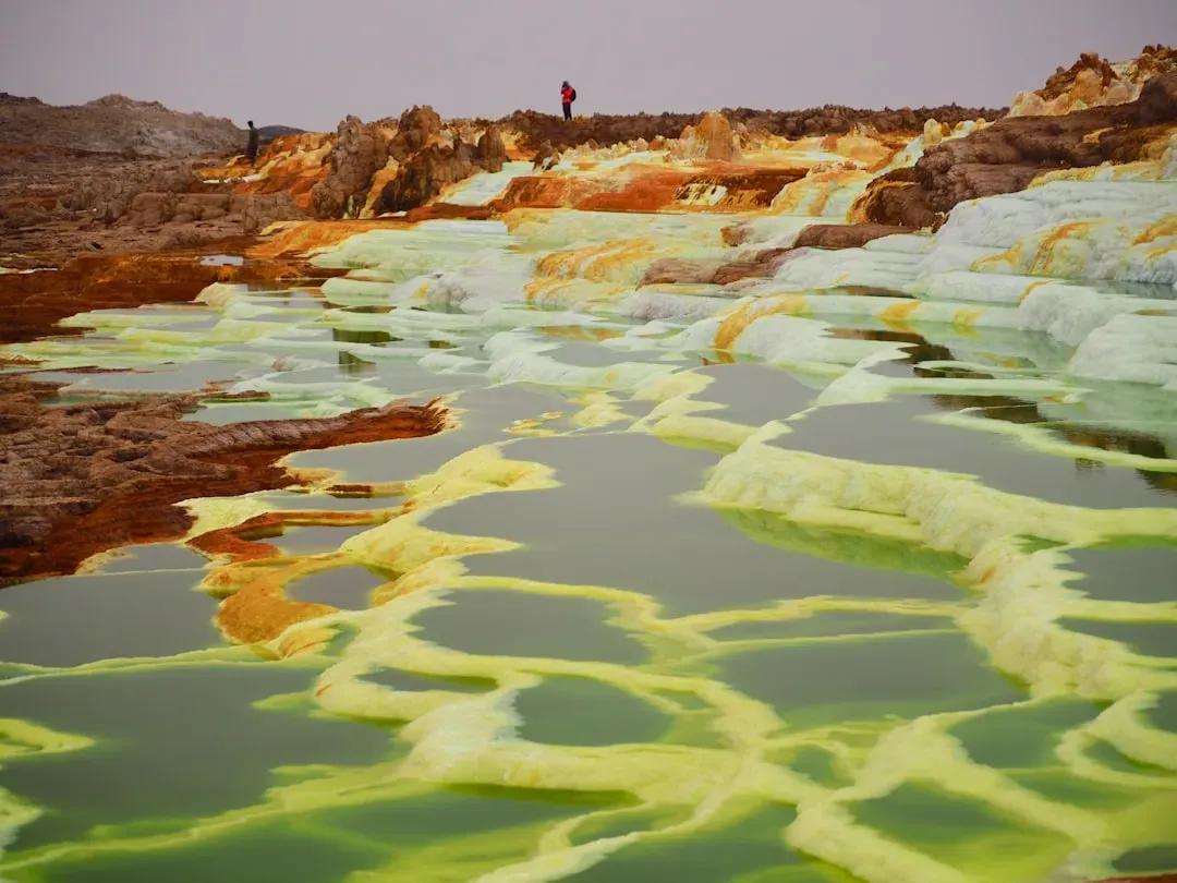
Within the Danakil Depression, Dallol feels like the fever dream version of a salt landscape. Here, rising hot fluids travel through a thick salt dome and erupt at the surface, leaving behind layers of halite, gypsum, and other evaporite minerals stained bright yellow, green, and orange by sulfur and iron. You’re not just looking at salt on the ground; you’re seeing salt actively built into terraces, chimneys, and thin crusts by steaming, mineral‑rich water. As you move around the hydrothermal mounds, you tread on fragile salt ledges and plates that might have formed only months or years ago. Boiling acid pools and toxic gases keep most life away, making the whole area feel eerily lifeless compared with more familiar hot‑spring regions. You can read this place like a live experiment: heat, brine, and salt constantly dissolving and re‑crystallizing, stacking thin salty layers into a kind of candy‑colored, ever‑changing geology.
The Dead Sea Shores: Salt Crusts, Cubes, and Disappearing Water
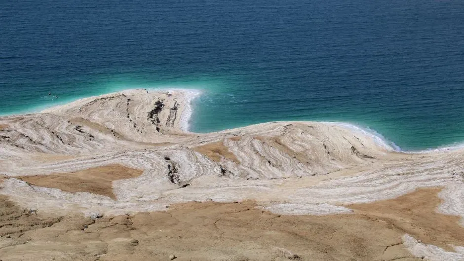
At the Dead Sea, on the border of Jordan, Israel, and the Palestinian territories, you don’t just see a salty lake; you watch salt take over the shoreline itself. Because the water is several times saltier than normal seawater and the region is very dry, evaporation is intense. As the super‑salty water recedes, it leaves behind shelves, mounds, and delicate lacework made of pure salt that creep outward from the water’s edge. If you walk along newer shorelines that were underwater a few decades ago, you’ll see rough salt crusts and loose salt cubes carpeting the mud. In some places, the crust thickens into benches and overhangs that look like melting snow frozen mid‑drip. The dramatic fall in water level has also led to underground salt layers dissolving and collapsing, forming sinkholes inland. So you’re looking at a landscape literally reshaping itself as the water vanishes and the salt reclaims the ground.
Great Salt Lake Desert, USA: Remnants of a Giant Inland Sea
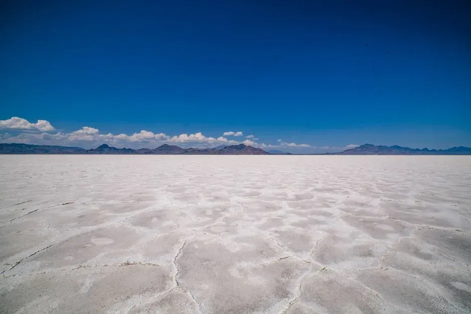
When you cross the Great Salt Lake Desert in Utah, it’s easy to think of it as just a big empty flat. But if you scratch the surface, you reveal a thin crust of salt and other evaporite minerals left behind when ancient Lake Bonneville shrank dramatically. You’re essentially driving or walking on the dried‑up floor of a prehistoric lake, now turned into a broad, white plain of salt‑rich sediments. Out on the flats west of the modern Great Salt Lake, evaporation outpaces rainfall, and shallow groundwater wicks salts upward. As that water evaporates at the surface, it builds a light‑colored, sometimes crunchy crust that can hide softer mud below. Race teams use some of the firmest, flattest parts for high‑speed runs at the Bonneville Salt Flats, where the hardness and smoothness of the salt surface make it one of the most famous speed tracks on Earth, even as seasonal flooding and erosion slowly reshape it.
Salar de Atacama and Other Chilean Salars: Salt Basins in the Driest Desert
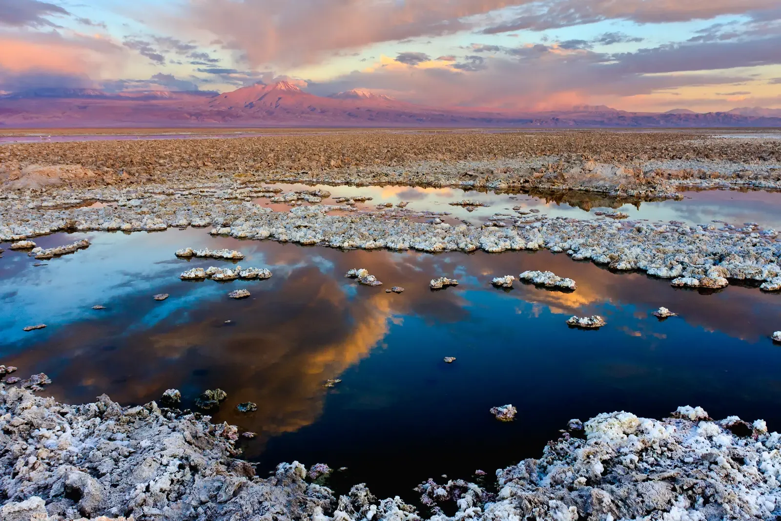
Head into northern Chile’s Atacama Desert and you encounter a different style of salt landscape, where salt forms rough, jagged surfaces instead of mirror‑flat plates. In salars like Salar de Atacama and smaller basins nearby, you walk across salt crusts that are buckled, broken, and pushed up into sharp ridges. The combination of high evaporation, minimal rainfall, and fluctuating groundwater creates a chaotic salt skin that can be tricky and even painful to cross. Beneath your feet, these basins often hide brines rich in lithium, potassium, and other dissolved minerals, fed by runoff from surrounding volcanic mountains. As the brines rise and evaporate, salts crystallize into thick layers, sometimes several meters deep, and can form polygon patterns or pressure ridges as they grow and shrink. Flamingos feed in shallow ponds on top of these crusts, while industrial operators tap the hidden brines, turning these salt‑built landscapes into both wildlife havens and critical mineral sources.
Pakistani Salt Range: A Mountain Belt Made of Ancient Sea Salt
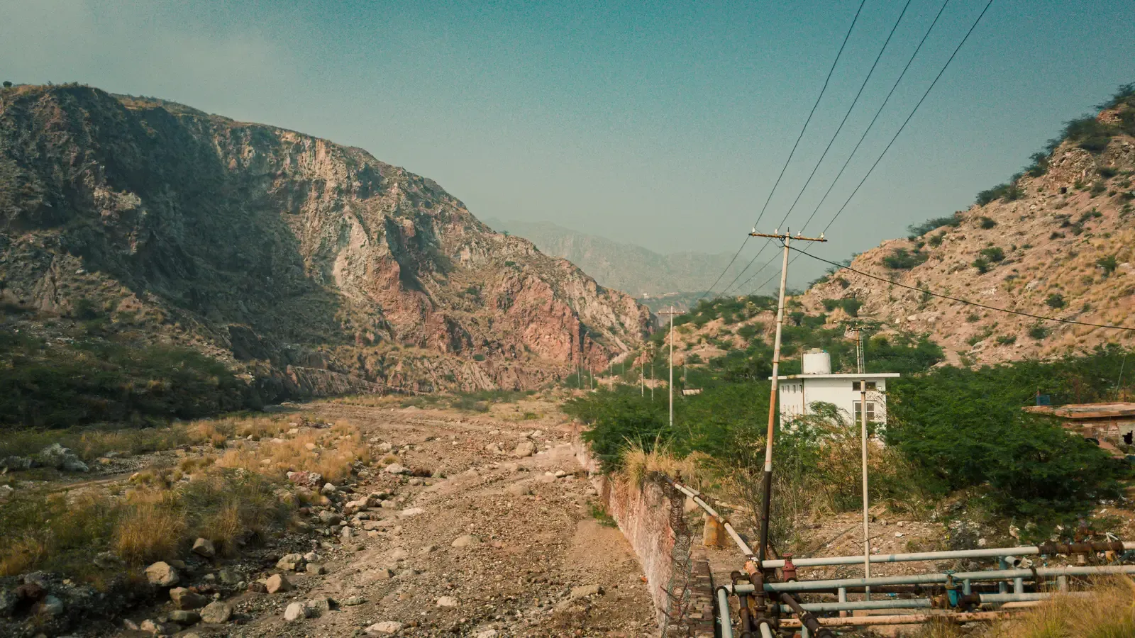
In Pakistan’s Salt Range, you’re no longer looking at flat salt pans; you’re looking up at hills and low mountains built on huge bodies of rock salt and related evaporites. These salts were originally deposited when ancient seas repeatedly flooded and dried out hundreds of millions of years ago. Later, when the Indian plate collided with Eurasia and built the Himalaya, those weak, slippery salt layers acted like a lubricated base, helping push younger rocks up into a folded range. When you travel through the area, especially near the famous Khewra Salt Mine, you see reddish‑pink and white salt beds forming cliffs and cave‑like chambers inside the hills. Geologists prize the Salt Range because it exposes an unusually long record of Earth’s history stacked above these old salty deposits. To you as a visitor, it’s a reminder that what you think of as a simple table seasoning can underlie entire mountains, subtly guiding how they rise and where they break.
Salt Domes of the Persian Gulf and Zagros Region: Underground Salt That Climbed Upward
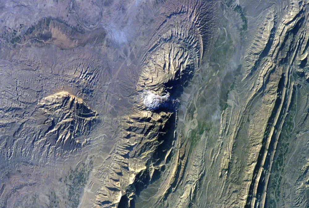
Along the margins of the Persian Gulf and the Zagros Mountains in Iran and nearby countries, you can spot odd, bulbous hills and ridges that do not quite match the surrounding rock. Many of these features are salt domes, where buried layers of ancient rock salt have slowly flowed upward over millions of years. Because salt is less dense and mechanically weaker than most other rocks, it behaves almost like cold toothpaste, squeezing its way toward the surface. When these domes break through, they can form exposed salt mountains and even localized salt glaciers that creep downslope under their own weight. Standing on or near one, you might notice flows and folds that look more like taffy than stone, with bands of white, gray, and sometimes reddish impurities. These structures not only create striking landscapes, they also influence where oil and gas get trapped underground, making them important targets in energy geology as well as natural marvels.
Salt Caves and Karst in the Dead Sea and Mount Sedom Region
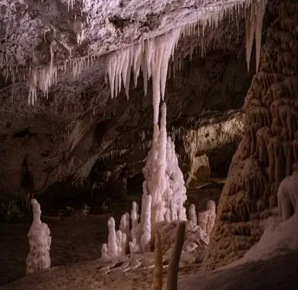
Near the southern end of the Dead Sea, in Israel, you can explore a very different sort of salt‑built world: a salt mountain riddled with caves. Mount Sedom is a ridge made mostly of rock salt capped by thin layers of other sediment. Because salt dissolves easily, rainwater and underground flows carve out tunnels, shafts, and chambers in the salt much faster than in normal limestone caves, giving you a landscape that evolves on human timescales instead of geological ones. When you enter one of these salt caves, you see translucent, crystalline walls and strange stalactites made from halite instead of the calcite you’d find in typical caves. The mountain itself is slowly creeping toward the Dead Sea, deforming and shedding blocks as gravity and dissolution do their work. Walking through this salty karst world, you realize that even solid‑looking salt is incredibly vulnerable to water, and whole hillsides can reshape within thousands or even hundreds of years.
Conclusion: Seeing Salt as a Landscape Builder, Not Just a Seasoning
By the time you step back from these nine places, salt stops being a simple kitchen ingredient and becomes a full‑blown architect in your mind. You’ve walked across flats so smooth they rival glass, peered into acid pools where new minerals grow in neon colors, climbed hills that exist only because ancient seas dried up, and seen how hidden salt layers can bend mountains, trap oil, or collapse into sinkholes. Everywhere, water and climate decide whether salt piles up, creeps, dissolves, or explodes into strange formations. If you ever travel to one of these landscapes, you’ll notice how fragile they feel once you know their story: a crack in a crust, a drop in lake level, or a shift in climate can transform them in a few decades or less. That makes them powerful laboratories for understanding how Earth works and how quickly it can change. Next time you pour a pinch of salt into a pot, will you picture a quiet shaker on your counter, or a blinding white flat stretching to the horizon under a high, hard sun?