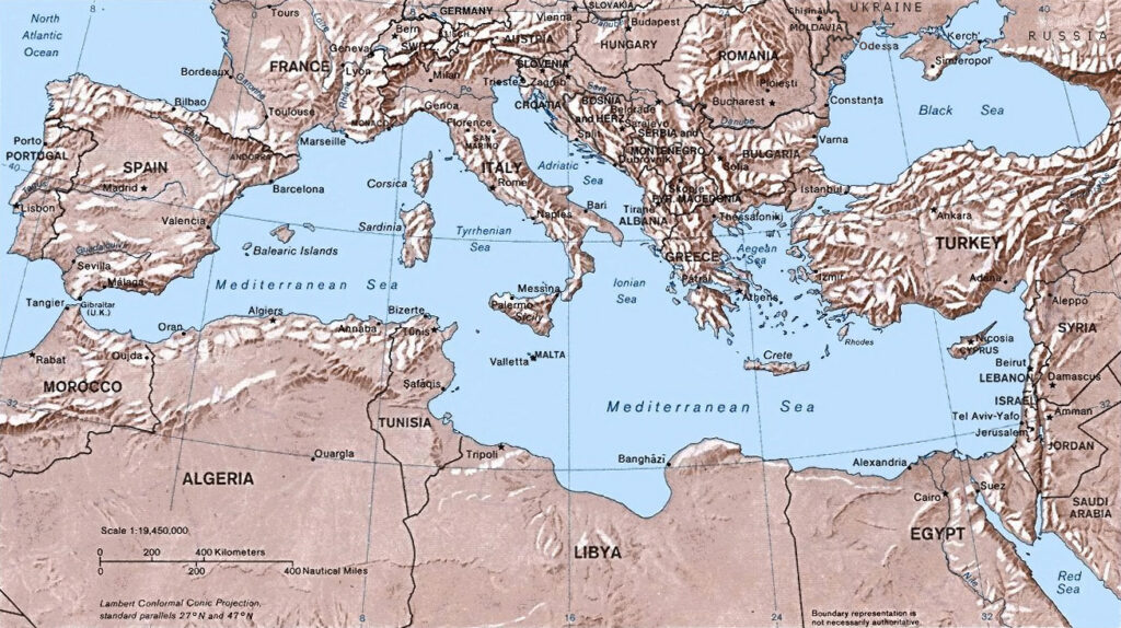
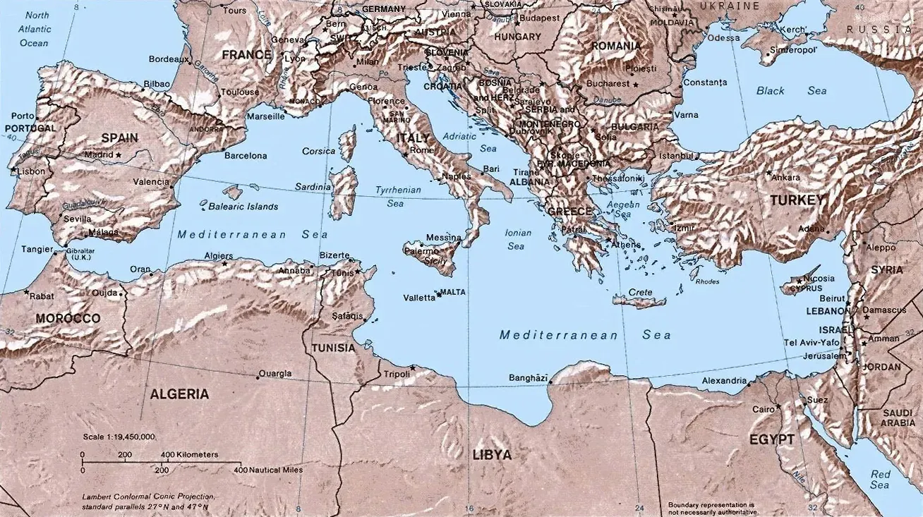
There’s a particular kind of vertigo that comes from looking at a map of the Mediterranean and imagining it gone. Not shrunk, not lowered a little, but mostly emptied, its floor exposed as a salt-crusted wasteland stretching from Gibraltar to the Levant. Geologists have been piecing together this scenario for more than half a century, and the deeper they dig, quite literally, the stranger and more compelling the story gets.
A sea cut off from the world
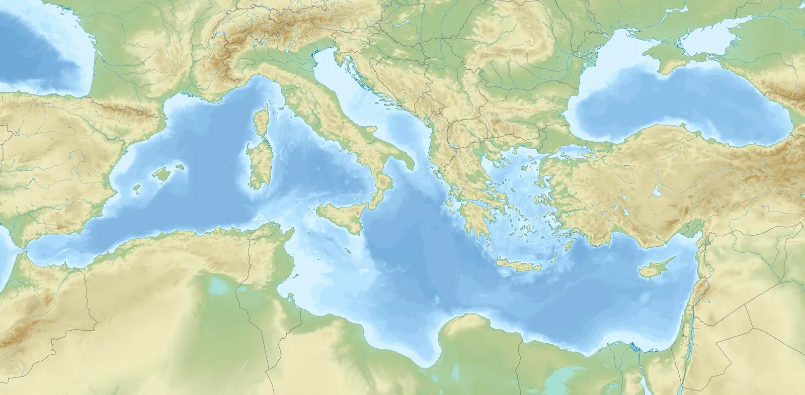
Around six million years ago, the tectonic dance between Africa and Europe closed the only gateway connecting the Mediterranean to the Atlantic Ocean. The culprit was plate tectonics, with the Mediterranean basin trapped between two continents that continue moving closer by up to two centimeters every year. Once that connection narrowed and finally sealed, the sea was on its own.
Without a steady inflow from the Atlantic, the basin’s fate was sealed by its own climate. The Mediterranean sits in a relatively warm and dry pocket of the planet, so its seawater evaporates at a very fast pace. That combination, a closed door and a thirsty atmosphere, set the stage for one of the most dramatic environmental transformations in the planet’s recent geological history.
The evidence hidden beneath the seafloor
Scientists didn’t stumble onto this idea by accident. The Deep Sea Drilling Project in the 1960s confirmed that evaporite layers continue under the seafloor, more than three kilometers thick in some places, which led researchers to hypothesize that the entire Mediterranean Sea had once dried up. That was a striking claim, and it needed more than one line of proof to hold up.
It got that proof from an unexpected direction, the shape of the land itself. The main evidence for the evaporative drawdown comes from the remains of many now-submerged canyons cut into the sides of the dry basin by rivers flowing down to the abyssal plain, with the Nile cutting its bed down to 200 meters below sea level at Aswan and 2,500 meters below sea level just north of Cairo. Rivers don’t carve gorges that deep unless the sea they’re draining into has vanished far below its current level.
Life reduced to a handful of salty pools
As the water disappeared, the Mediterranean didn’t become an empty bowl overnight. At the peak of the crisis, the water level was so low that the sea had shrunk to a few large, hypersaline lagoons. These pockets held on while everything around them turned to salt flats and desert.
Conditions in what remained were brutal by any standard. Summer temperatures may have soared to 80 degrees Celsius at the basin floor, and only extremophile bacteria survived there. Yet the picture wasn’t uniformly apocalyptic across the whole basin. It was probably not terribly hot and inhospitable at all times, since the climate varied from region to region and fluctuated as time passed.
A land bridge between continents
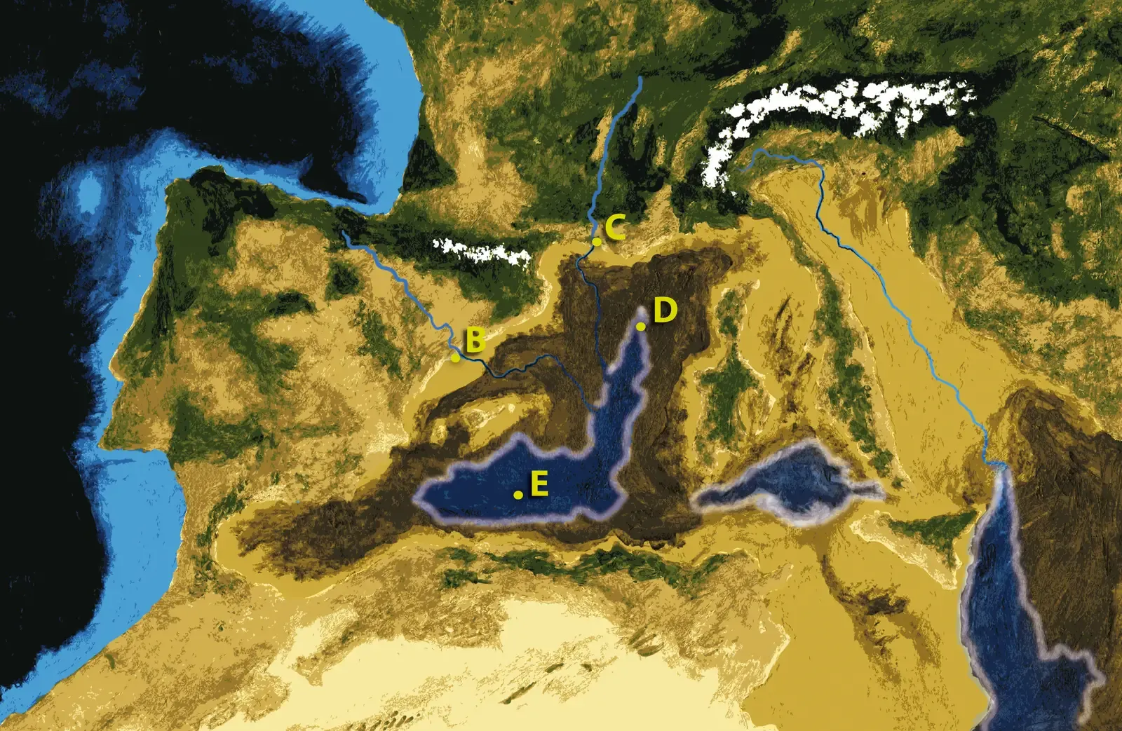
One of the more startling consequences of the crisis was what it did to the landscape connecting Europe and Africa. With no fresh influx of water from the Atlantic, the enclosed sea dried up within just a few thousand years, leaving behind a salt-caked basin that connected parts of North Africa with southern Europe, so in theory it would have been possible to wander from present-day Morocco to Spain or Libya to Italy. That’s not a hypothetical detail dreamed up for effect, it changed the biology of an entire region.
Some animals did make this migration, and some researchers theorize that islands like Mallorca, Menorca, Ibiza, and Formentera were colonized by land animals during this stretch of desiccation. Fossil evidence for camelids and gerbils crossing the newly exposed corridor near Gibraltar backs this up, offering a rare case where a geological catastrophe doubled as a biological highway.
An extinction hiding in plain sight
The salt crisis wasn’t just a plumbing problem, it was a mass extinction event for marine life. The crisis caused the decimation of marine biodiversity in the Mediterranean, killing off up to 89 percent of endemic marine species. Later research sharpened that number further, with newer estimates suggesting less than 11% of Mediterranean marine species survived the crisis, showing just how big and lasting the impact was on life in the sea.
Some writers have framed this as rivaling the extinction that ended the age of dinosaurs, at least within the region it affected. The episode is considered the biggest extinction event suffered by the Earth since the meteorite that wiped out the flightless dinosaurs 65 million years ago. That comparison is regional rather than global, but it captures just how thoroughly the Mediterranean’s ecosystem was scrambled in a geological instant.
The flood that supposedly ended it all
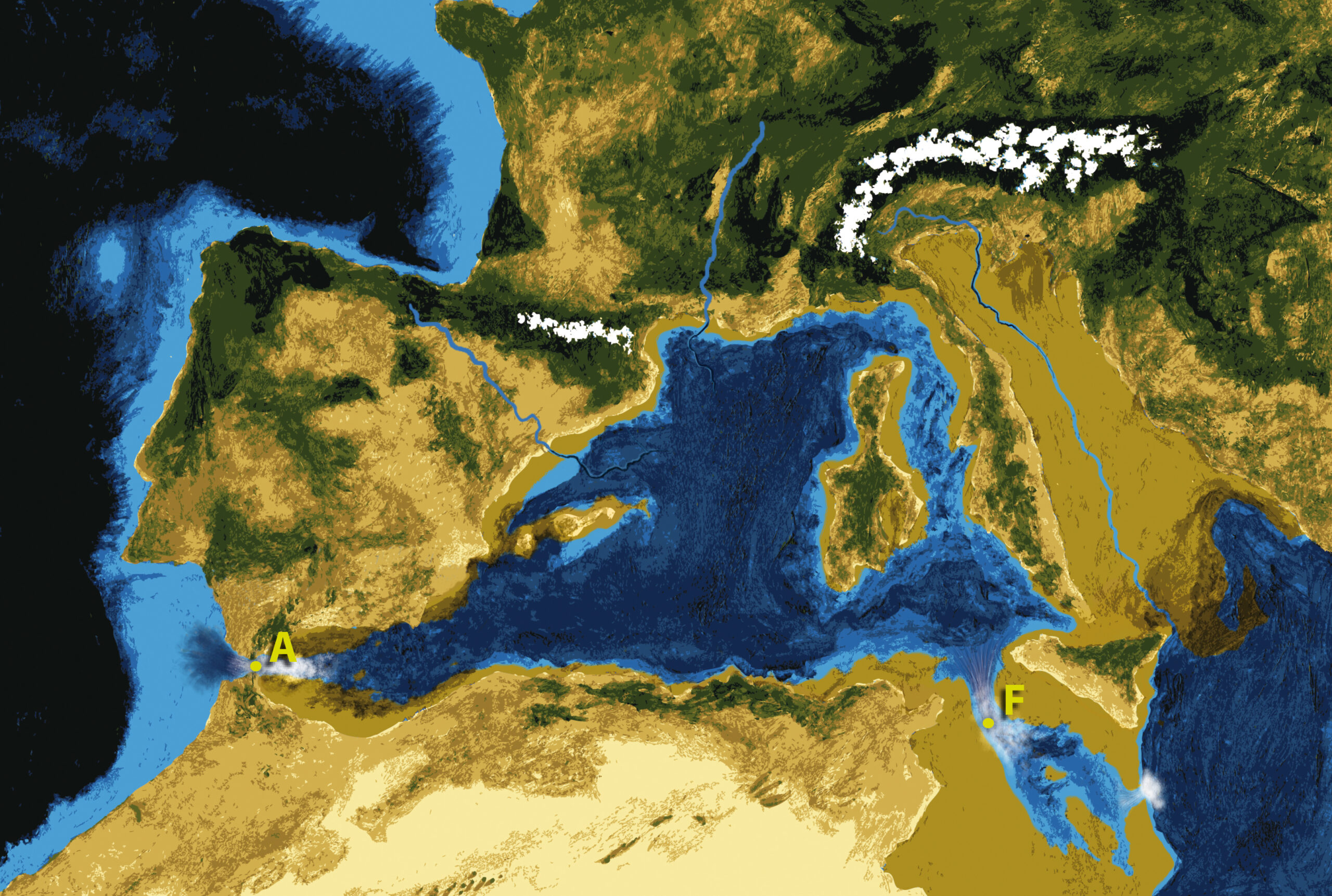
For decades, the standard ending to this story involved water crashing back through Gibraltar in a single, spectacular event. The Zanclean flood is theorized to have refilled the Mediterranean Sea 5.33 million years ago, with Atlantic water pouring through the modern Strait of Gibraltar so that ninety percent of the basin flooding occurred abruptly over a period estimated at somewhere between several months and two years. Some models push the numbers even further, describing sea level rise that may at times have reached rates greater than 10 metres per day.
This wasn’t a gentle refill. One team estimates that the flood carried, at its peak, about 1,000 times the water of the modern Amazon, roughly 100 million cubic metres of water per second, pouring from west to east through the Strait of Gibraltar. The story became famous enough to inspire a documentary and even a postage stamp, with Gibraltar issuing a 5-pence stamp portraying the “3,000-metre waterfall.”
Why the debate is far from settled
Recent research has complicated the tidy version of events, and that complication is worth taking seriously rather than glossing over. Fresh doubts have arisen recently about every part of this story, from the mega-desert to the mega-Niagara, with many geologists now arguing for a much briefer desiccation followed by a far more gradual refilling. A 2025 review made the disagreement explicit, noting that the Zanclean megaflood is often described as established fact, but evidence for Atlantic-Mediterranean exchange during the crisis leaves room for longer-lived, less complete desiccation and a more gradual component to the refilling.
Newer sedimentary evidence from Sicily has added another layer, showing water surging eastward through a separate gateway rather than just Gibraltar alone. Researchers have investigated sedimentary rock from the Zanclean era that seems to record how the water surged through a gap between modern-day Sicily and mainland Africa to refill the eastern half of the Mediterranean. Still, even the scientists behind that work are careful to note the limits of certainty, since if correct, and some scientists do dispute the theory, the megaflood would be the largest single flood recorded on Earth, and extraordinary claims like this require extraordinarily solid evidence.
The takeaway
It’s tempting to want a clean answer here, a single flood, a single desert, a single dramatic ending fit for a documentary voiceover. The honest picture is messier, and I’d argue that’s what makes it more worth paying attention to rather than less. Salt three kilometers thick under the seafloor doesn’t lie, whatever refilled that basin, however fast or slow it happened, the Mediterranean genuinely came close to vanishing, and the fact that scientists are still arguing about the details in 2026 says less about sloppy research and more about how hard it is to reconstruct a five-million-year-old catastrophe from sediment and inference. That unfinished quality isn’t a weakness in the science. It’s the honest state of a puzzle still being solved, one core sample at a time.