Most people picture continental drift as something that happens far below the ocean, hidden from view and impossible to witness directly. That assumption is not quite right. In a handful of locations around the world, the process of continents splitting apart is visible above the waterline, measurable with ordinary GPS equipment, and in some cases walkable on foot.
These are not hypothetical fault lines or theoretical boundaries drawn on a map. They are active geological features where rock is being stretched, cracked, and pulled in two directions at once, often at a pace that would be almost impossible to notice within a single human lifetime, yet unmistakable across a few thousand years. Here are seven of them.
Þingvellir National Park, Iceland
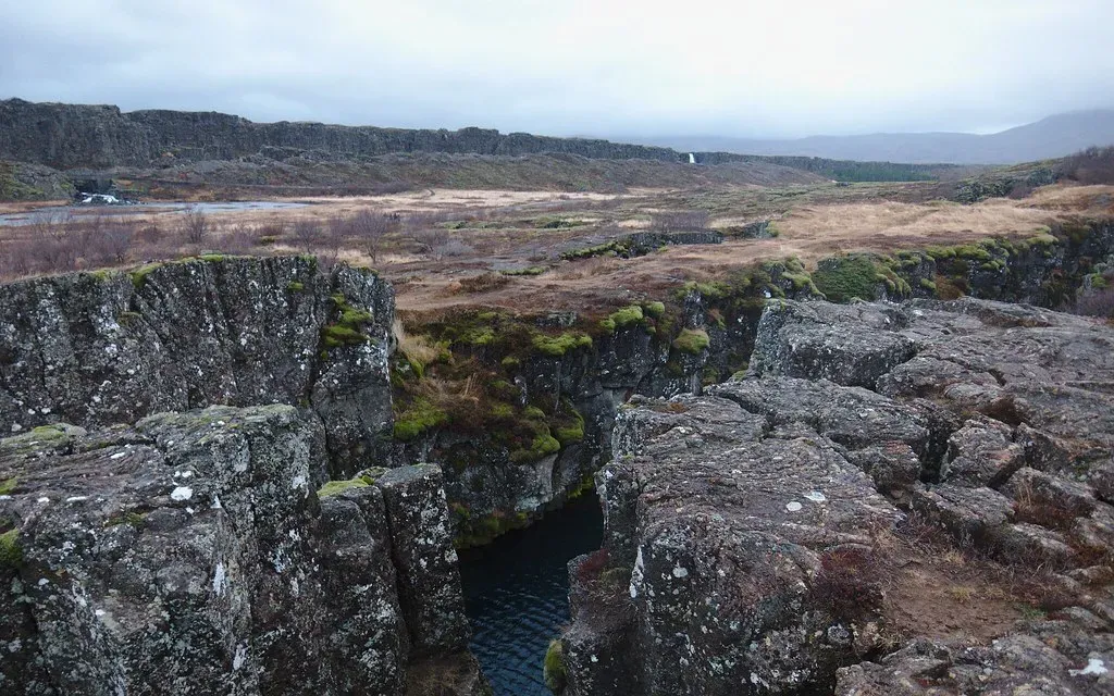
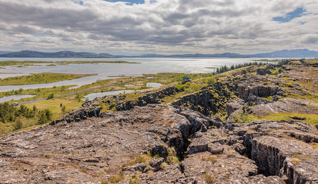
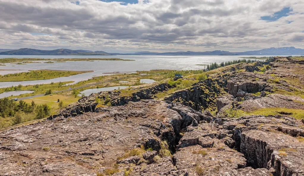
Iceland sits directly on top of the Mid-Atlantic Ridge, and nowhere is that more obvious than at Þingvellir, where visitors can walk through a canyon that literally separates two tectonic plates. Þingvellir sits directly on the Mid-Atlantic Ridge, where the Eurasian and North American tectonic plates are literally pulling apart at a rate of 2.5 centimetres per year. That is roughly the speed a fingernail grows, which sounds trivial until you consider it has been happening continuously for millions of years.
The visible result is the Almannagjá fissure, a dramatic rift wall that has become one of the park’s signature sights. Over the past 10,000 years the Thingvellir Rift Valley has widened by 230 feet and sunk by 131 feet. Standing in that gap, you are technically straddling two continents, which is a strange thing to process on what otherwise feels like a normal hiking trail.
Reykjanes Peninsula, Iceland
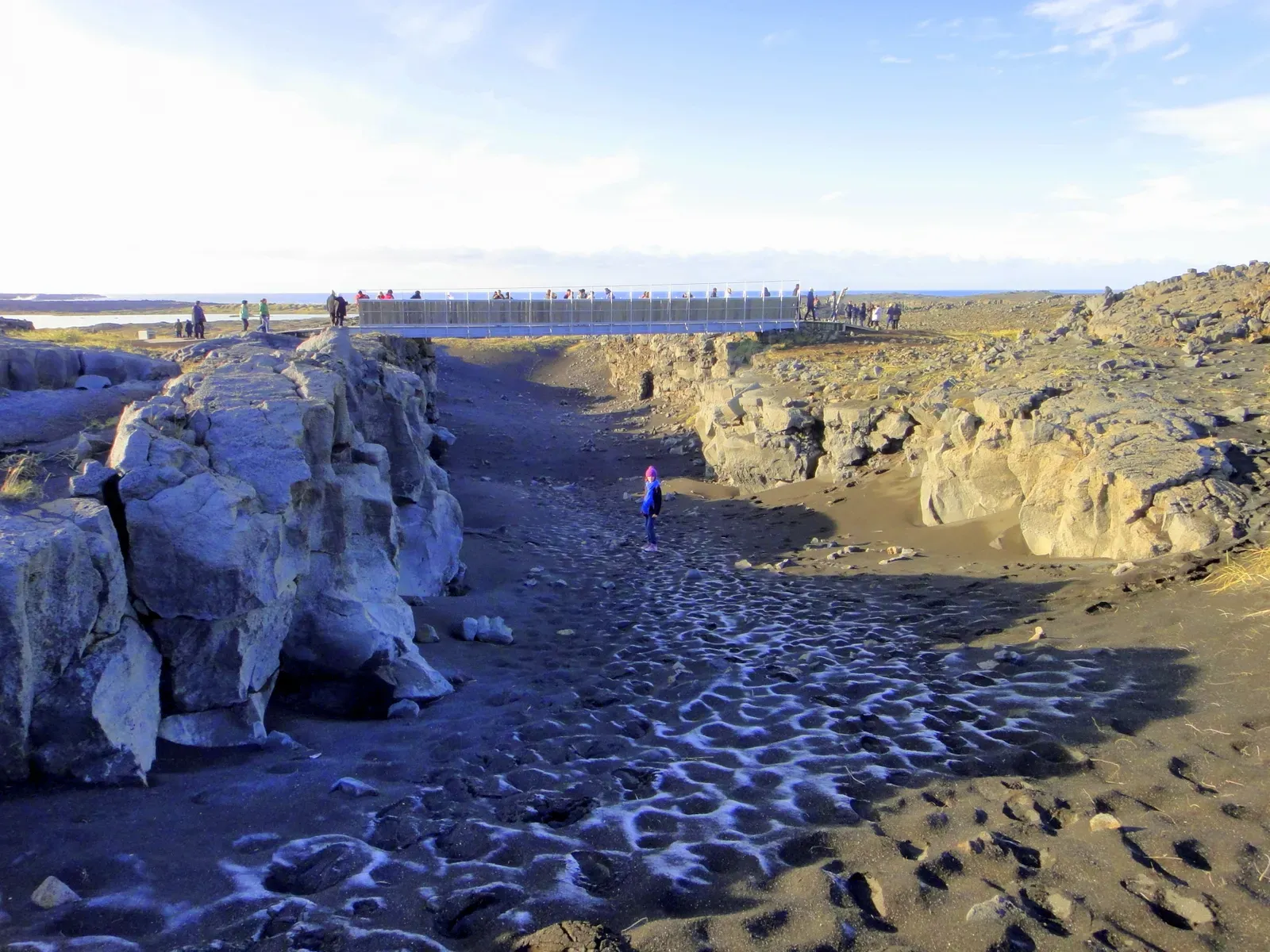
A short drive from Þingvellir, the Reykjanes Peninsula offers a different flavor of the same story, one where the rifting shows up as fresh lava rather than quiet fissures. The Reykjanes Peninsula, sharing the same rift system, experienced renewed volcanic activity in 2021 after 800 years of dormancy, suggesting the broader system may be entering a more active phase. That kind of shift after eight centuries of quiet is exactly the sort of thing geologists watch closely.
What makes Reykjanes particularly striking is the “Bridge Between Continents,” a small footbridge built over one of the rift’s open fissures, connecting the North American side to the Eurasian side. It is a bit of a tourist gimmick, sure, but it sits on genuine, actively separating crust. The peninsula’s recent volcanic unrest is essentially the rift telling you, in real time, that the plates underneath are still very much in motion.
The Turkana Rift, Kenya and Ethiopia
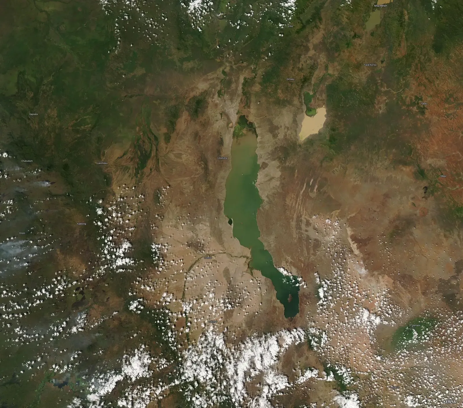
Far from Iceland’s icy landscapes, the Turkana Rift in East Africa tells a similarly active story, just on dry, dusty ground instead. This rift is a 500-kilometer-wide, low-lying region that spans Kenya and Ethiopia, where the African and Somali plates are drifting apart at a rate of about 4.7 millimeters per year. That is slower than Iceland’s spreading rate, but the underlying crust here has been thinning for a very long time.
Research published in 2026 revealed the region is further along in the breakup process than previously assumed. Study lead author Christian Rowan, a Ph.D. student at Columbia University’s Lamont-Doherty Earth Observatory, found that rifting in this zone is more advanced, and the crust is thinner, than anyone had recognized, with the Turkana Rift having begun opening about 45 million years ago. Not every rift finishes what it starts, but Turkana appears to be one that will.
The Afar Depression, Ethiopia
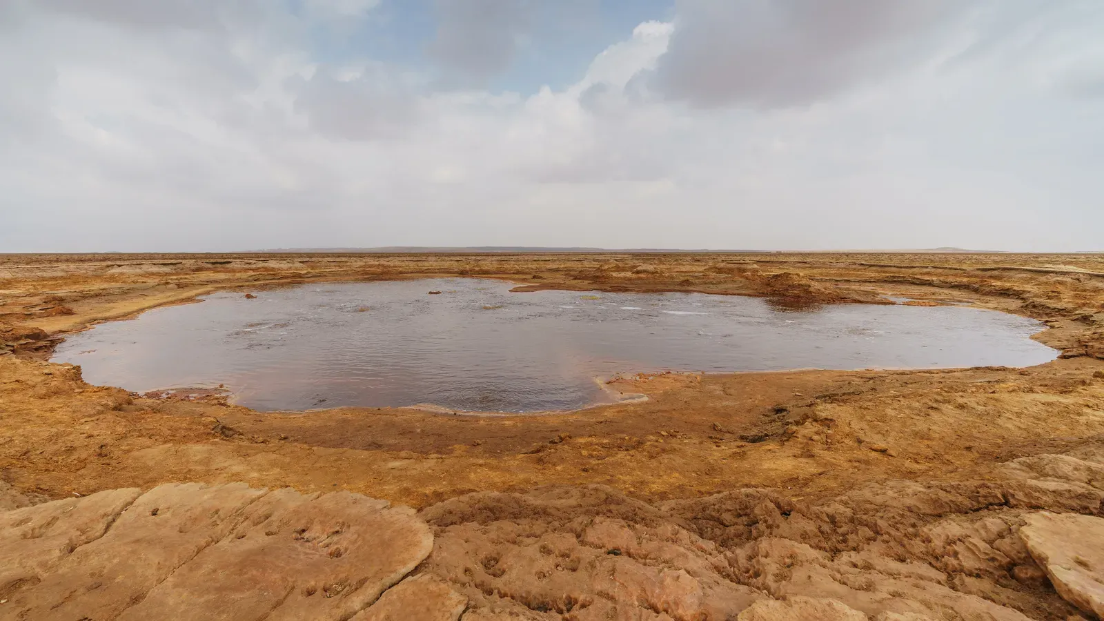
If Turkana is a rift still working things out, the Afar Depression is closer to graduation. This region sits at the meeting point of three tectonic plates, and it is here that the transition from continental crack to actual ocean basin is furthest along. The Afar sits at the crossroads of three tectonic plates, the Nubian, Somali, and Arabian, which are gradually pulling away from one another, a process known as rifting that is reshaping the landscape and offering scientists a rare opportunity to study how continents split and oceans are born.
Some of the crust beneath the surface here no longer even qualifies as continental rock. Oceanic crust is denser and chemically distinct from continental rock, and it normally exists only under existing oceans, so its presence beneath portions of the East African Rift confirms the region is actively transitioning toward something more closely resembling a seafloor. If current trends hold, the Red Sea and Gulf of Aden could eventually pour into the rift valley and create a new ocean basin, an outcome projected to occur within 5 to 10 million years based on current plate separation rates. That is an unfathomable stretch of time by human standards, but it is a blink of an eye geologically, and the process driving it is already measurable with modern instruments.
Lake Baikal, Siberia
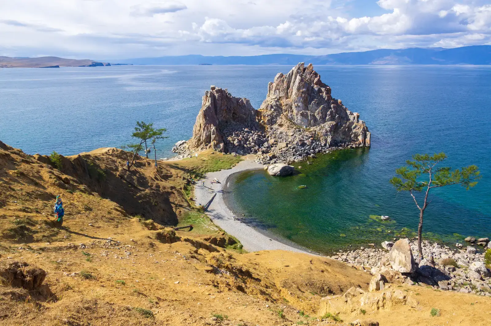
Lake Baikal is usually described in superlatives, the deepest lake, the oldest lake, the largest single reservoir of unfrozen fresh water on the planet. What gets less attention is the reason it exists at all. Lake Baikal is in a rift valley, created by the Baikal Rift Zone, where the Earth’s crust is slowly pulling apart, and in geological terms the rift is young and active, widening about 2 centimeters per year.
That widening has been happening long enough to carve out an astonishingly deep basin. The bottom of the lake is more than a full kilometer below sea level, and the rift valley that created it goes far deeper still, with roughly 7,000 meters of sediment having fallen into the rift over time, placing the rift floor 8 to 11 kilometers beneath the surface, making it the deepest continental rift on Earth. More precise satellite measurements have put the actual plate divergence rate closer to a few millimeters a year rather than the full surface widening figure, but either way, the ground beneath Baikal has not finished moving.
The Gulf of California, Mexico
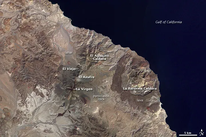
The Baja California peninsula is not really attached to mainland Mexico the way it looks on a map. It is riding its own microplate, and that microplate has been sliding away for millions of years. Relative plate motion between the Baja California microplate and North America in the southern gulf is roughly 45 to 47 millimeters per year. That is a genuinely fast rate by continental rifting standards, closer to how oceanic plates move than how most continental rifts behave.
The consequence is a body of water that essentially fills a widening gash between two pieces of land that used to be joined. Every year, Baja creeps a little farther away from the continent, slowly widening the gap, with separation taking place at an average rate of about 2 to 5 centimeters per year. Scientists studying the region have noted it formed unusually quickly compared to other ocean basins on Earth, a reminder that rifting does not always move at the same glacial pace everywhere.
The Rio Grande Rift, New Mexico
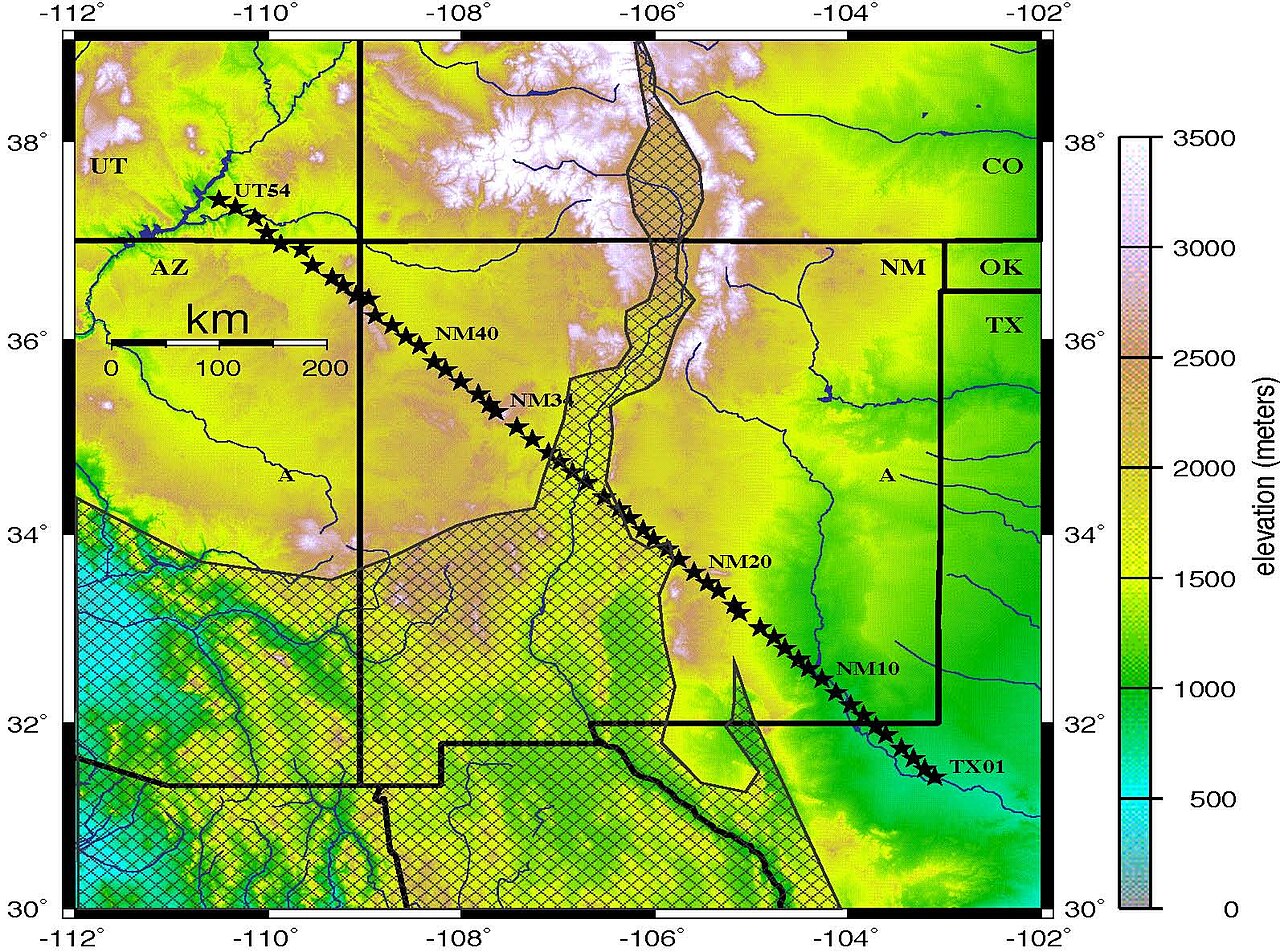
Not every rift on this list is racing toward a dramatic finale, and the Rio Grande Rift is a good example of one that has settled into a slower, quieter rhythm. Stretching roughly from central Colorado down through New Mexico and into Mexico, it began forming tens of millions of years ago as the crust in the western United States started to stretch and thin. The visible legacy is a long chain of basins and mountain ranges running roughly north to south, carved by faults that are still technically active, if only modestly so.
Compared to Iceland or the Afar region, movement here is far more subdued, with extension rates generally measured in a fraction of a millimeter to a couple of millimeters per year in most sections. It rarely makes headlines the way East Africa or Baja California do, partly because the drama unfolded mostly in the geologic past rather than in front of modern instruments. Even so, occasional small earthquakes along the rift’s fault systems are a reminder that the stretching, however gentle, has not entirely stopped.
Final Thoughts
What strikes me most about these seven places is how differently they wear the same basic process. Iceland turns it into a tourist attraction you can straddle for a photo. East Africa turns it into a slow-motion origin story for a future ocean. Baja California turns it into one of the fastest rifting events geologists have ever documented.
None of this should keep anyone up at night, since the timescales involved dwarf entire human civilizations, let alone a single news cycle. Still, there is something genuinely worth paying attention to in the fact that our planet’s surface is not fixed scenery. It is closer to a very slow, very patient work in progress, and for once, we happen to be around with the tools to actually watch it happen.