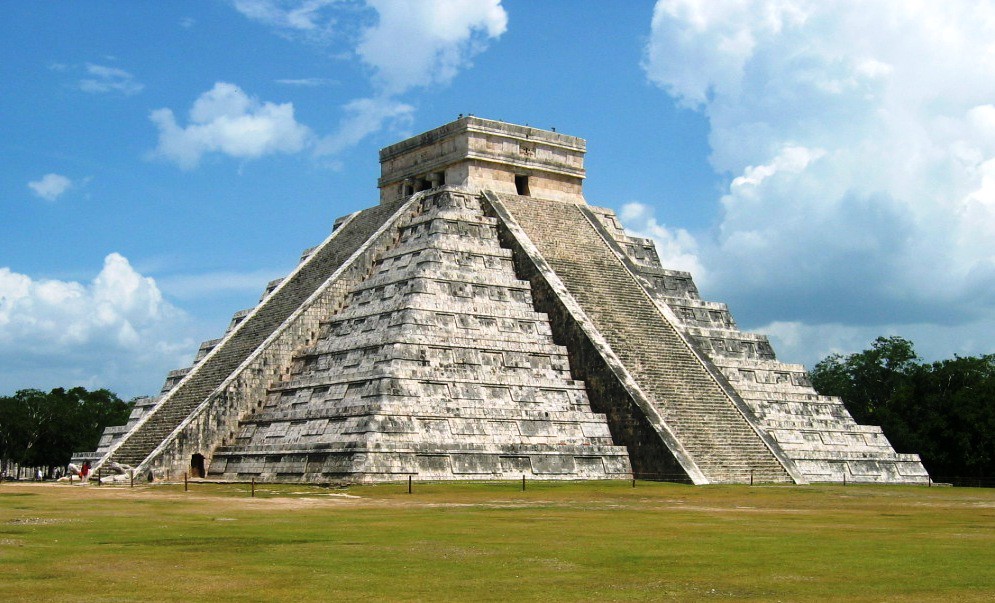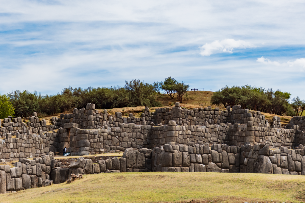
Picture the stereotype: shivering hunter-gatherers stacking a few rocks and hoping the gods approve. That’s the “ancient people” most of us grew up believing in. It’s also, according to the dirt itself, almost entirely wrong.
Archaeologists keep uncovering cities with street grids, temples locked onto solstice sunrises, and drainage systems more advanced than some modern suburbs. These weren’t lucky accidents stumbled into by primitive tribes. They were blueprints, enforced by someone with real authority, built by crews who understood geometry, hydraulics, and the sky centuries before anyone wrote a word about any of it. What follows are 14 sites that quietly demolish the tidy timeline school taught you, and the deeper you go, the stranger the evidence gets.
#14 – Poverty Point, USA: A City of Earthworks Before Cities Were “Supposed” to Exist
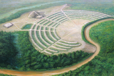
Most people assume North America didn’t see large planned centers until the Maya and later the Mississippians. Poverty Point blows that idea up completely. In what’s now Louisiana, around 1700–1100 BCE, people built a complex of massive earthworks: six concentric C-shaped ridges and huge mounds stretching nearly a mile.
These ridges weren’t random. They’re laid out with striking geometric regularity, consistent spacing, and a clear central axis. That kind of symmetry doesn’t happen without surveying, shared design standards, and leaders enforcing a plan.
Archaeologists have found organized housing zones on the ridges, suggesting an intentionally structured community rather than a one-off ritual gathering. Long-distance trade goods – stone from the Appalachians, copper from the Great Lakes – show this wasn’t an isolated village. It was plugged into a continent-scale network, coordinated enough to pull resources in from thousands of miles away.
Even more surprising, this happened while many Old World societies were barely forming recognizably urban landscapes. Hunter-fisher-foragers in North America were already reshaping entire river bluffs into a proto-city grid made of dirt.
#13 – Göbekli Tepe, Turkey: Monumental Architecture Before Farming
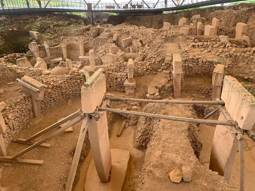
Most people assume cities came first, then temples. Göbekli Tepe suggests the exact opposite. Dating back to around 9600–8000 BCE, this hilltop in southeastern Turkey holds circular and oval enclosures made of T-shaped stone pillars weighing up to 20 tons each.
These pillars sit in carefully planned rings, with two larger central monoliths facing one another inside each enclosure. The layouts repeat with eerie consistency, almost like an architectural template passed down over generations. Carved foxes, snakes, birds, and abstract symbols show a shared symbolic system, not one-off doodles, and coordinated artistic programs placed in specific spatial positions.
What really shocks researchers is the construction sequence. Builders dug foundation trenches, set pillars into sockets, raised stone walls between them, and in some cases later backfilled entire enclosures on purpose, almost like decommissioning sacred structures in a planned ritual cycle.
All of this happened before pottery, before metal tools, and before fully developed agriculture. It suggests large, organized labor forces assembled around shared religious projects, and that the urge to build something huge and orderly may have actually pulled people toward permanent settlement rather than the other way around.
#12 – Mohenjo-Daro, Pakistan: The Gridded City With Ancient “Zoning Laws”
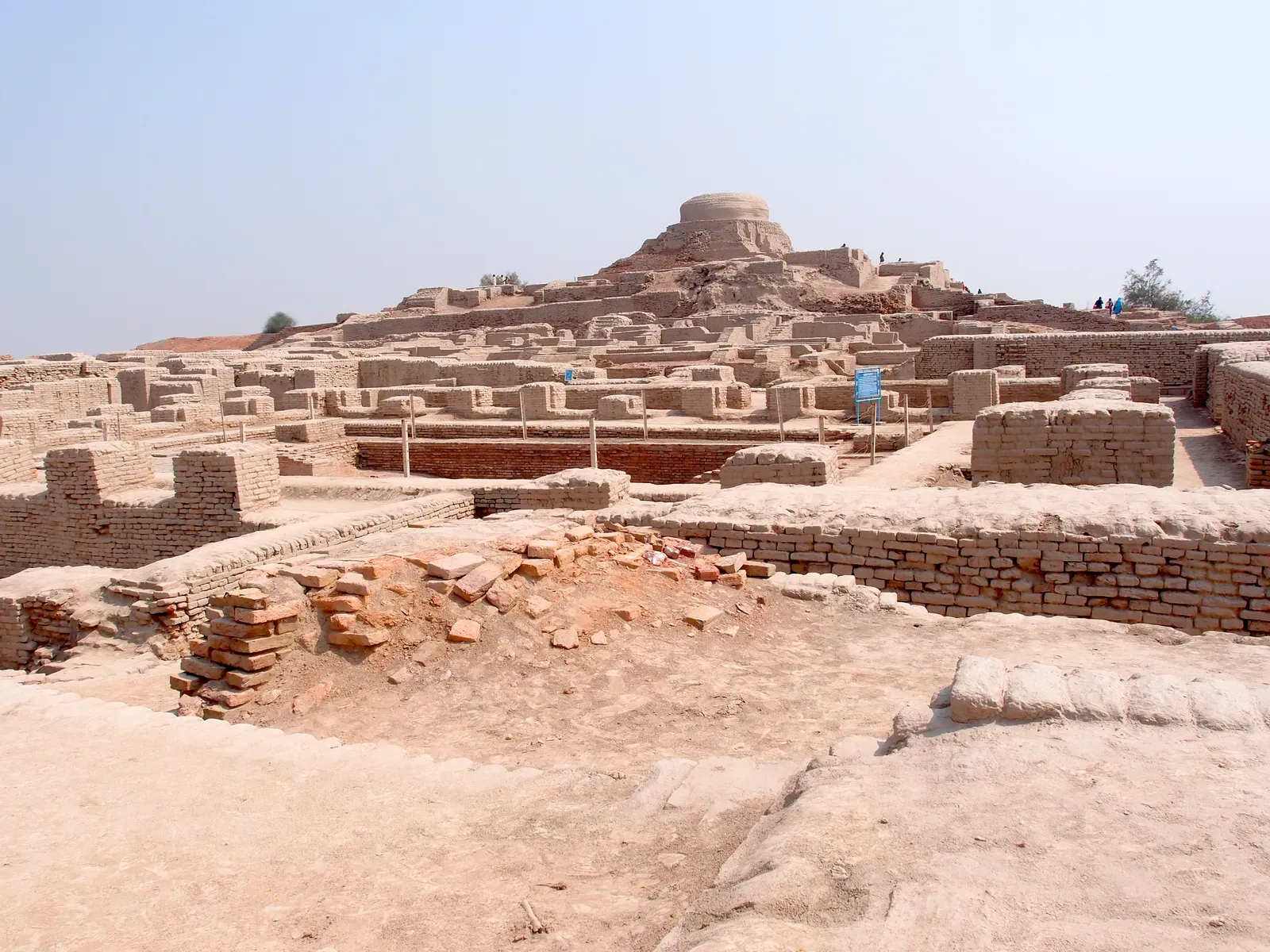
Everyone learns about Mesopotamia and Egypt as the birthplaces of civilization, but the Indus city of Mohenjo-Daro quietly outclasses many early urban centers in one key way: planning. Founded around 2600 BCE, it isn’t a cluster of mud-brick houses. It’s laid out on a near-perfect north-south and east-west grid, with straight streets crossing at right angles.
The city appears to have distinct “higher” and “lower” sectors, often called the citadel and the lower town, hinting at deliberate zoning for public, administrative, and residential functions. The real showstopper, though, is the water management.
Almost every house had access to a well or shared water source, plus covered brick drains running beneath the streets. Wastewater flowed through a carefully graded network out of the city. That level of civic infrastructure implies agreed building rules, coordination across neighborhoods, and someone insisting everyone follow the same layout.
What’s wild is how standardized the bricks are: many fit a consistent 1:2:4 ratio, like an early building code stretching across multiple Indus cities. That points to a regional system of measurement and planning long before formal empires carved up the map.
Fast Facts
- Founded around 2600 BCE in the Indus Valley, modern-day Pakistan
- Streets run in a near-perfect north-south, east-west grid
- Nearly every home had access to a well and a covered drain
- Bricks followed a standardized 1:2:4 ratio across multiple Indus cities
#11 – Caral, Peru: A Planned Sacred City in the Desert
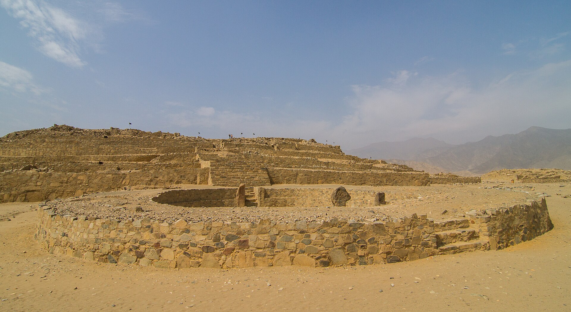
Most people think urban planning in the Americas starts with the Maya. Peru’s Caral proves that wrong by roughly a thousand years. Dating to around 2600–1800 BCE, it’s one of the oldest known urban centers in the Americas.
From above, you can see a tightly organized layout: multiple platform mounds, residential areas, and two carefully positioned sunken circular plazas. These aren’t plopped down at random – they create focal points connecting major architectural complexes, almost like planned public squares.
Major structures at Caral align with cardinal directions and possibly astronomical events. The city’s core sits on a terraced step of the valley, arranged to command views and manage space. Even more telling, there’s virtually no evidence of fortifications or warfare. Planning here seems focused on ritual, trade, and administration rather than defense.
The scale of construction – massive stone and earth platforms – required organized labor, centralized decision-making, and a long-term vision everyone agreed on. You don’t move that much rock unless someone is directing crews to exact locations with a deliberate plan.
#10 – Teotihuacan, Mexico: A City Built on a Cosmic Grid
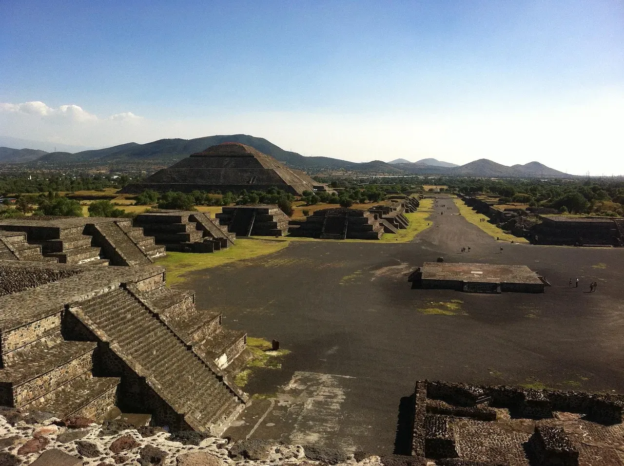
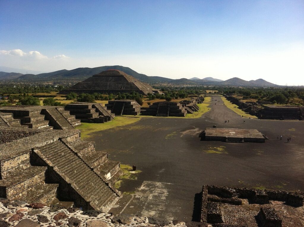
Teotihuacan is famous for its pyramids, but the real shock is the urban blueprint underneath them. Flourishing between about 100 BCE and 550 CE, the city covered up to 20 square kilometers, making it one of the largest cities in the world at its peak.
Its entire urban core follows a central north-south axis, the so-called Avenue of the Dead, plus a secondary east-west axis. The city is tilted about 15.5 degrees east of true north, and that skew looks deliberately chosen, possibly to align with specific solar or stellar events.
Residential compounds, temples, and marketplaces all conform to this grid, meaning new neighborhoods still followed a master plan as the city grew. Many apartment compounds are standardized in size and layout, suggesting something close to a state-level housing policy. Different ethnic or occupational groups appear to have lived in distinct, planned barrios: merchants here, craftsmen there, foreigners in their own enclaves.
That’s social planning written directly into the architecture. Visitors see big pyramids; the deeper story is a city engineered like a cosmic diagram, where religion, power, and daily life were locked into the same geometric framework.
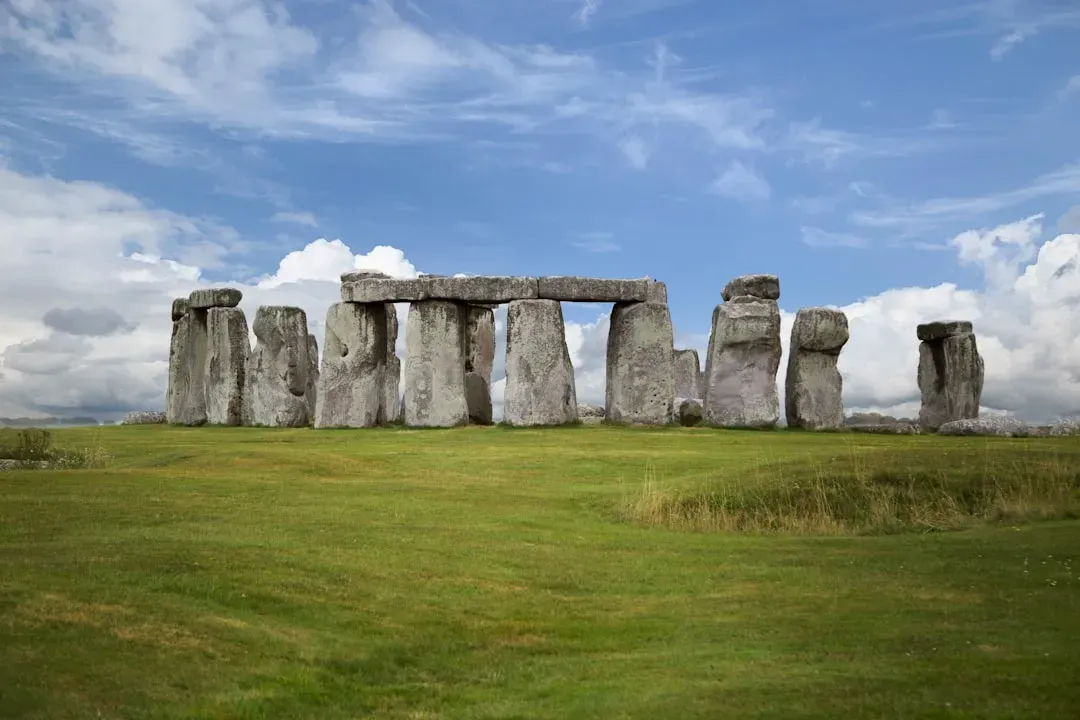
#9 – Stonehenge, England: More Than a Stone Circle in a Field
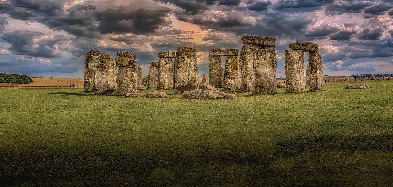
People treat Stonehenge like a single, isolated ring of stones. In reality, it’s the centerpiece of a carefully organized ritual landscape spanning miles. Built and modified between roughly 3000 and 1600 BCE, it aligns famously with the midsummer sunrise and midwinter sunset – an alignment that demands precise astronomical observation and careful positioning of stones weighing up to 25 tons.
The planning goes far beyond that single alignment. The site connects to the surrounding Avenue, a processional route aligned with the solstice sunrise, plus the nearby henge sites at Durrington Walls and other monuments, and burial mounds arranged with consistent orientations.
- Timber circles positioned in relation to sightlines and celestial events
- Earthworks coordinated across the wider ritual landscape
- Stone settings placed with three-dimensional joints and lintels, not a rough ring
The logistics are just as impressive: stones from Wales had to be quarried and dragged over 100 miles, then set into pre-dug sockets. The end result is less a random stone circle and more a prehistoric masterplan for ritual space.
#8 – Great Zimbabwe, Zimbabwe: A Walled Complex With Subtle Order
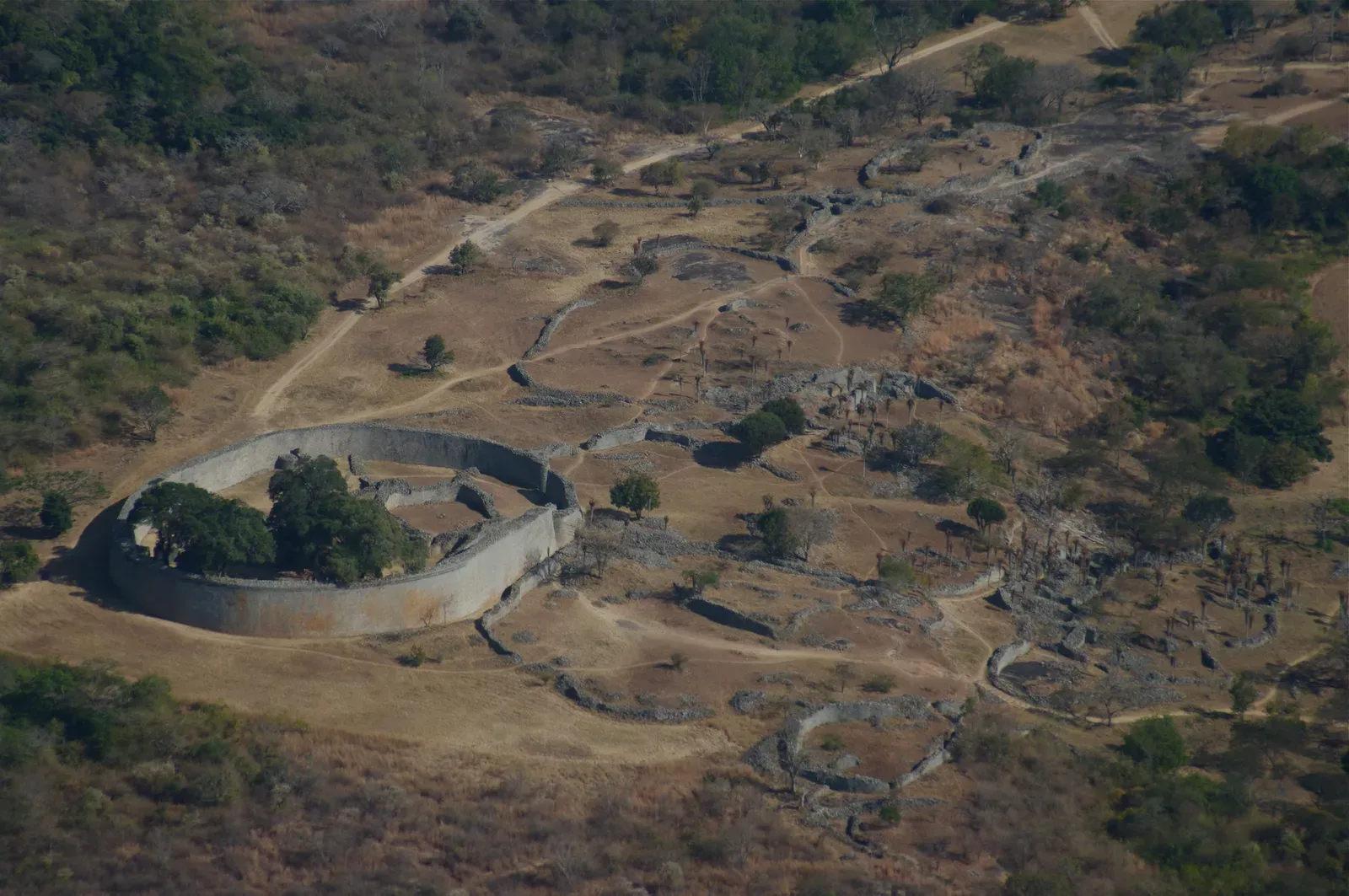
Great Zimbabwe is often misrepresented as a mysterious ruin in the hills. Look closer, and you see sophisticated spatial planning tied to power and ritual. Built between about 1100 and 1500 CE, it consists of stone enclosures, towers, and passageways constructed without mortar.
The most iconic feature, the Great Enclosure, has walls up to 11 meters high, curving around in an almost perfect ellipse. Inside, narrow, planned corridors control how people move and what they can see, funneling visitors toward certain spaces while concealing others.
The placement of enclosures across the landscape appears to reflect social hierarchy: elite areas perched on the Hill Complex, more public or craft areas lower down. The famous Conical Tower inside the Great Enclosure wasn’t just decorative – its prominent, central position suggests a deliberate symbol of authority.
One underappreciated fact: building walls of that length and thickness with dry-stone techniques required consistent stone block sizes, stable foundations, and an understanding of load and curvature. That’s not luck. That’s coordinated design across multiple building phases.
#7 – Angkor, Cambodia: A Temple City With Hidden Hydraulics
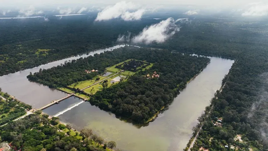
Most tourists see temple towers and tree roots at Angkor. The real genius, revealed by satellites and lidar, is a mega-engineered water landscape. Angkor, the core of the Khmer Empire from roughly the 9th to 15th century CE, wasn’t a single city but a sprawling urban network.
At its heart, temples like Angkor Wat and Angkor Thom sit inside a grid of rectangular reservoirs, canals, embankments, and rice fields. These weren’t ornamental ponds – they were a managed hydraulic system built to control monsoon water: storing it, redirecting floods, and irrigating vast agricultural zones.
Angkor Wat itself is aligned to the west, unusual for Khmer temples, and wrapped in moats and concentric galleries following precise proportions. Zoom out and you see causeways and processional routes connecting temples like nodes in a grand design. Recent lidar surveys have even revealed straight, planned streets and orthogonal field systems locked into the larger framework.
Worth Knowing
- Angkor’s core thrived from roughly the 9th to 15th century CE
- Reservoirs and canals doubled as flood control and irrigation infrastructure
- Lidar surveys have revealed hidden streets and field grids beneath the jungle canopy
- Angkor Wat faces west, an unusual orientation among Khmer temples
This wasn’t an organic town that simply grew. It’s closer to an ancient water-powered metropolis, where political power literally depended on the ability to shape and maintain the landscape at scale.
#6 – The Nazca Lines, Peru: Giant Ground Drawings You Can’t See From the Ground
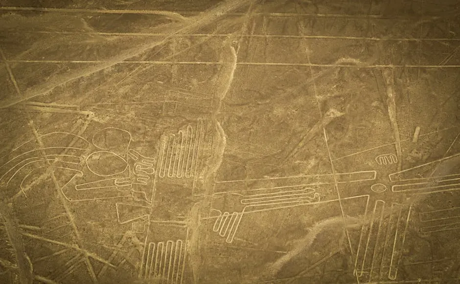
From eye level, the Nazca Lines barely register. From the air, they scream planning on a mind-bending scale. Etched into the Peruvian desert between roughly 500 BCE and 500 CE, these hundreds of geoglyphs include straight lines, trapezoids, and figures like hummingbirds, monkeys, and spiders.
Some lines run for kilometers in nearly perfect straight paths over uneven terrain, which implies surveying, sighting points, and teams of workers keeping alignment across long distances. The animal figures follow consistent proportions and orientations – some hundreds of meters across – yet still maintain symmetry.
Here’s the part that genuinely unsettles people: these designs are best appreciated from high vantage points the Nazca simply didn’t have. No planes, no drones, nothing. That strongly suggests they conceptualized the landscape from an abstract, map-like viewpoint – a mental “above view” – long before any aerial perspective existed.
You don’t get this level of large-scale, coordinated geometry by accident.
People still argue about purpose – ritual paths, offerings to sky deities, water rites – but almost nobody disputes the planning behind them.
#5 – Cahokia, USA: A North American City With a Cosmic Street Plan
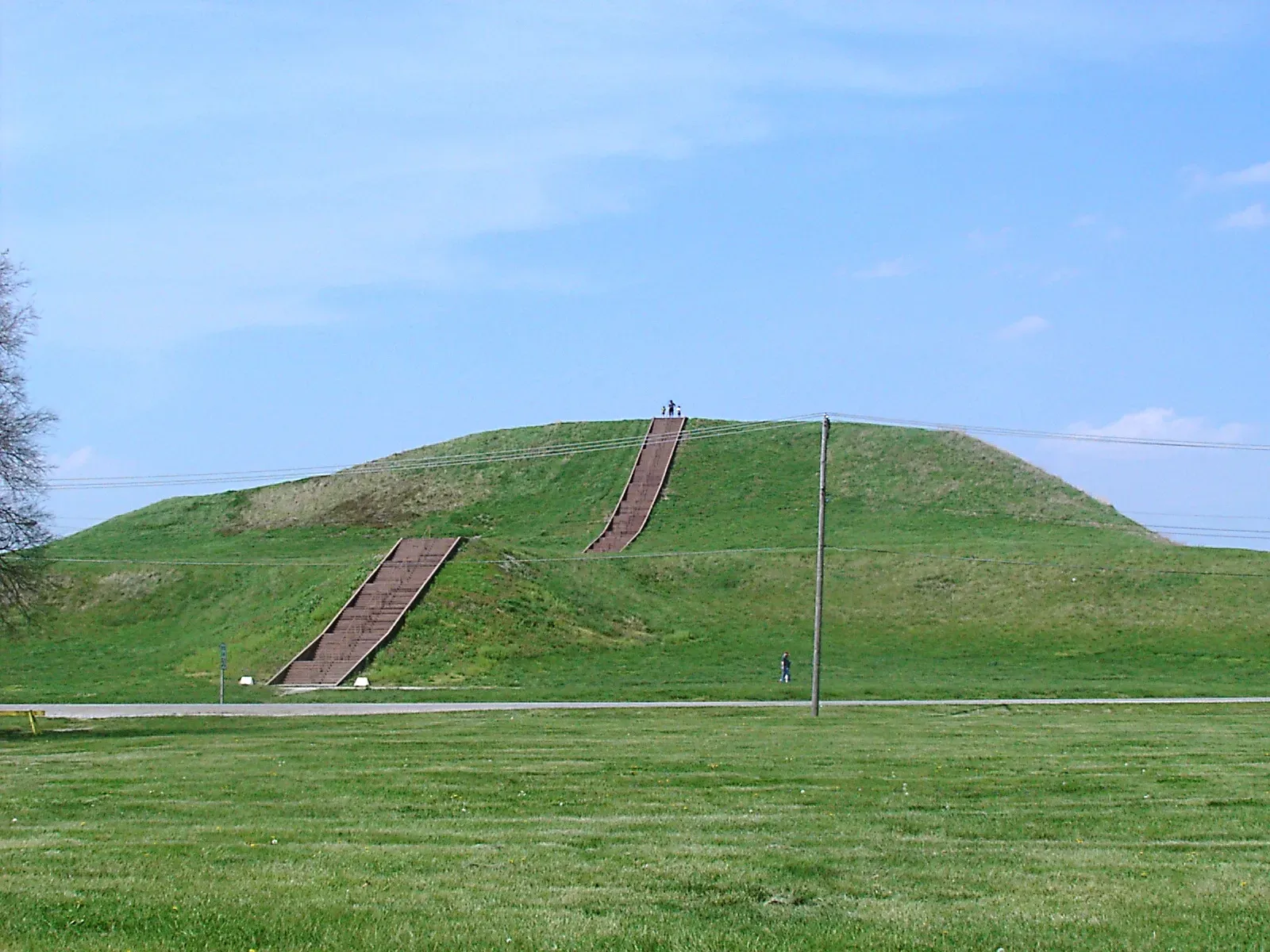
Cahokia is the site that quietly shatters the myth that pre-Columbian North America was all small villages and scattered camps. Located near present-day St. Louis, it boomed between about 1050 and 1350 CE, with a population that may have rivaled or exceeded contemporary European cities.
Its centerpiece, Monks Mound, is the largest earthen structure in the Americas. But the overall city layout is what really undercuts old stereotypes. The central plaza is framed by mounds arranged along a planned north-south and east-west axis, with some structures aligned to solstice sunrises and sunsets.
Archaeologists have identified “Woodhenge” timber circles that marked solar events, integrated directly into the city’s spatial design. Certain neighborhoods appear to have been rebuilt following repeated patterns – same orientations, repeated platform layouts – hinting at a shared urban code, not random sprawl.
Cahokia also appears to have been ethnically and functionally diverse, with craft districts and possibly immigrant quarters. Despite all this, it barely shows up in most school curricula, which still frame North American urbanism as something that started after colonization. The evidence says otherwise.
#4 – The Minoan Palace of Knossos, Crete: Labyrinth or Planned Complex?
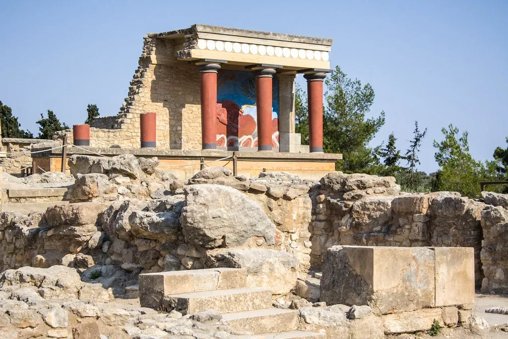
People know Knossos from the myth of the Labyrinth and the Minotaur. Ironically, the “labyrinth” feel comes not from chaos, but from highly intentional spatial design. Occupied and rebuilt over millennia, with a major phase around 1900–1450 BCE, Knossos is a multi-story complex of courts, halls, storerooms, and staircases.
At first glance it looks like a maze. On closer study, archaeologists see careful organization: central courts oriented roughly north-south, wings dedicated to specific functions like storage, ritual, and administration, and light wells and corridors engineered to bring air and light deep inside the building.
Huge storage magazines lined with giant jars suggest a centralized economy, with food and goods flowing into and out of a coordinated hub. Drainage channels, terracotta pipes, and even what looks like early flushing systems show attention to water and waste management that many later cultures never matched.
The visual confusion is almost a feature. Elites could control movement and access by understanding a plan that ordinary visitors couldn’t see – architectural power politics, not randomness. For a Bronze Age island society, that level of multi-level complexity still raises eyebrows among researchers who assumed it should come much later.
#3 – The Pyramids and Giza Plateau, Egypt: Alignment on a Monumental Scale

Everyone knows the pyramids are big. Fewer people realize how insanely precise, and collectively planned, the whole Giza plateau really is. Built around 2600–2500 BCE, the three main pyramids of Khufu, Khafre, and Menkaure aren’t placed randomly – their bases line up along a shared diagonal, and their sides are oriented within a fraction of a degree of true north-south and east-west.
The Great Pyramid’s base sides differ in length by only a few centimeters over more than 200 meters. That kind of precision requires standardized units of measurement, real survey technique, and strict adherence to a master design.
Quick Compare
- Khufu (Great Pyramid): roughly a 230-meter base, originally about 146 meters tall
- Khafre: roughly a 215-meter base, originally about 143 meters tall, built on higher ground to appear equally tall
- Menkaure: roughly a 105-meter base, about 65 meters tall, far smaller yet still perfectly aligned
Then there’s the broader layout: the Sphinx, causeways, mortuary temples, and subsidiary queens’ pyramids all form part of one coordinated funerary complex. Some researchers argue the positions echo stars in Orion’s Belt; whether or not every detail was intentional, nobody disputes the astro-geometric awareness on display.
Importantly, the logistics were their own kind of planned architecture – quarries, worker villages, supply routes, and seasonal labor schedules all orchestrated together. This wasn’t just building big. It was managing a national-scale construction industry for decades at a time, and it still makes modern engineers blink.
#2 – Chavín de Huántar, Peru: Underground Sound Design in Stone
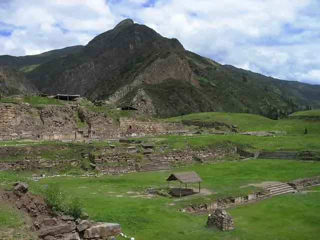
Chavín de Huántar doesn’t look as massive as the biggest pyramids, but in terms of conceptual planning, it may be one of the most sophisticated sites in the ancient Andes. Flourishing around 900–200 BCE, this highland ceremonial center is famous for its labyrinthine interior galleries, carved stone art, and the enigmatic Lanzón monolith.
What really stands out is the integration of architecture, sensory manipulation, and water engineering. Inside the temple, narrow stone passageways twist and intersect in ways that distort sound and sight. Archaeologists and acoustics researchers have tested how conch shell trumpets – real ones have been found on site – would have boomed and echoed through the corridors, likely making voices and instruments seem superhuman.
On top of that, Chavín incorporates complex drainage and water channels. During heavy rains, these could have created controlled rushing sounds or even small, dramatic water features, all built directly into the temple’s design.
In other words, the site seems engineered not just as a physical space but as a psychological device. Planning here isn’t only about symmetry and grids; it’s about understanding how built space can manipulate human perception, centuries before anyone wrote a word of architectural theory.
#1 – Çatalhöyük, Turkey: A “City” Without Streets That Was Still Carefully Planned
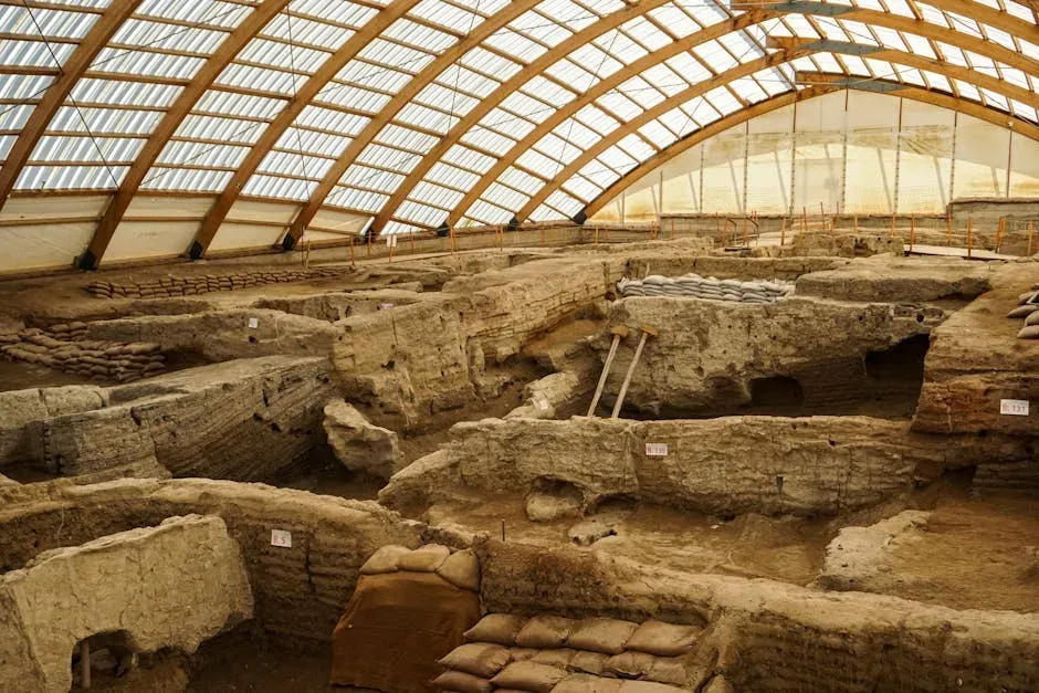
If you think planning requires streets and plazas, Çatalhöyük will break your brain. Dating to around 7400–6000 BCE, this site in central Turkey is often called one of the first proto-cities. From above, it looks chaotic – thousands of mud-brick houses jammed together, no obvious streets, roofs touching like a solid carpet of buildings.
But that apparent chaos hides a different kind of planning. People entered their homes through the rooftops, and the roofs doubled as shared circulation space, a continuous pedestrian platform running across the whole settlement. Houses follow repeated internal patterns: ovens in similar positions, sleeping and burial platforms in predictable spots, wall paintings and bull horns concentrated in special rooms.
This standardization across generations suggests strong cultural rules, almost a design language everyone followed without needing streets to enforce it. The densification itself was intentional – new houses were built directly atop old ones, slowly raising the mound while keeping alignments and orientations remarkably consistent.
Why It Stands Out
- No streets, plazas, or palaces – yet a clear, repeated design language across the whole settlement
- Residents entered homes through rooftop openings, turning roofs into shared public walkways
- New houses were built directly atop older ones for generations, raising the mound over time
- One of the earliest large, densely packed settlements ever excavated
That’s long-term planning stretched across centuries: a community collectively deciding to grow upward and maintain continuity rather than sprawl randomly outward. There’s no palace, no temple in the usual sense, yet the whole settlement functions like a highly organized organism. Planning doesn’t always look like grids and boulevards. Sometimes it’s encoded in how you agree to stack your entire life, literally, on top of your ancestors.
The Bottom Line
Across continents and millennia, these sites punch a hole in the lazy idea that early humans “didn’t know what they were doing” until a few famous civilizations showed up. From Çatalhöyük’s roof-level circulation to Angkor’s hydraulic super-grid and Teotihuacan’s tilted cosmic avenues, the evidence is uncomfortable for anyone who likes clean, tidy timelines. Large-scale, intelligent planning appears, disappears, and re-emerges in multiple places far earlier than most textbooks admit.
What strikes me most is that so much of this planning wasn’t even about comfort or defense. It was about ritual, perception, and cosmic order – people mobilizing entire populations not just to survive, but to force meaning into the landscape itself. That’s a very different picture of “primitive” than the one most of us were handed in school.
So which of these sites do you think most seriously forces us to rethink what “primitive” actually means – and is there one you’d put in your own top 14 that didn’t make this list?