Open any textbook or museum wall panel about an extinct species, and you’ll meet the same reassuring image: a smooth, confidently shaded blob on a map, as if scientists watched the animal live out its whole life across every inch of that colored zone. It looks like settled science. It isn’t.
Pull the actual specimens instead – the skulls in drawers, the radiocarbon-dated bones, the museum tags with real coordinates – and something strange happens. Case after case, the physical evidence clusters in tight little pockets while the “official” range balloons across entire mountain chains, deserts, and continents. Sometimes the mismatch is embarrassing. Sometimes it rewrites the whole extinction story. Here are 22 animals whose recovered bones flatly contradict the maps we’ve been handing out for decades.
Extraordinary claims require extraordinary evidence.
Carl Sagan
#22 – The Western Black Rhinoceros That “Skipped” Half Its Map
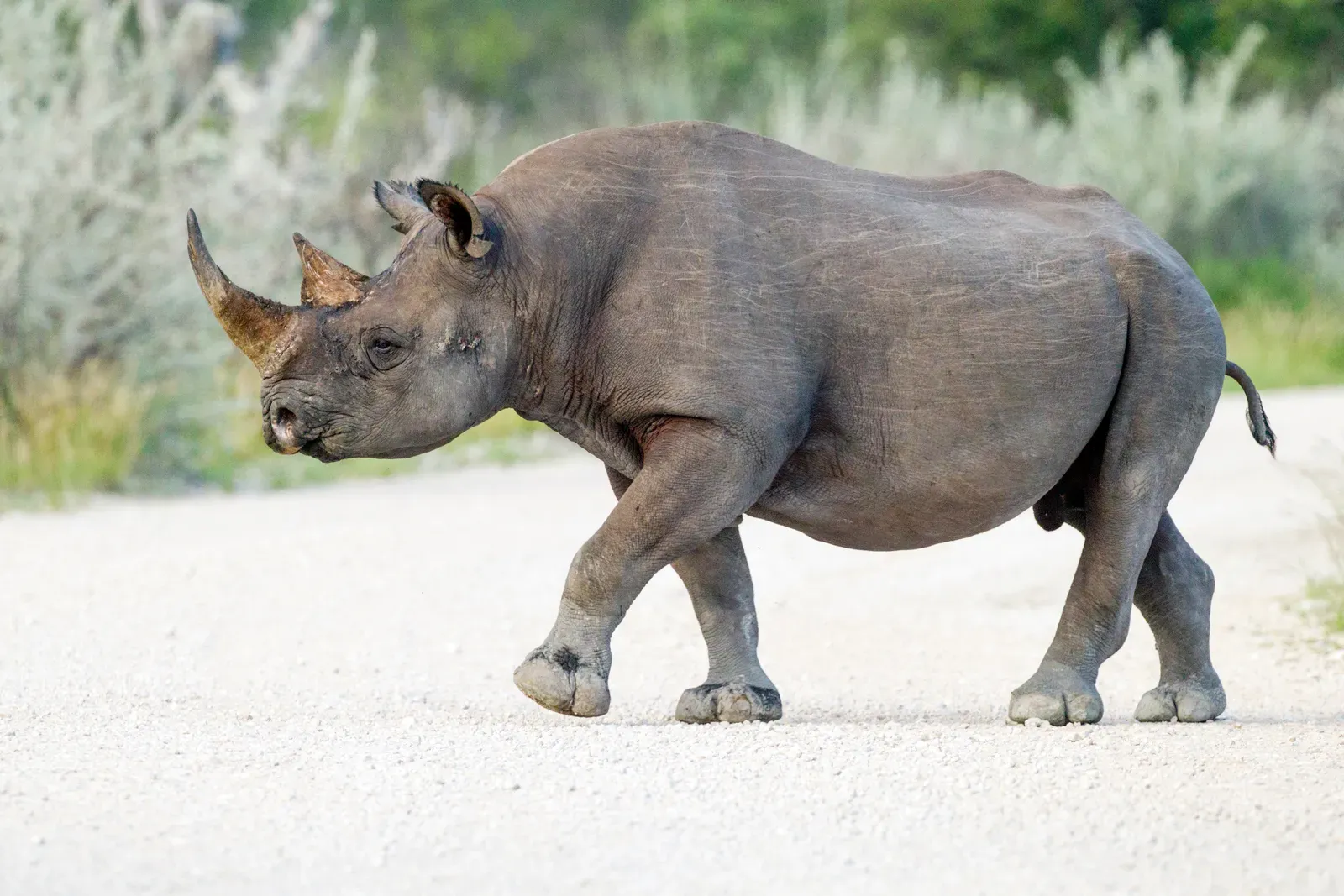
Flip through a conservation atlas and the western black rhino looks like it once owned half of West and Central Africa – a thick green smear rolled from Cameroon clear over to Chad. The specimens tell a much smaller story. Nearly every trophy skull, horn core, and colonial-era hunting record that can be reliably pinned to this subspecies comes from one tight core in northern Cameroon and its immediate neighbors.
So why the mismatch? A lot of those confident map polygons were built on secondhand “a local said he saw one” notes, habitat guesswork, and NGO reports copy-pasted for decades. The truth the bones point to is far more fragile: a patchy, shrinking pocket of rhinos squeezed by farmland and hunters, not a continental resident. Some biogeographers now say the western black rhino’s real range was never the sprawling empire the textbook blob implies – it was already down to its last strongholds long before the maps admitted it.
#21 – The Steller’s Sea Cow That Apparently Ignored Its Own Fossils
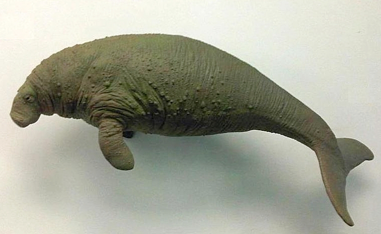
The Steller’s sea cow story usually gets told in one sad sentence: it lived only around the Commander Islands until hunters finished it off in the 1700s. Most modern maps back that up with a tiny, tidy halo around Bering Island, as if that speck was the whole story. Paleontologists keep pointing out something inconvenient: subfossil remains matching Steller’s sea cow or its close relatives show up far south of there, scattered across older deposits around the North Pacific.
The best explanation isn’t that the maps are wrong about the 18th-century population – it’s that they stopped the clock too early. The animals we lost near the Commanders were likely a glacial-age remnant of a genus that once ranged across a much wider arc of the Pacific Rim. Conservation graphics kept the tiny relict range and quietly dropped the deeper fossil evidence, so today’s map shows a postage stamp while the bones insist the family used to be everywhere.
Fast Facts
- Discovered by naturalist Georg Steller in 1741 after his ship wrecked on what’s now called Bering Island
- Grew up to 30 feet long and weighed as much as 10 metric tons – the largest sirenian ever known
- Hunted into extinction in just 27 years, with the last confirmed animals killed by 1768
- Its range stretched across the whole North Pacific during the Pleistocene, long before contracting to that lone island refuge
#20 – The California Grizzly Drawn Into Mountains It Barely Touched
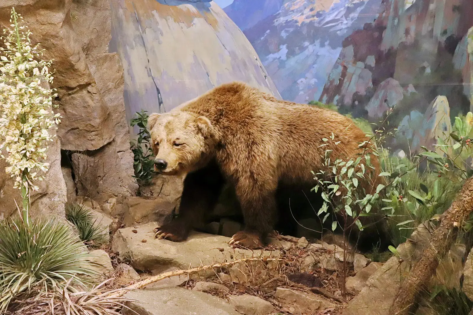
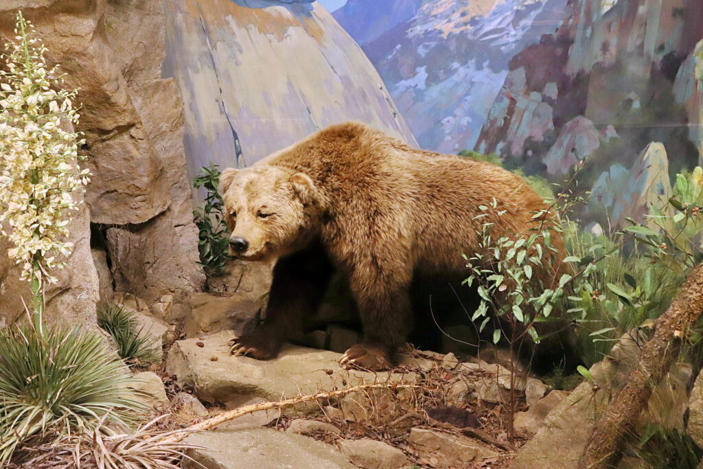
Ask an American where California grizzlies roamed and most will point straight at the Sierra Nevada, thanks to a hundred years of postcards and state flags. Range maps play along, shading almost the entire mountain spine along with most of the state. The confirmed skulls, skins, and mission-era records tell a very different bear story.
Dense clusters of verified specimens hug the coast instead of the peaks:
- Coastal grasslands and chaparral
- Productive river valleys and woodland edges
Meanwhile the high alpine zones and the scorching interior deserts that look so dramatic on the map are nearly empty of authenticated bones. Biologists increasingly suspect California’s grizzlies were lowland edge-foragers who happened to get mythologized as high-mountain royalty – a branding upgrade the fossil record never signed off on.
#19 – The Quagga That Maps Turn Into a Pan-South African Zebra
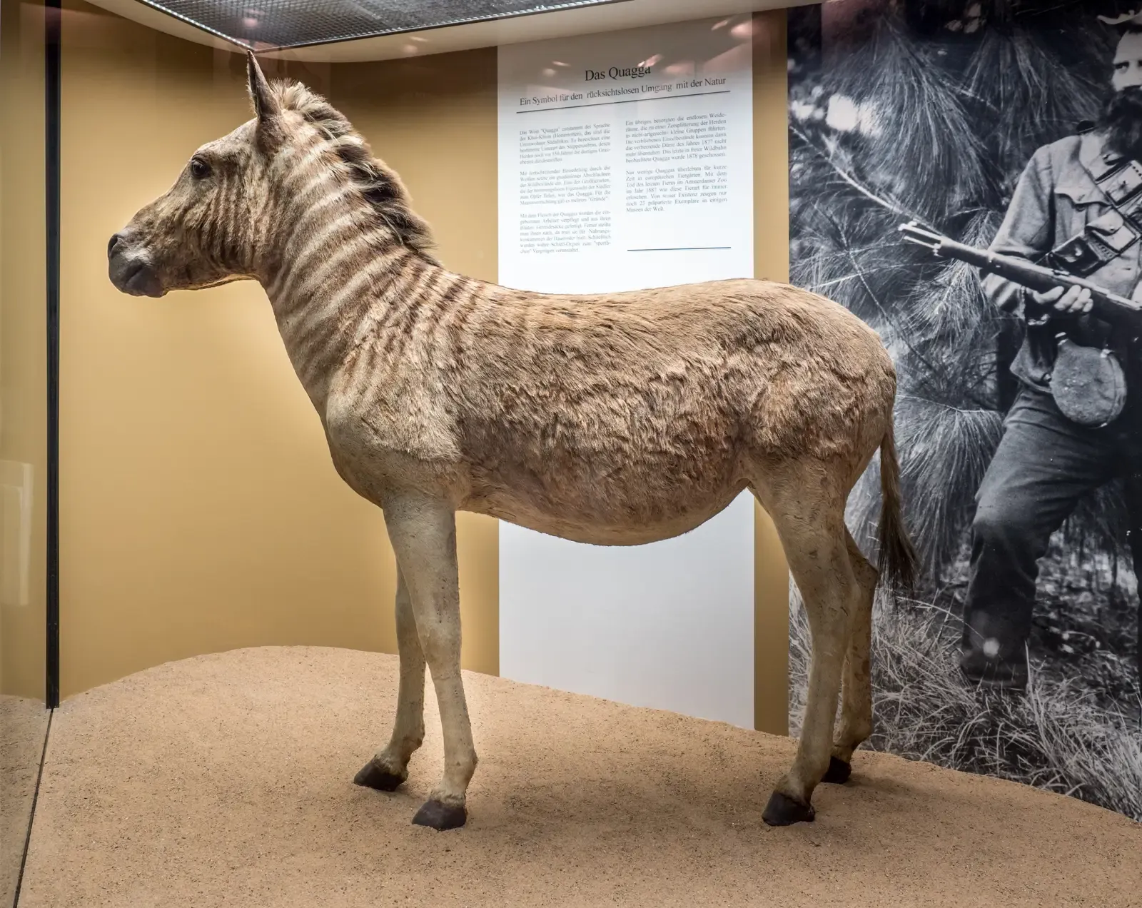
The quagga is meme royalty: “the half-striped zebra that roamed South Africa until 1883,” always illustrated with one big confident oval stretching across the Cape interior and beyond. Pull open the actual museum drawers, though, and the story shrinks fast. Nearly every mounted quagga skin, skull, or specimen with solid locality data traces back to a much smaller south-western pocket of the subcontinent.
The real hotspots were narrow and specific:
- The Karoo and adjacent Cape Colony grasslands
- Pastoral landscapes reachable by colonial hunting routes
“Reported sightings” and habitat modeling did the rest, inflating a regional population into a near-continental one. There’s virtually no hard evidence from the far eastern edge of that shaded map, and some researchers now think the “quagga range” quietly absorbed sightings of other plains zebra forms. The fossils whisper localized; the infographics shout continental.
#18 – The Atlas Bear Whose Map Overruns North Africa
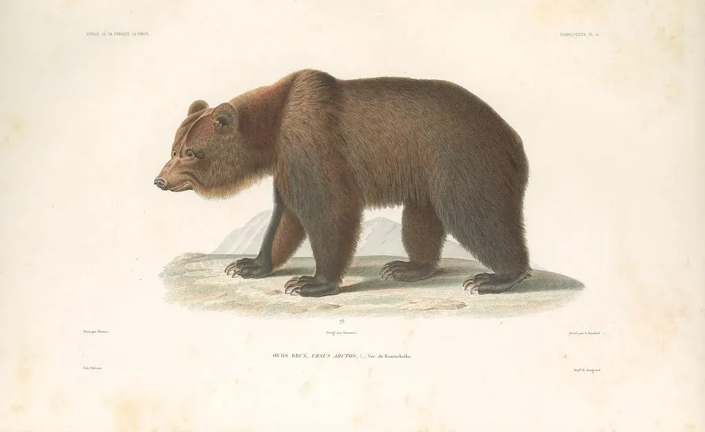
Wildlife books love painting the extinct Atlas bear across almost the entire Maghreb – Morocco, Algeria, Tunisia, one continuous mountain belt labeled Ursus arctos crowtheri. The subfossil bones and Roman-era remains disagree. They’re heavily concentrated around a handful of well-studied mountain systems and old trade centers, not one endless strip.
Solid assemblages come from specific, limited zones:
- Parts of the Rif and Middle Atlas in Morocco
- Certain Algerian massifs tied to Roman hunting activity
Whole sections of the “official” range – especially the drier eastern stretches – rest on little more than vague historical mentions of “bears” somewhere nearby. Paleobiogeographers increasingly suspect the Atlas bear lived in fragmented pockets rather than one solid band, which matters a lot if anyone ever seriously proposes bringing brown bears back to North Africa.
#17 – The Great Auk: North Atlantic Icon With a Patchy Reality
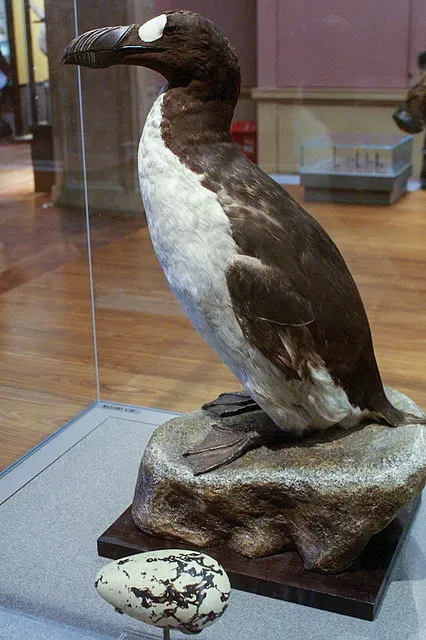
The great auk is the go-to poster bird for seabird extinction, and most maps smear a confident purple line along North Atlantic coasts from Newfoundland to northern Europe – implying it was a common sight almost everywhere on that coastline. The recovered skeletons and egg collections say otherwise. They cluster hard around a handful of breeding islands, while huge stretches of that painted coast have essentially no physical backup.
The real evidence hubs were tiny by comparison:
- Dense finds on islands like Funk Island and the Faroes
- Sparse, often purely anecdotal presence along much of the mainland
Sure, a diving seabird can roam widely between meals. But nesting and haul-out sites are what actually define a meaningful range, and those sites were far more localized than the map admits. Turning occasional presence into a permanent colored fringe hides exactly how vulnerable a few island colonies were to a handful of determined egg collectors.
#16 – The Thylacine Mapped Into Forests It May Have Only Passed Through
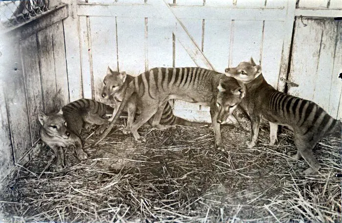
Tasmanian tiger maps usually wash green over nearly the whole island of Tasmania, and older references go further, smearing color across mainland Australia and New Guinea for the Pleistocene. Dated thylacine bones tell a tighter story: confirmed remains concentrate in limited Tasmanian uplands and specific dry forest-grassland mosaics, not the whole island uniformly.
The mainland record makes things messier, not simpler. Confirmed fossil localities there are scattered and mostly ancient, yet the wide green polygon implies the thylacine hung on across huge mainland areas right up until recently, with zero secure remains to back that up. Blending “known from old fossils” and “maybe survived here” into one map color makes an animal look omnipresent in the graphics and strangely rare in the actual dirt – a distinction that matters enormously for extinction-timing debates.
#15 – The Woolly Mammoth Whose “Eurasian” Range Hides Its Last Strongholds
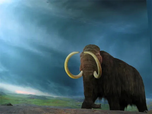
If any extinct animal deserves a “whole continent” map, it’s the woolly mammoth – and popular graphics deliver, sweeping one band from Spain through Siberia into North America. That broad picture is real for most of the species’ history. But narrow the focus to the last mammoths that ever lived, and the tidy sweep falls apart.
Late-surviving bones and DNA come from surprisingly small refuges:
- Isolated Arctic islands like Wrangel and St. Paul
- Scattered mainland pockets rarely marked as special on any map
Most popular graphics never flag those islands, instead just repeating the old Ice Age maximum, which makes it look like mammoths vanished everywhere at once. In reality, every specimen that pushes the extinction date later comes from a tiny refuge sitting outside the main shaded zone – meaning the range maps and the actual timeline of extinction are quietly at war with each other.
#14 – The Irish Elk That Wasn’t Really Irish (and Barely “Elk”)
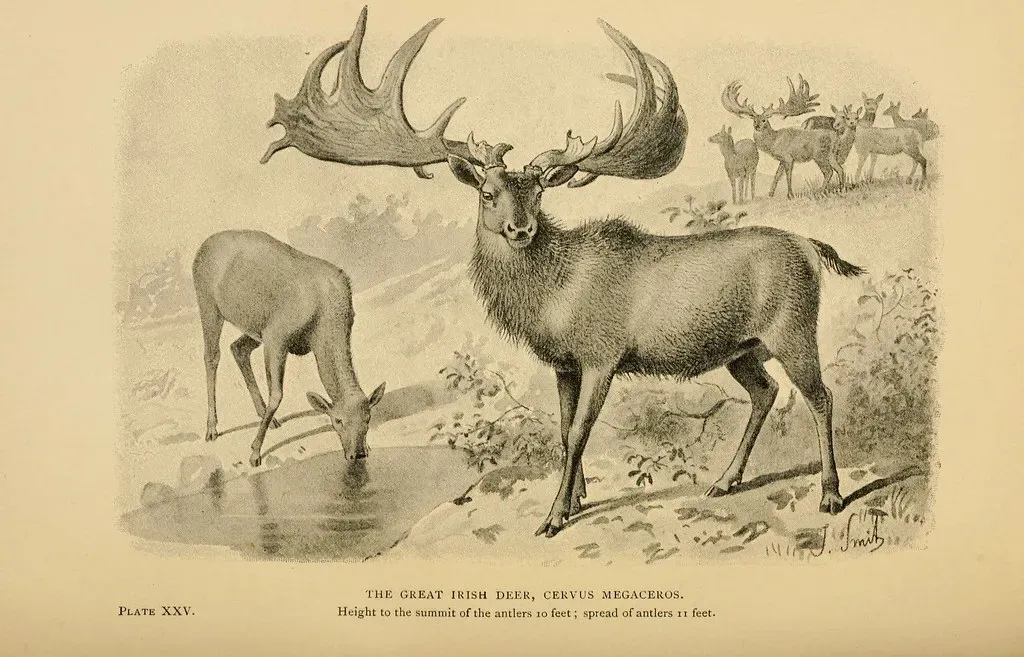
The “Irish elk” has one of the most romantic range maps in paleontology: bold green over Ireland, fading shading across the rest of Eurasia, name and all suggesting an Irish story at its core. The specimen counts disagree hard. The biggest, best-studied bone concentrations actually come from mainland Europe and western Asia – Ireland’s bogs are gorgeous, but they’re only one slice of a much bigger picture.
There’s a timescale problem too. Some maps casually merge early and mid-Pleistocene finds into one blob, hiding the fact that different lineages and antler shapes occupied shifting regions at very different times. Ireland just happens to preserve stunning, complete skeletons in peat – not necessarily the densest or longest-lasting populations. The “Irish elk range” turns out to be a branding exercise more than a fossil-driven map. And for the record, it wasn’t a true elk either.
At a Glance
- Scientific name Megaloceros giganteus – a true giant deer, not an elk at all
- Antlers spanned up to 12 feet tip to tip, the largest of any deer species ever recorded
- Stood roughly 6.9 feet tall at the shoulder and could weigh over 1,500 pounds
- The last confirmed population survived in Siberia until about 7,700 years ago, thousands of years after it vanished from Ireland
#13 – The Caribbean Monk Seal “Everywhere” in the Sea, But Not in the Sand
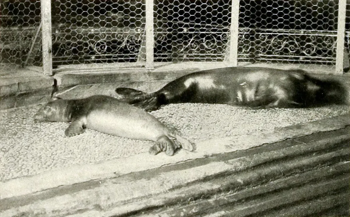
For decades, the Caribbean monk seal’s range has been an enormous blue wash covering almost the whole Caribbean and Gulf of Mexico, implying regular breeding and feeding practically everywhere in that basin. Look at where verifiable skulls, skins, and archaeological seal bones have actually turned up, and the picture narrows sharply.
The confirmed hotspots are specific and limited:
- Certain island groups and keys with good haul-out beaches
- A subset of coastal zones documented by early naturalists and fishers
Everywhere else inside that shaded polygon leans on one-off sightings, vague sailor journal entries, or the assumption that suitable habitat must equal historic presence. But recovered remains show strong site fidelity and tight colonies, not an even blanket of seals. It’s entirely possible several countries’ waters never hosted a true breeding colony at all, no matter what color they’re painted on the map.
#12 – The Dodo Confined to Mauritius but Fossils Hint at a Messier Story
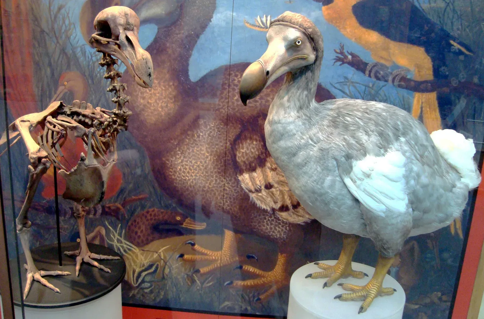
Here’s a rare case where the mainstream story and the map basically agree: the dodo lived only on Mauritius. Even here, though, there’s slippage – some stylized graphics shade nearby islands as “likely range,” even though every reliable skeletal remain comes from Mauritius itself, mostly from famous deposits like Mare aux Songes.
The real surprise is inside the island. Dodo fossil distribution there is wildly uneven: certain lowland swamps and river valleys produce troves of bones, while other habitats are colored in on maps purely from guesswork and forest reconstructions, with no subfossils to back them up. The dodo really was micro-endemic to Mauritius – but the detailed internal map of where on Mauritius it lived is more artistic license than data.
#11 – The Passenger Pigeon’s “Ocean of Birds” vs. Specimen Clusters
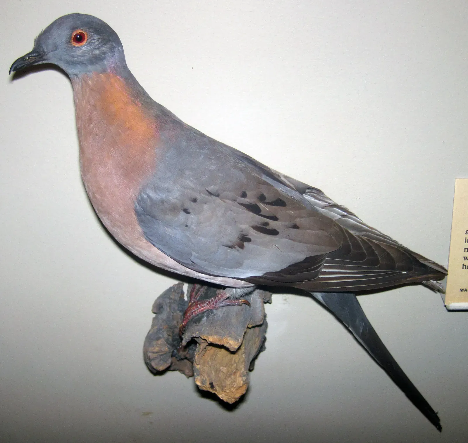
Everyone thinks they understand the passenger pigeon’s collapse, and the popular map plays into that confidence: a massive breeding range over eastern forests, a wintering range hugging the Southeast, all painted with total certainty. Then you check the museum skins, banded skeletons, and archaeological kill-site bones, and the neat two-color story gets messier.
Those physical records don’t spread evenly across the shaded zones at all. They cluster densely near major settlement corridors, roost sites, and processing camps, while huge parts of the map have almost no material trace. Some sampling bias is inevitable, but it doesn’t explain everything – some “breeding range” sections are backed by nothing more than eyewitness accounts of flocks passing overhead, not a single nest or carcass ever found there. The more we map actual bones instead of stories, the more the tidy range graphic looks like a historical exaggeration.
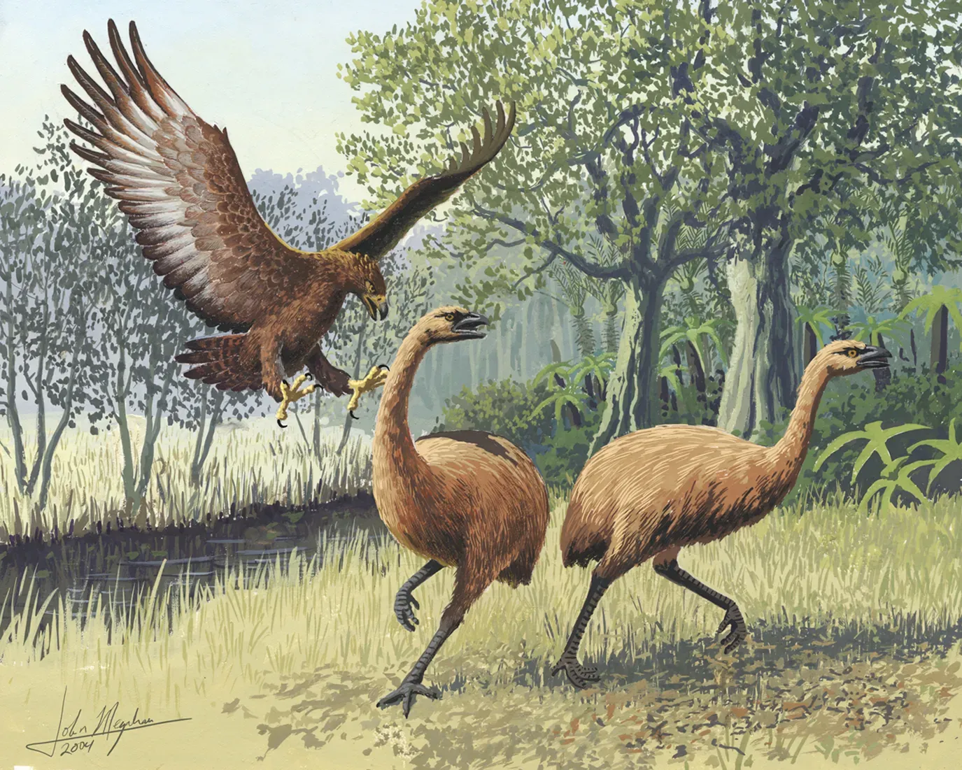
#10 – The Moa Lineup: New Zealand Giants Stuffed Into the Same Polygon
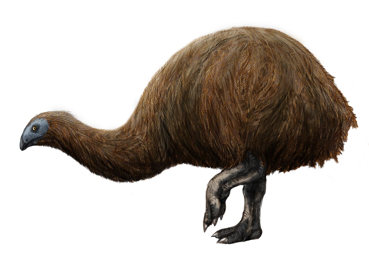
Casual graphics treat “moa country” as one giant, shared territory covering both main islands of New Zealand, sometimes with a legend just listing species names as if they were roommates. The fossil record insists otherwise. Different moa species left completely different spatial footprints, and averaging them into one blotch erases something real.
Subfossil deposits reveal specialists, not generalists:
- Species tightly tied to particular forest types or elevations
- Others dominant only in dry grasslands or coastal scrub
When a map shades “moa range” across terrain where a given species has zero known bone record, that map is technically contradicted by every specimen we’ve ever found for that species. The public pictures one big flightless bird wandering everywhere; the fossils describe parallel, non-overlapping guilds that barely crossed paths.
#9 – The Saber-Toothed Cat Drawn as a Continent-Wide Superpredator
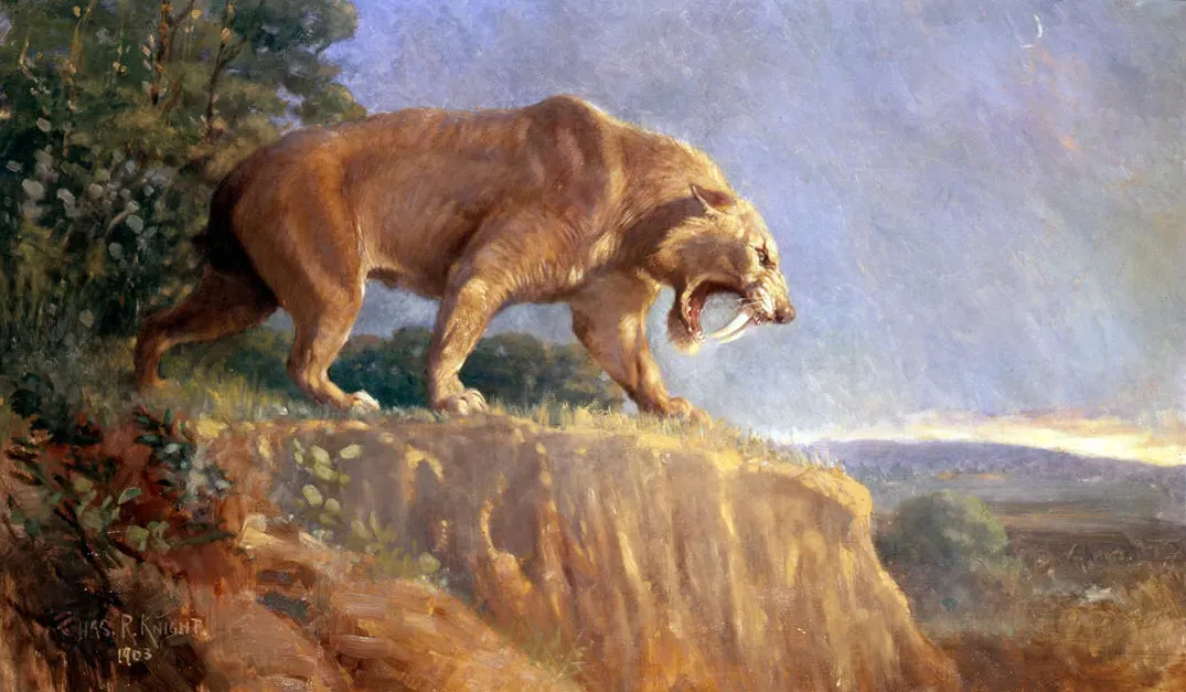
Smilodon gets the full Hollywood treatment: a cartoonishly enormous range shaded across North and South America, tundra to tropics, like one continuous super-predator empire. Species-level fossil data tells a far more fragmented, climate-tied story. Smilodon fatalis, S. populator, and S. gracilis were not sharing one giant range at one time.
In North America, Smilodon fatalis is heavily concentrated in specific pockets:
- La Brea and similarly fossil-rich sites across the western and southern U.S.
- A scattering of other localities, with clear, wide absences elsewhere
Some range maps just merge every Smilodon find from every epoch and continent into a single color, which effectively claims a continuous presence in regions where no Smilodon bone has ever turned up – only other big cats, or nothing at all. Paleontologists are increasingly pushing time-sliced maps that look nothing like the monolithic saber-tooth empire from childhood books.
#8 – The Cave Lion Whose “Pan-Eurasian” Range Ignores Ice and Time
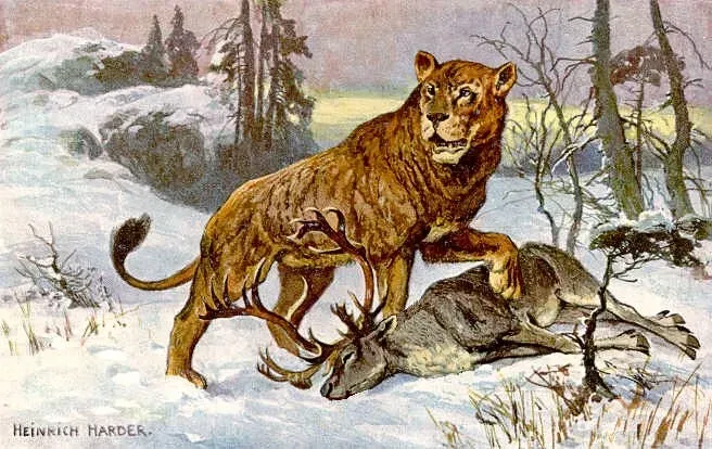
Cave lions, usually lumped as Panthera spelaea, get drawn prowling in one uninterrupted band from Spain to Siberia. Those graphics rarely admit that glacial cycles and shifting grasslands chopped that theoretical range into separate provinces with very little fossil overlap between them. Actual bones and radiocarbon dates form distinct clusters, separated by both distance and time.
Some widely shared maps make two mistakes at once: they merge early and late Pleistocene occurrences together, and they shade areas with rich fossil assemblages that are conspicuously lion-free. That treats “looks like good habitat” as proof of presence, even in caves where we’ve excavated extensively and never found a single cave lion bone. The newer, data-driven reconstructions look patchier and far less cinematic – which is probably why they get a fraction of the internet attention.
Worth Knowing
- Formally Panthera spelaea, estimated to be roughly 10% larger than today’s African lions
- Ice Age cave paintings, including those at France’s Chauvet Cave, suggest males carried little to no mane
- Roamed for hundreds of thousands of years before disappearing around 13,000 years ago, just before the Pleistocene ended
- Fossil evidence shows the species shrank noticeably in body size during its final tens of thousands of years, shortly before going extinct
#7 – The Steppe Bison That Somehow Occupies Every Cold Grassland at Once
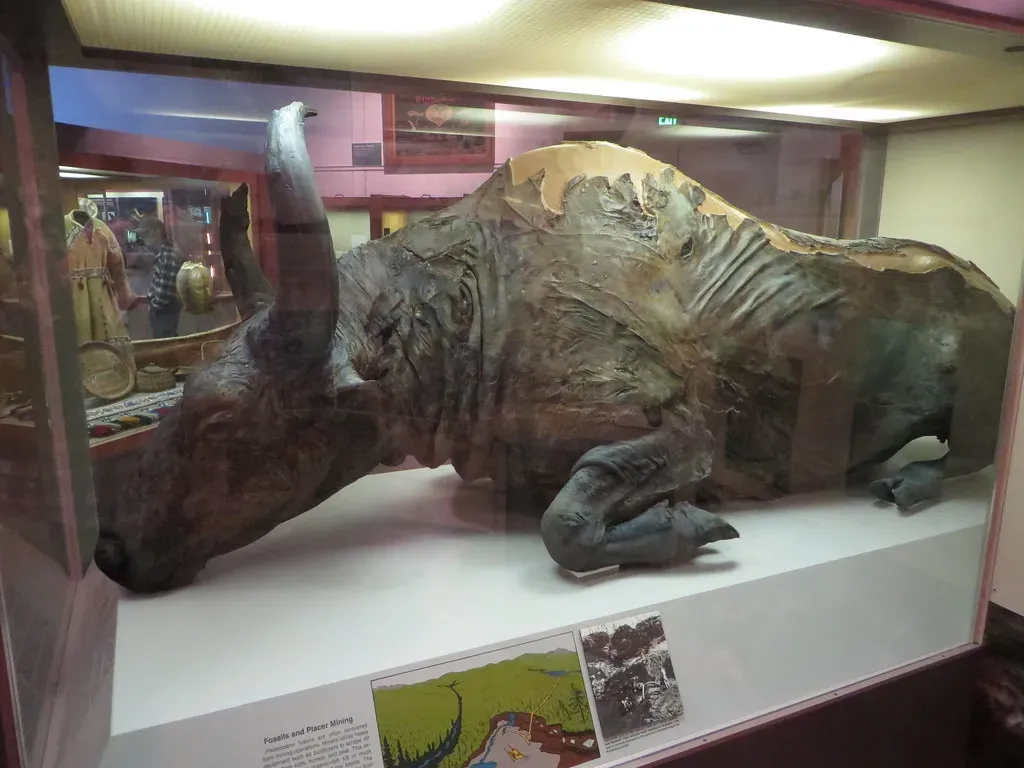
Steppe bison usually get shown as one sprawling population flooding every cold grassland across Europe, northern Asia, and North America in a single wash of color. The actual radiocarbon-dated skulls and horn cores tell a story of shifting centers of abundance, with real gaps during certain climate pulses. There are well-sampled Pleistocene sites loaded with other megafauna where steppe bison are strangely rare or completely missing.
Yet popular maps keep painting those same regions solid because the vegetation models say “this looks like steppe, so bison must have been here.” That’s a climate envelope doing the work that bone evidence should be doing. Genetic studies back up the fossils, pointing to distinct populations and separate refugia that a single confident blob simply erases – the steppe bison map is often a climate model quietly wearing a fossil costume.
#6 – The Dire Wolf’s North American Monopoly That DNA Won’t Back
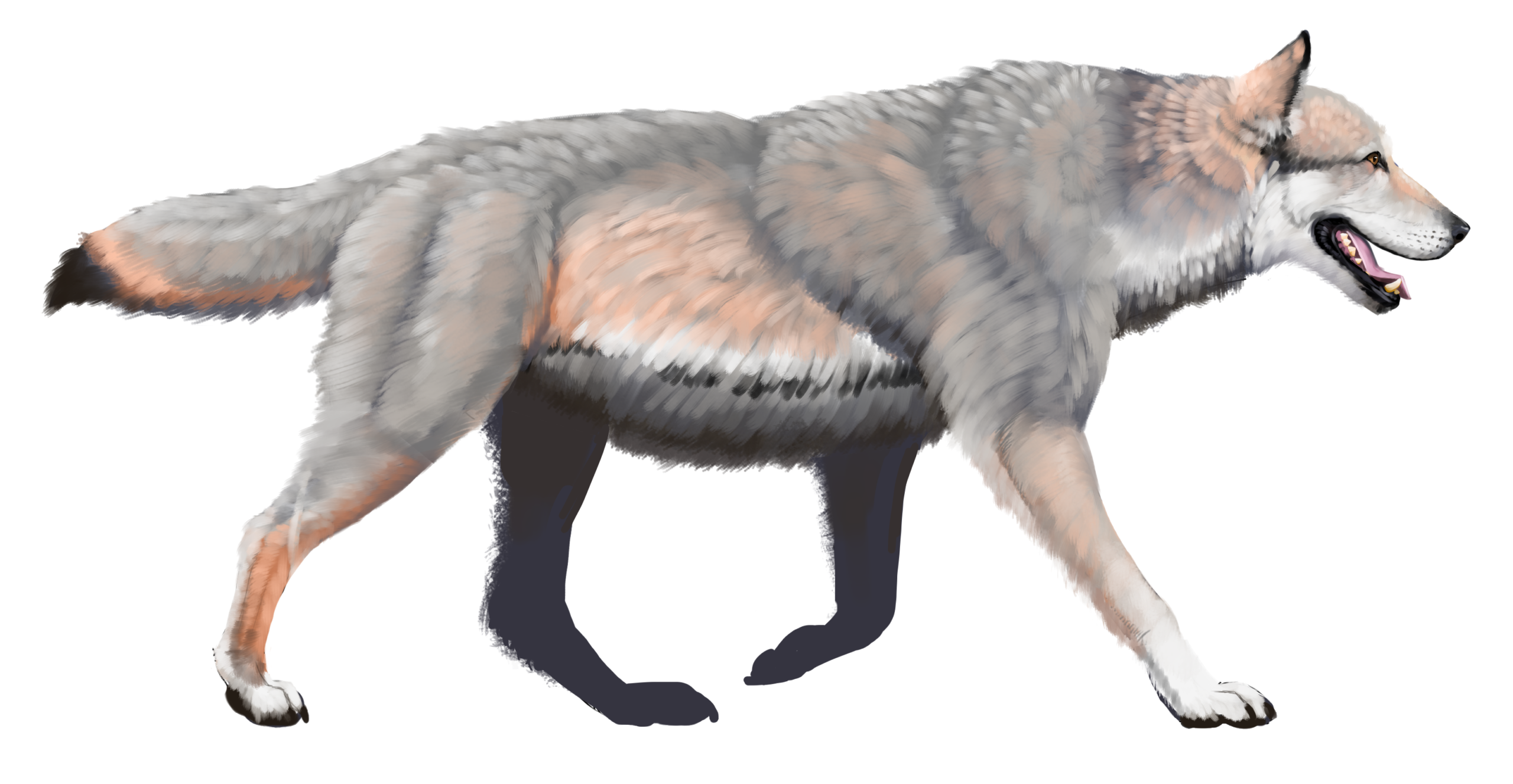
Thanks to a certain TV dynasty, the dire wolf is now pop culture royalty, and most maps oblige by blanketing almost all of temperate North America in its color. La Brea anchors that image perfectly. Move away from those iconic tar pits, though, and the dire wolf’s fossil footprint thins out fast, leaving huge empty corridors where regular wolves and coyotes dominate the record instead.
Recent genetic and fossil re-analyses point to something more interesting than one continental population:
- Distinct dire wolf lineages tied to specific ecological niches
- Clear gaps in presence that oversimplified maps just brush past
Some of the bolder range diagrams even extend dire wolf territory into zones where decades of intense paleontological digging has never produced one Pleistocene dire wolf bone. That’s not a small error – it makes people think dire wolves failed everywhere at once, when the fossils suggest they were regional specialists blindsided by rapid ecosystem collapse.
#5 – The Huia of New Zealand Drawn Into Forests It Might Have Already Lost
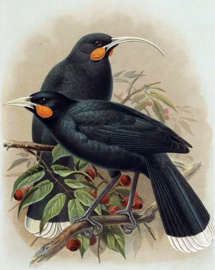
The huia, that strange New Zealand wattlebird with wildly different male and female beaks, is usually mapped across most of the North Island’s native forest, as if it used every remaining forest block right up until extinction. Historical diagrams tend to be generous by default. Plot the actual archaeological bones, labeled museum specimens, and late observational records, though, and a clear contraction pattern appears.
The hard evidence clusters in specific pockets:
- Forest districts that saw lower hunting pressure and later European encroachment
- Specific iwi hunting territories with documented cultural importance
Meanwhile, the map’s outer edges rest on vague “formerly widespread” phrasing and forest-type analogies, with effectively zero recovered huia remains despite good avian fossil sampling in those areas. What we’re calling a “historic” range is really a pre-human reconstruction dressed up as a late-survival map – and the legend almost never admits it.
#4 – The Pyrenean Ibex Whose Resurrection Talk Ignored Its Patchy Past
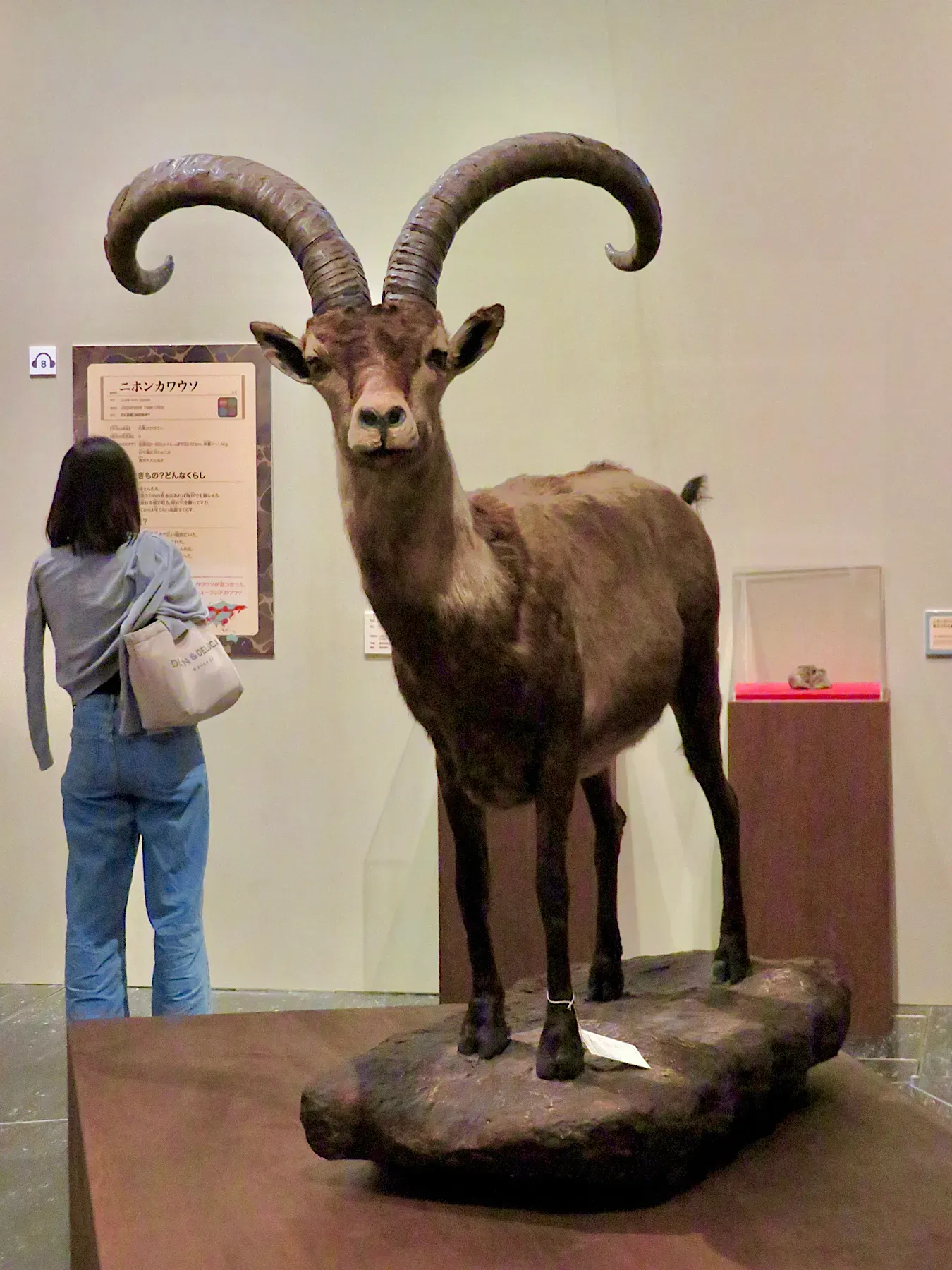
Before its brief, famous moment as the first “de-extinct” animal via cloning, the Pyrenean ibex was routinely drawn as the emblematic goat of the entire Pyrenees, its color filling the whole mountain chain like a continuous ridge-top population. The bones, hunting records, and genetic samples paint the last animals hanging on in scattered, shrinking pockets instead, especially on the Spanish side.
Historical references only reinforce the contraction:
- Local extirpations documented long before the species’ final extinction
- Valleys marked “formerly present” where not a single subfossil has ever been recovered
Rewilding and ecosystem diagrams keep shading the full historic range anyway, labeling entire mountain segments as occupied when every actual specimen contradicts that. Whenever scientists seriously discuss restoring the Pyrenean ibex, they end up admitting we don’t really know its true late-Holocene range – only its last, much smaller refuges.
#3 – The Baiji (Yangtze River Dolphin) Painted Into Tributaries It Never Left Bones In
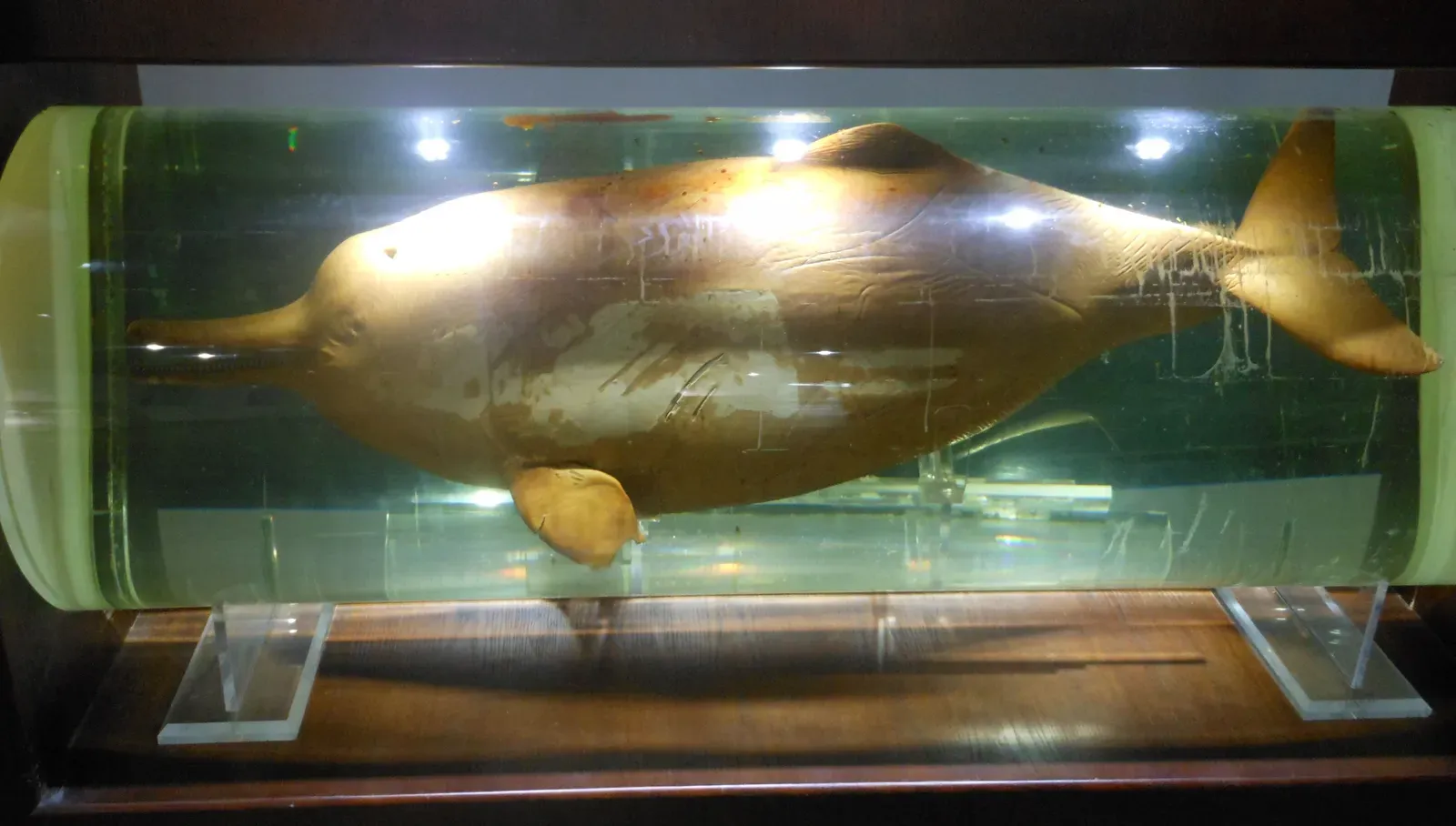
The baiji’s map is mostly fair along the main stem of the Yangtze, but many diagrams also casually shade a whole web of tributaries and connected lakes as “historic range.” The hard problem is that nearly all physical remains – necropsied carcasses, skeletal collections, everything – come from the main river channel itself, particularly certain well-documented stretches, not that sprawling tributary network.
The detailed specimen record is concentrated, not diffuse:
- Mainstream sections near major river towns and industrial centers
- Select side-channels directly connected to the Yangtze proper
Some of the marginal zones on the map never produced a single baiji skeleton, even during active modern surveys and archaeological digs. That gap turns into a quiet scandal for conservation history: we overestimated how much river the dolphins truly dominated, which makes their extinction look more dramatic on paper but harder to fully explain against the actual bone record.
#2 – The North African Ostrich Whose Map Bleeds Deep Into the Sahara
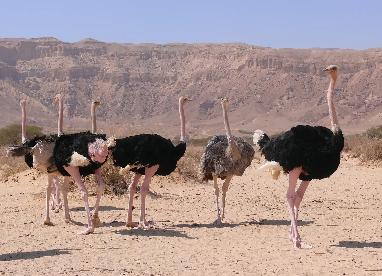
Most people don’t even know North Africa had its own ostrich subspecies, Struthio camelus camelus, let alone that its map is one of the most overreaching on this list. Popular and even some scientific maps wash its former range clean across the Sahara and Sahel, occasionally almost coast to coast. Actual subfossil eggshells, bones, and trade remains cluster instead around Sahelian and steppe edges, oasis belts, and old caravan routes.
Yes, scattered eggshell fragments and rock art hint at ostriches occasionally pushing deeper into the desert. But entire colored sectors of the map seem justified mainly by “continuous sandy habitat,” which is not the same thing as proven occupation. In some of the driest, most hyper-arid cores – places with excellent bone and eggshell preservation – surveys have found no clear ostrich remains at all, which makes the smooth desert-wide polygon more of a habitat-envelope guess than a fossil-backed map.
Fast Facts
- Scientific name Struthio camelus camelus, also called the Barbary ostrich – the largest ostrich subspecies and the largest living bird
- Historically ranged from Sudan and Ethiopia in the east to Mauritania and Senegal in the west
- Now found naturally in only 6 of the 18 countries it originally inhabited
- Reintroduction efforts have targeted parts of the Sahara where the subspecies had disappeared entirely for roughly 50 years
#1 – The American Cheetah That We Drew Over a Continent We Barely Know It From
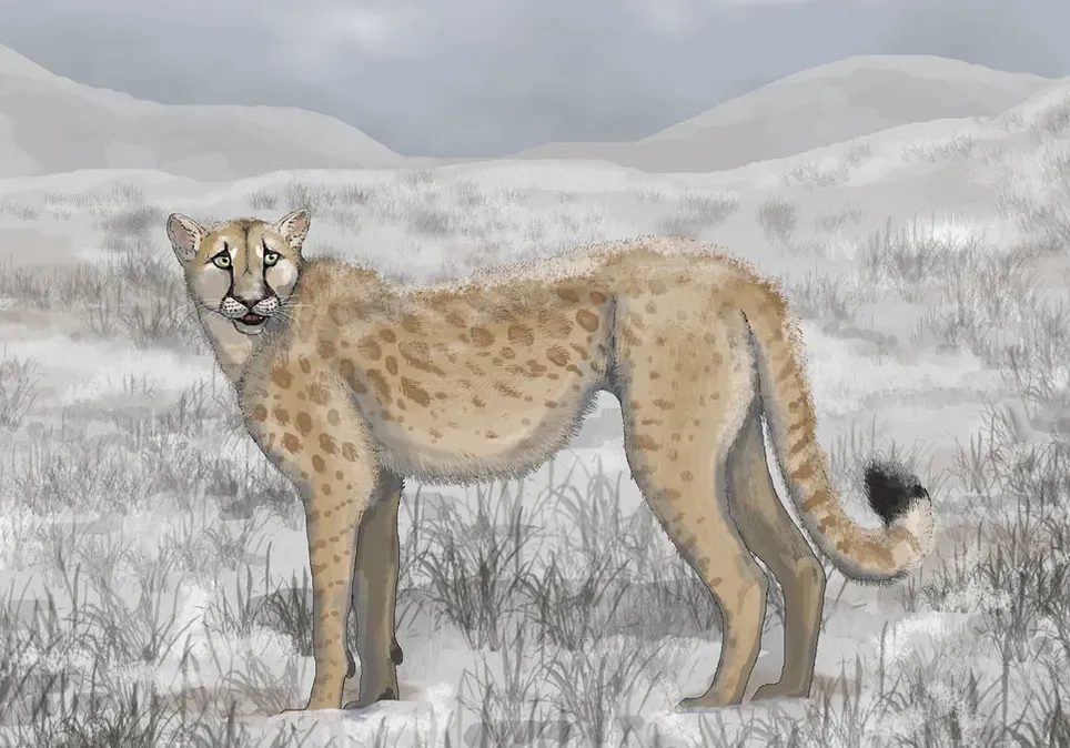
Save the biggest mismatch for last: the so-called American cheetahs, or Miracinonyx. Modern illustrations love mirroring their range to today’s pronghorn spread, shading most of western North America as Miracinonyx country to support the tidy evolutionary story that pronghorn evolved their absurd speed to outrun these cats. It’s a great story. The fossils are far more stingy than the narrative demands.
Verified Miracinonyx remains come from a short, specific list:
- Certain Pleistocene cave and sinkhole sites
- A limited scatter of localities across parts of the western and central U.S.
Huge stretches of today’s “pronghorn belt” have rich Pleistocene fossil records and exactly zero confirmed Miracinonyx bones, yet the range graphics color them in anyway, as if the cats were prowling everywhere pronghorn ran. It’s a satisfying evolutionary arms-race story that outruns its own evidence – in the areas outside the known fossil sites, every single bone we actually have contradicts the shaded range that claims the cheetah lived there.
The Bottom Line
Taken together, these 22 cases expose an uncomfortable pattern: extinction stories get told with maps first and fossils second. From an American “cheetah” painted across a continent it’s barely known from, to a sea cow shrunk down to a postage stamp that ignores its own deeper lineage, the gap between where the color says an animal lived and where its actual bones lie is bigger than most people ever get told.
This isn’t harmless simplification. It distorts how we think about abundance, vulnerability, and even the evolutionary pressures we credit for shaping these animals in the first place. If anything, the fossil record is a humbling teacher here – ranges were patchier, more dynamic, and almost always smaller than the confident graphics suggest.
My take: any clean, continuous range map for an extinct species should be treated as a hypothesis, not a fact, unless someone can show you the specimen dots underneath the paint. The bones don’t lie. The blobs, unfortunately, often do.