
You probably already feel it: hurricane headlines are getting louder, scarier, and more frequent. Over the last ten years, the United States has taken direct hits from some of the most powerful storms ever measured, the kind that re-draw coastlines, erase neighborhoods, and turn everyday routines into survival stories. When you look at them side by side, you’re not just scrolling disaster porn – you’re staring at a scientific pattern that affects where you live, how you build, and even how you plan a simple beach vacation. To rank the eight most powerful U.S. hurricanes of roughly the last decade, meteorologists go beyond the scary satellite images. They lean on data: maximum sustained winds at landfall, the storm’s central pressure (lower usually means more intense), storm surge heights, and how all of that lines up with the Saffir–Simpson scale. You’re about to walk through those storms one by one – what made them scientifically extreme, how they changed the rules for coastal communities, and what you can actually do with this knowledge besides just worry.
1. Hurricane Melissa (2025): The New Benchmark for Raw Power
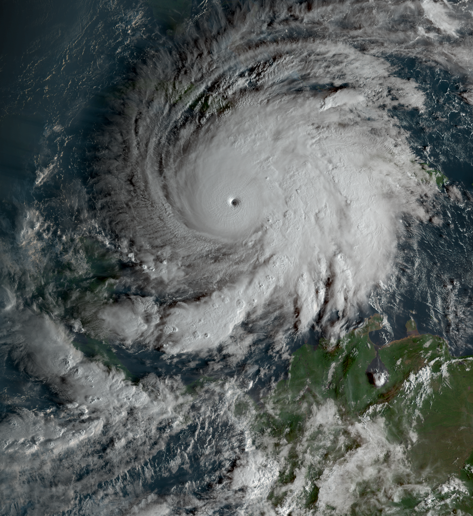
If you think the era of “record-breaking” hurricanes peaked a while ago, Melissa proves you wrong. When this Category 5 monster roared ashore in 2025 with sustained winds well over one hundred eighty miles an hour and a central pressure under nine hundred millibars, it instantly joined the tiny club of the most intense Atlantic landfalls ever recorded. Meteorologists now routinely mention it in the same breath as the legendary Labor Day 1935 storm and Wilma, which tells you just how extreme Melissa really was from a scientific standpoint. You feel the significance of Melissa in how it reshaped the conversation about what “worst case” even means along the U.S. coast. Melissa showed you that models warning about rapid intensification in bath‑warm waters are not hypothetical exercises – they are your new baseline. If you live on the Gulf or Atlantic coast, the storm is a flashing red reminder that building codes, evacuation planning, and even insurance pricing have to assume that a Melissa‑level event is not a once‑in‑a‑century freak, but something you might see again in your lifetime.
2. Hurricane Michael (2018): Catastrophic Category 5 in the Florida Panhandle
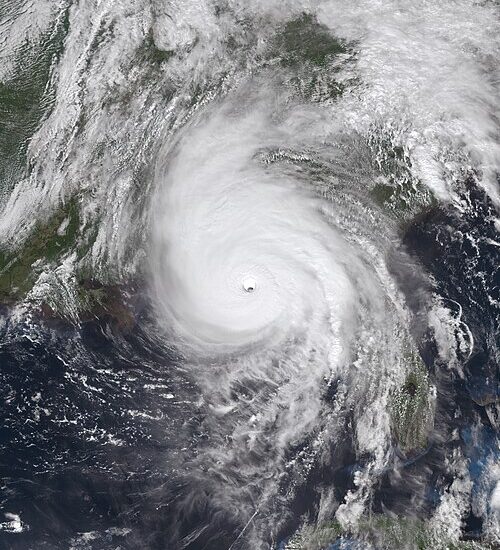
If you grew up hearing that the central and western Gulf Coast got “strong storms but nothing like South Florida,” Hurricane Michael shattered that illusion in a single afternoon. Making landfall near Mexico Beach, Florida, as a Category 5 with sustained winds around one hundred sixty miles an hour and a central pressure near nine hundred nineteen millibars, Michael became one of the most intense U.S. landfalls ever measured. For the Florida Panhandle, which had never seen a Category 5 at landfall before, it was like suddenly skipping several levels on the disaster scale. Scientifically, Michael is the storm that forced you to stop thinking in terms of old local history. Entire blocks of structures built to outdated standards simply vanished under wind and surge, while newer, elevated, and better‑anchored buildings often fared noticeably better. When you see post‑storm aerial photos that look like someone took an eraser to neighborhoods, you’re not just looking at bad luck – you’re seeing a live demonstration of what Category 5 wind fields and severe storm surge actually do when they meet vulnerable design.
3. Hurricane Maria (2017): A Cat 4 Landfall That Felt Like a Direct Hit from Physics
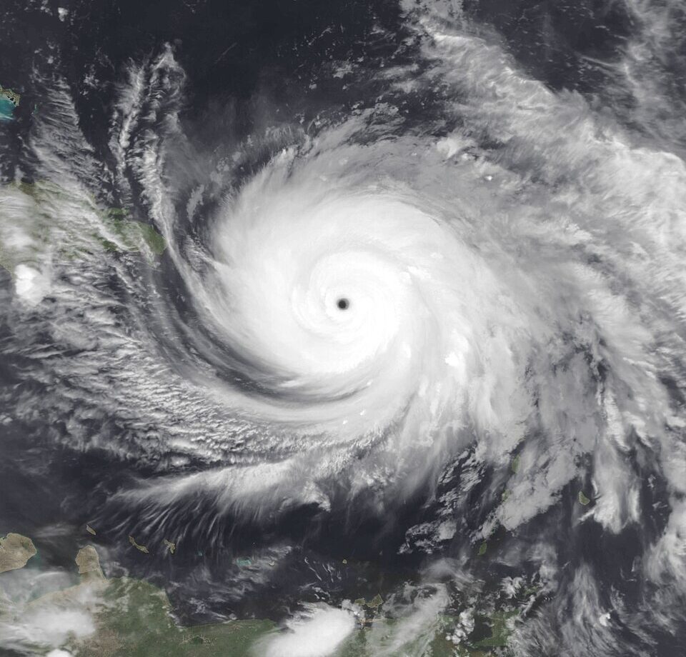
When Hurricane Maria slammed into Puerto Rico in September 2017 with sustained winds near one hundred fifty‑five miles an hour, you were watching a storm that was a hair’s breadth away from Category 5 at landfall. Scientifically, Maria belongs on the short list of the strongest U.S. landfalls ever recorded by wind speed and pressure, ranking alongside older greats like Camille and Andrew. Its eyewall carved straight across the island, turning the entire territory into a real‑world laboratory for long‑duration extreme winds over complex terrain and dense infrastructure. For you, Maria’s real lesson goes beyond the terrifying wind statistics. It showed exactly how fragile modern life becomes when a hurricane shreds the electrical grid across an entire region for months, not days. You probably remember the stories of people queuing for water, fuel, and basic medical care long after the last rain band faded. From a science‑and‑policy angle, Maria is now the case study for how cascading failures – power, communications, healthcare, and roads – can turn a very strong landfall into a humanitarian emergency that outlasts the storm by a full season.
4. Hurricane Ian (2022): Storm Surge Redefining “Inland Enough” in Florida
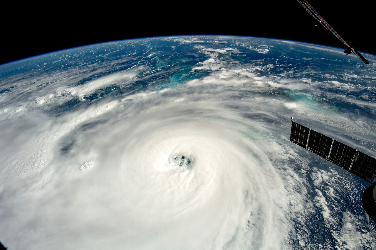
You might remember the heartbreaking images from southwest Florida in 2022, with homes peeled off their slabs and boats flung blocks inland. That was Hurricane Ian, making landfall near Cayo Costa as a very high‑end Category 4 hurricane with sustained winds around one hundred fifty miles an hour. While its central pressure did not crack the all‑time top five, the combination of wind speed, slow motion, and the geometry of the coast turned Ian into one of the most consequential U.S. hurricane landfalls of the modern era. For you, the standout scientific story with Ian is storm surge. Coastal gauges recorded water levels far above historical benchmarks in many locations, and that surge pushed well inland into river systems and low‑lying neighborhoods that many residents thought were “safe enough.” If you live near the coast and mentally draw your danger zone as a skinny strip along the beach, Ian is your wake‑up call: surge and freshwater flooding travel upstream, into bays and rivers, and across seemingly modest elevations in ways that maps and outdated memories can seriously underestimate.
5. Hurricane Ida (2021): Category 4 Winds, Hundreds of Miles of Consequences
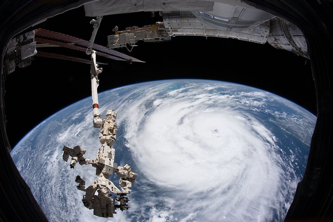
You might have thought Katrina had already taught New Orleans and the central Gulf all the big hurricane lessons, but Hurricane Ida came along in 2021 to test everything again. Ida made landfall in Louisiana as a strong Category 4 hurricane with sustained winds around one hundred fifty miles an hour, tying it by wind speed with storms like Laura and Charley at the top tier of historical U.S. landfalls. Its central pressure placed it among the more intense Gulf storms on record, reinforcing how quickly tropical cyclones can ramp up over very warm shelf waters. What makes Ida especially important for you is how far its impact footprint extended. Even if you live nowhere near the Gulf, you might remember shocking flood footage from the Northeast days later – subway stations filling with water, basement apartments turning deadly, and highways becoming rivers. Ida showed you, in awful detail, that when a major hurricane keeps its structure as it curves inland, the inland flood risk can rival or even exceed the coastal wind damage, especially in cities built around rivers and old drainage systems.
6. Hurricane Laura (2020): Precision Strike on the Louisiana–Texas Border
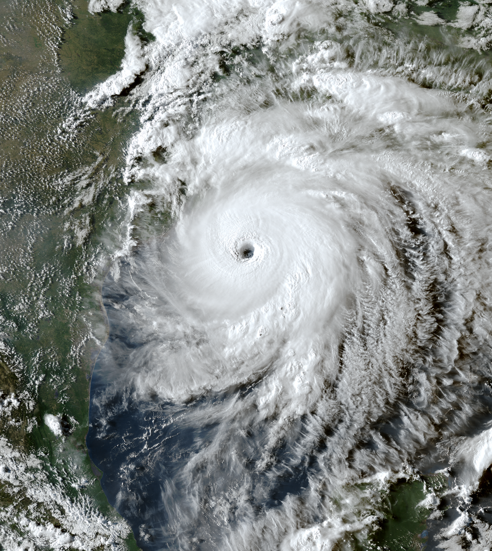
If you track hurricanes casually, Laura might blur together with the hyperactive 2020 season. But from a scientific standpoint, you can’t ignore it. Laura roared ashore near the Louisiana–Texas border as a very strong Category 4 hurricane with sustained winds also around one hundred fifty miles an hour, putting it in the same wind‑speed league as Ida, Charley, and several other all‑time greats. Its central pressure dipped into the range historically associated with some Category 5 storms, highlighting how narrow the margin can be between the top two categories. For you, Laura drives home how much regional geography matters. The storm pushed a massive surge into coastal Louisiana’s shallow bays and marshes, flooding communities that sit only a few feet above sea level. If you live anywhere in this kind of landscape, Laura is a reminder that your protection is usually a patchwork of levees, elevation, and personal choices about where and how you build. It also proved that even in a year packed with named storms, one well‑placed high‑end major hurricane can dominate the damage statistics for an entire season.
7. Hurricane Helene (2024): A New‑Era Major Landfall in a Hyperactive Season
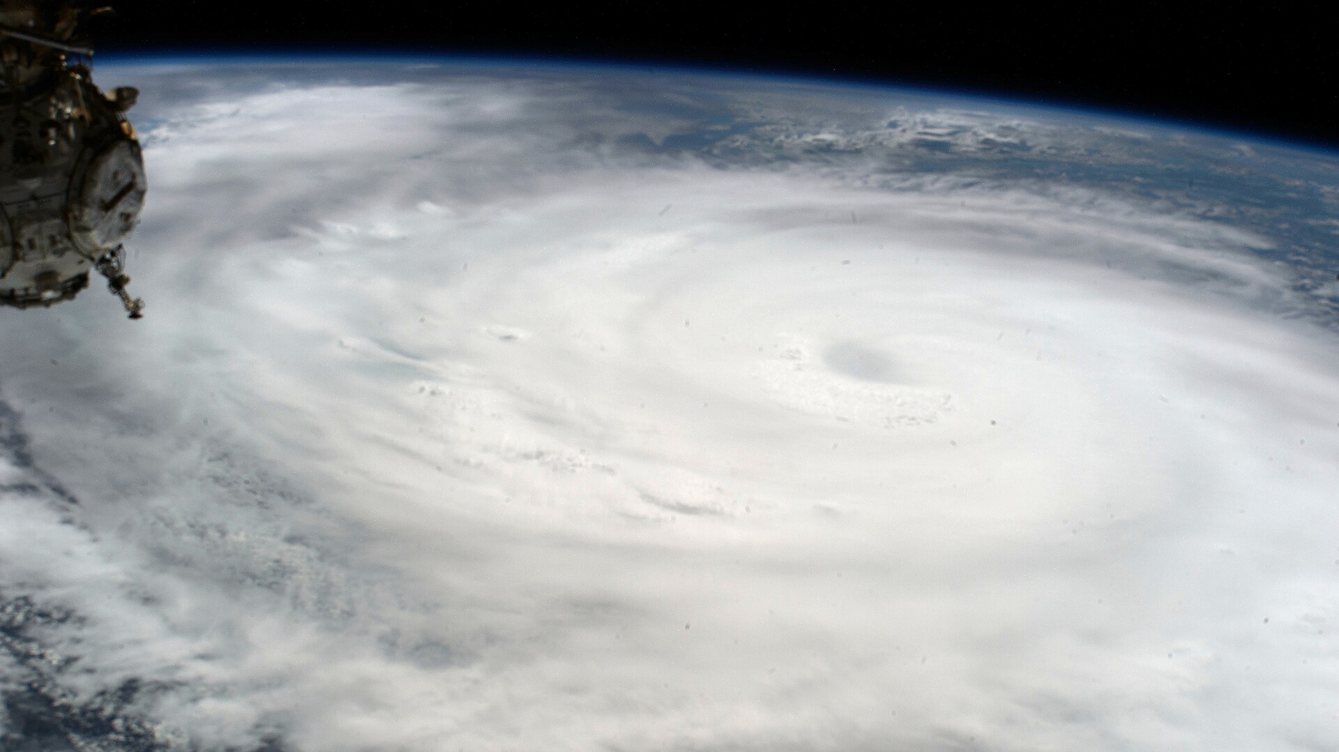
By 2024, you might have been numb to the phrase “record‑breaking season,” but Hurricane Helene cut through that fog. Helene made landfall in the United States as a major hurricane – reaching Category 4 strength at the coast – at a time when the Atlantic was running record‑warm and vertical wind shear was strikingly low. In that environment, Helene fit perfectly into the modern pattern: a storm that could intensify quickly, maintain high sustained winds at landfall, and hold together long enough to punch far inland. For you, Helene is part of a troubling statistic: recent years have strung together a run of Category 4 and Category 5 landfalls on or near the U.S. coast that would have seemed unlikely a few decades ago. When you hear scientists talk about warmer oceans loading the dice for more rapid intensification, Helene is one of the real‑world examples behind those graphs. If you rely on the old idea that storms always weaken gently before landfall, Helene is a clear sign that you need to plan for the opposite – sharp strengthening right up until the eyewall arrives.
8. Hurricane Milton (2024): Gulf Superstorm That Barely Missed the Worst‑Case U.S. Scenario
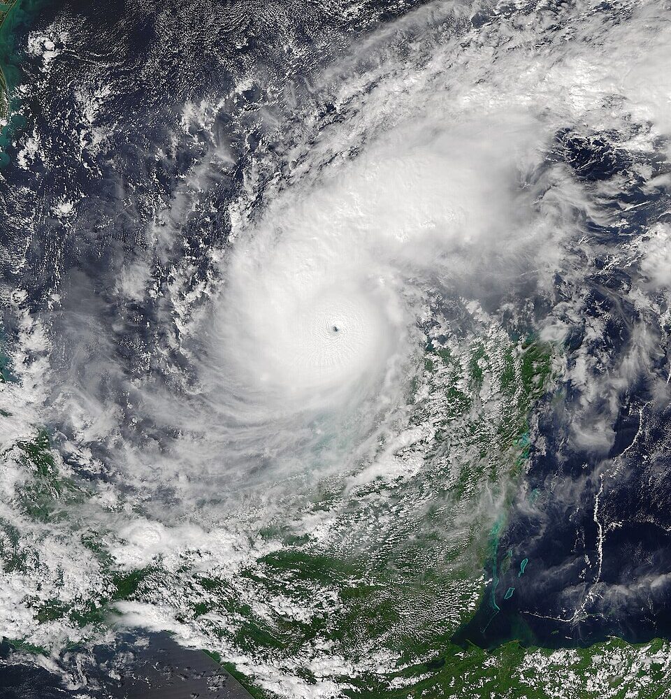
Milton is the storm that kept a lot of meteorologists up at night in 2024, and if you live along the Gulf, it probably gave you that familiar uneasy feeling. Over the open Gulf of Mexico, Milton exploded into a Category 5 beast with peak sustained winds near one hundred eighty miles an hour and a central pressure below nine hundred millibars, placing it among the strongest Atlantic hurricanes ever measured by those metrics. In pure physics terms – wind, pressure, and thermodynamics – you were watching a storm that played in the same league as the most infamous historical giants. From your perspective on land, the key word with Milton is “near miss.” The exact track and timing meant that U.S. communities dodged the absolute worst version of what such a storm could have done at landfall, but the scientific community did not treat it as a lucky one‑off. Instead, Milton is the vivid demonstration that the Gulf’s bath‑like waters can now support truly extreme intensification over very short time windows. If you ever think you’ll have two or three full days to react from the moment a storm hits major status, Milton should permanently reset that assumption.
Conclusion: What These Eight Hurricanes Really Mean for You
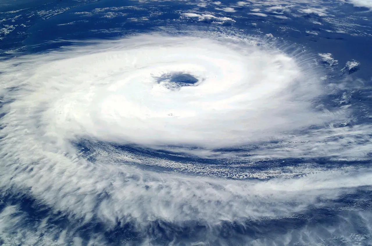
When you line up Melissa, Michael, Maria, Ian, Ida, Laura, Helene, and Milton, you are not just leafing through a grim scrapbook of disasters. You are looking at a pattern in which very high‑end storms – Category 4 and Category 5 by wind, with pressures that once seemed rare – have become regular players along the U.S. coastline over roughly a single decade. That is the scientific story behind the headline: the combination of warmer waters, favorable upper‑air patterns, and sprawling coastal development has pushed you into an era where “unthinkable” is now something you plan around, not dismiss. But this list also hands you something powerful: clarity. You can see which kinds of structures tend to survive, how far inland surge and flooding really reach, and how quickly a storm can go from “just a concern” to life‑threatening. If you live anywhere near the Atlantic or Gulf, that means checking your elevation, knowing your evacuation zone, pressing your local officials about building codes, and treating forecasts of rapid intensification as a serious call to move – not a suggestion. Looking at these eight storms, you have to ask yourself: ten years from now, do you want to be surprised again, or do you want to be the one person on your street who was actually ready?