
You were taught the story a certain way: small, isolated peoples building modest settlements before fading into jungle or desert. Meanwhile, the “real” empires – Rome, Egypt, China – got the maps, the timelines, the textbook chapters. That framing wasn’t just incomplete. In case after case, it was flat-out wrong.
New lidar scans, underwater surveys, and sediment cores are quietly rewriting the population math on a dozen civilizations we thought we understood. Some of these societies weren’t regional footnotes at all – they were demographic giants hiding in plain sight, undercounted by the millions. Here’s what the evidence is now forcing archaeologists to admit.
#12 – The Kingdom of Aksum: Africa’s Overlooked Superpower
For decades, textbooks treated Aksum as a side note to Rome and Persia. New fieldwork suggests that’s exactly backwards. Centered in what’s now Ethiopia and Eritrea, Aksum controlled vast highland and Red Sea trade corridors – and its real population footprint looks seriously undercounted.
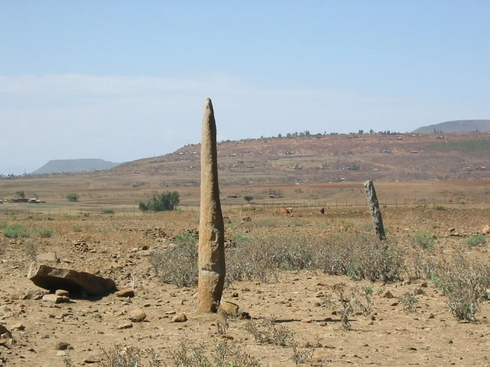
Surveys of terraced hillsides, rural churches built on older foundations, and long-forgotten satellite settlements point to a dense, multi-tiered urban system, not one flashy capital with a few outposts. Monumental stelae fields, widespread coin circulation, and irrigation projects now read as evidence of a state-scale powerhouse. And here’s the irony: while travelers chase pyramids in Egypt, the Aksumite landscape is still barely mapped with modern tools. Once lidar catches up here, some researchers expect population estimates to double, maybe triple.
#11 – The Indus Valley Civilization: An Iceberg We Barely Scratched
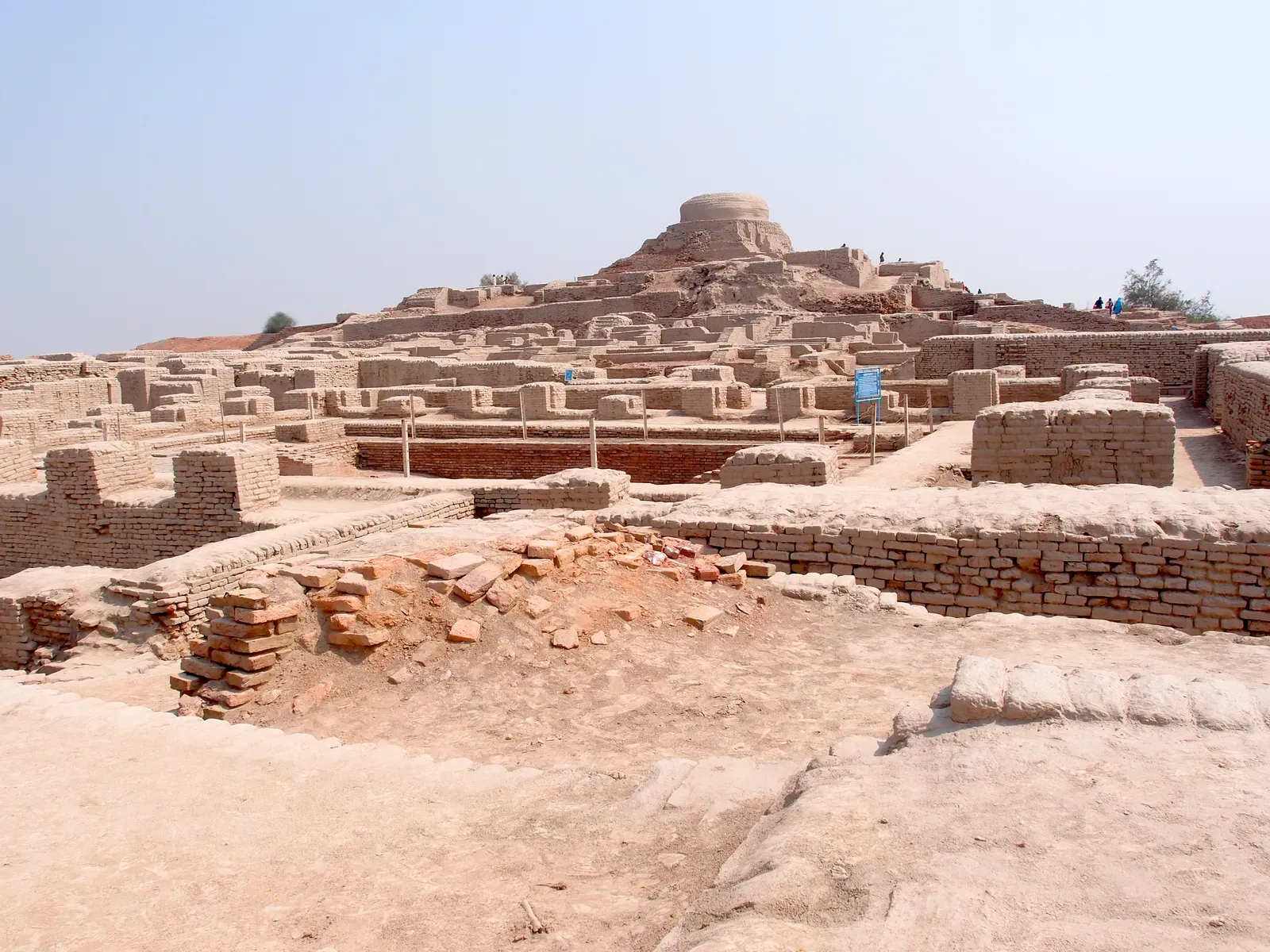
You’ve probably heard of Harappa and Mohenjo-daro. What most people don’t realize is that those two famous cities were just the tip of something enormous. Systematic surveys across Pakistan and northwest India have now identified hundreds of Harappan sites, from walled cities to specialized craft villages, many buried under modern fields and towns.
The emerging picture is a civilization spread across more than a million square kilometers, tied together by standardized bricks, coordinated drainage systems, and long-distance trade with Mesopotamia. That’s not a loose cluster of city-states – that’s deep integration. Some archaeologists now argue earlier headcounts lowballed the Harappan world by several million people, largely because rural sites were ignored or misdated. The strange part? Their script still isn’t deciphered, so we’re reconstructing a probable super-civilization almost entirely from bricks and pottery.
Fast Facts
- Surveys have documented well over a thousand Harappan-era sites across Pakistan and northwest India.
- The civilization’s footprint likely spanned somewhere between 800,000 and 1.25 million square kilometers.
- Mohenjo-daro and Harappa both show planned street grids, standardized brick sizes, and covered drainage.
- The Indus script remains undeciphered, with more than 400 distinct symbols catalogued so far.
#10 – The Mississippian Mound Cities: America’s Buried Metropolis
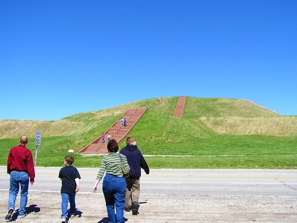
Most Americans grow up picturing pre-Columbian North America as sparsely populated, small bands wandering through empty forest. Mississippian archaeology has quietly demolished that story. Cahokia, near present-day St. Louis, wasn’t a village – it was a true city, with platform mounds, neighborhoods, and defensive works.
Lidar, soil chemistry, and large-scale excavation now suggest Cahokia alone may have supported tens of thousands of people at its peak. And it wasn’t an anomaly. From Wisconsin to Georgia, researchers are finding dense clusters of mound towns, agricultural fields, and road-like alignments. Some scholars argue that disease-driven collapse after European contact was so severe that early colonists walked through post-apocalyptic landscapes and mistook them for untouched wilderness – a revision uncomfortable enough that it’s still barely taught in schools.
#9 – Teotihuacan’s Hidden Sprawl Beneath Central Mexico
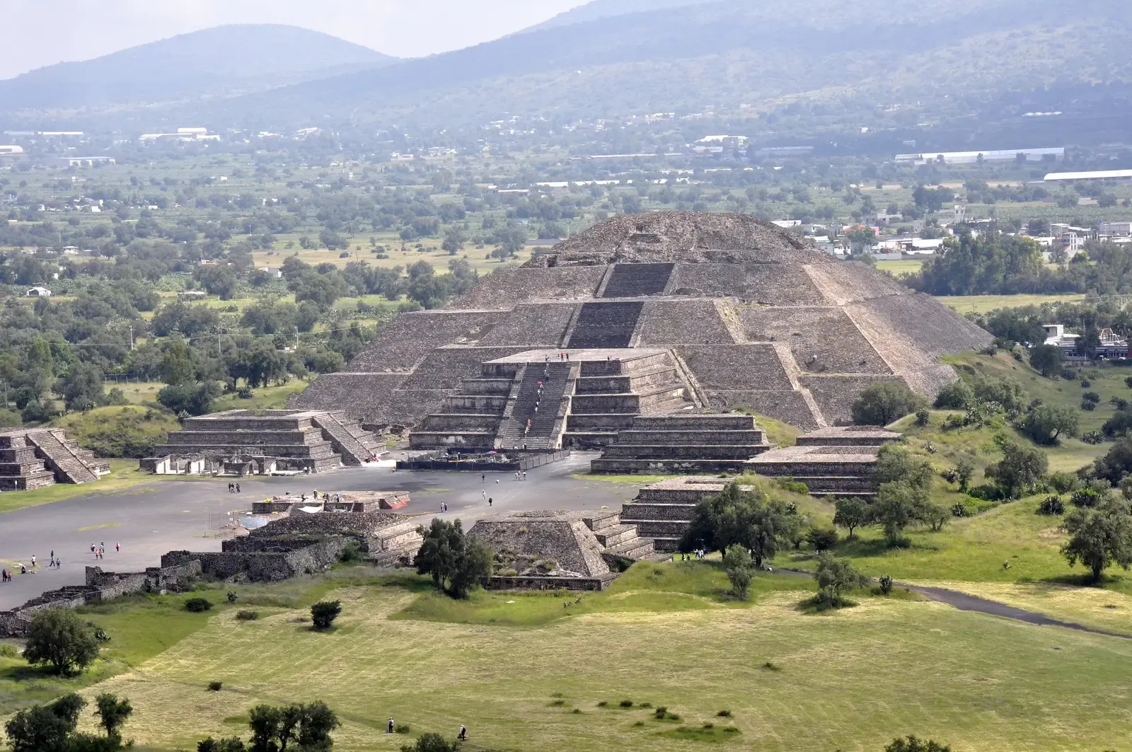
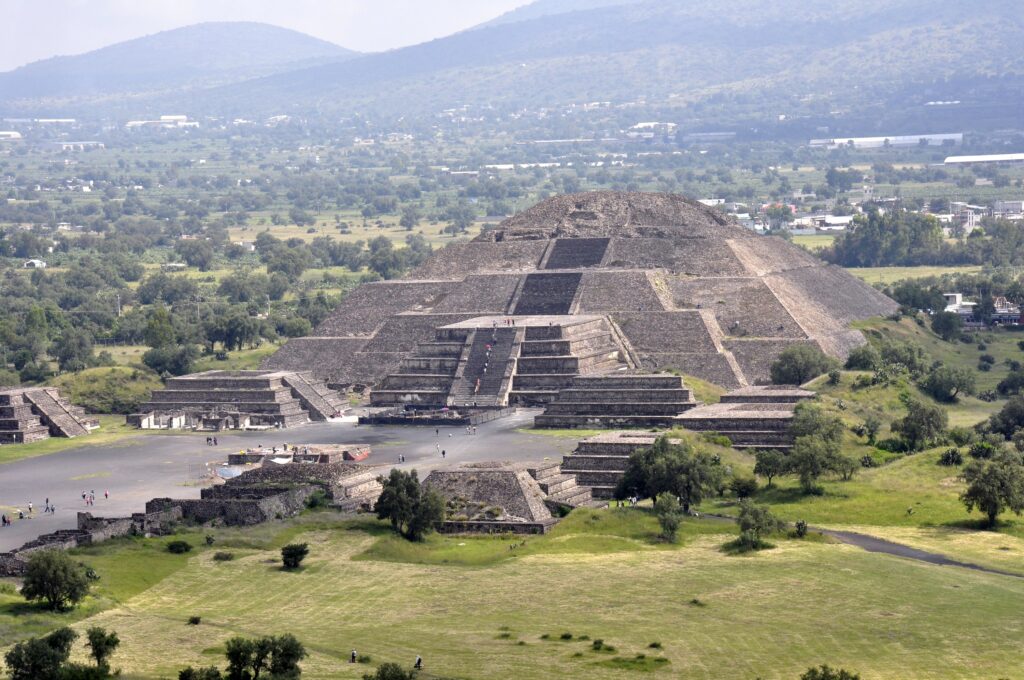
Teotihuacan has always been famous. What’s changing is our sense of everything around it. The city itself, north of modern Mexico City, was already recognized as one of the largest in the ancient world, likely home to 100,000-plus people. The real shock is what lidar and regional surveys are revealing beyond the pyramids.
Teotihuacan sat inside a densely urbanized valley, laced with satellite towns, irrigation systems, and roads researchers are still struggling to fully map. Entire districts have vanished under later construction and modern sprawl, effectively erased from the archaeological record. As methods improve, population estimates for this broader urban sphere keep creeping upward – pushing Teotihuacan into the same conversation as Rome or Chang’an, not as a quirky outlier but as a genuine global-scale city cluster.
#8 – The Minoans of Crete: More Empire Than Island Culture
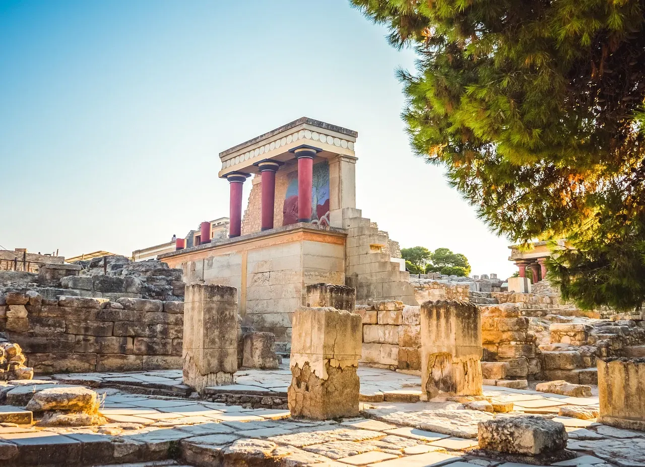
The popular story paints the Minoans as a small, artsy people known mainly for a few palaces and pretty frescoes. That picture is getting shredded. Intensive surveys on Crete and nearby islands have turned up a thick mesh of farmsteads, ports, and secondary centers well beyond Knossos and Phaistos.
Stack that against their far-flung trade in metals, ceramics, and luxury goods, and a new reality emerges: Minoan Crete was likely far more populous and urbanized than we were taught. Extensive terracing, storage facilities, and harbor installations suggest an agricultural base large enough to feed complex, palace-centered economies. Add growing evidence of Minoan influence on the Greek mainland, and this starts looking less like an isolated sea culture and more like a full regional maritime power – one still hiding much of its headcount under modern vineyards.
#7 – Great Zimbabwe: The African Empire They Tried to Erase
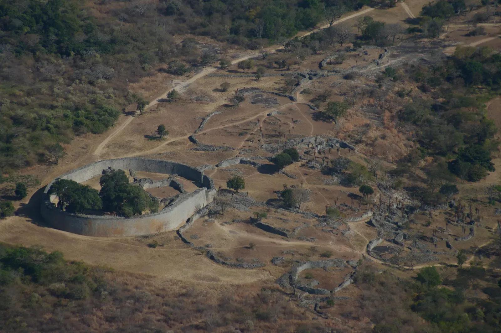
For decades, colonial myths insisted Great Zimbabwe must have been built by outsiders – a claim that was always racist nonsense, and one the evidence has now thoroughly buried. The pendulum is finally swinging toward recognizing how large and locally rooted this Shona-speaking civilization actually was.
The stone enclosures in the photographs are just the core. Recent work traces related sites, trade routes, and farming landscapes across a wide swath of southern Africa, fueled by a gold, ivory, and cattle economy that funneled serious wealth inward. Trade beads and ceramics from as far as the Swahili coast and the Middle East hint at a population far bigger than earlier, colonially biased estimates ever allowed. Some archaeologists now describe a whole constellation of Zimbabwe-style centers, each anchoring thousands of people – a system we minimized largely because it didn’t fit old narratives of “tribal” Africa.
#6 – The Buried Cities of the Amazon
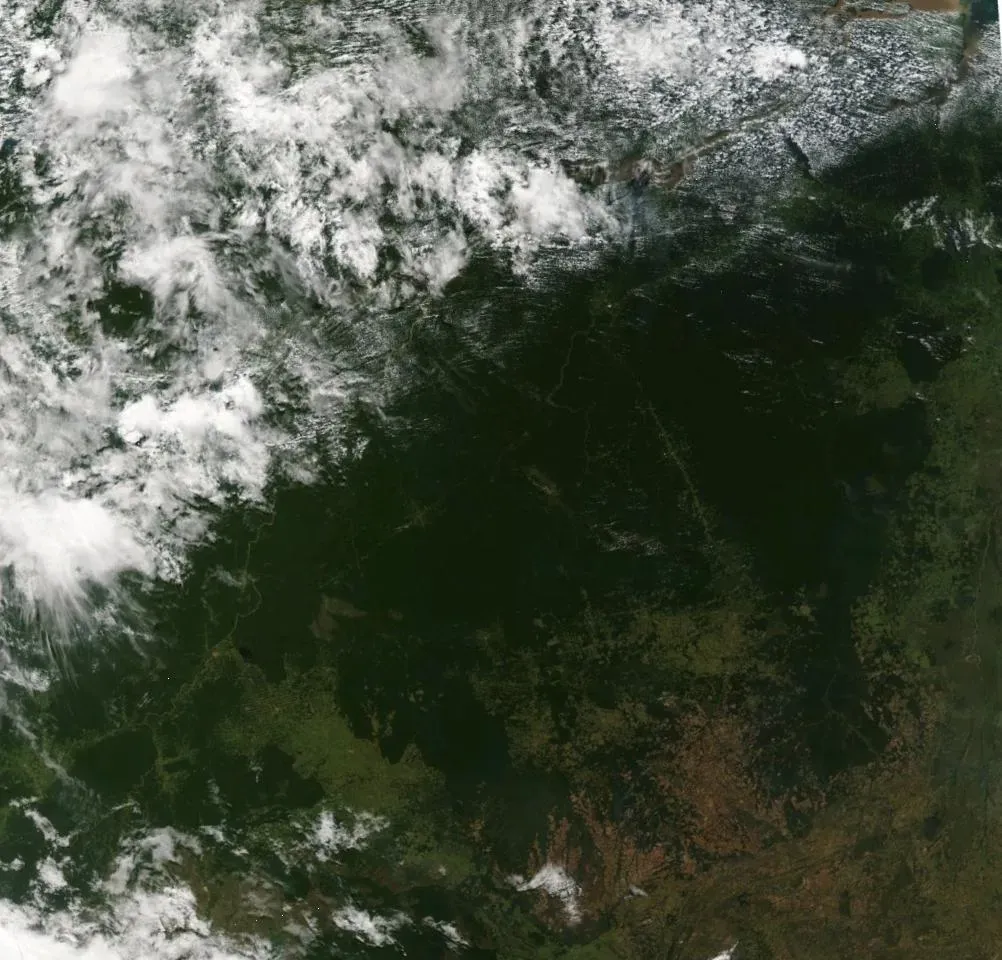
Most people still imagine the Amazon as a timeless, pristine wilderness dotted with small, scattered groups. Satellite images and lidar are tearing that fantasy apart. Under the forest canopy of southwestern Amazonia, researchers have found geometric earthworks, gridded settlements, causeways, and defensive ditches – a landscape engineered at scale, not randomly cleared.
Soil analysis reveals extensive use of terra preta, human-made “dark earth” built by adding charcoal and organic waste to improve fertility. That kind of soil doesn’t appear by accident; it points to long-term, deliberate land management by a dense population. A growing camp of researchers now argues pre-Columbian Amazonia may have supported millions of people in complex societies, not the scattered bands we assumed for so long. If they’re even half right, the idea of “untouched rainforest” needs a full rewrite.
Worth Knowing
- Terra preta soils stay fertile for far longer than the thin, quickly exhausted soils typical of the rainforest floor.
- Lidar surveys in Bolivia and Brazil have revealed geometric earthworks completely invisible from ground level.
- Some causeway networks link settlements across several kilometers of forest.
- Updated estimates for pre-Columbian Amazonian population now stretch into the millions, not the low thousands once assumed.
#5 – The Nabataeans: An Empire Hiding Behind Petra
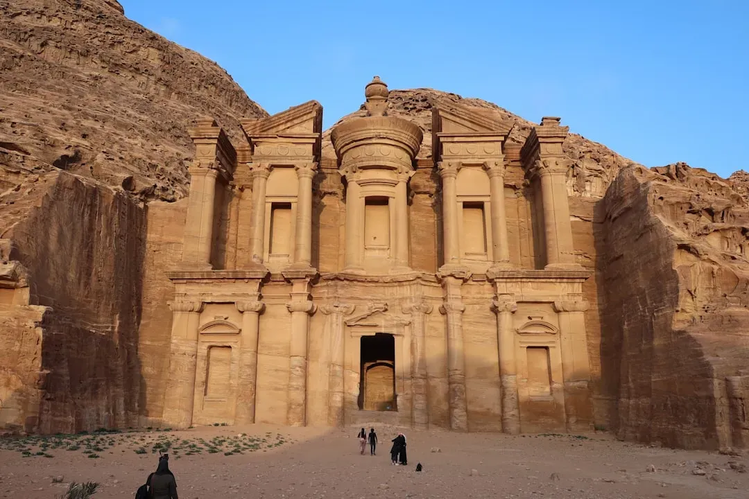
Petra is Instagram-famous, but the civilization behind it has been strangely underestimated. Tourists see one gorge and a few carved facades and assume that’s the whole story. Archaeologists increasingly see a large, dispersed kingdom spread across what’s now Jordan, Saudi Arabia, Israel, and Syria.
New surveys of caravan stops, agricultural terraces, and water-management systems reveal an impressive hydraulic and logistical infrastructure – proof this was never just one stone city in a canyon. Controlling the incense and spice trade between Arabia and the Mediterranean required a dense network of stations, forts, and farming communities. Factor in all those rural and semi-urban sites, and the Nabataean population jumps from “minor desert kingdom” into major Near Eastern player, with a headcount that likely rivaled better-known contemporaries.
#4 – The Hittite World: An Empire Bigger Than the Textbooks Admit
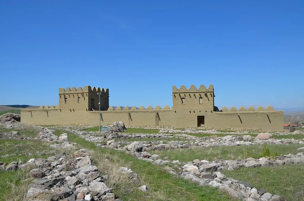
The Hittites show up in school as a big empire that fought Egypt at Kadesh, then quietly vanish from the narrative. What’s underappreciated is how badly we may have underestimated the density and spread of their heartland in central Anatolia. Only a fraction of known Hittite sites have ever been excavated, and remote sensing is now revealing far more fortified centers, roads, and rural settlements than earlier generations expected.
Some scholars argue the Hittite “empire” wasn’t a handful of cities plus vassal states, but a deeply integrated network of administrative hubs and farming communities capable of supporting large standing armies and monumental construction. Modern development and political limits on excavation have kept population estimates conservative for decades. As survey data fills in, especially across the plateau regions, the picture is shifting toward a far more populous, intensively managed landscape – one that may force a serious rewrite of how Hittite power compared to Egypt’s.
#3 – Angkor: The Megacity Lidar Finally Uncovered
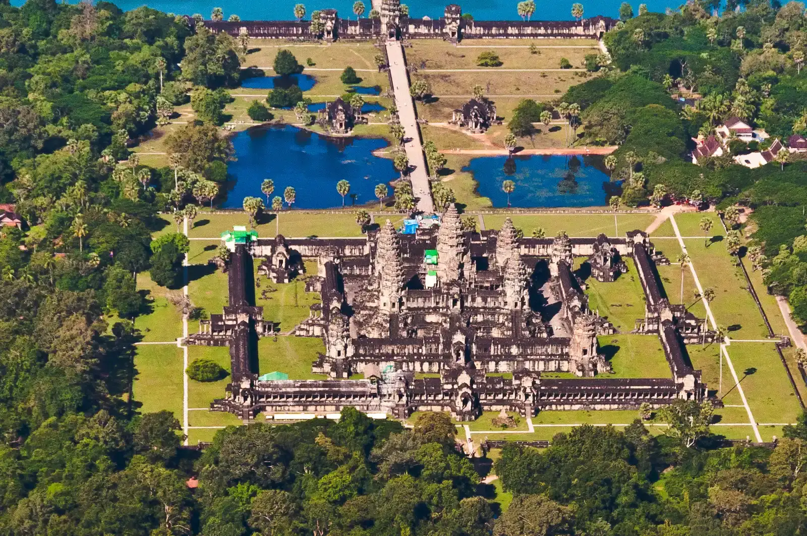
Most people see a few stone temples at Angkor Wat and assume that’s the whole story. Lidar has proven that assumption wildly wrong. When researchers scanned the surrounding forest, they uncovered vast urban grids, roadways, reservoirs, and residential mounds extending far beyond the famous temples – evidence that Angkor was one of the largest low-density cities on Earth, spread across hundreds of square kilometers.
That map forced a painful rewrite of the population numbers. Earlier estimates in the hundreds of thousands now look timid; some studies suggest the greater Angkor region supported on the order of a million inhabitants or more, fed by intricate water-management systems built for large-scale rice agriculture. The catch is that most of this city was built in wood and earth, not stone, leaving almost no footprint until lidar lit it up. We didn’t underestimate Angkor because it was small. We underestimated it because we simply couldn’t see it.
At a Glance
- A landmark lidar survey mapped hundreds of square kilometers of hidden urban infrastructure around Angkor Wat in a single flyover.
- Greater Angkor’s water network includes canals, moats, and reservoirs engineered for large-scale rice farming.
- Population estimates for the wider Angkor region now stretch toward roughly a million people.
- Most residential structures were built from wood and thatch, which is exactly why they vanished from view for centuries.
#2 – The Maya “Jungle Kingdoms”: Millions We Never Counted
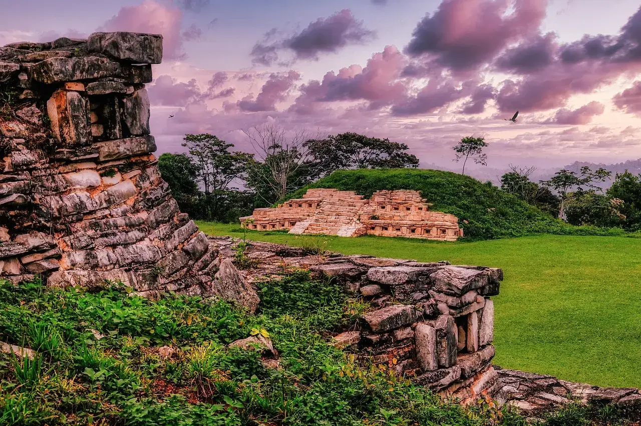
Everybody knows the Maya built big temples. Fewer people realize how badly we misjudged how many Maya there actually were. For decades, scholars based population estimates largely on visible stone architecture – then lidar flights over Guatemala, Mexico, and Belize revealed a staggering web of causeways, terraces, reservoirs, and house platforms hiding under supposedly “empty” jungle.
Some lidar-based studies now propose population densities in key Maya regions comparable to modern rural areas, not wilderness. That pushes total Late Classic population estimates into the mid- to high-millions, with some corridors looking almost continuously occupied. Not everyone agrees on the exact numbers, and that debate matters. But the core point isn’t controversial anymore: the Maya world was far larger and more interconnected than anyone dared put in a textbook thirty years ago.
#1 – Greater Mesopotamia: The Cradle Was Bigger Than We Ever Taught
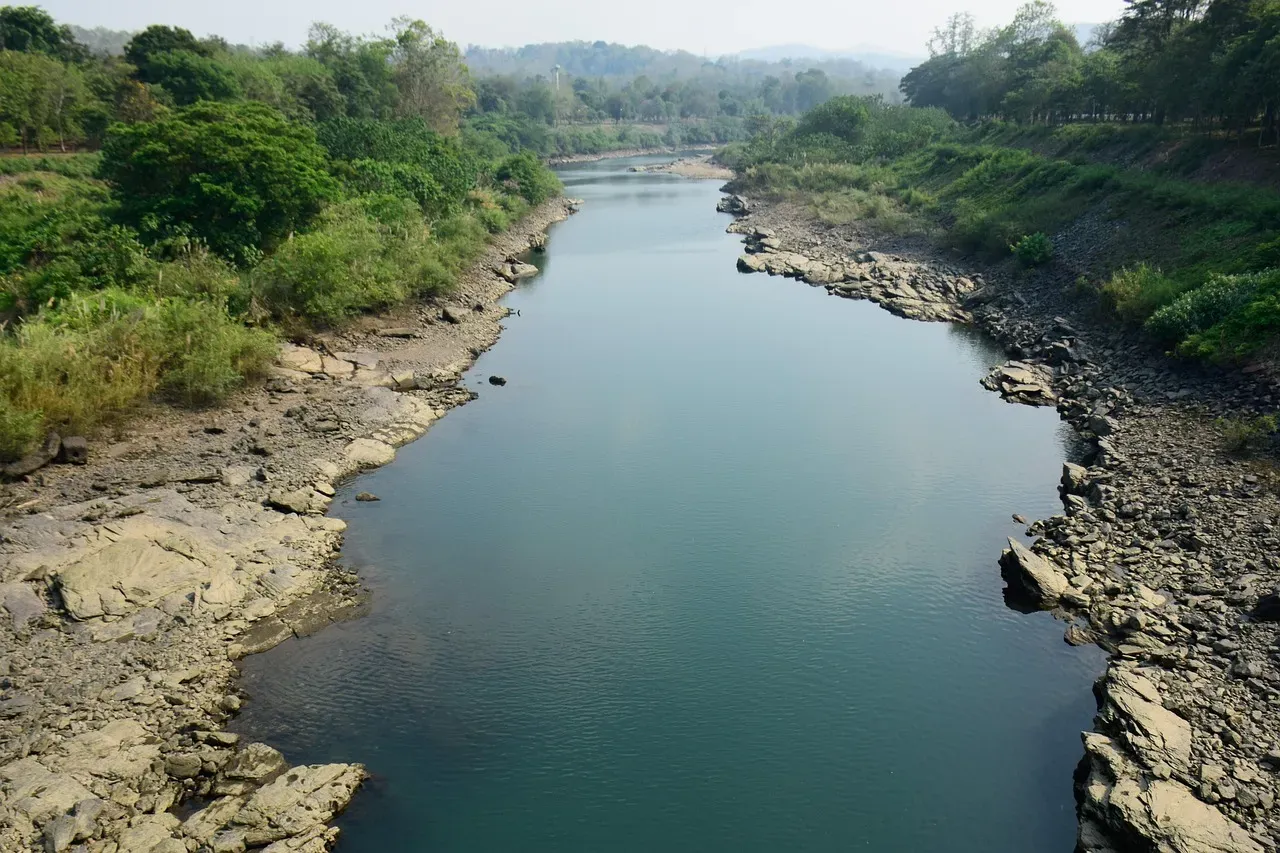
Mesopotamia usually gets reduced to a handful of famous names – Ur, Uruk, Babylon – scattered along the Tigris and Euphrates. That’s a bit like judging modern Europe by a few postcards of Paris and Rome. Landscape archaeology, satellite imagery, and sediment coring have uncovered thousands of smaller sites, canals, field systems, and trackways stitching southern Iraq, eastern Syria, and parts of Turkey and Iran into one heavily engineered zone that lasted millennia.
What’s changing isn’t whether Mesopotamia mattered – we always knew that. It’s how big and continuous its urban world really was. Researchers increasingly describe an “extended urban ecosystem,” where secondary towns, villages, and estates filled the space between the famous capitals. Factor in those ghost settlements, many now buried under modern fields or lost to shifting rivers, and traditional population estimates start looking far too cautious. Several experts now suspect Bronze and Iron Age Mesopotamia supported significantly more people than mid-20th-century models ever allowed – rivaling, or even exceeding, other classical “cradles” in sheer demographic weight.
Why It Stands Out
- Satellite and sediment studies have identified thousands of smaller settlements beyond the famous capital cities.
- Ancient canal networks once stretched across parts of modern Iraq, Syria, Turkey, and Iran.
- Researchers now describe an “extended urban ecosystem” linking secondary towns to major centers.
- Many of these settlements sit buried under shifting river channels or modern farmland, invisible without remote sensing.
The Bottom Line
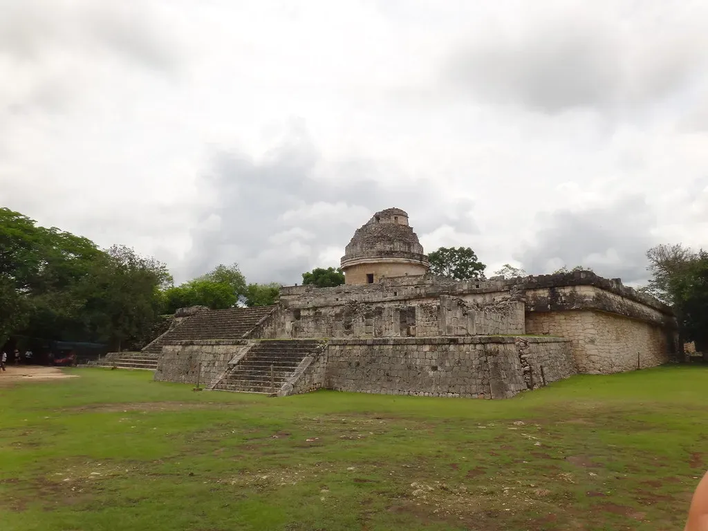
The pattern across all twelve of these cases is brutally consistent. Every time we get better tools – lidar, satellite imagery, regional surveys, soil science – the same thing happens: civilizations we dismissed as minor, peripheral, or sparsely populated suddenly swell into view as densely networked, region-scale societies.
The real bias was never buried in the soil. It was in our assumptions, especially about Africa, the Americas, and so-called “frontier” cultures that didn’t fit the old story of who got to be great. Researchers will keep arguing over exact headcounts, and they should. But pretending these worlds were small is no longer scientifically honest – it’s just habit dressed up as history.
Our ancestors built large, complex, deeply networked societies in far more places than the old textbooks ever admitted. So here’s the real question worth sitting with: which civilization on this list do you think we’re still underestimating the most, and what does that say about whose history we’ve been trained not to look for?