
Every now and then, you stumble across a pattern in the ancient world that makes you stop and think: either this is all a gigantic cosmic coincidence, or people thousands of years ago were coordinating on a level we still do not fully grasp. Lines that seem to slice through pyramids, temples, stone circles, and mountain peaks across different continents have become a favorite topic in documentaries, online forums, and late-night debates.
Some of the most sensational claims go way beyond what the evidence can support. But buried in all the hype are a few geographical and architectural alignments that really are intriguing, especially if the measurements are accurate and not cherry‑picked. Let’s walk through eight of the most talked‑about cross‑continental alignments, sticking to what we can reasonably verify, while still allowing ourselves to admit: if these numbers are exactly right, then someone, somewhere, was planning very, very far ahead.
The Giza Plateau and the Orion Correlation Problem

The three main pyramids on the Giza Plateau in Egypt are famous for a proposed alignment with the three stars of Orion’s Belt. The basic idea is simple: the offset of the smallest pyramid seems to echo the offset of the dimmest star, Mintaka, creating a sky‑to‑ground mapping. What makes this relevant across continents is that similar star‑inspired layouts have been suggested for sites as far away as Mexico and possibly even parts of Asia, raising the question of coordinated intent on a planetary scale if they were all deliberately copying the same celestial template.
Here’s where we have to be careful: the Orion correlation at Giza itself is controversial among scholars, and tying it to other continents adds an extra layer of speculation. Still, if you accept that the Giza pyramids were intentionally aligned to Orion, and then you compare them to alleged star alignments in Mesoamerican pyramid groups, you end up with monuments separated by oceans that seem to mirror the same three‑star pattern in surprisingly similar ways. If that geometry actually holds up to rigorous, independent measurement, then our ancestors were not just building stone piles – they were embedding a global conversation in the night sky.
The Great Circle: Giza, Nazca, Easter Island, and Angkor on One Line
One of the more mind‑bending claims floating around is that several iconic sites – including the Great Pyramid at Giza, the Nazca Lines in Peru, Easter Island in the Pacific, and Angkor in Cambodia – fall roughly along a single great‑circle route on the globe. A great circle is just the shortest path between two points on a sphere, like the routes airlines use, but when you plug in coordinates for multiple ancient sites and see them clustering near the same geodesic, it understandably grabs attention.
In reality, the evidence is mixed. Some of these places do lie within a few degrees of a shared great‑circle path, but the Earth is covered in potential lines, and it is easy for the human brain to find patterns where none were intended. However, if future high‑precision geodetic work ever showed that several major monuments were deliberately placed within a narrow band of the same great‑circle trajectory, it would imply not just local surveying skill but a kind of global mapping capability that would dramatically rewrite our story of ancient navigation and coordination.
Stonehenge and the Solstitial Network Reaching to Newgrange and Beyond
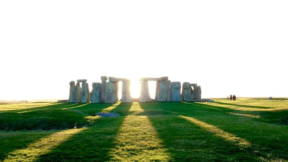
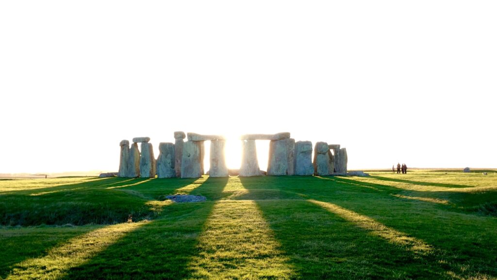
Stonehenge in England is probably the most famous prehistoric monument linked to solar alignments, especially the sunrise at the summer solstice and sunset at the winter solstice. Across the Irish Sea, Newgrange in Ireland has its own carefully engineered winter solstice alignment, where sunlight floods the inner chamber on only a few days each year. Both structures were created by different communities, yet they lock onto the same astronomical events with remarkable precision.
Now stretch that idea further: solstice‑aligned structures are found in Europe, the Americas, and parts of Asia and Africa. On their own, each site can be explained as a local response to the same universal sky. But if you zoom out and treat these monuments like nodes in a network – all pinned to the same annual solar markers, and sometimes sitting at latitudes that create similar shadow lengths or horizon effects – you begin to see a loose global grid of people tuned into the same solar clock. If precise measurements ever showed a repeating pattern of shared latitudes or angular separations between far‑flung solstice monuments, it would be hard not to see at least some level of deliberate, long‑distance knowledge transfer.
The Pyramid Belt: Giza, Teotihuacan, and Chinese Pyramids Near Similar Latitudes
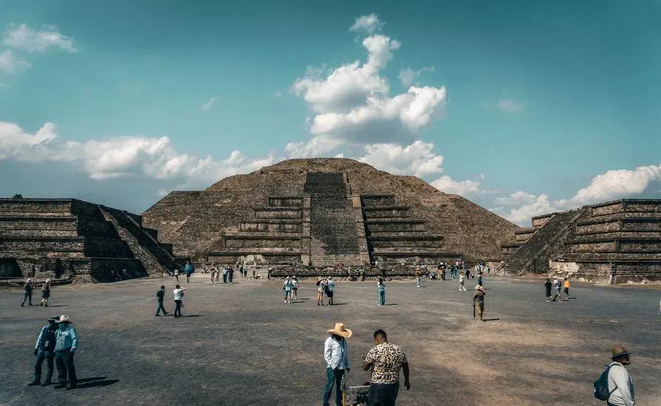
Egypt is not the only place on Earth with pyramids. Teotihuacan in central Mexico boasts massive stepped pyramids aligned to its own sacred directions, and in China, especially in Shaanxi Province, there are large pyramid‑like burial mounds built for ancient emperors. When you plot these on a map, some of the major complexes hover in mid‑latitude bands that, while not identical, cluster in ways that enthusiasts argue are more than coincidence.
Scientifically, there is no good reason to jump straight from “similar latitudes” to “global master plan.” Climate, agriculture, and habitable land naturally concentrate civilizations in certain zones, so of course some architectural traditions will show up at similar latitudes. But suppose someone could demonstrate that major pyramid centers across continents are separated by consistent angular distances, or that their key monuments share resonant bearings relative to true north. If those measurements were confirmed and not the product of cherry‑picking, we would be looking at an intentional pyramid belt that hints at shared surveying principles echoing across oceans.
Angkor Wat, Preah Vihear, and a Wider Asian Alignment Web

In Cambodia, the temple complex of Angkor Wat is famously aligned both to cardinal directions and to celestial events, with its towers and causeways mapped carefully to the sun and possibly certain stars. Not too far away, the temple of Preah Vihear sits dramatically on a cliff, also with a strong axial layout that engages with the horizon in striking ways. Some researchers have suggested that the distances and angles between these and other regional temples form larger geometric patterns, almost like a sacred architectural lattice spread across Southeast Asia.
So far, these broader cross‑site alignments are more hypothesis than consensus, but the precision of each temple’s internal geometry is not in doubt. If someone eventually showed that the axes of Angkor, Preah Vihear, and other key sites intersected or paralleled each other in a way that was statistically unlikely to be random, it would point to a coordinated surveying program operating over hundreds of kilometers. Scale that up and link it, even loosely, to similar alignment traditions in India, China, or the Middle East, and you start to see the faint outline of a pan‑Asian blueprint for sacred space laid across the landscape.
Nazca, Andean Sacred Peaks, and Distant Latitudinal Echoes

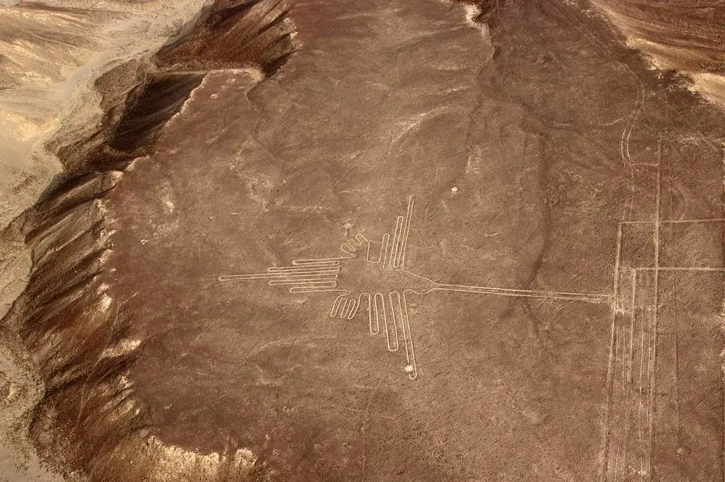
The Nazca Lines in Peru are a classic example of humans drawing on a giant canvas, carving enormous geoglyphs and straight lines into the desert that stretch for kilometers. Many of these lines point toward Andean mountain peaks, water sources, or solar and lunar rising points on the horizon. In the broader Andean world, countless temples, shrines, and Inca ceque lines linked sacred places in radial patterns that blended astronomy, geography, and ritual into a single landscape system.
What gets interesting is when you compare Nazca’s latitude and alignments to other geoglyph traditions in different parts of the world, such as large ground drawings in the Middle East or step‑like petroglyph fields elsewhere. The data is currently patchy, and most similar sites arise from local cultural needs, not from any provable global plan. But if robust measurements eventually showed recurring latitudinal bands where multiple geoglyph traditions independently cluster, and if their main axes share similar angular relationships to true north or to specific stars, then it would be tempting to see this as evidence of a shared mental map of Earth and sky that transcended continents.
Easter Island, Polynesian Wayfinding, and Distant Alignments to Other Sacred Sites
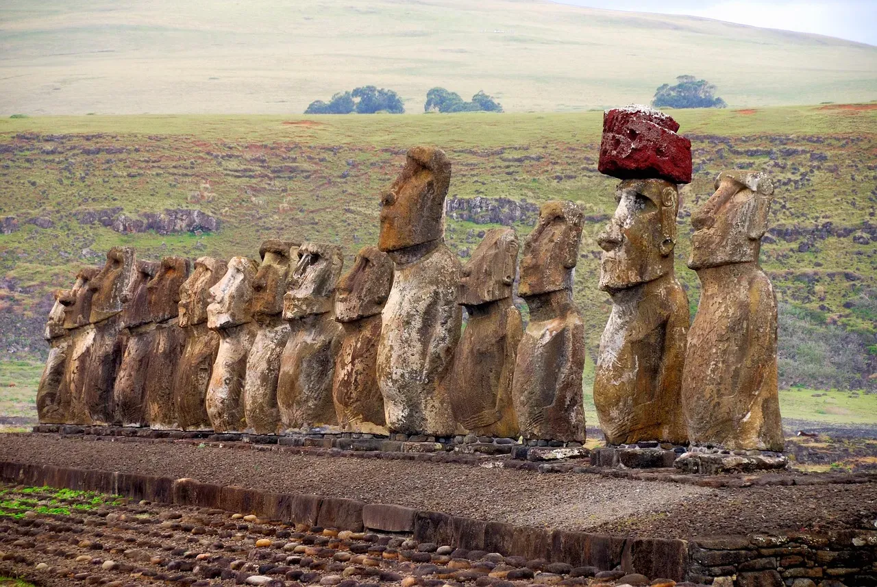
Easter Island (Rapa Nui) stands almost alone in the Pacific, famous for its moai statues and the platforms, or ahu, on which many of them stand. Some of these platforms are aligned with astronomical events or particular points on the horizon, and there is growing appreciation for how deeply Polynesian cultures integrated navigation, ocean swells, and the night sky into their worldview. Traditional wayfinders could cross vast distances using stars, currents, and subtle environmental cues, long before modern instruments existed.
Now imagine mapping Polynesian voyaging routes, the position of Easter Island, and the orientations of its monuments onto a globe, and then comparing that to longitudes and star paths connected to distant sacred sites in the Americas or Asia. At present, the evidence for any tight, cross‑continental alignment is speculative, and it is far safer to say that Easter Island and, say, the pyramids of Giza were products of separate cultural trajectories. But if precise studies one day revealed that key Rapa Nui axes or wayfinding star paths lined up with other famous monuments thousands of kilometers away to within very small margins of error, it would imply that ancient navigators were not only crossing oceans, but also quietly plugging their sacred architecture into a much larger, coordinated spatial story.
Mountains, Volcanoes, and Sacred Peaks on Shared Great‑Circle Arcs
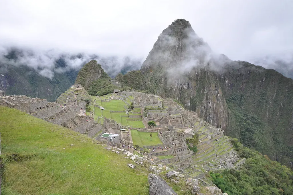
Not all alignments involve human construction; some of the most powerful “monuments” on Earth are natural: mountains, volcanoes, and distinctive peaks that societies have treated as sacred for millennia. When you map famous sacred mountains – from the Andes to the Himalayas, from Mount Fuji to Mount Olympus – some of them appear to line up in roughly straight, great‑circle arcs that stretch across continents. Humans did not place the mountains, but they did choose which peaks to venerate, build near, or align temples towards.
This is where coordinated intent becomes a subtle question. Nature provides the raw geography, but culture selects and emphasizes certain places. If it turned out that sacred peaks in different cultures, which had no known contact, fell along the same carefully constructed great‑circle paths that also stitched together human‑built monuments, then the only explanation would be a shared, high‑resolution knowledge of Earth’s geometry. Right now, such a claim is far ahead of the evidence. Yet it remains an intriguing possibility: perhaps some ancient sky‑watchers and surveyors were quietly treating the planet itself as one enormous temple, with mountains and monuments serving as aligned pillars in a global hall.
Conclusion: Fascination, Skepticism, and the Possibility of a Global Blueprint
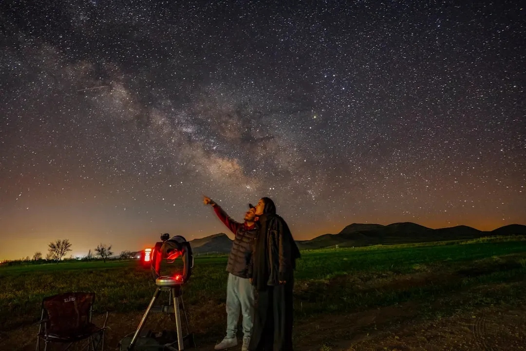
I think the honest position here is both skeptical and fascinated at the same time. On one hand, humans are pattern‑seeking machines, and we can connect dots across maps and star charts until everything looks like a deliberate design. On the other hand, some of these monuments are so precisely aligned to cardinal directions, solstices, and possibly stars that dismissing every cross‑continental echo as pure coincidence feels a bit too comfortable. The truth is probably in the messy middle: lots of coincidence, plenty of shared constraints from living on the same planet under the same sky, and maybe a few real, jaw‑dropping examples of ancient coordination that we have only started to detect.
If future, carefully controlled measurements confirm that certain lines, angles, and distances really do repeat across continents with far tighter accuracy than chance would allow, then we will have to admit that our ancestors were playing a much bigger game with space, time, and geometry than we gave them credit for. Until then, these global alignments sit in a tantalizing gray zone – not proven, not impossible, but rich enough to keep archaeologists, skeptics, and dreamers arguing for years. Which side do you lean toward right now: cosmic coincidence, or a hidden, ancient blueprint that we are only beginning to see?