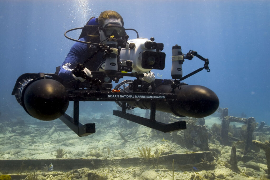

Most people assume the ocean floor has already given up its biggest secrets, but marine scientists will tell you that’s laughably wrong. Less than 5% of the world’s oceans have ever been mapped or explored, which means most of what’s down there was never searched for – it was tripped over.
A diver looking for hammerhead sharks. A sonar crew hunting for shipwrecks. A fisherman dragging a net. Time and again, the most baffling structures on Earth have surfaced not through expeditions, but through pure accident. Here’s what marine archaeologists, geologists, and stunned amateur divers actually found when they weren’t even looking.
#1 – The Yonaguni Monument, Japan
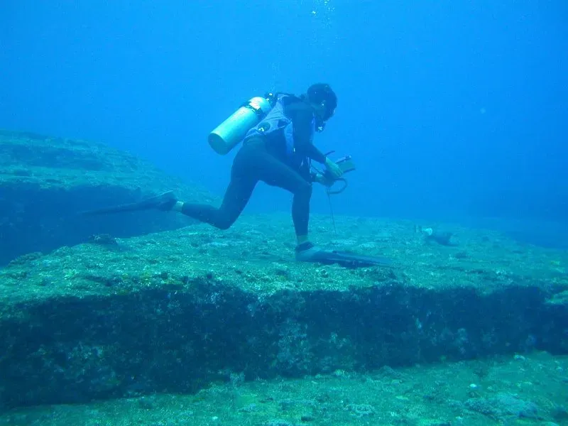
A scuba instructor looking for sharks accidentally found what some call Japan’s Atlantis.
Kihachiro Aratake, a local scuba diver and tour operator, discovered the Yonaguni Monument in 1986 while seeking hammerhead sharks and noticed peculiar seabed formations that resembled architectural structures. He wasn’t hunting for lost civilizations – he was scouting a new dive site to keep tourists interested. Instead he found a massive stone mass with terraces, sharp edges, and near-perfect right angles sitting just meters below the surface.
The main structure measures approximately 150 by 40 meters and stands about 27 meters tall, with its top lying just 5 meters below the surface. Geologists are still split decades later – some insist it’s natural sandstone fracturing along tectonic fault lines, others argue it’s a 10,000-year-old man-made relic. Either way, it’s become one of the most dived-on “accidents” in ocean history. And somehow, the next one is even harder to explain away.
Fast Facts
- Discovered by accident in 1986 by a shark-tour diver
- Roughly 150m long, 40m wide, 27m tall
- Top of the structure sits just 5m below the surface
- Debate: tectonic sandstone fracturing vs. 10,000-year-old construction
#2 – The Baltic Sea Anomaly
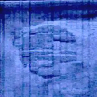
Treasure hunters searching for a sunken ship instead found something people compared to a crashed spaceship.
The Baltic Sea anomaly is a feature visible on an indistinct sonar image taken by Peter Lindberg, Dennis Åsberg and their Swedish OceanX diving team while treasure hunting on the floor of the northern Baltic Sea at the center of the Gulf of Bothnia in June 2011. They weren’t looking for mysteries – they were looking for old shipwrecks and cargo.
Instead, the team claimed their image showed a 60-metre (200 ft) diameter circular object with features that appeared possibly man-made. The sonar even picked up what looked like a runway leading to it, sparking wild theories about crashed UFOs. A consensus of experts and scientists say that the image most likely shows a natural geological formation – but the internet still isn’t fully convinced. Meanwhile, a professor hunting shipwrecks in the Great Lakes was about to trip over something just as strange.
#3 – “Michigan’s Stonehenge,” Lake Michigan
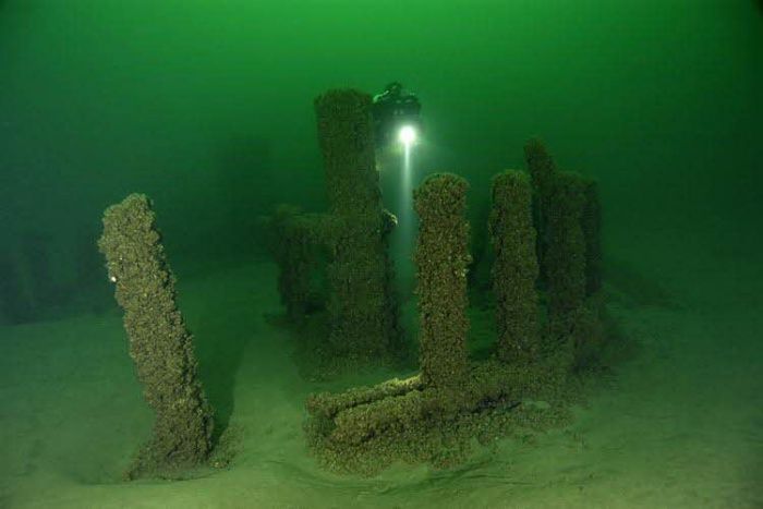
A professor scanning for shipwrecks stumbled onto a mile-long stone trail nobody expected to find in a Great Lake.
In 2007, Mark Holley, professor of underwater archaeology at Northwestern Michigan University, first came across a rock that he said bears a prehistoric carving of a mastodon while looking for shipwrecks in Grand Traverse Bay. He wasn’t chasing ancient history – he was mapping the lakebed for maritime wrecks.
About 40 feet below the surface, a winding line of stones spans over a mile, and though smaller than the famous British monument, the layout shows deliberate design with stones ranging from basketball-sized to as big as compact cars. Experts still can’t agree if it’s intentional construction or a lucky glacial accident. Holley has kept the exact coordinates secret out of respect for Indigenous heritage ties. The lake right next door was hiding something even older.
#4 – The Lake Huron Caribou Corridor
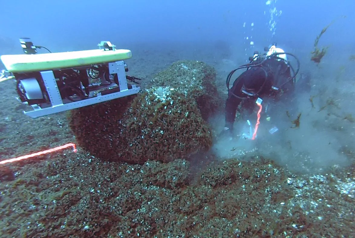
While studying that same “Stonehenge,” researchers found something even older hiding in the neighboring lake.
In Lake Huron, archaeologists uncovered a 9,000-year-old hunting corridor along the Alpena-Amberley Ridge, a now-submerged land bridge, where stones were arranged to guide herds of caribou into traps. This wasn’t the target of any expedition – it was found while researchers were cross-checking the Michigan formation for comparison.
Scientists say the main feature, known as Drop 45 Drive Lane, is the most complex hunting structure discovered beneath the Great Lakes to date, with two parallel lines of stones leading to a cul-de-sac lined with cobblestones. If confirmed, it predates Stonehenge by thousands of years. Most travelers have never even heard of it, yet many archaeologists argue it’s more historically significant than any pyramid-shaped rock formation making headlines. A world away, a routine seafloor survey was about to turn up something just as impossible.
#5 – The Sicilian Channel Monolith
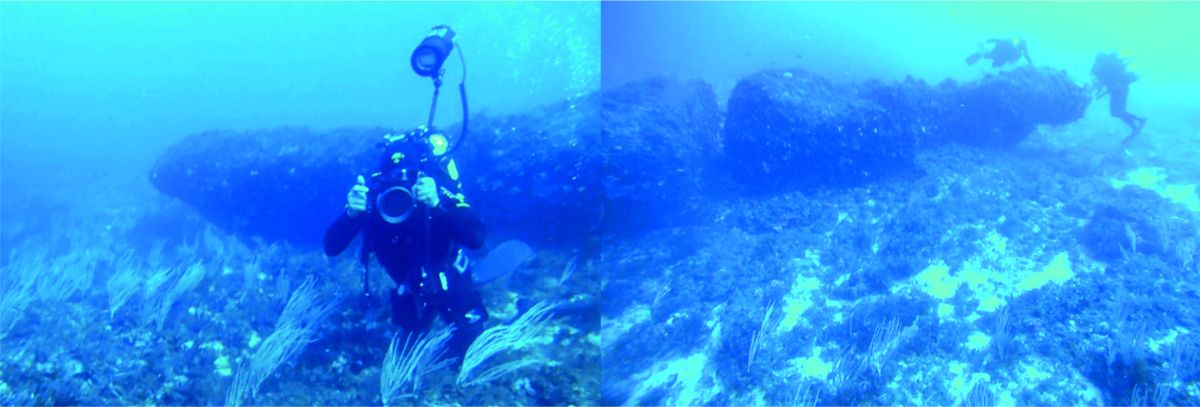
Mapping the seafloor for routine geology, researchers instead found a 15-ton carved stone that shouldn’t have existed.
During a high-resolution mapping of the seafloor surrounding Sicily, researchers discovered an ancient treasure: a stone monolith spanning 39 feet, resting on the bottom of the Mediterranean, and stunned by the find, they sent down divers with cameras to get a closer look. They weren’t hunting for ruins – they were doing standard bathymetric surveys.
There are no reasonable known natural processes that may produce these elements, according to the researchers who found the monolith. It’s at least 9,300 years old, meaning it predates written language entirely. Researchers believe the structure was functional to the settlement, since these people were used to fishing and trading with the neighboring islands, and it could have been some sort of lighthouse or anchoring system. What divers found next off Japan looked less like ancient engineering and more like an alien signal.
#6 – Japan’s Underwater “Crop Circles”
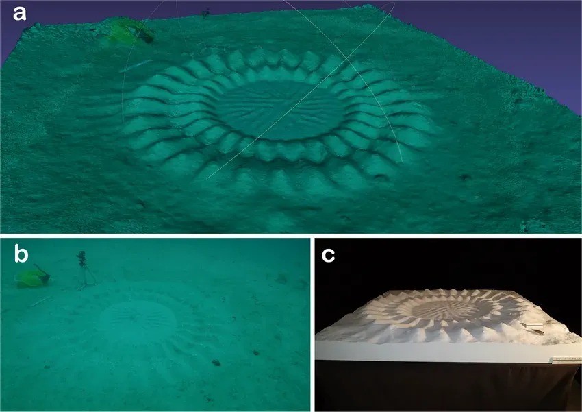
Divers thought they’d found evidence of something otherworldly – the truth turned out to be even stranger.
In 1995, divers off the coast of Japan discovered strange, circle designs on the seabed that resemble the famous crop circles that mysteriously appear in farmers’ fields. Nobody was searching for these – they simply appeared on routine dives near Amami Oshima Island.
More than 15 years later, scientists discovered that these creations were the work of a new species of pufferfish, Torquigener albomaculosus. A five-inch fish built structures seven feet wide, using nothing but its fins, purely to attract a mate. A 2020 study found that an unidentified pufferfish was also constructing these circles off northwest Australia, more than 5,500 kilometers from those observed near Japan. Storm-driven sponge divers off Greece were about to make a discovery with far bigger consequences.
#7 – The Antikythera Shipwreck
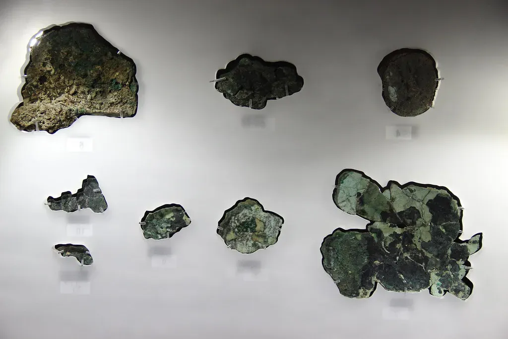
Sponge divers thrown off course by a storm found the wreck that would reshape how we think about ancient technology.
In 1900, Greek sponge divers sheltering from bad weather near the tiny island of Antikythera stumbled onto a Roman-era shipwreck scattered across the seabed. They weren’t archaeologists – they were working-class divers just trying to make a living, and the wreck was purely a detour.
Buried in the debris was a corroded lump of bronze gears that turned out to be an analog astronomical calculator, now known as the Antikythera Mechanism. It’s considered the world’s first known analog computer, built over 2,000 years before anything comparable. Many historians now argue it single-handedly proves ancient Greek engineering was centuries ahead of what textbooks credit it for.
This device is just extraordinary, the only thing of its kind.
Jo Marchant, science journalist and author on the Antikythera Mechanism
Not far from that same coastline, a geologist doing unrelated fieldwork was about to find an entire lost town.
#8 – Pavlopetri, Greece
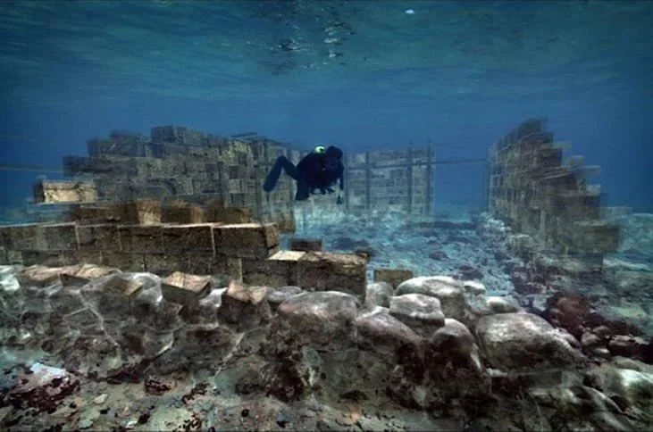
An oceanographer mapping sediment layers accidentally found the oldest known submerged town on Earth.
In 1967, marine geologist Nicholas Flemming was surveying the seafloor off the Peloponnese coast for geological research when he noticed unmistakable stone outlines beneath the shallow water – streets, courtyards, and building foundations laid out in a clear urban grid.
The site, later named Pavlopetri, dates back roughly 5,000 years, predating even Plato’s writings about Atlantis. It’s the oldest submerged town ever discovered, complete with what appear to be roads, rectangular buildings, and tombs. Most guidebooks barely mention it, yet many archaeologists argue it deserves far more attention than flashier “lost city” myths that turn out to be nothing but folklore. Across the Atlantic, a low-flying pilot was about to spark one of the internet’s favorite conspiracy theories.
#9 – The Bimini Road, Bahamas
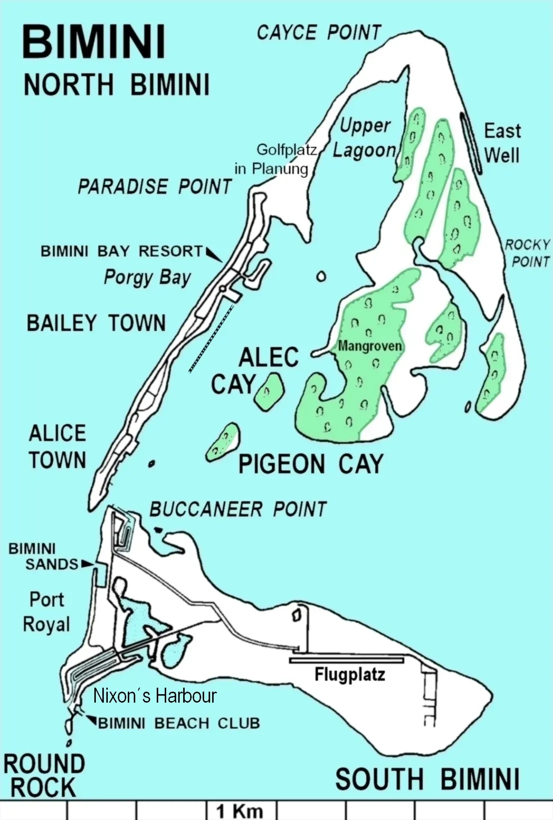
A pilot flying low over turquoise water noticed something that launched decades of Atlantis speculation.
In 1968, researcher Robert Manson Valentine spotted a long, straight formation of massive limestone blocks lying just beneath the surface off North Bimini Island. It wasn’t a research dive – it was practically a chance sighting from the air that sent him diving to confirm what he saw.
The formation stretches roughly half a mile and features blocks arranged in a strikingly linear pattern. Some believers insist it’s the remains of Atlantis itself, while most geologists maintain it’s simply beachrock that cracked along natural fault lines. The debate has never fully settled, and honestly, that’s probably why tourists still flock there decades later. In Egypt, a sonar crew chasing scattered debris was about to find something far bigger than a wreck.
#10 – Thonis-Heracleion, Egypt
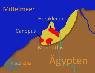
A French underwater archaeologist searching Alexandria’s harbor for scattered relics found an entire lost city instead.
In 2000, Franck Goddio’s team was using sonar to map debris fields in Egypt’s Aboukir Bay when they detected structures far larger than any single wreck. What they uncovered was Thonis-Heracleion, a major port city that had vanished beneath the Mediterranean over a thousand years earlier.
The city once controlled trade between Egypt and the Greek world before earthquakes and soil liquefaction dragged it underwater. Statues, temples, and even coins were found virtually undisturbed after more than a millennium submerged. Many Egyptologists now call it one of the most important archaeological finds of the last century – and it was found purely because a survey team followed sonar noise. That same harbor still had one more secret waiting, and it was personal.
#11 – Cleopatra’s Sunken Palace
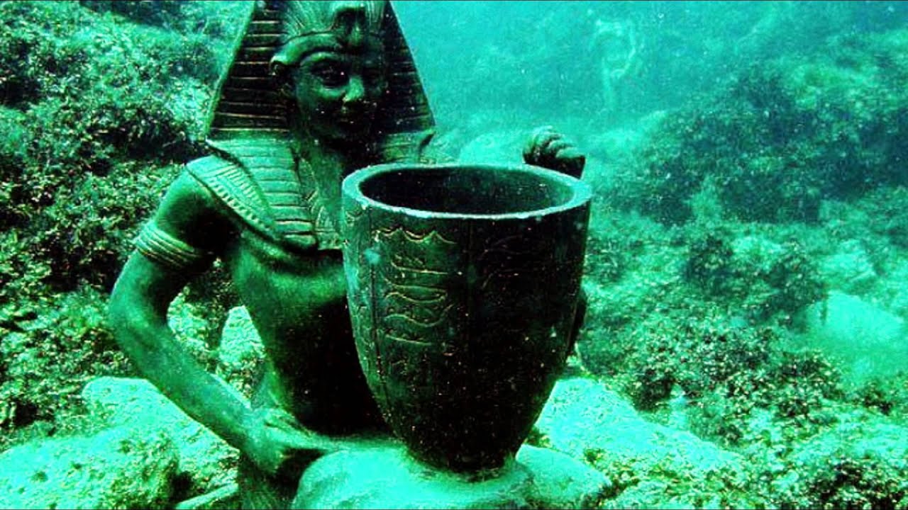
The same Alexandria harbor surveys that found Thonis-Heracleion turned up something even more personal: a queen’s private quarters.
Divers mapping the debris-strewn seafloor near the old Pharos lighthouse site kept finding granite columns and sphinx statues in a tight cluster. Follow-up excavation suggested this was the royal quarter of ancient Alexandria, believed to include remnants connected to Cleopatra’s palace complex, submerged by earthquakes and tsunamis centuries ago.
Divers have pulled fragments believed to be linked to the Ptolemaic dynasty right out of Alexandria’s harbor mud. It’s a controversial claim among historians, and some argue the “Cleopatra” branding oversells uncertain evidence purely for headlines. Still, the fact that any of it survived intact underwater at all remains genuinely stunning. The same waters had one more surprise: a piece of one of the Seven Wonders.
#12 – The Lost Pharos Lighthouse Blocks
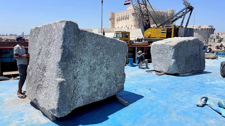
Divers surveying that same harbor for unrelated construction work found chunks of one of the Seven Wonders of the Ancient World.
In the 1990s, underwater archaeologists working in Alexandria’s eastern harbor came across massive granite blocks, obelisks, and statue fragments scattered across the seafloor. The blocks are believed to be remnants of the Pharos Lighthouse, which once guided ships into Alexandria before collapsing in a series of medieval earthquakes.
Some of the blocks weigh over 50 tons, raising real questions about how ancient engineers ever moved them into place. The discovery wasn’t the goal of any lighthouse-hunting mission – it emerged from broader harbor mapping meant to catalog general debris. Today, some of those blocks are viewable by tourists in glass-bottom boats right over the original wreckage. Across the ocean, a different kind of disaster was about to preserve an entire pirate city in place.
#13 – Port Royal, Jamaica
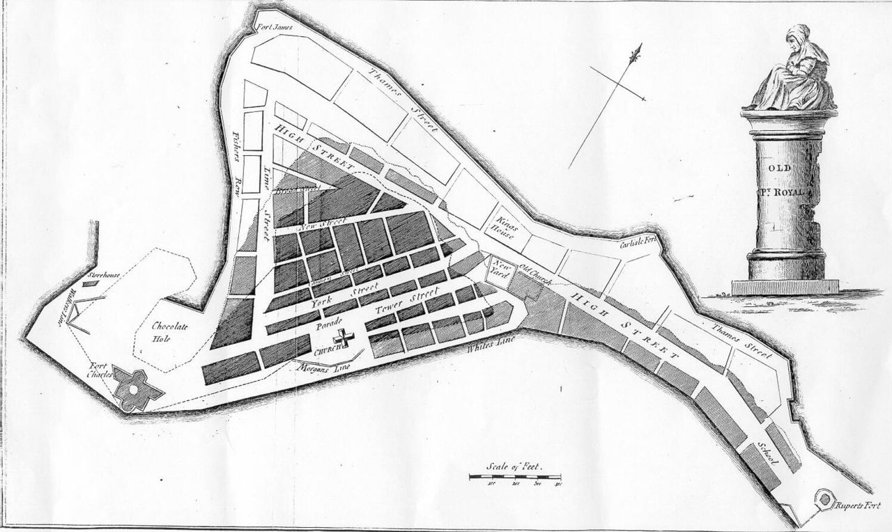
An earthquake sank an entire city in minutes, and centuries later, routine harbor dredging accidentally rediscovered it frozen in time.
In 1692, a massive earthquake swallowed two-thirds of Port Royal, once nicknamed “the wickedest city on Earth” for its pirate population. It wasn’t rediscovered by treasure hunters chasing pirate gold – it resurfaced through 1950s harbor dredging and later formal excavations meant for unrelated infrastructure work.
Because the city sank so fast, entire households were preserved mid-use, including pocket watches frozen at the exact moment of the quake. Archaeologists have called it the “Pompeii of the deep” for how perfectly it captured a single moment in time. It remains one of the only underwater sites where everyday 17th-century life is preserved this completely. Halfway around the world, a pollution survey was about to stumble into a religious firestorm.
Worth Knowing
- Two-thirds of the city sank in minutes during the 1692 quake
- Rediscovered by accident through 1950s harbor dredging
- Households were preserved mid-use, down to stopped pocket watches
- Nicknamed the “Pompeii of the deep” for its frozen-in-time state
#14 – Dwarka’s Underwater Ruins, India
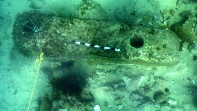
Marine archaeologists mapping India’s coastline for pollution studies instead found what many locals believe is a mythical lost city.
Off the coast of Gujarat, survey teams from India’s National Institute of Oceanography stumbled onto stone structures, anchors, and pottery scattered across the seabed near Dwarka. The team wasn’t hunting for mythology – they were conducting general marine archaeological surveys of the coastline.
Some Hindu texts describe Dwarka as the sunken city of Lord Krishna, and the discovery reignited debate about whether ancient legend and archaeology finally overlap. Skeptics argue the structures are simply natural rock formations misread through a cultural lens. Either way, the site has become one of India’s most politically sensitive archaeological debates. Nearby, another routine survey was about to spark an even bigger academic brawl.
#15 – The Gulf of Cambay Structures, India
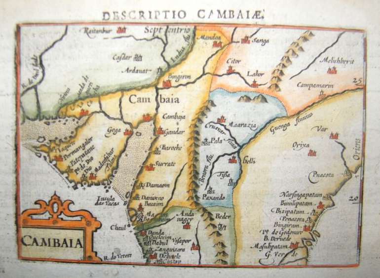
A pollution-monitoring sonar survey in 2001 accidentally picked up geometric shapes that some claimed rewrote the history of civilization.
Researchers from India’s National Institute of Ocean Technology were surveying the Gulf of Cambay for unrelated environmental monitoring when sonar revealed rectangular formations resembling building foundations, sitting over 120 feet below the surface.
Some researchers dated pottery and wood fragments from the site to nearly 9,500 years old, sparking claims of a lost civilization older than Mesopotamia. Mainstream archaeologists have pushed back hard, arguing the dating methods and site interpretation were rushed and unreliable. It remains one of the most disputed “accidental” finds in underwater archaeology, precisely because nobody agrees on what it actually proves. It took a natural disaster to finally settle a similar legend down the coast.
#16 – Mahabalipuram’s Submerged Temples, India
A devastating tsunami briefly pulled the ocean back and revealed ruins nobody knew were there.
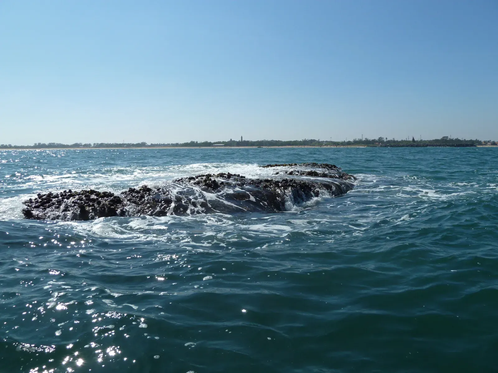
During the 2004 Indian Ocean tsunami, the receding water off Mahabalipuram’s coast exposed rows of stone structures that local fishermen had never seen before. It wasn’t archaeologists who spotted it first – it was ordinary residents watching the shoreline pull back in a terrifying, unnatural way.
Follow-up dives confirmed multiple temple structures and carved rock formations submerged just offshore, aligning with ancient legends of a “Seven Pagodas” site where only one temple remains visible today. The tsunami that caused so much devastation ironically handed archaeologists their first real physical proof of a myth locals had repeated for generations. An oil survey team in the Caribbean was about to find something that felt just as improbable.
#17 – Cuba’s Underwater Megalithic Formations
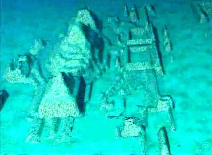
A survey team scanning the seafloor for oil and gas potential instead found something that looked disturbingly like a sunken city.
In 2001, researchers led by Pauline Zalitzki were using sonar to study the seabed off Cuba’s Guanahacabibes Peninsula when they detected large, symmetrical stone structures roughly 2,000 feet down – far deeper than any known coastline from recent history.
If the depth estimates are accurate, whatever built these structures would have needed dry land there more than 6,000 years ago. Critics argue the images are too blurry to confirm anything beyond natural rock formations, and no peer-reviewed excavation has ever fully confirmed intentional construction. Still, it remains one of the most tantalizing “we’re not totally sure” discoveries in modern marine geology. Off the coast of Italy, local fishermen had been swimming over an entire sunken party town without realizing it.
#18 – Baiae, the Sunken Roman Resort City
Roman elites built a luxury vacation town, and centuries of volcanic activity quietly swallowed it whole.
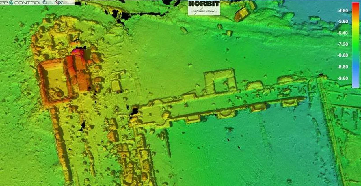
Baiae was once a playground for Roman emperors and aristocrats, famous for scandalous parties and lavish villas along Italy’s coast. Volcanic activity in the region caused the land to sink gradually over centuries, and the ruins were rediscovered largely through local fishermen noticing mosaic floors visible through clear shallow water.
Entire villa floors, statues, and even a nymphaeum dedicated to Emperor Claudius remain intact just a few meters underwater. It’s now a protected marine archaeological park where snorkelers can swim directly over Roman mosaics. Many historians argue Baiae’s decadent reputation for excess makes its slow underwater burial feel almost symbolically fitting. In China, engineers made a very different kind of sacrifice – on purpose.
#19 – Shicheng, the Lion City, China
Engineers flooding a valley for a hydroelectric dam accidentally created one of the best-preserved ancient cities on Earth.
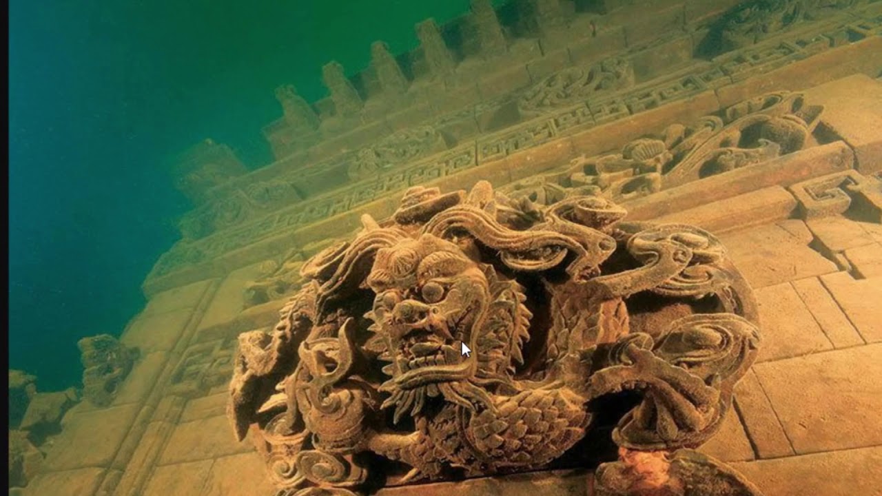
In 1959, Chinese authorities flooded a valley to build the Xin’an River Dam, submerging the 1,300-year-old city of Shicheng beneath what is now Qiandao Lake. Nobody was trying to preserve the city – it was simply deemed expendable for the reservoir project.
Divers rediscovered it decades later in 2001, stunned to find wooden beams, stone lions, and archways still standing almost perfectly intact thanks to the still, oxygen-poor water. The preservation is so good that carved inscriptions from the Ming Dynasty remain legible after over 60 years fully submerged. Some historians now argue the flooding accidentally preserved the city better than open-air exposure ever could have. In Israel, it took a storm – not an engineer – to uncover something even older.
#20 – Atlit-Yam, Israel
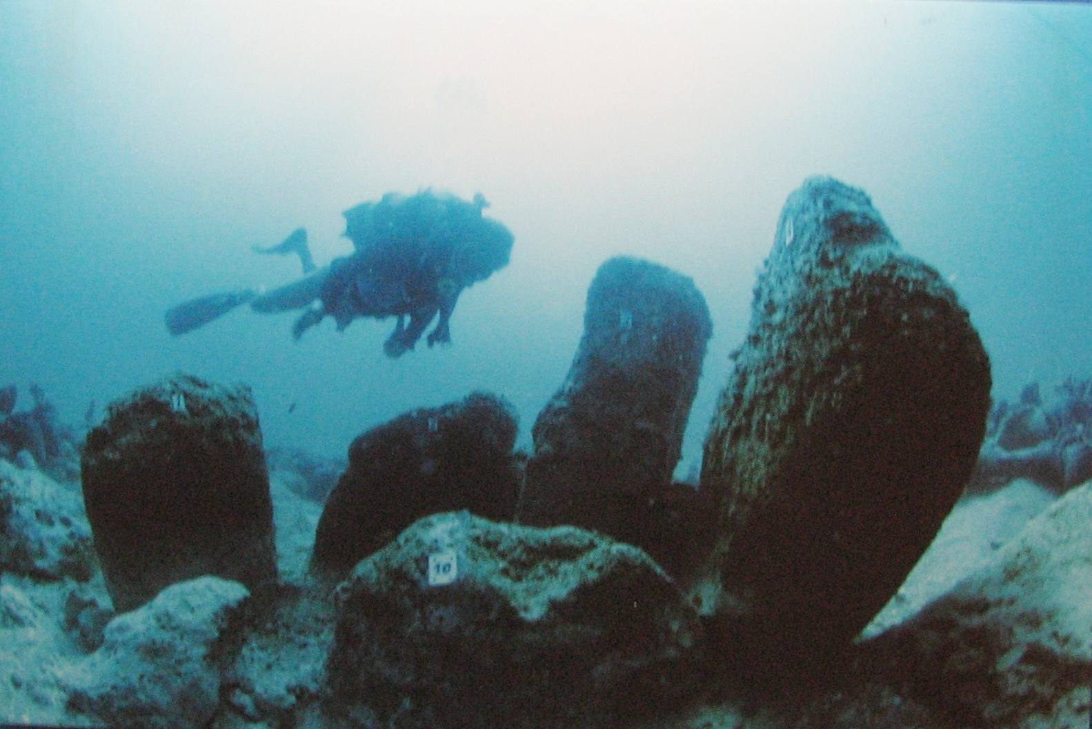
A storm scoured away seafloor sediment and exposed an entire Neolithic village that had been hidden for 9,000 years.
In 1984, archaeologist Ehud Galili was surveying the seabed near Atlit, Israel, after storms shifted sand along the coastline, revealing stone foundations, wells, and even human skeletons preserved beneath the Mediterranean.
The village dates back roughly 9,000 years, making it one of the oldest and largest submerged Neolithic settlements ever found. Researchers even discovered a stone circle believed to be used for water rituals, predating Stonehenge by thousands of years. It wasn’t the target of any planned excavation – it surfaced entirely because a storm did the digging first. Off the English coast, it wasn’t weather that gave away the next find – it was a lobster trap.
#21 – Bouldnor Cliff, England
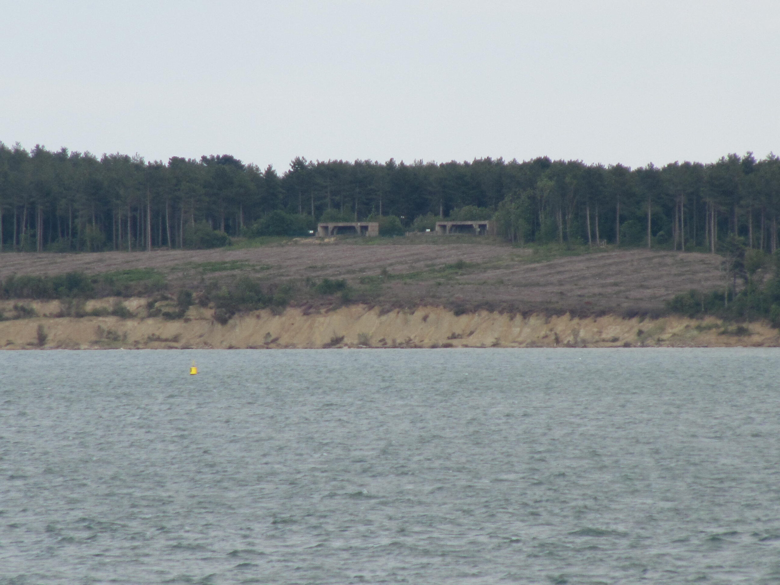
Lobster fishermen off the English coast kept snagging their gear on something that turned out to be a submerged Stone Age settlement.
Divers investigating the seabed disturbance found worked flint tools and timber structures dating back roughly 8,000 years, hidden beneath the Solent strait near the Isle of Wight. Nobody set out looking for Mesolithic history – it emerged because local fishing gear kept catching on buried debris.
Researchers later found wheat DNA at the site, thousands of years before farming was believed to have reached Britain, suggesting ancient trade networks were far more advanced than textbooks assumed. The find quietly rewrote assumptions about prehistoric Britain, all because of snagged lobster pots. Not far away, entire trawler crews had been dragging up an even bigger secret for decades without realizing it.
#22 – Doggerland’s Lost Artifacts
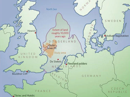
Fishing trawlers dragging nets across the North Sea kept pulling up mammoth bones and ancient tools nobody expected.
For decades, commercial fishing boats operating in the North Sea have accidentally dredged up prehistoric artifacts – flint tools, antler harpoons, and the remains of mammoths and lions – embedded in what was once dry land called Doggerland before rising seas swallowed it roughly 8,000 years ago.
An entire prehistoric landscape, once home to thousands of people, now sits fully submerged beneath one of the busiest shipping routes in the world. None of it was discovered through targeted excavation; it surfaced purely because fishermen kept noticing strange objects tangled in their nets. Many archaeologists now argue Doggerland deserves the same fame as Atlantis, minus the myth. Off the California coast, a routine seafloor charting job was about to relocate a ghost from the nuclear age.
At a Glance
- Flooded roughly 8,000 years ago as sea levels rose
- Now buried beneath one of the busiest shipping routes on Earth
- Finds include flint tools, antler harpoons, mammoth and lion remains
- Discovered entirely through fishing nets, never a planned dig
#23 – The USS Independence Wreck
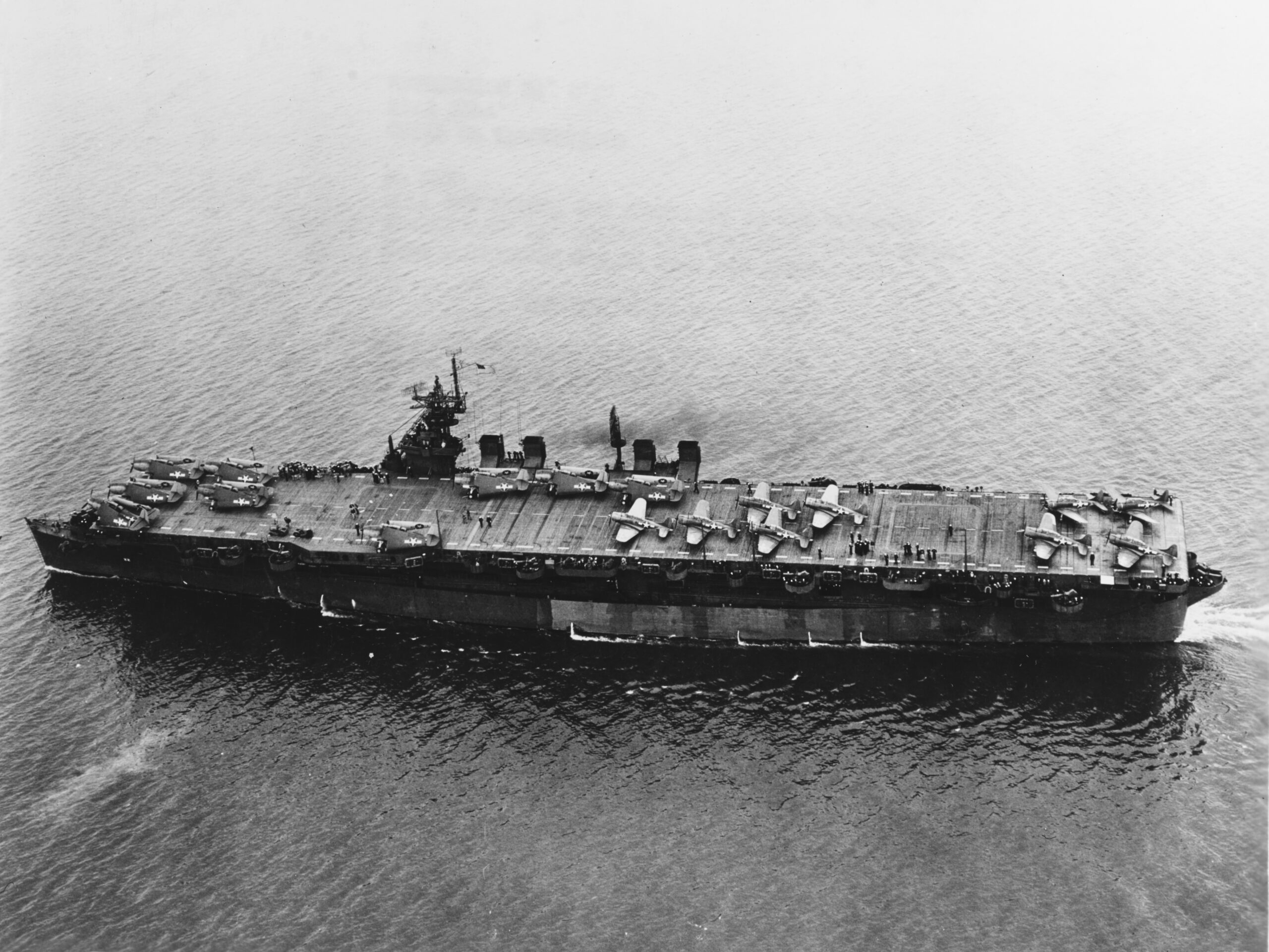
A routine seafloor mapping survey off California accidentally located a decommissioned aircraft carrier nobody had pinpointed in decades.
In 2015, a NOAA-led sonar survey conducting general seafloor mapping near the Farallon Islands identified the wreck of the USS Independence, a World War II aircraft carrier deliberately sunk decades earlier during nuclear weapons testing. The survey wasn’t hunting for it specifically – it emerged from broader ocean-floor charting work.
The ship had been sitting upright on the seafloor for nearly 60 years, remarkably intact despite radioactive contamination from nuclear test exposure. Its rediscovery gave historians a rare, undisturbed look at Cold War-era naval history preserved almost perfectly by the cold, dark water. In the Pacific, recreational divers were about to realize they’d been swimming through an entire sunken war.
#24 – Truk Lagoon’s Ghost Fleet
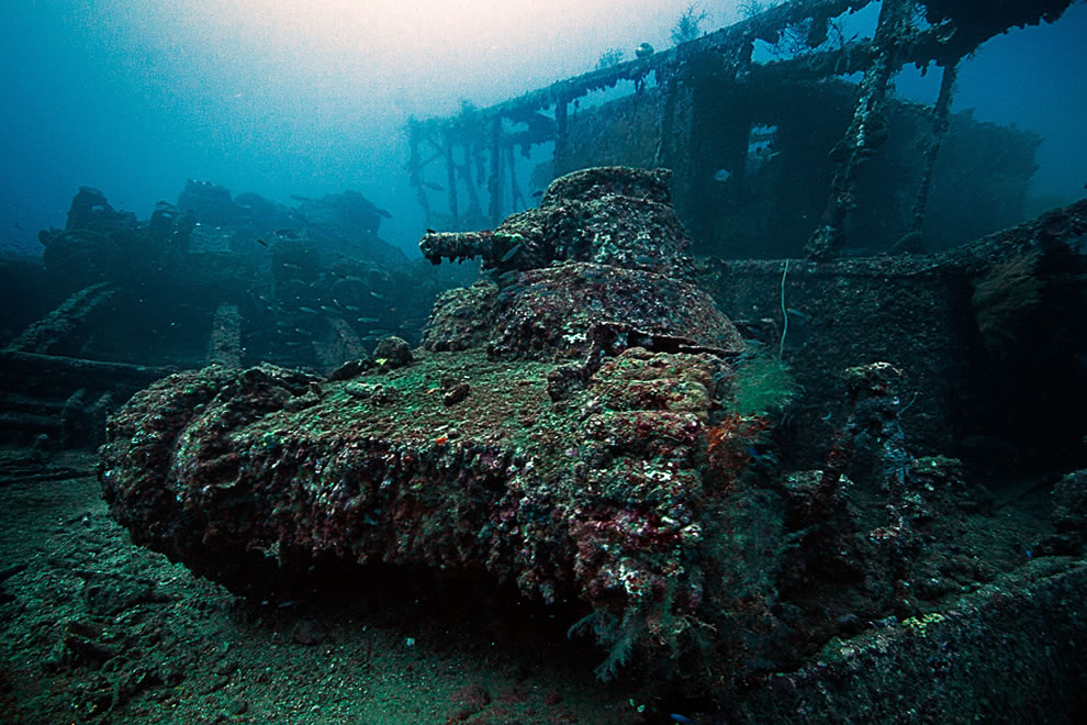
Allied bombing runs during World War II sank an entire Japanese fleet in a single lagoon, and decades later, recreational divers stumbled onto an accidental museum.
Truk Lagoon in Micronesia became the final resting place for dozens of Japanese ships and aircraft after a 1944 surprise attack. It wasn’t until decades later that recreational divers exploring the area for general wreck diving realized just how much intact wartime machinery remained scattered across the lagoon floor.
Some wrecks still contain gas masks, ammunition, and even human remains, virtually untouched since the 1940s. The lagoon has since become one of the most famous wreck-diving destinations on Earth, entirely because divers kept finding “just one more” ship hiding beneath the surface. Off Monterey Bay, a marine biology survey was about to bump into a flying aircraft carrier.
#25 – The USS Macon Airship Wreck
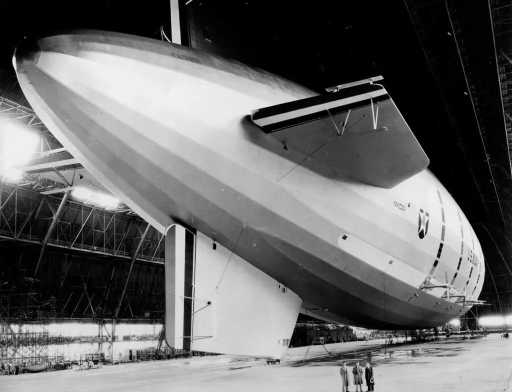
A research submersible searching Monterey Bay for marine life instead found the wreckage of a massive 1930s airship.
The USS Macon, a helium-filled Navy airship, crashed into the Pacific off California in 1935. Decades later, in 1990 and again in 2005, marine researchers using ROVs originally deployed for biological surveys in Monterey Bay stumbled onto scattered wreckage on the seafloor, including intact fighter planes the airship had carried.
The debris field includes some of the only surviving examples of a rare 1930s biplane, preserved because the airship’s crash scattered them across the deep, oxygen-poor seabed. It’s a bizarre reminder that America once experimented with flying aircraft carriers – an idea most people today have never even heard existed. In the Arctic, one of history’s most famous cold cases was finally about to crack.
#26 – HMS Erebus
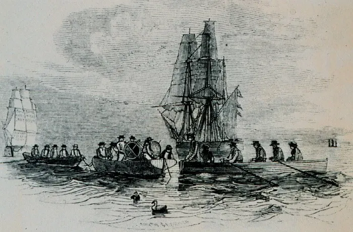
A search team following Inuit oral histories for a 170-year-old mystery finally accidentally located one half of one of history’s most famous doomed expeditions.
Sir John Franklin’s ships vanished in the Arctic in 1845 while searching for the Northwest Passage. In 2014, a Parks Canada-led search team relying partly on centuries-old Inuit testimony finally located HMS Erebus, sitting remarkably well-preserved in shallow Arctic water after being missed by dozens of previous search attempts.
The wreck’s location matched Inuit accounts passed down for generations, accounts that had been largely dismissed by earlier European search parties. Its rediscovery corrected 170 years of assumptions and validated oral history that mainstream expeditions had ignored for over a century. Two years later, the same lead paid off again, in a spot nobody had prioritized.
#27 – HMS Terror
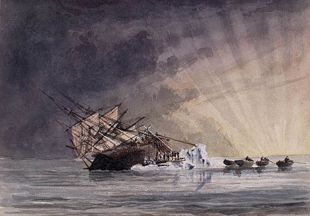
Just two years after finding Erebus, the same broader search effort stumbled onto the second missing Franklin ship in a location nobody had prioritized.
In 2016, searchers exploring an area of Nunavut’s Terror Bay – following a tip from an Inuit crew member rather than official expedition records – found HMS Terror sitting almost perfectly upright, remarkably intact after more than 170 years underwater.
Interior compartments remain sealed, meaning artifacts inside may still be perfectly preserved after nearly two centuries. Many historians now argue that if researchers had trusted Inuit accounts decades earlier instead of dismissing them, both ships could have been found generations sooner. It’s a controversial but increasingly accepted opinion in modern Arctic archaeology. Back near Antikythera, one famous wreck was about to reveal it had a neighbor.
Quick Compare
- HMS Erebus: found 2014, shallow water, led by Inuit testimony
- HMS Terror: found 2016, Terror Bay, nearly upright with sealed interiors
- Both vanished in 1845 and sat undiscovered for over 170 years
- Both were ultimately found by trusting Inuit oral history over official records
#28 – The Second Antikythera Wreck
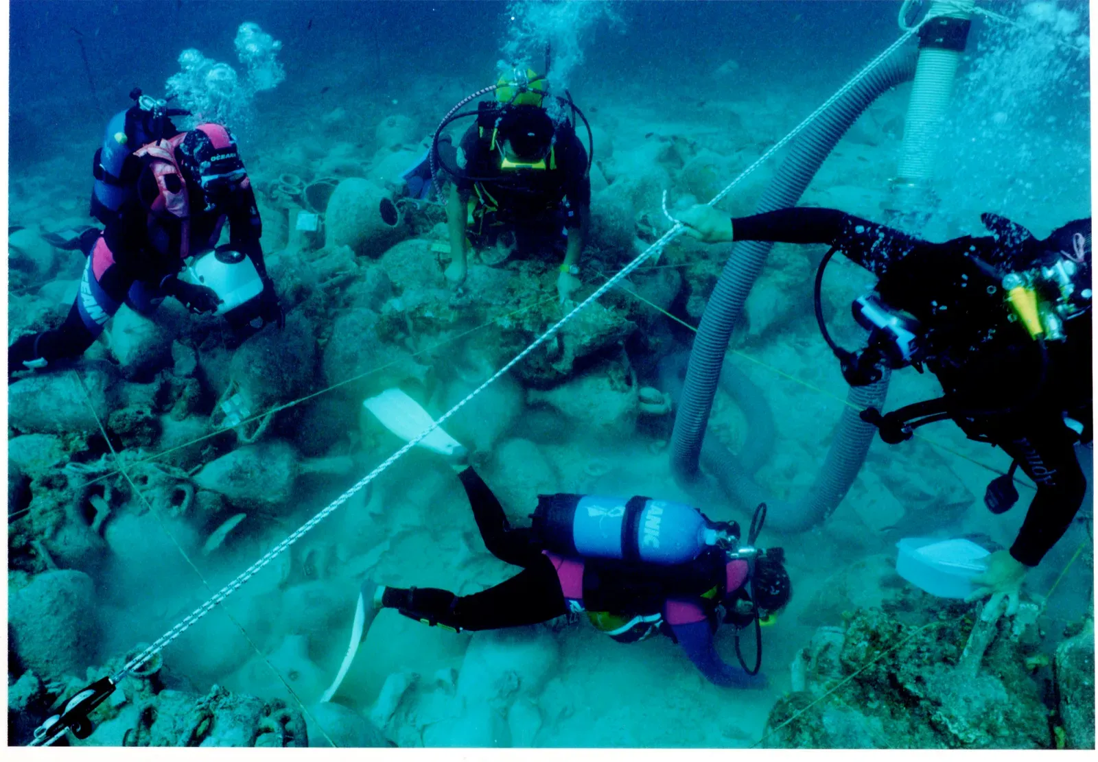
Decades after divers found the famous Antikythera Mechanism, archaeologists returned for routine site mapping and found an entirely separate shipwreck nearby.
In 2014, marine archaeologists conducting standard survey work around the original Antikythera wreck site detected a second, previously unknown shipwreck resting close by, loaded with its own cargo of ancient artifacts.
Two Roman-era ships apparently sank in almost the exact same spot, likely centuries apart, purely by geographic coincidence. The find wasn’t the goal of the mission – researchers were simply re-surveying known terrain when sonar flagged an anomaly nobody expected. It’s forced historians to reconsider just how heavily trafficked, and dangerous, that stretch of the Aegean really was. High in the Andes, a water-quality check was about to turn up ruins from a civilization most people have never heard of.
#29 – Lake Titicaca’s Underwater Ruins
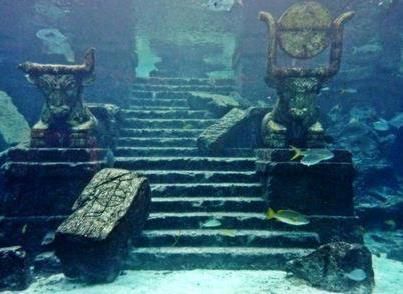
Divers researching water quality in one of the world’s highest lakes instead found stone structures tied to a pre-Incan civilization.
Teams surveying Lake Titicaca, straddling Bolivia and Peru, for unrelated environmental and archaeological cataloging discovered submerged temple platforms, agricultural terraces, and even ceremonial artifacts believed to be linked to the Tiwanaku civilization, dating back over a thousand years.
Some of the underwater terraces sit at over 12,000 feet above sea level, making it one of the highest-altitude underwater archaeological sites on Earth. The submersion likely happened gradually as ancient water levels rose over centuries. Local researchers argue the site remains dramatically understudied compared to its land-based counterparts nearby. In Belize, a documentary shoot was about to prove something far bigger than good television.
#30 – The Great Blue Hole’s Hidden Cave System
![#30 - The Great Blue Hole's Hidden Cave System (Source: [1], fetched September 2006. Caption on this USGS web page was, "Blue Hole: Aerial view of the 400-ft-deep oceanic blue hole (Lighthouse Reef Atoll Blue Hole) located east of Belize.", Public domain)](https://nvmwebsites-budwg5g9avh3epea.z03.azurefd.net/dws/8ae6d56db3b95aed5b0a6adb4ccea07a.webp)
A team diving for a documentary about ocean sinkholes instead confirmed the existence of an ancient dry cave system buried beneath Belize’s coastline.
Submersible expeditions exploring Belize’s famous Great Blue Hole – originally intended to map general sinkhole geology – discovered massive stalactites deep inside the hole’s walls, formations that can only form in dry air, not underwater.
Those stalactites prove the entire structure was once an above-ground cave system before rising sea levels flooded it thousands of years ago. The expedition wasn’t searching for proof of ancient sea-level change specifically – it stumbled onto the evidence simply by mapping the hole’s interior more thoroughly than anyone had before. It’s now considered one of the clearest physical records of prehistoric sea-level rise anywhere in the world. And the very last entry on this list didn’t need a submersible, a sonar rig, or a research grant at all.
#31 – Olous, the Sunken City of Crete
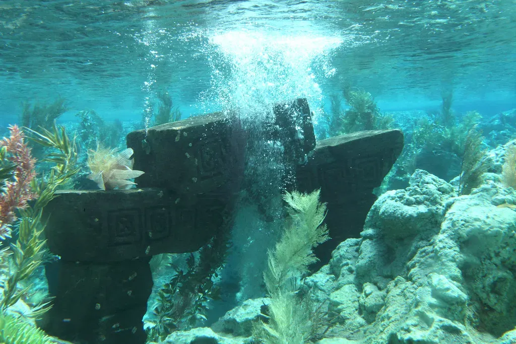
Snorkelers enjoying a routine swim off Crete’s coast accidentally floated directly over the remains of an entire ancient Greek city.
Near the town of Elounda, casual swimmers and snorkelers noticed stone wall outlines and mosaic fragments visible through shallow, crystal-clear water. What they’d stumbled onto was Olous, a once-thriving ancient Greek city-state that slowly sank due to earthquakes and gradual coastal subsidence over roughly 1,500 years.
Locals had reportedly known about faint shapes in the water for generations before archaeologists formally confirmed the site’s identity. No sonar survey or funded expedition found it first – ordinary tourists floating on the surface did. It remains one of the few major underwater ruins accessible to anyone with a snorkel and a sense of curiosity, no scuba certification required.
The Bottom Line
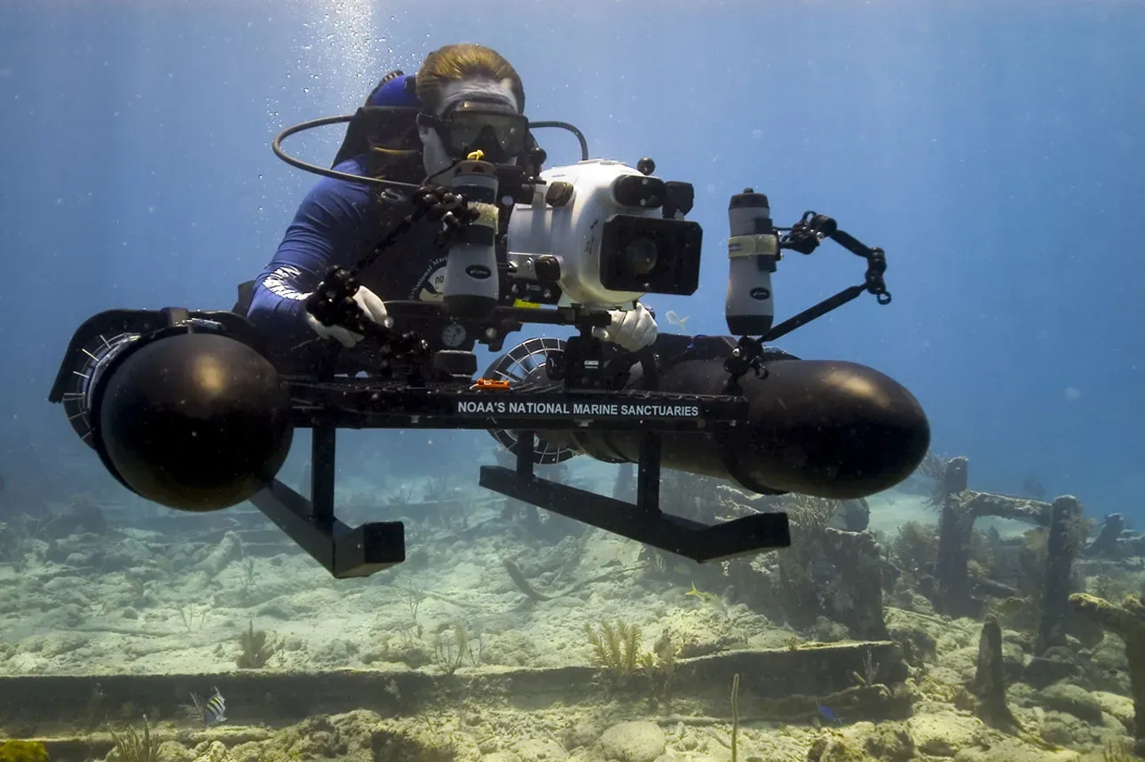
Across three continents and thousands of years, the pattern never changes: nobody was actually looking for most of these structures. A shark-watching dive turned into Japan’s most debated monument. A dam project accidentally preserved a Chinese city better than any museum could. Lobster fishermen rewrote British prehistory. Even Inuit oral history – dismissed for over a century – ended up outperforming official European search parties equipped with better funding and better maps.
That’s the part that should actually bother us. We’ve spent more money mapping the surface of Mars than the floor of our own oceans, and yet the accidents keep piling up faster than the funded expeditions. The ocean isn’t hiding these things on purpose – we just haven’t bothered to look properly, and after 31 examples of pure dumb luck rewriting history, that’s starting to feel less like coincidence and more like an indictment.