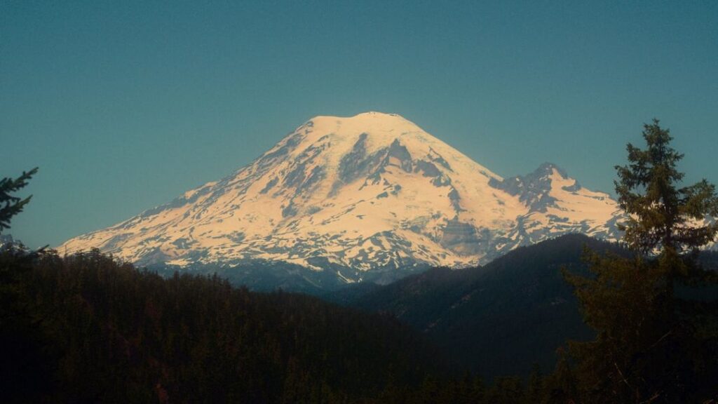
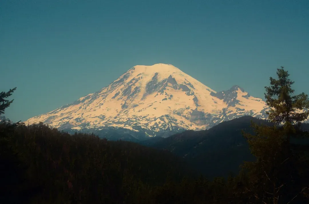
Stand on a clear summer day in Seattle, look south, and Mount Rainier fills the horizon like a frozen titan. From a distance, it still looks timeless, a gleaming white pyramid that seems too big, too cold, and too old to change. But up close, scientists are documenting something far less comforting: the mountain’s ice is thinning, its glaciers are pulling back, and the pace of that retreat is outstripping what many models predicted only a couple of decades ago.
This is not just a sad story about vanishing ice. On Rainier, losing glaciers also means destabilizing rock walls, overloading valleys with loose sediment, and priming the landscape for sudden, violent debris flows that can roar down river channels toward roads, campgrounds, and communities. The unsettling twist is that the mountain can look perfectly calm right up until it is not. Understanding what is happening to Rainier’s ice is not just a scientific puzzle; it is a matter of practical safety for everyone who lives, works, or plays in its shadow.
A shrinking ice giant: what’s actually happening to Rainier’s glaciers?
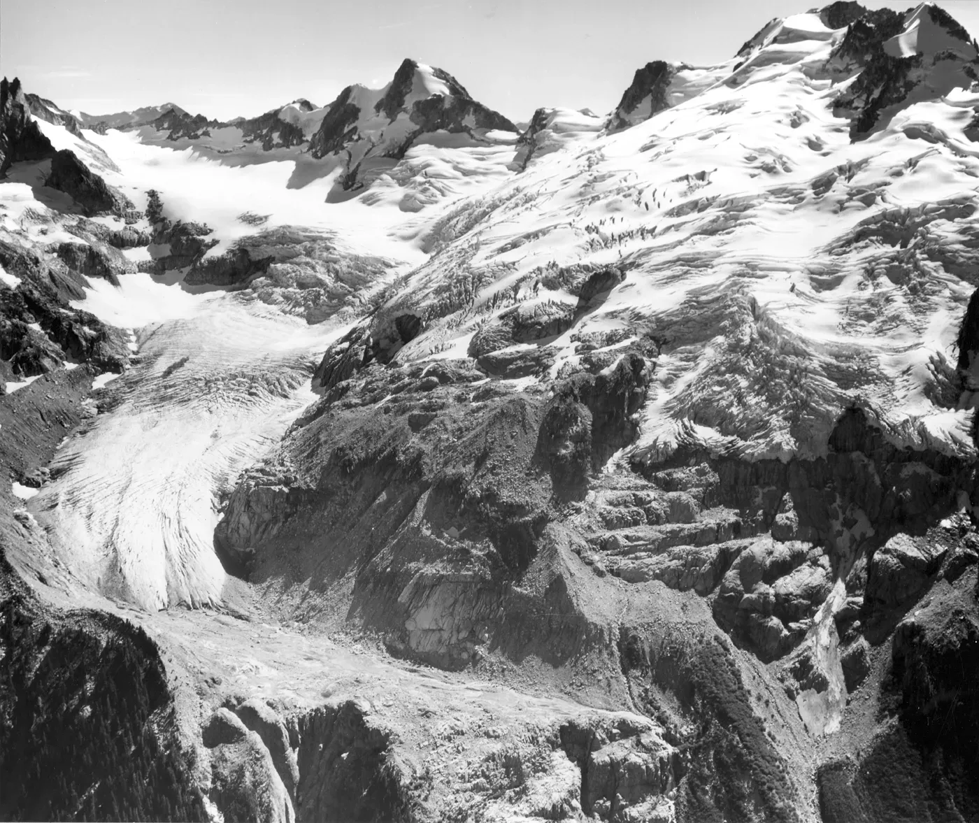
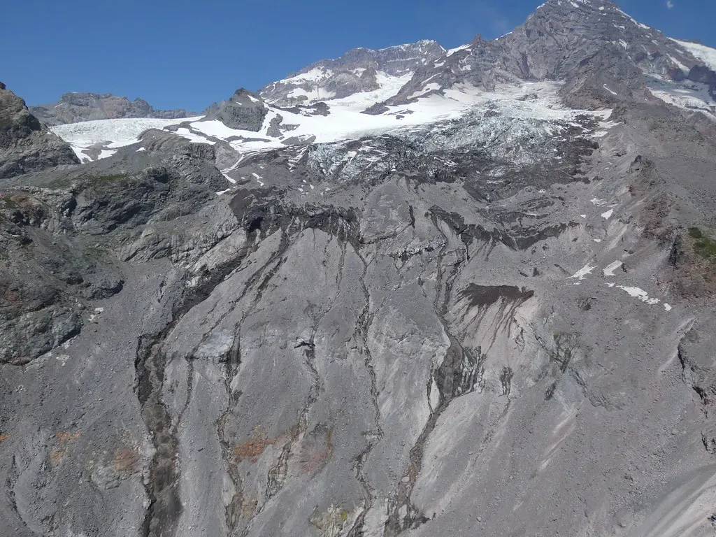
Mount Rainier is one of the most heavily glaciated peaks in the lower forty‑eight United States, yet its cloak of ice is steadily unraveling. Over the past several decades, careful measurements and repeated aerial and satellite surveys have shown that nearly all of Rainier’s major glaciers are losing mass and retreating uphill. In many cases, the ice has thinned by tens of meters and pulled back hundreds of meters from positions mapped in the mid‑twentieth century, and in some smaller cirques the ice has already vanished entirely.
What has surprised many researchers is not simply that the glaciers are retreating, but how quickly some of them are responding to a warmer climate. Warmer summers, milder winters, more rain and less snow, and an overall shrinking snowpack mean glaciers are being fed less and melted more, year after year. When you add in extreme heat events and longer melt seasons, the balance tips even further. Instead of slowly adapting over centuries, Rainier’s ice is changing on the scale of a single human lifetime, and in some cases faster than earlier projections suggested.
Why faster glacial retreat matters for debris flows
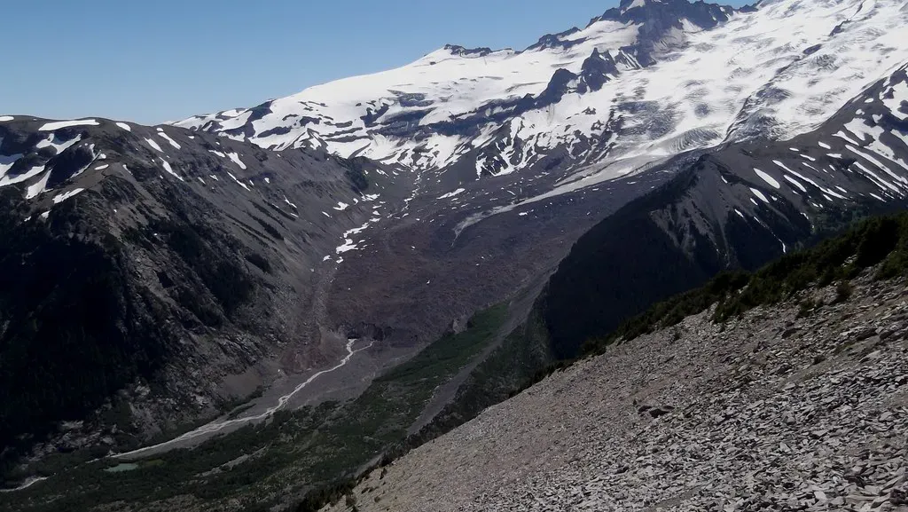
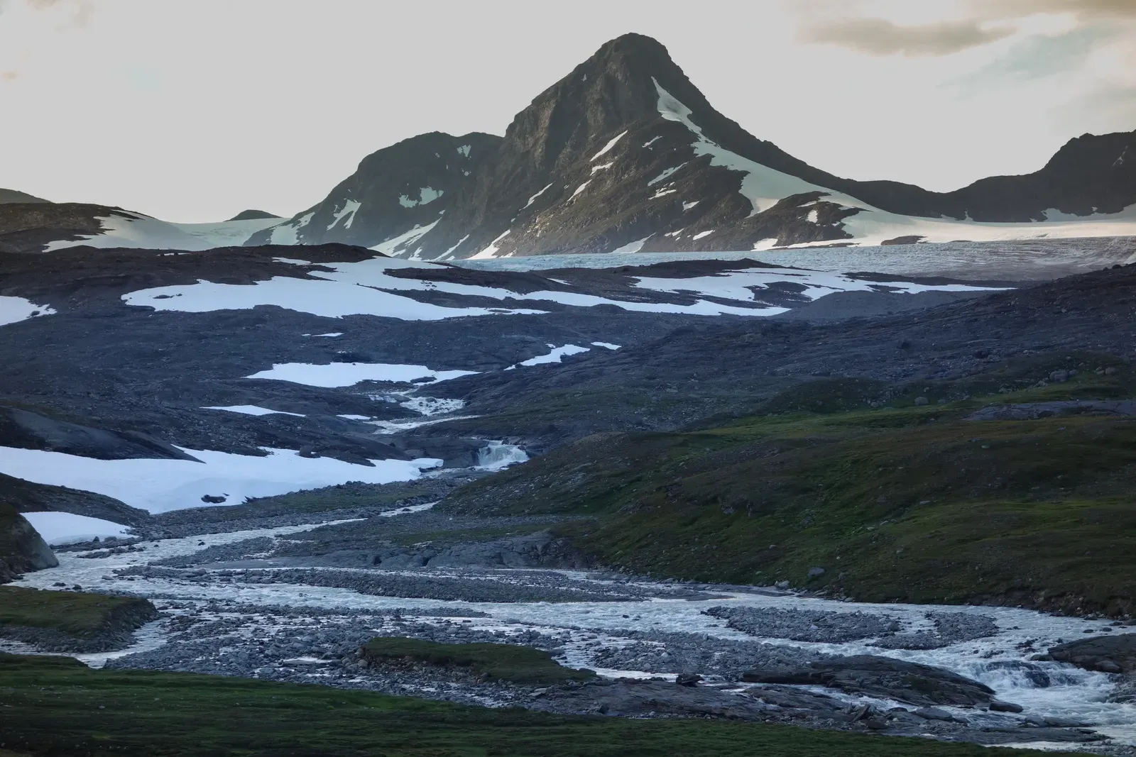
At first glance, it might seem like melting glaciers would simply mean more water in streams, not dramatic, muddy floods. But glaciers do much more than store frozen water; they also act like structural glue, holding loose rock, ash, and older landslide debris in place on steep slopes. As the ice thins and pulls back, that stabilizing effect weakens. Large areas of freshly exposed, unconsolidated sediment are left behind, often perched on over‑steepened valley walls or piled in thick layers on valley floors.
This is the raw material for debris flows: a mix of rock, mud, and water that can behave more like wet concrete than like a normal stream. When intense rainstorms, rapid snowmelt, glacial outburst floods, or even small slope failures hit these sediment‑choked zones, they can mobilize enormous volumes of material in a matter of minutes. In other words, faster retreat is not just a number on a climate graph; it translates directly into more unstable slopes and more easily triggered, potentially larger debris flows racing down the mountain’s flanks.
How debris flows form and why Rainier is especially prone to them
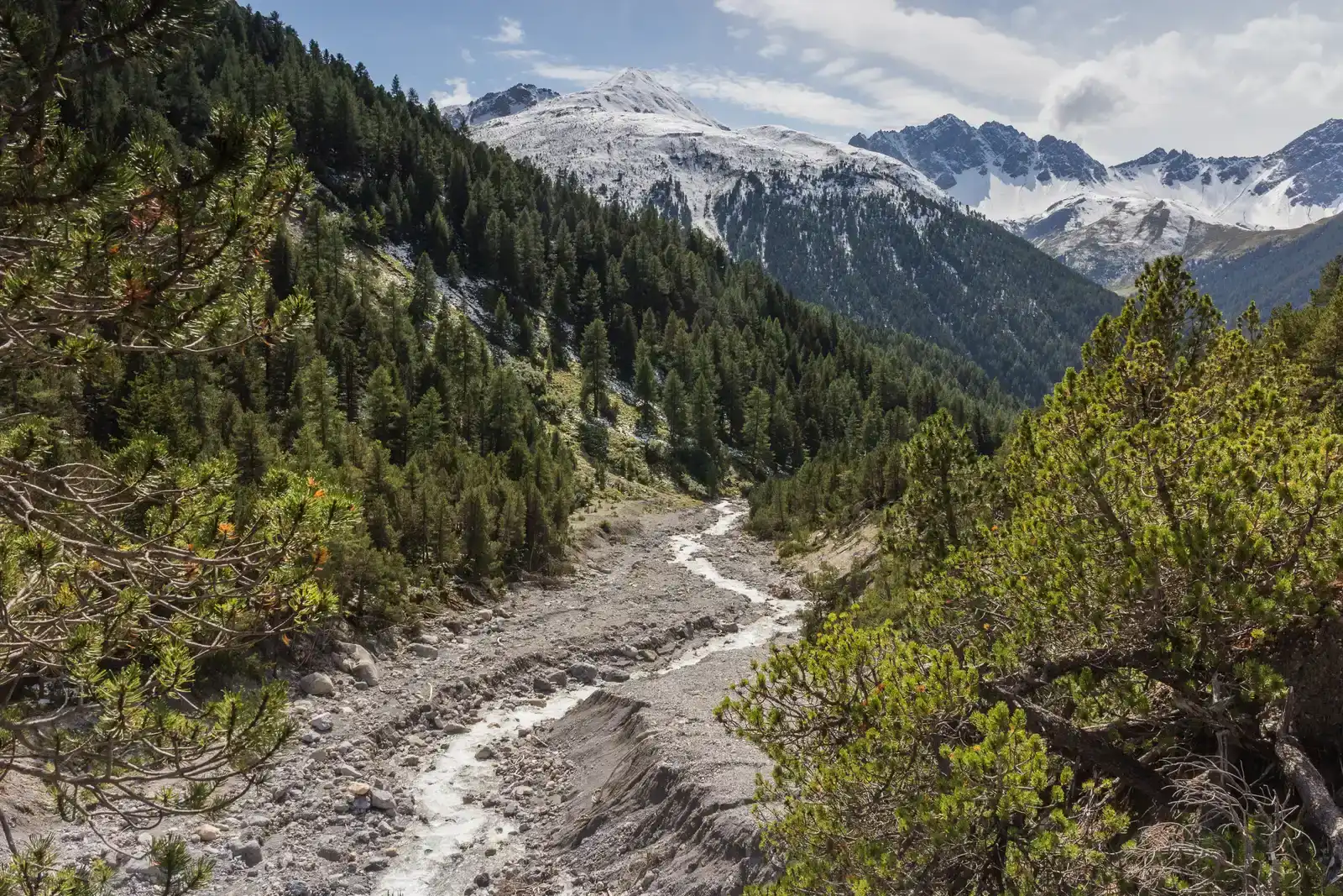
Debris flows often begin quietly. A heavy rain saturates loose volcanic ash and glacial till, a small gully collapses, or a meltwater stream undercuts a bank of sediment. Once enough material starts to move, it picks up speed, scooping more rock and mud as it goes. Within a short distance, a trickle can become a churning, dense flow capable of moving boulders the size of cars, snapping trees, and scouring valley bottoms down to bedrock. Unlike clear water floods, debris flows can arrive as a thick wall of sediment, with a front edge that behaves more like a bulldozer blade than a wave.
Mount Rainier is uniquely primed for these kinds of events. The mountain is built from layers of volcanic rock and ash, much of which weathers into weak, easily eroded material. Its glaciers carve steep‑walled valleys and leave behind massive moraine deposits and fan‑shaped sediment piles at valley mouths. When you combine that geology with heavy Pacific Northwest rainstorms, warming‑driven glacier retreat, and a history of past lahars and debris flows, you get a landscape where the question is less whether debris flows will happen and more how big they might be and where they will go.
Heat, rain, and climate: the drivers behind the accelerating change
Climate change is not a vague backdrop in this story; it is the main driver speeding up Rainier’s ice loss. Regional observations show warmer average temperatures, earlier spring snowmelt, and more precipitation falling as rain instead of snow, especially at mid‑elevations where many of Rainier’s glaciers are nourished. When mountain snowlines climb higher in winter, glaciers receive less fresh snow to compact into ice. At the same time, warmer summers lengthen the melt season, so the glaciers are losing mass for more days each year than they used to.
On top of these gradual shifts, extreme events are becoming more influential. Multi‑day heat waves can turbocharge melt, sending surges of glacial runoff downvalley. Intense rainstorms, especially those landing on snow or ice, can trigger sudden melt spikes and rapidly saturate newly exposed sediments. As someone who has watched snow vanish almost overnight during a warm, rainy winter storm in the Cascades, it is jarring to realize that what feels like an odd weather swing is actually part of a broader pattern nudging the mountain’s systems closer to their limits.
Communities, roads, and trails in the path of potential flows
When we talk about debris flows, it is easy to picture remote alpine gullies far from human activity. In reality, many of Mount Rainier’s major river valleys host highways, bridges, campgrounds, and popular hiking routes. Roads like those following the Nisqually, White, Carbon, and Puyallup Rivers are lifelines for tourism and local access, yet they also sit in low‑lying areas that past flows have reached. Even relatively small debris flows can bury roads in thick deposits, damage culverts, or reroute channels, sometimes in just a single storm.
Downstream, the risk becomes more complex. Towns and infrastructure in the broader river valleys are far from the summit, but not necessarily far from lahar and debris‑flow pathways mapped from past events. The idea that a mountain many people only visit for day hikes could send a muddy surge through communities hours away feels almost unreal, which is precisely why it is uncomfortable to talk about. Still, ignoring that reality because it is unsettling would be a mistake; the combination of faster glacier retreat and expanding development means the exposure is real, even if the exact timing of large events remains uncertain.
How scientists are tracking change and improving early warning
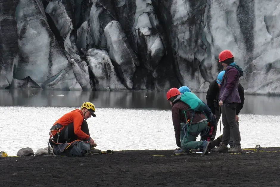
To make sense of all this, scientists are throwing almost every modern tool they have at Mount Rainier. High‑resolution satellite imagery and repeat aerial photography track changes in glacier length and area over time. Laser‑based mapping from aircraft, along with ground‑based surveys, captures subtle shifts in terrain, showing where valleys are filling with new sediment or where slopes are becoming over‑steepened and unstable. Stream gauges measure how water and sediment pulses move downstream after warm spells or storms, giving clues about how quickly the system responds to different triggers.
Beyond mapping, there is a growing focus on monitoring and early warning. Seismic sensors can detect the rumble of a large debris flow starting high on the mountain, and automated gauges can sense abrupt changes in water level or turbidity. In some drainages, experimental systems aim to send alerts when unusual signals appear, buying precious minutes for closure of roads or evacuation of vulnerable areas. The technology is not perfect and certainly not a guarantee of safety, but it is a crucial bridge between abstract scientific understanding and practical, on‑the‑ground action.
Rethinking risk, responsibility, and what we owe places like Rainier
It is tempting to think of Mount Rainier’s changing glaciers and rising debris‑flow risk as inevitable side notes in a global climate story that is too big for any one person to influence. But that mindset quietly lets us off the hook. The truth is that the greenhouse gases driving these rapid changes come from a tapestry of choices, from energy systems to land use to how often we fly or drive. We cannot control when the next major debris flow will occur, but we absolutely can influence how fast the mountain’s ice continues to unravel and how prepared we are when nature reminds us who is really in charge.
In my view, the uncomfortable reality is also a call to be braver and more honest about risk. We need land‑use decisions that respect known lahar and debris‑flow paths, park infrastructure designed with future extremes in mind, and climate policies that take seriously what is already visible on Rainier’s flanks. Pretending the mountain is static is a comforting illusion; facing its instability head‑on is harder, but also more respectful. Maybe the real question is not whether Rainier is becoming more dangerous, but whether we are willing to change fast enough to match the pace of a warming world. Did you expect a quiet snow‑capped peak to be such a loud warning bell?