When most people picture the ancient Americas, they think of the Maya pyramids, Inca roads, or Aztec temples – and then the story seems to stop. But archaeologists are now uncovering a far stranger, richer picture: a hemisphere filled with cities in the rainforest, coastal engineering projects on foggy desert shores, and complex societies that rose and fell long before European contact. New dating methods, satellite imagery, and underwater surveys are dragging these “missing civilizations” out of obscurity. What we thought were isolated ruins or odd mounds are turning out to be the scattered footprints of once-thriving cultures. The deeper scientists dig, the more the standard textbook version of American prehistory starts to look shockingly incomplete.
The Hidden Clues: Caral and the Forgotten Cities of Peru’s Desert Coast
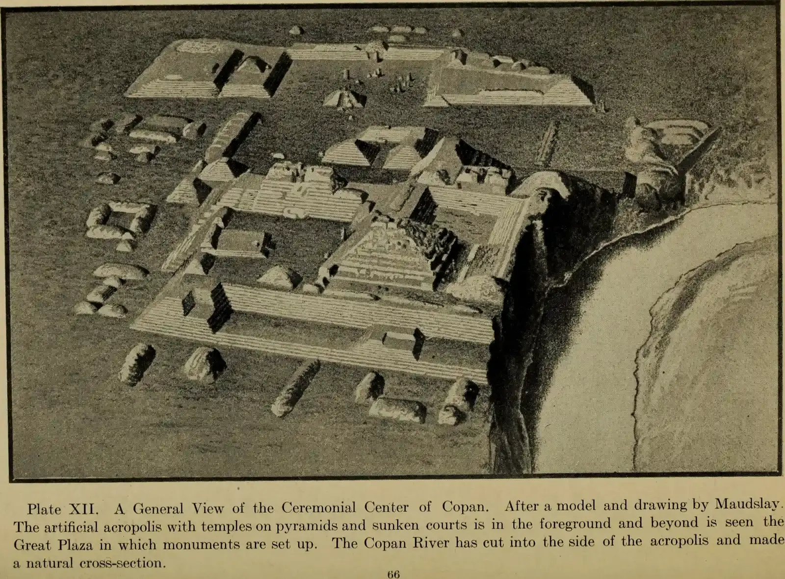
About 5,000 years ago, while the pyramids of Egypt were still under construction, a very different kind of pyramid city rose in the coastal valleys of what is now Peru. Today we call its best-known center Caral, a sprawling complex of sunken plazas and stepped pyramids built by a civilization often described as one of the earliest in the Americas. From a distance, the ruins look like weathered hills, and for decades that is exactly what many people assumed they were. Only careful excavation revealed planned architecture, ceremonial platforms, and evidence of large gatherings that reshaped how archaeologists think about social complexity in South America.
Caral’s people farmed cotton and crops in an arid landscape, using river irrigation instead of massive stone fortifications or weapon caches to hold their society together. Researchers have found flutes made from condor and pelican bones, suggesting that music and ritual were central to civic life, even in the absence of obvious signs of warfare. The city’s layout, with plazas that seem ideal for mass ceremonies, hints at a society organized around shared religious and political events. In a way, Caral is a quiet rebuke to the idea that early civilizations must be driven by kings, conquest, and constant conflict. It reminds us that even the world’s first cities could be powered as much by gatherings and belief as by blades and blood.
Buried in the Amazon: The Marajoara Culture of the River Islands
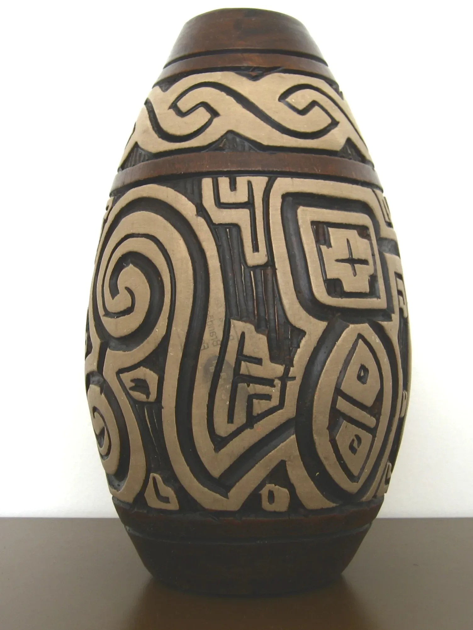
Ask someone to imagine the pre-contact Amazon, and they will probably picture scattered villages hidden beneath endless trees. The Marajoara culture of Brazil’s Marajó Island turns that stereotype on its head. Long before European arrival, people there were building enormous earthworks, engineered mounds, and water channels on land that floods seasonally. Archaeologists have uncovered intricate pottery decorated with bold, swirling motifs and human and animal figures that suggest a rich symbolic world. These finds point to an organized society capable of large-scale planning in a landscape many once dismissed as too fragile for dense populations.
Instead of battling the river, the Marajoara appear to have worked with it, reshaping flooded zones into fish ponds, raised fields, and habitable platforms. Soil analyses show that they deliberately enriched the ground, turning soggy terrain into productive farmland over generations. In some sites, burial mounds filled with elaborate ceramics reveal social differences and possibly hereditary elites. Yet this civilization almost vanished from public awareness after European diseases and disruptions devastated the region. The Marajoara story challenges the old notion that the Amazon was a “pristine wilderness,” suggesting it was more like a vast, managed garden crafted by millions of human hands.
Engineers of the Dunes: The Chimú Empire Before the Incas
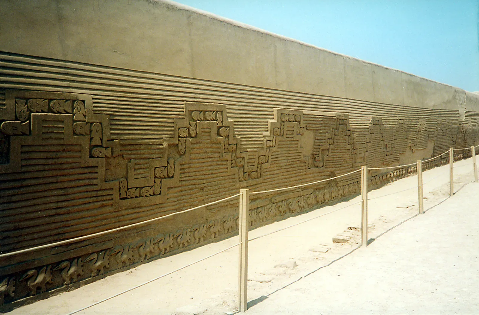
Along Peru’s northern coast, the Chimú built one of the largest adobe cities on the planet at Chan Chan, and yet most people outside archaeology circles barely recognize their name. Their capital spread across the desert in a maze of high mud-brick walls, courtyards, reservoirs, and storehouses, shimmering in the coastal sun like a mirage. From this base, the Chimú controlled a narrow but fertile strip between the Pacific Ocean and the Andean foothills, relying on an astonishing network of canals. These irrigation systems captured water from distant rivers and redirected it across dry plains, effectively manufacturing an agricultural landscape out of sand.
Chimú artisans were famous for black metalwork, textiles, and shell ornaments that moved along long-distance trade routes. Some of their compounds appear to have been dedicated to craft specialists, with standardized designs hinting at state control over production and labor. The empire eventually fell to the expanding Inca, and later the Spanish, but not before leaving a physical and cultural blueprint that later rulers studied and absorbed. In the layered adobe walls and reshaped river valleys, scientists see a society pushing the limits of what is possible in one of the driest coastal deserts on Earth. It is a sobering example of both human ingenuity and ecological vulnerability in a world increasingly shaped by climate stress.
Mountains of Mounds: The Mississippian Cities of North America
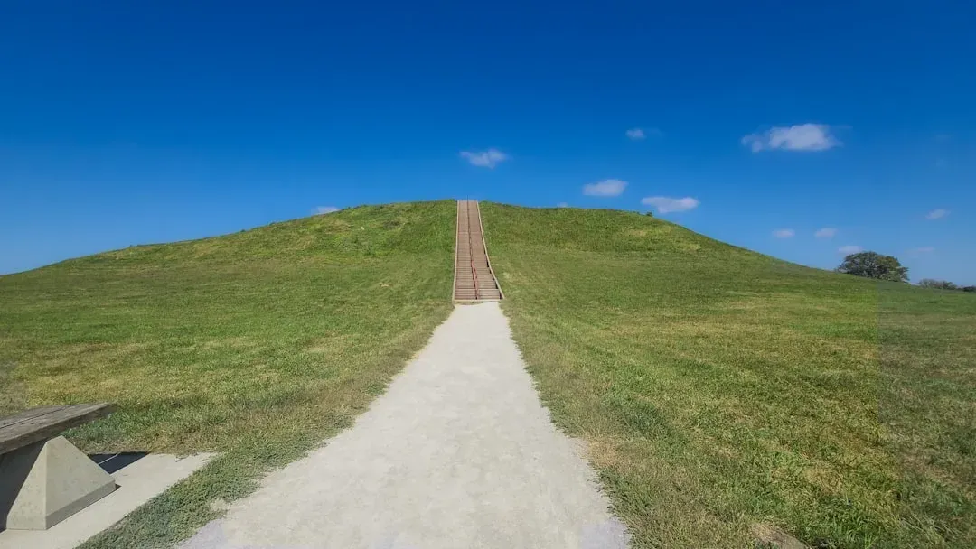
In the floodplains of the Mississippi and its tributaries, massive earthen mounds rise above the fields, often within sight of highways and parking lots. Many Americans drive past them without realizing they are skirting the ruins of pre-contact cities as impressive, in their own way, as medieval European towns. The Mississippian culture, which flourished roughly about a thousand years ago, built platform mounds, plazas, and palisades from the Great Lakes down to the Gulf Coast. Its largest known center, Cahokia near present-day St. Louis, boasted monumental earthworks, wooden circles that may have functioned like solar observatories, and neighborhoods arranged around open ceremonial spaces.
What makes the Mississippian world so intriguing is how it blurs the lines between city, temple, and farm. Archaeologists have found evidence of long-distance trade in copper, shells, and finely worked stone, along with signs of hierarchical leadership and complex religious symbolism. At the same time, maize agriculture tied communities closely to river soils and seasonal cycles. As the network fragmented, new regional centers rose and fell, leaving scattered mounds that later settlers sometimes leveled or ignored. The surviving earthworks are more than grassy hills; they are compressed histories of urban experiments on a continent many still imagine as sparsely populated before colonization.
Islands of Stone: The Taíno Chiefdoms of the Caribbean
Long reduced in popular imagination to a brief prelude to Columbus, the Taíno societies of the Caribbean were far from simple or marginal. On islands like Hispaniola, Puerto Rico, and Cuba, they built plazas ringed by carved stones, cultivated cassava fields, and linked villages into networks under powerful chiefs. Ball courts, lined with upright monoliths and engraved figures, served as arenas not only for sport but for ritual and diplomacy. These were places where politics, religion, and community life converged in ways that left a subtle but enduring mark on island landscapes.
Archaeologists and anthropologists now highlight that Taíno communities practiced sophisticated agroforestry, mixing crops, fruit trees, and managed wild resources to cushion themselves against hurricanes and droughts. Their navigation skills allowed them to move between islands in canoes, maintaining trade routes and kinship ties across open water. The arrival of Europeans led to catastrophic population loss, but it did not erase Taíno cultural threads that survive in languages, foods, and local traditions. For many Caribbean people today, renewed research on Taíno sites is not just about filling gaps in academic knowledge. It is about reclaiming a history that was once written off as a footnote to someone else’s “discovery.”
From Sunken Plazas to Satellite Maps: The Tiwanaku Sphere Around Lake Titicaca
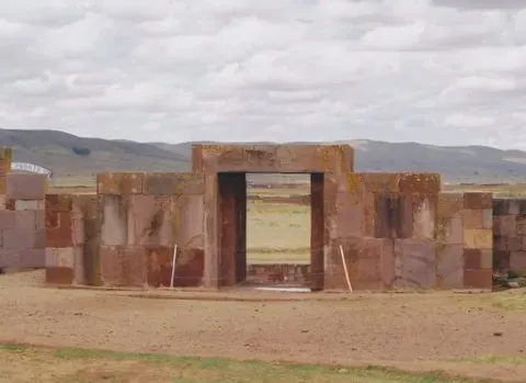
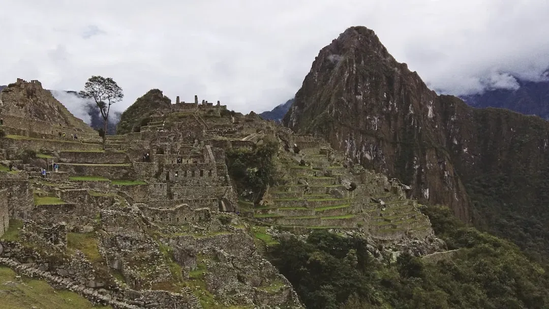
High in the Andes, near the shores of Lake Titicaca, lie the monumental remains of Tiwanaku, a civilization that predates the Inca and once anchored a vast cultural sphere. Its stone gateways and sunken courtyards have long impressed visitors, but only recently have researchers begun to map the full extent of its influence. Using satellite imagery, drone surveys, and ground-penetrating radar, scientists are identifying terrace systems, ritual centers, and road networks that radiated outward from the heartland. What once looked like a cluster of isolated ruins is starting to resemble a coordinated landscape shaped by shared ideas and political power.
Tiwanaku’s farmers mastered high-altitude agriculture by building raised fields and canals that buffered crops against nighttime frost, a technique some agronomists have tried to revive in response to modern climate change. Ceramic styles and religious motifs associated with Tiwanaku spread across hundreds of kilometers, suggesting a blend of trade, pilgrimage, and political alliances rather than simple conquest. When the system eventually collapsed, likely under the pressure of environmental shifts and social upheaval, successor cultures inherited both infrastructure and iconography. The story unfolding around Lake Titicaca underscores how much of ancient political life played out not only in palaces but also in the design of fields, waterways, and sacred routes etched into the earth.
Why These “Unknown” Civilizations Matter More Than We Think
The fact that many people have never heard of Caral, the Marajoara, or the Chimú is not just a random oversight; it reflects how history has been filtered through colonial narratives and narrow educational priorities. School lessons often compress the pre-contact Americas into a handful of “major” civilizations, as if the rest of the hemisphere were a blank stage waiting for Europeans to arrive. That framing quietly suggests that complexity, science, and urban life were rare exceptions rather than widespread patterns. When archaeologists demonstrate that dozens of regions supported dense populations, advanced engineering, and intricate belief systems, they are not only revising a timeline. They are challenging deep-rooted assumptions about who counts as a maker of civilization.
There is also a scientific cost to ignoring these societies. Their innovations in water management, agroforestry, soil building, and climate adaptation offer real-world case studies for a planet now facing escalating environmental crises. Lessons from raised-field agriculture in the Andes or engineered floodplains in the Amazon can inform modern strategies for resilient farming. Likewise, understanding how Mississippian cities rose and fragmented can refine models of urban growth and collapse used by historians and climate scientists. Paying attention to “forgotten” civilizations, in other words, is not simply an act of belated respect; it is a way to widen our toolkit for understanding the past and navigating the future.
The Future Landscape: New Technologies, Old Landscapes, and What Comes Next
Right now, some of the most dramatic discoveries about these civilizations are unfolding not with shovels but with lasers and algorithms. Aerial lidar, which can peel away forest cover virtually, has revealed buried causeways, geometric earthworks, and settlement grids in places once written off as empty. High-resolution satellite imagery and machine learning tools are scanning floodplains, deserts, and islands for subtle patterns that hint at human modification. Each new map layer has the potential to promote a minor culture from the margins of a footnote to the center of a new chapter in American prehistory. In many cases, archaeologists are racing to document fragile sites before modern development or climate-driven erosion wipes them away.
At the same time, debates about how to interpret these findings – and who should control them – are getting louder. Indigenous communities are increasingly involved in research design, fieldwork, and decisions about what should be excavated or left undisturbed. That shift raises hard questions that science can no longer avoid, from repatriation of artifacts to the ethics of probing sacred places. Funding priorities, political instability, and environmental threats will shape which stories get told and which remain literally underground. The future of discovering ancient American civilizations will depend as much on partnerships and respect as on any breakthrough sensor or software. For those of us watching from the outside, the most honest prediction is that the map of the past will keep changing, and it will keep surprising us.
How You Can Engage with These Hidden Histories
Engaging with these lesser-known civilizations does not require a degree in archaeology or a plane ticket to Peru, although both certainly help. One of the simplest steps is to seek out museums, books, and documentaries that highlight pre-contact Americas beyond the usual Maya–Inca–Aztec trio. When you visit historic sites, whether in the United States, the Caribbean, or South America, look for the local Indigenous perspectives and community-led tours that frame ruins as living heritage rather than dead stones. Even something as basic as learning the names – Caral, Marajoara, Tiwanaku, Chimú, Mississippian, Taíno – starts to chip away at the myth of an empty or “simple” pre-Columbian world.
You can also support organizations that work with descendant communities to protect archaeological sites from looting, unchecked tourism, and environmental damage. In classrooms and conversations, asking why some civilizations make it into the spotlight while others are left in the shadows can open space for more honest histories. For me, the turning point was stumbling across a small exhibit on Amazonian earthworks and realizing that my mental map of the Americas had been missing entire cities. That moment of discomfort was also a kind of invitation: if the past was bigger and stranger than I was taught, what else have we been overlooking? The next time you pass a lonely mound by the road or see a faint geometric pattern in a satellite image, it might be worth wondering whose forgotten city you are really looking at.

Suhail Ahmed is a passionate digital professional and nature enthusiast with over 8 years of experience in content strategy, SEO, web development, and digital operations. Alongside his freelance journey, Suhail actively contributes to nature and wildlife platforms like Discover Wildlife, where he channels his curiosity for the planet into engaging, educational storytelling.
With a strong background in managing digital ecosystems — from ecommerce stores and WordPress websites to social media and automation — Suhail merges technical precision with creative insight. His content reflects a rare balance: SEO-friendly yet deeply human, data-informed yet emotionally resonant.
Driven by a love for discovery and storytelling, Suhail believes in using digital platforms to amplify causes that matter — especially those protecting Earth’s biodiversity and inspiring sustainable living. Whether he’s managing online projects or crafting wildlife content, his goal remains the same: to inform, inspire, and leave a positive digital footprint.