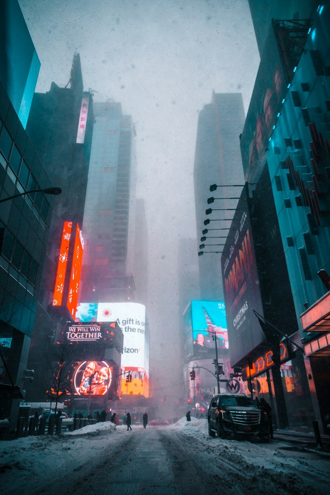
New York likes to pretend it’s weather-proof, but the past decade proved otherwise when several blizzards flipped the world’s noisiest city into a snow-muffled standstill. Streets emptied, subways paused, and airports turned into echo chambers of canceled plans as nor’easters flexed their muscle along the Atlantic corridor. The science behind those shutdowns is as dramatic as the scenes themselves: fast-deepening coastal storms, razor-thin rain–snow lines, and wind fields that turn flakes into white walls. What seemed like surprise plot twists at street level were actually the product of well-mapped atmospheric chess games, sometimes decided by a wobble in the jet stream thousands of miles away. Understanding how and why these storms hit pause on New York isn’t just a look back – it’s a guidebook for the next time the city meets its match.
The Nights the City Stopped

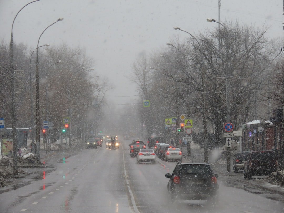
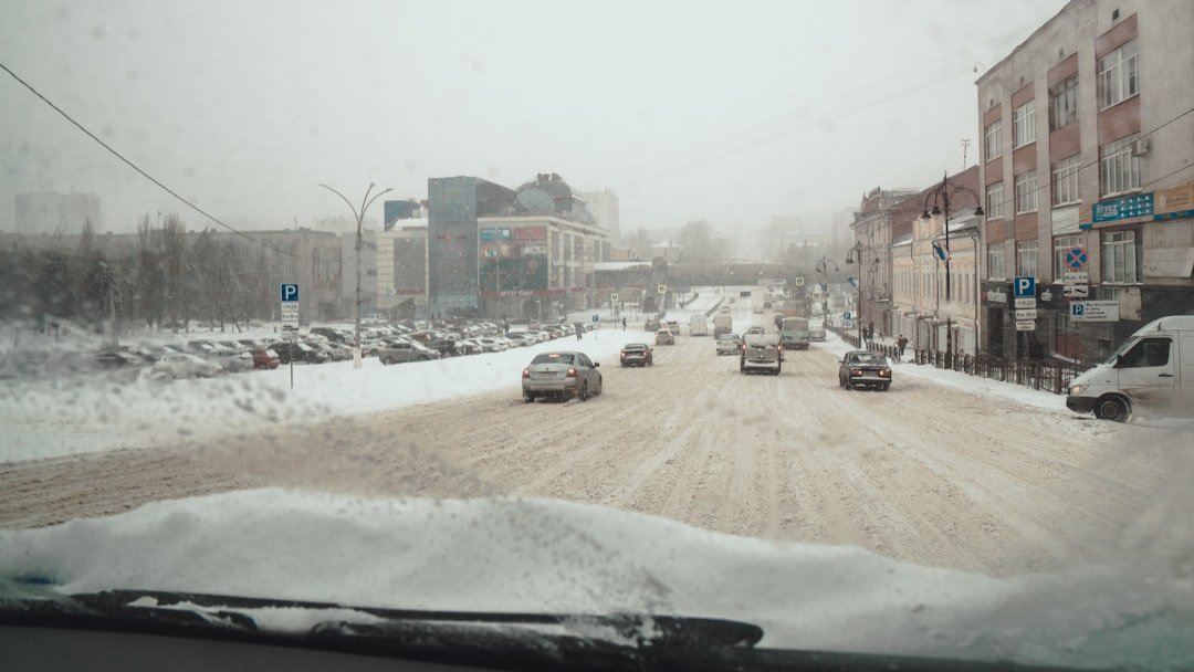
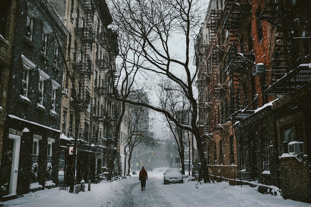
I still remember trudging down a Brooklyn block in January 2016, the city so quiet that snowflakes sounded like static in my ears. That blizzard buried Central Park in more than two feet of snow and prompted sweeping travel restrictions, with buses off the roads and above-ground trains halted while plows formed a silver phalanx down the avenues. A year earlier, in January 2015, a widely anticipated storm led to rare overnight transit suspensions and empty highways, the kind of eerie stillness that only New York can make feel cinematic.
Subsequent winters piled on more episodes: a fast-hitting March 2017 event glazed streets with sleet after a burst of heavy snow, and a bomb-cyclone in early 2018 slammed coastal neighborhoods with fierce winds and near-zero visibility. The city wasn’t defeated so much as strategically paused, its choreography rewritten for safety and cleanup. Schools closed, flights vanished from departure boards, and those legendary corner bodegas became the only open lifelines on entire blocks.
The Hidden Clues
A blizzard isn’t just a snowstorm with attitude; it’s a precise recipe: strong winds, intense snowfall or blowing snow, and visibility shrunk to a quarter mile or less for hours. New York’s most disruptive events usually ride in as nor’easters, coastal lows that siphon ocean heat and moisture, then spin it into sprawling spirals. The result is a turbocharged conveyor belt of snow bands that can park over one borough while leaving another in comparative calm.
The trickiest ingredient is the rain–snow boundary, a narrow zone that can slide a few miles and flip forecasts. Urban heat from buildings and pavement nibbles at accumulations near the core, while a shift in wind direction can yank colder air back in and shut the door. When that happens, sidewalks turn from slush to powder in minutes, and cleanup plans have to pivot just as fast.
From Past Playbooks to Modern Models
Forecasting the shutdown blizzards of the last decade relied on tools that didn’t exist a generation ago. High-resolution models now simulate storm structure street by street, while ensembles map out probabilities instead of pretending there’s only one future. That’s why you’ve seen snowfall “ranges” and “reasonable worst-case” charts – forecasters are showing their math, not hedging their bets.
New York’s decision-makers blend that guidance with ground truth from road sensors, airport observations, and crowdsourced reports. When winds cross that blizzard threshold and rates jump to a couple inches per hour, timing becomes everything: suspend buses before they jackknife, slow trains before switches freeze, and stage plows before the first commuter steps outside. It’s a choreography of risk, and it has gotten measurably sharper.
Why It Matters
Blizzard shutdowns expose the city’s circulatory system: what keeps moving, what gets clogged, and what can’t be allowed to fail. Compared with older playbooks that waited for conditions to deteriorate, modern operations move early to prevent gridlock, reduce crashes, and protect essential workers. That shift has public health consequences too, curbing exposure to hypothermia and carbon monoxide incidents that tend to spike when vehicles idle and vents get buried.
The economic calculus is sobering but clear-eyed. A single day of disruption can ripple through finance, logistics, and hospitality, yet the upfront cost of preemptive closures often beats the price of a chaotic, dangerous commute. The goal isn’t to avoid every snow day; it’s to avoid the wrong kind of snow day.
Data Points from a Turbulent Decade
Each of the big shutdown storms left a measurable fingerprint on the city’s ledgers and memory. The January 2016 blizzard set the second-highest single-storm snowfall total in Central Park’s modern records, paired with sweeping travel limits and swift, around-the-clock plowing. Early 2018’s rapidly deepening coastal storm produced official blizzard conditions in parts of the metro area and a cascade of airport cancellations that stretched for days.
Consider a few grounding numbers and patterns that tell the story at a glance:
– Roughly about one third of major nor’easters that threaten New York in a typical decade will feature brief blizzard-level visibility and wind in at least part of the metro.
– Nearly half of the most disruptive events occur on weekends, when cleanup can accelerate but staffing is more complex.
– The vast majority of citywide transit adjustments happen in the first twelve hours of snowfall, before the heaviest bands peak.
These aren’t absolutes, but they are the statistical nudges behind decisions you feel at street level.
Global Perspectives
New York’s blizzards are local theater with a global script. The jet stream’s winter meanders, nudged by ocean temperatures and polar air reservoirs, set the stage for coastal storm development days in advance. When high pressure locks north of New England and a low rockets up the coast, the city sits near the snowmaking sweet spot – close enough to the ocean for moisture, far enough inland for cold.
Climate signals complicate the picture without erasing extremes. Warmer seas can supercharge moisture supply, yet a warmer baseline atmosphere can push marginal events into mixed precipitation. That paradox explains how the city can slog through a quiet winter, then suddenly endure a blockbuster storm that writes itself into the record book.
The Human Geography of Snow
Shutdowns highlight how unevenly risk is spread across neighborhoods. Coastal stretches face wind-driven snow and flooding, while interior blocks grind to a halt when side streets drift and sidewalk corners pile up. For delivery workers, home health aides, and overnight staff, the difference between a manageable storm and a dangerous one is often a bus route that keeps moving.
Snow equity is a real issue: the speed of plowing, access to heated shelters, and building maintenance all map onto broader patterns of infrastructure investment. Community groups step in where maps fall short, from shoveling stoops for seniors to staffing warming centers. Those small acts are the hidden scaffolding of the city’s resilience.
The Future Landscape
The next decade will bring sharper tools and tougher choices. Street-level forecasts will fuse radar, traffic cameras, and machine learning to predict not just snow totals but hazard hotspots – exact corners where ice will form or drifts will block curb cuts. Drones and truck-mounted sensors could verify conditions in real time, feeding storm rooms with the same granularity you see on smartphone maps.
Policy will have to keep pace. Dynamic congestion pricing, flexible school schedules, and precision alerts can minimize disruption without overreacting. The stakes rise as gig-economy labor, e-commerce, and electrified transit add new dependencies that snow can briefly break – unless we design for graceful slowdown.
How You Can Engage
Prepare for blizzards like you prepare for a big interview: the plan matters more than the nerves. Sign up for city alerts, keep a go-bag with medications and chargers, and treat carbon monoxide detectors as nonnegotiable winter gear. If you can, adopt the nearest fire hydrant and curb ramp – clearing them may save a neighbor you’ll never meet.
Support science with simple acts: share accurate snowfall and road conditions through vetted reporting apps, and donate to community groups that staff warming centers and check on homebound residents. Most of all, respect the pause when it comes; it’s not weakness, it’s strategy. When the city goes quiet under a sky full of static, what would you do with that rare, silver silence?

Suhail Ahmed is a passionate digital professional and nature enthusiast with over 8 years of experience in content strategy, SEO, web development, and digital operations. Alongside his freelance journey, Suhail actively contributes to nature and wildlife platforms like Discover Wildlife, where he channels his curiosity for the planet into engaging, educational storytelling.
With a strong background in managing digital ecosystems — from ecommerce stores and WordPress websites to social media and automation — Suhail merges technical precision with creative insight. His content reflects a rare balance: SEO-friendly yet deeply human, data-informed yet emotionally resonant.
Driven by a love for discovery and storytelling, Suhail believes in using digital platforms to amplify causes that matter — especially those protecting Earth’s biodiversity and inspiring sustainable living. Whether he’s managing online projects or crafting wildlife content, his goal remains the same: to inform, inspire, and leave a positive digital footprint.