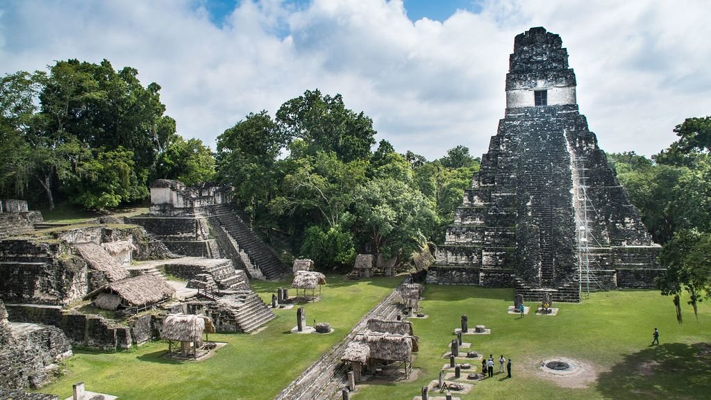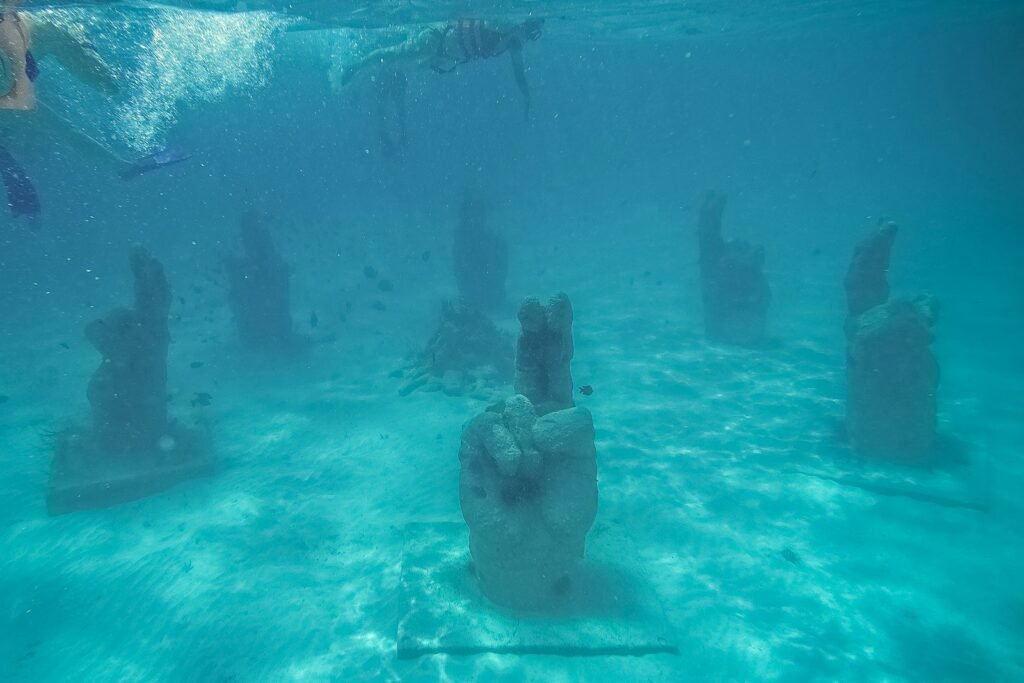
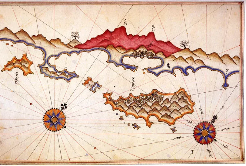
The idea of a city swallowed by the sea sounds like pure myth – Atlantis territory – yet divers and marine archaeologists around the world are mapping real drowned streets, temples, and palaces right now. Advances in sonar, robotics, and 3D imaging are turning murky legends into precise seafloor blueprints, revealing how coastlines, cultures, and even climates have shifted over thousands of years. These places complicate the neat boundaries between land and ocean, reminding us that much of human history lies just out of sight, beneath the waves. At the same time, every new discovery forces scientists to wrestle with a sobering question: how many of today’s coastal cities might share the same fate in a warming world?
The Lost Harbors of Thonis-Heracleion: Egypt’s Drowned Gateway
Not long ago, Thonis-Heracleion was a rumor historians argued about, a city mentioned in ancient texts but missing from maps. Then, in the early 2000s, survey teams scanning the seafloor at the mouth of the Nile picked up ghostly alignments of stone and statue shapes buried in sediment dozens of feet below the surface. Divers soon found colossal granite figures, temple blocks, and even preserved wooden ships lying along what had once been busy quays and canals. The picture that has emerged is of a bustling port city that controlled trade between Egypt and the Mediterranean world for centuries.
Geological studies suggest that a lethal combination of rising sea levels, earthquakes, and unstable delta sediments caused the ground to liquefy and entire districts to sink. Archaeologists have recovered ritual objects, everyday pottery, and tax-related inscriptions that reveal the city’s double life as both religious center and customs checkpoint. Survey teams use sub-bottom profilers and magnetometers to pick out buried walls and harbor basins, then map them with photogrammetry to reconstruct the urban layout. Even now, only a portion of the site has been thoroughly explored, and each season adds new pieces to a puzzle that was missing for more than a thousand years.
Pavlopetri, Greece: A Bronze Age City Frozen in Shallow Water
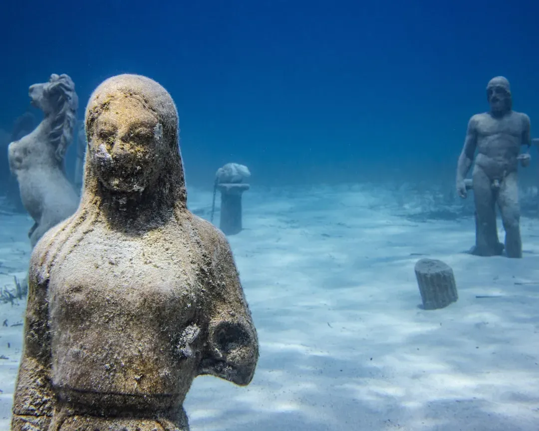
Swim off the coast of Laconia in southern Greece, and you can literally glide over the foundations of an entire prehistoric town in only a few yards of water. Pavlopetri is often described as the world’s oldest known submerged city, with building remains that date back more than four thousand years to the early Bronze Age. The site preserves streets, rectangular houses, courtyard spaces, and even what looks like a town square, all laid out in a surprisingly organized plan. That level of preservation is partly a quirk of luck: the city sank gently, without being smashed apart by waves or buried under huge landslides.
Marine archaeologists have used high-resolution multibeam sonar and diver-held laser scanners to create detailed 3D models of the settlement. Those digital reconstructions let researchers test ideas about population size, trade routes, and social hierarchy without disturbing fragile structures. Sediment cores and microfossils point to gradual sea-level rise and local tectonic movements as the drivers that slowly drowned the town. For many scientists, Pavlopetri has become a benchmark for what coastal Bronze Age urban life looked like in the Aegean, reshaping debates about how early and how densely people built along the sea. It also makes sea-level rise feel uncomfortably tangible; this is what a coastal community looks like after the ocean decides to redraw the shoreline.
Dwarka, India: Myth, Tides, and a Controversial Submerged City
Off the coast of Gujarat, on India’s western edge, a cluster of underwater stone structures has fueled one of the most heated debates in marine archaeology. The area near modern Dwarka has long been linked in religious texts to a legendary city associated with the deity Krishna, said to have been reclaimed by the sea. When sonar surveys and divers began reporting walls, platforms, and possible harbor structures on the seafloor, the story rocketed beyond academia into a fierce public argument about myth versus material evidence. Some commentators hailed it as proof of very ancient urban centers far older than mainstream archaeology accepts, while others warned against over-reading scattered ruins.
More measured scientific work has focused on mapping the features, dating associated artifacts, and analyzing sediments to understand how and when local sea levels shifted. Pottery fragments and construction styles suggest that at least part of the submerged complex belongs to more recent historical periods rather than deep prehistory. Still, the region clearly hosted important coastal settlements that were repeatedly reshaped and partly submerged by changing tides, storms, and shifting channels. The Dwarka case shows how invisible underwater heritage can become a flashpoint where national pride, religious tradition, and scientific caution collide. It also underlines a key truth: in shallow, dynamic coastal zones, archaeology and oceanography are inseparable.
Yonaguni, Japan: Natural Formation or Lost Monument Complex?
On the seabed off Yonaguni Island in Japan’s Ryukyu chain lies one of the most polarizing underwater sites on the planet. Divers encounter vast stepped terraces, right-angled edges, and what look like broad platforms and corridors carved into solid rock, all at depths where only trained teams can safely operate. To some eyes, it resembles a sunken pyramid complex or stone city; to others, it is a spectacular but entirely natural rock formation, sculpted by waves and tectonic fractures. The debate has raged for decades, with geologists emphasizing known patterns of sandstone erosion and archaeologists looking for unmistakable signs of human modification.
So far, the most rigorous surveys have documented both sharply geometric features and more irregular, clearly natural surfaces within the same structure. There are intriguing details – a few notches, pillar-like shapes, and flat surfaces – that some researchers argue could have been enhanced by humans living on what were once dry cliffs during the last ice age. However, there is a near-total lack of associated artifacts, foundations, or cultural layers that would clinch the case for a true “city.” Whether it turns out to be a masterpiece of nature, an altered landscape, or a mixture of both, Yonaguni has pushed scientists to refine how they distinguish between human-made and naturally sculpted features underwater. It also shows how the allure of a lost civilization can sometimes outrun the evidence, even among serious researchers.
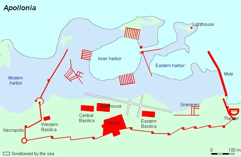
Baiae, Italy: The Roman Resort Town Now Under the Sea
Just off the coast near Naples, Roman villas that once hosted emperors and elites now lie beneath a few meters of turquoise water. Baiae was the luxury resort of its day, packed with bath complexes, lavish mosaics, and seaside mansions that leaned as close as possible to the shore. Over centuries, volcanic and tectonic activity in the Campi Flegrei region caused parts of the coastline to subside while the sea crept in. Instead of being erased, the city’s lower districts were gently flooded, preserving walls, statues, and mosaic floors in situ under a soft blanket of sediment.
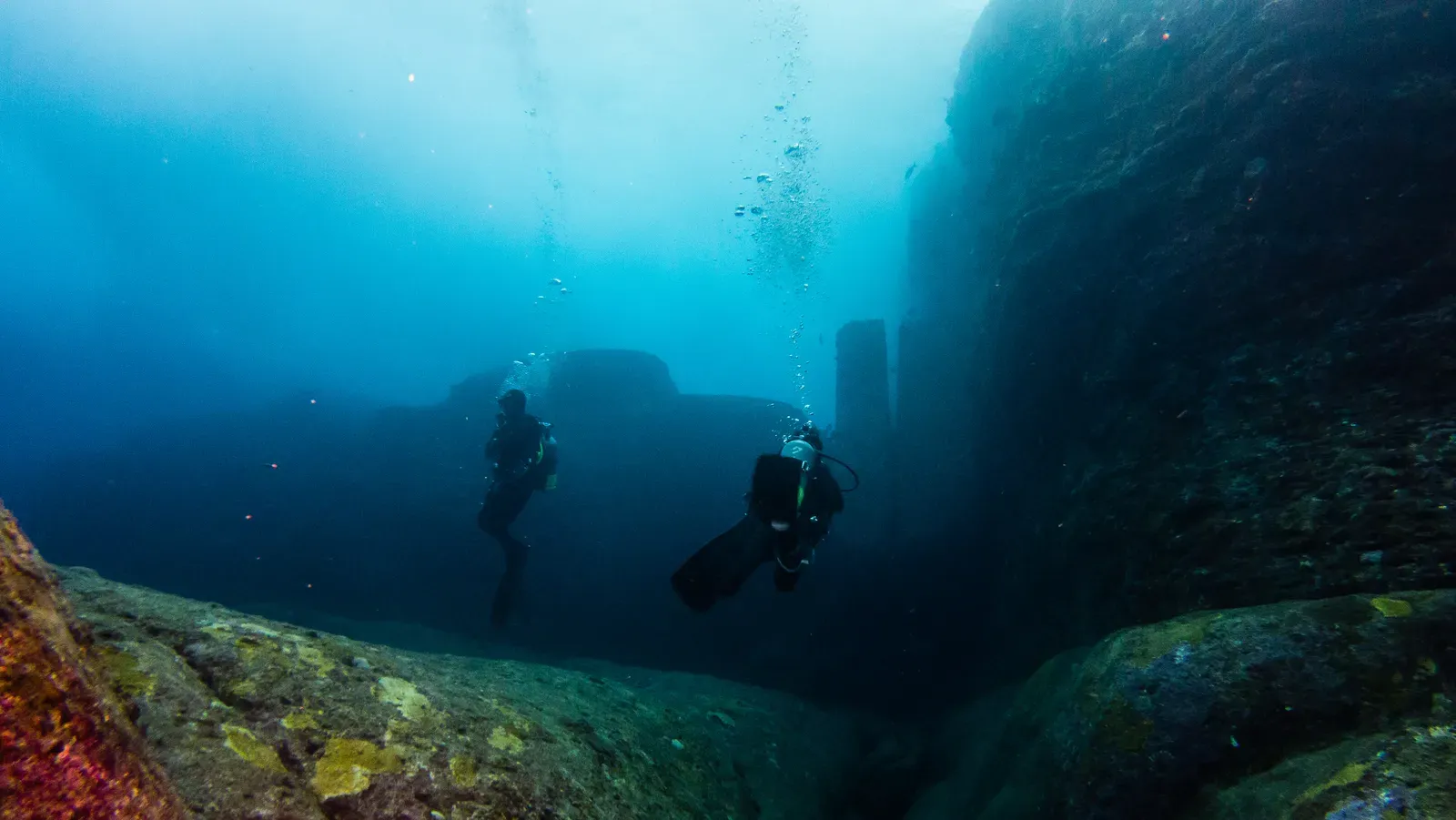
Today, Baiae functions as an underwater archaeological park, where divers can follow ancient streets and hover over dining rooms frozen in time. Marine archaeologists use methods similar to those on land – careful excavation, photogrammetry, architectural analysis – but adapt them to low-visibility water and fragile marine growth. The site offers a rare full-scale snapshot of Roman seaside architecture and leisure culture, including evidence of complex plumbing, heating systems, and decorative programs. Because Baiae’s submergence was gradual rather than catastrophic, it provides a slow-motion record of how environmental change and human adaptation played out along a volcanic coast. It is both an open-air museum and a warning stage built by geology itself.
Port Royal, Jamaica: A Pirate Capital Swallowed in Minutes
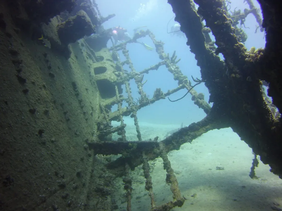
Unlike the quietly sinking towns of the Mediterranean, Port Royal’s fate was brutally sudden. In 1692, a powerful earthquake and subsequent liquefaction caused large sections of this notorious Caribbean port – then a center of trade, piracy, and colonial power – to slide straight into Kingston Harbor. Eyewitness accounts described buildings collapsing and streets vanishing as the ground behaved like liquid sand. Roughly about two thirds of the bustling town was destroyed in a matter of minutes, leaving an underwater graveyard of taverns, warehouses, and homes.
For marine archaeologists, Port Royal is a rare time capsule of daily life in a specific year, right down to clay pipes, bottles, coins, and household items abandoned mid-use. Excavations, conducted in challenging, often murky conditions, have revealed intact building fronts, wooden structures preserved in anaerobic mud, and even personal belongings that tell stories of traders, enslaved people, and sailors. Researchers combine archival documents with structural remains to match addresses on paper to buildings on the seafloor, something almost impossible at most ancient submerged sites. The city has become a key reference point for studying sudden coastal disasters and their social aftermath, especially in regions sitting on active fault systems. It is a visceral example of how quickly a thriving human landscape can become an underwater site for future scientists to decode.
Why These Underwater Cities Matter for Science and Society
At first glance, underwater cities might seem like pure adventure fodder – treasure-hunting stories with a scientific gloss. In reality, they are dense archives of information about how people built, traded, worshiped, and coped with environmental change over thousands of years. Many of these drowned sites lie along the ancient shorelines that humans favored for settlement, meaning they capture parts of our history that land-based archaeology simply cannot reach. When researchers analyze sediments, pollen grains, and microfossils around these ruins, they also reconstruct past climates, storms, and sea-level changes with surprising precision.
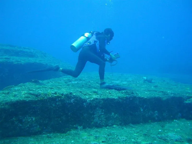
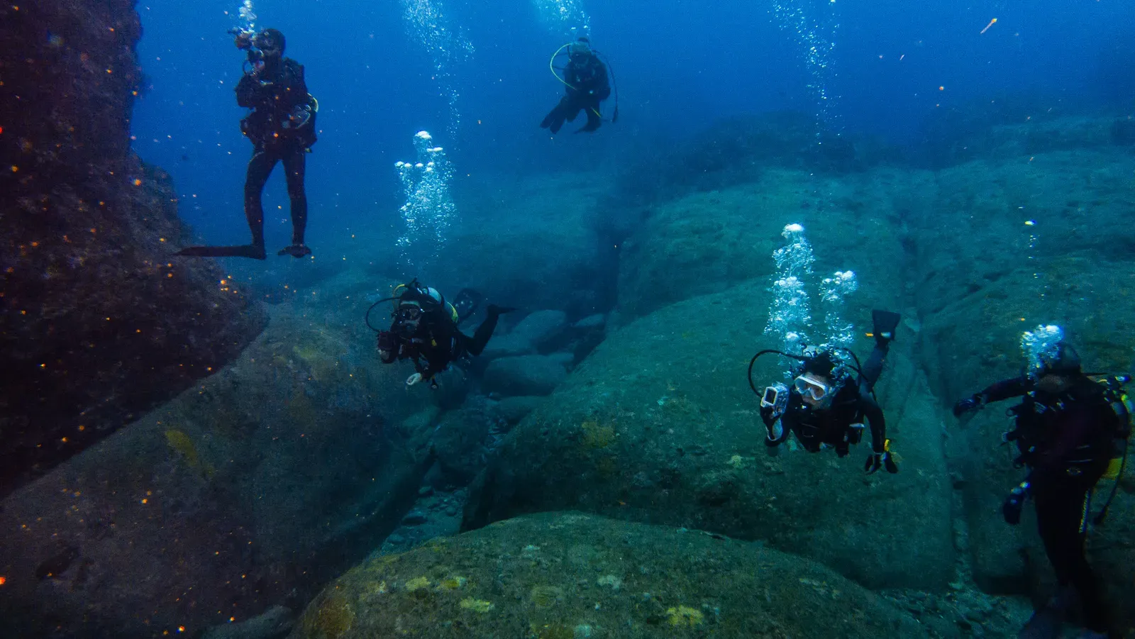
Compared with traditional excavations on dry land, underwater archaeology brings both sharper risks and sharper insights. Access is harder, seasons are shorter, and costs are higher, but the payoff can be exceptional preservation and more complete urban layouts. Submerged streets and harbor basins often remain undisturbed by later construction, unlike city centers on land that have been rebuilt layer upon layer. These sites also carry emotional and political weight: they resonate with present-day coastal communities watching tides creep closer to their doorsteps. Studying long-vanished drowned towns is, in a very real sense, a way of looking at possible futures for cities we live in now.
The Future of Underwater Exploration: Robots, AI, and Racing Against Time
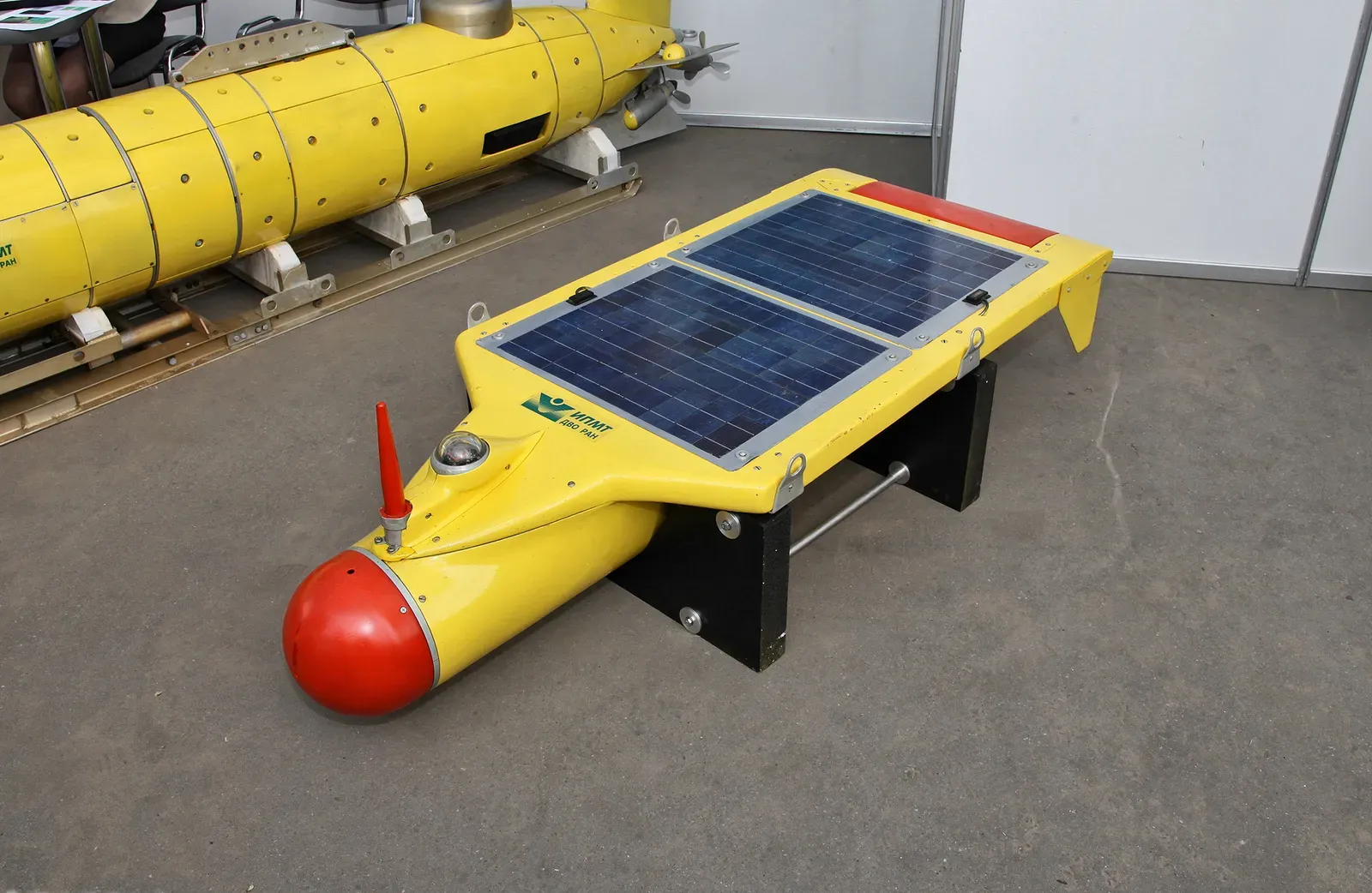
Exploring submerged cities used to mean sending a small team of highly trained divers into risky environments for short, carefully planned dives. Today, fleets of autonomous underwater vehicles and remotely operated robots can scan vast areas with sonar, lasers, and high-resolution cameras, then send back terabytes of data for scientists to sift through. Artificial intelligence is increasingly used to spot patterns in those datasets – walls, harbor lines, or foundations that a human eye might miss on first pass. That combination of robotics and machine learning is making systematic surveys of entire continental shelves, once a fantasy, feel technically plausible.
Yet even as tools improve, the clock is ticking. Rising sea temperatures, acidifying waters, and trawling damage threaten fragile underwater heritage sites, especially those in shallow, heavily used coastal zones. Marine growth can both protect and obscure ruins, while storms linked to a warming climate can strip away protective sediments overnight. Future projects will have to balance detailed, careful study with the need to document sites rapidly before they are degraded beyond recognition. International cooperation, legal protections, and shared databases of 3D models will be crucial if the scientific community hopes to capture these cities digitally before nature erases them physically.
How You Can Engage With the World of Underwater Cities
Most of us will never descend to a drowned temple or swim over a Roman mosaic, but there are still meaningful ways to connect with and protect this hidden heritage. Many research teams and museums now release interactive 3D reconstructions and virtual dives, letting you explore submerged streets on a screen while understanding the science that brought them to light. Supporting reputable maritime museums, science journalism outlets, and conservation charities helps fund both the fieldwork and the painstaking analysis back in the lab. Simple choices, like backing policies that reduce coastal pollution and greenhouse gas emissions, indirectly safeguard underwater sites by easing some of the environmental pressures that erode them.
If you live near the coast, even paying attention to local shoreline history – old harbor lines, vanished villages, flood stories passed down through families – can reframe how you see the place you call home. Classroom projects, citizen science efforts that log underwater finds, and responsible dive tourism programs all feed data back into the scientific effort. In a way, every person who learns about these cities becomes part of their afterlife, helping ensure they are remembered not just as curiosities, but as chapters in a much larger story of humans and the sea. The question that lingers is simple and unsettling: which of today’s seaside skylines will archaeologists of the future map as the next generation of underwater cities?

Suhail Ahmed is a passionate digital professional and nature enthusiast with over 8 years of experience in content strategy, SEO, web development, and digital operations. Alongside his freelance journey, Suhail actively contributes to nature and wildlife platforms like Discover Wildlife, where he channels his curiosity for the planet into engaging, educational storytelling.
With a strong background in managing digital ecosystems — from ecommerce stores and WordPress websites to social media and automation — Suhail merges technical precision with creative insight. His content reflects a rare balance: SEO-friendly yet deeply human, data-informed yet emotionally resonant.
Driven by a love for discovery and storytelling, Suhail believes in using digital platforms to amplify causes that matter — especially those protecting Earth’s biodiversity and inspiring sustainable living. Whether he’s managing online projects or crafting wildlife content, his goal remains the same: to inform, inspire, and leave a positive digital footprint.