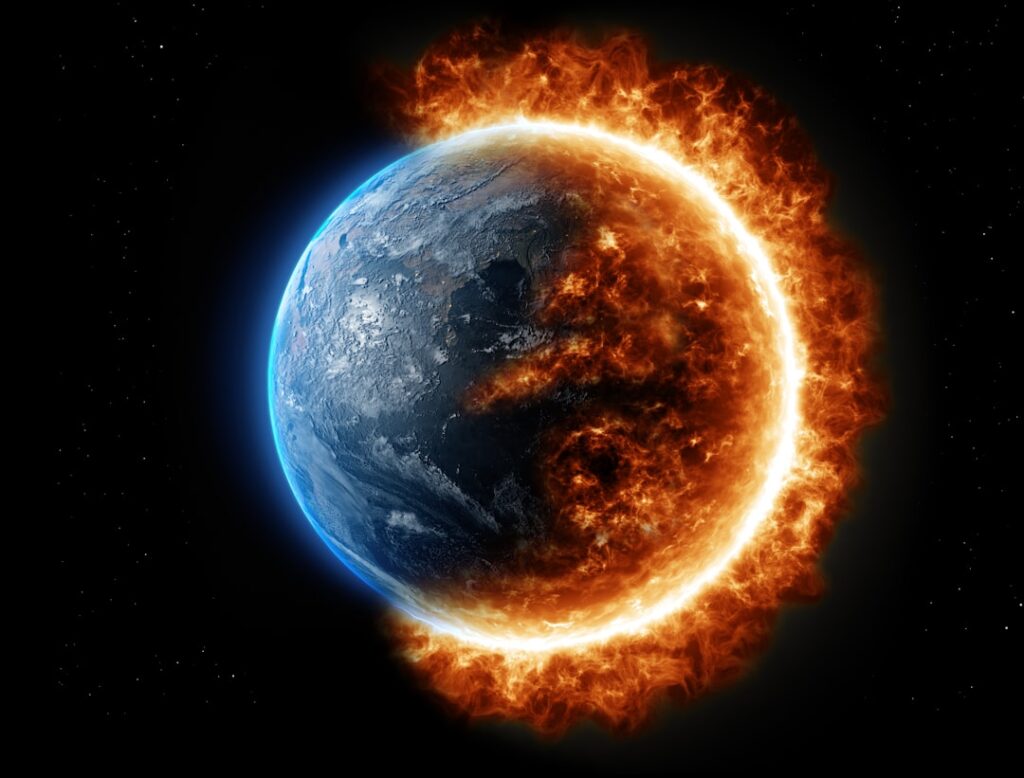
Every forecast app promises certainty: rain at 3 p.m., sunshine by 5. But the atmosphere does not always play by our rules. Hidden inside that shifting chaos are strange, almost unbelievable events that still leave scientists scratching their heads, even in 2026. Some of them look like scenes from a sci‑fi movie; others are so rare that a person could live an entire lifetime and never see them.
Even with satellites, supercomputers, and decades of climate research, there are corners of Earth’s weather that remain deeply mysterious. We can describe them, sometimes even predict the broad conditions that help them form, but the “why here, why now, why like this?” questions are still open. Let’s dive into seven of the weirdest weather phenomena that stubbornly refuse to give up all their secrets.
1. Ball Lightning: Glowing Orbs That Refuse to Be Explained
Imagine a thunderstorm rolling overhead and suddenly a glowing, floating ball of light drifts through the air – sometimes even reported inside houses or airplanes – then vanishes with a bang or a quiet fade. That’s ball lightning: one of the strangest and most controversial weather mysteries on record. People have described it for centuries, yet scientists still don’t agree on what it actually is, or even if all the sightings are the same phenomenon.
Some theories suggest ball lightning is a kind of plasma, others point to vaporized silicon in soil, and a few ideas involve bizarre electromagnetic knots held together for a few seconds. The main problem is that it is incredibly rare and unpredictable, so controlled experiments are hard to pull off. A few laboratory attempts have created ball‑like glows, but none fully match the real‑world reports. I still remember as a kid reading about a glowing orb rolling down a church aisle during a storm – it felt like a ghost story dressed up as physics, and in a way, that’s still how science treats it: real enough to take seriously, but elusive enough to haunt the data.
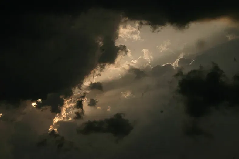
2. Sprites, Elves, and Blue Jets: Thunderstorms’ Secret Sky Fireworks
High above a thunderstorm, far beyond the rain and the flashing lightning we can see from the ground, other electrical events light up the upper atmosphere. They have whimsical names – sprites, elves, blue jets – but they are anything but trivial. These are huge, extremely brief flashes of light that stretch tens of kilometers up into the sky, often too faint and fast for the naked eye to catch. Pilots started talking about them decades ago, and for a long time, people wrote those stories off as misidentifications or imagination.
Now we have solid video and satellite observations, but a lot of the underlying physics is still murky. Scientists know that sprites tend to occur above powerful lightning strikes and that they interact with the thin air of the mesosphere and ionosphere. Still, the details of how energy moves from the thunderstorm up into these ghostly forms – and how they might subtly affect radio communication or the chemistry of the upper atmosphere – are being actively studied. It’s like discovering that storms have a secret second act, performed on a stage fifty miles above our heads, and we’re only now learning the script.
3. Morning Glory Clouds: Perfect Rolls in a Chaotic Sky
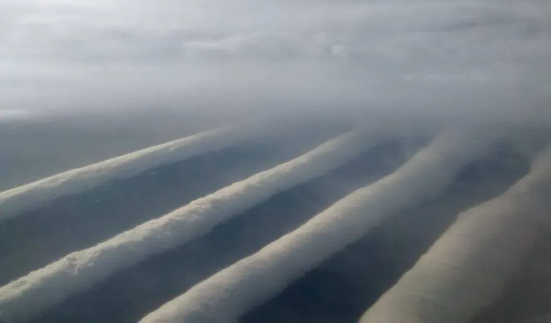
Picture a gigantic, sky‑spanning roll of cloud, long and narrow, gliding across the horizon like a white cylinder pulled on an invisible conveyor belt. That’s the Morning Glory cloud, most famously seen in northern Australia’s Gulf of Carpentaria region. These cloud rolls can stretch hundreds of kilometers, yet be only a kilometer or so wide, and they often move in a strangely smooth, steady way that feels almost mechanical rather than natural.
Meteorologists link them to special combinations of sea breezes, temperature contrasts, humidity, and waves in the lower atmosphere. In the Gulf of Carpentaria, the local geography seems to line things up just right more often, which is why glider pilots actually travel there hoping to ride these clouds like surfers on a rare wave. But we still do not have a complete, universal recipe that explains every occurrence. Similar roll clouds appear in other parts of the world under different setups, so there is clearly more than one path to the same eerie result. The atmosphere, once again, is using multiple routes to cook up the same weird dish.
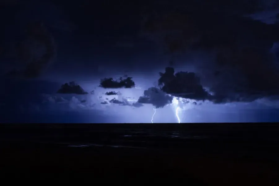
4. Catatumbo Lightning: The Storm That Almost Never Sleeps
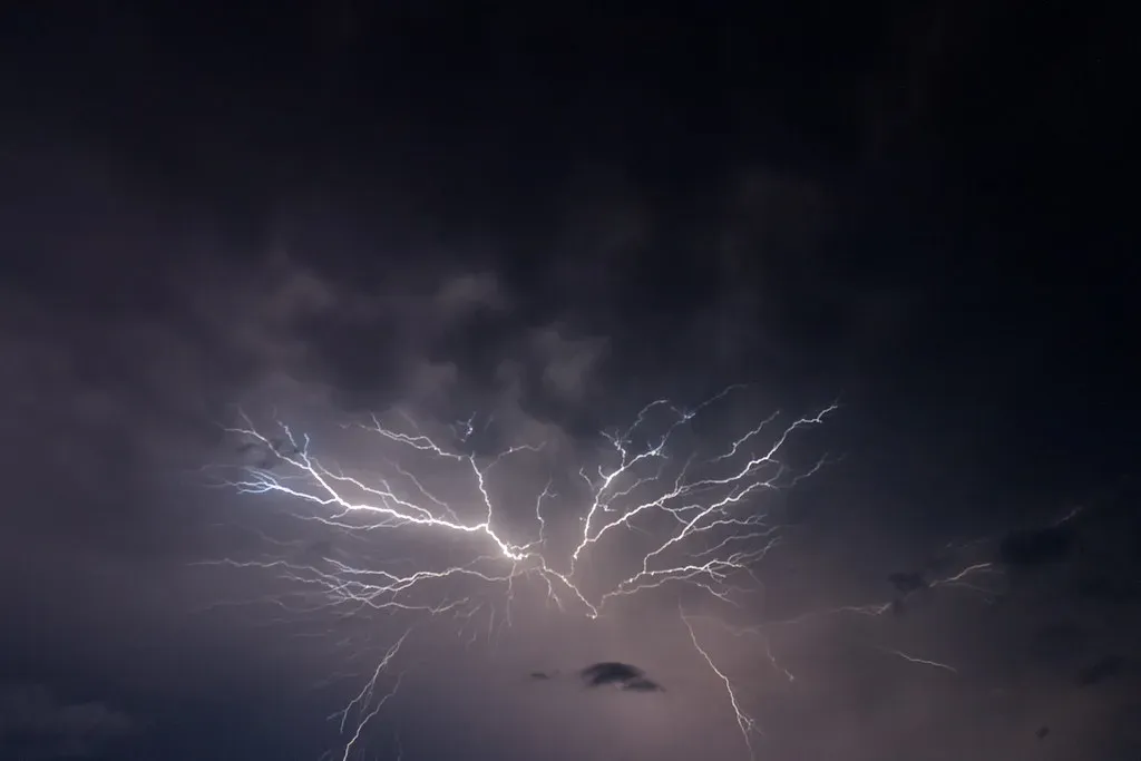
In northwestern Venezuela, over the Catatumbo River where it meets Lake Maracaibo, lightning can flash on hundreds of nights each year, often for hours at a time. From a distance, it looks like a silent, flickering wall of light, as if the horizon itself were malfunctioning. This “Catatumbo lightning” has become famous because of its intensity and persistence, sometimes recorded on nearly two hundred nights in a single year, with thousands of flashes in one night.
Scientists suspect that the unique mix of warm lake water, surrounding mountains, humidity, and prevailing winds makes this region a natural lightning machine. Yet the phenomenon is not perfectly steady; there have been years where the lightning nearly vanished for months, only to roar back again. Explaining these ups and downs is tricky: shifts in regional climate patterns, large‑scale influences like El Niño, and subtle changes in local conditions likely all play a role. We can map where lightning happens, but fully predicting how this “everlasting storm” waxes and wanes is still very much a work in progress.
5. Waterspouts and Fire Tornadoes: Vortices That Break the Rules
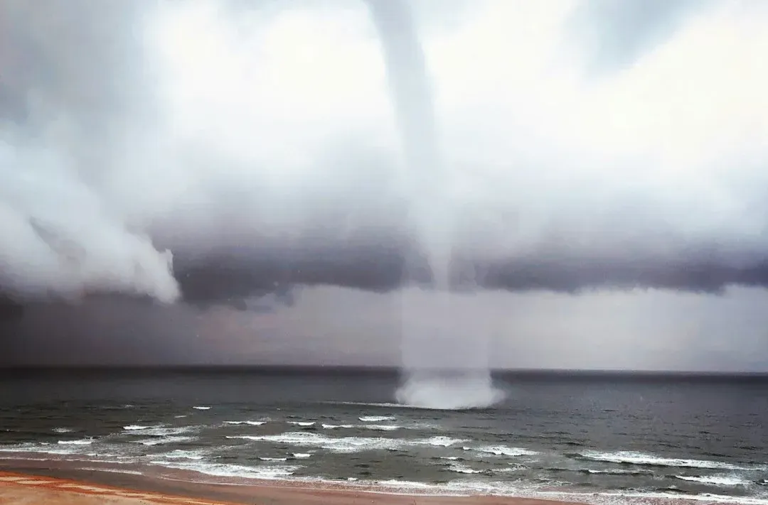
Most of us think of tornadoes as dusty or debris‑filled funnels carving paths across land, but the atmosphere seems to enjoy remixing that idea. Waterspouts are tornado‑like columns over water, sometimes gentle, sometimes intense, drawing up spray in a ghostly column. They form in ways that overlap with both fair‑weather convection and severe storms, depending on the type, and the boundaries between “true tornado” and “just a rotating column” get blurry. Even with radar and satellite data, we still struggle to predict exactly when and where they will spin up.
Then there are fire tornadoes – rotating columns of air driven by intense wildfires, powerful updrafts, and turbulent winds. They can loft burning embers and spread flames rapidly, turning an already dangerous wildfire into something almost surreal. As climate change fuels longer and more destructive fire seasons in places like North America and Australia, these fiery vortices are getting more attention. Yet modeling them is brutal: you have to combine wildfire behavior, complex terrain, and chaotic weather in one simulation. The result is a violent marriage of fire and weather that defies clean categories and still pushes the limits of current science.
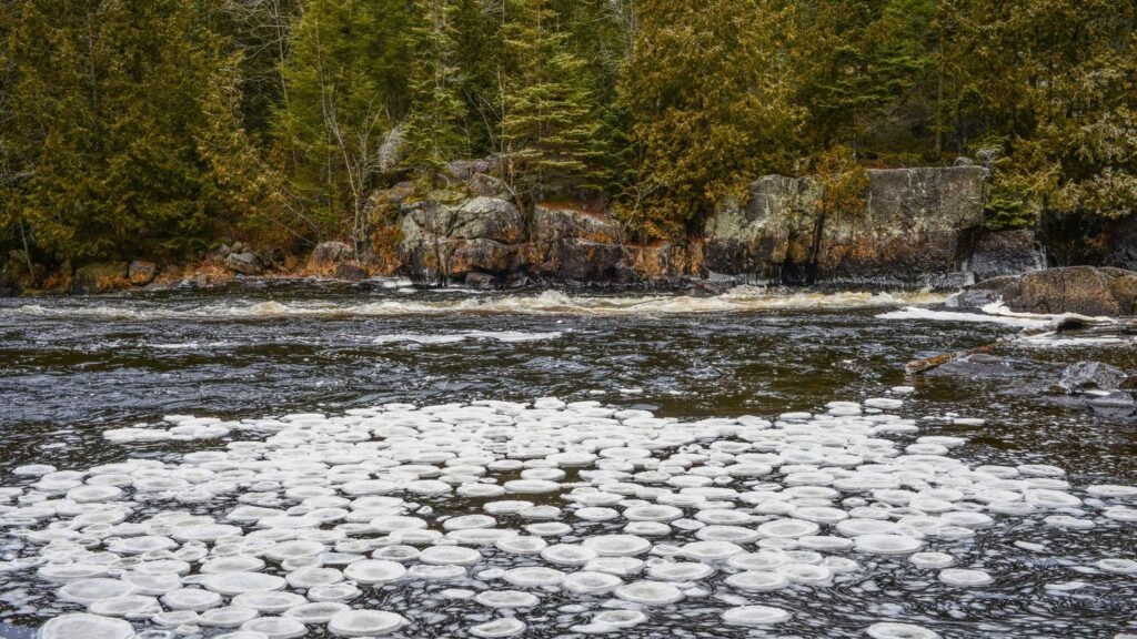
6. Ice Discs, Ice Circles, and Weird Frozen Geometry
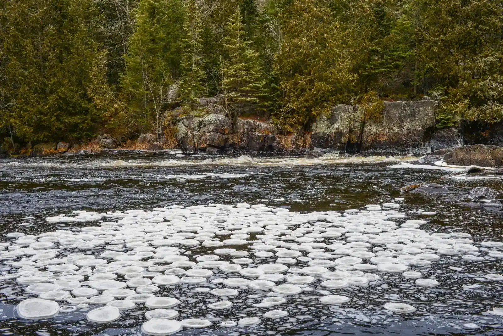
Every so often, someone looks out over a river in a cold region and sees something that looks like it belongs in a cosmic art gallery: a nearly perfect circular slab of ice, slowly spinning in place. These ice discs, or ice circles, can be several meters across and turn gently like a lazy record on a turntable. They form most often in slow‑moving rivers where cold temperatures, thin ice, and gentle currents interact in just the right way to grind chunks of ice into a rotating disc.
The broad outlines of the process make sense: rotation plus erosion plus freezing can carve circles out of irregular pieces. But why some rivers and not others, why some winters and not others, and why the circles are sometimes incredibly precise are all harder questions. Other strange ice shapes – like so‑called “pancake ice” or stacked formations on lakes – also raise eyebrows. They remind us that phase changes of water, combined with small shifts in wind and flow, can create geometry that looks almost engineered. It is humbling when something as simple as freezing water produces shapes that look more mathematically pure than anything we could design on purpose.
7. Atmospheric Rivers and “Rain Bombs”: When the Sky Opens All at Once
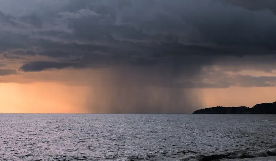
In recent years, two terms have become more familiar in weather coverage: atmospheric rivers and what people often call “rain bombs” or flash‑flood downpours. Atmospheric rivers are long, narrow corridors in the sky that carry huge amounts of water vapor, like airborne superhighways of moisture stretching from the tropics toward higher latitudes. When they hit mountains or collide with colder air, they can dump staggering amounts of rain and snow in a short time, triggering floods and landslides. Scientists can track many of these plumes from space, yet nailing down exactly how intense their rainfall will be at a specific place and time is still a major challenge.
“Rain bombs” are more informal language, but they point to another puzzle: very localized, extremely heavy bursts of rainfall that overwhelm drains, rivers, and cities in minutes. As the climate warms, a warmer atmosphere can hold more moisture, so when storms do form, they can have more water to release. We have solid physics behind that general idea, but the fine‑scale details – which storm will stall over a city, which one will organize into a monster downpour and which will fizzle – remain hard to forecast. For people on the ground, it feels like the sky just broke open; for scientists, it is a reminder that the intersection of climate change and local weather is one of the hardest frontiers to map precisely.
Conclusion: Living With a Sky Full of Mysteries
For all our radar networks, weather models, and climate reports, the atmosphere still keeps some of its weirdest tricks close to the chest. Glowing orbs of ball lightning, endlessly flashing storms, rolling clouds, and spinning ice all underline the same point: nature is not just complicated, it is inventive. It can take basic ingredients – water, air, heat, and motion – and assemble them into spectacles that feel almost supernatural until we look closer, and even then, we are often left with more questions than answers.
Personally, I find that comforting rather than unsettling. It means we are living under a sky that can still surprise us, that there are discoveries left for curious kids staring out of airplane windows or watching storms from a porch. As our climate changes and extreme events become more frequent in many regions, understanding these phenomena is not just about wonder; it is about safety, planning, and resilience. But even as we learn more, it is likely some mysteries will remain, flickering just beyond the edge of our models. When you look up at the clouds tomorrow, will you see just weather – or a tiny piece of something we still do not fully understand?