If you thought you had already seen everything weather can throw at you, probably proved you wrong. From blizzard conditions on normally balmy beaches to windstorms smashing records that stood for generations, you were living through a year that felt like the climate system had gone slightly off-script. Scientists were busy updating record books while ordinary people were busy digging cars out of snow in places that rarely see frost.
As you look back on from today, it’s not just about shock value. These bizarre events are like flashing warning lights on your dashboard, showing you how a warming world can twist familiar patterns into something far stranger. Here are six of the weirdest, most head‑tilting weather moments from that year – and what they quietly tell you about where the climate is heading.
1. A full‑on blizzard on the Gulf Coast
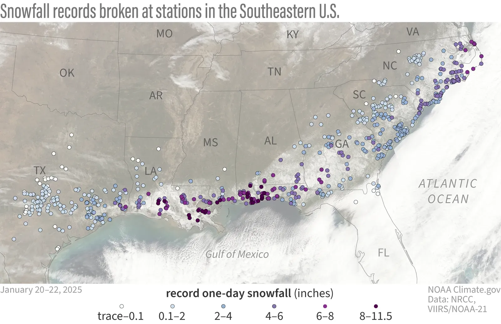
Imagine waking up along the Louisiana or Florida Gulf Coast in January expecting mild winter rain, and instead you open the door to a blizzard so intense you can barely see your neighbor’s porch. Between January 20 and January 22, 2025, that is exactly what happened: a rare and powerful winter storm, nicknamed Winter Storm Enzo by The Weather Channel, buried parts of the Gulf Coast in record‑breaking snow. Some locations in Louisiana and Florida set all‑time single‑day snowfall records, with double‑digit snowfall totals that locals usually associate with Colorado ski resorts, not palm trees and shrimp boats. ([en.wikipedia.org](https://en.wikipedia.org/wiki/2025_Gulf_Coast_blizzard?utm_source=openai))
What made this so strange is how many unlikely things had to line up at once for it to happen where you live. A strong plunge of Arctic air pushed unusually far south, meeting deep moisture streaming in from the Gulf of Mexico at just the right angle, then slowing down long enough to dump snow instead of blowing through. You were essentially watching a classic snowstorm template get dragged several hundred miles south of its normal comfort zone. For many coastal communities, it was the first time in living memory that kids could build snowmen in yards that usually grow citrus, and for emergency managers, it was a crash course in handling icy roads and power lines in a region built for heat, not ice. ([en.wikipedia.org](https://en.wikipedia.org/wiki/January_2025_North_American_cold_wave?utm_source=openai))
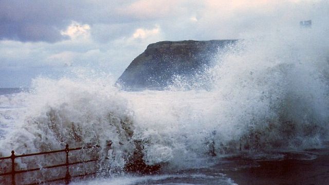
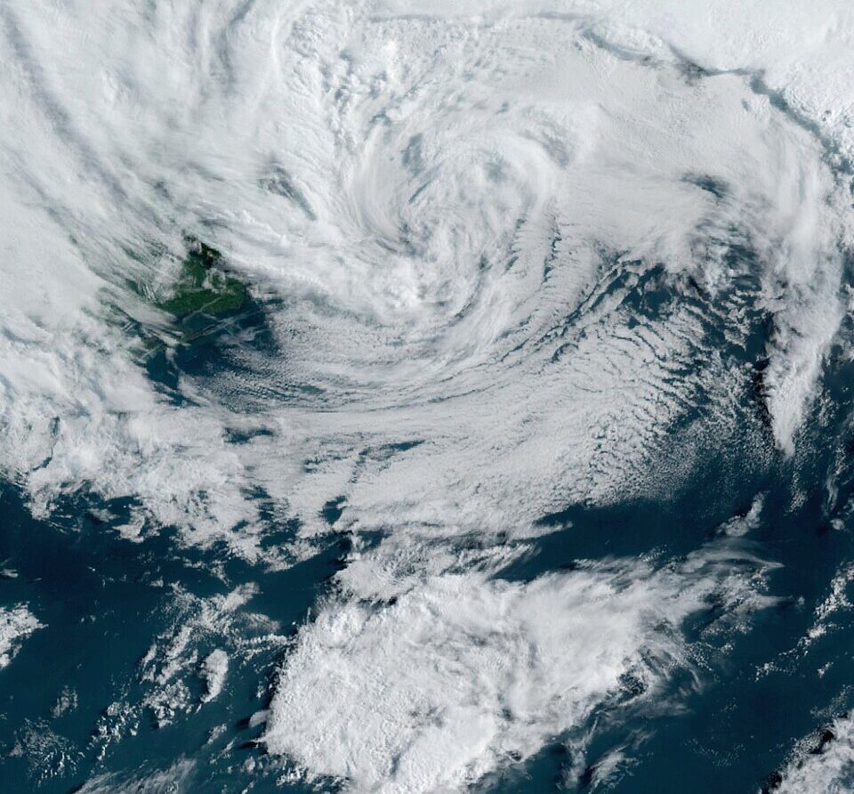
2. A Gulf Coast blizzard’s leftovers smash Ireland with historic winds

As if a Gulf Coast blizzard were not odd enough on its own, the same storm’s energy went on a kind of world tour. After dumping snow across the American South, the system reorganized as it crossed the Atlantic and contributed to what became one of Ireland’s most powerful windstorms on record, named Storm Éowyn. When it hit on January 24 and 25, 2025, Ireland recorded wind speeds high enough to break national records that had stood for roughly about eight decades, with damage stretching from the Isle of Man to Norway. You had the bizarre situation where a single storm memory linked Floridian snowdrifts with Irish hurricane‑like gusts. ([weather.com](https://weather.com/news/news/2025-06-24-strangest-weather-2025-through-june?utm_source=openai))
For you, this is a reminder that weather does not recognize national borders or your sense of what is “normal” for each place. The atmosphere is one connected machine, and when it spins up an especially energetic system, that energy can be recycled thousands of miles away in a totally different form. A snow day for one coast can translate into roof‑ripping winds for another continent days later. It also underlines why European forecasters now pay close attention to major North American storms, knowing that a powerful blizzard over the Gulf of Mexico might be tomorrow’s explosive cyclone over the North Atlantic, and why you increasingly hear about “trans‑Atlantic” storm stories instead of isolated local oddities. ([weather.com](https://weather.com/news/weather/news/2026-01-07-otd-winter-storm-enzo-gulf-coast-2025?utm_source=openai))
3. Chicago chokes in a rare dust storm
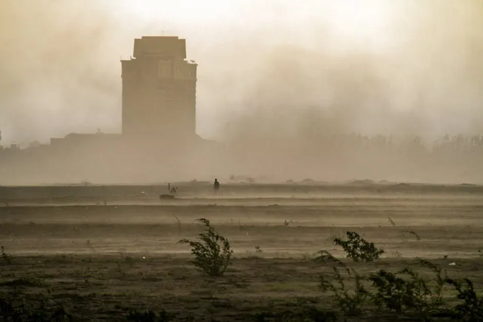
When you picture Chicago weather, you probably think of lake‑effect snow, brutal windchill, or sticky summer humidity – not a brown wall of dust swallowing the skyline. Yet in March 2025, a powerful storm system kicked up so much loose soil across parts of the Midwest that an old‑fashioned dust storm, or haboob‑like event, rolled into the Chicago area. According to meteorologists, it was the first dust storm to hit the city since the mid‑1980s, a type of event so uncommon there that many residents had literally never seen anything like it in their lifetimes. ([weather.com](https://weather.com/news/news/2025-12-22-strangest-weather-2025?utm_source=openai))
You felt something almost surreal about watching visibility plunge and the sky turn sepia in a place better known for its gleaming lakefront. The ingredients behind it were a warning sign in themselves: dry, exposed fields; strong winds tied to a vigorous storm system; and just enough prior warmth to leave soils vulnerable instead of frozen or snow‑covered. For you, it is a glimpse of how shifting temperature and precipitation patterns can turn even relatively humid regions into temporary dust bowls when conditions line up just wrong. It also highlights how land management, soil conservation, and changing climate all intersect in ways you can literally breathe – or struggle to breathe – when these events hit. ([ncei.noaa.gov](https://www.ncei.noaa.gov/news/national-climate-202505?utm_source=openai))
4. A deadly, days‑long April super‑storm over the Mississippi Valley
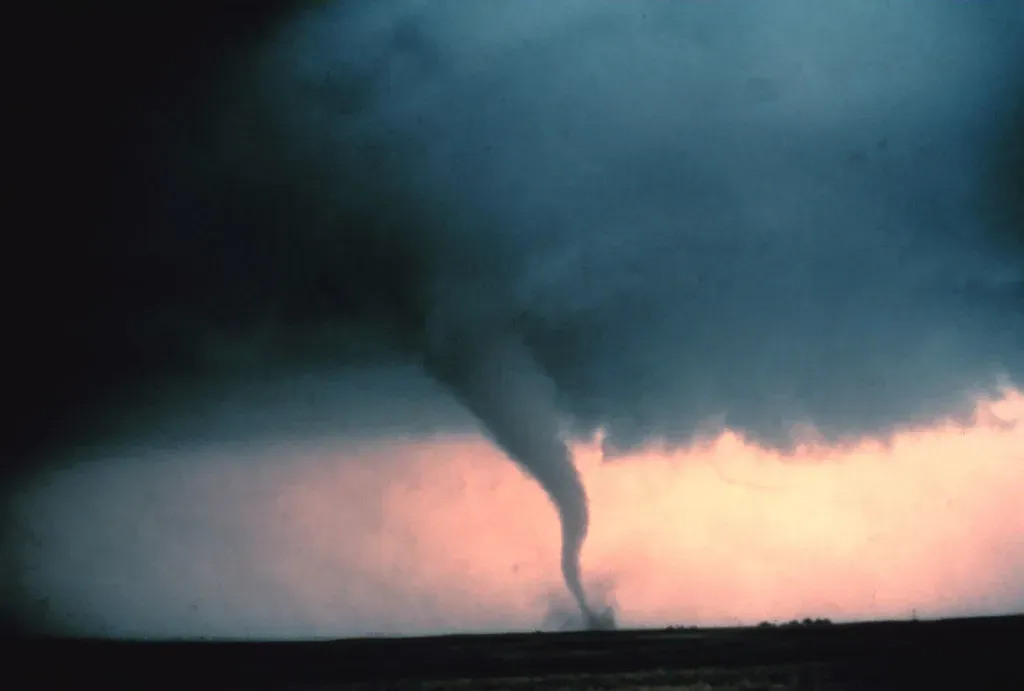
In early April 2025, you watched the central Mississippi Valley endure what felt less like a passing storm and more like a slow‑motion siege. Over about four days, a sprawling system parked itself over the region, spawning hundreds of tornadoes, torrential downpours, hailstorms, landslides, and destructive straight‑line winds. By the time it finally moved on, at least two dozen people had been killed, and communities across several states were dealing with catastrophic flooding and widespread damage. For emergency responders, it was one of those nightmare scenarios where sirens and warning messages barely had time to reset before the next wave hit. ([theguardian.com](https://www.theguardian.com/us-news/2025/may/08/storms-mississippi-valley-climate-change-study?utm_source=openai))
What really made this event stand out for you was not just the severity but the science that followed almost immediately. A rapid analysis by climate researchers concluded that human‑driven warming had made this kind of slow‑moving, extreme storm significantly more likely and more intense, especially in terms of the exceptional rainfall that flooded the Mississippi Valley. In other words, you were not just unlucky; the dice had been loaded by decades of greenhouse gas emissions. When you add in the fact that the United States keeps setting new records for the number and cost of billion‑dollar weather disasters, 2025’s April super‑storm looks less like an outlier and more like a preview. It shows you how a warmer atmosphere, which can hold more moisture, can turn an ordinary frontal boundary into a multi‑day deluge machine. ([climatecentral.org](https://www.climatecentral.org/climate-matters/2025-in-review?utm_source=openai))
5. A rare late‑May nor’easter that refused to act like spring
By late May, if you live in New England or Atlantic Canada, you are usually thinking about spring flowers, outdoor events, and maybe the first trips to the coast – not a raging coastal storm that looks more at home in November. Yet in late May 2025, an unusually strong nor’easter spun up off the Atlantic coast and hammered the region with heavy rain, damaging winds, coastal flooding, and even mountain snow. Forecasters flagged it as a rare, late‑season event, one that showed you winter‑style systems are not necessarily staying politely within the traditional “winter months” anymore. ([en.wikipedia.org](https://en.wikipedia.org/wiki/May_2025_nor%27easter?utm_source=openai))
For you, this weirdly timed nor’easter is a perfect example of how shoulder seasons – spring and fall – are getting messier. You can have record warmth one week and a storm more typical of deep winter the next, as energy and moisture slosh around in a climate system that has more heat baked into it overall. From a practical perspective, it complicates everything: road crews, utility companies, coastal planners, and even small businesses have to stretch their “storm readiness” mindset deeper into the calendar. It also means that if you live by the ocean, you cannot assume that storm surge or damaging waves are only a cold‑season problem anymore; late‑spring trips to the shore now come with a small but real chance of encountering a storm that feels wildly out of sync with the calendar. ([weather.com](https://weather.com/news/climate/news/2025-05-08-april-2025-second-warmest-behind-2024-ecmwf-noaa?utm_source=openai))
6. A globally hottest January despite cooling La Niña
On the global scale, one of the strangest “weather” moments was not a single storm but a temperature milestone that defied expectations. Climate scientists went into the year expecting that the onset of La Niña – a Pacific pattern that usually has a slight cooling influence – would finally put a dent in the record‑breaking heat streak that had dominated 2023 and 2024. Instead, data showed that January 2025 was the hottest January ever recorded worldwide, running roughly one and three‑quarters degrees Celsius above pre‑industrial levels according to European reanalysis data. The month extended an almost unbroken run of record or near‑record global warmth stretching back to mid‑2023. ([wmo.int](https://wmo.int/media/news/january-2025-sees-record-global-temperatures-despite-la-nina?utm_source=openai))
If you live anywhere on Earth, you felt the knock‑on effects of that background heat, even if your local weather still swung between cold snaps and heat waves. Warmer oceans and atmosphere mean heavier downpours when storms do form, fiercer heatwaves when high‑pressure systems park overhead, and a higher likelihood that “once in a lifetime” extremes will visit you more than once. When a year like 2025 manages to break monthly heat records despite a pattern that traditionally cools things down, it is a sign that the long‑term warming trend is now overpowering many of the old natural rhythms. For you, that means the oddities you saw in 2025 are not random plot twists – they are part of a new climate storyline that will shape the rest of your life. ([wmo.int](https://wmo.int/media/news/january-2025-sees-record-global-temperatures-despite-la-nina?utm_source=openai))
Conclusion: What these strange storms are really telling you

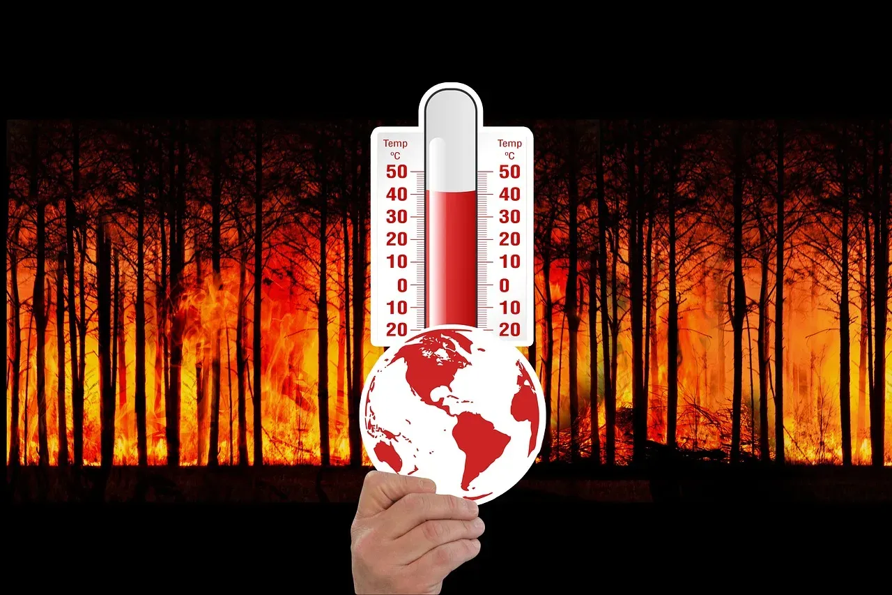
When you line up a Gulf Coast blizzard, a dust storm in Chicago, a rogue May nor’easter, a historic Mississippi Valley super‑storm, record‑shattering North Atlantic winds, and the hottest January on record, it is tempting to shrug and say the weather is just getting weirder. But if you look a little closer, you can see a pattern behind the chaos: a warmer world, holding more moisture and energy, is stretching the boundaries of where and when certain types of weather can happen. Events that used to be nearly unthinkable in your lifetime are now rare but plausible, and those that were already dangerous are becoming sharper and harder to manage. ([climatecentral.org](https://www.climatecentral.org/climate-matters/2025-in-review?utm_source=openai))
The good news is that you are not powerless in the face of this. Understanding these strange events helps you plan better – demanding smarter infrastructure, pushing leaders for real climate action, and taking your own steps to prepare at home and in your community. The atmosphere is clearly telling you that the old playbook is out of date; the question now is how quickly you adapt your habits, your policies, and your expectations to match the world you are actually living in. When you think back on 2025’s bizarre weather, do you see it as a freakish one‑off, or as the year you finally realized the future had already arrived?