We have walked on the Moon, drilled into Mars by proxy, and tracked distant galaxies across the universe. Yet most of Earth’s own seafloor is still a blurry mystery, mapped more crudely than lunar mountains and craters. In terms of detail, we know the topography of the Moon far better than the world beneath our waves, and that gap is not just a trivia fact; it shapes everything from climate predictions to submarine cables and geopolitics.
It is tempting to imagine that by 2026, satellites must have solved this. They haven’t. What we have for much of the deep ocean are low‑resolution gravity-based estimates, not sharp sonar maps. Think of it as looking at a city from orbit and guessing where the buildings are by how the ground sags, instead of actually seeing the streets. That’s roughly the level we are at for huge stretches of the seabed.
Below are 13 kinds of places on the seafloor that, even today, are ’s surface. Some are massive undersea mountain ranges; others are deep trenches or forgotten plateaus. Many are simply in locations that are expensive, dangerous, or politically awkward to reach. Together, they tell a slightly uncomfortable truth: on our own planet, we are still mostly guessing.
#1 The Deepest Trenches Beyond the Famous Few
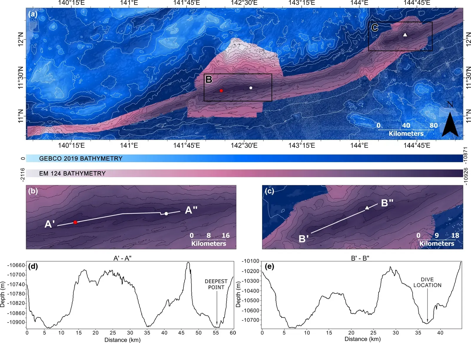
Everyone knows the name “Mariana Trench,” but that single celebrity hides a larger story: there are more than twenty recognized deep‑ocean trenches on Earth, and the vast majority of them are imprecisely mapped. Outside a few heavily studied spots in the western Pacific, many trench floors have never been scanned in detail with modern multibeam sonar. We sometimes know their maximum depth only from isolated ship tracks, rather than a continuous, high‑resolution map.
In practical terms, that means these chasms are still outlines on a sketch, not finished drawings. Their steep walls, secondary basins, and small landforms like landslide scars or mud volcanoes may simply not appear at all in global bathymetry datasets. For comparison, common lunar digital elevation models capture features on the Moon down to tens of meters in scale, while large swaths of trench floors are effectively lumped into coarse depth pixels hundreds of meters across.
That lack of detail matters. Deep trenches are where old ocean crust is swallowed back into the mantle, where powerful earthquakes are born, and where extreme ecosystems cling to life in near‑total darkness. If we do not accurately know their shape, we are guessing at how tsunamis might propagate, how carbon is recycled, and how life survives in the planet’s harshest pressure cooker. For all our talk of conquering the deep, in many trenches we have barely traced the outline.
#2 The Mid‑Ocean Ridge System Winding Around the Planet
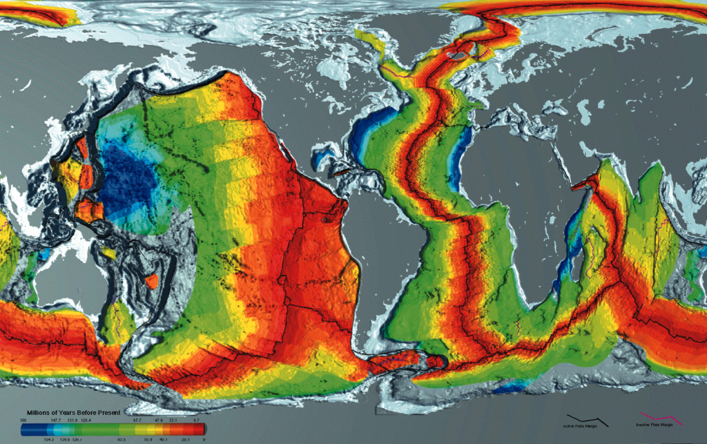
If Earth had a heartbeat, it would be the mid‑ocean ridges: a continuous undersea mountain chain longer than the entire circumference of the planet. New crust forms here as tectonic plates pull apart, magma rises, and lava cools, literally building seafloor in real time. You might expect that such a central system would be mapped with obsessive precision, but large stretches remain shockingly fuzzy in our datasets.
Some iconic segments, like parts of the Mid‑Atlantic Ridge near Iceland or the East Pacific Rise, have exquisite high‑resolution coverage thanks to decades of research cruises. Sail a few hundred or a few thousand kilometers along the same ridge, though, and you quickly fall back into the blur of satellite-derived bathymetry. Small volcanoes, fissures, and transform fault scarps that would be obvious in a detailed sonar map simply vanish into the averaged signal.
From a scientific standpoint, this is like studying a forest by closely examining a few trees and then assuming the rest looks identical. We know enough to understand the broad pattern of seafloor spreading, but we lack the nuanced picture: which parts of the ridge are more active, how magma channels vary, or where unusual hydrothermal activity might erupt. The Moon’s mountain ranges and valleys, by contrast, have been mapped consistently at much finer detail than many of these underwater birthplaces of crust.
#3 Submarine Canyons Carved into Continental Margins
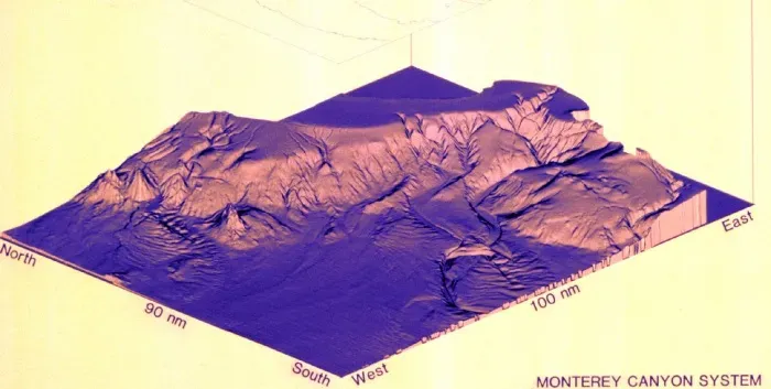
Hugging the edges of continents are thousands of submarine canyons – deep cuts that slice down the continental slope, often starting near river mouths and ending in the deep sea. Some, like Monterey Canyon off California, are very well mapped and studied. But for every famous canyon, there are dozens that have barely been touched with modern sonar. In many regions, we still rely on sparse ship tracks or outdated data to sketch where these chasms run.
Submarine canyons are important highways for sediment, nutrients, and sometimes even pollutants from the shallow shelf to the abyss. Their exact shapes – how steep, how branched, how choked with landslides – control how material moves during storms, floods, or earthquakes. Without sharp maps, we are largely guessing which paths sediment and organic carbon take on their journey to deep storage or resuspension.
That matters not just for academic reasons but for practical infrastructure. Undersea cables, pipelines, and offshore installations are often routed along continental margins. A poorly mapped canyon system can hide hazards like steep scarps or unstable slopes that might fail during a quake. In a strange twist, we have better topographic data for many lunar craters than for some of the chasms that sit only a few hundred kilometers off our coasts.
#4 Polar Ocean Floors Beneath Permanent or Seasonal Ice
The Arctic and parts of the Southern Ocean are some of the hardest places to map on Earth, simply because thick, shifting ice covers the surface for much of the year. Traditional sonar mapping relies on ships or autonomous vehicles that need reasonably open water. Where the sea is choked with pack ice, the logistics and safety challenges skyrocket, so large areas of the polar seabed remain only crudely known.
Submarine and icebreaker campaigns have filled in a few critical gaps, especially on key Arctic ridges and shelves, but they are nowhere near complete. Many basins and ridges beneath the ice are represented in maps using interpolations and gravity-based estimates rather than real, dense sonar tracks. The result is a patchwork: small, exquisitely mapped patches surrounded by vast regions of low‑resolution guesswork.
This is particularly ironic because the polar seabed is central to issues we care deeply about in 2026. Seafloor topography controls how warm Atlantic or Pacific waters sneak under Arctic sea ice, hastening its melt, and how deep waters form that help drive global circulation. It also underpins legal claims to extended continental shelves in the Arctic, which can shape future resource rights. Yet, in many places, our picture of the polar seabed is still blurrier than our maps of the far side of the Moon.
#5 Deep Abyssal Plains Far from Any Shipping Lanes
Abyssal plains sound featureless – wide, deep expanses of sediment many kilometers below the surface. Because they are often considered boring compared with ridges and trenches, they have been among the least thoroughly mapped. Vast regions of the South Pacific, South Atlantic, and Indian Ocean abyssal plains lie far from dense shipping routes and research hotspots, so high‑resolution bathymetry is thin or nonexistent there.
Ironically, calling these plains “flat” and moving on is a bit of a myth. Even seemingly featureless abyssal areas can host subtle hills, buried channels, small seamounts, and complex sediment waves that are invisible in low‑resolution products. Satellites can capture broad gravity anomalies, but anything smaller than a few kilometers across tends to be smeared out, producing a deceptively smooth picture.
These neglected plains are increasingly in the spotlight as potential zones for deep‑sea mining, especially where polymetallic nodules are scattered across the sediment. Without detailed maps, it is hard to design careful scientific studies, let alone credible environmental impact assessments. It is unsettling to realize that we know more about crater chains on the Moon’s maria than we do about the real texture of many abyssal plains we are now eyeing for resource extraction.
#6 Seamounts and Undersea Volcanoes Hidden in Plain Sight
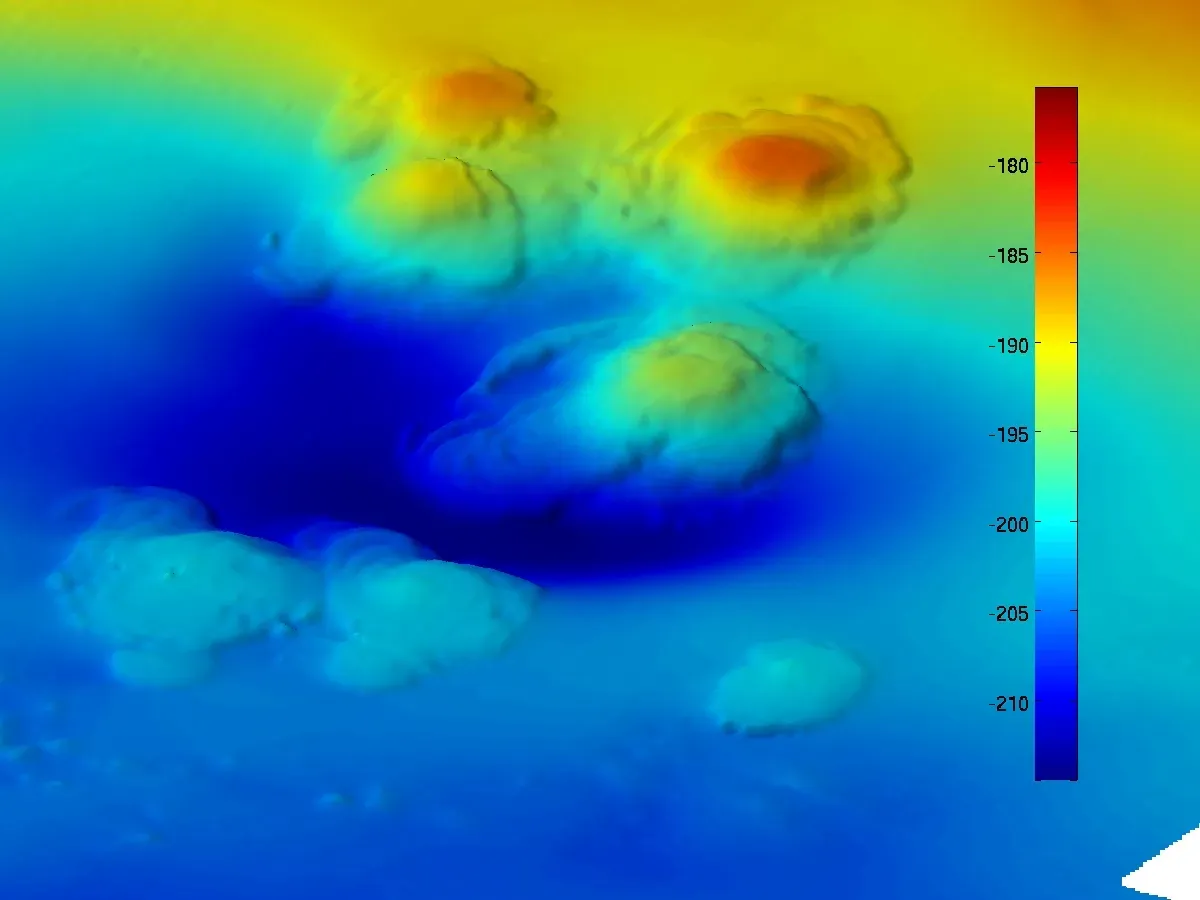
Scattered across the seafloor are tens of thousands of seamounts – underwater mountains, many of them extinct volcanoes, that rise hundreds to thousands of meters above the surrounding seabed. Only a small fraction of these have been accurately mapped in high resolution. Many known seamounts are inferred mainly from satellite gravity data, and researchers suspect that thousands more remain unrecognized altogether.
Here’s where the Moon comparison gets especially striking. On the lunar surface, mountains of similar scale are resolved cleanly in global elevation models. On Earth, a seamount of that size might appear as a vague bump in a low‑resolution seafloor grid, with no clear sense of its true height, shape, or cratered summit. Some volcanic cones only emerge as proper topographic features once ships pass directly over them with multibeam sonar.
That lack of mapping is not just a cartographic curiosity; it is a safety and ecological issue. Uncharted or poorly charted seamounts can be hazards for deep‑draft vessels and submarines, and they are also biological hotspots where corals, sponges, and fish aggregate. To manage fisheries, protect vulnerable marine ecosystems, or plan safe submarine routes, we need much better maps of these undersea mountains than we currently have in many regions.
#7 Fracture Zones and Transform Fault Valleys
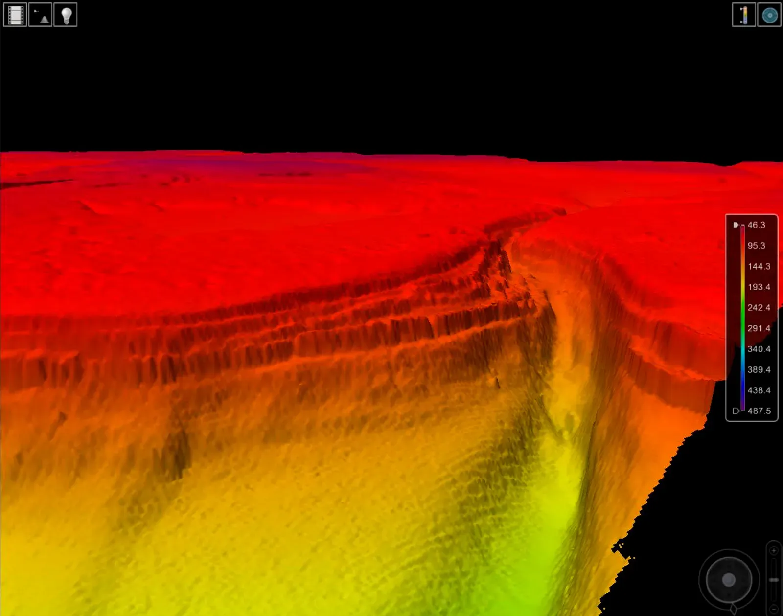
Oceanic plates do not slide apart quietly and symmetrically. They are riven with fracture zones and transform faults – long, linear features where blocks of crust grind past each other horizontally. These structures create deep valleys, scarps, and offset ridges that can stretch for thousands of kilometers. Yet, outside a limited number of well‑studied segments, their detailed topography is poorly constrained.
In some global datasets, a fracture zone might appear as a smooth stripe of slightly different depth, when in reality it may contain multiple steep-sided canyons, fault scarps, and collapsed blocks. Compared with the crisp imagery we now have of lunar rilles and grabens, the seafloor equivalents often look like smudged lines on a map. That is not because they are less dramatic, but because we have not sailed enough sonar tracks across them.
Understanding these structures in detail helps with more than tectonic theory. Fracture zones can channel deep currents and influence how heat and nutrients move through the ocean interior. They can also be focal points for earthquakes, small landslides, and unusual circulation patterns that affect everything from abyssal ecosystems to cable stability. In many stretches of the Atlantic and Indian Oceans, though, we are still looking at these features through a very blurry lens.
#8 Back‑Arc Basins and Complex Marginal Seas
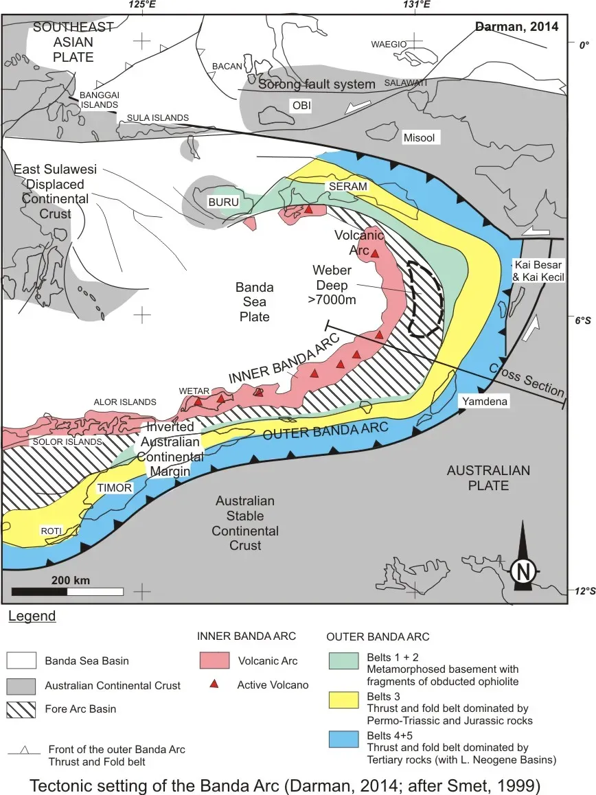
Behind many island arcs – those graceful chains of volcanic islands in the Pacific and elsewhere – lie back‑arc basins: dynamic seafloor regions where plates stretch, thicken, or rearrange in complicated ways. Some back‑arc basins host small spreading centers, others deep basins or unusual volcanic fields. Their tectonics can be more intricate than the big mid‑ocean ridges, and unfortunately, their mapping is often worse as well.
Funding and ship time tend to focus on a few iconic sites like the Mariana or Lau back‑arc systems, leaving many lesser-known basins with only patchy sonar coverage. The result is a very uneven picture: we may have beautiful, high‑definition strips along certain cruise tracks, surrounded by yawning gaps where the bathymetry reverts to sparse, low‑resolution information. The Moon, in contrast, benefits from uniform, mission-wide mapping campaigns that cover its entire surface at similar resolution.
Back‑arc regions matter because they host intense hydrothermal activity, arc volcanism, and sometimes significant mineral deposits. They are also geologically restless, with complex faulting and rapid changes in crustal structure. Without detailed seafloor maps, models of back‑arc evolution are forced to rely heavily on inferences rather than direct observation, leaving big uncertainties about how these regions grow, deform, and influence nearby subduction zones.
#9 Submerged Continental Fragments and Microcontinents
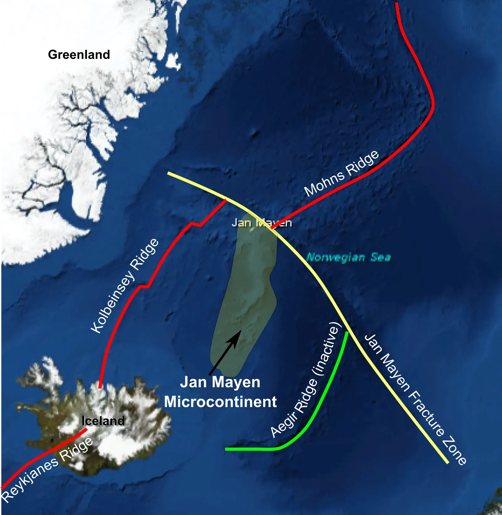
Not all seafloor is young basaltic crust. Scattered across the oceans are pieces of ancient, buoyant continental crust that now lie submerged – microcontinents, sunken plateaus, and rifted fragments that did not quite make it into full-fledged continents. Some of these, like certain plateaus in the Indian and Atlantic Oceans, are only loosely mapped relative to their scientific importance.
These submerged fragments can hold vital clues to plate tectonic history: how supercontinents broke apart, how past oceans opened and closed, and where ancient shorelines once stood. In many cases, though, our maps of their edges, interior basins, and fault systems are too rough to answer fine‑grained questions. We see the broad outline, but not the subtle fractures and steps that reveal their story.
There is also a legal and economic angle. Claims to extended continental shelves under international law often hinge on detailed bathymetric and geological data from these regions. Where mapping is thin, countries may lack the evidence needed to support their claims, or disputes may simmer around whose maps are more accurate. Meanwhile, we have centimeter-scale coverage of some lunar features that no one is arguing over at all.
#10 Ultra‑Deep Pockets and Hadal “Hotspots” Off the Main Map
Even within better-known trenches, there are smaller ultra-deep pockets – narrow hadal depressions or secondary basins – that have slipped through the cracks of mapping. Some have been discovered almost by accident when new expeditions find that local depths exceed previous estimates by hundreds of meters. These tiny deep “hotspots” can be more poorly mapped than almost any other terrain on Earth.
Because they are small and often off the main ship tracks, these pockets are easily smoothed out in global bathymetric models. From a satellite-gravity perspective, they are too small to stand out, much like a single building cannot affect a city’s gravitational field in an obvious way. Without dense sonar coverage, we do not even know where some of these deepest points truly are, let alone their exact shape.
Yet these minute hadal zones are of enormous scientific interest. Extreme pressure conditions, unusual fluid flows, and unique biological communities may all cluster in such localized depressions. Where we have explored, we have found organisms adapted to crushing pressures and strange geochemical gradients. Where we have not mapped in detail, those niches remain hidden, effectively invisible to science despite being on our own planet.
#11 Subsea Landslide Slopes and Tsunami‑Generating Scarps
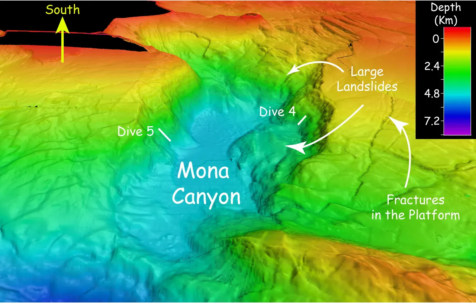
Many of the world’s largest tsunamis are not generated directly by earthquakes but by giant subsea landslides: masses of sediment and rock suddenly cascading downslope. The scars and deposits of these events are etched into the seafloor around continental slopes, volcanic islands, and glaciated margins. However, outside a few high‑risk areas that have been intensively surveyed, many potential landslide slopes are only coarsely mapped.
In low‑resolution data, a dangerous slope may look deceptively gentle and featureless. Zoom in with modern multibeam sonar, and you might see steep amphitheater-shaped headwalls, stacked slide blocks, and thin layers of remobilized sediment. Those details help scientists estimate how likely further failures are and how much material could move in a future event. Without them, hazard assessments are built on shaky ground – sometimes literally.
Some key points that highlight the problem include:
- Large parts of continental slopes are still represented by sparse profile lines instead of dense area maps.
- Many historic submarine landslides were discovered only after dedicated mapping years later.
- Critical infrastructure, from offshore platforms to cables, often sits near slopes that are not fully mapped.
Compared to this, the Moon’s old landslide scars and crater walls are mapped in uniform detail, even though they pose no direct hazard to anyone living on Earth.
#12 Under‑Ice Shelves and Grounding Zones of Antarctica and Greenland
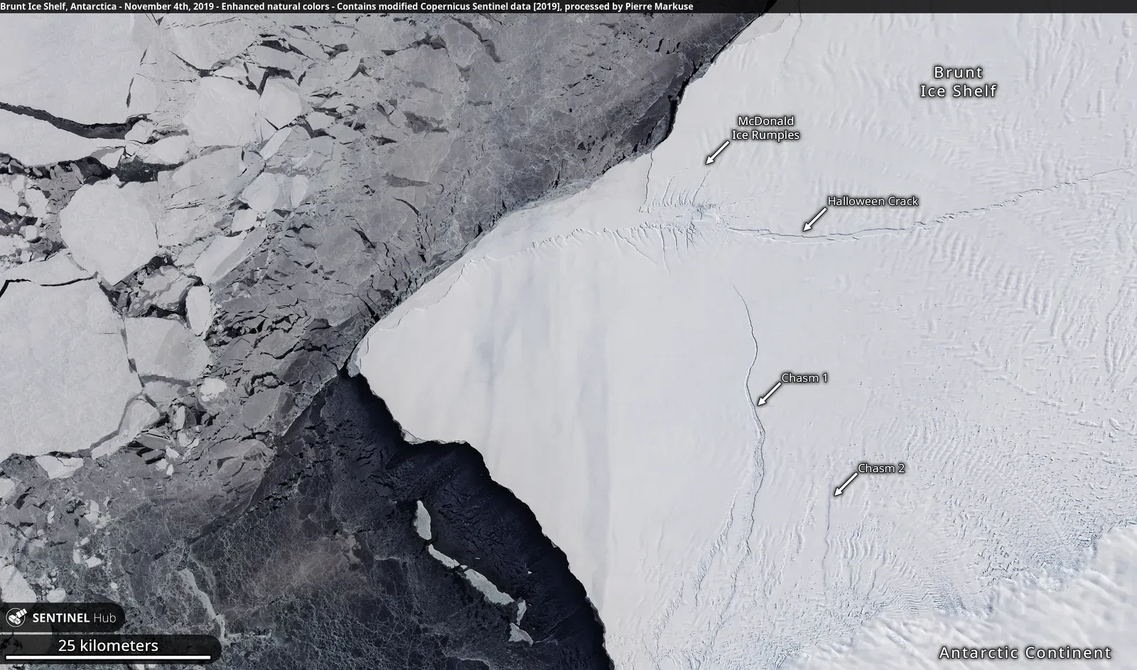
Along the fringes of Antarctica and parts of Greenland, thick floating ice shelves extend out over the ocean. Beneath them lies a hidden world: seabed troughs, ridges, and grounding zones where ice transitions from resting on rock to floating on seawater. These areas are notoriously difficult to map because ships cannot reach them and under‑ice vehicles face serious technical challenges.
What we know so far suggests that the shape of the seabed here critically controls how quickly ice sheets can retreat. Deep troughs can funnel warm water toward grounding lines, speeding melt, while sills and ridges can act as partial barriers. But large stretches of these key regions remain crudely mapped, stitched together from limited ship surveys near the ice edge, ice‑penetrating radar, and extrapolations.
In a world anxiously tracking sea‑level rise, that ignorance carries a cost. It means our models of future ice loss and ocean circulation rest partly on assumed seafloor topography. Some recent field campaigns have dramatically revised local maps, revealing channels and basins we did not know were there. It is sobering to realize that we can visualize small craters in lunar polar regions, bathed in permanent shadow, in more consistent detail than many grounding zones that help set the pace of real-world coastal change.
#13 Remote Plateaus and Rises Far from Any Nation’s Immediate Interests
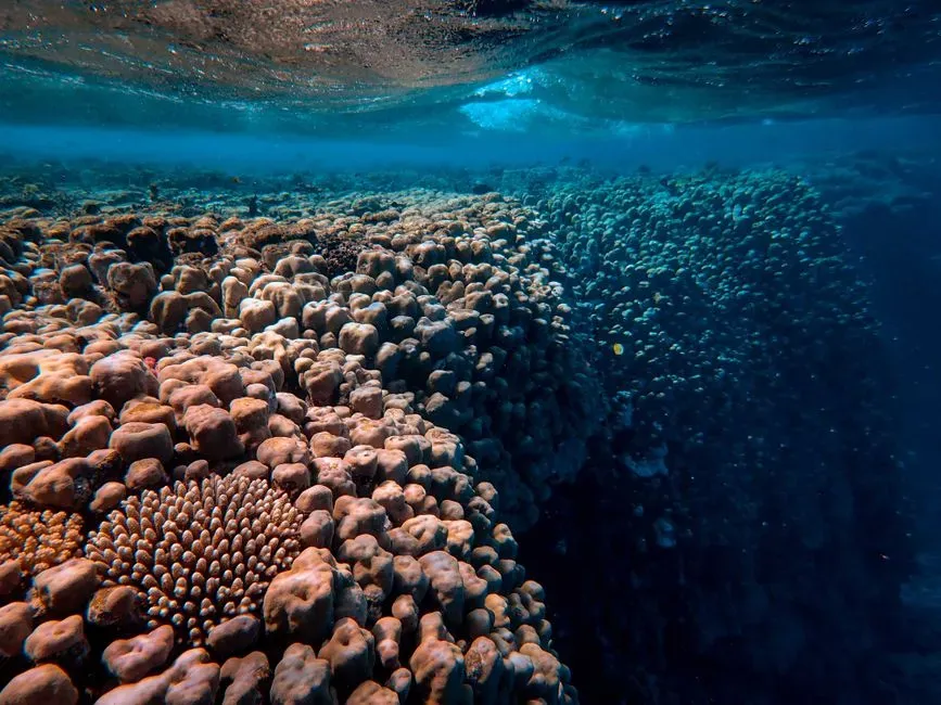
Finally, there are the orphan regions of the global seafloor: remote plateaus and rises that sit far from major shipping lanes, away from coastal nations’ core economic zones, and outside the obvious hotspots for fishing or energy. Think of them as the empty spaces at the edges of old maps that once read “here be dragons.” Today, the dragons have been replaced by low‑resolution bathymetry, but the spirit is the same: we simply have not invested the time to look closely.
Some of these plateaus are geologically intriguing, potentially representing lava floods, old microcontinents, or relict volcanic provinces. Others might host unique ecosystems or influence regional ocean circulation through their effect on currents and internal waves. But when funding is tight and ship time limited, these out‑of‑the‑way features rarely make it to the top of the priority list. We map just enough to sail over them safely, then move on.
Here’s what often characterizes these neglected regions:
- They lie far from existing deep‑sea research hubs or marine protected areas.
- They fall outside the immediate jurisdiction or strategic focus of powerful coastal states.
- They show up in global maps as smooth blobs, with few of the fine details we take for granted in terrestrial or lunar mapping.
If you have ever zoomed in on a global seafloor map and noticed that everything becomes strangely featureless at a certain scale, chances are you were looking at one of these places – the parts of our own planet that we still treat like the dark side of the Moon.
Conclusion: Why We Tolerate Knowing the Moon Better Than Our Own Planet
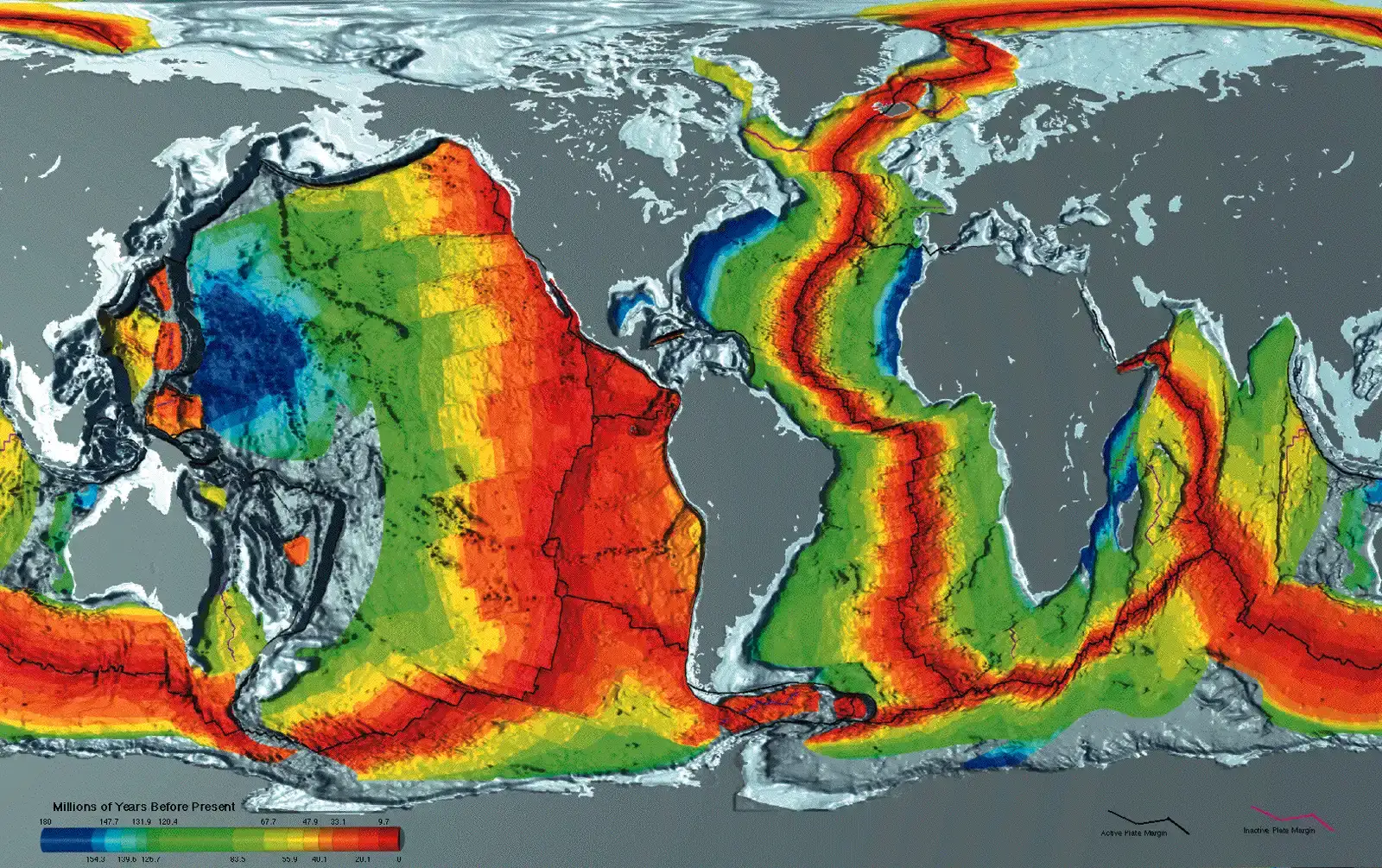
When you put all these regions together – the trenches, ridges, canyons, plains, seamounts, polar basins, and forgotten plateaus – a pattern emerges. Humanity has poured extraordinary effort into mapping places we can see from afar, like the Moon, while accepting astonishing gaps at home simply because the ocean surface gets in the way. It is not that the seabed is inherently unknowable; it is that we have collectively chosen not to invest enough in knowing it.
That choice carries consequences. Poorly mapped slopes complicate tsunami risk estimates; fuzzy trench and ridge data blur our understanding of earthquakes and plate tectonics; coarse polar bathymetry undermines precise climate and sea‑level projections; and missing details in abyssal plains and back‑arc basins hamper environmental oversight just as interest in deep‑sea mining and new shipping routes is accelerating. We are, quite literally, planning our future on a half‑finished map.
Personally, I find this imbalance hard to justify. Lunar topography is beautiful and scientifically rich, but the shape of the seafloor decides how heat moves, where storms leave their mark, where life hides, and where our infrastructure is safe or vulnerable. Treating the seabed as an optional extra while we admire alien landscapes feels a bit like memorizing the layout of a distant museum while ignoring the cracks in the foundation of your own house.
The good news is that the technology to fix this already exists: modern multibeam sonars, autonomous and uncrewed surface vessels, better data‑sharing, and international initiatives dedicated to complete ocean mapping. The real question is whether we are willing to treat the hidden seventy‑plus percent of our planet with the same curiosity and seriousness we give to barren, airless worlds. Next time you see a pristine map of the Moon, will you wonder what the bottom of your own planet actually looks like?