You probably grew up hearing about Atlantis and assuming all lost cities under the sea were pure myth. Then you discover places that really did sink, with streets, temples, harbors and houses still lying quietly on the seabed – and suddenly the line between legend and history feels very thin. As you look closer, you realize something even stranger: many of these real underwater cities still do not fit neatly into any existing historical story. Archaeologists can map walls, date pottery and raise statues, yet basic questions remain wide open: who exactly lived there, how their power worked, why the city failed and how much of it you are still missing. That uncertainty is where things get fascinating. You are not just reading history; you are standing in the middle of an unfinished puzzle, where every dive or new sonar scan could change the big picture overnight.
Pavlopetri, Greece: The Oldest Planned Underwater City You Can Still Swim Over
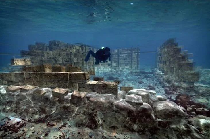
If you ever wanted to literally snorkel above a Bronze Age street grid, Pavlopetri is where you start. Off the coast of Laconia in southern Greece, you find well‑planned streets, rectangular buildings and even what looks like a central square, all lying just a few meters under clear water. Researchers date the settlement back to the early Bronze Age, around the third millennium BCE, and possibly even earlier, making it one of the oldest known planned towns now underwater. Yet for all that, you still do not really know what kind of community this was. Was Pavlopetri a small local port serving coastal trade, or part of a much larger Minoan-Mycenaean network with regional importance? Earthquakes and sea‑level changes probably sank it, but the exact sequence of events and the social story behind the ruins remain hazy. When you look at its tidy street plan, you sense a complex society, but the written records that could place it in a broader political framework simply have not turned up.
Thonis–Heracleion, Egypt: Egypt’s Drowned Gateway to the Mediterranean
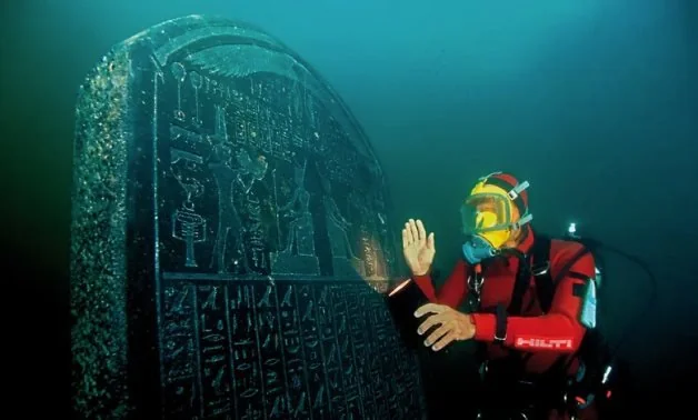
Imagine approaching ancient Egypt by sea and being forced to stop at a bustling port city long before you ever saw the pyramids or the great temples up the Nile. That entry point once existed: the twin‑named city Thonis–Heracleion, which controlled traffic at the mouth of the Canopic branch of the Nile. Today, it rests in Abu Qir Bay, several kilometers offshore and under about ten meters of water, with colossal statues, temple complexes, shipwrecks and harbor installations spread across the seabed. You know from ancient writers that this city mattered politically and religiously, especially for trade between Egypt and the Greek world, but the underwater evidence is still being pieced together. Soil liquefaction, earthquakes, gradual subsidence and rising sea levels seem to have combined to drag the city down over centuries. Even so, you are left with a big unanswered question: how exactly did Thonis–Heracleion balance royal control, local priestly power and foreign merchants in its heyday? The material remains scream “major port,” but the fine‑grained history is still mostly blank.
Canopus and Menouthis, Egypt: Vanished Sacred Suburbs on a Sinking Coast
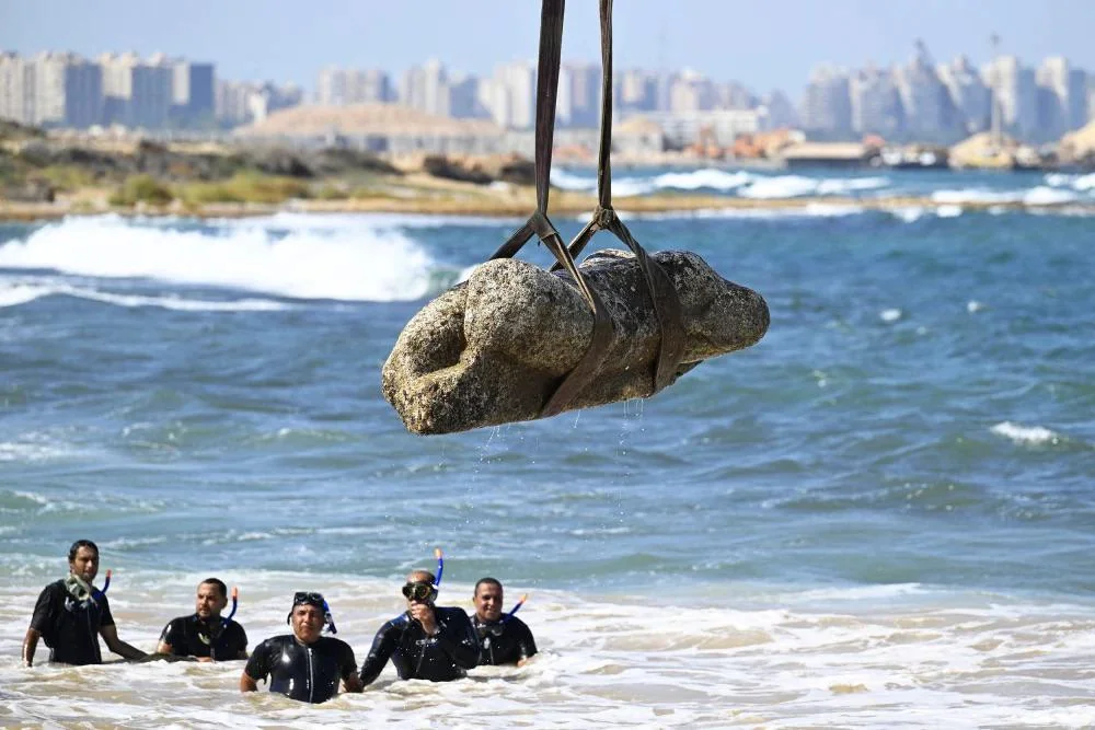
Staying in Abu Qir Bay, you find something even more confusing: multiple cities, not just one, lying drowned in the same general region. Canopus and Menouthis were once famous religious centers, associated with cults of Isis, Serapis and healing sanctuaries that drew visitors from across the Mediterranean world. Now they survive as scattered ruins – temple foundations, statues, inscriptions – on a seabed that used to be dry land. You can read ancient texts praising their sanctuaries, and you can map underwater structures, but knitting those two strands into a coherent urban history is surprisingly tough. Coastal subsidence and Nile flooding appear to have slowly undermined the entire area, but you still do not fully understand who lived in these “suburban” religious hubs and how they related to larger nearby cities like Alexandria. When you see how temples, canals and settlements are half‑buried in sediment, it feels like watching a film that jumps suddenly from the first scene straight to the end credits with the middle missing.
Port Royal, Jamaica: The Pirate Capital That Slid into the Sea
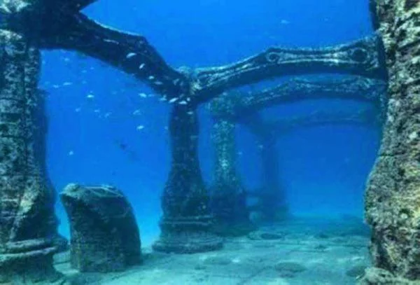
When you picture a sunken town, you probably imagine something ancient and quiet. Port Royal refuses to play that role. In the late seventeenth century, this Caribbean port was a noisy, notorious center of trade, privateering and what moralists of the time called shocking vice. Then, in 1692, an earthquake and liquefaction event caused part of the town to slump into Kingston Harbour within minutes, freezing its final hours in sediment. You might think, because the disaster was relatively recent and well documented, that historians have Port Royal neatly classified. In reality, the underwater remains reveal a day‑to‑day urban life that never appears in official records: tavern layouts, shop inventories, domestic objects and imported goods all jumbled together. As you compare written accounts with what divers find, you realize you still lack a full framework that explains how this hybrid world of merchants, enslaved people, pirates and colonial officials functioned on the ground. The seabed is telling you a story that the paperwork never bothered to write down.
Baiae, Italy: The Submerged Resort of Roman Elites
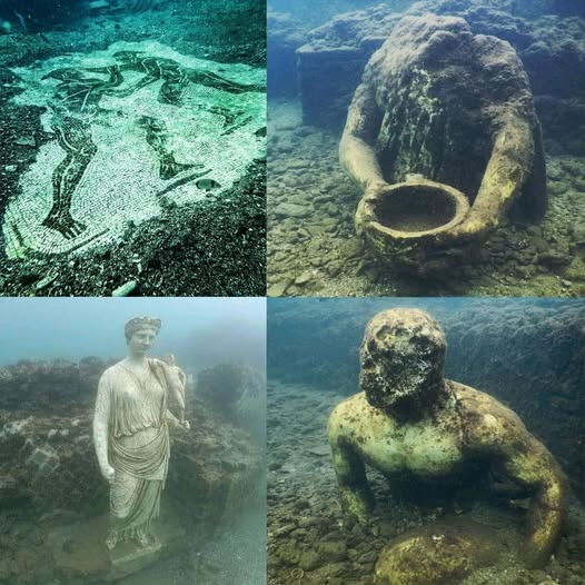
Off the Bay of Naples, you can dive or boat over Baiae, once a glamorous resort where Rome’s wealthy came to relax, scheme and show off. Today, mosaics, statues, villa foundations and streets lie underwater, creating the eerie feeling that you are gliding above a sunken luxury district. Volcanic activity and gradual subsidence in the Phlegraean Fields have pushed large areas of the old shoreline below sea level. You know from Roman authors that Baiae had a reputation for excess and political intrigue, yet underwater archaeology shows a landscape that does not quite match those literary snapshots. Thermal baths, private harbors and shoreline villas appear in patterns that are still being mapped and interpreted. You are left asking how this watery mosaic fits into the broader story of Roman urbanism: was Baiae just a pleasure resort, or a semi‑official power stage where alliances were made and careers destroyed? The ruins are stunningly clear, but their social meaning is still partly out of reach.
Atlit‑Yam, Israel: A Prehistoric Village Frozen Mid‑Life
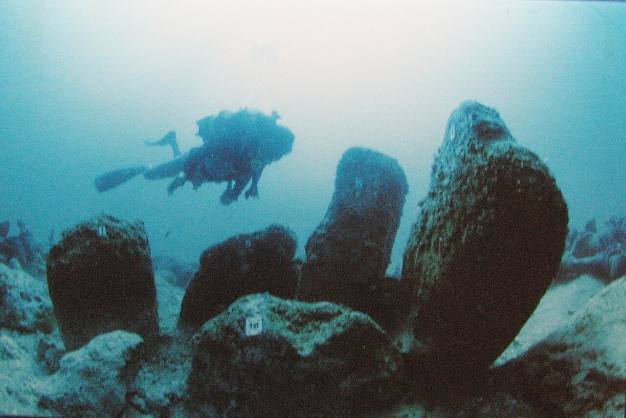
Far off the romantic image of classical temples, you find Atlit‑Yam, a Neolithic settlement now lying under the Mediterranean off the coast of Israel. Instead of marble and inscriptions, you see stone house foundations, wells, a circle of standing stones and even burials that include early evidence of diseases like tuberculosis. Sea‑level rise after the last Ice Age likely drowned this coastal community several thousand years ago. The site gives you hauntingly intimate glimpses of daily life – food remains, tools, and carefully arranged graves – yet the broader cultural framework is fuzzy. Where exactly do the people of Atlit‑Yam fit among the many early farming and herding cultures of the Levant? Did they see themselves as part of a wider network, or just as a local shoreline community trying to adapt to changing seas? You can read their diet in the bones and their crafts in the artifacts, but their sense of identity and their links to neighboring groups remain mostly guesses.
Dwarka and the Gulf of Khambhat, India: Between Epic Memory and Seabed Discoveries
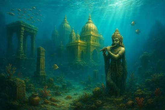
Along India’s western coast, near modern Dwarka and further south in the Gulf of Khambhat, underwater surveys have revealed walls, stone blocks, possible jetty structures and paleo‑river channels. Some media reports rush to connect anything found offshore with the legendary city of Dwarka from ancient Sanskrit texts. When you look at the actual research, you see a much more cautious and complicated picture. Offshore excavations have documented fortification remains and harbor features near Dwarka and Bet Dwarka, pointing to real historical coastal settlements that interacted with changing sea levels and maritime trade. In the deeper Gulf of Khambhat, sonar and sampling suggest relict landscapes and possible human activity, but many archaeologists urge restraint, arguing that existing evidence does not yet support grand claims about a lost pre‑Harappan metropolis. As you follow the debate, you realize you are watching an underwater region still searching for a secure place in South Asian prehistory, balanced between genuine finds and over‑heated interpretations.
The Sunken Districts of Alexandria, Egypt: Palaces, Ports and Political Mysteries
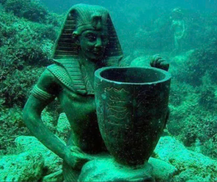
When you stand on the modern shore of Alexandria, it is easy to forget that large chunks of the ancient city now lie under the waves. Underwater surveys in its harbors have revealed ruined palaces, port structures, lighthouse remains and monumental statues, all hinting at the lost royal quarters of the Ptolemaic dynasty and later Roman periods. Earthquakes and coastal subsidence helped drag this part of the city down, scattering blocks, columns and sphinxes across the seabed. You can identify some structures with reasonable confidence – a royal quarter here, harbor installations there – but many details remain unsettled. Which exact buildings belonged to which rulers, how ceremonial routes connected land and sea, and how ordinary residents interacted with these monumental spaces are still being reconstructed. You may think of Alexandria as a well‑documented Hellenistic and Roman metropolis, yet its underwater districts remind you that even famous capitals can be only partly understood when half their core has literally slipped beneath the surface.
Phanagoria’s Drowned Quarter, Black Sea: A Greek City Still Re‑Drawn
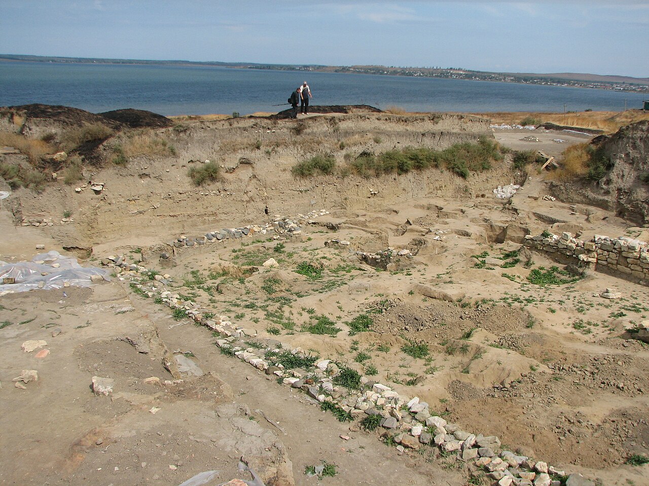
On the Taman Peninsula by the Black Sea, the ancient Greek city of Phanagoria sprawled across land and, as it turns out, into what is now shallow water. Parts of its harbor area and urban fabric have been found submerged, with walls, streets and artifacts showing a bustling center of trade linking Greek settlers, local peoples and later larger empires. Coastal change and erosion over many centuries appear to have eaten away at the shoreline, taking districts with them. Even when you combine land excavations and underwater work, the whole picture keeps shifting. Was Phanagoria primarily a Greek colonial city, a mixed frontier capital, or something more fluid that changed character dramatically over time? You see traces of different cultural layers in the finds, but pinning them down to a single, simple narrative does not work. The underwater quarter, in particular, forces you to rethink tidy models of colonization and cultural contact and admit that real ancient port cities rarely behaved according to textbook categories.
Lion City (Shi Cheng), China: A Deliberately Drowned Time Capsule
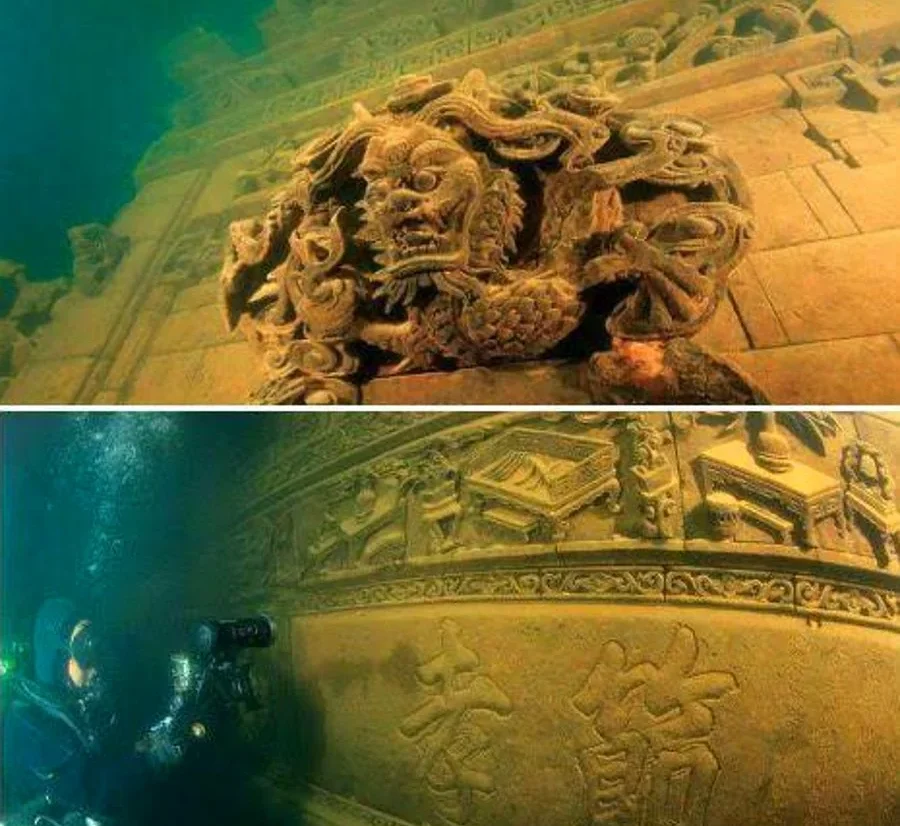
Not every underwater city vanished in a mysterious ancient catastrophe. In eastern China, the city of Shi Cheng, often called Lion City, was intentionally flooded in the twentieth century during the creation of the Qiandao Lake reservoir. Beneath the water, multi‑story buildings, gates, ornate carvings and traditional street layouts are preserved in cold, relatively still conditions, turning the lake into a kind of accidental museum. You would think, because the flooding happened so recently, that Shi Cheng would be simple to place historically. In some ways, it is: you know its approximate age, its role as a county center and its position in imperial Chinese administration. But when divers and remote cameras show you rooftop lines disappearing into green water and elaborate stonework untouched by modern redevelopment, you notice something else. The city survives as a physical snapshot that no longer matches living memory, challenging you to reconcile the bureaucratic records of a routine regional town with the almost mythic aura it has gained as an underwater ghost city.
Yonaguni, Japan: Monument, Geology or Something In‑Between?
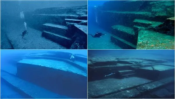
Near Japan’s Yonaguni Island, divers encounter massive stepped formations with sharp angles, terraces and what some people insist look like carved features. Ever since these structures became widely known in the late twentieth century, they have sparked arguments. Are you looking at a natural sandstone formation shaped by currents and fractures, or the submerged remains of a human‑modified structure from a time when sea levels were lower? Geologists often lean toward natural explanations, while a few researchers and many enthusiasts argue for at least some human reshaping of existing rock. What makes Yonaguni fit this list is that it sits uneasily between categories: not securely a city, not comfortably just an untouched geological oddity in the public imagination. When you watch videos or see diagrams, you are pulled into the same uncertainty professionals wrestle with, recognizing that your desire for a dramatic underwater city can easily outrun the actual evidence.
Conclusion: Why These Cities Resist a Simple Story
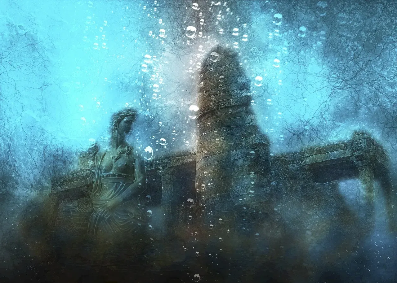
When you pull back and look at all these places together, a pattern emerges: the sea is not just a graveyard of cities, it is a messy archive of histories that do not quite fit your current frameworks. Some sites, like Pavlopetri and Baiae, sit at the edge of well‑known civilizations but reveal urban experiments you had not fully grasped. Others, like Atlit‑Yam, Tybrind Vig or the debated structures off India and Japan, challenge your tidy timelines and your confidence about what counts as a “city” in the first place. Living in 2026, you have access to sonar mapping, 3D modeling and advanced dating techniques, yet you are still only scratching the surface of this underwater world. Every new survey has the potential to rearrange your mental map of the past, just as an unexpected current can push a diver into a completely new section of a site. As more of these drowned landscapes come into focus, you are forced to ask yourself: how many major chapters of human history are still lying just out of sight, waiting for you beneath the waves?