You probably think you already know America’s national parks: big canyons, tall mountains, photogenic arches. But behind those postcard views, some parks are quietly hiding wild geological stories that most visitors never hear about. If you love peeling back the surface and understanding what is really going on beneath your feet, these places will completely change how you see the landscape. What follows is not just a list of pretty spots. You’re going to walk into ancient seas, stand atop buried volcanoes, look across a crack in the Earth’s crust, and peer into the skeleton of a long‑vanished reef system. Think of this as the “director’s cut” of the national parks: same scenery, but with all the behind‑the‑scenes geology revealed in a way you can actually understand and use on your next trip.
1. Yellowstone National Park: Inside a Living Supervolcano
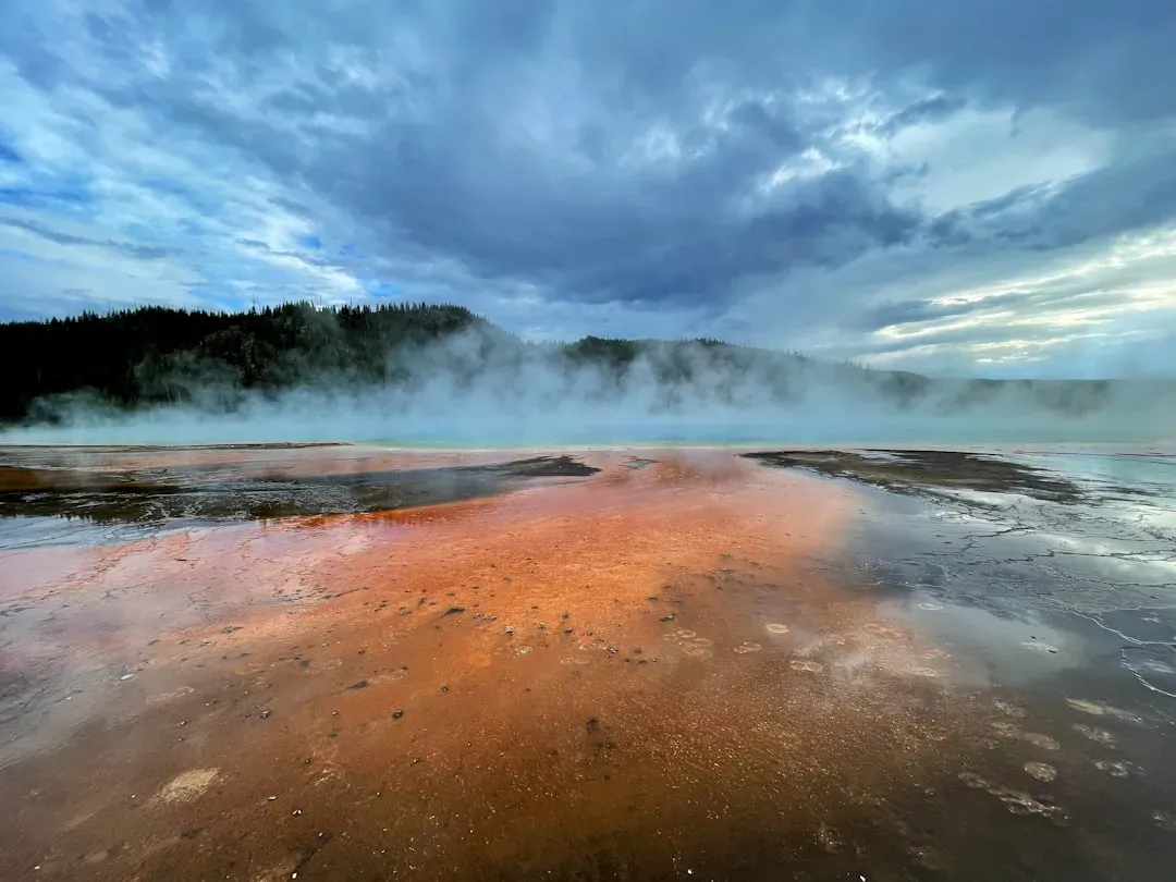
When you watch Old Faithful erupt, you’re really seeing the pressure valve of a gigantic volcanic system that you’re standing inside. Yellowstone sits atop a huge volcanic caldera, formed by cataclysmic eruptions that blasted out so much material the ground collapsed into a broad, shallow bowl. Beneath you, a hot mantle plume, often called the Yellowstone hotspot, continues to supply heat, driving the park’s roughly thousands of thermal features, from geysers and hot springs to fumaroles and bubbling mud pots. That constant churning explains why you see brilliantly colored pools lined with heat‑loving microbes and terraces of mineral deposits growing like frozen waterfalls.
The hidden secret is that the “mega eruption” narrative you often hear is only part of the story; the real ongoing action is the restless movement of the ground itself. You can actually track uplift and sinking of the caldera floor over time, a slow breathing motion measured in inches that reveals magma and hot fluids shifting deep below. As you walk past steaming vents and sulfur‑rich pools, you’re basically touring the plumbing of one of Earth’s most studied active volcanic systems, a place where geology is happening in real time instead of being frozen in the distant past.
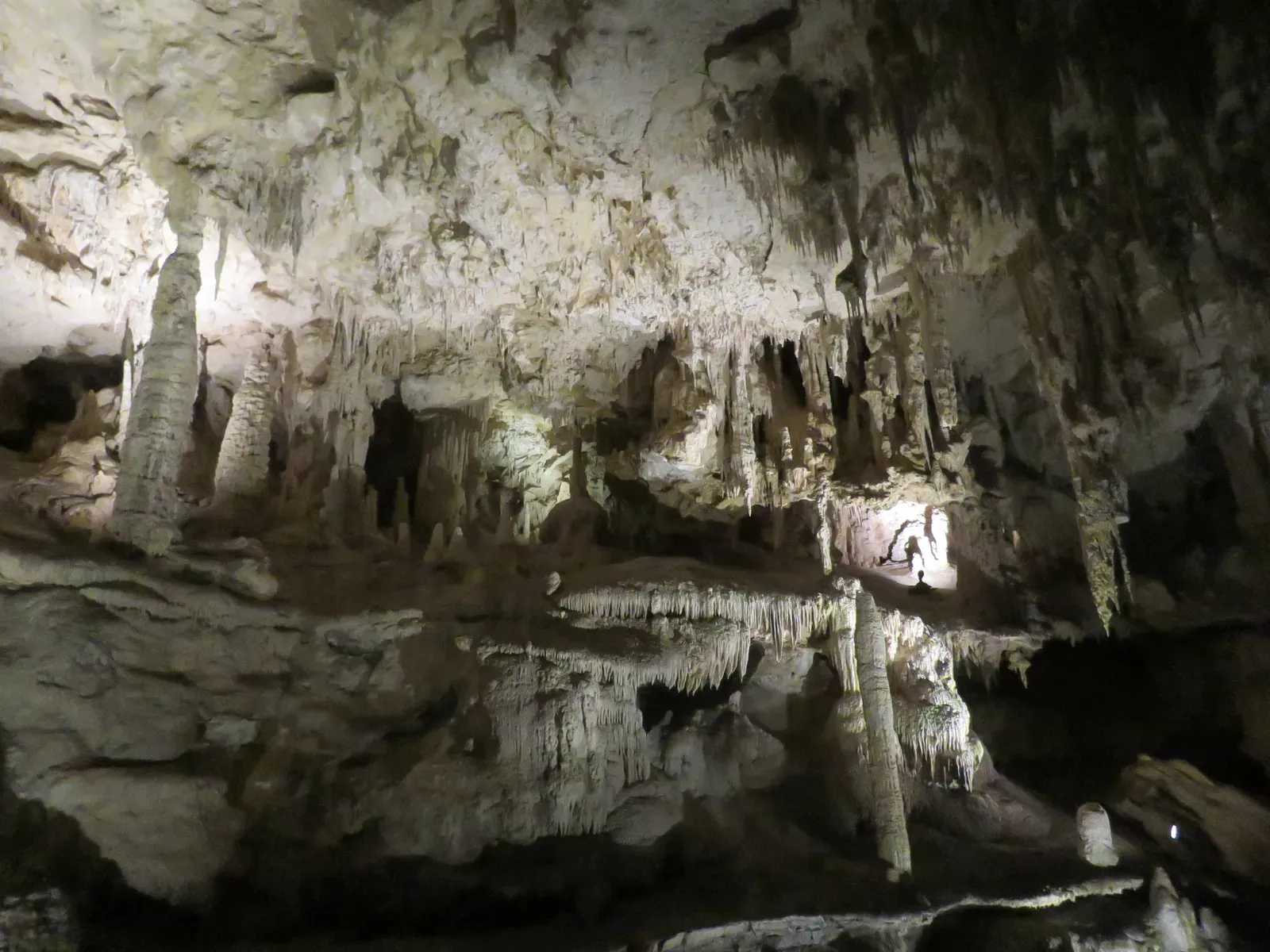
2. Carlsbad Caverns National Park: An Ancient Reef Dissolved From Within
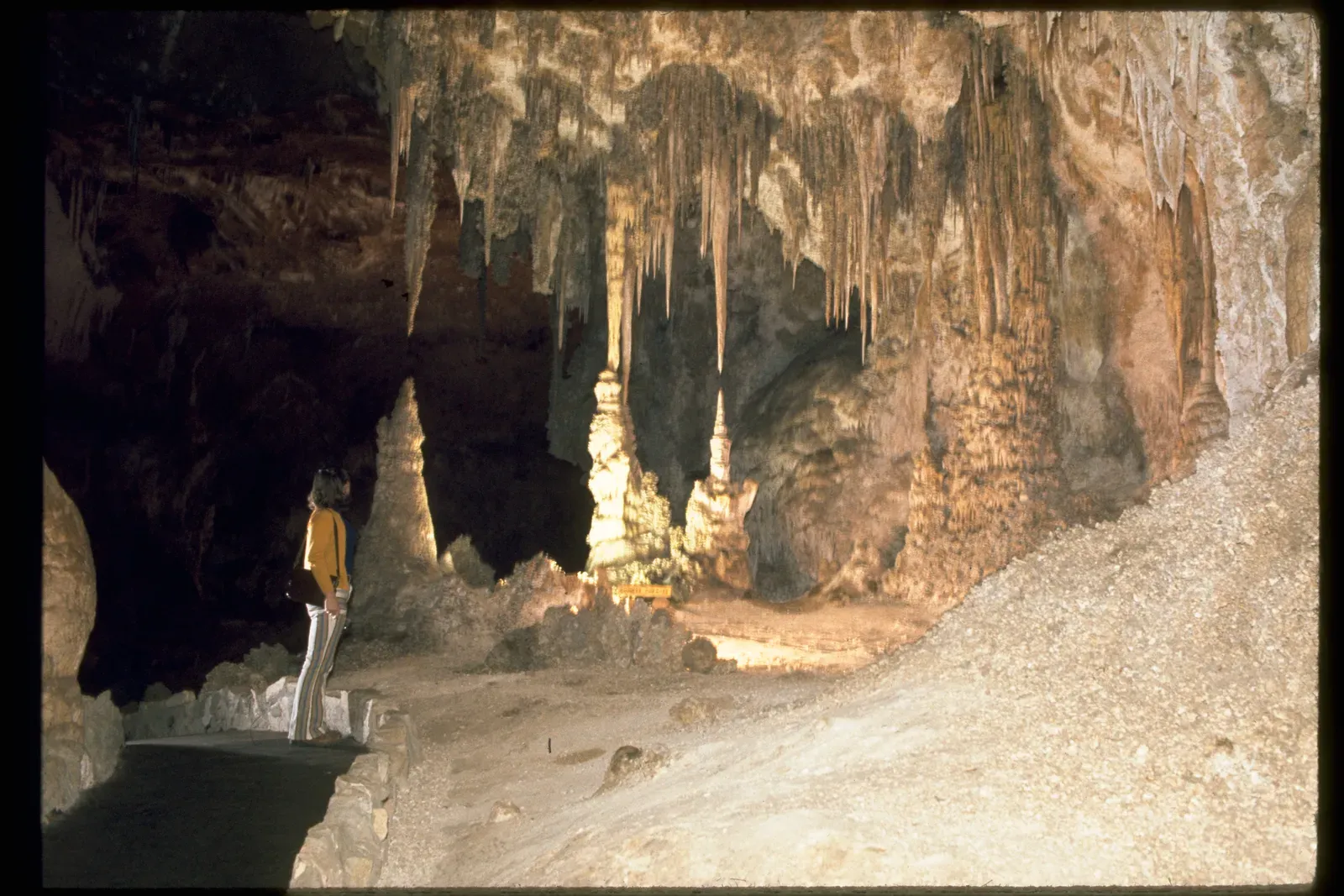
When you descend the switchbacks into Carlsbad Cavern, you might think you’re just entering a big limestone cave decorated with stalactites. In reality, you’re stepping inside the fossilized remains of a 260‑million‑year‑old reef that once rimmed a warm inland sea. The surrounding Guadalupe Mountains are built from that old reef complex, packed with ancient marine fossils that tell you this desert used to be more like a tropical lagoon than a dry wilderness. Instead of forming mainly from dripping water like many caves, the main chambers at Carlsbad were carved by acidic hydrogen‑sulfide‑rich waters rising from below, which reacted with oxygenated groundwater to create sulfuric acid that ate away the rock from the inside.
This unusual process is what makes the caverns so huge and complex, with rooms large enough to swallow skyscrapers. As you explore the Big Room and its towering formations, you’re walking through hollowed‑out chunks of that old reef, later decorated by ordinary dripstone as surface water slowly seeped in. The hidden story is that Carlsbad is not just a pretty cave; it’s a rare example of sulfuric‑acid speleogenesis, a mouthful of a term that basically means the cave grew upward from chemical reactions in deep groundwater rather than just downward from rain. You’re literally wandering through a dissolved reef, rebuilt drop by drop into the sculptures you see today.
3. Capitol Reef National Park: A Hundred‑Mile Wrinkle in the Earth
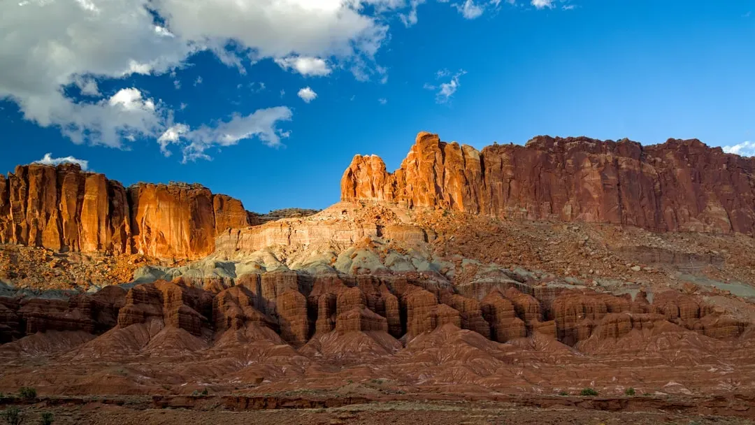
Capitol Reef looks at first like just another stretch of red rock country, but if you pay attention to the skyline you’ll notice something strange: the land tips, folds, and dives in one consistent direction for mile after mile. That tilt is part of the Waterpocket Fold, a roughly hundred‑mile‑long monocline, which is essentially a giant step in otherwise flat rock layers created when deeper faults shifted and bent the overlying crust. Think of a thick rug pushed from one side so it bunches up in a single long crease; that’s what this park preserves on a colossal scale. The name “Waterpocket” comes from the many potholes that trap water along this tilted landscape, turning it into an unlikely reservoir in desert country.
As you hike through canyons like Capitol Gorge or look out over Strike Valley, you’re actually seeing a cross‑section of Earth’s crust peeled open. Different rock layers, from ancient seas to river deposits, are exposed like pages in a half‑open book, letting you read a long chapter of geologic time simply by changing your viewpoint. The hidden secret here is not a single rock formation but the way the entire region is warped, revealing how slow, deep tectonic movements can reshape huge tracts of land without the drama of an earthquake or volcano. If you want to understand how continents bend, this is one of the clearest places in the US to do it with your own eyes.
4. Big Bend National Park: A Front‑Row Seat to the Dinosaur Extinction Boundary
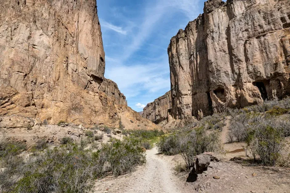
Big Bend is famous for remote desert canyons and sweeping river views, but if you know where to look, you can stand near rock layers that quietly record one of Earth’s most dramatic turning points: the end of the age of dinosaurs. The park preserves some of the southernmost known terrestrial sedimentary rocks in the US that span the Cretaceous–Paleogene boundary, the interval when a massive asteroid impact and other factors triggered a global extinction. In those layers, paleontologists have found fossils from dinosaurs, giant crocodiles, and early mammals, capturing a world that was about to change forever. You’re not just seeing rocks; you’re standing in the middle of a time line that crosses a mass extinction.
The park’s geology also shows off a mix of ancient seas, uplifted mountains, and volcanic activity, all stitched together in one landscape. As you drive from the Rio Grande up into the Chisos Mountains, you’re climbing through deposits that shift from marine limestones with sea creatures to volcanic rocks erupted from local centers. The hidden twist is that Big Bend is both a fossil treasure chest and a structural puzzle, where collision, rifting, and volcanism have all left marks. If you’re willing to dig into the map and maybe talk with a ranger or geologist on site, you can trace not only how dinosaurs lived here but how the ground beneath them was constantly being rearranged.
5. Mammoth Cave National Park: The World’s Longest Known Cave System
When you first step into Mammoth Cave, you might assume it’s just another limestone cavern, but you’re actually entering the largest known cave system on the planet, with hundreds of miles of mapped passages and more still being explored. This underground labyrinth formed in a classic karst landscape, where slightly acidic rainwater and groundwater slowly dissolved thick limestone and created networks of tunnels, shafts, and sinkholes. What makes Mammoth unusual is how many distinct levels of passages exist, stacked like a multistory parking garage that records different past river levels. As surface streams cut deeper into the land over millions of years, groundwater followed, abandoning higher tubes and carving new ones below.
Walking along the broad, dry corridors of the main tour routes, you’re often in old river channels that no longer carry water, ghosts of ancient drainage systems preserved in rock. Above you, sinkholes and disappearing streams on the surface mark places where water still vanishes into the subsurface to continue the slow work of dissolution. The hidden geological secret here is not a single dramatic chamber but the sheer scale and complexity of the underground network, which shows how ordinary chemical weathering and water flow can quietly engineer one of the planet’s biggest subterranean structures. If you ever wanted proof that small processes add up over time, you’re literally walking through it.
6. Glacier National Park: Ancient Seafloor Thrust Over Younger Rocks
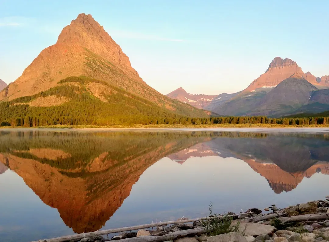
Glacier National Park grabs your attention with jagged peaks and turquoise lakes, but the real geological shock comes when you realize many of those high cliffs are made of very old rocks sitting on top of much younger ones. The park is dominated by a feature called the Lewis Overthrust, where massive slabs of Precambrian sedimentary rock were pushed more than fifty miles and shoved over younger Cretaceous rocks along a low‑angle fault. In everyday terms, it’s as if someone slid the basement of the house out over the front yard and left it perched on top. When you hike above Going‑to‑the‑Sun Road or stare up at the towering walls, you’re looking straight at this tectonic sleight of hand.
Those ancient rocks, once deposited in shallow seas, often preserve ripple marks, mud cracks, and even rare fossils of early life, giving you a glimpse into a world hundreds of millions of years older than the dinosaurs. The hidden secret is that Glacier is not just about ice carving valleys; it is also about huge horizontal movements of crust that stacked the deck of geologic time out of order. If you pay attention to the roadside signs and basic rock colors, you can actually see where the older overthrust rocks meet younger layers below, a subtle line that tells a story of continent‑scale forces powerful enough to rearrange the order of history preserved in stone.
7. Petrified Forest National Park: A Buried Floodplain Turned to Stone
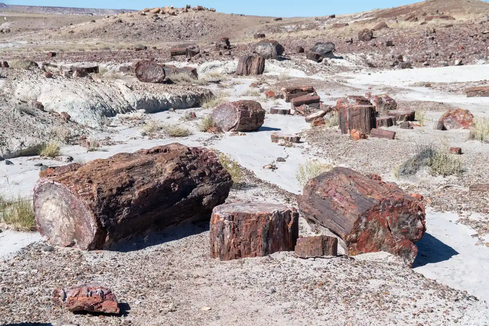
At first glance, Petrified Forest looks like a collection of colorful logs scattered across painted badlands, but those “logs” are actually the mineralized remains of ancient trees that lived roughly during the Late Triassic period. Back then, this area was a lowland floodplain crossed by rivers, filled with lush vegetation and early dinosaurs and crocodile‑like reptiles. When trees fell, many were rapidly buried by sediment, cutting off decay. Over time, silica‑rich groundwater slowly infiltrated the wood, replacing organic material cell by cell with quartz and other minerals. The result is solid stone that still preserves growth rings and bark textures, now stained with iron and manganese in bright reds, purples, and yellows.
The real hidden story is how much broader the geology is than just the logs. The surrounding Chinle Formation holds a record of ancient river systems, volcanic ash falls, and changing climates at a time when reptiles were diversifying and mammals were just getting started. As you wander through Crystal Forest or Blue Mesa, you’re walking across layers that captured both catastrophic floods and quiet floodplain soils, all later carved into badlands by erosion. If you look beyond the obvious beauty of the petrified wood, you start to see a full ecosystem frozen in place, a snapshot of life and landscape at a time when the continents were still part of the supercontinent Pangaea.
8. Crater Lake National Park: The Aftermath of a Collapsed Volcano
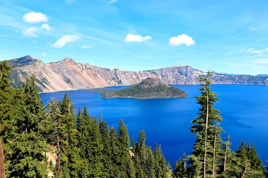
Standing on the rim of Crater Lake, you see one of the clearest, deepest lakes in the world, but what you are really looking into is the scar left by a volcanic mountain that tore itself apart. About seven and a half thousand years ago, Mount Mazama, a large composite volcano in the Cascades, experienced a massive eruption that emptied so much magma from its underground chamber that the summit area collapsed inward. This collapse formed a deep caldera that later filled with rain and snowmelt, eventually becoming the intensely blue lake you see today. Wizard Island, the cone poking out of the water, is a younger volcano that erupted on the caldera floor after the main event.
The lake’s remarkable clarity and depth help hide another secret: the underwater slopes are dotted with additional volcanic features, including smaller cones and lava flows that never broke the surface. Modern mapping using sonar has revealed this submerged landscape in detail, showing that the volcanic story continued long after the initial collapse. As you drive the rim or take a boat tour when available, you’re circling and traversing the remains of a large volcano that was dramatically rearranged over a short geologic time span. It is one of the best places in the US to see how calderas form and evolve, not just in diagrams but as a real, walkable terrain.
9. Great Basin National Park: Marble Caves and Ancient Bedrock
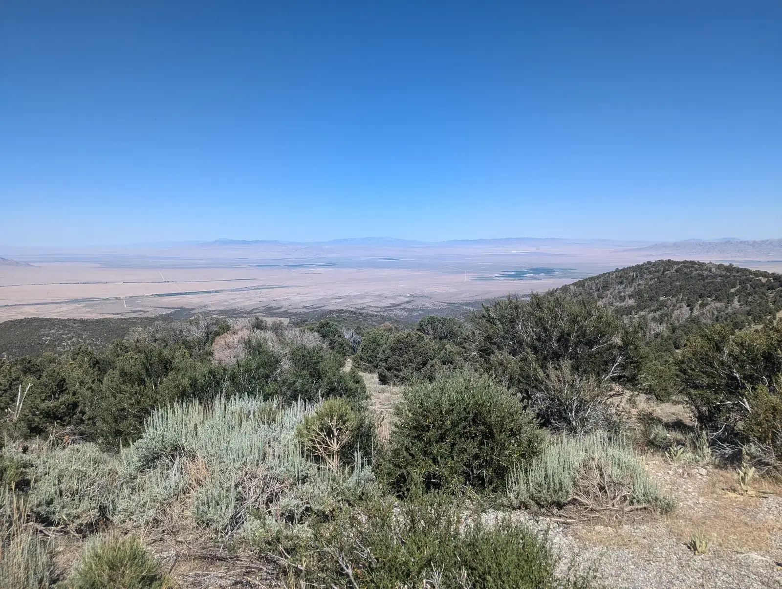
Great Basin often flies under the radar, but if you head into Lehman Caves at the base of Wheeler Peak, you find a surprisingly dense concentration of unusual cave formations. These marble caves formed when limestone layers were metamorphosed under heat and pressure, then later dissolved by slightly acidic water, leaving behind elaborate chambers. What sets Lehman Caves apart is the abundance of rare formations known as shields, flat, disk‑like deposits that jut from the walls and ceilings, along with draperies, columns, and delicate helictites that twist in gravity‑defying directions. In a relatively short distance underground, you see a catalog of speleothems that usually would be spread out over a much larger area.
Above ground, the park exposes some of the oldest rocks in the region, along with glacial features carved during recent ice ages that left cirques, moraines, and polished bedrock near the high peaks. You can literally move from ancient basement rocks to relatively young glacial deposits on a single hike. The hidden secret here is how much geologic diversity is packed into one compact area: deep‑time bedrock history, underground karst development, and very young ice‑age landforms all layered together. If you’re the kind of traveler who likes to see multiple chapters of Earth’s story in one place, Great Basin rewards you for going out of your way.
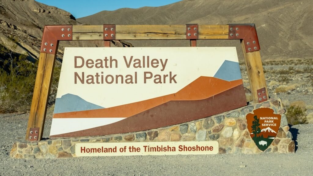
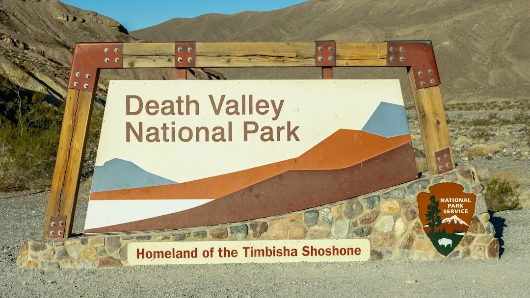
10. Death Valley National Park: Sliding Rocks and a Hyper‑Active Landscape
Death Valley is known for extreme heat and salt flats, but tucked away on a remote playa called the Racetrack you find one of its strangest geological mysteries: rocks that appear to have slid across the mud, leaving long tracks behind them. For many years, people speculated about everything from strong winds to magnetic forces, but careful observations eventually showed that a rare combination of thin ice sheets, shallow water, and light breezes can nudge the rocks along when conditions are just right. When the ice breaks up into floating panels, they gently push the stones, carving those eerie trails in the soft playa surface. You almost never catch it in action, but the tracks remain as proof that even slow, subtle forces can leave dramatic marks.
The broader valley itself is an active tectonic basin, dropping as surrounding ranges rise along normal faults, creating one of the lowest points in North America alongside nearby peaks that soar more than two miles above. This rapid stretching of the crust, combined with recent volcanic activity and ongoing erosion, means the landscape is being reshaped on humanly appreciable timescales. As you drive from Badwater Basin up to higher viewpoints, you’re traveling across a cross‑section of Earth’s crust that is literally being pulled apart. The hidden story is that Death Valley is not just a static land of extremes; it is a dynamic laboratory where climate, tectonics, and surface processes interact in ways you can actually see from one overlook to the next.
US national parks are often praised for their scenery, but when you start paying attention to the geology, the scenery turns into a set of clues in a much bigger story. Each of these ten parks lets you stand inside a process: a collapsing volcano, a dissolving reef, an underground river system, or a continent bending along a giant fold. If you approach your next visit with a bit of curiosity, reading the rock layers and landforms like a detective, you’ll find that every viewpoint suddenly comes with depth, history, and a sense of awe that goes far beyond a pretty photo.
Next time you pull off at a turnout or step onto a trail, ask yourself what invisible forces built the shapes in front of you and how long they have been at work. When you start to see the hidden volcanic chambers, ancient seas, shifting faults, and vanished forests behind those views, the parks stop being just destinations and become stories you can walk through. Which of these hidden geological secrets are you most excited to go stand on, inside, or above for yourself?