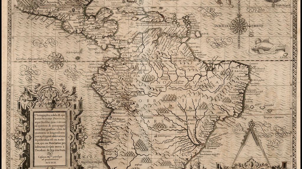
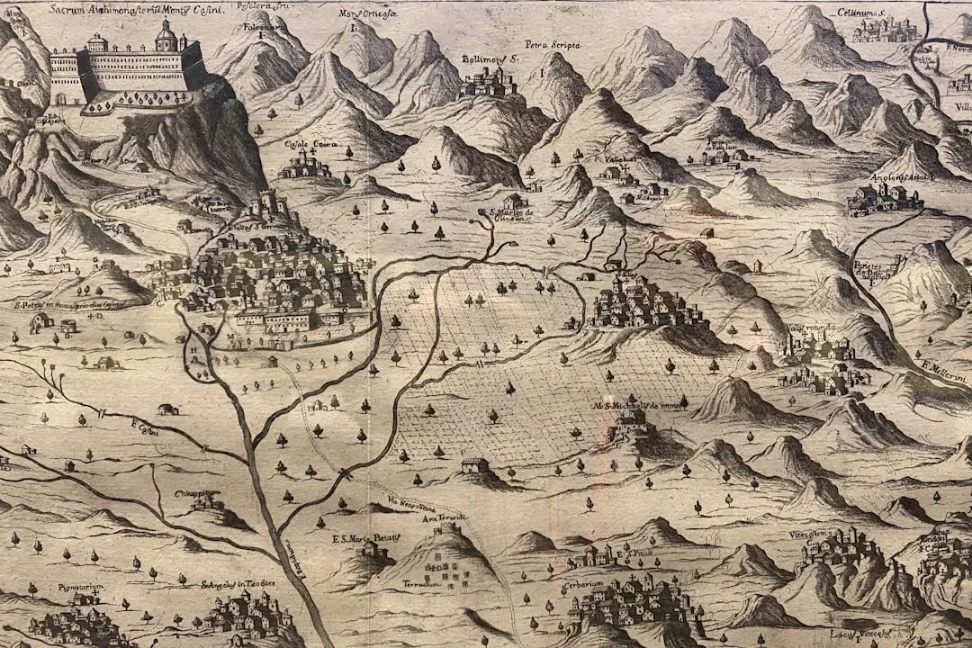
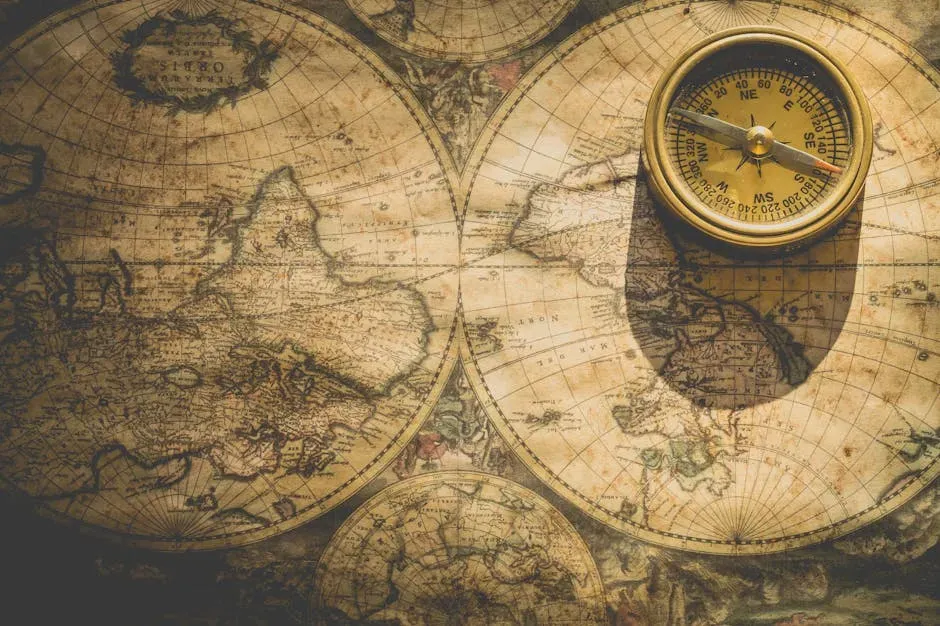
If you have ever stared at a reproduction of an ancient map and felt a weird chill, you are not alone. Some of these maps seem to show coastlines that should not have been charted yet, continents shaped with eerie accuracy, or mysterious lands that supposedly did not exist in the cartographer’s world. It almost feels like someone peeked into the future, then tried to sketch it with ink and parchment. That tension between what ancient people should have known and what appears on their maps has fueled centuries of speculation, from lost civilizations to alien visitors.
But once you get past the dramatic claims, the real story of these impossible maps is stranger in a quieter, more human way. It is about how sailors misheard things in storm-battered ports, how monks copied old manuscripts they barely understood, and how coastlines were guessed from the vaguest hints like a rumor heard in a crowded market. In that messy mix of observation, error, myth, and genuine insight, some maps ended up looking uncannily modern. So, are these maps proof of forgotten global explorers, or just a reminder that history is rarely as clean and linear as we want it to be?
The Strange Case of “Too Accurate” Ancient Maps
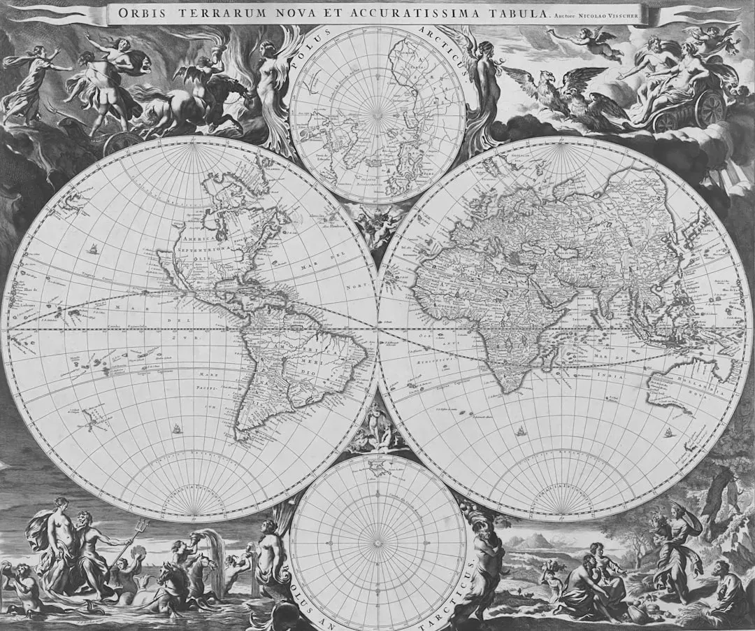
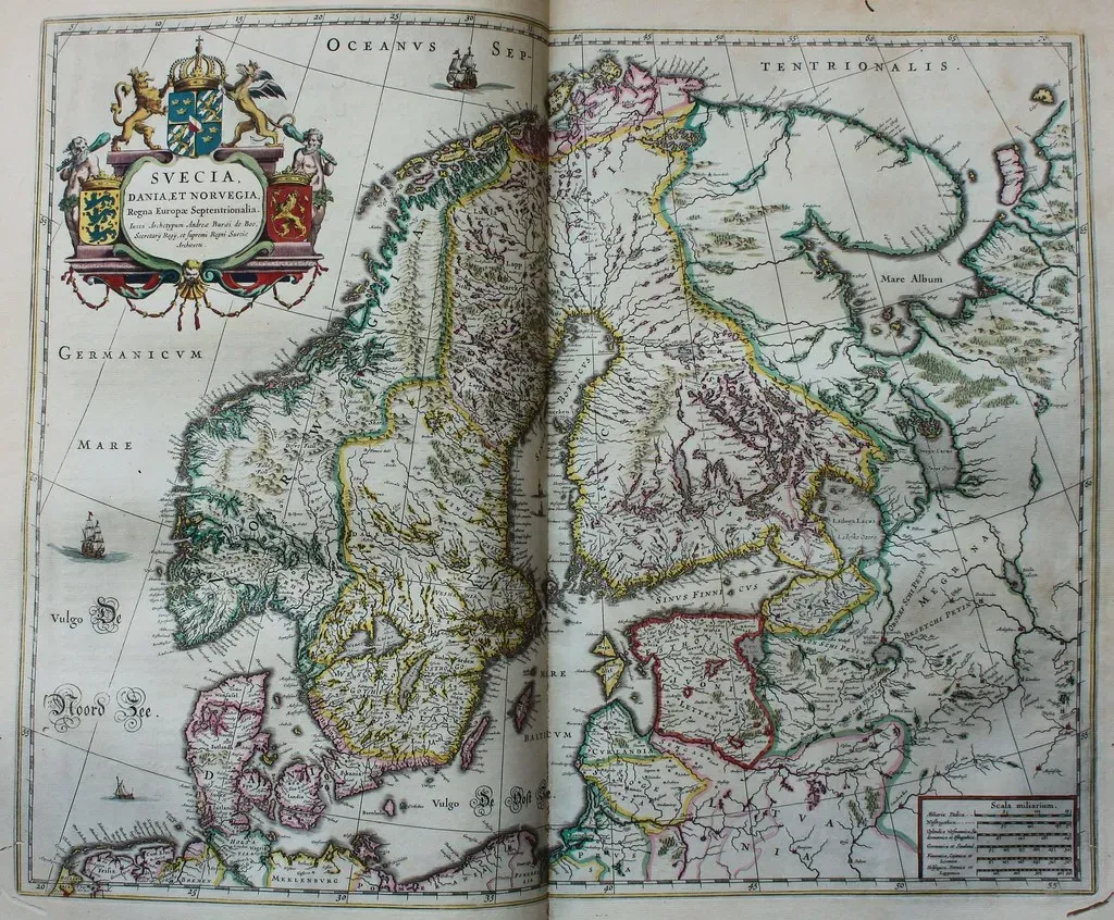
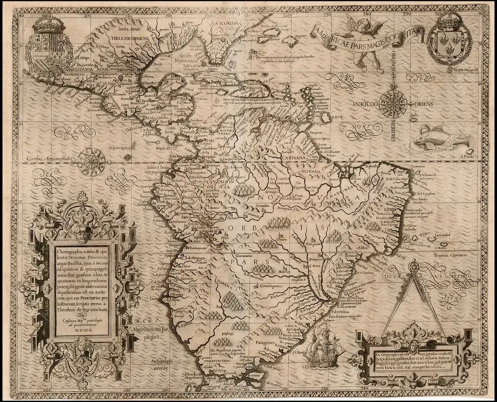
One of the biggest reasons people get excited about ancient maps is a simple visual shock: some coastlines look surprisingly familiar. You see a rough outline of South America or a recognizable Mediterranean, and your brain goes straight to the question of how they could possibly have known. From a modern perspective, we think of mapping as a scientific process that demands direct measurement and exploration, so anything that seems ahead of its time looks suspiciously like a cheat code to the past.
But that reaction leaves out how approximate and interpretive most early maps really were. When we compare an old parchment to a modern satellite image, we are doing something those mapmakers never imagined. Many of these “too accurate” shapes turn out to be a mix of educated guesses, distorted scaling, and the human brain’s tendency to see patterns everywhere. It is like seeing animals in clouds: once someone tells you that squiggle on the page is a continent, you cannot unsee it, even if the resemblance is mostly coincidence.
Oral Reports, Trader Gossip, and the Power of Secondhand Geography
We tend to picture ancient cartographers as scholars in quiet rooms, but their raw data often came from sailors shouting over crashing waves or merchants gossiping in crowded harbors. A captain might describe a “great land to the west, with a long curving coast and big rivers,” and that turns into a confident line on a map. Over time, as more travelers repeat similar tales, the shape gets refined, stretched, or merged with others, until it resembles something we recognize today. What looks like impossible knowledge may just be the cumulative effect of many partial, messy stories stitched together.
Think of it like trying to draw a friend’s house based solely on what other people remember from quick visits. One person recalls a big bay window, another mentions a sloping driveway, someone else talks about a garden to one side. None of them have architectural plans, but if you are stubborn and creative enough, you can assemble a rough sketch that feels oddly close to reality. Ancient geographers did something similar at a planetary scale, and their maps sometimes look uncanny not because they had secret technology, but because humans are remarkably good at turning scattered hints into coherent pictures.
Copying Errors, Misread Texts, and the Telephone Game of Cartography
Another huge piece of the puzzle is far less glamorous: people made mistakes, and those mistakes got copied for centuries. A scribe misreads a number for a distance, a coastline label slips a little to the left, and suddenly a landmass moves hundreds of miles on the map. Later cartographers then treat that inherited error as solid fact, layering new details onto a foundation that was crooked from the start. Over generations, the mistake starts to look like deliberate knowledge, when it is really just the paper version of a rumor that got out of hand.
This is where the telephone game metaphor really fits. Imagine a geographic description passed orally across languages, then written down, copied by hand, and reinterpreted by someone living in a totally different era. Every step adds tiny distortions, and sometimes those distortions accidentally create shapes that look meaningful to modern eyes. What we think is a precise outline of a far-off land might just be the end result of centuries of copying, rounding, and creative guesswork. In a way, these maps tell us as much about how information decays as they do about what their makers actually knew.
Mythical Lands, Lost Continents, and the Lure of the Unknown
Ancient and medieval maps did not draw a hard line between geography and mythology the way we do today. To them, including legendary islands or speculative continents was not necessarily dishonest; it was a way to visualize possibilities and stories they found compelling or important. So when we see a strange landmass at the edge of the world, that might be less about secret exploration and more about myth bleeding into cartography. The map became a canvas where real voyages and imagined realms could sit side by side.
There is also a powerful psychological pull behind mysterious blank spaces. Humans hate not knowing, and empty areas on a map almost demand to be filled with something, whether that is a rumored island, a speculative southern continent, or a fantastical land of riches. In that sense, many “impossible” lands on old maps are really just a snapshot of curiosity and projection. They show us how earlier societies wrestled with their own ignorance, sometimes bravely admitting it, and other times papering it over with stories that made the world feel a bit more complete.
When Modern Eyes Misread Ancient Intentions
A lot of the drama around these maps comes from a modern habit: we project our expectations backward in time. We look at a centuries‑old chart and assume its maker was aiming for the same kind of precision as a satellite, so any resemblance to real geography must be purposeful and exact. In reality, many ancient maps were symbolic as much as they were literal, arranged around religious ideas, political centers, or philosophical concepts of the cosmos. Accuracy, in the modern technical sense, was not always their main goal.
This mismatch in expectations can turn ordinary features into supposed mysteries. A distorted coastline meant to show relative position or importance might end up looking like a surprisingly accurate modern outline when squinted at from the right angle. Decorative flourishes, artistic conventions, or symbolic shapes can be mistaken for careful surveys. Once you remember that many of these maps were trying to tell a story about the world, not just measure it, a lot of the apparent impossibilities start to feel more like misunderstandings on our side than miracles on theirs.
Pre‑Modern Navigation Was Smarter Than We Think
There is another side people often overlook: ancient and medieval navigators were not clueless wanderers. They had sophisticated ways to estimate latitude from the stars, to track distances by time and speed, and to feel their way along coasts using currents, winds, and recognizable landmarks. They might not have had GPS, but they had generations of accumulated seafaring wisdom encoded in routes, star paths, and sailing instructions. When that body of knowledge started to feed into mapmaking, it could produce outlines that were surprisingly strong in some regions.
Of course, this knowledge was uneven, and often best where trade was regular and intense. So you might see a stretch of coast that is oddly modern‑looking because ships had been hugging it for ages, while nearby areas are wildly distorted or completely missing. What feels impossible to us can just be the footprint of forgotten networks of sailors and merchants who quietly knew far more than later scholars gave them credit for. Instead of assuming maps were magically ahead of their time, it can be more honest – and more awe‑inspiring – to admit that pre‑modern people were simply better observers than we have often imagined.
Why Wild Theories Stick – and What We Risk Ignoring
It is easy to see why sensational explanations cling to these maps. Stories about lost high‑tech civilizations or hidden global explorers are far more dramatic than slow, cumulative improvements in navigation and cartography. There is something intoxicating about the idea that a single artifact could overturn everything we think we know about history. I will admit, as a reader, there is a part of me that wants those wild theories to be true, just because they are so narratively satisfying.
But leaning too hard into those fantasies can actually erase the real achievements of the people who made these maps. When we credit mythical super‑civilizations for every surprisingly good outline, we ignore the grit, risk, and careful observation of generations of unnamed sailors, scribes, and scholars. The more I look at the evidence, the more it seems that the “impossible” lands on ancient maps are less about magic knowledge and more about the messy, impressive, very human process of piecing the world together with whatever tools you have. In chasing miracles, we sometimes overlook how remarkable ordinary human effort already is.
Conclusion: The Real Mystery Is How Much They Managed to Get Right
When you strip away the wishful thinking and the dramatic headlines, ancient maps stop looking like smoking guns from a forgotten epoch and start looking like what they really are: imperfect but astonishing attempts to turn a chaotic, half‑known planet into something you could fold up and hold in your hands. The supposedly impossible lands and uncanny coastlines mostly fall into place once you factor in secondhand reports, copying errors, symbolic choices, and a surprisingly deep well of navigational knowledge. To me, the more plausible story is not that someone secretly mapped the entire globe long before recorded history, but that thousands of people, across generations, gradually pushed the edges of the known world outward, and their efforts sometimes produced shapes that feel unnervingly modern.
So if there is a mystery here, it is not a hidden civilization but our own tendency to underestimate the past. We want either total ignorance or science‑fiction brilliance, when the truth is more subtle and, in a way, more impressive: people with limited tools still managed to sketch a world they were only beginning to understand, and occasionally, they got closer than they had any right to. Maybe the real question is not whether they knew too much, but whether we give them enough credit for what they did with so little. Did you expect the most astonishing explanation to be the one that keeps their achievements fully human?