Most people assume weather folklore is just charming nonsense – grandma’s superstitions with zero science behind them. But here’s the twist nobody talks about: NOAA scientists, university meteorologists, and even modern forecasting textbooks have quietly confirmed that a surprising number of these “old wives’ tales” are built on real atmospheric physics.
Turns out, a lot of that handed-down wisdom wasn’t guesswork at all. It was centuries of pattern recognition, and some of it still outperforms a glance at your weather app. Here’s what meteorologists actually say holds up – and why they still use these tricks themselves.
#1 – Red Sky At Night Isn’t Just A Rhyme, It’s Barometric Truth
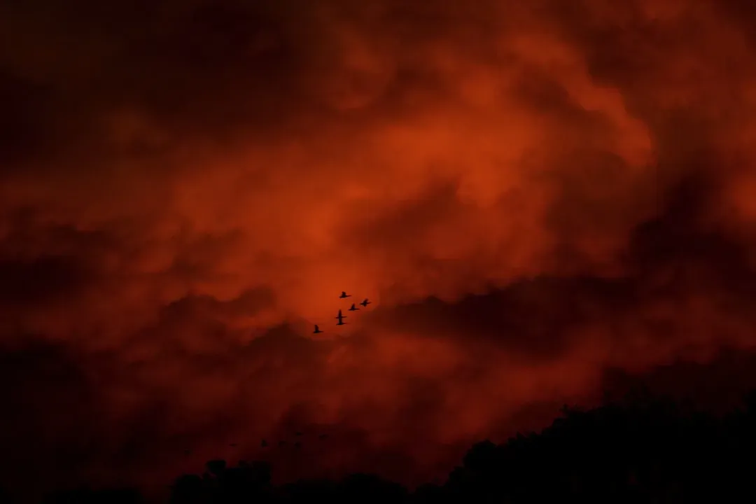
Sailors have chanted this one for centuries, but meteorologists will tell you it’s not folklore – it’s forecasting. “Red sky at night, sailors’ delight; red sky in the morning, sailors take warning” has scientific validity, and the saying’s roots run deep. It even shows up in the Bible, long before anyone owned a barometer.
The mechanism is straightforward atmospheric physics. A red sky at sunset means high pressure is likely moving in from the west, suggesting clear skies are on the way – hence “sailor’s delight.” A fiery red sunrise, on the other hand, means that high pressure has already passed, leaving behind moisture-rich air and signaling a storm system could now be approaching.
The single most surprising fact here: this saying holds up under real scientific scrutiny from an agency as rigorous as NOAA. Unlike superstitions about groundhogs or aching knees, it’s been checked, tested, and largely confirmed. But it’s not universal – near the equator, where trade winds dominate instead of westerlies, the opposite pattern can actually hold true. That’s a detail most retellings conveniently leave out.
#2 – A Ring Around The Moon Really Does Mean Rain Is Coming
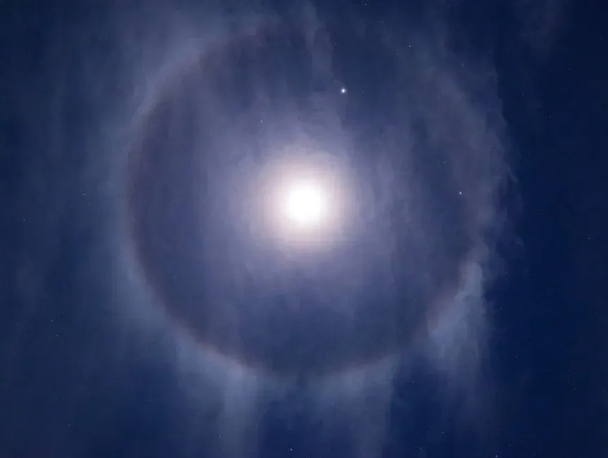
This one sounds like pure superstition – a glowing circle around the moon predicting your Tuesday forecast? Turns out it’s one of the most scientifically reliable pieces of sky-reading folklore that exists.
The halo itself isn’t magic. It’s a sign of high, thin cirrus clouds drifting 20,000 feet or more above our heads, packed with millions of tiny ice crystals that bend moonlight into a perfect ring. Here’s the part meteorologists actually care about: those clouds tend to arrive right before a storm does.
Fast Facts
- The halo forms in cirrostratus clouds, typically 20,000 feet or higher.
- Hexagonal ice crystals bend moonlight into what’s known as a 22-degree halo, the most common ring size.
- These clouds usually mark the leading edge of a warm front.
- Rain or snow often follows within 12 to 24 hours of the halo appearing.
The surprising fact most people miss: this isn’t a coin-flip prediction. Cirrus and cirrostratus clouds almost always show up at the leading edge of an approaching warm front, and warm fronts bring rain or snow within 12 to 24 hours of those clouds passing overhead. Even skeptical meteorologists admit the pattern is consistent enough to build a real forecast around.
#3 – Mare’s Tails In The Sky Mean Rain Is Three Days Out
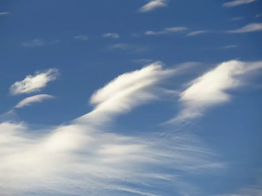
Wispy, feathery clouds that stretch across the sky like a horse’s tail have a nickname among old-timers, and it’s not decorative – it’s diagnostic. These are cirrus clouds, the same high-altitude ice formations behind lunar halos, but their shape tells a slightly different story than a full ring does.
A veteran chief meteorologist for a Washington, D.C. television station has publicly backed this one up as a working rule of thumb, saying it holds true roughly 70 percent of the time, especially from the East Coast to the Plains. Mare’s tails, in his read, mean rain is likely within three days.
What most people don’t realize is that a 70% hit rate is genuinely respectable in short-range forecasting, especially for a technique that requires zero equipment. The catch: mare’s tails only tell you rain is possible, not guaranteed – they mark a shift in the upper atmosphere, not a confirmed storm track. Old sailors weren’t wrong to watch the sky this closely; they just didn’t have the luxury of knowing exactly how far out that rain would land.
#4 – A Mackerel Sky Never Stays Dry For Long

“Mackerel sky, mackerel sky, never long wet, never long dry” is one of the oldest cloud rhymes in the book. It refers to a very specific pattern: cirrocumulus clouds arranged in rippled, scale-like rows that genuinely resemble fish skin.
Quick Compare
- Cirrus (mare’s tails): thin, streaked wisps – rain likely within about three days.
- Cirrocumulus (mackerel sky): rippled, scale-like rows – signals unsettled, back-and-forth weather rather than a single storm.
- Cirrostratus (halo clouds): a thin veil covering the whole sky – rain or snow often within 12 to 24 hours.
These clouds form at high altitude when a thin layer of moist air develops small-scale turbulence, breaking a smooth cloud sheet into that distinctive dappled texture. Meteorologists still recognize this cloud type as a classic marker of an unsettled, transitional atmosphere – the kind that flips between clear and stormy in short bursts rather than settling into one extended pattern.
Here’s the surprising part: the “never long wet, never long dry” half of the rhyme is arguably more accurate than the storm-warning half. A mackerel sky doesn’t necessarily mean a major storm is inbound; it means the atmosphere is unstable and changeable, which is exactly the kind of forecast modern meteorologists still hedge with words like “variable” or “unsettled.” Grandma’s rhyme basically predicted the five-day forecast icon that alternates between sun and clouds.
#5 – Crickets Can Tell You The Exact Temperature
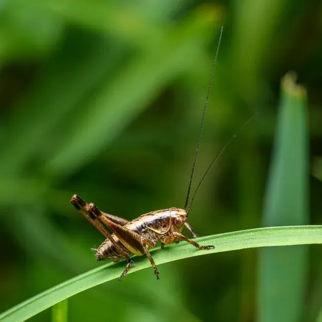
This isn’t folklore dressed up as science – it’s actual, peer-reviewed physics with a name: Dolbear’s Law. It describes the relationship between air temperature and the rate at which crickets chirp, formulated by physicist Amos Dolbear and published in 1897 in an article aptly titled “The Cricket as a Thermometer.”
The reason it works comes down to biology, not magic. Cricket muscle activity speeds up or slows down with air temperature, changing their chirp rate in a predictable way. Count the chirps, run a simple formula, and you get a shockingly precise readout.
Worth Knowing
- The classic formula: count chirps for 14 seconds, then add 40 to estimate the temperature in Fahrenheit.
- Amos Dolbear published his findings in 1897, formally linking chirp rate to temperature.
- The method is most accurate between roughly 55°F and 100°F.
- Snowy tree crickets are considered the most reliable species for this trick thanks to their evenly spaced chirps.
The single most surprising fact: the method is most accurate between 55°F and 100°F and typically predicts temperature within a few degrees under good conditions. The snowy tree cricket earned its nickname honestly – its evenly spaced chirps make it one of the most reliable insect “thermometers” in North American backyards. NOAA’s own education materials call this a legitimate way to estimate temperature in the field.
#6 – Achy Joints Before A Storm Isn’t All In Your Head

Every family has that one relative who claims they can “feel a storm coming” in their knees. For decades, doctors rolled their eyes at this. Meteorologists, however, have quietly sided with grandma – and the science is more solid than most people expect.
Many people with chronic pain, especially those with arthritis, report their discomfort increasing as bad weather approaches. Falling barometric pressure, rising humidity, and dropping temperatures all typically occur together as a storm moves in, and that combination acts directly on inflamed tissue.
Here’s the controversial opinion worth arguing about in the comments: most doctors still dismiss weather-related joint pain as anecdotal, but the underlying meteorology is undeniable. A dropping barometer physically changes the pressure differential inside joint capsules, and for people with existing inflammation, that shift is measurable, not imagined.
#7 – Frizzy Hair Really Is A Humidity Gauge

If your hair puffs up the second a storm rolls in, you’re not imagining it, and you’re definitely not alone – you’re basically wearing a scientific instrument on your head.
Mechanical hygrometers, devices that measure humidity, once used human hair as their sensing element. Hair absorbs water from the air through hydrogen bonds, and the more moisture in the air, the more bonds form along each strand. That extra bonding is what causes hair to fold back on itself. Frizz, in other words, is just visible chemistry.
The surprising fact: this isn’t a loose folk comparison – actual mechanical hygrometers used hair as their measuring mechanism for decades before electronic sensors took over. So next time your hair rebels before a downpour, know that meteorologists once built entire instruments around exactly that reaction.
#8 – The Smell Before Rain Is A Real, Measurable Compound

“I can smell rain coming” sounds like something only your grandfather says, but it’s rooted in real atmospheric chemistry that scientists have identified and named. That earthy, unmistakable scent before a storm has an actual source: soil bacteria release an organic compound that gets kicked into the air when raindrops strike dry ground.
At A Glance
- The scent is called petrichor, a term coined in 1964 by two Australian researchers.
- The compound behind it is geosmin, produced by soil-dwelling Streptomyces bacteria.
- Human noses are extraordinarily sensitive to geosmin, able to detect it at very low concentrations.
- Raindrops striking dry soil release the compound into the air as a fine aerosol.
Rising humidity then carries that scent ahead of the storm itself. Meteorologists consider this a legitimate short-range warning sign, especially in dry regions where the smell is more concentrated and noticeable. Combine it with a sudden drop in air pressure – which many people also physically sense as ear pressure or a heaviness in the air – and you’ve got two separate, scientifically grounded storm cues working together.
What’s genuinely controversial is how dismissive modern forecasting culture has become of these sensory cues, treating radar apps as the only legitimate source of truth. Old-timers who relied on their nose weren’t being unscientific; they were using an early-warning system that predates Doppler radar by centuries.
#9 – A Green Sky Really Can Mean A Tornado Is Coming
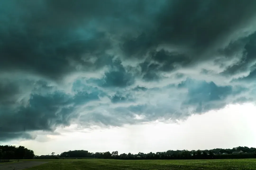
This one sounds like exaggeration until you’ve actually seen it – and meteorologists confirm the color shift is real, not a trick of memory or panic. One family’s oral tradition held that when a tornado is coming, the sky turns green and the wind sounds like a freight train. Decades later, during an actual tornado touching down in southern West Virginia, that description proved 100% accurate.
The science behind the color involves how sunlight scatters through extremely dense, hail-loaded storm clouds late in the day. Thick moisture and suspended ice combine with the low angle of the sun to shift the visible light spectrum toward green tones – a phenomenon strongly associated with severe supercell thunderstorms capable of producing tornadoes.
The most important detail: a green sky isn’t a guarantee of a tornado, but meteorologists treat it as a serious escalation signal worth immediate shelter-seeking action. This is one storm sign nobody should treat as folklore – it’s a documented severe-weather indicator, and it has a body count behind it when people ignore it.
#10 – Rain Before Seven, Clear By Eleven Actually Tracks With The Sun’s Schedule
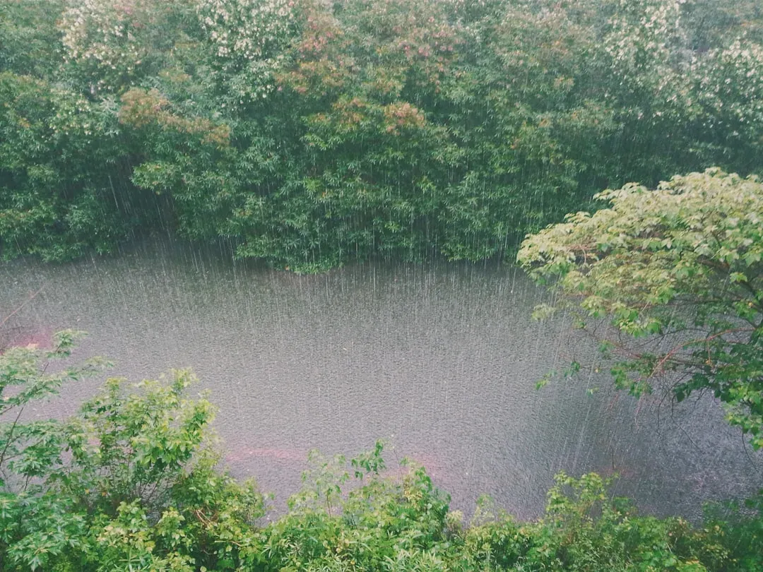
This one feels almost too simple to be legitimate meteorology, yet it’s rooted in a real daily weather cycle that repeats with surprising consistency in many climates.
The rhyme suggests that if rain starts early in the morning, it’s likely to clear up by late morning – and this is often true thanks to the diurnal cycle of convection. The sun’s energy heats the ground, causing air to rise and form clouds, while morning rain frequently comes from overnight frontal passages or leftover instability that burns off once the sun climbs high enough to stabilize the lower atmosphere.
The controversial take here: plenty of amateur forecasters treat this rhyme as a guarantee, but meteorologists are quick to point out it only works reliably with weak, fast-moving weather systems – not slow-moving fronts or tropical systems that can dump rain for days. Still, for garden-variety morning showers, this 200-year-old rhyme predicts the forecast about as well as some modern apps.
#11 – Birds Flying Low Really Do Signal Falling Pressure
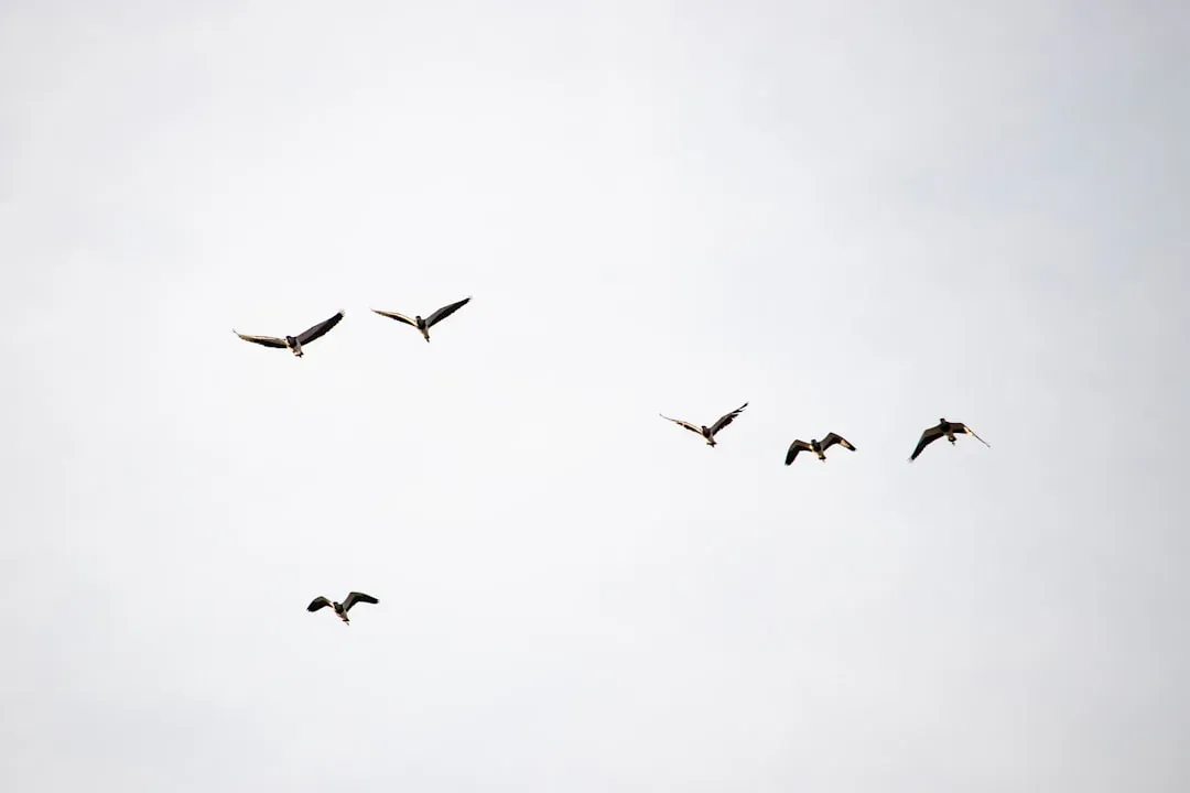
Old farmers swore that swallows and swifts skimming close to the ground meant a storm was hours away, and this sign has aged remarkably well under scientific review. The logic connects two separate natural systems: falling atmospheric pressure and insect behavior.
As barometric pressure drops ahead of an approaching storm, the insects that birds feed on – gnats, flies, and other small flying prey – are forced to fly lower to the ground, likely because thinner, more humid air makes it harder for their wings to generate lift at higher altitudes. Birds, chasing their food source, naturally follow suit and drop their flight patterns closer to the treetops and fields.
Why It Stands Out
- It’s a two-layer forecast: insects react to falling pressure first, then birds react to the insects.
- The pattern shows up across many species, from swallows to swifts, in wide-ranging geographic areas.
- No instruments are required – just a clear view of the treetops or fields.
- It works as a companion clue alongside a barometer, not a replacement for one.
What makes this genuinely interesting is that it’s a two-layer prediction system built entirely on animal behavior, with zero human instrumentation involved. Farmers who noticed birds “flying low before a storm” weren’t reading the sky at all – they were reading an entire ecosystem’s response to invisible pressure changes.
#12 – Smoke That Won’t Rise Means A Storm Is Close
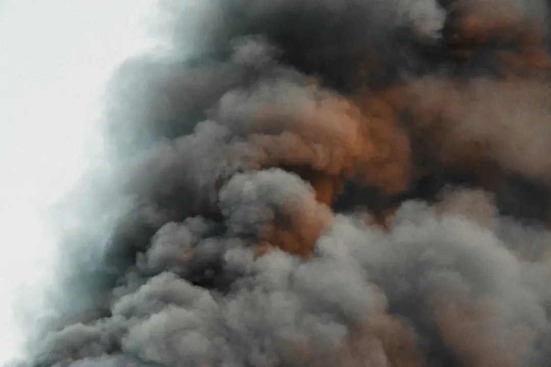
This final sign is one many people have witnessed without realizing it was a legitimate forecasting tool. Watch smoke from a chimney or campfire: on a clear, high-pressure day, it rises straight and thin into the sky. But before a storm, that same smoke often flattens out, curling downward and clinging near the ground instead of climbing.
The explanation is pure atmospheric pressure. High pressure systems are associated with sinking, stable air that lets smoke rise cleanly through a well-organized atmosphere. Low pressure systems – the kind that bring storms – create denser, more turbulent air near the surface that resists that upward motion, trapping smoke closer to the ground.
The most surprising part is how consistently this sign has held up across completely different climates and centuries, from sailors watching ship smoke to farmers watching chimney smoke. It doesn’t require a single piece of equipment, and it works almost anywhere, which is exactly why old-timers trusted it as much as they trusted a barometer they couldn’t afford to own.
The Bottom Line
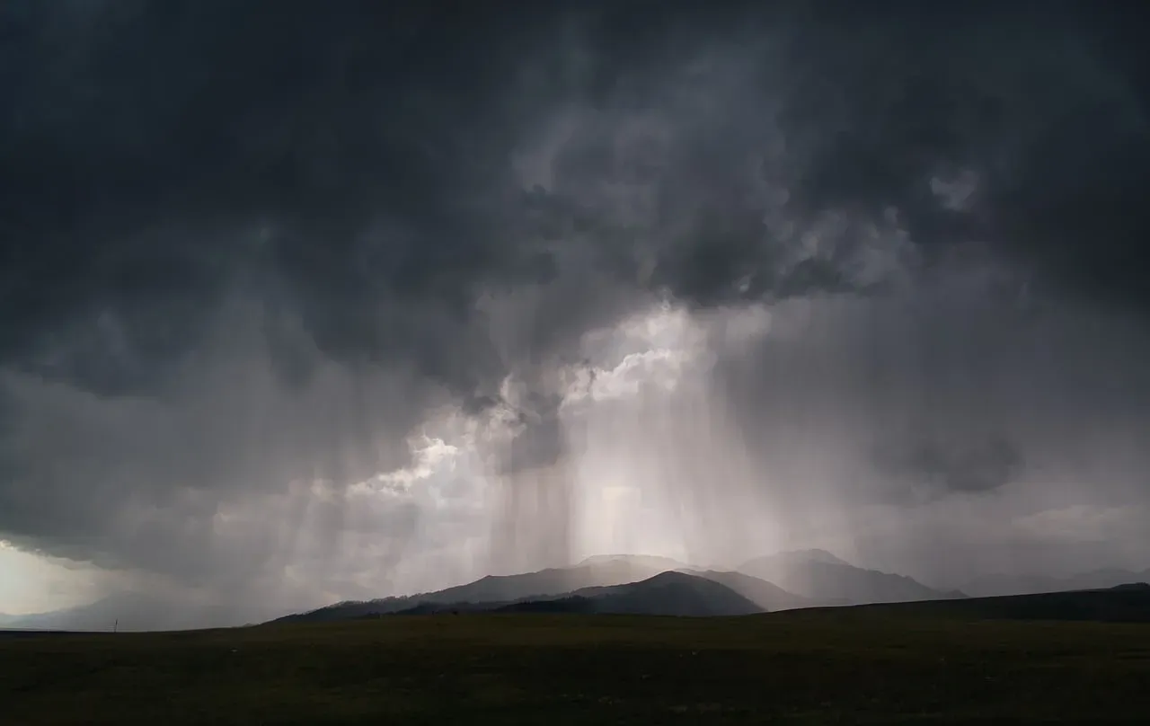
Here’s the uncomfortable truth for anyone who assumed weather apps made observation obsolete: most of these old signs weren’t superstition – they were early atmospheric science, tested by generations who had no other choice but to get it right.
From the halo that predicts rain within 24 hours to the crickets that double as thermometers, these clues survived because they actually worked. Meteorologists didn’t debunk them; they explained them.
The real mistake isn’t trusting old weather lore. It’s assuming your smartphone has made you a sharper observer than your grandparents ever were, when in truth, they were reading the same sky, the same pressure, and the same atmosphere you are – just without a screen telling them what they already knew. Which of these surprised you the most? Drop it in the comments.