If you saw a headline claiming the Pacific Ocean is literally draining through a crack off California, your first instinct might be to panic, laugh, or immediately fact‑check it. Honestly, you should. The idea hits some deep, almost prehistoric fear that the planet might suddenly open up and swallow the sea. But the reality behind stories like this is both more mundane and more fascinating than the viral versions suggest.
There is no giant bathtub plug being pulled under California, and the Pacific Ocean is not suddenly emptying like a sink. What we do have, and what scientists including teams at NOAA and research institutions have been watching for years, are leaks, seeps, faults, and upwelling zones where water and fluids move in strange and powerful ways along the seafloor. When people say things like “a crack in the Pacific,” they are often loosely describing complex tectonic and fluid‑flow processes that are absolutely real, but not apocalyptic. The real story is subtler, more scientific, and honestly more interesting than the doomsday version.
A crack in the Pacific? What that actually means in science terms
The Earth’s crust under the Pacific is not a smooth, solid plate like a dinner plate; it is fractured, folded, and riddled with faults and cracks. Off the coast of California, the edge of the Pacific Plate meets the North American Plate in one of the most studied tectonic zones on Earth, with the San Andreas system on land and a messy network of faults offshore. When scientists talk about a “crack,” they are usually referring to a fault or fracture zone where rocks are breaking, sliding, or being pulled apart over long periods of time.
These fractures can allow fluids to move: seawater can penetrate into the crust, superheated water can rise back up, and small amounts of mineral‑rich fluids can seep out of the seafloor. From a satellite headline, that movement can get exaggerated into the ocean “draining,” but what’s really happening is the normal, continuous circulation of water and fluids through Earth’s crust. It is dramatic on a geological level, but not in the sense of the entire Pacific rushing into a hole.
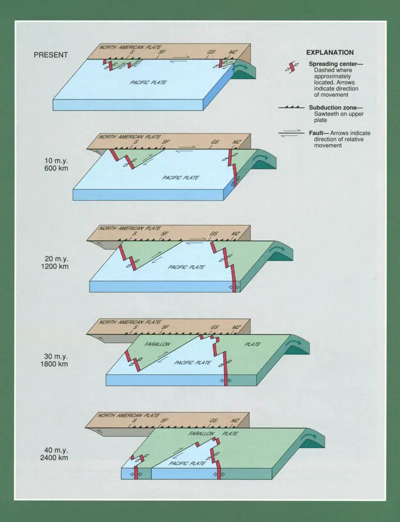
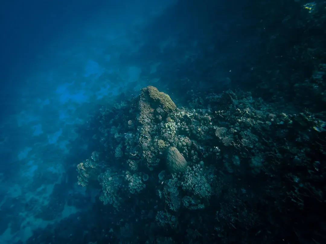
How ocean basins already “leak” without collapsing
![How ocean basins already “leak” without collapsing ([1], CC BY 4.0)](https://nvmwebsites-budwg5g9avh3epea.z03.azurefd.net/dws/87b4faf8d0c8af29767cd0490ba523f3.webp)
Here’s the part that sounds shocking at first: the ocean floor is constantly leaking. At mid‑ocean ridges, hydrothermal vents blast superheated, mineral‑rich water back into the sea. In subduction zones and along some faults, cold seeps slowly release methane and other fluids. In other places, groundwater from land can push out into the ocean beneath the seafloor. So in a way, the Pacific has been “draining and refilling” through cracks for millions of years.
The ocean is not a closed tank; it’s part of a planet‑wide plumbing system. Water moves from the surface into the deep, into the crust, and back up again on timescales from days to millions of years. The reason we do not see sea level plummet from this leaking is that the system is balanced: water that goes down or into the crust is matched, on average, by water returning and by inputs like ice melt and river flow. When a headline suggests a new, catastrophic drain has opened, it is usually overselling what is, in reality, a local feature in a very large, very old system.
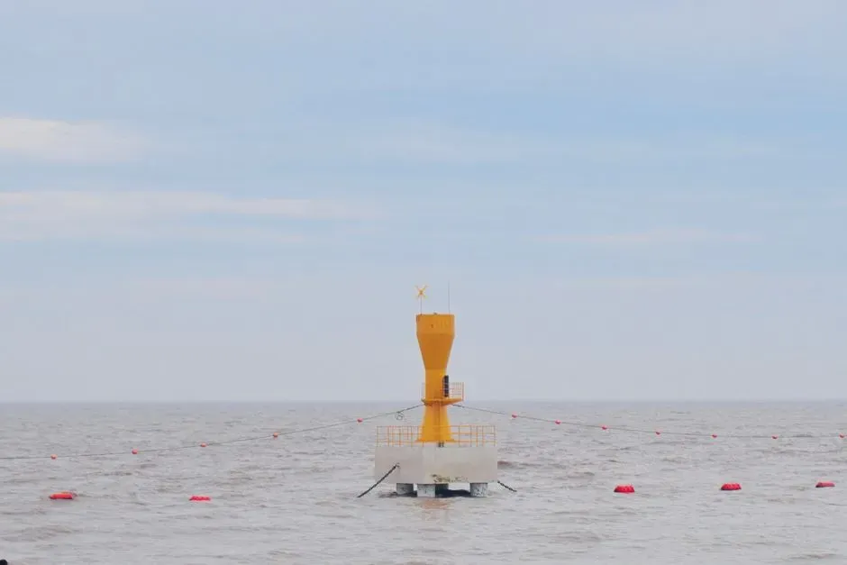
What NOAA actually tracks when something “weird” shows up offshore
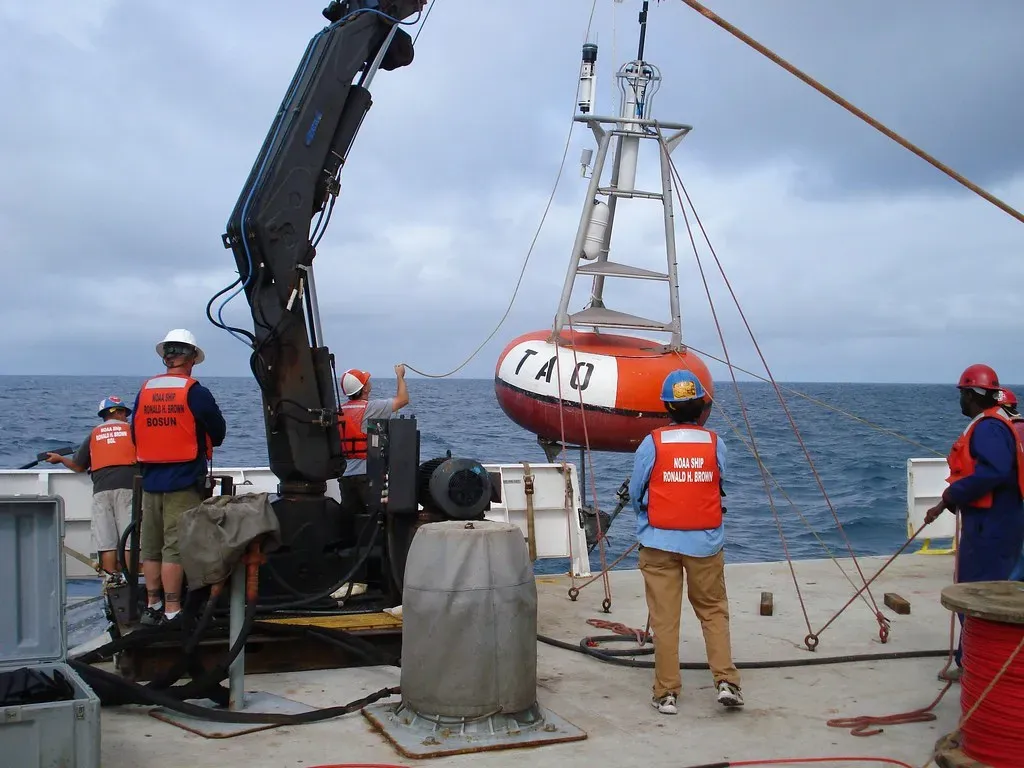
NOAA’s job is not to chase internet rumors; it is to monitor the ocean and atmosphere with a dense network of tools and to flag anything that might pose real risk. That includes sea level gauges along the coast, buoys that measure waves and pressure offshore, satellites that track sea surface height, and ships and underwater vehicles that map the seafloor. When you hear that NOAA has been “tracking” something since January, what that usually means is that an anomaly showed up in the data and scientists started paying extra attention.
If the Pacific Ocean were truly draining through a sudden new crack, the first evidence would show up in tide gauges all along the coast as persistent, unexplained drops in sea level, and in satellite altimetry that sees subtle changes in the shape of the sea surface. Instead, the real anomalies scientists chase are often smaller: unusual pressure changes on a seafloor sensor, a cluster of seismic events along a fault, or a patch of odd temperature or chemistry in the water. Those things can be linked to fluid movement at depth, but not to anything like a planetary plug being pulled.
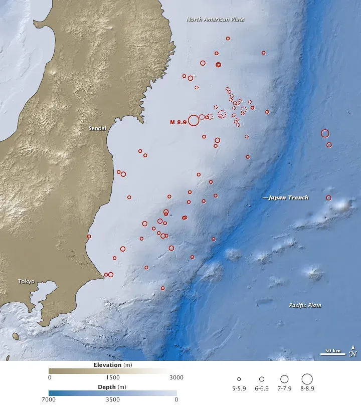
The role of tectonics: plates, faults, and slow‑motion drama
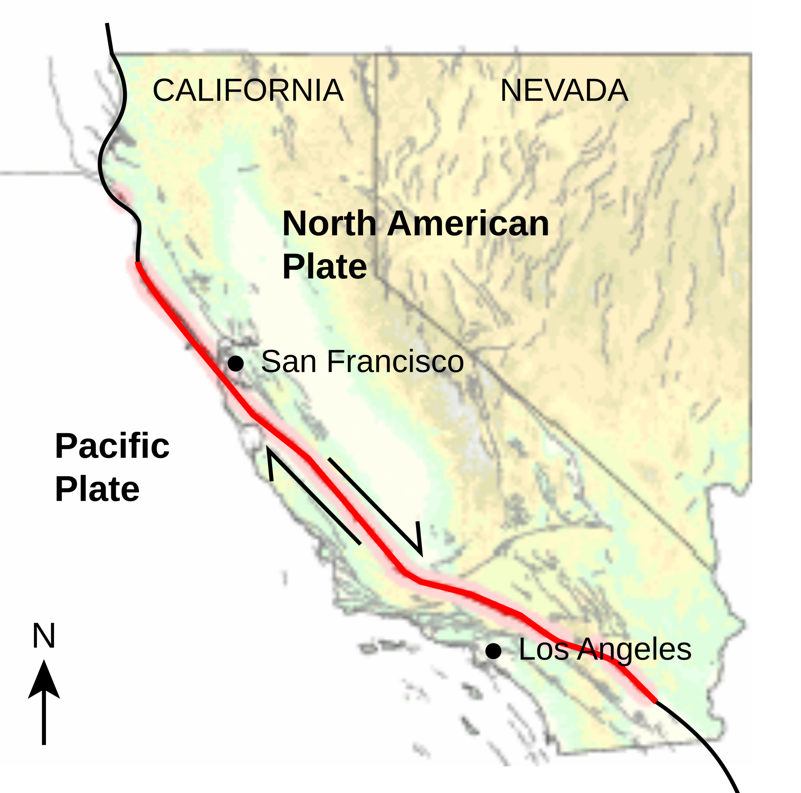
The coast of California sits next to a tectonic boundary that looks quiet from the beach, but is incredibly active in slow motion. The Pacific Plate is sliding northwest past the North American Plate along the San Andreas Fault, and offshore there are additional faults, basins, and ridges all interacting. Over millions of years, sections of crust dive into the mantle, others get uplifted, and some are stretched and thinned, creating spaces where fluids can circulate and, yes, sometimes escape to the seafloor.
When a study finds a zone of concentrated fluid flow near a fault, it can be tempting for headlines to call it a “crack that is draining the ocean.” In reality, these zones are more like leaky seams in a moving pavement than a catastrophic chasm. They matter hugely for understanding earthquake behavior, because fluid pressure in faults can influence how easily they slip. But they are not going to turn California into a drained shoreline any time soon. The drama is real, but it plays out over centuries and millennia, not months.
Sea level reality check: what the instruments are actually showing
Here is the uncomfortable but important truth: if anything dramatic were already happening to the Pacific’s water levels, coastal communities would notice very quickly. Tide gauges along California’s coast have records stretching back many decades, and they show trends dominated by sea level rise driven by global warming, not sudden mysterious drops. On top of those long‑term trends, there are well‑understood short‑term wiggles from storms, tides, and climate patterns such as El Niño, all of which scientists factor in when looking for true anomalies.
Satellites add another layer by measuring sea surface height across the entire Pacific to a precision of a few centimeters. Put together, these systems form an early‑warning network for anything that really would count as “the ocean draining.” So far, the big story is the opposite: the vast majority of records show gradual sea level rise and regional variations, not an ocean emptying through a new crack. If you live near the coast, your bigger long‑term worry is water creeping up, not vanishing overnight.
I still remember standing on a foggy pier in California and noticing the high tide creeping a bit closer to a line of old barnacles than the photos from my childhood. That tiny, personal observation lines up with what the instruments say far more than any dramatic draining narrative does.
Why stories like this go viral – and why they’re hard to shake
The phrase “ocean draining through a crack” has everything a viral story loves: danger, mystery, a hint of science, and a simple visual everyone can imagine. It is way easier to picture a giant plughole in the seafloor than a web of tectonic plates, pore pressures, and long‑term fluid cycling. In a world where attention is currency, nuance loses to spectacle almost every time, especially once a dramatic image or headline starts bouncing through social feeds.
The downside is that our mental model of how the planet works gets skewed. People start to feel like catastrophic surprises are lurking everywhere, while the slow, well‑documented changes slip into the background. That makes it harder to focus on very real, very urgent ocean issues like warming, acidification, pollution, and sea level rise, which do not come with Hollywood‑style visuals. The irony is that the real science behind these “crack in the Pacific” stories is genuinely compelling, but it requires us to stay curious for more than five seconds.
What might actually be happening when scientists flag a seafloor anomaly
Suppose there really is a newly observed, focused outflow of fluids along a fault off California, and NOAA and research teams have been watching it since January. The likely reality is that instruments picked up a change – maybe warmer water, unusual chemistry, faint tremors, or shifting pressure – that suggests fluids are moving differently along a known structure. That can happen after earthquakes, as stress redistributes, or as long‑term tectonic processes tweak the plumbing at depth.
From a scientific point of view, that is gold. It helps refine models of how faults behave, how heat and chemicals move between the crust and ocean, and how ecosystems adapt to changing seafloor conditions. From a public safety point of view, it is something to monitor, not panic over. Most of these features do not pose direct danger to coastal communities; instead, they add one more piece to the massive, evolving jigsaw puzzle of Earth’s dynamic shell.
So, is the Pacific really draining – or are we missing the real crisis?
Here is the blunt, opinionated take: the Pacific Ocean is not dramatically draining through some newly opened crack near California, and framing it that way is a distraction. What is very likely happening is a blend of normal tectonic fluid flow, ongoing scientific monitoring, and exaggerated storytelling. The data we have points toward a slowly changing ocean that is warming, rising, and becoming more stressed by human activity, not one vanishing down a hole in the seafloor.
In my view, the real scandal is not that the Earth has secret drains, but that we keep ignoring the slow emergencies unfolding in plain sight because they do not come with enough shock value. If the idea of the Pacific suddenly emptying can grab our attention, imagine what we could do if we aimed that same emotional intensity at cutting emissions, protecting coastal ecosystems, and understanding the tectonic and ocean systems that actually keep this planet habitable. Between a fake plughole apocalypse and a very real, gradual reshaping of shorelines and seas, which one do you think we should be preparing for?