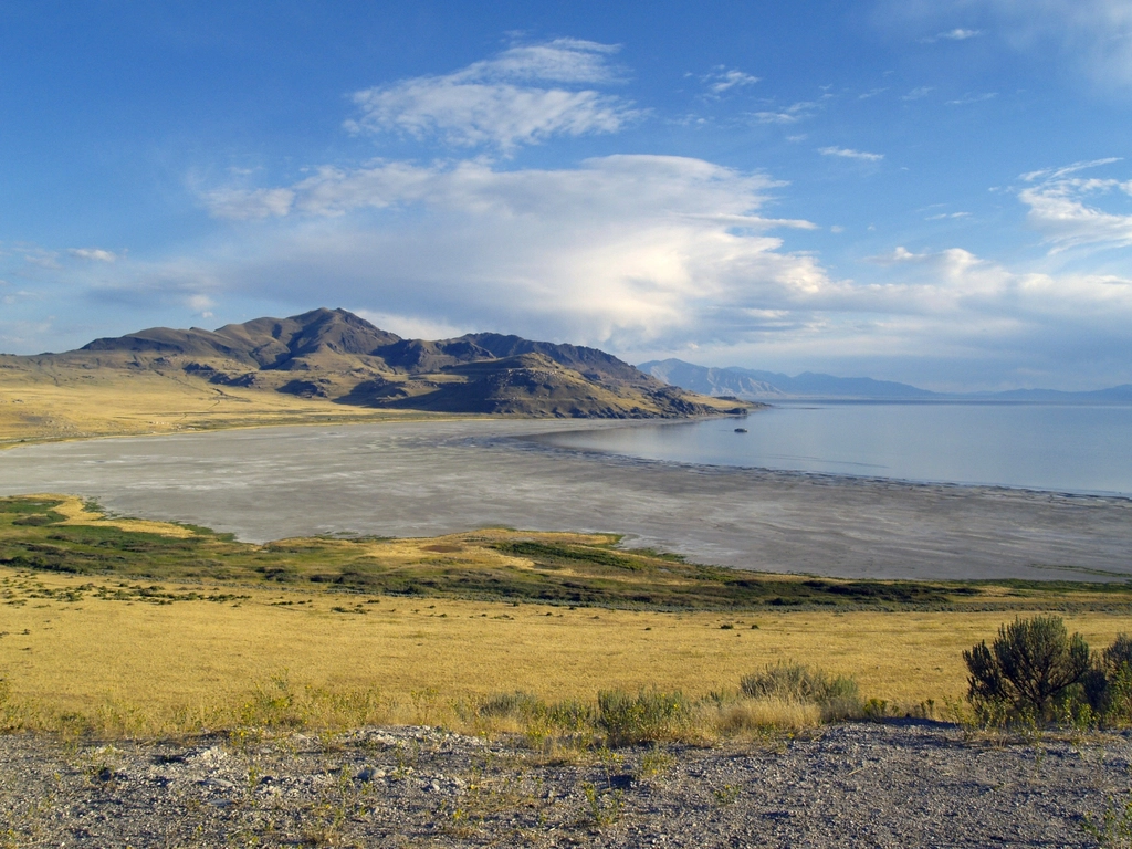
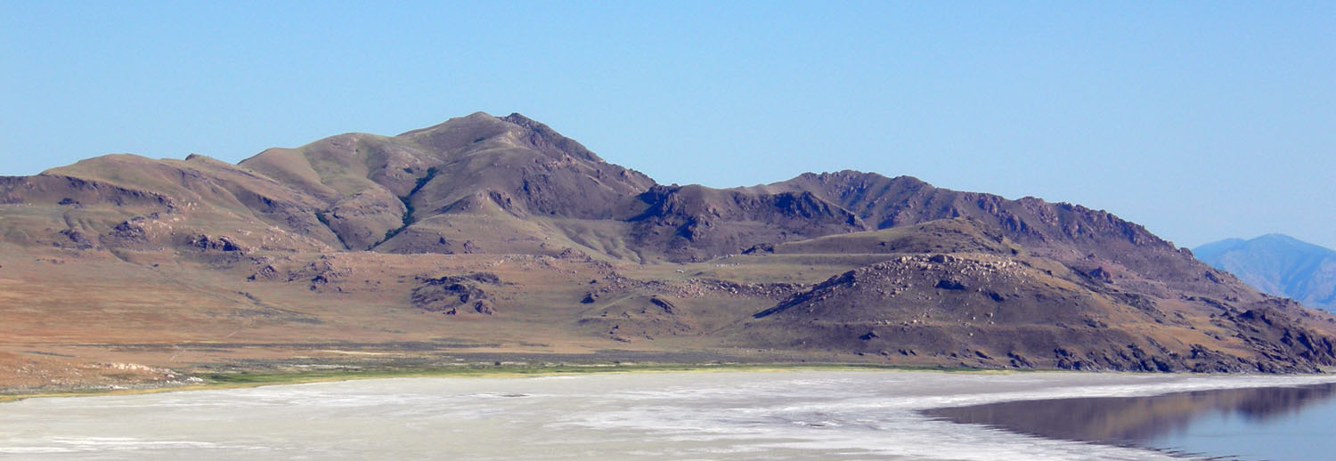
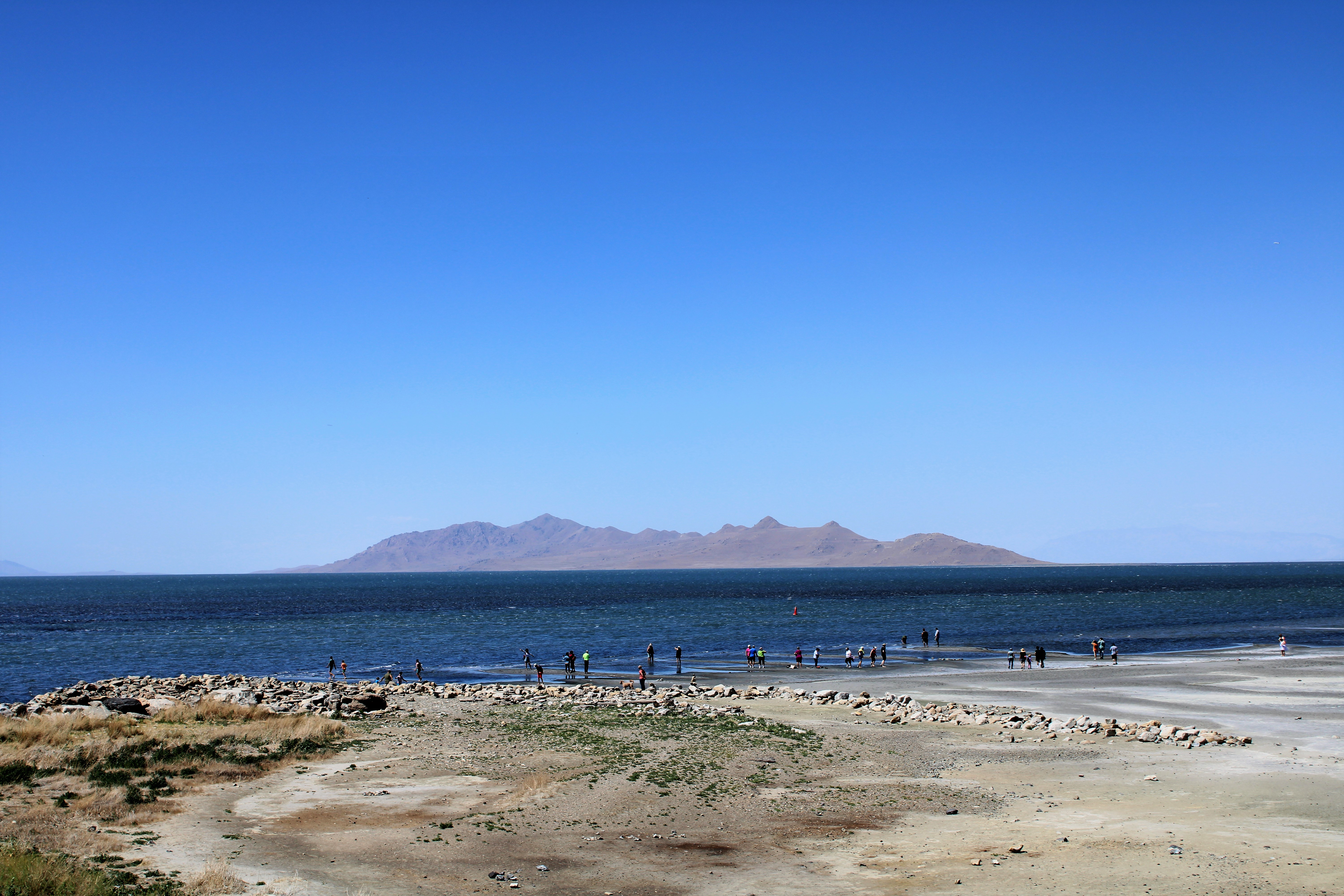
You might think you know everything about the largest saltwater lake in the Western Hemisphere, but the Great Salt Lake has been keeping secrets hidden for thousands of years. Picture stumbling across mysterious islands that shouldn’t exist, sprouting up from the lake’s shrinking bed like something out of a science fiction novel. That’s exactly what happened to scientists when the lake’s water levels dropped to historic lows, revealing formations that have revolutionized our understanding of what lies beneath Utah’s iconic body of water.
What started as puzzling reed-covered mounds on the exposed lakebed has turned into one of the most significant hydrogeological discoveries in the region. These aren’t just random formations, they’re windows into an entire hidden world that could reshape everything we know about water management in the American West.
Reed-Covered Mysteries: The Islands That Shouldn’t Exist
As the Great Salt Lake shrinks, scientists are uncovering mysterious groundwater-fed oases hidden beneath its drying lakebed. Reed-covered mounds and strange surface disturbances hint at a vast underground plumbing system that pushes fresh water up under pressure. These formations, which researchers have dubbed “phragmites islands,” first appeared along the southeastern shoreline and immediately caught the attention of University of Utah geologists.
The most intriguing part? Bill Johnson, a professor in the Department of Geology & Geophysics at the University of Utah, believes that these mounds form where pressurized groundwater from beneath the lakebed makes its way to the surface. Think of it like natural springs, but ones that were completely invisible until the lake receded enough to expose them. Each mound tells a story of water that has traveled deep underground before finally emerging at the surface.
What makes these discoveries even more remarkable is their timing. Phragmites-covered mounds in recent years have appeared on the drying playa off the lake’s southeast shore. After several years of scratching their heads, University of Utah geoscientists, deploying a network of piezometers and aerial electromagnetic surveys, are now finding out what’s going on under the lakebed that is creating these reed-choked oases.
High-Tech Detective Work: Mapping the Invisible Underground

In February 2025, Johnson hired a Canadian firm, Expert Geophysics, to conduct airborne electromagnetic surveys over Farmington Bay using a “It’ll give you a spectrum, basically, of magnetic fields, and we’ll use that data to create a 3D image of what’s under the Earth,” said Jeff Sanderson, a crew leader with Expert Geophysics. The technology sounds like something from a spy movie – helicopters carrying massive circular sensors that peer deep into the earth.
Suspended beneath a helicopter, a circular sensor sends currents into the earth, producing magnetic field data that can be transformed into detailed 3D images of the subsurface. “This technology gives us a spectrum of magnetic fields, which we use to create a 3D map of the underground system,” explains Jeff Sanderson, the project lead at Expert Geophysics. This cutting-edge approach allows scientists to see what’s happening hundreds of feet below the surface without digging a single hole.
And Zhdanov and Michael Jorgensen are processing the electromagnetic data gathered in the airborne geophysical surveys to construct a 3D image of the subsurface beneath the lake. “We hope to map out the boundary between fresh water and salt water, and find the location of freshwater springs that are discharging groundwater into the lake,” said Solomon, who is scheduled to present preliminary findings recently at the Geochemical Society’s 2025 Goldschmidt conference in the Czech Republic.
The Underground Ocean: A Vast Hidden Water System
Instead, the sensors revealed an enormous and complex groundwater system beneath the lake – one that stretches approximately two miles deep and spans a wide area. Researchers believe this subterranean reservoir is under pressure, forcing freshwater upward through the lakebed, particularly in the southeastern area where the islands have emerged. Imagine an underground ocean trapped beneath layers of sediment and rock, constantly pushing against the boundaries above.
The team’s investigation has located freshwater in tight sediments up to 30 feet below the surface, with geophysical data indicating depths of up to 10,000 feet. “We hope to map out the boundary between fresh water and salt water, and find … That’s deeper than most skyscrapers are tall. The sheer scale of this underground water system is staggering – it extends far beyond what anyone previously imagined.
Johnson believes there are hundreds of these groundwater-fed oases scattered across Great Salt Lake’s exposed playa, suggesting the presence of a vast underground reservoir connected to the surface by a plumbing system that is only now getting close study, thanks in part to the lake’s decline. With his colleagues’ help, the geologist hopes to discover where the water came from, when it fell as snow and most critically, how much is there.
Rewriting the Water Budget: From 3% to 12%

Before this study, scientists estimated that only around 3 percent of the Great Salt Lake’s water came from groundwater. Thanks to the new findings, that figure is now believed to be as high as 12 percent, four times greater than previously thought. This isn’t just a minor statistical adjustment – it’s a fundamental shift in how scientists understand the lake’s water sources.
Earlier estimates suggested groundwater contributed just 3% of the lake’s water budget. But new chemical mass balance studies point to a far more significant number: up to 12%. This change dramatically alters scientific understanding of how the lake functions, especially under the stress of ongoing drought and water diversion. The implications ripple through every aspect of water management planning in the region.
Think about what this means for the future. If roughly one-eighth of the lake’s water comes from underground sources that scientists barely understood until now, it changes everything from drought response strategies to long-term conservation planning.
Ancient Waters Rising: The Pressure System at Work

And Zhdanov and Michael Jorgensen are processing the electromagnetic data gathered in the airborne geophysical surveys to construct a 3D image of the subsurface beneath the lake. This detailed mapping reveals something remarkable about the underground pressure dynamics. “Those show that the fresh water in the center is pressured the deeper you go; the more hydraulic head it has. It really wants to come up,” Johnson said. “And that’s true also in the perimeter, but it’s freshwater at depth there.
Near-surface water is the purest measured at the center of the mound and gets progressively more saline as you move closer to the edge, while deep water is fresh at all locations. The pattern tells a story of ancient freshwater trapped far below the surface, constantly seeking upward release. The deeper you go, the more pressure builds, creating a natural hydraulic system that has been operating for possibly thousands of years.
“The water spent considerable time underground before reaching the lake,” Johnson notes during a site visit to Round Spot 9. “But where exactly that happens has remained a mystery – until now.” By combining field observations with piezometers and airborne geophysical surveys, researchers are mapping the subterranean networks that feed these oases, revealing a complex web of water pathways previously invisible to the naked eye.
Lake Bonneville’s Legacy: Secrets from the Ice Age
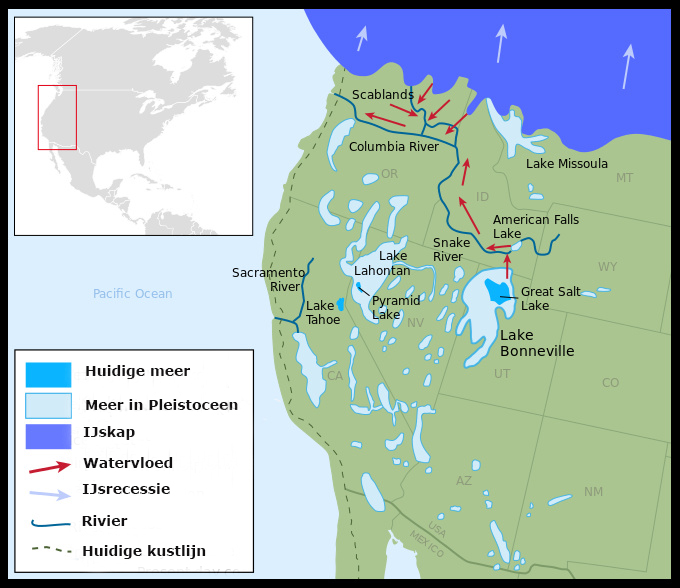
Lake Bonneville was a massive, Ice Age lake that existed from about 30,000 to 13,000 years ago. It occupied a low, bowl-shaped depression in the eastern Great Basin. At its largest extent, it spanned about 20,000 square miles of western Utah and parts of eastern Nevada and southern Idaho. Lake Bonneville was about 325 miles long, 135 miles wide, and had a maximum depth of over 1,000 feet. Today’s Great Salt Lake is merely a shallow puddle compared to its ancient predecessor.
Over geologic time, the water in the Bonneville basin has risen and fallen, most dramatically as freshwater Lake Bonneville lost enormous volume 15,000–13,000 years ago and became the modern day Great Salt Lake. It is likely that paleo-humans lived along the shores of this body of water as it shrunk to the present margins, and native peoples inhabited the surrounding desert and wetlands in recent times. The underground water system being discovered today may be connected to this ancient history in ways scientists are just beginning to understand.
Lake Bonneville water levels started dropping significantly around 16,000 years ago when the climate began drying and warming, increasing evaporation and decreasing precipitation, which caused a shift in the water balance. Lake Bonneville water levels started dropping significantly around 16,000 years ago when the climate began drying and warming, increasing evaporation and decreasing precipitation, which caused a shift in the water balance. In about 2,000 years, the lake had dropped to about the level of modern Great Salt Lake. Some of the freshwater now being discovered deep underground might be remnants from this massive prehistoric lake system.
Environmental Implications: Dust, Restoration, and Future Management
As low lake levels persist, the lakebed will increasingly serve as a source of wind-blown dust affecting Utah’s population centers. Ongoing research by U atmospheric scientists suggests that the disturbed lakebed crusts that keep sediments in place can be regenerated when they are submerged. One goal of Johnson’s research is to determine whether the groundwater can be tapped to restore broken lakebed crusts, thereby reducing dust pollution. This isn’t just an academic exercise – it’s about public health and air quality for millions of people.
“It looks like it’s a from a water resource that could be useful in the future, but we need to understand it and not overexploit it to the detriment of the wetlands,” said Johnson, who has served on the Great Salt Lake Strike Team, the university-state agency partnership exploring ways to reverse the lake’s decline. The delicate balance between utilizing these discoveries and protecting fragile ecosystems represents one of the biggest challenges facing water managers.
These surveys also highlight how delicate the lake’s underground water system is. Though the mounds may appear resilient, their water sources are under stress, reflecting the pressures of climate change and human activity. By understanding these subterranean flows, scientists can better predict the consequences of continued water loss and develop strategies to protect the lake and its surrounding habitats.
The Scientific Quest Continues: What’s Next?
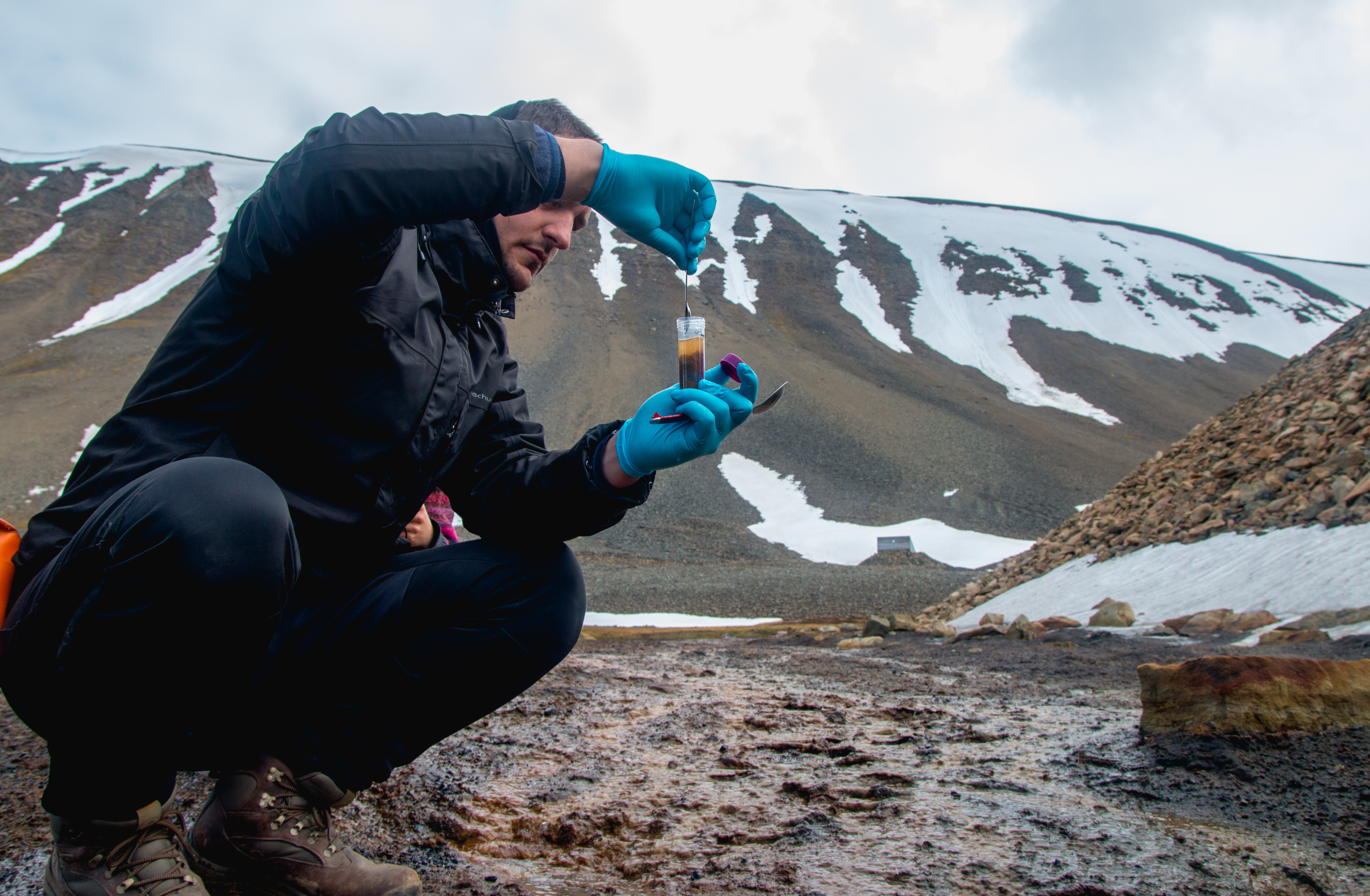
On Round Spot 9 in Farmington Bay, Johnson’s team has installed three sets of four piezometers at various distances from the edge of the 250-foot-diameter island. The four instruments are placed at varying depths, 7, 11, 30 and 60 feet, connected to the surface via white PVC pipes. Accompanied by grad students like Adomako-Mensah, Johnson has regularly visited the site this year by mountain bike or airboat to recover data that is already telling an interesting story. These monitoring stations provide real-time data about water pressure and flow patterns deep underground.
The research team, which includes other senior geology faculty, including Kip Solomon, Mike Thorne and Michael Zhdanov, is seeking to discover the breadth and depth of the freshwater under the lake. For example, Solomon’s lab is using isotope analysis to determine the age of the groundwater and its recharge elevation, or where it originated in the mountains. Thorne is constructing on-ground resistivity profiles. Each specialist brings unique tools to solve different pieces of the underground puzzle.
With his colleagues’ help, the geologist hopes to discover where the water came from, when it fell as snow and most critically, how much is there. “The last thing we wanted to do is for this to be characterized as a water resource we should be tapping,” he said. “It’s much more fragile than that, and we need to understand it better.” The scientists approach their discoveries with both excitement and caution, knowing that hasty decisions could have lasting consequences.
Conclusion
The Great Salt Lake’s hidden groundwater system represents more than just a scientific curiosity – it’s a game-changer for understanding water resources in the American West. These discoveries beneath Utah’s iconic lake reveal an underground world that has operated in secret for millennia, possibly containing remnants of ancient Lake Bonneville and supporting life in ways we never imagined.
From mysterious reed-covered islands to vast underground reservoirs stretching thousands of feet deep, scientists have uncovered a complex hydraulic system that could influence everything from dust control to water management strategies. The revelation that groundwater contributes four times more to the lake’s water budget than previously thought fundamentally changes how we understand this ecosystem.
What do you think about these remarkable discoveries hidden beneath the Great Salt Lake? Tell us in the comments.