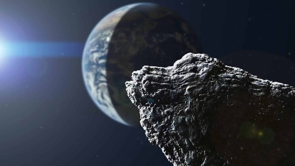
On a quiet Sunday afternoon in 1960, the ground beneath southern Chile did something the planet had never recorded before: it convulsed with a power that defied imagination. In just over ten minutes, the so‑called Great Chilean Earthquake unleashed more energy than hundreds of nuclear bombs, sending a tsunami racing across the Pacific and rewriting the science of what an earthquake could be. Even today, in an age of satellites, AI models, and global seismograph networks, that single event still looms like a mountain on the graph of Earth’s most violent moments. Scientists are still dissecting how it grew so big, why it spread so far, and what it means for future megathrust quakes in places like the Pacific Northwest or Japan. Beneath the drama of collapsing buildings and towering waves is a quiet race: can our science advance fast enough to keep the next great quake from becoming the next great catastrophe?
The Day the Planet Shook: Inside the 1960 Great Chilean Earthquake
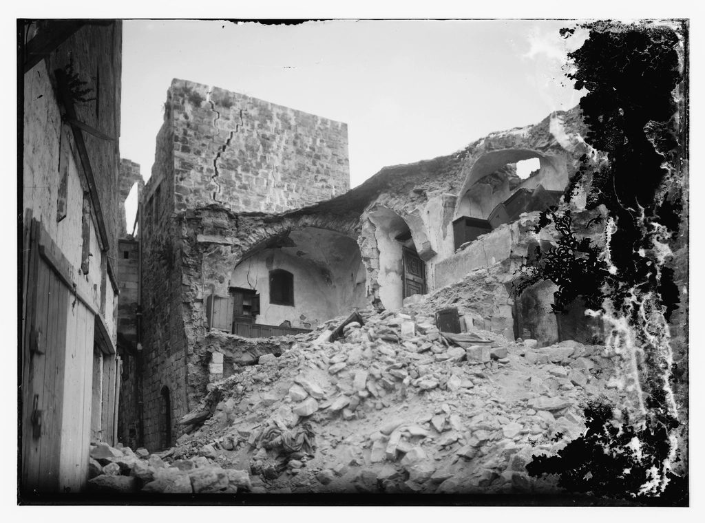
On May 22, 1960, at 3:11 p.m. local time, a rupture began deep beneath the Pacific off the coast of Chile and then simply refused to stop. What started as just another jolt along the restless boundary of the Nazca and South American plates cascaded into an extraordinary, continent‑scale failure of rock. The quake’s official magnitude, 9.5, makes it the largest instrumentally recorded earthquake in human history, dwarfing even the devastating 2004 Indian Ocean and 2011 Tōhoku events. For more than ten minutes, the fault ripped open along roughly a thousand kilometers of margin, from near Concepción to south of Puerto Montt, as if someone had unzipped a seam in the planet’s outer skin. People in cities hundreds of kilometers apart reported the same terrifying feeling: the shaking just went on and on, far beyond what their bodies and buildings were built to tolerate.
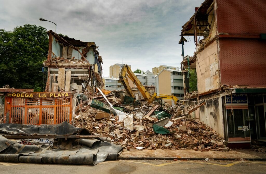
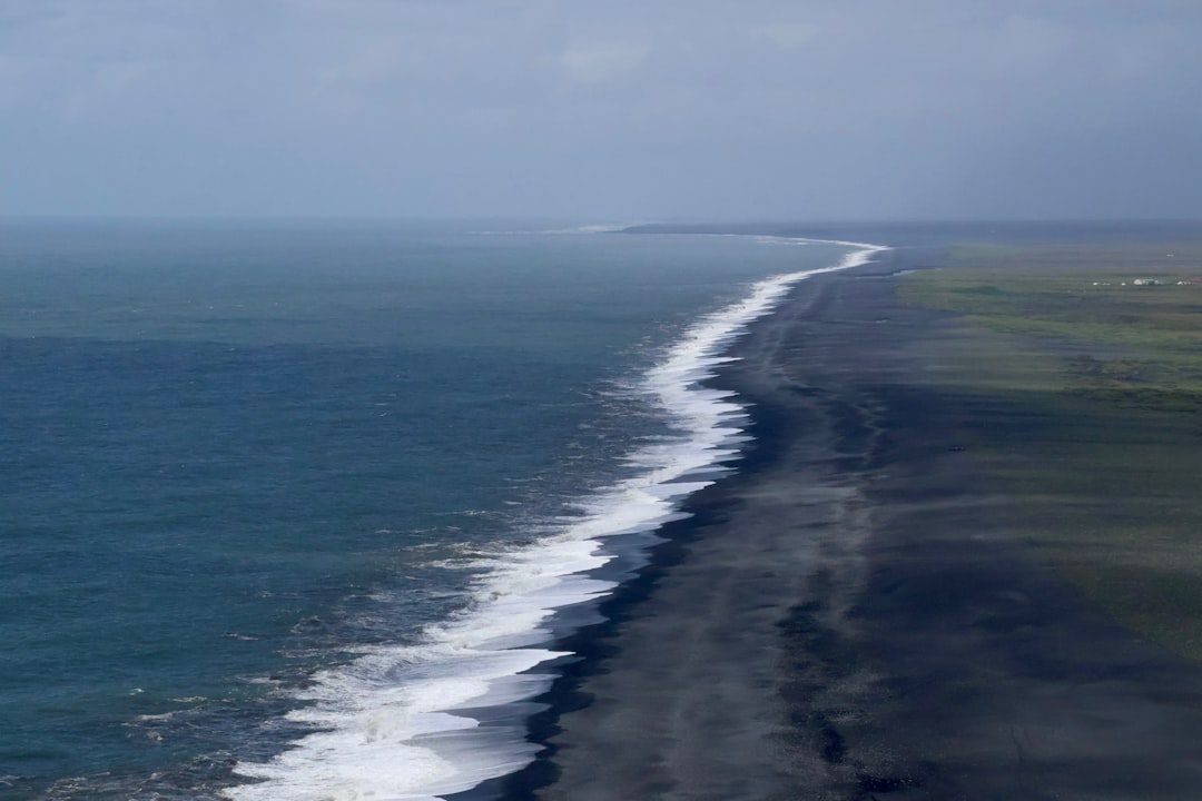
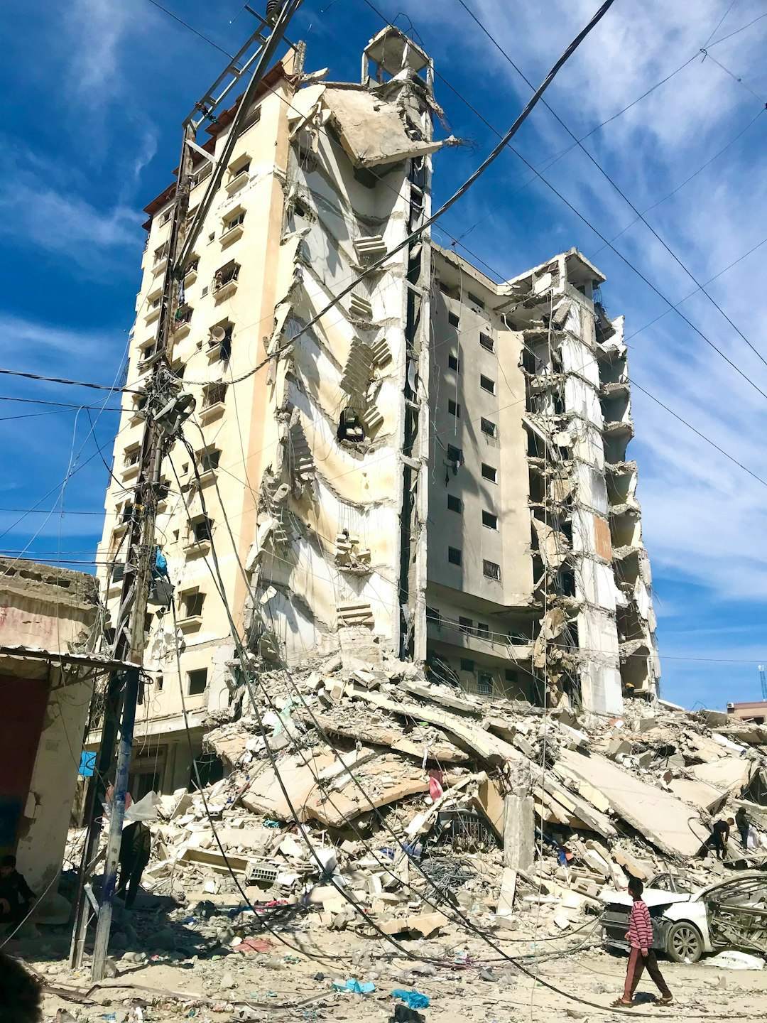
The numbers behind that experience are almost hard to believe. Geophysicists estimate that the vertical movement of the seafloor reached several meters in places, enough to displace colossal volumes of water and send tsunamis racing at jetliner speeds across the Pacific. In Chile, entire neighborhoods collapsed, bridges snapped, and landslides wiped out rural communities in an instant. The tsunami that followed struck coastal Chile within minutes, but the disaster did not stop there; waves went on to batter Hawaii, Japan, and the Philippines many hours later, proving that a disaster born in one corner of the world can become truly global. For those who lived through it, the event was not just a powerful quake; it was a lesson in how small human systems are when the planet’s deep machinery kicks into high gear.
The Hidden Clues: What Made This Quake So Enormous?
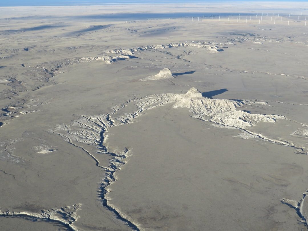
Earthquakes happen every day, but only a tiny fraction reach the staggering scale of Chile 1960, and that raises a natural question: why there, and why then? The key lies in the type of boundary where the rupture occurred, a subduction zone where the dense Nazca Plate is diving beneath the lighter South American Plate. These zones are like enormous mechanical presses, locking up over centuries as plates grind together, storing stress until the rocks finally give way. In southern Chile, that locked segment was exceptionally long and wide, and when it failed, it failed almost all at once, allowing an immense area of the fault to slip. The average slip along parts of the fault is thought to have been on the order of tens of meters, like watching two continents jerk past each other by the length of a city bus.
What makes this even more unsettling is that many of the clues were buried out of sight beneath the ocean and deep underground. Unlike a volcano, which often gives off visible warning signs, giant subduction earthquakes hide their growing stress behind quiet coastlines, subtle land deformation, and confusing precursor quakes. Modern analysis of historical tide‑gauge records, uplifted shorelines, and tree‑ring damage has revealed that sections of the Chilean margin had been building strain for centuries before 1960. Put simply, the conditions for a monster event had been silently maturing over several human lifetimes. That’s one of the cruel ironies of megathrust quakes: the people hardest hit are rarely the ones who enjoyed the centuries of apparent calm that set the stage.
Shockwaves Across Oceans: A Disaster That Refused to Stay Local
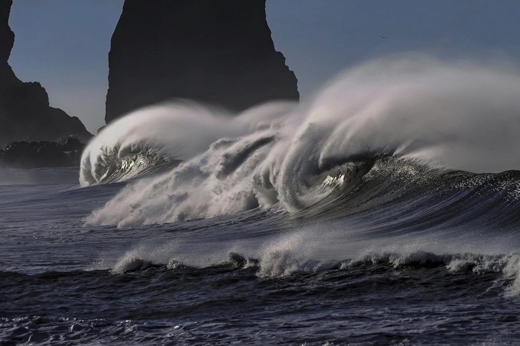
One of the most haunting aspects of the 1960 quake is how it turned the entire Pacific into a disaster zone. When the Chilean seafloor heaved upward, billions of tons of water were suddenly displaced, launching a train of tsunami waves that radiated across the ocean like ripples from a stone – if that stone were the size of a mountain range. Within about fifteen minutes, coastal regions of southern Chile were hammered by waves that, in some places, towered higher than multi‑story buildings. Entire fishing villages were scoured clean, ships were thrown inland, and survivors described the sea vanishing and then returning as a roaring wall of water. But hours later, on faraway Pacific shores, people who had never heard of Valdivia would see the same water rise up against them.
The tsunami went on to strike Hawaii, where waves swamped Hilo, causing deadly flooding and destruction in the early morning hours. In Japan, roughly a day later, communities along the northeastern coast were hit by waves that overwhelmed sea defenses and destroyed homes and harbors. Coastal areas in the Philippines, New Zealand, and beyond experienced damaging surges and strong currents, even where the waves were not particularly tall. That global footprint delivered a brutal but important message: a truly giant earthquake is not just a regional issue, it is a planetary one. In a sense, the Chilean event functioned like a natural stress test for coastal societies all around the Pacific, exposing weak warning systems, vulnerable infrastructure, and the dangerous illusion that a distant disaster cannot reach your own shoreline.
From Paper Traces to Planet‑Wide Networks: How Science Evolved After 1960
When the 1960 quake struck, global seismology was still in its adolescence, relying on sparse networks of seismographs that recorded wiggles on paper drums in research basements. Even so, the sheer size of the signals forced scientists to rethink their tools, because their existing magnitude scales were never designed for an event that large. The quake helped drive the refinement of the moment magnitude scale, which measures the physical size of the rupture rather than just the shaking at particular stations. This shift allowed researchers to more accurately compare truly giant earthquakes and appreciate just how exceptional a magnitude 9.5 really is. It also nudged seismology away from a purely observational science toward one that wrestles with the physics of rock friction, plate motion, and fault mechanics.
In the decades that followed, the Chilean event influenced everything from how we deploy instruments to how we model future hazards. Satellite geodesy, including GPS and radar interferometry, now lets scientists measure tiny movements of Earth’s crust, revealing where strain is accumulating along subduction zones similar to Chile. Global tsunami warning systems, coordinated through international agencies, came into being partly because leaders did not want a repeat of an unannounced trans‑Pacific disaster. Today, digital seismometers record data with exquisite precision, and real‑time networks feed directly into early‑warning alerts in many countries. The leap from paper traces to dense global networks does not make megathrust earthquakes less likely, but it does give us a sharper, faster view when they begin to unfold.
Why It Matters: Lessons for a Restless Planet
It might be tempting to file the 1960 Chile quake under “once in a millennium” disasters and move on, but that would be dangerously misleading. Subduction zones capable of producing magnitude 9 earthquakes ring much of the Pacific, from Alaska and Cascadia to Japan and Indonesia, and geological records show that many of them have unleashed similarly massive events in the past few thousand years. The 2004 Indian Ocean and 2011 Tōhoku earthquakes, while slightly smaller than Chile 1960, demonstrated that we are still very much living in the age of planet‑scale seismic disasters. That matters because more people than ever now live in coastal megacities, on engineered shorelines, and in low‑lying deltas that are exquisitely vulnerable to both shaking and tsunamis. In other words, even if the probability of a 9.5 is low in any given decade, the potential impact if it does occur is higher than at any time in human history.
Compared with the past, we also have far more infrastructure that can fail catastrophically: nuclear plants, data centers, global supply hubs, submarine cables. Traditional risk assessments often focused on local building codes and immediate casualties, but the Chilean quake’s Pacific‑wide tsunami footprint hints at something larger. A single megathrust event today could trigger cascading failures in trade, food supply, power grids, and digital networks across continents. That is why seismologists, emergency planners, insurers, and even climate scientists pay close attention to the lessons from 1960. The biggest earthquake ever recorded is not just a historical curiosity; it is a worst‑case scenario that every coastal society must quietly reckon with, even when the sky is clear and the sea seems calm.
Lives in the Fault’s Shadow: Human Stories and Uneven Vulnerability
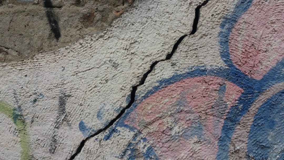
Behind the stark numbers from Chile in 1960 are human stories that make the scale of the event feel painfully real. Many survivors described watching the ground ripple like water, hearing a deep roar unlike any storm, and then seeing familiar landmarks crumble within minutes. In poorer neighborhoods, houses built from unreinforced masonry or lightweight materials stood little chance, while some better‑engineered buildings survived remarkable shaking. That contrast is not unique to Chile; in almost every major earthquake, the toll is shaped as much by inequality and planning as by geology. Wealth can buy stronger buildings, safer locations, and faster recovery, while marginalized communities often occupy the most exposed zones with the fewest protections.
The same pattern plays out with tsunamis and evacuation. Communities that had local knowledge of past events, clear routes to high ground, and trusted local leaders tended to fare better, even if their resources were modest. In places where residents did not recognize the warning signs – prolonged shaking, sudden retreat of water – or lacked safe paths inland, the tsunami was far more deadly. These differences highlight a hard truth: the Earth may shake everyone equally, but the outcomes are brutally uneven. Studying the human geography of events like the 1960 Chile quake reminds us that disaster science is not just about faults and waves; it is also about housing policy, education, governance, and whose lives are considered worth protecting before the ground ever moves.
The Future Landscape: Can We See the Next Giant Coming?
Looking ahead, scientists are cautiously optimistic about our ability to better characterize, if not fully predict, the next generation of giant earthquakes. Dense arrays of seismometers and GPS stations now monitor many major subduction zones continuously, watching for slow slip events and subtle strain changes that might signal evolving conditions on the fault. Experimental early‑warning systems, such as those operating in Japan and parts of the Americas, can already provide seconds to tens of seconds of notice once a rupture begins, enough to halt trains, shut valves, and trigger protective actions. Researchers are also exploring machine‑learning approaches that comb through vast datasets, searching for weak precursory signals that human analysts might miss. None of this amounts to reliable long‑term prediction, but it does sharpen our ability to react in the crucial first moments.
At the same time, there are big challenges on the horizon. Many of the most dangerous subduction zones still lack adequate instrumentation, especially in offshore regions where drilling and deployment are technically difficult and expensive. Coastal development continues to surge in vulnerable areas, sometimes outpacing improvements in building codes or evacuation infrastructure. And as climate change raises sea levels, the reach of future tsunamis could extend farther inland, even if wave heights are similar to past events. The legacy of Chile 1960, then, is a sort of scientific and moral obligation: use what we have learned about the biggest earthquake ever recorded to guide smarter choices before the next one arrives. Whether we meet that challenge will determine how shocking, or survivable, the next truly great quake will be.
What You Can Do: Turning Awe into Action
It is easy to read about a magnitude 9.5 earthquake and feel both horrified and helpless, as if such forces sit completely outside the realm of ordinary life. But individuals and communities can do more than just hope the ground stays quiet. If you live in or travel to a quake‑ or tsunami‑prone region, learning the basic warning signs – long or strong shaking, unusual sea behavior – and the nearest routes to higher ground can make a life‑or‑death difference. Supporting stronger building codes and retrofits, even when they seem like invisible investments, is another powerful way to reduce the human cost of the next big event. Community drills, school education programs, and local volunteer networks might sound mundane, but over and over, post‑disaster studies show that prepared neighbors save lives.
You can also back the science itself, whether by advocating for funding of seismic networks and ocean observatories or by following and sharing trustworthy information from research agencies and geological surveys. In a world where disasters are often framed as random acts of nature, it is quietly radical to insist on understanding the underlying processes and acting on that knowledge. The story of is not just about a terrifying afternoon in 1960; it is about what we choose to build, study, and protect today. The Earth will keep moving beneath our feet. The open question is how ready we decide to be when it moves in ways that bend our imagination.

Suhail Ahmed is a passionate digital professional and nature enthusiast with over 8 years of experience in content strategy, SEO, web development, and digital operations. Alongside his freelance journey, Suhail actively contributes to nature and wildlife platforms like Discover Wildlife, where he channels his curiosity for the planet into engaging, educational storytelling.
With a strong background in managing digital ecosystems — from ecommerce stores and WordPress websites to social media and automation — Suhail merges technical precision with creative insight. His content reflects a rare balance: SEO-friendly yet deeply human, data-informed yet emotionally resonant.
Driven by a love for discovery and storytelling, Suhail believes in using digital platforms to amplify causes that matter — especially those protecting Earth’s biodiversity and inspiring sustainable living. Whether he’s managing online projects or crafting wildlife content, his goal remains the same: to inform, inspire, and leave a positive digital footprint.