Stand on a cliff edge in winter and the ocean feels like a living thing, breathing, grabbing, pulling the land away grain by grain. Around the world, famous coastlines people grew up with are literally disappearing in front of their eyes. Roads that once felt safely inland now end in mid‑air, lighthouses teeter on the brink, and whole neighborhoods face the question no one wants to ask: how long before the next storm takes it all?
What is especially unsettling is that for many places, the erosion is not a slow, gentle creep. Each winter storm season, the sea seems to lunge further inland than the year before. Storm surges, rising seas, heavier rainfall and human interference are working together like a demolition crew that never clocks off. Some communities fight back with walls, sand and engineering; others are quietly preparing to step away from the edge.
Below are 11 coastal sites where the land has been steadily moving landward, winter after winter. They are not the only ones, but together they show the different ways a coastline can unravel – from soft dunes and marshes to hard rock cliffs and concrete sea-walls. As someone who has stood on some of these shores and felt the ground literally cracking underfoot, I can tell you: once you see how fast a coast can change, you never look at a blue horizon the same way again.
#1 Happisburgh, England – The Village Watching Its Street Map Vanish
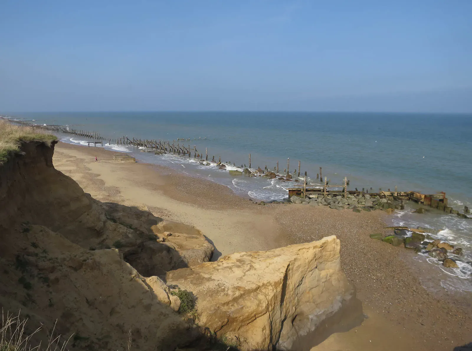
Few places capture the drama of coastal retreat as starkly as Happisburgh on England’s east coast. Perched on soft cliffs made of glacial sands and clays, the village has been losing land at a pace that would have sounded unbelievable a few generations ago. Winter storms in the North Sea hit the base of the cliffs, undercut them, and entire chunks simply slump into the waves.
Locals have watched gardens, roads, and even whole houses disappear over the edge, sometimes within a single stormy season. Old maps show streets that no longer exist, and the coastline that once lay safely beyond fields now cuts frighteningly close to homes. The pattern is painfully familiar: every winter, stronger waves and occasional storm surges nibble away another slice of the clifftop edge.
The science behind Happisburgh’s erosion is brutal but simple. The cliffs are made of unconsolidated materials left behind by ancient ice sheets, which are much easier to carve away than solid rock. Add in sea-level rise and the way coastal defenses in some areas can concentrate wave energy elsewhere, and the village has become a textbook example of how fast a soft coast can retreat under modern conditions.
Some core realities at Happisburgh can be summed up quickly:
- Soft, easily eroded cliffs mean winter storms do disproportionate damage.
- Sea-level rise and storm surges are increasing the reach and power of waves.
- Human attempts to hold the line nearby may be shifting the problem along the coast.
#2 Pacifica, California – Apartment Cliffs and Collapsing Walkways
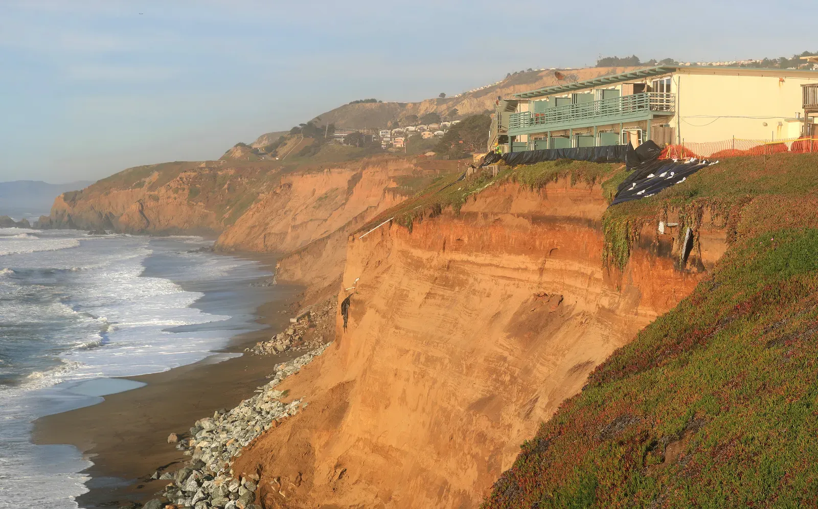
On the U.S. West Coast, the town of Pacifica just south of San Francisco has become almost synonymous with cliff erosion headlines. Ocean-view apartment blocks that once looked like secure investments have ended up on national news as images of cracked foundations and fenced-off balconies circulate after winter storms. Each wet season, heavy Pacific swell and intense rainfall combine to chew into the base of the coastal bluffs.
The bluffs here are a mix of ancient marine sediments and weak rocks, not as fragile as sand dunes but far from bulletproof. Winter after winter, wave action at the base causes undercutting, while rainwater seeping through the bluff face helps trigger collapses from above. This two-sided attack often shows up as dramatic sudden failures, even though the underlying process has been building all season.
City authorities have tried a range of responses: sea walls, riprap (large rocks placed at the toe of cliffs), and constant monitoring of at-risk buildings. But those measures can be a bit like trying to tape together a snow sculpture during a heatwave. They slow some of the damage and buy time, yet the overall trend – the bluff edge inching landward most winters – remains.
From a broader perspective, Pacifica highlights a grim truth many coastal communities are now facing: once development sits too close to a retreating edge, there are only three real options left – defend, elevate, or retreat. None of those choices is easy when people’s homes, memories, and savings are embedded in that ground.
#3 Louisiana’s Vanishing Marsh Coast – The Gulf’s Slow Drowning Frontier
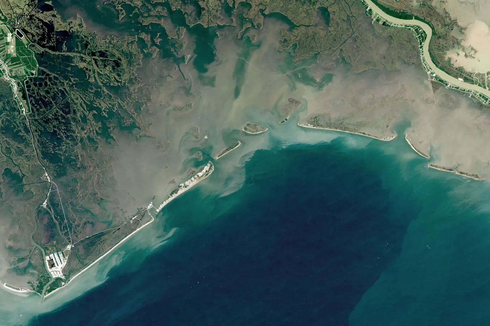
Coastal Louisiana does not have the steep cliffs of England or California; instead, its edge is a lacework of marshes, wetlands and barrier islands. But those soft landscapes are shrinking at a scale that is hard to comprehend. For decades, the state has lost land to open water as subsiding soils, rising seas, and repeated storm damage work together. Each hurricane season – which overlaps with the wetter, stormier months – tends to push the line of open water a bit further inland.
The causes here are layered. Natural subsidence has always caused the deltaic plain to sink slowly, but levees and river engineering have starved the marshes of fresh sediment that once rebuilt them. Meanwhile, oil and gas canals have cut channels that let saltwater penetrate further inland, damaging vegetation that helps hold the marsh together. Add stronger storms and higher seas, and the Gulf pushes deeper into what used to be solid ground.
Winter fronts and cold-season storms may not have the name recognition of big hurricanes, but they still whip up strong winds and waves across the shallow Gulf. Those energies can tear at the edges of marsh islands and erode fragile shorelines season after season. In some places, what once was a continuous strip of land is now scattered into isolated patches surrounded by open water.
People who grew up fishing in marsh ponds now speak of landmarks that have simply melted away. For coastal communities, that loss is more than just a cartographic curiosity: wetlands act as a natural buffer against storm surges. As they disappear, towns and cities like New Orleans become more exposed, turning every winter’s erosion into a small but meaningful increase in future risk.
#4 The Outer Banks, North Carolina – A Sand Ribbon on the Move
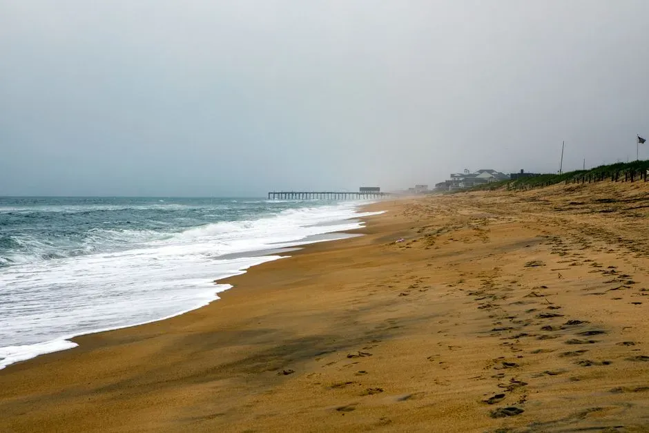
The Outer Banks of North Carolina are often marketed as a peaceful, nostalgic beach escape, but geologically they are anything but stable. These barrier islands are essentially long, narrow piles of sand sitting off the mainland, constantly reshaped by wind, waves and storms. Each winter’s nor’easter storms often rearrange beaches, dunes and inlets like a child sweeping their hand through a sandbox.
Barrier islands naturally migrate landward over time as waves push sand up and over the island in storm events, a process called overwash. In the past, that migration would have been accepted as part of a wild coastline. Today, though, roads, houses and critical infrastructure like Highway 12 sit right on that shifting ground. The result is a constant battle to keep sand under what humans want to stay fixed.
After intense winter storms, it’s common to see sections of road undermined, dunes scoured away, and houses edging closer to the surf line. Protective measures such as beach nourishment and dune rebuilding try to put the sand back where people expect it to be, but the underlying long-term pattern still points inland. Each season, overwash fans and beach loss remind everyone that the Outer Banks are moving, even if maps and deeds pretend otherwise.
- The islands are inherently mobile by nature; they are not meant to be permanent.
- Winter nor’easters often cause more sustained erosion than a single summer hurricane.
- Attempts to “freeze” the islands in place clash with the way barrier systems evolve over centuries.
#5 Keta, Ghana – A West African Town Fighting the Atlantic’s Advance
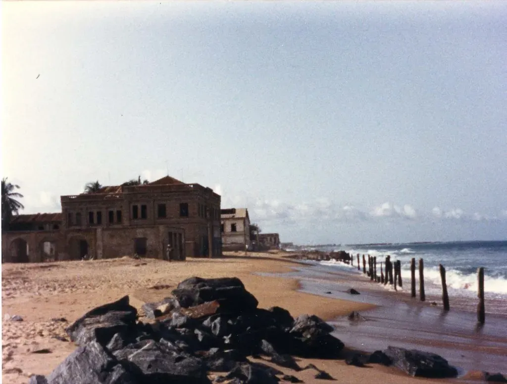
On the Gulf of Guinea in West Africa, the town of Keta in Ghana has become a powerful symbol of coastal vulnerability. Over many decades, the town and neighboring villages have seen their shoreline retreat, with homes, roads and even a once-thriving beachfront area lost to the Atlantic. The erosion is not only a summer or monsoon story; energetic waves during various seasons, including the boreal winter months, keep nibbling away at what remains.
Several drivers interact here. Upstream dam construction and river regulation have reduced the flow of sand to the coast, meaning the natural supply that used to replenish beaches is now weakened. Combined with strong wave action and sea-level rise, that sediment deficit leaves the shoreline exposed. In some sections, the beach has narrowed so much that even moderate storms can reach and damage buildings.
Ghana has responded with hard-engineering projects such as sea defense walls and groynes in parts of the Keta area. These have successfully slowed or halted erosion in certain protected zones, but they can shift erosion further down the coast, where the structures end. Residents further along the shore sometimes feel like they are absorbing the energy that can no longer be dissipated naturally up-drift.
What makes Keta particularly poignant is the social and cultural dimension. Coastal erosion has forced relocations, disrupted livelihoods based on fishing and small-scale trade, and reshaped a community’s relationship with a shoreline that was once central to its identity. Every storm season that carves the shore a little deeper is also carving through that way of life.
#6 The Holderness Coast, England – Europe’s Fastest-Eroding Cliffs
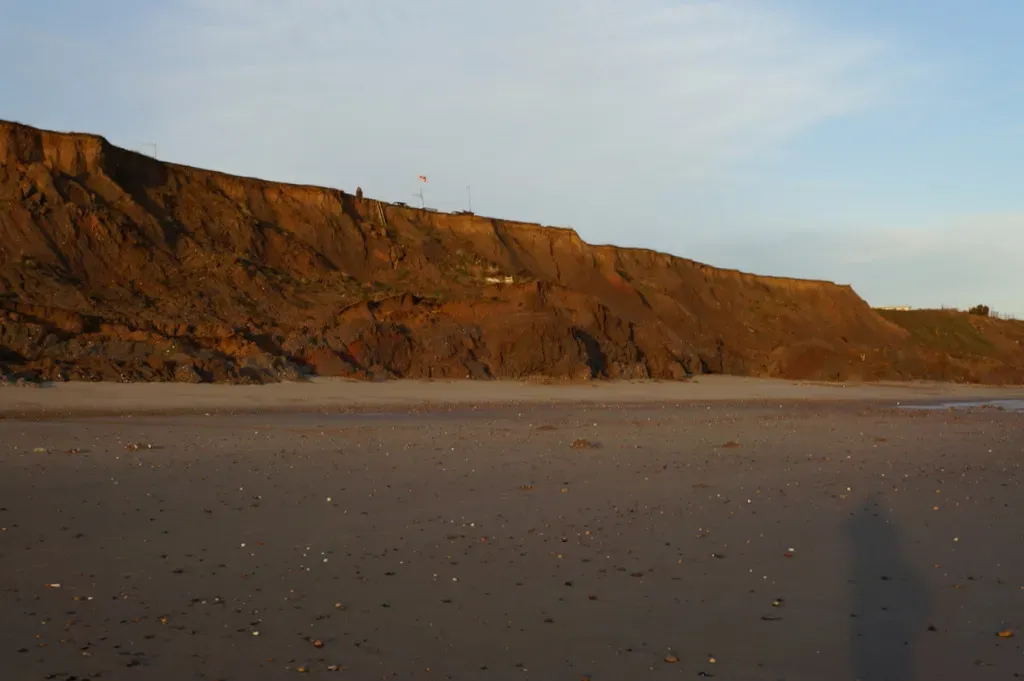
Drive along England’s Holderness Coast and you are traveling beside one of Europe’s fastest-eroding shorelines. Stretching between Flamborough Head and Spurn Point on the North Sea, this coast is made largely of soft glacial till, a mix of clay, sand and gravel laid down by ancient ice sheets. That material has little resistance to wave attack, which is why the coastline here has been marching landward for centuries.
Winter storms are particularly vicious along this stretch. Powerful waves crash into the base of the low cliffs, removing support and causing frequent slumps and landslides. Rain and groundwater seep through the sediments from above, adding extra weight and lubrication that encourages collapse. Residents sometimes wake after a storm to find a fresh scar where part of a field or pathway used to be.
Coastal defenses such as sea walls and rock armor have been installed to protect specific towns like Withernsea and Mappleton. These do reduce erosion locally, but they also interrupt the natural movement of sediment along the coast. Down-drift, where the protections stop, erosion often speeds up because the beaches there are being starved of sand that would have arrived in a more natural system.
Over time, entire medieval villages have been lost to the sea along Holderness, their exact locations now lying offshore. The history here underlines a sobering idea: when the land is made of fragile materials and the sea has a long fetch to build powerful waves, it is not a question of whether the edge will move, but how fast and who will be in its path.
#7 Bangladesh’s Deltaic Coast – Rivers, Cyclones and a Shrinking Edge
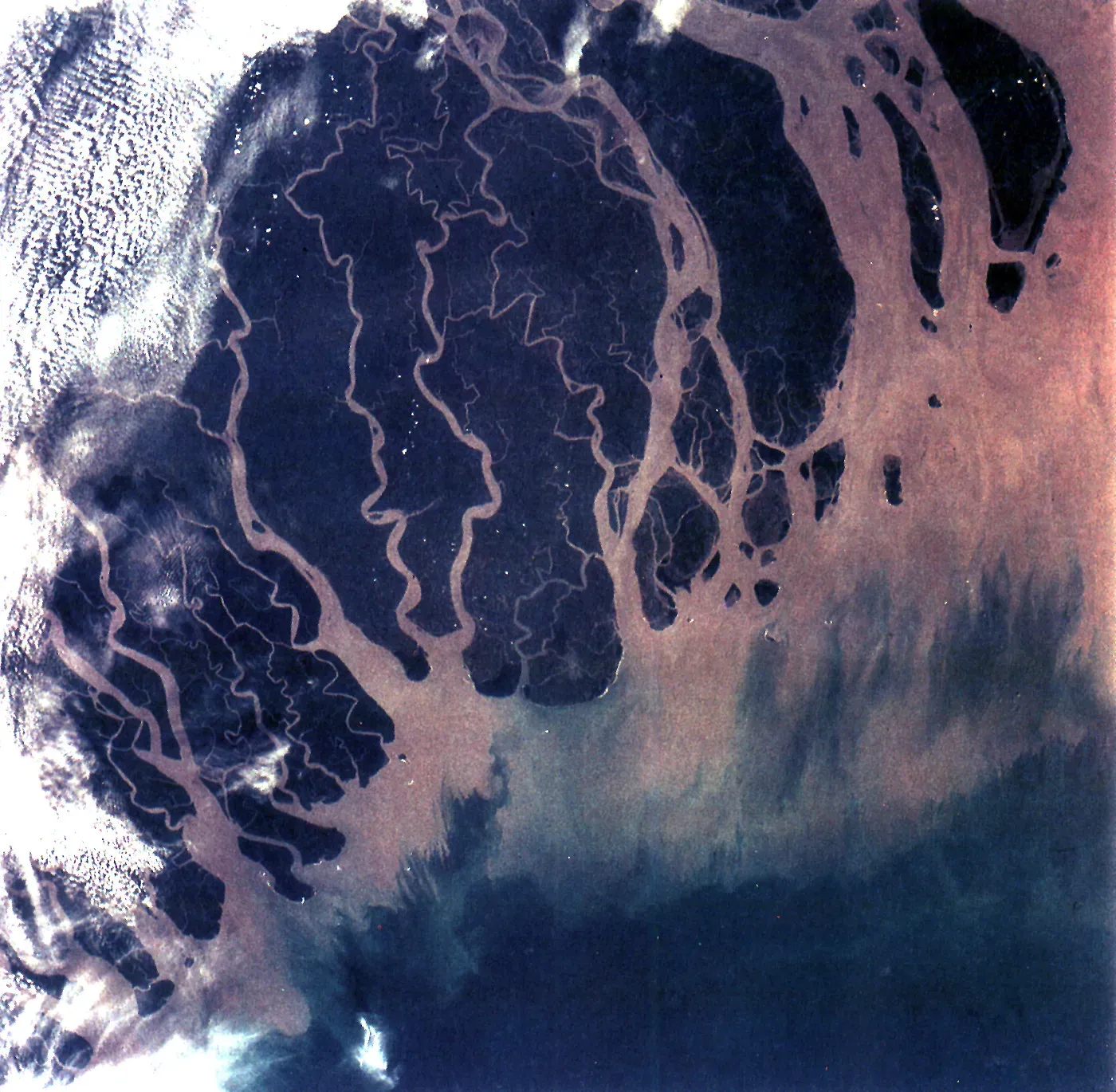
Bangladesh sits on one of the world’s largest river deltas, where the Ganges, Brahmaputra and Meghna rivers meet the Bay of Bengal. This geography brings incredible fertility but also relentless instability. The coastline is a dynamic mosaic of mudflats, mangroves and sandbars that appear and disappear on human time scales. Each cyclone season and each spell of rough winter monsoon seas can rearrange that margin significantly.
Unlike rocky coasts, deltaic edges are made of very fine sediments held together largely by vegetation and gentle hydrodynamics. When storms bring strong waves and surges, they can erode embankments, breach polders (embanked lowlands), and carve away at the edges of inhabited islands. People in these regions are used to moving when the river changes its course, but rising seas and more intense weather are making those moves more frequent and more costly.
In some coastal districts, villages have had to relocate multiple times within a generation as riverbanks and shorelines retreat. Families might see their house, then their field, and finally their entire village site claimed by a combination of riverbank erosion and coastal flooding. Winter cold spells do not stop this process; if anything, certain seasonal winds and waves continue the slow attrition outside of headline-grabbing cyclone events.
- Fine sediments and low elevation make the coast extremely sensitive to wave and surge attack.
- Human-made embankments provide protection but can fail catastrophically when overtopped.
- Planned relocation and flexible land tenure are becoming as important as physical defenses.
#8 Shishmaref, Alaska – A Village on Thawing Permafrost and Open Water
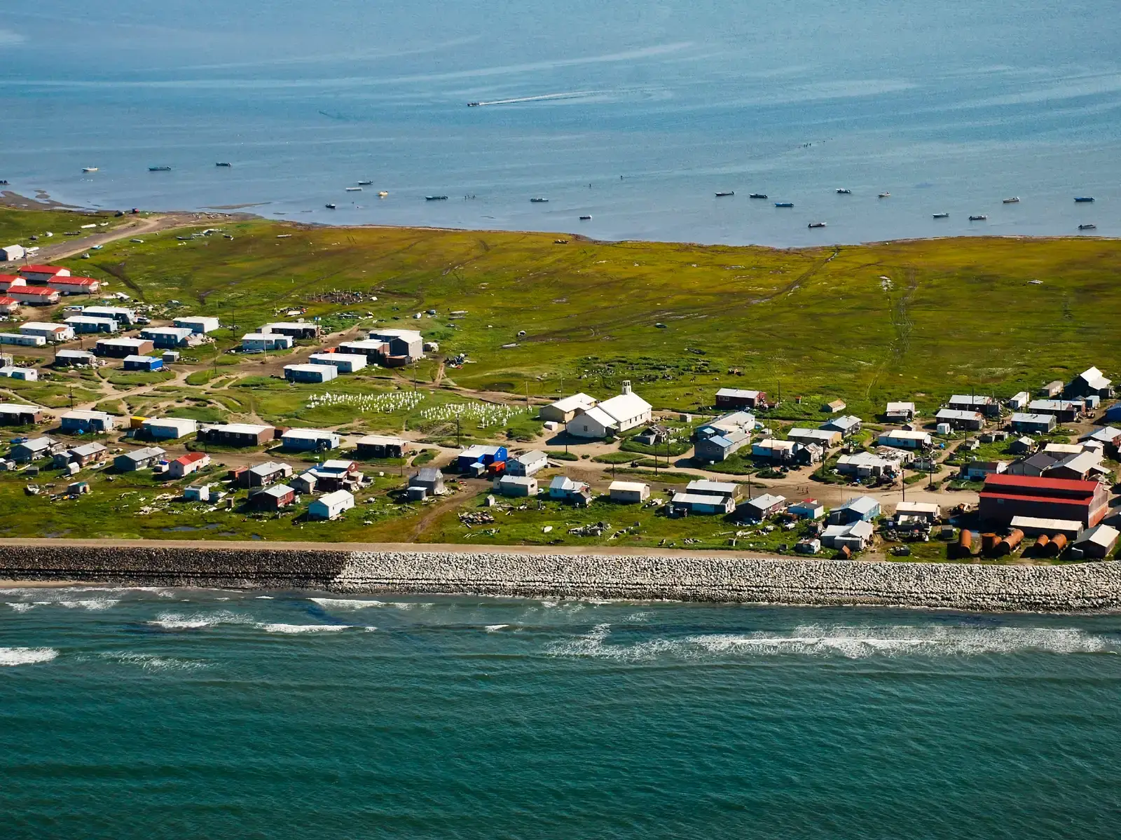
At the other end of the climate spectrum, the Inupiat village of Shishmaref in Alaska sits on a barrier island in the Chukchi Sea. Traditionally, sea ice covered the waters here for much of the year, acting like armor that protected the coast from wave attack. As Arctic sea ice seasons have shortened and the ice forms later and breaks up earlier, there are more autumn and early winter storms when open water can directly batter the shoreline.
Shishmaref’s island is built on permafrost – frozen ground that is now warming and thawing. When that permafrost loses its ice content, the soil becomes weaker and more prone to erosion. Waves hit the base of small bluffs and shorelines, carving them away more easily because the thawed ground offers far less resistance. Each storm season, residents see more of their narrow island chipped away.
Protective rock revetments and emergency projects have been placed along some sections of the coast, but the long-term question of relocation hangs over the community. The combination of thawing ground and increasing storm exposure means the island is, quite literally, disappearing under people’s feet. It is one of the places where climate change is not an abstract chart but a daily reality of losing land, buildings, and cultural sites.
Visiting similar Arctic communities, I remember being struck by how people casually pointed to places offshore and said that used to be part of the island. It drives home a harsh lesson: when the climate baseline shifts, the old patterns of ice and storms that coastal life relied on can unravel frighteningly fast.
#9 Miami Beach, USA – Sand, Streets and the Encroaching Atlantic
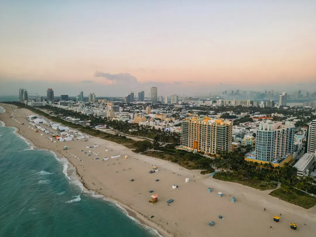
Miami Beach does not fit the classic image of cliffs crumbling into the sea, but it still qualifies as a coastal site inching closer to the edge every winter. Built on a barrier island, the city has armored much of its shoreline with seawalls, nourished beaches with imported sand, and installed pumps and raised roads to deal with rising waters. Yet seasonal king tides, stronger storms and long-term sea-level rise mean that water is appearing where it never used to be.
In the cooler months, high tides can combine with seasonal weather patterns and low-pressure systems to push water up through storm drains and over seawalls. Streets flood even on sunny days, a phenomenon that locals now call tidal flooding or sunny-day flooding. While this is not classic “erosion” carving away land, it signals that the functional boundary between land and sea is shifting inland, winter by winter.
Beach erosion is still part of Miami Beach’s story too. Heavy winter swell and storms can strip away sand that was carefully placed there by nourishment projects, exposing underlying rock or leaving a steep, narrow beach. Municipalities then face the recurring cost of bringing in more sand to restore the tourist-friendly shoreline that underpins the local economy.
- Sea-level rise has turned rare nuisance flooding into a regular seasonal experience.
- Beach nourishment is essentially a recurring rental fee paid to the ocean to keep the shoreline in place.
- Raising roads and buildings may extend habitability but does not stop the ocean from advancing.
#10 Venice’s Barrier Islands and the Adriatic Edge – Defenses Under Pressure
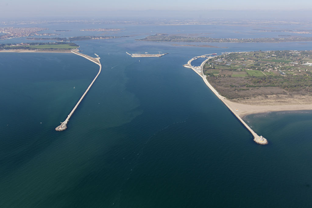
Everyone knows Venice for its canals, but fewer people think about the low-lying barrier islands and spits that help shield the Venetian Lagoon from the open Adriatic Sea. Places like the Lido and Pellestrina form a fragile outer edge. Over the past century and beyond, these barrier islands have battled erosion, subsidence, and sea-level rise, with stormy autumn and winter seasons repeatedly threatening to breach or overtop them.
Historically, Venice and the surrounding communities built sea walls, jetties and other structures to stabilize these islands and control inlets. Those defenses have helped, but they also altered sediment movement and sometimes intensified erosion in unprotected sections. Strong winter storms in the Adriatic can rupture beaches, eat away at dunes, and undermine man-made structures meant to hold the line.
On top of that, parts of the region have sunk due to groundwater extraction and natural geological processes, meaning relative sea-level rise has been effectively amplified. The MOSE barrier system, designed to protect the lagoon and the city from extreme high tides, is a major engineering response to this shifting edge. Yet even with such ambitious projects, the combination of soft shorelines, busy maritime traffic, and climatic changes leaves the outer coastal rim under constant pressure.
Walking those narrow strips of sand and stone in winter, it is hard to shake the feeling that the city’s fate is intimately tied to a few fragile lines of defense. The barrier islands are not only physical shields but also early warning indicators, showing how much energy the sea is throwing at this iconic region.
#11 The Maldives – Coral Atolls on a Tightening Timeline
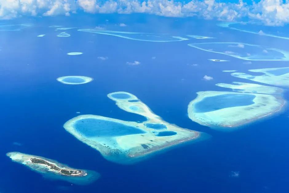
The Maldives, a nation of coral atolls scattered across the Indian Ocean, has become a global symbol of low-lying coastal vulnerability. Most of its land rises only a couple of meters above sea level at best, and many islands are little more than narrow sand ridges-ringed by reefs. Seasonal monsoon cycles, combined with higher sea levels and coral stress, are putting intense pressure on these delicate shorelines.
During stormy periods, particularly in the wetter monsoon months, waves can overtop narrow beaches and flood interior areas, stripping away sand that forms the islands’ main protection. In some cases, repeated events have caused measurable changes in island shape and size. When protective coral reefs are healthy, they can dissipate much of the wave energy, but warming oceans and coral bleaching events have weakened this natural shield in many locations.
Island communities and the national government have invested in measures like sea walls, breakwaters and artificial island-building to create higher, more stable ground for critical infrastructure. These projects buy valuable time, but they also highlight a deep tension: a tourism economy built on an image of pristine beaches and turquoise water is increasingly reliant on hard coastal engineering and constant maintenance.
Every storm season that erodes a beach or damages a reef adds to a creeping sense of urgency. For Maldivians, discussions about adaptation and even potential long-term relocation are not abstract debates. They are conversations about whether grandchildren will be able to stand on the same pieces of land, or whether those sands will have slipped below the tides entirely.
Conclusion – Living With a Moving Edge Instead of Pretending It Is Fixed
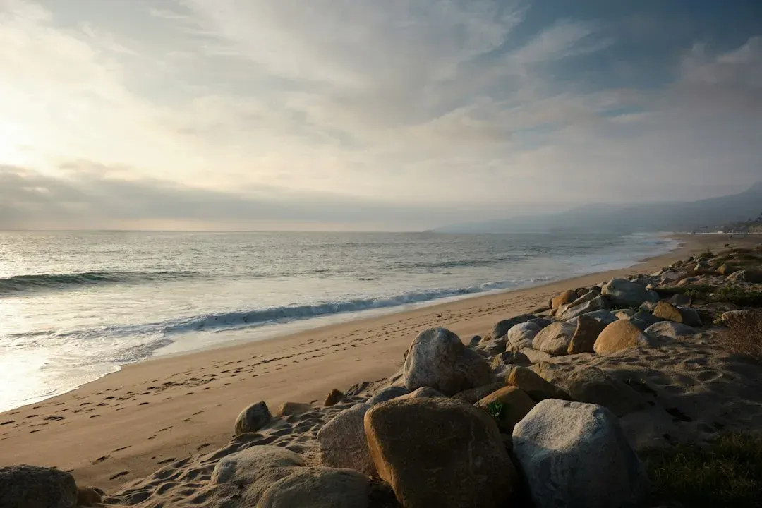
Looking across these 11 sites, what stands out is not just that the coast is moving, but how hard we have tried to pretend it is not. We build homes on soft cliffs, pave roads across migrating sandbars, and anchor entire economies to low-lying marshes and atolls. Then, when winter storms and rising seas do exactly what physics says they will do, we treat each collapse and flooded street like an isolated surprise instead of part of a clear pattern.
Scientifically, the story is straightforward: where land is low, soft or sinking, and where waves are getting a little more reach and power each decade, the shoreline will retreat. Emotionally and politically, though, the choices are messy. Defending every inch with concrete is not only expensive; it often just shifts the damage further down the coast. Strategic retreat feels like defeat, but clinging to the edge at all costs can leave communities trapped in a cycle of crisis, repair and deeper loss.
My own bias, shaped by walking these fragile edges and talking to people who live there, is that honesty is the only real starting point. That means admitting that some places will have to move, designing new neighborhoods with the expectation of change, and treating wetlands and reefs as infrastructure just as vital as roads and levees. It also means letting go of the comforting myth that the line between land and sea is a thin stroke on a map instead of a wide, living zone that shifts with every season.
In the end, the real question is not whether coasts will keep moving – they will – but whether we choose to move intelligently with them or wait until the next winter storm makes the decision for us. If you stood on your nearest shoreline today and imagined where the edge will be in fifty years, would you still be standing on dry ground, or would you already be underwater in your mind’s eye?