Most people glance up at the sky, see a puffy cloud, and think nothing of it. But meteorologists have been quietly reading clouds like a weather report for over a century, and the shapes overhead can reveal what’s coming hours – sometimes days – before radar ever picks it up. Storm chasers, pilots, and farmers have long relied on this skill, catching warning signs that modern forecast models still miss entirely.
Some of these shapes look almost cartoonish – fish scales, cotton balls, flying saucers – while others look like the sky is bruising right in front of you. Yet each one is coded language, and by the time you reach the cloud sitting at #1, you’ll understand why trained spotters still trust their own eyes over a radar screen. Here are the 11 readings forecasters actually use.
#11 – Cirrus Clouds (“Mare’s Tails”)

Those wispy, feathery streaks high in the sky aren’t just pretty – they’re often the first whisper of a system moving in.
Cirrus clouds form at altitudes above 20,000 feet, made almost entirely of ice crystals rather than water droplets. Because they sit so high, they don’t produce rain themselves, but their appearance and thickening pattern matter enormously to trained eyes. When cirrus clouds start multiplying and thickening into a hazy sheet, forecasters treat it as an early warning that a warm front could arrive within 24 to 48 hours.
Sailors and pilots nicknamed them “mare’s tails” because of their horse-hair curl, and old maritime folklore turned the pattern into a warning verse passed down for generations.
Mare’s tails and mackerel scales make tall ships carry low sails.
Traditional sailors’ weather rhyme
Today’s meteorologists don’t need poetry, but the underlying physics still holds. Thin, isolated cirrus usually means fair weather continues. Dense, streaking cirrus is different – it often marks the leading edge of a jet stream disturbance. But #10 is where the sky gets a lot more literal.
#10 – Altocumulus (“Mackerel Sky”)
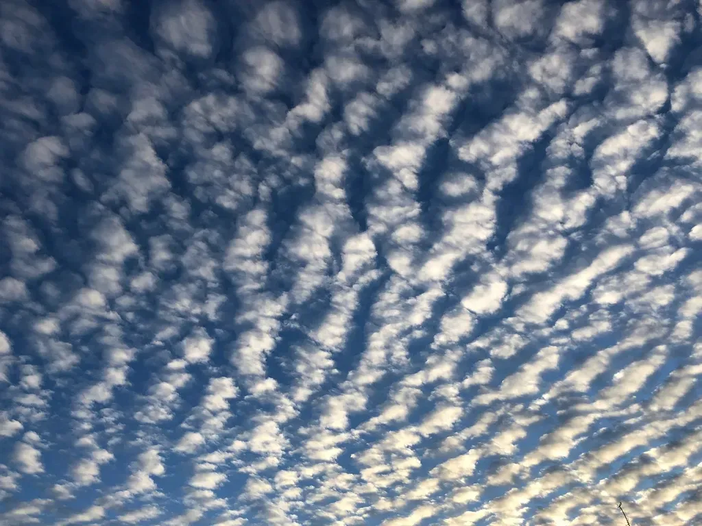
If the sky looks like it’s covered in fish scales, pay attention – this pattern has a surprisingly reliable track record.
Altocumulus clouds sit in the middle atmosphere, typically between 6,500 and 20,000 feet, and appear as rows of small, rounded cloud clumps. When they cluster tightly and repeat in a rippled, scaled pattern, they create what’s commonly called a “mackerel sky.” Forecasters have long used this formation as one of the more dependable visual cues for thunderstorms developing within 6 to 12 hours, especially during warm, humid afternoons.
Fast Facts
- Sits roughly 6,500-20,000 feet up, right in the atmosphere’s “middle layer”
- Made mostly of water droplets, occasionally supercooled at the higher end of that range
- The rippled texture comes from mid-level instability, not from strong wind alone
- Often shifts or dissolves within just a few hours once conditions change
- Easy to confuse with cirrocumulus, which forms much higher and looks finer-grained
The science behind it involves instability at mid-levels of the atmosphere – pockets of rising and sinking air create that bumpy, textured look. Unlike cirrus, altocumulus forms closer to the ground and reacts faster to atmospheric shifts, making it a shorter-range signal.
Many amateur weather watchers dismiss this pattern as just a “cool-looking sky,” but pilots and farmers have used it for generations to decide whether to delay outdoor plans. Still, none of this compares to the shift happening in #9.
#9 – Cumulus Humilis (Fair-Weather Cumulus)
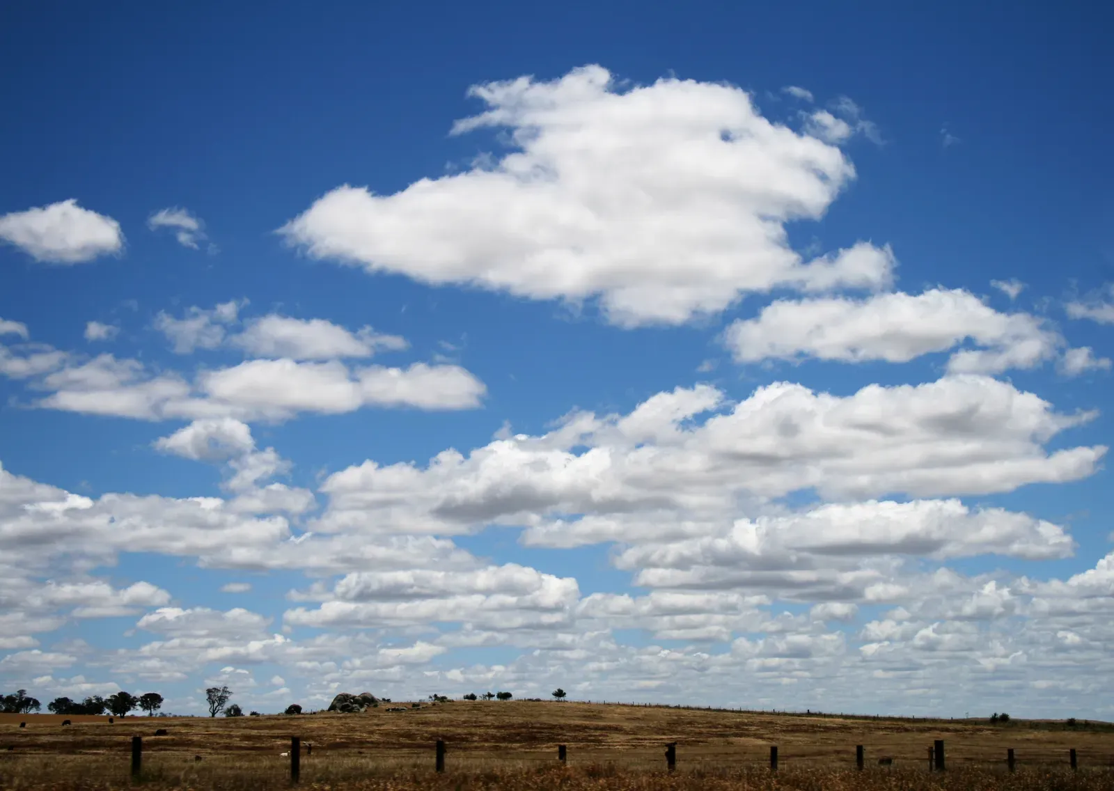
These are the cotton-ball clouds everyone loves, but even “boring” clouds carry a hidden signal.
Cumulus humilis clouds are small, flat-bottomed, and puffy – the textbook image of a nice day. They form when warm air near the surface rises just enough to condense but doesn’t have the energy to build vertically. Meteorologists actually use these clouds as a baseline reading: if cumulus stays flat and shallow throughout the day, it usually confirms a stable atmosphere with little storm risk.
The real value comes from watching how these clouds evolve, not just how they look at a single moment. If fair-weather cumulus starts growing taller by early afternoon, that’s often the tell-tale sign of increasing instability – the atmosphere gaining the “fuel” needed for storms later in the day.
Farmers historically used these clouds to time fieldwork, since their shape shift between morning and midday hours often predicted whether afternoon storms were likely. Yet even this calm stage is nothing next to what happens in #8.
#8 – Cumulus Congestus (Towering Cumulus)
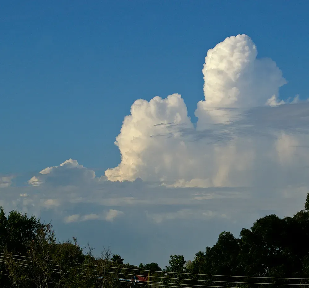
This is where things start getting serious – cumulus clouds don’t stay cute for long once they start climbing.
Cumulus congestus clouds are the intermediate stage between harmless fair-weather puffs and full-blown thunderstorms. They develop a cauliflower-like texture and can grow several thousand feet tall within just 20 to 30 minutes under the right conditions. Storm spotters treat rapidly rising cumulus congestus as one of the most reliable “get ready” signals available, often more useful in the short term than radar, which can lag behind real-time development.
The speed of vertical growth matters just as much as the height. Clouds that balloon upward quickly usually indicate strong instability and available moisture – the two core ingredients for severe weather. Many storm chasers specifically watch for congestus towers because they mark the exact location where a storm is most likely to fire first.
While most casual sky-watchers assume only fully formed thunderclouds matter, professionals argue this earlier stage is actually the more valuable read. And that’s still mild compared to the optical illusion waiting in #7.
#7 – Lenticular Clouds (The “UFO” Clouds)
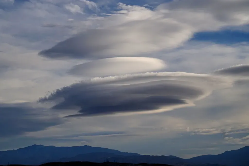
These smooth, saucer-shaped clouds have fueled decades of UFO sightings, but their real purpose is far more practical for pilots and forecasters.
Lenticular clouds form when stable, moist air is forced up and over mountains or terrain, creating a wave pattern in the atmosphere. Their lens-like, stacked shape is unmistakable and often stays nearly stationary even in strong winds – a detail that confuses onlookers but tells meteorologists exactly what’s happening aloft. Aviation forecasters treat lenticular clouds as a direct warning sign of severe turbulence, since they mark powerful mountain waves that can toss aircraft even in clear skies.
Worth Knowing
- Meteorologists also call them “wave clouds” because they trace invisible air waves rolling over terrain
- Most common near mountain ranges like the Rockies, Cascades, and Sierra Nevada
- Can stack into multiple smooth layers, sometimes described as a “stack of plates” in the sky
- Pilots often log a lenticular sighting as an informal turbulence advisory for the area
- Can hover in the same spot for hours despite strong winds passing through them
Pilots have historically avoided flying near active lenticular formations because the turbulence can appear with no visible storm at all – making it one of the more dangerous “invisible” hazards in meteorology. Ground observers also use them to judge upper-level wind strength and direction, since the wave pattern only forms under specific speed and stability conditions.
It’s a great example of a cloud shape most people find beautiful, while professionals see a caution sign. Which is nothing next to the myth-busting truth about #6.
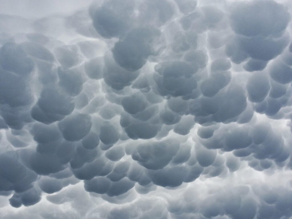
#6 – Mammatus Clouds
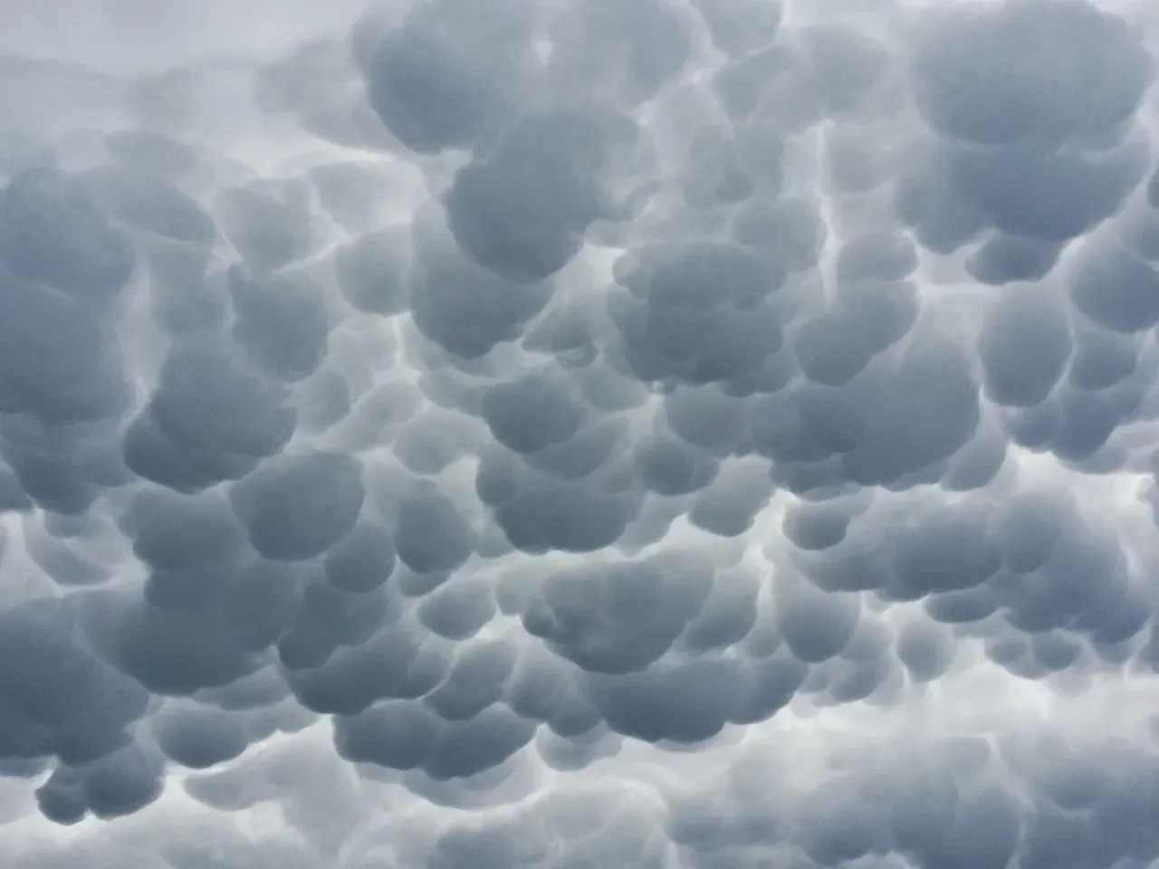
Few cloud formations look as unsettling – or get misread as often – as mammatus clouds.
These pouch-like, bulging formations hang from the underside of a cloud, most commonly an anvil from a thunderstorm. Despite popular belief, mammatus clouds don’t cause severe weather – they typically appear after the worst of a storm has already passed, forming as sinking pockets of cool, moist air spread beneath the storm’s outflow. Many people assume the opposite, associating the dramatic look with an approaching tornado, which experts say is largely a myth.
Forecasters do use mammatus as confirmation that a storm reached significant intensity, since the turbulent internal dynamics required to create the pattern only occur in strong, well-developed thunderstorms. Photographers love them for their surreal, textured appearance, but meteorologists use them more as a “storm report” than a warning.
This is one of those slightly controversial corrections that surprises even long-time weather watchers: the scariest-looking cloud in the sky is often the safest stage of the storm. But #5 doesn’t give you that luxury of time.
#5 – Shelf Clouds (Arcus Formation)
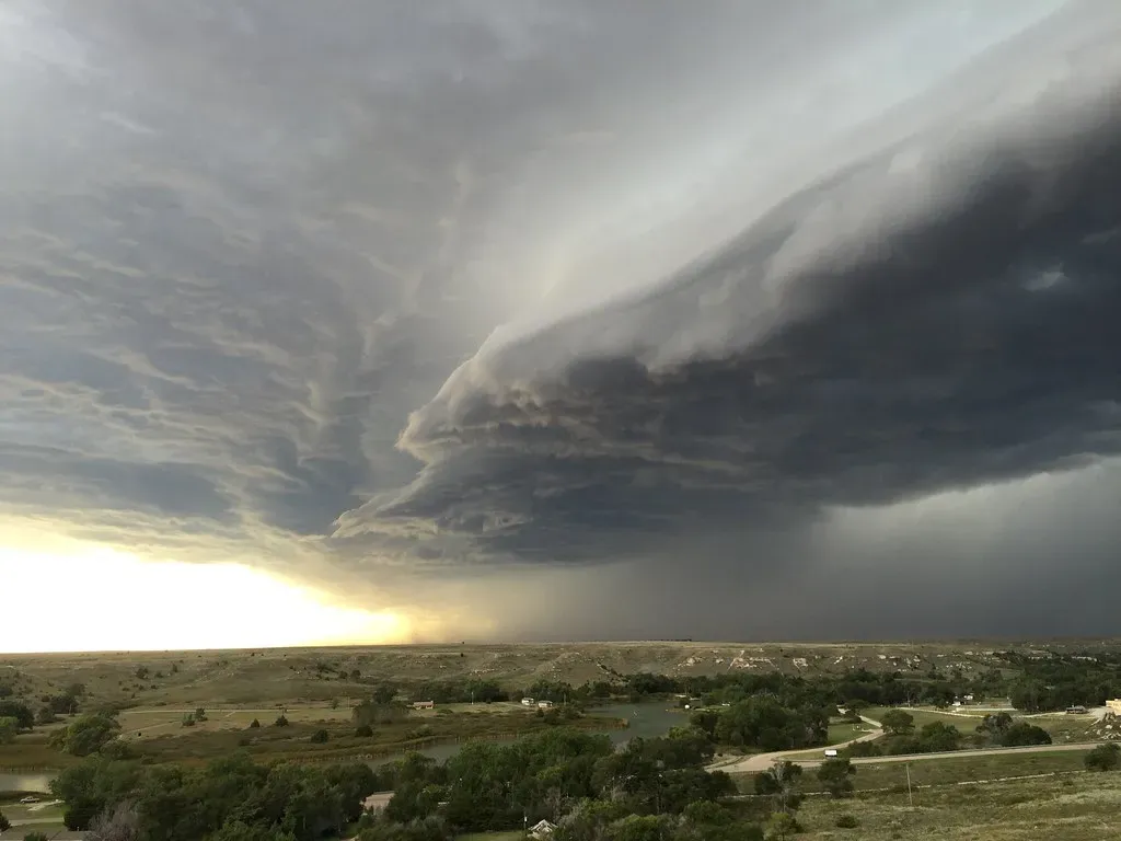
If you’ve ever seen a long, smooth, wedge-shaped cloud rolling toward you like a wave, you’ve witnessed one of the most immediate warning signs in meteorology.
Shelf clouds form along the leading edge of a thunderstorm’s outflow boundary, where cool, sinking air rushes outward and lifts warm, humid air ahead of it. The result is a dramatic, low, horizontal cloud that can stretch for miles. Forecasters consider an approaching shelf cloud one of the clearest visual cues that damaging straight-line winds are imminent, often within minutes rather than hours.
Unlike many of the slower-developing signals earlier on this list, shelf clouds demand immediate action once spotted. Their smooth, layered underside comes from rapid temperature and pressure changes at the surface, and wind gusts accompanying them can exceed 60 mph even without a tornado present.
Storm spotters are trained to distinguish shelf clouds from rotating wall clouds, since the two look superficially similar but signal very different threats – one brings powerful straight-line wind, the other can bring rotation. Compare that to #4, where up is actually down.
#4 – Anvil Clouds and Overshooting Tops
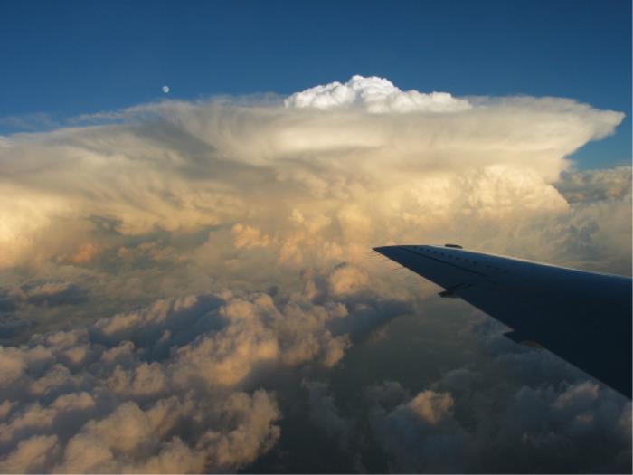
The flat, spreading top of a thunderstorm might look like it’s calming down – but experts say that’s exactly backwards.
Anvil clouds form when a thunderstorm’s updraft slams into the stable layer at the top of the troposphere and spreads horizontally, creating that iconic flat-topped shape. Forecasters pay close attention to a specific feature within the anvil called an “overshooting top” – a dome of cloud punching above the flat anvil surface, which signals an unusually powerful, sustained updraft capable of producing severe hail, damaging wind, or tornadoes.
Quick Compare
- Smooth, flat anvil: updraft has matched the stable air above; storm may be nearing its mature or weakening phase
- Anvil with a brief overshoot: storm is likely near peak intensity but not necessarily producing severe weather at the surface
- Persistent overshoot lasting 10+ minutes: strong signal of a sustained, powerful updraft and elevated severe hail or tornado risk
- Collapsing overshoot: can precede a sudden downburst as the unstable dome falls back into the storm
Satellite meteorologists use overshooting tops as one of their most trusted intensity indicators, since the feature rarely appears in weak or short-lived storms. The taller and more persistent the overshoot, the stronger the storm’s internal engine likely is.
Many casual observers assume a spreading anvil means a storm is weakening and moving past its peak, but professionals argue this is one of the most common misreadings in amateur storm watching – an active overshooting top often means the most dangerous phase is just beginning. None of that prepares you for the color warning in #3.
#3 – Green-Tinged Storm Clouds
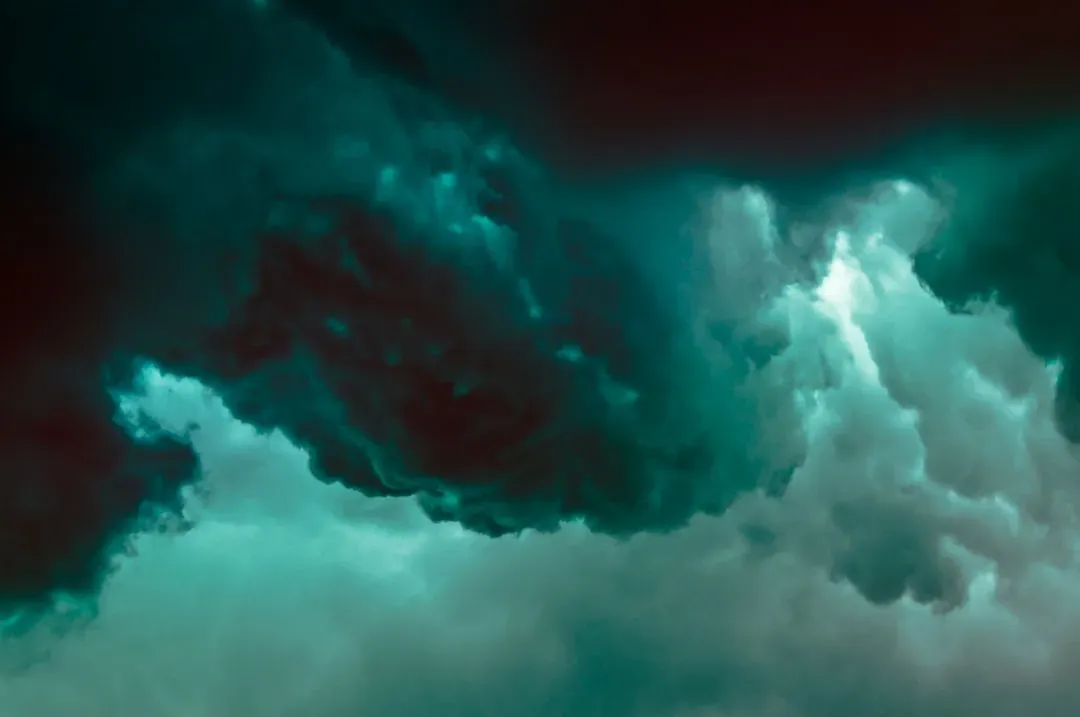
A greenish sky is one of the most talked-about – and misunderstood – visual warnings in severe weather.
This eerie coloring happens when sunlight passes through a storm cloud loaded with large water droplets and hail, scattering light in a way that shifts its color toward green. Forecasters use a green-tinged sky as a strong indicator of large hail potential, since the phenomenon is closely tied to storms with deep, hail-producing updrafts.
Despite widespread belief, a green sky does not automatically mean a tornado is coming – that link is more folklore than forensic meteorology. What it does reliably suggest is a storm carrying significant water content and possibly severe hail, sometimes golf-ball size or larger.
Storm chasers treat the coloring as a serious caution sign worth documenting, since it often precedes reports of property damage from hail rather than tornadic activity specifically. This is one of the more controversial corrections meteorologists make to public assumptions, and it tends to spark debate every time it’s brought up. Still, nothing rattles a storm chaser like #2.
#2 – Rotating Wall Clouds
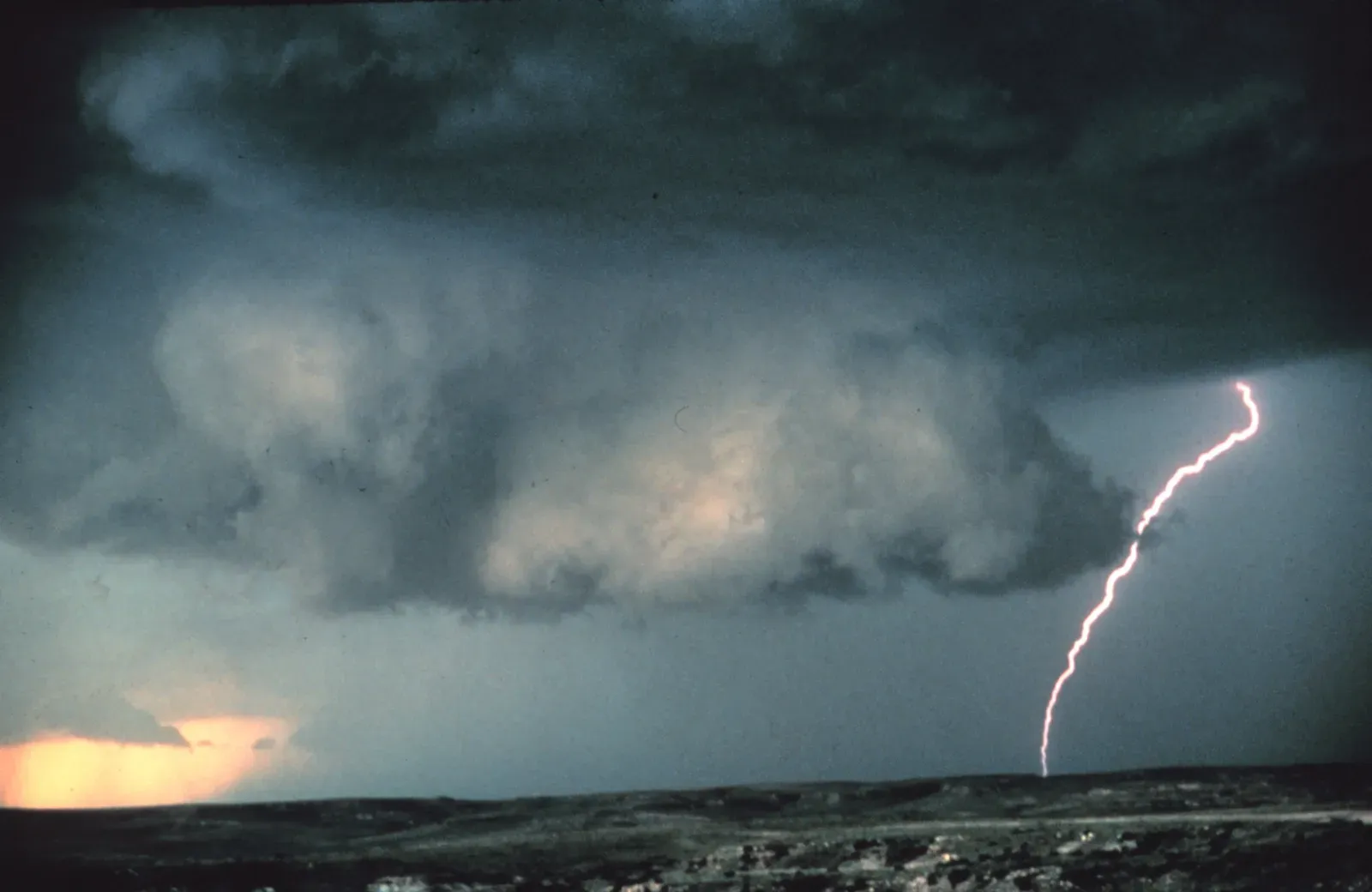
Now we’re entering the territory that keeps storm chasers glued to the horizon – a lowering, rotating cloud beneath a thunderstorm’s base.
Wall clouds form when a thunderstorm’s rotating updraft pulls in moist air near the ground, creating a distinct, often rotating lowering that hangs beneath the main cloud base. The presence of persistent rotation in a wall cloud is one of the most trusted precursors to tornado formation, and trained spotters treat it as a signal to alert authorities immediately.
Not every wall cloud produces a tornado – in fact, most don’t – but the combination of rotation, rapid rising motion, and sustained duration dramatically increases the odds. Spotters are specifically trained to distinguish between a slow, non-rotating lowering (usually harmless) and a tightening, spinning wall cloud, which often precedes funnel formation within 10 to 20 minutes.
This distinction has real consequences: emergency alerts and tornado warnings are frequently issued based directly on trained spotter reports of rotating wall clouds, sometimes before radar confirms rotation aloft. And then there’s #1 – the one everyone’s actually watching for.
#1 – Funnel Clouds
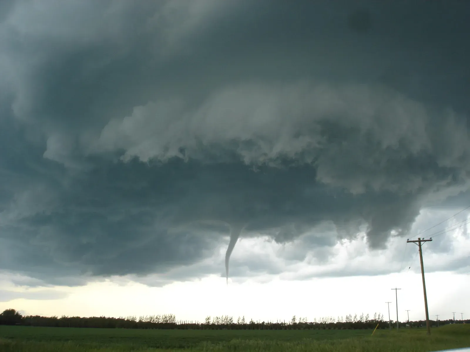
This is the moment every forecaster, spotter, and storm chaser is ultimately watching for – the visible, narrowing rotation that can become a tornado in seconds.
A funnel cloud is a rotating column of air extending from the base of a thunderstorm that has not yet made contact with the ground. Once it does, it’s officially classified as a tornado. Forecasters consider a visible funnel cloud the single most urgent visual reading in all of storm observation, since it represents rotation that has already organized into a coherent, descending column.
At a Glance
- Only earns the name “tornado” the moment it makes contact with the ground
- Many funnel clouds are brief, dissipating in well under 10 minutes
- Thin, rope-like funnels tend to signal a weakening circulation
- Wide, wedge-shaped funnels are associated with the most destructive tornadoes
- A spotter’s real-time report can trigger a warning faster than radar confirmation alone
The shape, speed of descent, and debris movement beneath the funnel all matter to trained observers. A funnel that remains thin, ropy, and slow-moving behaves differently than a wide, wedge-shaped funnel descending rapidly – the latter is associated with some of the most destructive tornadoes on record.
Emergency management agencies rely heavily on real-time spotter reports of funnel clouds because satellite and radar data, while powerful, can lag behind what a trained human eye sees happening in real time. This is why storm spotting programs still exist today, even with advanced radar technology – because the sky, quite literally, often shows the danger before the instruments do.
The Bottom Line
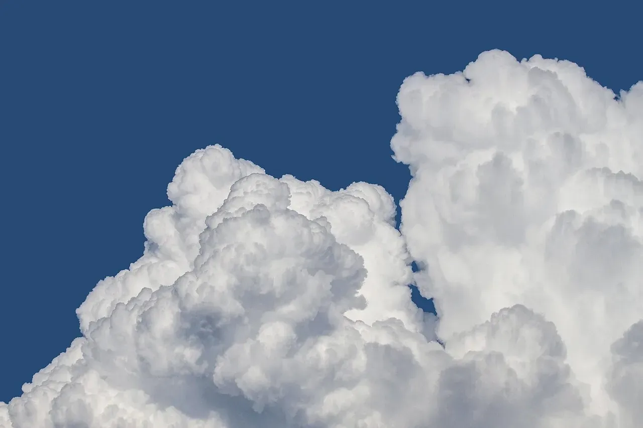
Reading clouds isn’t outdated folklore – it’s a skill still used every single day by pilots, farmers, and storm chasers to make split-second decisions. The most surprising takeaway is how often the most dramatic-looking clouds, like mammatus, are the least dangerous, while the most urgent warning, the wall cloud, can look deceptively calm. Cirrus whispers a warning days out, shelf clouds scream one minutes out, and funnel clouds demand immediate action.
In our opinion, this makes it borderline reckless that basic cloud literacy isn’t taught more widely, especially in tornado-prone regions where minutes matter more than radar lag time. The sky has been broadcasting warnings for as long as humans have looked up – we just stopped listening. Did we miss a cloud shape that’s saved you from bad weather? Drop it in the comments.