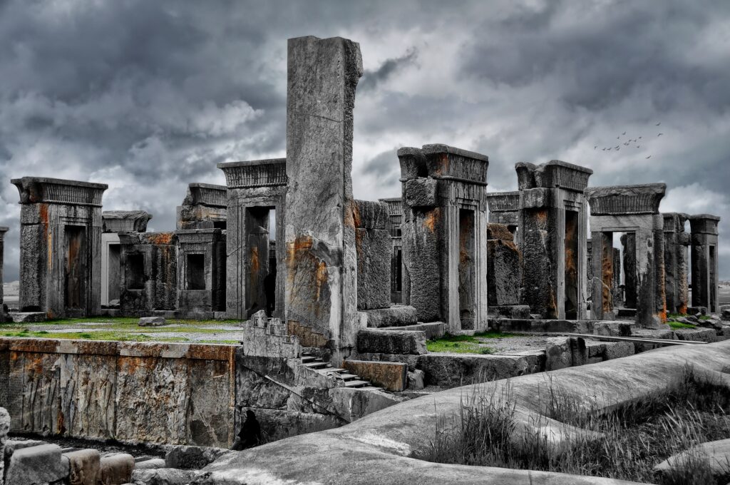

Archaeology in the Middle East can feel a bit like opening a door in an old house and finding an entire city behind the wall. Every few years, something buried for thousands of years suddenly steps into the light, and instead of providing neat answers, it blows up what we thought we knew. These discoveries are not just dusty ruins; they are bold interruptions to the story we have been telling ourselves about where cities began, how empires rose, and what ancient people were capable of. What fascinates me most is how often the ground quietly contradicts the textbooks. You look at a buried temple complex or a mudbrick neighborhood frozen in time and realize our “grand narratives” are usually stitched together from fragments. Below are ten discoveries from across the Middle East that keep poking holes in those stories. Some are famous, some are barely in the headlines, but all of them are still raising new questions that archaeologists are scrambling to answer.
1. Göbekli Tepe (Turkey): The Temple That Shouldn’t Exist So Early
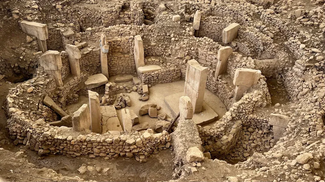
If one site has haunted modern archaeology, it is Göbekli Tepe in southeastern Turkey. Dating back roughly eleven and a half thousand years, this vast hill hides circular stone enclosures with towering T‑shaped pillars carved with lions, snakes, birds, and abstract symbols. It is older than Stonehenge, older than the pyramids, and, according to the old story, much too early for temples of this scale to exist, because it predates settled farming communities in the region. That timing is exactly what keeps archaeologists arguing. Were hunter‑gatherers organizing massive construction projects long before permanent villages and agriculture took hold, meaning religion and ritual may have come first and pulled people together? Or does Göbekli Tepe hint at early, experimental forms of cultivation and social hierarchy that we have barely begun to recognize? Every new excavation area adds complexity – different building phases, evidence of feasts, changes in iconography – suggesting a long‑lived ritual center rather than a single moment in time, and even basic questions like who buried it, and why it was deliberately backfilled, remain unsettled.
2. The Lost Megacity of Tell Brak (Northeastern Syria)
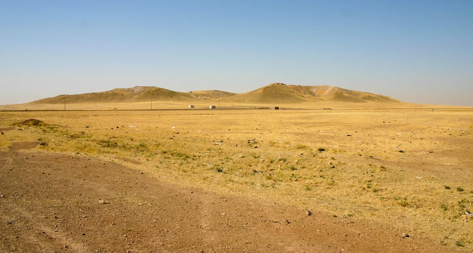
Quietly, without the fame of Mesopotamian giants like Uruk or Babylon, Tell Brak has been rewriting how we think cities formed. From aerial and satellite surveys, archaeologists have mapped out a sprawling urban footprint in northeastern Syria, with dense clusters of houses and streets stretching far beyond the mound’s main hill. This settlement was already huge around six thousand years ago, rivaling early cities in southern Mesopotamia in scale, even though it sat hundreds of kilometers away in what used to be considered the “periphery.” What makes Tell Brak so intriguing is the way it appears to have grown from multiple surrounding neighborhoods that gradually merged, rather than from a single central core radiating outward. That pattern suggests a more messy, bottom‑up process of urbanization than the neat charts in textbooks. It also raises hard questions: How were such large populations managed before writing and formal bureaucracy became standard? Did people come voluntarily for trade and protection, or were they drawn in under pressure? The site includes evidence of conflict, mass graves, and sudden changes in building patterns, hinting that early cities might have been more turbulent and contested than the shiny reconstructions on museum walls imply.
3. The Buried Royal Tombs of Ur (Southern Iraq)
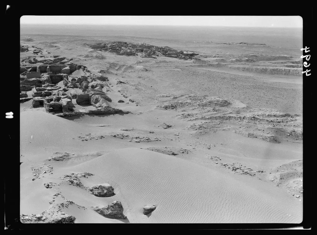
The royal cemetery of Ur, excavated in the early twentieth century in southern Iraq, is one of those finds that still feels almost unreal. Beneath the desert lay lavish tombs packed with gold and lapis lazuli, ornate headdresses, musical instruments, and the remains of attendants who appear to have gone into death alongside their rulers. Nearly four and a half thousand years later, these chambers still raise unsettling questions about power, religion, and sacrifice in the early cities of Sumer. Despite decades of study, we still do not fully understand the rituals that created these burials. Were the attendants willingly participating in a sacred transition, or were they coerced in brutal displays of royal authority? Chemical analyses of remains and objects keep adding hints – traces of possible sedatives, imported materials, and evidence of complex feasting – but the bigger picture remains foggy. There are also unresolved puzzles about how these tombs fit into the political landscape of the time: Were these rulers part of a tight city‑state system, or were they projecting power over a wider, shared culture in ways that our modern boundaries between “city,” “state,” and “empire” distort?
4. The Flooded Harbors and Sunken Quarters of Ancient Alexandria (Egypt)
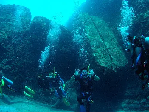
When you walk along modern Alexandria’s corniche, it is easy to forget that much of the ancient city – especially some of its wealthiest districts – now lies underwater. Over the last few decades, underwater archaeologists have mapped and excavated parts of the drowned eastern harbor and nearby submerged islands. They have found colossal statues toppled into the sea, sphinxes, temple foundations, columns, and whole stretches of harbor installations that once framed one of the Mediterranean’s busiest ports. These underwater finds complicate almost everything we thought we knew about the city’s topography. Where exactly were the royal palaces? How did religious and political spaces intersect at the water’s edge? And how much of our understanding of Hellenistic cosmopolitanism depends on a partial, land‑only snapshot? Submerged structures also reflect a long dance between human engineering and a volatile coastal environment: earthquakes, subsidence, and sea‑level changes reshaped the shoreline more than once. Each newly mapped building or statue pushes research further into geoarchaeology and climate history, forcing scholars to treat ancient Alexandria not as a frozen “classical” image but as a shifting, risky experiment in waterfront urbanism.
5. The Desert Kites and Giant Stone Geoglyphs of the Arabian Peninsula
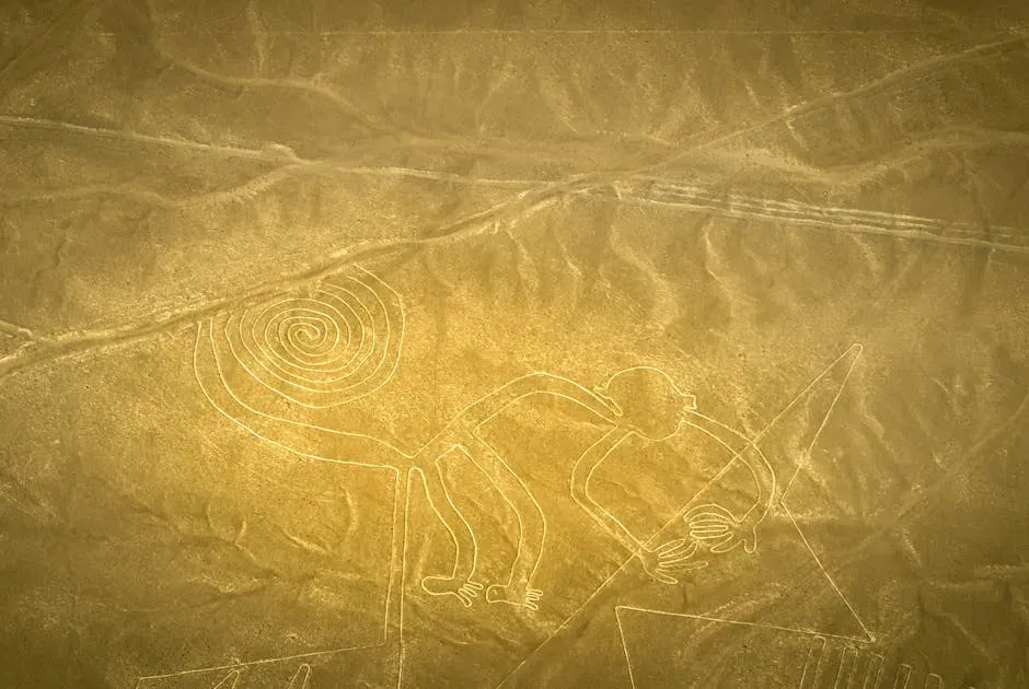
Seen from the ground, many of the stone constructions scattered across the Arabian deserts are just low walls and odd outlines. From the air, they transform into vast “desert kites,” funnel‑shaped structures stretching for hundreds of meters, apparently designed to drive and trap wild animals. Scattered across Syria, Jordan, Saudi Arabia, and beyond, some of these constructions date back several thousand years, and they reveal a level of landscape planning and cooperative hunting that feels startlingly modern in scale. Then there are the large stone “mustatil” rectangles, circles, and other geometric designs etched into the basalt and sand – geoglyphs only fully legible from above. Their purpose is still debated: ritual enclosures, territorial markers, cattle cult sites, or something else entirely. As satellite imagery and drone surveys expand, archaeologists are discovering more of these structures than they can possibly excavate, forcing a shift toward big‑data mapping and pattern analysis. The sheer quantity and variety force us to rethink the Arabian Peninsula not as a marginal, empty “desert in between empires,” but as a long‑occupied, creatively engineered landscape where people shaped animal migrations, ritual spaces, and social networks at massive scales.
6. The Underground Palace and Tunnel Complex of Persepolis (Iran)
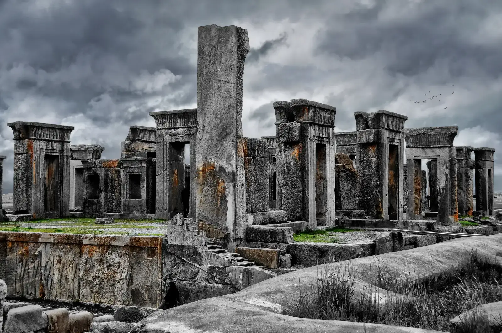
Persepolis, the ceremonial heart of the Achaemenid Empire in modern Iran, looks at first glance like a purely above‑ground marvel: soaring stone staircases, columned halls, detailed reliefs of tribute bearers. Yet beneath the terraces and platforms lies a hidden world of channels, drains, and tunnels carved into the rock. Studies of these buried systems have revealed an intricately planned hydraulic and infrastructural network designed to manage water, waste, and structural stability across a sprawling monumental complex. These hidden works raise questions about planning and knowledge transfer within the empire. Were similar underground systems standard in other major Achaemenid centers we simply have not recognized yet, or was Persepolis uniquely engineered as a showpiece of imperial power and craftsmanship? The precision of the subsurface channels hints at specialized surveyors and engineers, but the lack of surviving technical texts from this period leaves their methods largely invisible. As researchers use ground‑penetrating radar and 3D modeling, more hidden voids and conduits keep appearing, suggesting that we still only see the exposed skeleton of a much larger, deeply integrated architectural organism.
7. The Mysterious Rock‑Cut Tombs of Mada’in Saleh (AlUla, Saudi Arabia)
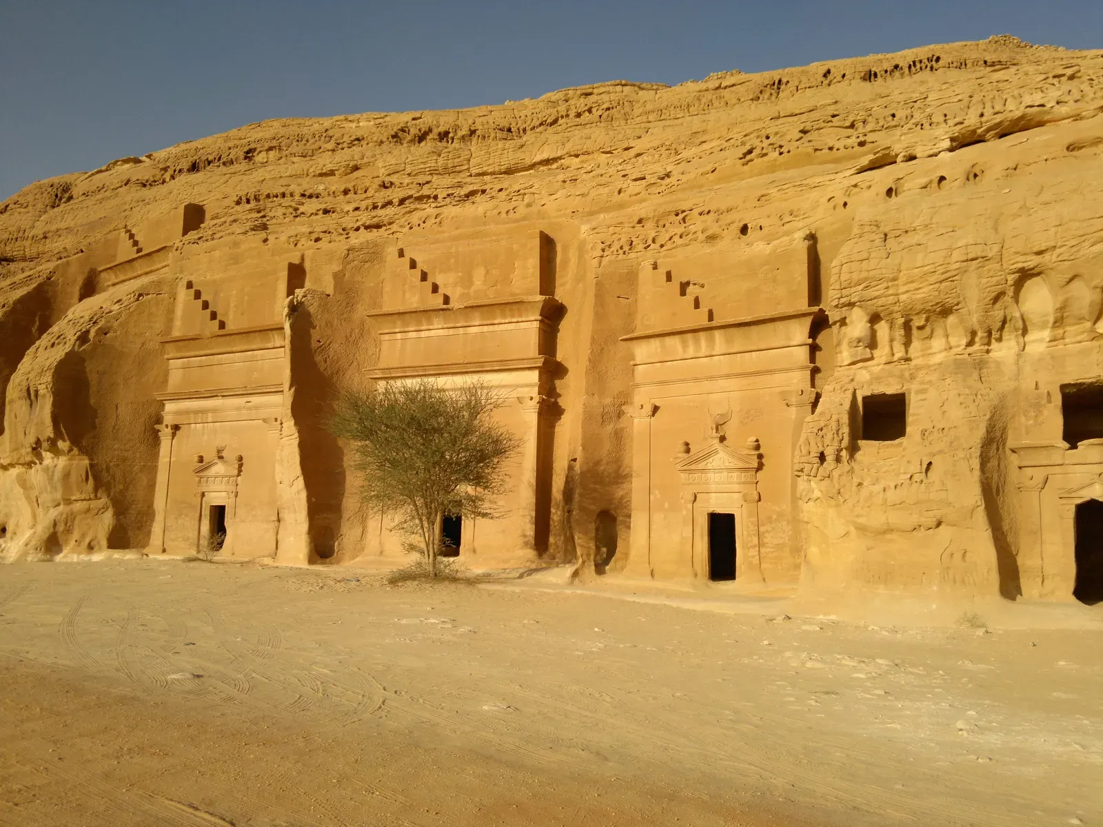
Carved into rose‑colored sandstone cliffs in northwestern Saudi Arabia, the tombs of Mada’in Saleh – also known as Hegra – look strikingly like their more famous cousins in Petra, Jordan. These elaborate facades, some several stories high, mark burial chambers belonging to the Nabataean culture that controlled trade routes across the region over two thousand years ago. But unlike Petra, much of Mada’in Saleh’s surrounding settlement and everyday life remains buried or only partially explored. That imbalance leaves a peculiar gap in our understanding: we can see in vivid detail how the elite wanted their tombs to look, but we still know little about how they actually lived, governed, and interacted with nearby cultures on a day‑to‑day basis. Recent excavations have started revealing houses, markets, inscriptions, and ritual areas, but the bigger questions remain: How autonomous was this city compared to Petra? Were local traditions shaping Nabataean identity here in distinct ways? The more archaeologists uncover beneath the sand around these iconic facades, the more it becomes clear that what we used to treat as a simple “outpost” might have been a complex regional hub with its own political and cultural priorities.
8. The Layered Secrets of Çatalhöyük and Early Urban Life (Central Turkey)
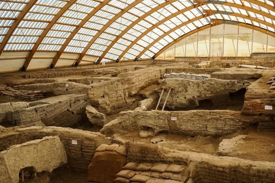
Çatalhöyük is often described as one of the world’s earliest large villages or protocities, but seeing it in person (or even in detailed reconstructions) feels almost alien. Around nine thousand years ago, hundreds of mudbrick houses were packed together with almost no streets; people moved across rooftop networks and climbed through ceiling openings to enter their homes. Beneath the floors lay burials, while interior walls were decorated with paintings, reliefs, and sometimes animal horns arranged with almost theatrical care. Decades of careful excavation under modern scientific standards have produced mountains of data, yet many basic questions are still fiercely debated. Was Çatalhöyük a surprisingly egalitarian community without strong centralized leadership, or do subtle differences in house size, storage, and imagery hide deeper inequalities? How did people manage conflict, sanitation, and resource distribution in such dense, streetless neighborhoods? The site has become a kind of laboratory for testing big ideas about gender roles, symbolism, and social organization, and depending on which dataset you emphasize – burials, diet, architecture, imagery – you can reach wildly different interpretations. That tension is exactly what keeps it central to conversations about how village life tipped toward truly urban forms.
9. The Enigmatic Ziggurat and Cities of Ancient Elam (Southwestern Iran)
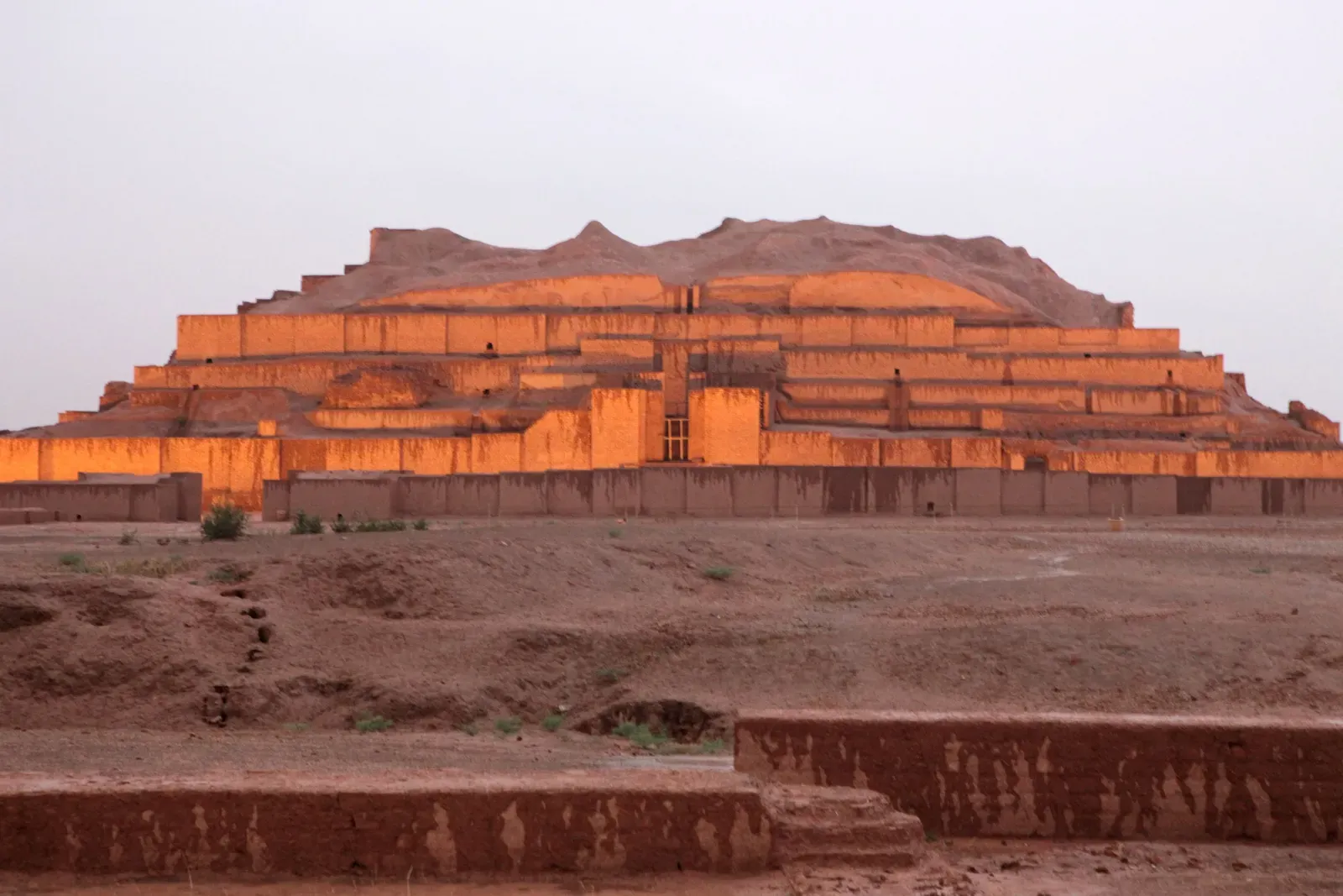
The ziggurat of Chogha Zanbil in southwestern Iran rises out of the plain like a brick‑built mountain, one of the best‑preserved step towers from the ancient Near East. Built by the Elamite kingdom in the second millennium BCE, it was part of a larger sacred city with temples, palaces, and defensive walls. Yet, compared to Mesopotamia to the west, Elam’s culture and political structures are still frustratingly shadowy, despite rich material remains. Part of the problem is that many Elamite texts are fragmentary or poorly understood, so archaeologists lean heavily on what the ground reveals. The careful planning of Chogha Zanbil, its water management systems, and its monumental architecture indicate a sophisticated, locally rooted tradition rather than mere imitation of Mesopotamian neighbors. But big questions linger: How did Elam’s religious worldview differ in practice from that of surrounding cultures? What internal dynamics led to the creation of such an ambitious sacred center away from major trade corridors? Every new inscription or architectural detail pulled from the buried sections of the site seems to complicate simple narratives of “influence” and “borrowing,” suggesting a regionally distinctive power whose story still sits largely underground.
10. The Concealed Suburbs and Palaces Around Babylon (Central Iraq)
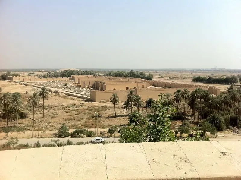
When people think of Babylon, they imagine towering city walls, the Ishtar Gate, and maybe the legendary Hanging Gardens. But in recent decades, archaeologists using satellite imagery and limited ground surveys have begun to map out a much broader pattern of buried suburbs, satellite settlements, canals, and palatial compounds that spread across the landscape around the city. What once looked like a single great urban center now appears more like a complex, sprawling metropolitan region stitched together by waterways and roads. This wider view raises tough questions about how we define a city in the ancient world. Was Babylon the sole beating heart of political life, or just the most visible node in a dense mesh of administrative, agricultural, and ritual sites? How did people move between these spaces, and how were different quarters integrated or segregated by class, profession, or ethnicity? Modern development and conflict have tragically limited large‑scale excavation, so researchers rely heavily on remote sensing and old excavation notes, piecing together a buried puzzle that may never be fully excavated. Even so, the emerging picture pushes us to imagine Mesopotamian urbanism as something more like a modern metropolitan corridor than a single, isolated walled town.
Conclusion: When the Ground Refuses to Match the Story
What ties these discoveries together is not just their age or their location under the sands and stones of the Middle East, but their refusal to line up neatly with our expectations. We wanted a simple timeline: first villages, then cities, then empires, each step driven by clear economic or technological triggers. Instead, Göbekli Tepe hints that monumentality may have preceded farming, desert kites reveal large‑scale coordination in places dismissed as “empty,” and drowned harbors show how fragile even the mightiest coastal capitals could be. My own opinion, after years of following these finds, is that the more we uncover, the less convincing any single grand theory about “the rise of civilization” really sounds. The Middle East’s buried past keeps insisting on something messier and more human: overlapping experiments, local traditions that do not fit the mold, and societies that combined belief, power, and practicality in ways that still surprise us. Maybe that is the real lesson here – not that we will eventually have all the answers, but that the ground itself is a restless archive, always ready to challenge our favorite stories just when we start to feel sure of them. Which of these buried worlds most upends the way you imagined the ancient past?