
Most people assume human history moves in a straight line: hunter-gatherers, then farmers, then cities, then everything else we call civilization. That tidy story just took a beating. A growing pile of archaeological anomalies – massive stone temples built before agriculture even existed, precision-cut megaliths that modern engineers still can’t fully explain – suggests the accepted timeline is missing entire chapters.
Mainstream archaeology has solid answers for most of it. But not all of it, and not always convincingly. Some of these 21 discoveries have already forced textbooks to be rewritten. Others remain open wounds in the field – real, ongoing fights between serious researchers, not fringe noise. Here’s what the ruins, the data, and the people who study them actually say, starting with the site that broke the “farming came first” rule entirely.
#1 – Göbekli Tepe Rewrote the Entire Timeline of Civilization
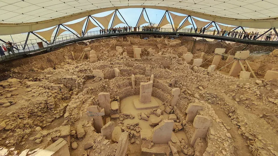
A temple complex in southeastern Turkey shattered everything archaeologists thought they knew about when organized society began.
Its circular structures, with their elaborately carved stones and distinctive, T-shaped pillars, are more than 12,000 years old – older than the invention of agriculture or even pottery, and the early dates have upended the idea that agriculture led to civilization. For decades, the assumption was simple: farming came first, then surplus food allowed people to build monuments. Göbekli Tepe flipped that script entirely.
Scholars long thought that when hunter-gatherers settled down and started growing crops, the resulting food surplus made it possible for people to organize complex societies, but Klaus Schmidt, the German archaeologist who led excavations, argued it might have worked the other way around – the labor force needed to build the enclosures pushed people to develop agriculture. The single most surprising fact: this was built by people who hadn’t invented the wheel, pottery, or writing, yet they moved multi-ton pillars into precise circular formations. That’s not supposed to be possible according to the old model.
Fast Facts
- Location: near Şanlıurfa, southeastern Turkey
- Age: at least 11,000-12,000 years old – roughly 7,000 years older than Stonehenge
- Led by German archaeologist Klaus Schmidt, whose excavations began in the mid-1990s
- Status: UNESCO World Heritage Site since 2018
#2 – A Possible Cosmic Catastrophe Erased the “Missing” Civilization

Around 12,900 years ago, something happened that plunged the planet back into an ice age almost overnight – and a controversial theory says it may have wiped out an entire pre-agricultural culture.
The Younger Dryas impact hypothesis proposes that a comet or fragmented cosmic body triggered a sudden climate collapse right as humanity was on the verge of a technological leap. The theory suggests that a cometary or meteoritic body or bodies hit and/or exploded over North America 12,900 years ago, causing the climate episode, extinction of Pleistocene megafauna, and the demise of the Clovis archaeological culture.
This is genuinely one of the most contested ideas in archaeology. Critics argue the physical evidence doesn’t hold up: no craters have been identified that date to the onset of the Younger Dryas. Yet the debate hasn’t died. Computer simulations have shown that a comet could explode before reaching the ground, creating a shock wave capable of widespread impacts without leaving a distinct crater, and minerals found in soil strata from the period are described as “proxies” of a comet strike. Most surprising fact: this cooling event lines up almost exactly with Göbekli Tepe’s construction era. Coincidence or catastrophe?
#3 – Baalbek’s Stones Are Heavier Than Anything Else Ever Quarried
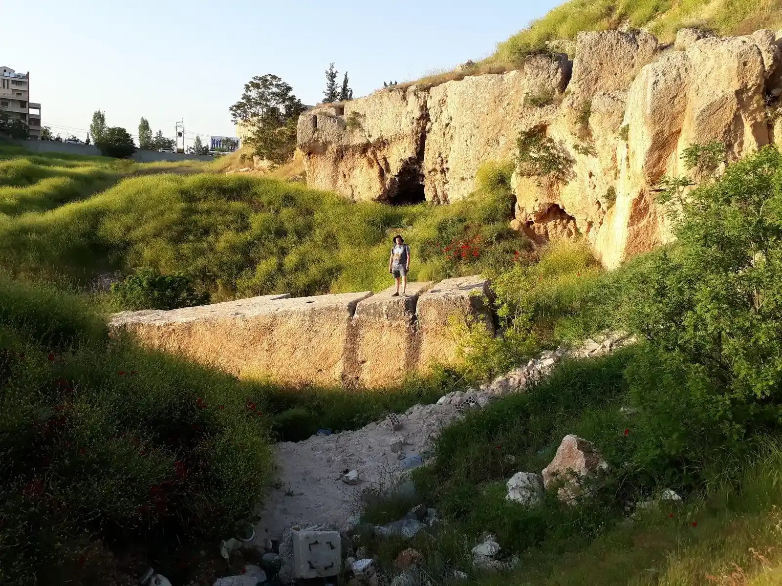
In the mountains of Lebanon sits a stone platform holding blocks so massive that modern cranes would struggle to lift them.
The smaller three stones are part of a podium wall in the Roman complex known as the “Trilithon,” and each is estimated at 750-800 tonnes. That alone would be remarkable. But nearby, in the quarry itself, sit even bigger monoliths that were never moved. The remaining three are Roman monoliths conventionally known as the “Stone of the Pregnant Woman” (estimated at 1,000 t), the “Stone of the South” (est. 1,242 t), and the “Forgotten Stone” (est. 1,650 t) – the first, third, and tied fifth largest known stones ever quarried in human history.
The wildest part: archaeologists only discovered the largest stone in 2014 – it had been sitting buried in the quarry for roughly two thousand years, undetected. Officially, historians credit these to Roman engineering. But debate persists over whether the Romans built on top of something older. Whether the megalithic stones were quarried and placed by Romans, or Romans built atop a pre-existing foundation, is a debate that continues with evidence on both sides. Most tourists rank this as a minor stop on an Egypt-and-Rome trip – many researchers now argue it’s one of the single greatest unsolved engineering mysteries on Earth.
Quick Compare
- Great Pyramid core blocks: roughly 2.5 tons on average
- Stonehenge sarsen stones: up to 25 tons each
- Baalbek’s Trilithon blocks: 750-800 tons each
- Baalbek’s “Forgotten Stone”: about 1,650 tons – heavier than a fully loaded Boeing 747
#4 – The Great Pyramid’s Alignment Is Almost Too Perfect
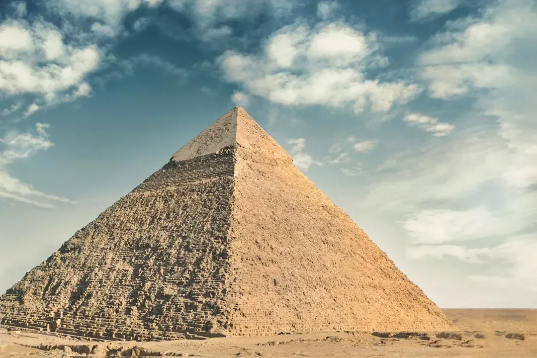
The Great Pyramid of Giza is oriented to true north with an accuracy that modern surveyors find genuinely startling for a structure built without satellites, compasses, or laser tools.
Ancient Egyptian engineers somehow achieved near-perfect cardinal alignment across a footprint covering over 13 acres, using nothing but sightlines, shadows, and stellar observation. The precision isn’t a myth – it’s measurable, and it has never been fully replicated by ancient builders anywhere else in the world at that scale. That level of consistency, repeated across multiple pyramids in the same era, suggests an inherited body of surveying knowledge rather than a lucky first attempt.
What most people don’t realize is that the “mystery” isn’t really about aliens or lost technology – it’s about how quickly this precision appears in the archaeological record, with little evidence of the trial-and-error phase you’d expect to precede it. Some Egyptologists argue earlier prototype structures simply haven’t survived or been found yet. Others say the skill was passed down from a tradition older than currently documented. Either way, the gap between “first attempt” and “near-perfect execution” remains one of the more genuinely puzzling aspects of ancient engineering.
#5 – The Sphinx May Show Signs of Rain Erosion From a Wetter Era
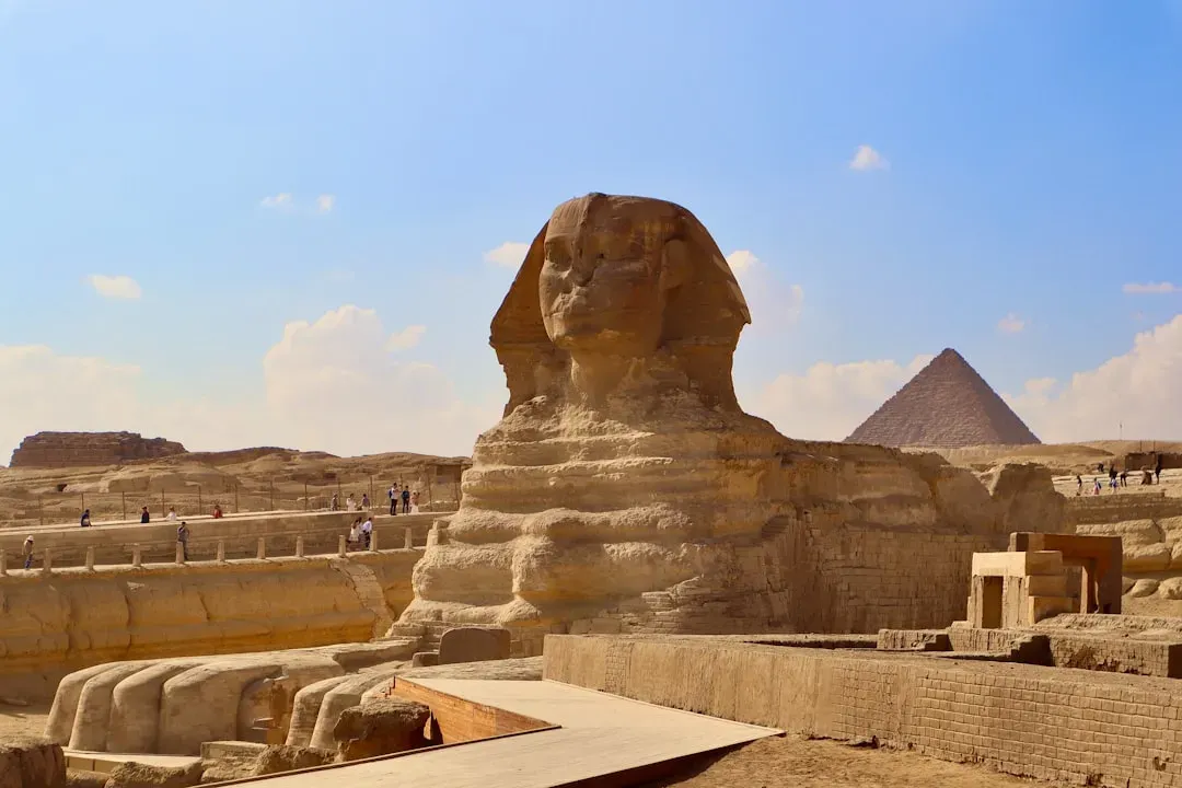
The Great Sphinx of Giza is conventionally dated to around 2500 BCE, but its weathering pattern has fueled one of Egyptology’s most stubborn controversies.
Geologist Robert Schoch, a leading proponent of this theory, argues that the vertical and undulating erosion patterns are consistent with water erosion, not wind or sand, suggesting a climate significantly wetter than modern Egypt. Schoch points to a possible construction date of 7000-5000 BCE – thousands of years before the accepted timeline. That’s not a small discrepancy; that’s an entirely different chapter of history.
Here’s the friction point: mainstream Egyptologists overwhelmingly reject this. Most archaeologists and Egyptologists have rejected the idea of an earlier construction, instead attributing it to pharaoh Khafre, and critics point out that the Sphinx enclosure fits into the overall layout of the Giza complex. Geologists have also offered a middle-ground explanation, attributing the erosion to Nile flooding and occasional heavy rains that persisted into the Dynastic period. The debate is far from settled, but it’s a genuine, ongoing scientific disagreement – not fringe noise.
#6 – Puma Punku’s Stones Look Machine-Cut, Not Hand-Carved
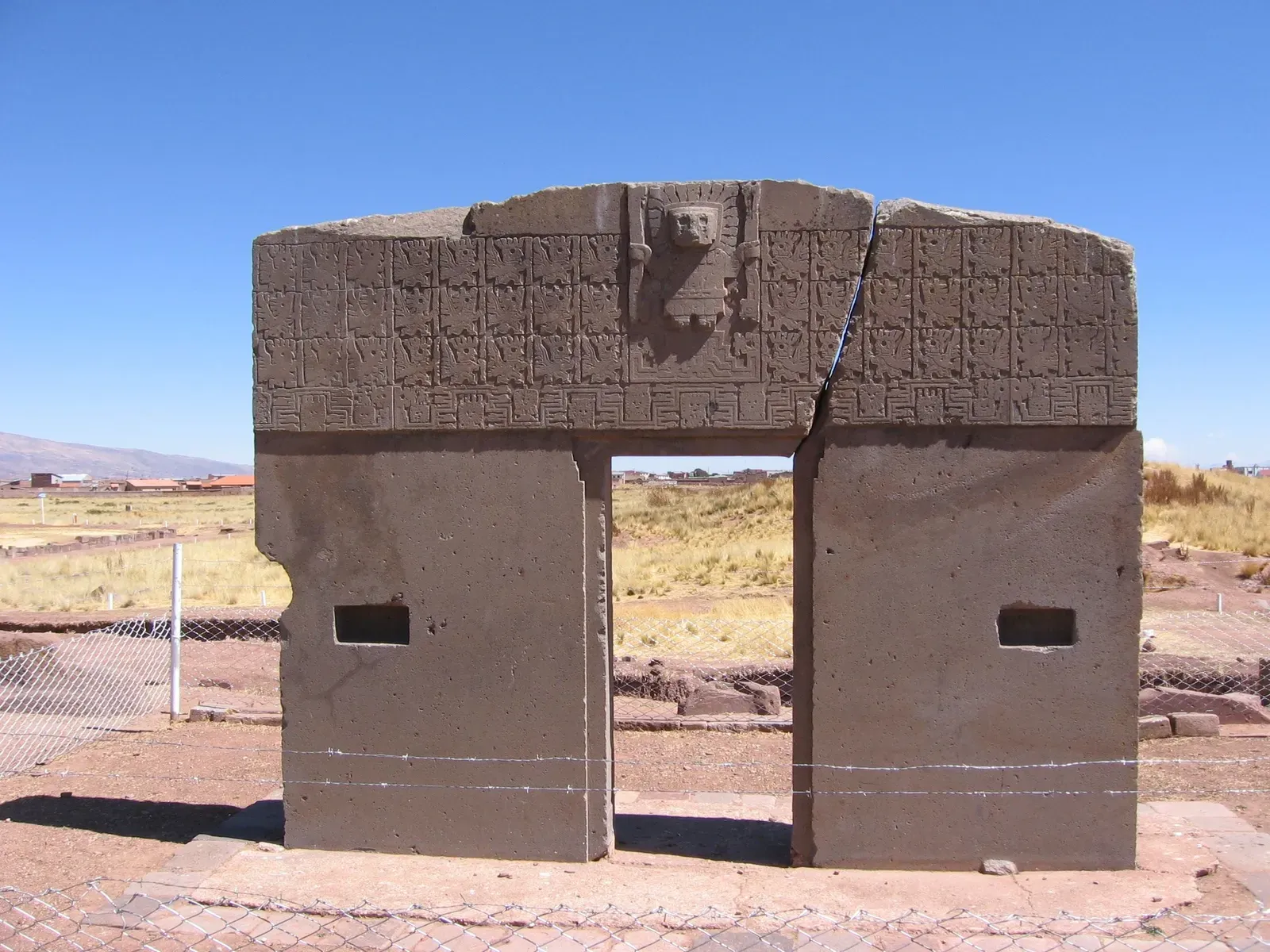
High in the Bolivian Andes, at an altitude over 12,000 feet, sits a ruin field of stone blocks with interlocking grooves so precise they look like they were stamped from a mold.
The site’s H-shaped blocks feature identical angles, matching recesses, and flat surfaces with almost no tool marks visible to the naked eye – a level of standardization rarely seen in pre-industrial stonework anywhere else in the Americas. Archaeologists attribute the site to the Tiwanaku culture, working with sandstone and andesite using stone and bronze tools, abrasives, and enormous amounts of coordinated labor.
The controversial opinion many researchers won’t say out loud: the “primitive tools” explanation feels increasingly unsatisfying the closer you look at the repeatability of the cuts. Skeptics counter that experimental archaeology has replicated similar joints using period-appropriate tools and patience – it just takes far longer than modern audiences assume. Either way, Puma Punku remains one of the most visually shocking megalithic sites on the planet, precisely because the stonework looks so deliberately industrial.
#7 – The Antikythera Mechanism Was a 2,000-Year-Old Computer
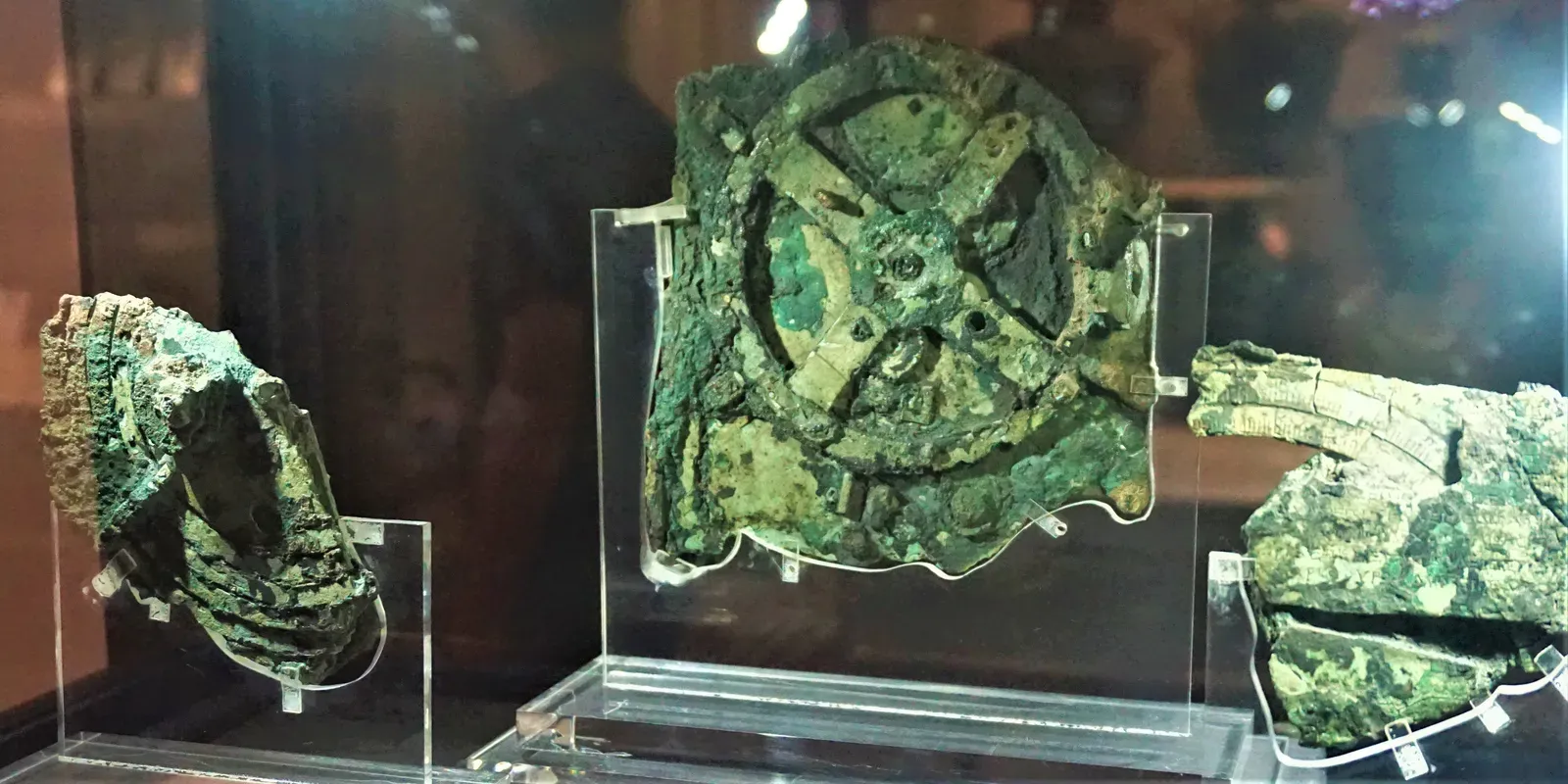
Pulled from a Greek shipwreck in 1901, this corroded bronze device sat in a museum drawer for decades before anyone realized what it actually was.
Once X-rayed and modeled, researchers discovered dozens of interlocking bronze gears designed to track the movements of the sun, moon, and possibly the visible planets, along with predicting eclipses years in advance. The complexity of the gear ratios matches astronomical cycles with a level of mathematical sophistication that had no known equal for over a thousand years afterward. Nothing this intricate shows up again in the historical record until medieval European clockwork – an enormous, unexplained technological gap.
The unsettling part isn’t that the Greeks were capable of this. It’s that we only know about it because of a shipwreck. That raises an uncomfortable question: how many similarly advanced devices simply rusted away, unrecorded, because they never happened to sink in a spot divers would later find? The Antikythera Mechanism isn’t evidence of aliens – it’s evidence that we’ve drastically underestimated ancient engineering literacy.
#8 – The Piri Reis Map Shows Coastlines Nobody Should Have Known
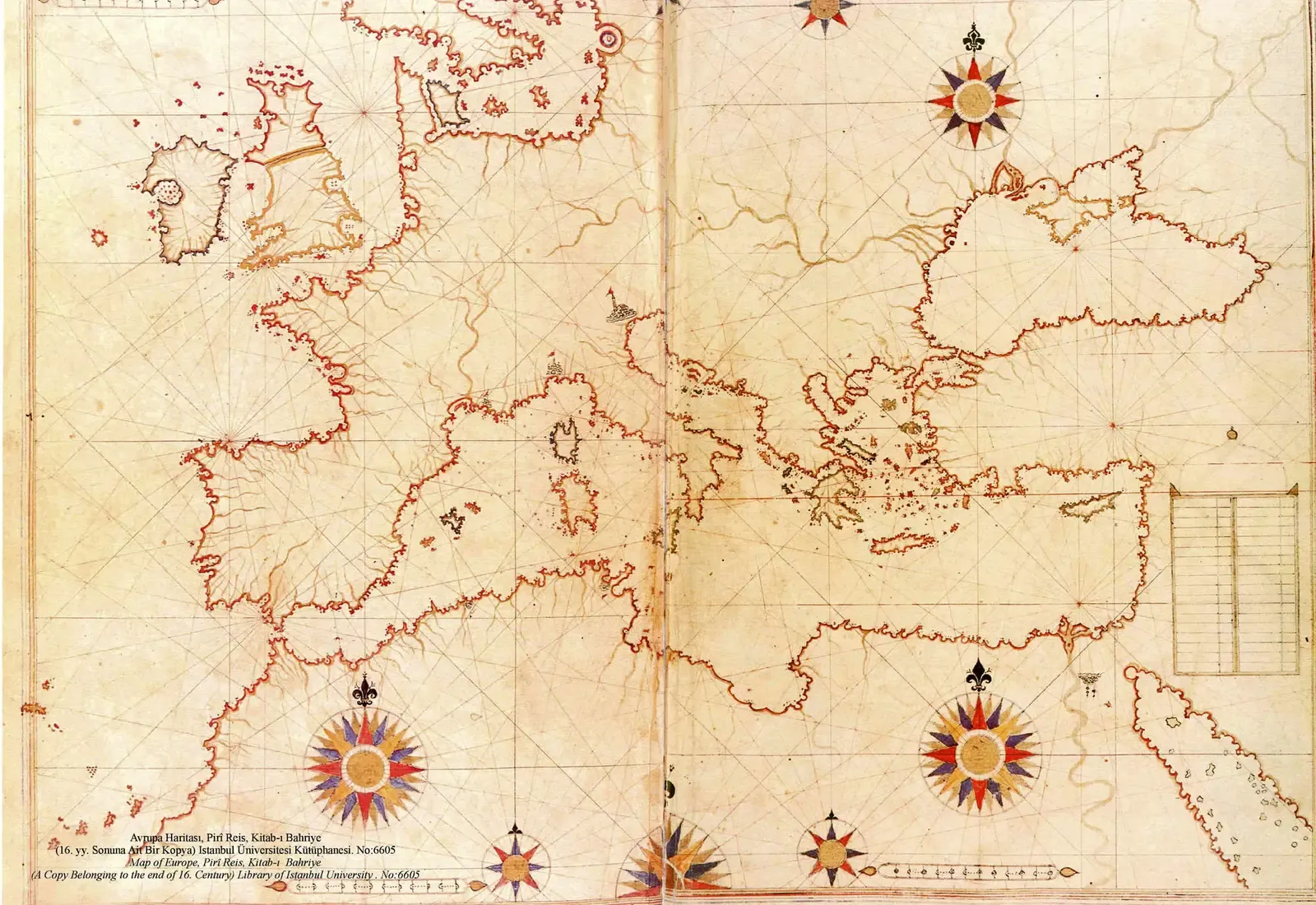
Drawn in 1513 by an Ottoman admiral, this map compiled from older, now-lost source charts shows the coast of South America and, more controversially, features some researchers claim resemble Antarctica’s coastline.
Piri Reis himself noted in the map’s margins that he compiled it from a mix of older maps, some reportedly dating back to the era of Alexander the Great, pulled from various Mediterranean and Arab sources that no longer survive. That detail alone is significant – it means the map isn’t an isolated artifact, but a compilation representing lost cartographic knowledge stretching back centuries or more before its creation.
The controversial claim is that a portion of the southern coastline resembles Antarctica’s shape beneath the ice – a continent not officially discovered until the 1800s. Mainstream cartography historians argue it’s more likely a distorted rendering of South America’s coast curving eastward. Still, the fact that any 16th-century map compiled ancient source material accurately enough to spark this level of debate says something about how much older geographic knowledge has simply been lost to time.
#9 – Yonaguni’s Underwater “Monument” Sits 5,000 Years Before Local History
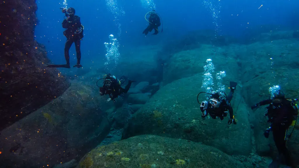
Off the coast of Japan, divers exploring the waters near Yonaguni Island in the 1980s found massive rock formations with sharp, stepped, terrace-like edges sitting roughly 80 feet underwater.
If these structures are man-made, they would have to predate the last major sea-level rise at the end of the Ice Age – placing potential construction thousands of years before Japan’s earliest known organized societies. That’s the core of the controversy: the terraces look eerily geometric, almost like a stepped pyramid or amphitheater, yet they sit in a region with no historical record of a culture capable of building anything like it at that depth.
Geologists who’ve studied the formation argue it’s a natural feature. Sandstone in the region is known to fracture along straight, angular planes due to natural sedimentary layering, which can produce shockingly regular-looking “steps” without any human involvement at all. It remains genuinely unresolved – one of the rare underwater sites where the “natural vs. man-made” debate hasn’t settled either way.
#10 – The Nazca Lines Can Only Be Seen From the Sky
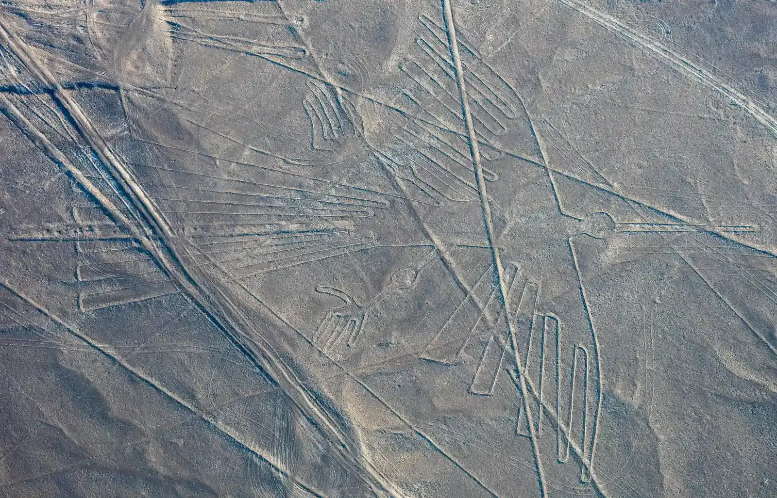
Carved into the arid Peruvian desert are hundreds of geoglyphs – massive geometric shapes and animal figures – that are only fully comprehensible from an aerial vantage point.
The people who made them, working roughly two thousand years ago, had no aircraft, no hot air balloons confirmed by evidence, and no elevated vantage point tall enough to view their own designs as a complete image. They created it anyway, using a technique of removing dark surface stones to reveal lighter soil beneath – simple in method, but requiring extraordinary large-scale planning to execute a design nobody on the ground could ever fully see.
That’s the genuinely strange part that doesn’t get enough attention: this wasn’t decoration for human eyes. Most theories point to ritual or astronomical significance intended for gods or spirits believed to view the desert from above. Whatever the motivation, the coordination required to plan a design at that scale, without being able to verify it as you build it, remains one of the most impressive feats of ancient large-scale planning on record.
At a Glance
- Location: Nazca Desert, southern Peru
- Estimated creation window: roughly 500 BCE to 500 CE
- Scale: geoglyphs stretch across a vast expanse of desert plateau, some lines running for miles
- Recognition: designated a UNESCO World Heritage Site in 1994
#11 – China’s Longyou Caves Are Hand-Carved Halls With No Historical Record
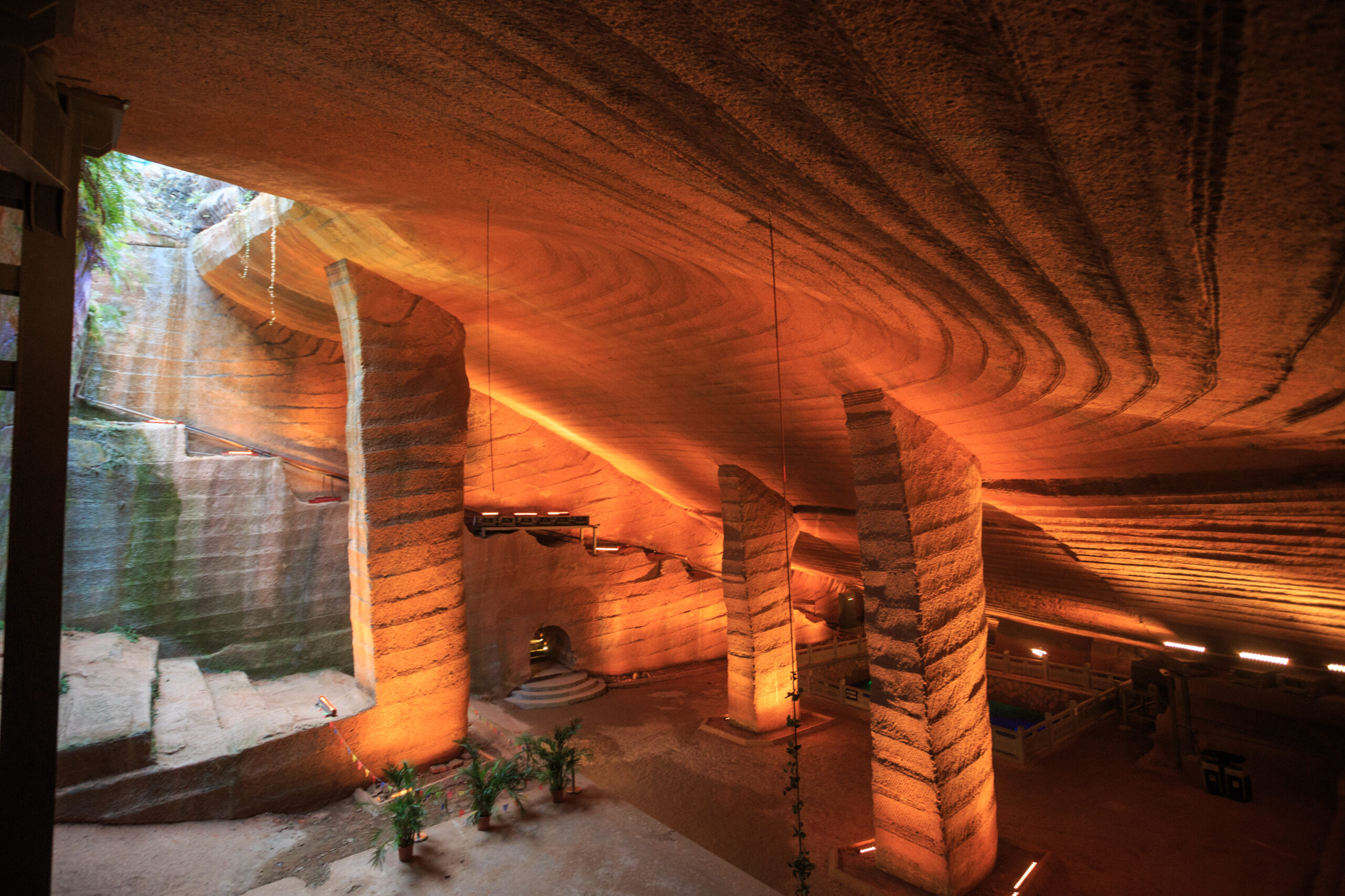
Discovered by local villagers in 1992 while draining a pond, the Longyou Caves in China’s Zhejiang province turned out to be a network of enormous, cathedral-sized underground chambers – carved entirely by hand from solid rock.
There are no historical documents, no local legends passed down accurately, and no dynastic records that clearly describe who built these caverns or why. The chisel marks covering every surface are uniform and rhythmic, suggesting an organized workforce using standardized tools and techniques, but the sheer volume of rock removed – enough to fill dozens of massive rooms – implies a project on the scale of a small city’s worth of labor, undertaken with zero written trace surviving into the modern era.
That’s the part that should unsettle people more than it does: an advanced engineering project, executed at a scale rivaling monumental palace construction, simply vanished from the historical record entirely. If a project this massive can disappear from documented memory in a literate society with dynastic record-keeping, it raises real questions about what else might be missing from far older, non-literate periods of human history.
#12 – Derinkuyu’s Underground City Could Shelter Thousands
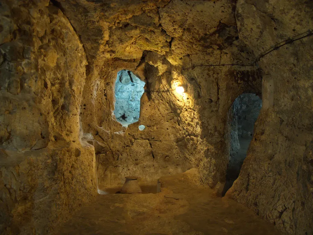
Beneath the region of Cappadocia in Turkey lies a multi-level underground city carved directly into soft volcanic rock, complete with ventilation shafts, wells, stables, and communal rooms extending many stories below the surface.
The engineering sophistication is what stands out: ventilation shafts run the entire depth of the complex, pulling fresh air down to lower levels that would otherwise be unlivable, while massive circular stone doors could be rolled into place from the inside to seal off sections during a siege. This wasn’t a hiding hole – it was a fully designed, livable civil-defense system built with airflow and defense logic that modern engineers still study.
What’s most notable is how many separate underground networks exist across the same region, suggesting this wasn’t a one-off achievement but part of a broader engineering tradition that has mostly gone unrecognized outside archaeological circles. The scale of coordinated planning required to carve, ventilate, and defend a structure like this underground – without modern tools – deserves far more attention than it typically gets in popular history.
#13 – A “Megalithic Yard” May Have Been Used Across Continents
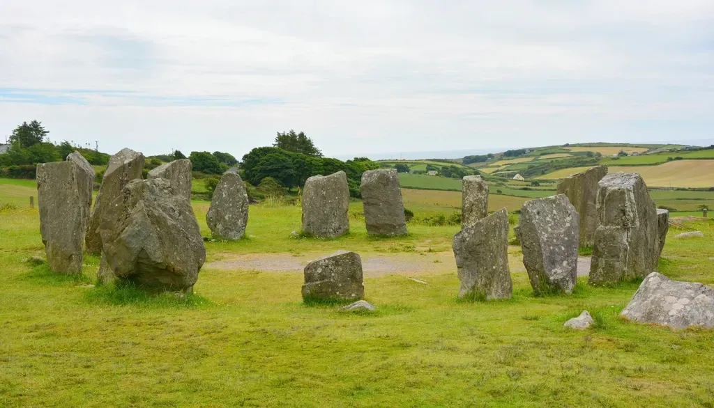
In the 1950s and ’60s, engineer and astronomer Alexander Thom surveyed hundreds of megalithic sites across Britain and France and proposed that many stone circles were built using a consistent unit of measurement – what he called the “megalithic yard.”
If accurate, this would mean separate, geographically distant Neolithic communities were working from a shared standardized measurement system long before any known trade network or written communication could have spread it. That’s a controversial claim precisely because it implies a level of coordinated knowledge-transfer that doesn’t fit comfortably into the standard picture of isolated, disconnected prehistoric tribes.
Mainstream statisticians have pushed back hard on Thom’s methodology, arguing that with enough monuments measured, some consistent unit will always appear to emerge through statistical noise. The debate has never fully resolved either way. But the mere fact that serious researchers continue re-analyzing the data decades later suggests this isn’t a closed case – it’s a genuinely unsettled question about how much prehistoric societies communicated with each other.
#14 – India’s Dwarka Ruins Sit Underwater in the Gulf of Khambhat
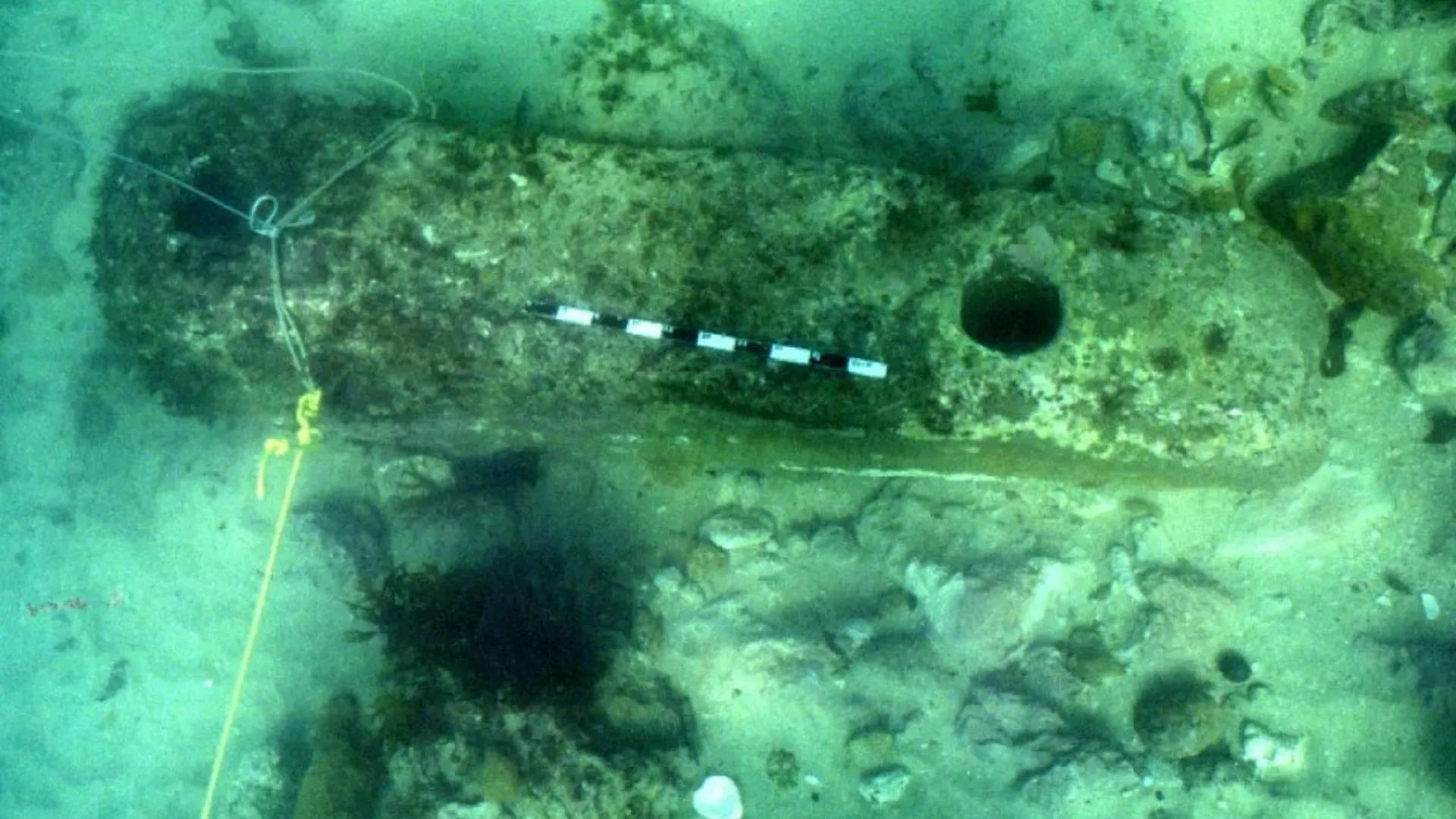
Off India’s western coast, marine archaeologists have surveyed structures on the sea floor near the Gulf of Khambhat and off the coast of Dwarka that some researchers argue represent submerged settlement remains.
The core argument centers on sea-level change: at the end of the last Ice Age, global oceans were dramatically lower, meaning coastlines that are underwater today were dry, habitable land thousands of years ago. If any organized settlement existed on that now-submerged coastal shelf, it would predate most conventionally accepted dates for Indian civilization by a significant margin.
This remains one of the more contested claims in Indian archaeology – sonar surveys have identified geometric-looking structures, but critics argue that natural sediment formations and old shipwreck debris can easily be misread as architecture underwater. Still, the broader point stands regardless of this specific site: massive amounts of coastal land were swallowed by rising seas at the end of the Ice Age, meaning entire chapters of early settlement history may simply be sitting underwater, largely unexplored.
#15 – Gunung Padang Sparked (and Then Lost) a Major Scientific Battle

In Indonesia, a hillside megalithic site called Gunung Padang became the center of one of archaeology’s biggest recent controversies when a 2023 study claimed it might be the oldest pyramid-like structure on Earth.
The paper claimed the site was built as a pyramid as early as 25,000 years ago, which would make it older than the world’s oldest accepted pyramid, the Pyramid of Djoser, which dates to around 2630 BCE. That’s an almost unbelievable claim – and it didn’t hold up under scrutiny.
The retraction noted a major error: the researchers had radiocarbon-dated soil samples that were not associated with any artifacts or features that could be reliably interpreted as man-made, meaning the pyramid interpretation was incorrect. Critic Flint Dibble made the flaw vivid:
If you went to the Palace of Westminster and dropped a core seven meters into the ground and pulled up a soil sample you might date it as being 40,000 years old.
Flint Dibble
Most surprising fact: even after retraction, the lead researcher stood by the findings and called the process “censorship,” and the underlying site – most previous estimates dated closer to 6,000 years old – is still genuinely old and unusual, just not the record-breaker it was claimed to be.
#16 – Sacsayhuamán’s Walls Fit Without a Single Drop of Mortar
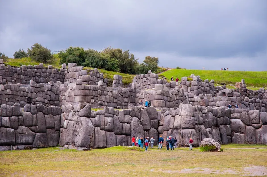
Above the city of Cusco, Peru, the Inca fortress of Sacsayhuamán features massive polygonal stone blocks – some weighing well over 100 tons – fitted together with joints so tight you can’t slide a piece of paper between them.
There’s no mortar holding these walls together at all. The stones are irregular, multi-sided shapes, not simple rectangular bricks, which makes the precision even more baffling – each block had to be individually shaped to interlock perfectly with its unique neighbors on every side, in three dimensions, without any binding material to hide small imperfections.
This level of interlocking precision has proven remarkably earthquake-resistant, which is part of why so much of the wall still stands today while later Spanish colonial structures built nearby have crumbled or required repair. Many modern engineers argue this wasn’t accidental – the flexible, interlocking design absorbs seismic shock far better than rigid rectangular masonry. Whether the Inca fully understood the earthquake engineering benefit or arrived at it through trial and error, the result remains one of the most technically impressive stone assemblies in the ancient world.
Worth Knowing
- Some Sacsayhuamán blocks weigh well over 100 tons, with the largest estimated near 200 tons
- The fortress overlooks Cusco and shares its UNESCO World Heritage designation with the old Inca capital
- No mortar was used anywhere in the primary defensive walls
- The zigzag wall layout likely served both defensive and earthquake-dampening purposes
#17 – The “Baghdad Battery” Might Be 2,000 Years Too Early for Electricity
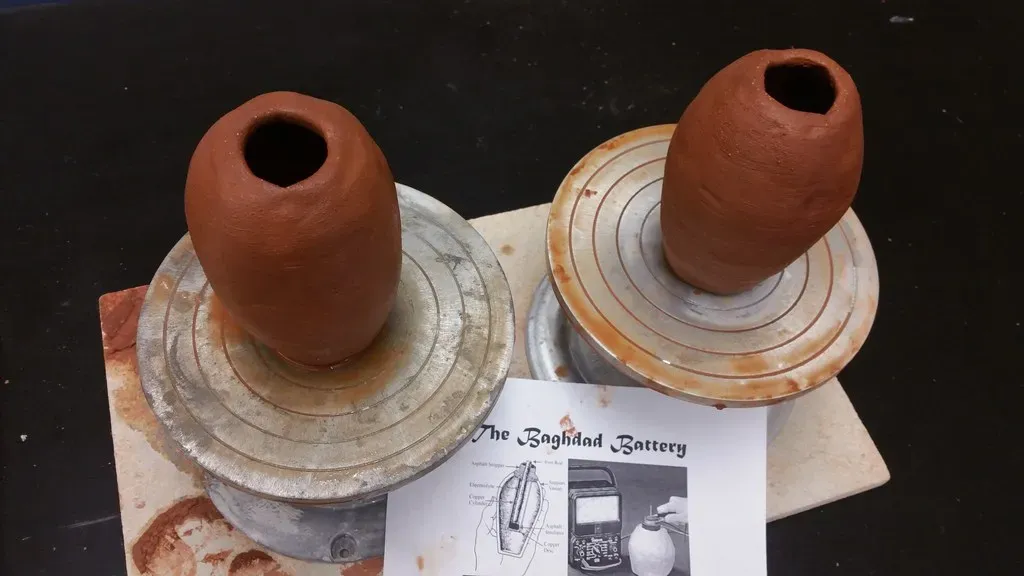
Discovered near Baghdad and dated to roughly the Parthian or Sasanian period, this odd ceramic vessel contains a copper cylinder and an iron rod arranged in a way that closely resembles a simple galvanic battery cell.
If filled with an acidic liquid like vinegar or wine, the object is capable of producing a small electrical charge – a fact multiple researchers have physically demonstrated by building working replicas. That doesn’t prove the ancient world understood “electricity” in any modern sense, but it does suggest whoever built this device knew that certain metal combinations, submerged in an acidic solution, produced a noticeable effect.
Most mainstream historians argue it was more likely used for electroplating small objects with a thin layer of gold or silver, or possibly had a completely different, non-electrical purpose like scroll storage. The controversial opinion worth stating plainly: dismissing it entirely as coincidence ignores how deliberately engineered the components appear. Ancient metallurgists were experimenting with electrochemical reactions long before the word “electricity” existed, whether or not they understood the underlying physics.
#18 – Scotland’s Vitrified Forts Show Signs of Extreme, Unexplained Heat
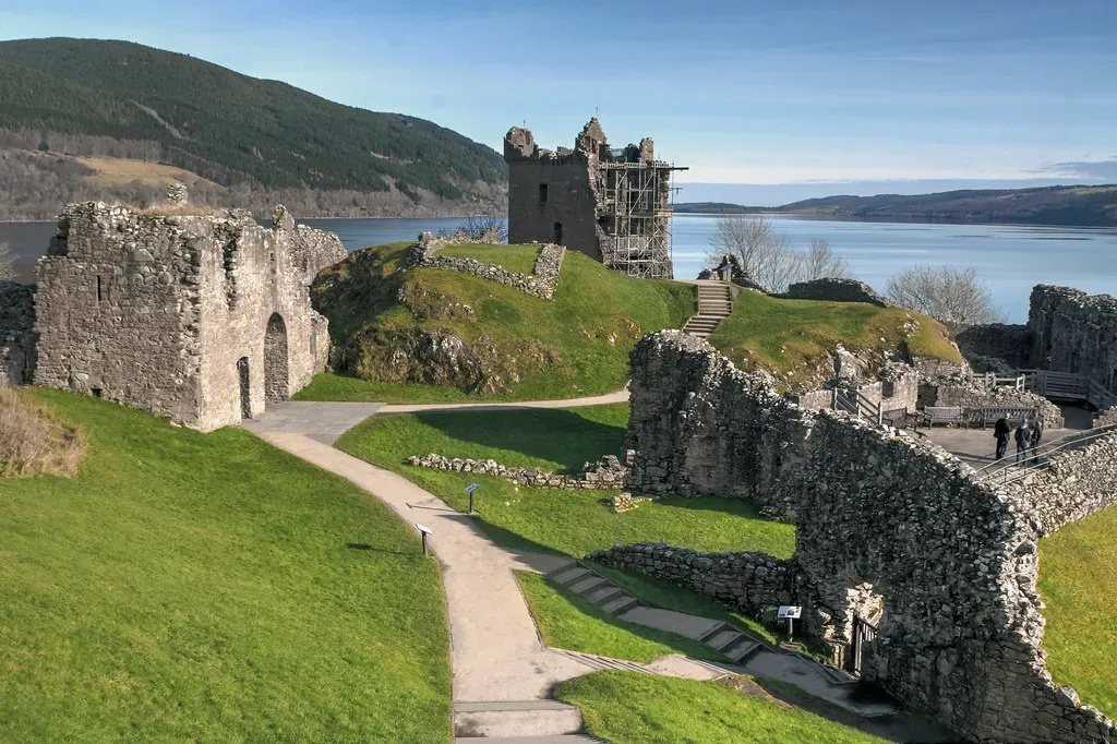
Scattered across Scotland and parts of Europe are ancient hillforts whose stone walls show clear signs of vitrification – meaning the stone was heated to temperatures high enough to partially melt and fuse together.
Reaching the temperatures needed to vitrify stone naturally requires an extraordinarily intense, sustained fire – far hotter and longer-burning than a typical structure fire from an accidental blaze or even most intentional wooden building fires would produce. That’s the core mystery: why would ancient builders deliberately (or accidentally) generate fire hot enough to melt rock, especially in a defensive structure where that kind of heat would seemingly weaken rather than strengthen the walls?
Some archaeologists argue the vitrification was intentional – a construction technique meant to fuse and strengthen fortification walls. Others believe it resulted from enemies burning the forts down during conquest, with wooden internal frameworks acting as a fuel source dense enough to reach unusually high temperatures. Either explanation requires a level of fire-management knowledge that doesn’t get nearly enough recognition in popular discussions of ancient technology.
#19 – Flood Myths Appear in Nearly Every Ancient Culture on Earth
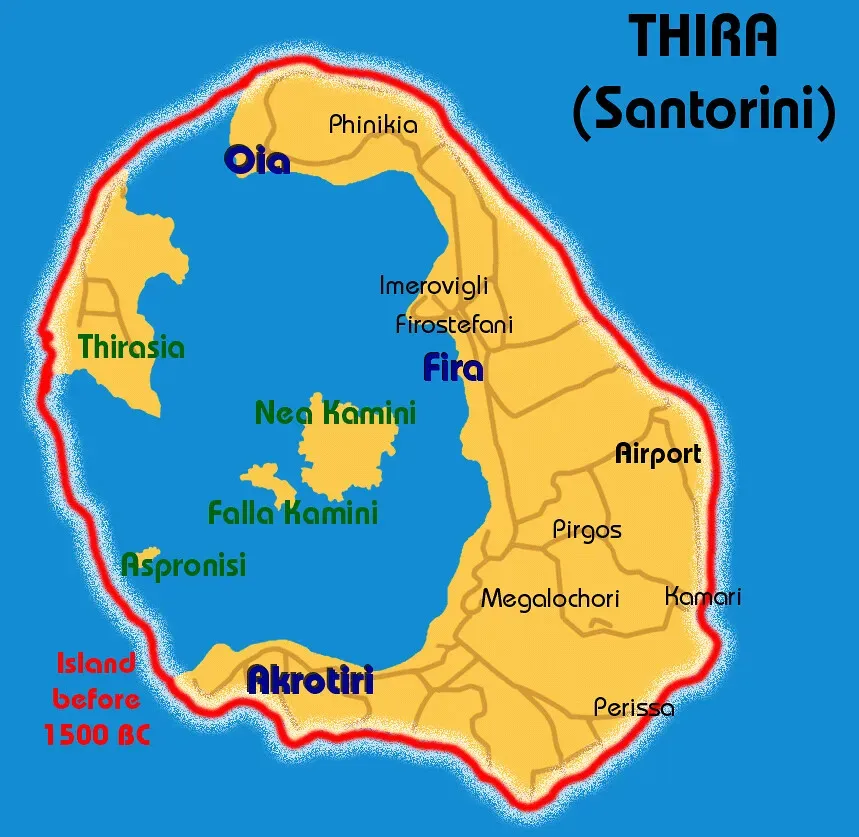
From Mesopotamia’s Epic of Gilgamesh to the biblical flood narrative, from Chinese legends of Gun-Yu to Indigenous American and Aboriginal Australian oral traditions, strikingly similar catastrophic flood stories appear across cultures that had no known contact with one another.
The consistency is what makes this genuinely interesting rather than coincidental noise: many of these independent traditions describe a small group of survivors, a vessel or refuge, and a world reshaped afterward. That pattern repeating across isolated continents suggests either a shared psychological archetype about humanity’s fear of water, or a memory of real, widespread coastal flooding tied to the dramatic sea-level rise that occurred as Ice Age glaciers melted roughly 10,000 to 12,000 years ago.
Skeptics rightly point out that flooding is a universal human experience – nearly every ancient society lived near rivers or coastlines prone to periodic flooding, so shared myths don’t require a single global cataclysm to explain them. Still, the sheer geographic spread and thematic consistency of these stories remains one of the more compelling pieces of circumstantial evidence for a shared ancient memory of massive environmental upheaval.
#20 – Malta’s Underground Hypogeum Predates the Pyramids Entirely
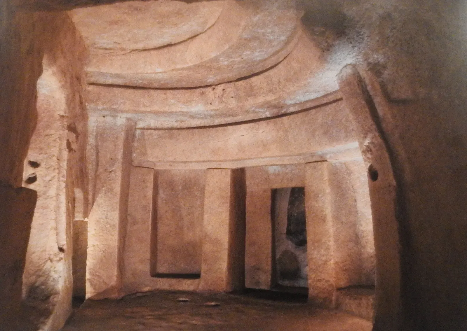
Beneath the island of Malta lies the Hypogeum of Ħal Saflieni, a multi-level underground temple complex carved directly into limestone bedrock, predating Egypt’s pyramids and featuring some of the oldest known monumental architecture in the Mediterranean.
The site includes chambers with unusually precise acoustic properties – certain rooms amplify low-frequency sound in a way that some researchers believe was intentional, designed to enhance ritual chanting or ceremonial resonance. That kind of acoustic engineering, achieved through rock-cutting rather than construction, implies a level of architectural sophistication that doesn’t match the “primitive” label often applied to prehistoric Mediterranean societies.
Malta’s above-ground megalithic temples, built by the same broader culture, are considered among the oldest freestanding stone structures on Earth. Yet compared to Stonehenge or the Egyptian pyramids, they remain relatively obscure in mainstream popular history – a genuinely curious oversight given how early and how architecturally advanced this Mediterranean temple-building tradition actually was.
#21 – An Entire Sunken Continent May Be Hiding Beneath Southeast Asia’s Seas
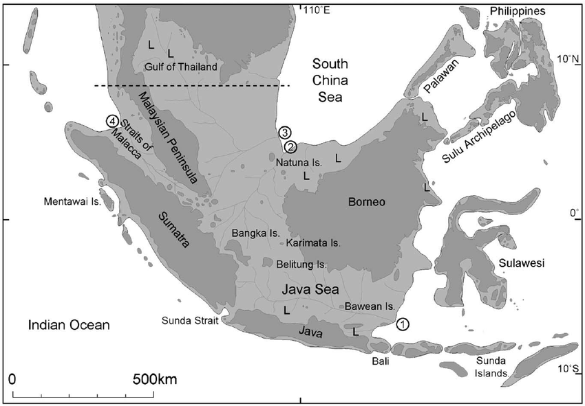
The most sweeping piece of evidence isn’t a single site – it’s an entire landmass. Sundaland, the now-submerged continental shelf connecting modern-day Indonesia, Malaysia, and parts of Southeast Asia, was dry, habitable land during the last Ice Age, before rising seas swallowed it roughly 14,000 to 7,000 years ago.
Some researchers, most notably geologist Arysio Santos and later popularized by other alternative historians, have argued this drowned shelf could be the true origin point for early advanced human settlement – a coastal civilization erased not by myth, but by verifiable, dramatic sea-level rise at the end of the last Ice Age. Mainstream archaeology is far more cautious, noting that no confirmed large-scale settlement ruins have been found on the shelf itself, and that hunter-gatherer populations in the region were likely small and dispersed rather than urbanized.
Still, the geological fact remains undeniable: a landmass roughly the size of India went underwater within a few thousand years, displacing entire populations and erasing whatever coastal settlements may have existed there. Given how much of Doggerland, the Persian Gulf basin, and other submerged shelves are now confirmed to have once been inhabited, Sundaland deserves the same serious underwater investigation – instead of being left to speculation.
The Bottom Line

None of this proves a single “lost advanced civilization” existed under the ice or the ocean. But it does prove something almost as important: our timeline of human ingenuity is full of holes, gaps, and genuinely unresolved fights between serious people.
Göbekli Tepe alone forced archaeologists to rewrite the relationship between religion and agriculture, while Gunung Padang shows exactly how fast enthusiasm can outrun evidence when a headline sounds too good to check twice. Somewhere between “ancient aliens built everything” and “there’s nothing here worth questioning” sits the real, messier truth.
My honest take: it’s the boring middle ground that keeps producing the wildest discoveries, not the extremes on either side. The next Puma Punku or Longyou Cave is probably sitting under a hillside or a sandbar right now, waiting for someone to drain the pond.