You probably know the Dead Sea as that surreal place where you can float without even trying. What you might not realize is that this same iconic landscape is now disappearing at a rate that is almost shocking: roughly three to four feet of water level loss every single year. As the shoreline sprints backward, it is peeling away the edges of one of the most history‑soaked regions on Earth and exposing things no archaeologist has ever had the chance to see in this way before.
That collision between a modern environmental crisis and ancient human history is where things get truly wild. As the water retreats, fresh bands of mudflats, salt-crusted terraces, buried structures, industrial installations, and long-forgotten shorelines appear almost like pages in a book being fanned open in front of you. You are not just looking at a drying lake; you are watching time itself being stripped of its cover, revealing layers that were sealed away for centuries or even millennia.
The Fastest‑Changing Shoreline in the Ancient Near East
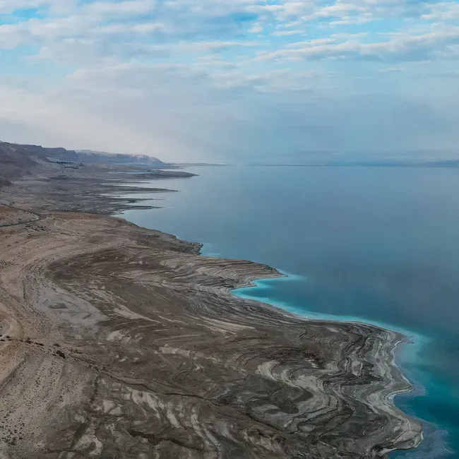
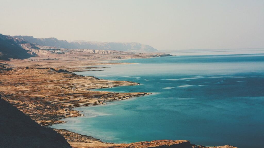
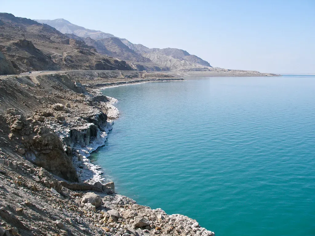
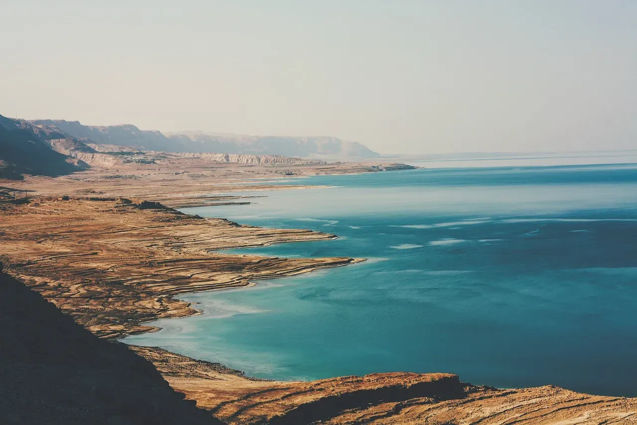
If you stand on the western shore of the Dead Sea today, you are literally watching geography move under your feet. Over the last several decades, the water level has been dropping by about three feet each year, and in some years recently even more, as inflow from the Jordan River shrinks and water is siphoned off for agriculture and industry. Seen up close, that steady number translates into something very physical: new bands of shore creeping outward by several yards every year, salt encrustations creeping forward like frost on a window, roads and buildings that were once beachside suddenly stranded far inland.
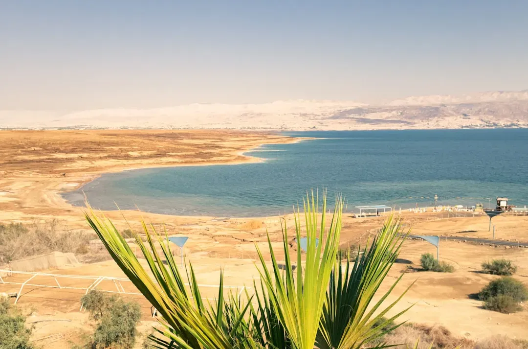
For you as an observer, it means that every time you return, the landscape looks noticeably different. Docks that once touched the water now hang in mid‑air above empty mudflats; beach resorts that were on the water’s edge a generation ago now sit hundreds of meters back, sometimes separated from the sea by sinkhole‑riddled wasteland. When you pair the raw speed of this retreat with the fact that this basin has hosted dense human activity for thousands of years, you begin to understand why experts keep using the word “unprecedented” when they talk about what is being uncovered.
A Surreal New Landscape of Mudflats, Salt, and Sinkholes
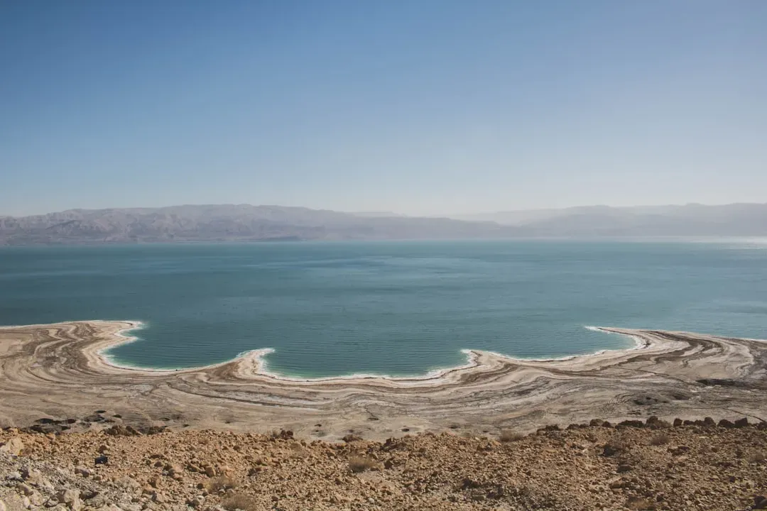
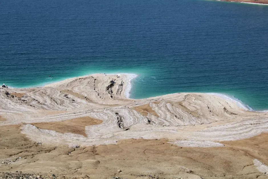
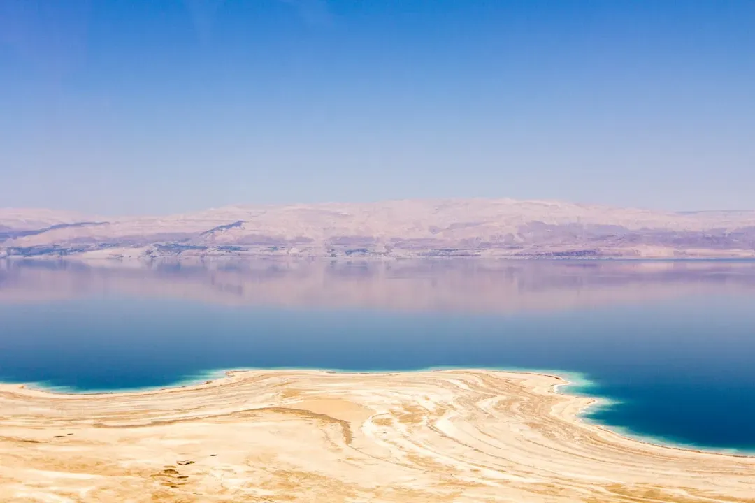
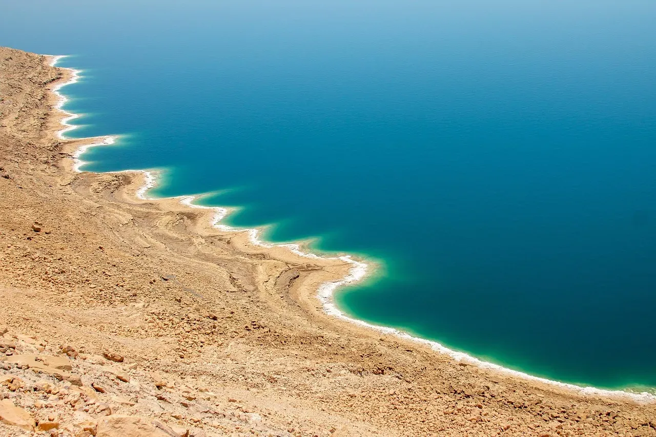
As the Dead Sea pulls back, it leaves behind a strip of ground that has not seen the light of day for a very long time. At first glance, you see a harsh, almost alien environment: blinding white salt veneers, polygonal crusts that crunch under your boots, dusty-gray mudflats veined with tiny channels and ridges. But when you walk across it, you quickly realize this is not just barren wasteland; it is a freshly opened excavation surface stretching for miles. The receding shoreline keeps generating new “exposure windows” of sediments that were laid down under different water levels and different climatic phases, effectively stacking natural archives right in front of you.
The catch is that this landscape is incredibly unstable. As the dense, salty water retreats, fresher groundwater seeps in and dissolves buried salt layers beneath the surface, hollowing out cavities that collapse without warning into deep sinkholes. You find surreal scenes: broken asphalt roads that suddenly drop into circular pits, palm trees tilted at odd angles over yawning voids, fences twisted like paper. For archaeologists and geologists, it is both a nightmare and a dream – dangerous to work in, but also constantly peeling back layers that would otherwise remain hidden.
Why This Retreat Is an Archaeological Game‑Changer

You might wonder why people are calling this newly exposed shoreline archaeologically without precedent. After all, coasts change all over the world. The key difference here is the combination of extreme retreat speed, the exceptional preservation conditions of hypersaline sediments, and the sheer density of human history around the Dead Sea. You are looking at a basin that has witnessed everything from Bronze Age trade routes and biblical kingdoms to Roman forts, Byzantine monasteries, Ottoman caravan stops, and modern industrial works – all perched around a water body that is now stepping backward year by year.
What makes this moment so unusual is that you are seeing whole archaeological zones emerge almost in time-lapse, rather than through traditional digging. The water itself, by dropping, is effectively doing the first stage of excavation for you, peeling back sealed margins of the lake and revealing structures, installations, shorelines, and deposits that no one has had access to in recorded history. It creates a kind of continuous, moving “trench” around the sea, but on a scale and speed that formal, controlled excavation could never replicate on its own.
Buried Architecture and Industry Reappearing at the Water’s Edge
As you follow the freshly exposed bands of shore, one of the most striking things you encounter is man‑made geometry emerging from what looks at first like natural mud. Low stone walls, rectangular foundations, channels cut with deliberate angles, and fragments of piers or jetties begin to poke out from beneath layers of sediment and salt. These may be the remnants of ancient or pre‑modern industrial operations, storage spaces, farm plots, or transport infrastructure built when the shoreline was in a different position than it is now.
Because the Dead Sea margin has been a magnet for salt and mineral exploitation for centuries, you are effectively seeing the ghost infrastructure of earlier extractive economies returning to view. Things that were abandoned as water levels rose in past centuries are now being revealed in reverse as the sea shrinks. For archaeologists, this gives you a front‑row seat to how people engineered, organized, and monetized this extreme environment at different times, and it allows you to compare that long arc of human adaptation with the very modern industrial complexes operating farther south today.
Layers of Climate and Culture Locked in Dead Sea Sediments
When you look at the exposed mudflats that form along the receding shore, you are not just looking at dirt; you are looking at a finely layered record of climate and human activity. Over thousands of years, changing water levels and flood events have stacked up alternating sheets of mud, salt, and other minerals, sometimes forming annual layers thin enough that you can count them like tree rings. As the sea retreats, it is slicing into these deposits and putting them within easy reach, so you can walk up to outcrops that would otherwise require deep coring or drilling from floating platforms.
That matters for archaeology because these layers do not just record natural changes; they often preserve pollen, charcoal, and even microscopic traces of ancient land use. When you sample them, you can begin to see how agricultural expansion, deforestation, or upstream water use may have changed alongside political or cultural shifts in the region. For you, that means the shoreline is not just revealing walls and buildings; it is revealing the environmental backstory of how societies around the Dead Sea coped with droughts, wet phases, and long‑term climatic swings, and how that history compares uneasily with the current human‑driven crisis.
Sitting at the Crossroads of the Dead Sea Scrolls and Desert Settlements
When you stand on the northern and western shores of the Dead Sea, you are in the heart of one of the most intensively studied ancient landscapes in the world. Nearby cliffs and caves hosted the famous scroll caches; terraced slopes and oases around the shore supported long‑lived settlements, monasteries, and fortresses. Now, as the water pulls back, you are seeing how shoreline positions and access routes may have looked in different periods, opening up new angles on questions researchers have argued over for decades: how people moved, where boats or rafts might have landed, what kind of shoreline infrastructure existed below now‑retreating waterlines.
For you, this changing geography helps you picture the region not as a static backdrop, but as a living, shifting environment that ancient communities constantly negotiated. Paths that once hugged the water may now sit surprisingly high above the present shore, making you realize how different distances and sightlines once were. That, in turn, helps you appreciate how fragile your mental maps of ancient sites can be if you ignore long‑term water‑level change. The Dead Sea’s current crisis is, oddly, giving you a more three‑dimensional understanding of its past.
Danger, Access, and the Race Against Time
Even if you are excited by what is emerging along the shore, you have to reckon with how hard it is to actually study it. Those sinkholes that keep appearing as the sea recedes are not minor inconveniences; they are deep, unpredictable traps, sometimes opening overnight in areas that seemed stable the day before. If you try to walk across a promising new exposure without guidance, you risk stepping onto a crust that could collapse under your weight, dropping you into a hidden cavity filled with brine or loose sediment. That is one reason why whole stretches of once‑popular beaches and access roads have been permanently closed.
For archaeologists and survey teams, this turns every season into a race against both time and safety. New features appear, but you might only have a narrow window before erosion, collapse, or modern development destroys them. In practice, that means you rely heavily on satellite imagery, drones, and remote sensing to spot promising anomalies before you send anyone in on foot. As a visitor or reader, it is important for you to understand that the extraordinary archaeological potential of this landscape is tightly bound to real hazards, and that responsible exploration demands patience, caution, and sometimes the frustration of knowing you cannot reach everything you can now see.
What This Means for You: Loss, Insight, and Responsibility
It is tempting to see the Dead Sea’s retreat as almost cinematic: the waters withdraw, secrets emerge, and you get an unprecedented glimpse into lost worlds. But if you let yourself sit with it for a moment, you realize that the same forces gifting you these new discoveries are also destroying ecosystems, undermining infrastructure, and signaling deep imbalances in how the region manages water. You are looking at a landscape where thousands of sinkholes have already formed, where long‑standing communities and tourist businesses grapple with crumbling ground and vanishing shorelines, and where no single plan to stabilize the sea has been agreed upon.
So you are caught in a kind of double vision. On one hand, the archaeologically rich strips of new shoreline feel like an extraordinary, maybe once‑in‑civilization opportunity to study the interface between climate, water, and human history. On the other hand, you know that allowing this process to continue unchecked means accepting escalating environmental damage. That tension puts a responsibility on you – whether you are a traveler, a student, a policymaker, or simply someone who cares about the past – to see these discoveries not as a free bonus, but as a warning signal about how quickly you can push a unique natural system beyond its limits.
Conclusion: A Vanishing Sea, an Unfolding Archive
When you put all of this together, you begin to see the Dead Sea today as more than a shrinking tourist postcard. You are witnessing a rare convergence of rapid environmental change and deep archaeological revelation, in a place where almost every meter of shore has a story to tell. Each year, as the waterline drops by those crucial few feet, new stretches of ground step into the sun carrying traces of ancient industry, settlement, and climate – and you are alive at the one moment when they are becoming visible after centuries of being sealed away.
The uncomfortable truth is that this is not a controlled experiment; it is an unfolding crisis that happens to illuminate the past even as it threatens the present. As you follow the retreat of the sea, you are really following a question: whether you will treat this moment as a fleeting curiosity, or as a catalyst to rethink how you handle water, heritage, and shared landscapes in a warming, thirsty world. When you imagine the shoreline a few decades from now, do you picture a stabilized basin and carefully protected archaeological zones – or a larger, emptier scar ringed by collapsed ground and lost opportunities?