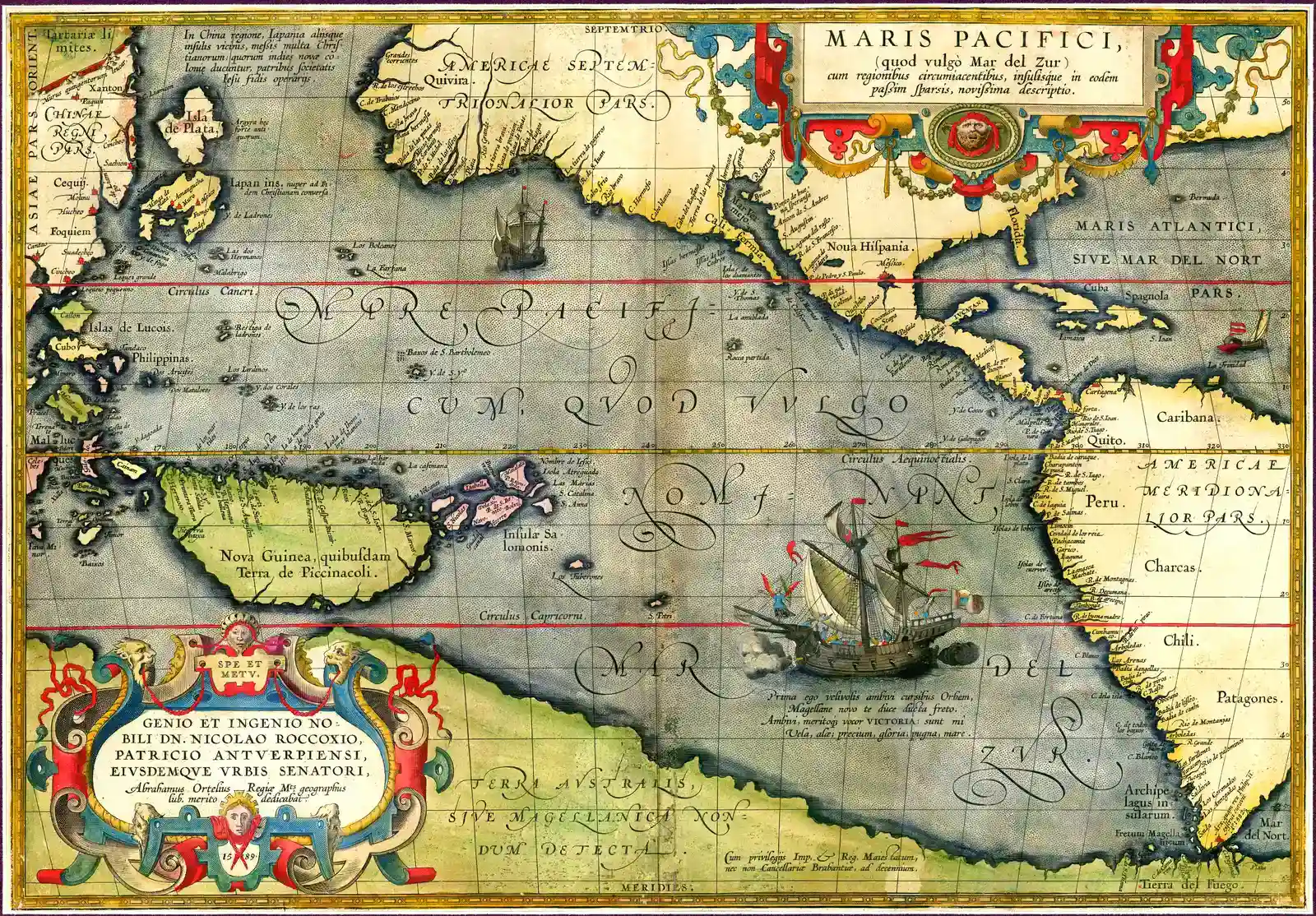
You stare at an old, yellowed map and suddenly notice it: a coastline that should not be there, an island that nobody officially reached for centuries, a dotted line vanishing into blank ocean as if someone had sailed off the edge of history. Ancient and medieval maps are full of these unsettling hints, half-forgotten stories pressed into ink and parchment. They do not just show geography; they show what people dared to imagine long before explorers planted flags and wrote reports.
When I first fell down this rabbit hole, I expected a few charming errors and mythical sea monsters. Instead, I found maps that quietly anticipated entire continents, guessed at polar landmasses, and sketched out islands that no one in Europe was supposed to know about yet. Some of these features turned out to be hoaxes or misunderstandings, others came from bold voyages that never made it into official chronicles, and a few remain genuinely mysterious. Let’s walk through thirty‑three of the most intriguing examples, and see how cartographers kept discovering the world on paper before it was discovered in person.
1. The Babylonian Map of the World and the Lands Beyond the Ocean
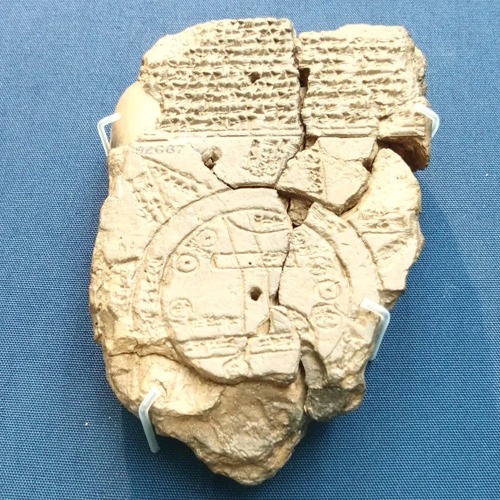
Hidden in a small clay tablet from around the sixth century BCE, the Babylonian Map of the World looks simple at first glance: Babylon in the center, a circular river around everything, and familiar nearby regions like Assyria and Elam. But then you notice the strange triangular wedges pushing past the encircling “bitter river,” each one labeled as a distant, almost unreachable land. To the Babylonians, these outer regions were not just far‑off provinces; they were zones at the edge of reality, where gods, monsters, and unknown peoples might live. ([en.wikipedia.org](https://en.wikipedia.org/wiki/Babylonian_Map_of_the_World?utm_source=openai))
Those little triangles are some of the earliest cartographic admissions that there were places out there they had not yet seen, but were sure existed. A few descriptions speak of regions where the sun barely rises, or where impossible animals roam, which sounds almost like a distorted memory of far northern latitudes. We cannot tie any one wedge to a modern country, but the mindset is clear: the world did not stop at the edge of their empire, and that “beyond” was important enough to carve into clay. In a sense, this tablet is the ancestor of every later map that dares to sketch hypothetical land over the horizon.
2. Eratosthenes and the Shadow of an Unknown Southern Continent
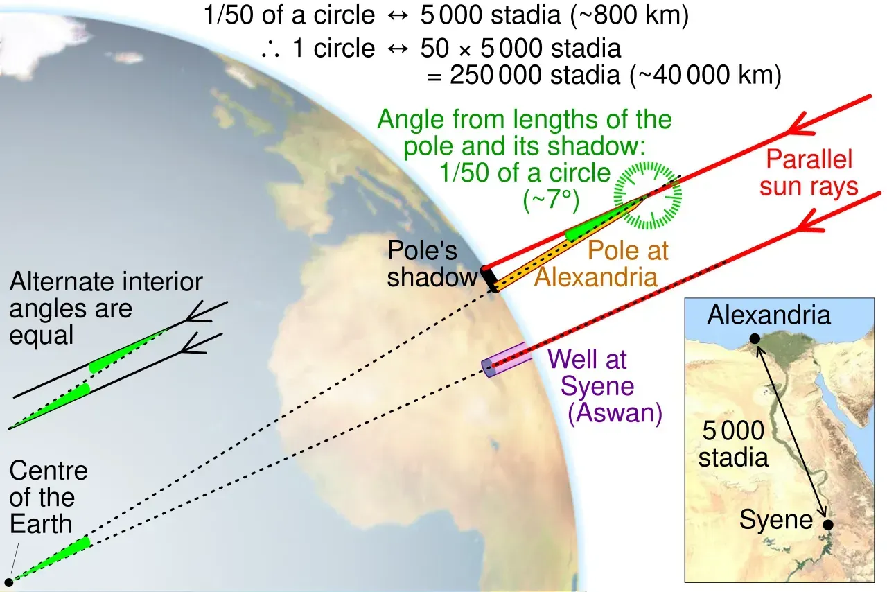
Jump to Hellenistic Greece, and you find Eratosthenes in the third century BCE already calculating Earth’s circumference with shocking accuracy. Once you accept that the planet is a sphere, you cannot help noticing that there seems to be a lot of ocean and land in the north and very little to balance it in the south. Greek geographers began to speak of an unknown “Antichthones,” a southern landmass that might exist to stabilize the globe. It was not on their surviving maps as a neat coastline, but it haunted the geometry of their world.
That simple logical leap – that something should be there, even if no one had sailed that far – became wildly influential later. Roman and medieval scholars borrowed the idea and turned it into full‑blown drawings of a great southern continent. They were not describing Antarctica as we know it, but the concept laid the groundwork: the future Terra Australis started as a mathematical hunch centuries before explorers pushed anywhere near the polar seas. In other words, the blank spaces on their maps were already filled in inside their minds.
3. Ptolemy’s World Map and the Hidden Eastern Ocean
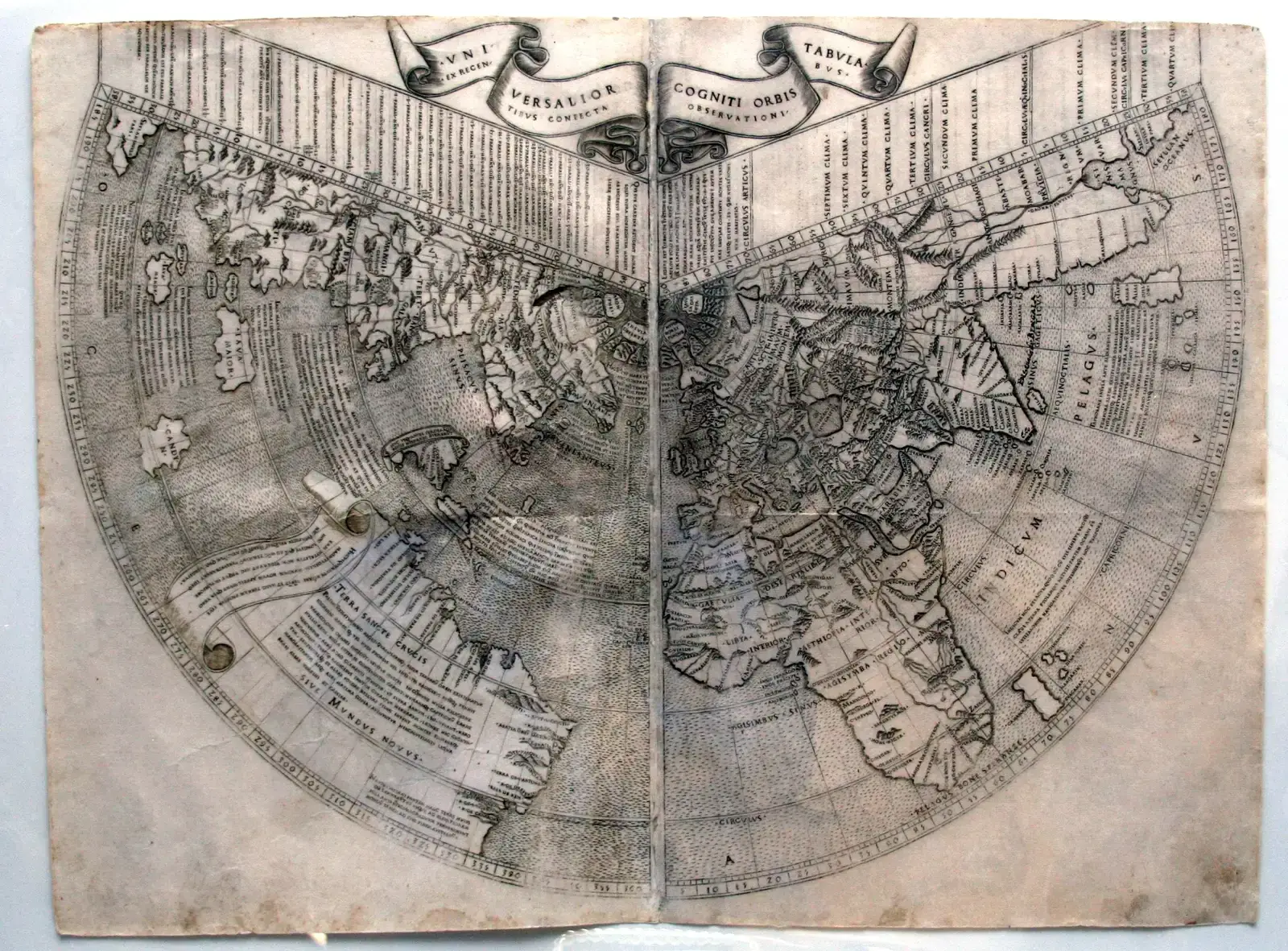
In the second century CE, Claudius Ptolemy stitched together reports from sailors, merchants, and earlier scholars to build a map that would dominate European cartography for over a millennium. His world ends in a bold way: Africa curves eastward and joins a huge southern landmass, sealing off the Indian Ocean like an enormous lake. That move erased any official possibility of sailing south of Africa into an open sea, even though later voyages would prove that assumption spectacularly wrong. ([en.wikipedia.org](https://en.wikipedia.org/wiki/Babylonian_Map_of_the_World?utm_source=openai))
What is fascinating is why he did it. Ptolemy knew he did not have data for what lay beyond, but the idea of a fully enclosed system appealed to his love of order. Ironically, by closing the gap, he hinted that more land must be stretching out off the edge of the parchment. When Portuguese sailors finally rounded the Cape of Good Hope in the late fifteenth century, they were not just disproving a theory; they were stepping into a watery void Ptolemy’s map had refused to draw. His diagram silently admitted that a whole second ocean – and unknown coasts beyond – was waiting to be discovered.
4. Medieval T‑O Maps and the Lost Lands of the Antipodes
Those round medieval “T‑O” maps, with Jerusalem in the middle and the world divided into Asia, Europe, and Africa, look almost childlike compared to modern atlases. Yet tucked into obscure commentaries and marginal notes, you find something more daring: speculation about people living on the opposite side of the globe. Many theologians feared that fully accepting the Antipodes would imply humans cut off from the story of salvation, but the idea refused to die. Some versions even hinted at land down there, unreachable and unnamed. ([worldgeographies.com](https://worldgeographies.com/the-imago-mundi/?utm_source=openai))
For a schoolkid today, imagining Australia as “down under” is easy, but for many medieval scholars it was a theoretical land carrying heavy religious baggage. The maps usually did not show clear antipodal continents, yet the discussions around them are an early case of people understanding there might be whole inhabited regions entirely absent from their standard world picture. It is like seeing the outline of a ghost continent in the negative space of theology and ink.
5. The Da Ming Hun Yi Tu and Africa Before Europe Went Around It

Somewhere around the late fourteenth or early fifteenth century, Chinese cartographers drew the Da Ming Hun Yi Tu, a massive wall map merging Ming knowledge with earlier sources. What catches modern eyes is not China’s careful rivers, but the presence of an unmistakable Africa and a surprisingly elongated Indian Ocean coastline, at a time when no European had yet rounded the Cape. The map stretches the continent, but it clearly places it far south of the Mediterranean, with a protruding horn and a broad body below. ([en.wikipedia.org](https://en.wikipedia.org/wiki/Da_Ming_Hunyi_Tu?utm_source=openai))
How did they know? Likely from centuries of Muslim and Indian Ocean trade networks, where information moved as steadily as spices. Yet the cumulative result is stunning: Chinese officials standing in Nanjing could point to a chart showing lands that, from a European point of view, would not be “properly discovered” for decades. When Zheng He’s fleets sailed into the western Indian Ocean in the early 1400s, they were not just wandering; they were following a mental and cartographic picture that already pushed far beyond their own horizons.
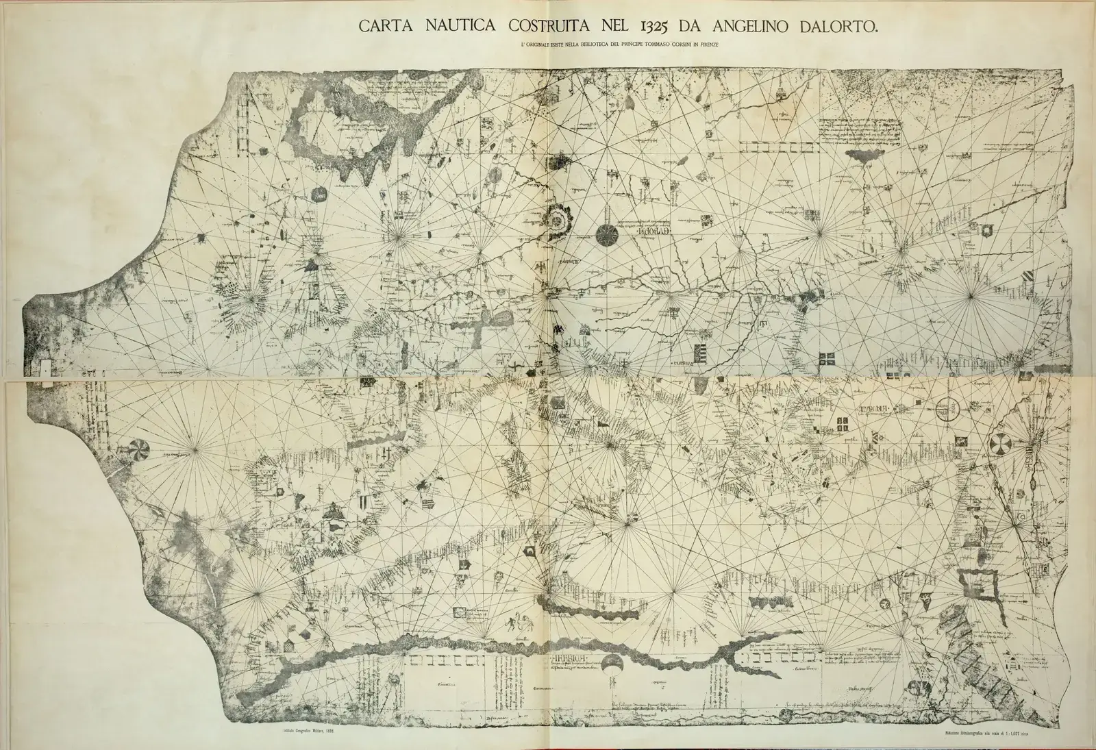
6. The Catalan Atlas and the Hint of Distant Atlantic Coasts
Drawn in 1375 in Majorca, the Catalan Atlas is famous for its luminous gold, kings sitting on thrones in the Sahara, and caravans crawling across desert tracks. But off to the west of the map, beyond the familiar shores of Iberia and North Africa, there are faint island clusters and vague landforms that feel speculative. Some islands echo known places like the Canaries, but others like Antilia or mysterious western lands occupy a liminal zone between rumor and reality. ([cartography.bg](https://cartography.bg/wp-content/uploads/2023/08/Beyond-the-Map-Exploring-the-Boundaries-of-Communication-in-Contemporary-Cartography-Data-Visualization.pdf?utm_source=openai))
Medieval sailors told stories of islands glimpsed in storms, or faint coasts that appeared at dawn and vanished by noon. The atlas folds some of these legends into its decorative margins, almost as if its creators could not resist putting down what might be there. You can sense European imagination straining westward, a century before Columbus sailed – the map becomes a kind of proto‑satellite photo, blurry at the edges, filled with guesses that would soon be tested by real voyages.
7. Portolan Charts and the Phantom Atlantic Islands
Medieval and early Renaissance portolan charts, used by mariners around the Mediterranean and Atlantic, are crisscrossed with wind‑rose lines and practical sailing directions. Along their Atlantic fringe, they also show islands that straddle the line between real and wishful thinking: St. Brendan’s Isle, Antilia, the Islands of the Seven Cities. These were not just storyteller’s flourishes; captains really went out looking for them. ([greatest-unsolved-mysteries.com](https://www.greatest-unsolved-mysteries.com/piri-reis-map.html?utm_source=openai))
When you study a portolan, you see how these phantom islands serve as stepping stones into an unknown ocean. They made the idea of crossing feel less insane; maybe you would not have to cross a terrifying emptiness but could hop from island to island. Even if most of these rocks did not exist where they were drawn, their presence on charts shaped decisions on where to sail, nudging explorers toward real coastlines that official geography had not yet accepted.
8. The Fra Mauro Map and an Open Indian Ocean
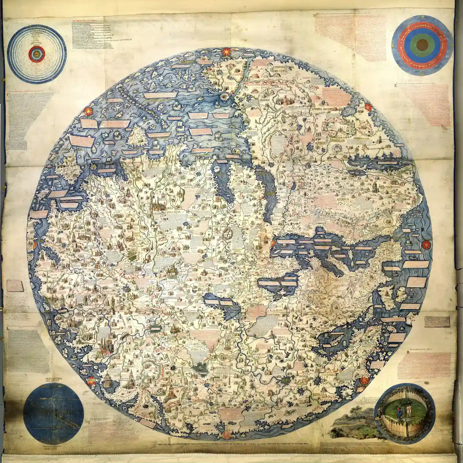
Around 1450, Venetian monk Fra Mauro created a gigantic circular world map that quietly blew up a core belief of Ptolemy. In his vision, the Indian Ocean is not a closed lake; it is open at the south, meaning ships could theoretically sail around Africa. On one section, he even includes a note referencing a reported voyage of an Indian or Chinese ship that sailed from the Indian Ocean into the Atlantic far to the south, decades before Bartolomeu Dias proved the route for Europe. ([myoldmaps.com](https://www.myoldmaps.com/renaissance-maps-1490-1800/322-piri-reis-chart-of-the/322a-piri-res.pdf?utm_source=openai))
This is a perfect example of a map capturing an “undiscovered” route in text before it was nailed down in European practice. Fra Mauro never went there himself, of course, but enough sailors’ stories reached Venice to convince him to redraw the edges. Standing in a candlelit scriptorium, he effectively mapped the possibility of the Cape route before Portugal’s royal court could celebrate it, sketching a world that had already grown larger in the minds of mariners.
9. The Cantino Planisphere and a Nearly‑Guessed Brazil
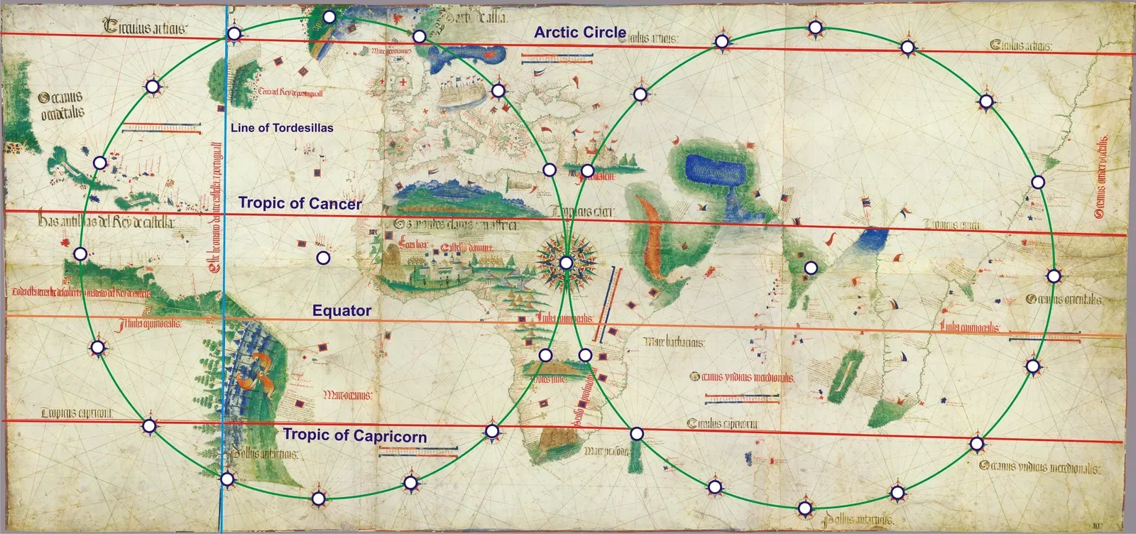
Smuggled out of Portugal in 1502, the Cantino Planisphere is an espionage masterpiece: an illegal copy of the kingdom’s secret master map. It shows the Atlantic sliced by the Treaty of Tordesillas line and, importantly, a heavy, leafy coastline bulging westward that we now recognize as Brazil. But that coastline is oddly long for what had been officially reported by then, suggesting that Portuguese pilots had seen more of South America than public chronicles admitted. ([myoldmaps.com](https://www.myoldmaps.com/renaissance-maps-1490-1800/322-piri-reis-chart-of-the/322a-piri-res.pdf?utm_source=openai))
This is one of those cases where the map leaps ahead of the story everyone else was being told. While Europe still celebrated “discoveries” in carefully staged announcements, cartographers were quietly updating coastlines with information from half‑secret journeys. In that sense, the Cantino chart shows a Brazil that had not been “discovered” in the loud, ceremonial sense yet, but clearly existed in the private geographic imagination of a seafaring empire.
10. The Waldseemüller Map and the Bold Naming of America
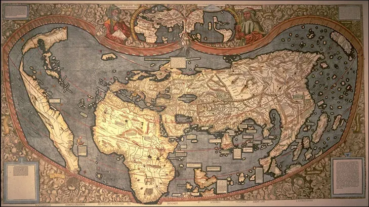
In 1507, Martin Waldseemüller printed a world map that did something stunning: it labeled a large western landmass “America,” after Amerigo Vespucci. At that point, Europeans had only touched some edges of South America and parts of the Caribbean. Yet Waldseemüller and his circle decided not only to show an extended southern continent but to treat it as a separate quarter of the world, distinct from Asia, long before the full coasts were charted. ([cartography.bg](https://cartography.bg/wp-content/uploads/2023/08/Beyond-the-Map-Exploring-the-Boundaries-of-Communication-in-Contemporary-Cartography-Data-Visualization.pdf?utm_source=openai))
The audacity here is not the name itself, but the confidence. Looking at fragments of coastline, travel letters, and tales of a “New World,” he extrapolated an entire continent running from high northern to far southern latitudes. Later discoveries would fill in and correct his outline, but the basic idea held. His map is a classic case of cartography racing ahead of exploration, drawing a whole land before the boots and ships had actually traced its full shape.
11. The Ruysch World Map and the Faint Shadow of North America
Just a year after Columbus’s final voyage, the 1507 Ruysch world map appeared in a printed edition of Ptolemy. On it, beyond Greenland, you can see landmasses and islands that look suspiciously like parts of northeastern North America, even though the official story still revolved around Asia and the Indies. The shapes are tentative, jagged, and clearly incomplete, but they are there, interrupting what had once been open ocean. ([myoldmaps.com](https://www.myoldmaps.com/renaissance-maps-1490-1800/322-piri-reis-chart-of-the/322a-piri-res.pdf?utm_source=openai))
Some historians think Ruysch drew on Portuguese and possibly Bristol voyages that reached Labrador or Newfoundland before the better‑known expeditions. If that is true, this map quietly records land that multiple kingdoms knew about yet hesitated to advertise. It feels like a half‑confession on paper: an admission that there is a “something” out there west of Europe and Greenland, even if no one is ready to spell out just how big or important it is.
12. The Piri Reis Map of 1513 and the Enigmatic Southern Coastline
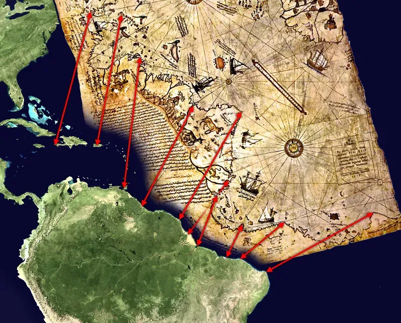
Few maps have sparked as many wild claims as the 1513 Piri Reis map, drawn by an Ottoman admiral who said he used about twenty older charts, including some attributed to Columbus. The surviving fragment covers the Atlantic, with Europe and Africa on the right and South America curving down the left. At its southern edge lies a puzzling extension, which some popular writers have insisted shows an ice‑free Antarctica centuries before anyone officially saw it. Mainstream research, however, argues it is a distorted stretch of South America continued too far south, possibly blended with the era’s imagined southern continent. ([en.wikipedia.org](https://en.wikipedia.org/wiki/Piri_Reis_map?utm_source=openai))
The real mystery, to me, is less about Antarctica and more about how much South American coastline appears at such an early date. Piri himself wrote that some of his sources came from “the western infidels,” hinting at Portuguese and Spanish state maps he should not have had. That suggests the big powers were again seeing more than they admitted, and those glimpses slipped into the Ottoman world through captured charts. In my mind’s eye, I see Piri in Cairo after the Ottoman conquest of Egypt, spreading forbidden European maps on a table and trying to reconcile them into a single, daring vision of the Atlantic.
13. The Second Piri Reis World Map and a Sketch of Panama
About a decade later, Piri Reis produced another world map, now almost entirely lost except for references and related charts. Surviving descriptions indicate that this version showed the Americas more fully, reportedly depicting coasts from Greenland down toward the Straits of Magellan and even suggesting the narrowing of Central America around Panama. That would have been remarkably up‑to‑date, catching the wave of discoveries almost as they happened. ([en.wikipedia.org](https://en.wikipedia.org/wiki/Piri_Reis?utm_source=openai))
The intriguing part is that some of these regions were still only partially explored by European fleets when Piri drew them. His map engaged with the frontier in real time, absorbing fragments of information moving along secret diplomatic and commercial routes. Places like Panama – which would soon be carved into history by the building of a canal centuries later – entered global cartography first as thin, tentative pen strokes, a narrow waistline on a page connecting two vast unknowns.
14. The Zeno Map and a Mysterious Western Archipelago
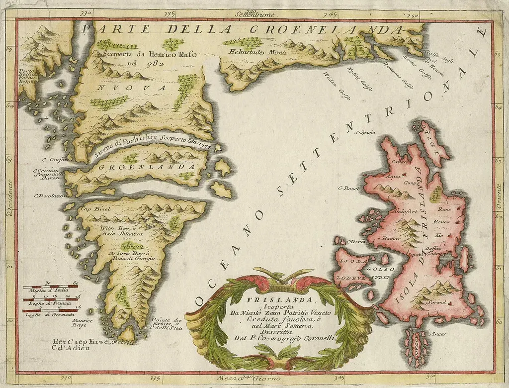
Published in the sixteenth century but claiming to depict a fourteenth‑century voyage, the Zeno map shows a scattered archipelago in the North Atlantic, including islands like Frisland and Icaria that modern geographers cannot pin down. It also nudges landmasses westward from Europe and Greenland in ways that have made some wonder whether it preserves a blurred memory of earlier, unofficial crossings toward North America. ([cartography.bg](https://cartography.bg/wp-content/uploads/2023/08/Beyond-the-Map-Exploring-the-Boundaries-of-Communication-in-Contemporary-Cartography-Data-Visualization.pdf?utm_source=openai))
Most scholars today see the Zeno narrative as at least partially fabricated, but that does not make the map worthless. It reveals how, once the New World entered the conversation, people started retrofitting older legends and half‑remembered sailing tales into new cartographic frameworks. Its phantom islands are like cartographic ghosts – the lingering trace of sailors’ claims about lands they saw “out there,” still not fully absorbed into the official gallery of continents.
15. The Vinland Map and the Illusion of a Pre‑Columbian America
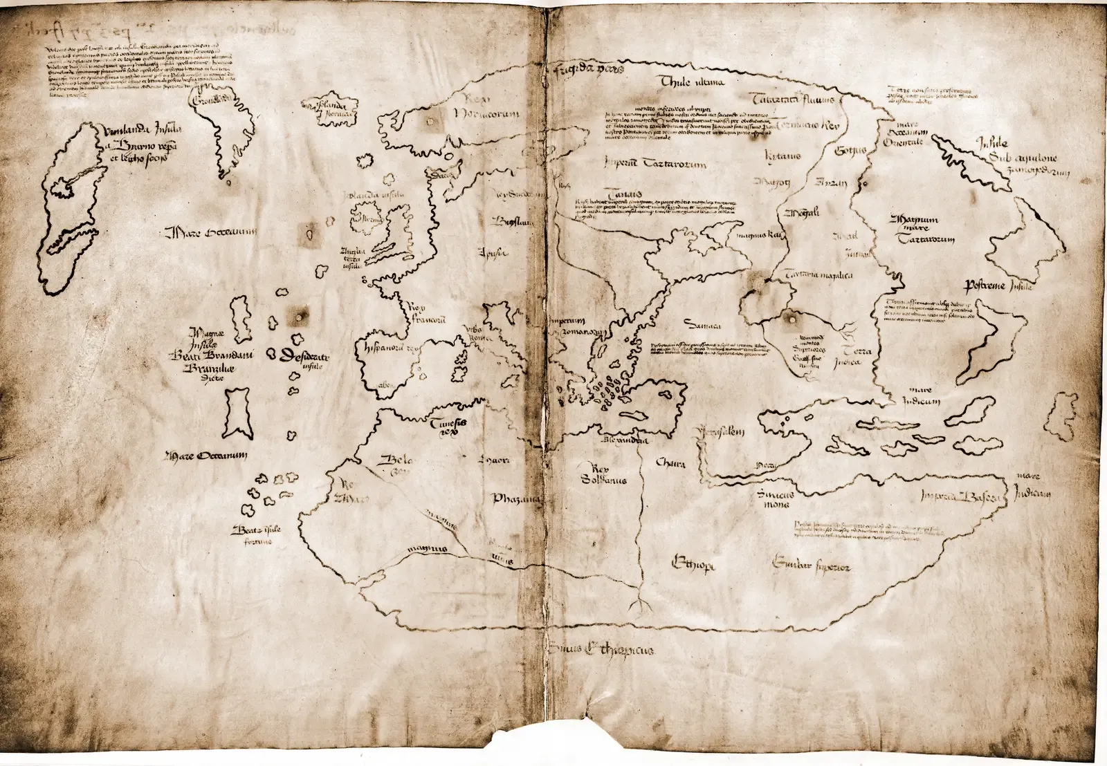
For decades, the Vinland Map looked like the smoking gun that proved Europeans knew about North America long before Columbus. It showed Europe, Africa, and Asia in medieval style, but tucked to the west of Greenland was a clearly labeled “Vinland,” resembling parts of northeastern North America. When Yale unveiled it in the 1960s, it seemed to rewrite the script: suddenly, a mid‑fifteenth‑century scribe had calmly drawn America into the story. ([en.wikipedia.org](https://en.wikipedia.org/wiki/Vinland_Map?utm_source=openai))
Modern scientific tests, however, have exposed it as a twentieth‑century forgery, likely drawn on an old parchment with modern ink. Yet this is still a map that “shows” a place not yet discovered in the mainstream narrative – because the hoaxer chose to put it there. The forgery itself tells us how strong the desire was, in the mid‑1900s, to find cartographic proof that the Vikings and other Europeans had recorded their western landfalls. Even when the map lied, it was lying toward a truth we now accept through archaeology: Norse sites in Newfoundland existed centuries before Columbus, even if medieval maps did not capture them clearly.
16. Norse Mental Maps and the Unwritten Cartography of Vinland

Long before any European printed “America” on a world map, Norse sailors carved mental maps of lands they called Helluland, Markland, and Vinland after crossing the North Atlantic around the year 1000. Their sagas describe coasts with beaches, forests, and grapes, and archaeologists have uncovered a Norse settlement at L’Anse aux Meadows in Newfoundland that backs up at least part of the story. Yet no surviving medieval Norse world map cleanly draws these western lands as enduring features. ([si.edu](https://www.si.edu/object/yt_XUCMiJj4VAU?utm_source=openai))
In a way, the “undiscovered” part here lies in the gap between lived experience and formal cartography. Norse navigators clearly knew something lay west of Greenland – they reached it, built structures, and then abandoned the experiment. For centuries after, European mapmakers drew oceans where those farms and boats had been. The lands existed, and had been touched, but they fell back into the category of places that were known locally, then forgotten, and eventually rediscovered by later empires who got to write the official maps.
17. The Hereford Mappa Mundi and Lands Inhabited by Marvels
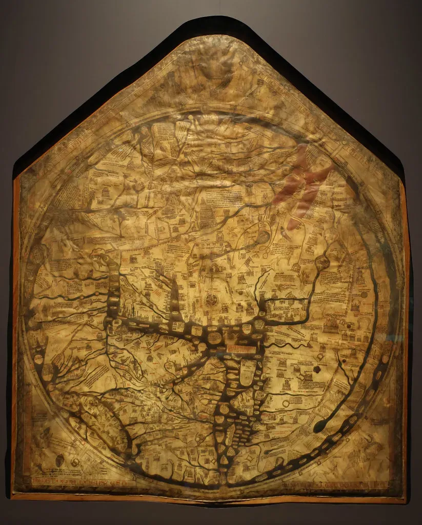
Created around 1300, the Hereford Mappa Mundi is a riot of theology and folklore: strange peoples with dog heads, deserts filled with wonders, and distant islands bristling with legend. Far to the east and south, the map hints at lands no European had thoroughly surveyed, populated by bizarre races that say more about medieval imagination than anthropology. Yet tucked inside those myths is a quiet admission: there is more world than we have measured, and it is very likely inhabited. ([cartography.bg](https://cartography.bg/wp-content/uploads/2023/08/Beyond-the-Map-Exploring-the-Boundaries-of-Communication-in-Contemporary-Cartography-Data-Visualization.pdf?utm_source=openai))
It would be easy to dismiss all that as fantasy, but remember, the mapmakers were blending traveler’s tales, classical texts, and religious motifs. The shapes of Africa and Asia bulge and wobble, stopping in places that clearly were not the real edges of land. Those gaps are where undiscovered coasts lived in their minds. Even when monsters guarded the margins, they were a way of saying: something lies beyond our borders, and we are not ready – or able – to draw it accurately yet.
18. The Ebstorf Map and the Ring of Unknown Peripheries
The Ebstorf Mappa Mundi, destroyed during World War II but preserved in photographs, was another giant circular map with Christ’s body framing the world. At its edges, particularly in the far east and far south, it clusters lands and peoples that are more hinted at than precisely located. You see vague coastal outlines and labels for kingdoms derived from travelers’ yarns, pushed up against the physical edge of the parchment. ([cartography.bg](https://cartography.bg/wp-content/uploads/2023/08/Beyond-the-Map-Exploring-the-Boundaries-of-Communication-in-Contemporary-Cartography-Data-Visualization.pdf?utm_source=openai))
This layout effectively turns the last few centimeters of the map into a band of uncertainty. The world did not end there; the pigmented vellum did. Everything beyond that perimeter, from an African interior they barely comprehended to possible antipodal regions, was an “undiscovered” zone waiting for a future generation of mapmakers. To me, the Ebstorf map feels like a confession in artistic form: here is all we dare claim, and then there is the rest of God’s earth that we have to leave uncolored.
19. Early Portuguese Charts and the Ghost of Australia
There is a persistent debate about whether early sixteenth‑century Portuguese charts hinted at Australia’s northern coasts long before the Dutch and English recorded them. Some scholars point to odd landmasses drawn far to the south of Indonesia – on maps like the so‑called Dieppe school charts – that loosely resemble parts of New Guinea or Australia. Others argue they are exaggerations of known islands or imaginative extensions of the mythical southern continent. ([cartography.bg](https://cartography.bg/wp-content/uploads/2023/08/Beyond-the-Map-Exploring-the-Boundaries-of-Communication-in-Contemporary-Cartography-Data-Visualization.pdf?utm_source=openai))
Because most of Portugal’s secret nautical archives were later lost or destroyed, we are left squinting at these enigmatic shapes, trying to decide if they reflect actual landfalls or wishful thinking. Either way, the maps act as visual speculation: cartographers filling in the blank ocean with guesses about what must be there. Whether those strokes of ink were based on real sightings or pure imagination, they showed a coastline that, in the standard European timeline, technically was not “discovered” yet.
20. Terra Australis Incognita and the Pre‑Discovery of the South
For centuries, European world maps featured a colossal, often beautiful southern continent labeled Terra Australis Incognita – the unknown southern land. No one had traced its borders; its existence was assumed to balance the continents of the north, a geographical yin to their yang. Sometimes it snaked up near the known southern tips of South America or Africa, as if reaching for the places ships actually visited, blurring the boundary between hypothetical and real. ([haroldcarver.info](https://haroldcarver.info/essays/map-that-doesnt-exist.html?utm_source=openai))
When Captain James Cook’s voyages in the eighteenth century failed to find such a huge landmass in the temperate south Pacific, the grand dream shrank. Antarctica turned out to be real but much smaller and farther south than those old maps imagined. Still, for centuries this drawn‑but‑unseen continent strongly influenced exploration. Sailors went looking for what the maps told them ought to exist, chasing a place that had been discovered first in the realm of theory and only much later – in a much colder, harsher form – in the real world.
21. Oronce Finé’s Heart‑Shaped World and the Early Antarctic Guess
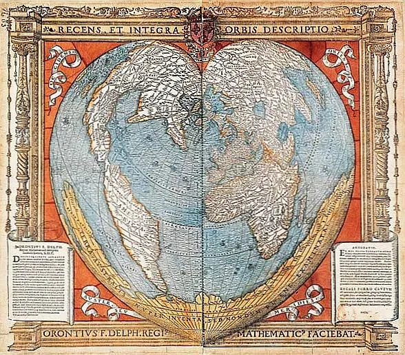
In 1531, French cartographer Oronce Finé produced a heart‑shaped world map featuring a detailed Terra Australis curling under the Indian Ocean and the Pacific. This southern land even sports bays, capes, and rivers, despite the fact that no European expedition had charted such features. He was combining classical ideas, reports from Magellan’s circumnavigation, and his own geometric reasoning to imagine a world balanced by continent‑sized symmetry. ([cartography.bg](https://cartography.bg/wp-content/uploads/2023/08/Beyond-the-Map-Exploring-the-Boundaries-of-Communication-in-Contemporary-Cartography-Data-Visualization.pdf?utm_source=openai))
Looking at Finé’s southern continent today is eerie. Some parts vaguely hint at future outlines – others bear no resemblance at all. But the point is not accuracy; it is mindset. He gave the unknown a shape, a coastline that explorers could respond to. You could say the map “pre‑discovered” Antarctica, not by describing what was truly there, but by making European minds expect land in that general direction, a conceptual target for centuries of later voyages.
22. Mercator’s 1569 Projection and a Persistent Southern Mass
Gerardus Mercator’s famous 1569 world map is remembered for its projection, which still shapes how we see the globe today. Less often discussed is the fact that he also included a large southern continent, merging hints from recent voyages with older Terra Australis tradition. On his chart, this landmass bulges upward toward the known coasts of South America and New Guinea, as if magnetically attracted to real discoveries. ([cartography.bg](https://cartography.bg/wp-content/uploads/2023/08/Beyond-the-Map-Exploring-the-Boundaries-of-Communication-in-Contemporary-Cartography-Data-Visualization.pdf?utm_source=openai))
By placing that land so boldly on a mathematically sophisticated projection, Mercator gave the impression that its existence was almost a certainty, not just a rumor. Generations of navigators studied his work, and some went south in part because the map showed something to be found. In that way, Mercator participated in a quiet feedback loop: explorers fed him partial data, he turned it into confident coastlines, and those coastlines then lured the next wave of explorers into areas that were still, on the water, completely unknown.
23. The Buache Hypothesis and a Proto‑Antarctic Interior
By the eighteenth century, French geographer Philippe Buache was sketching hypothetical maps of the Antarctic region based on ocean currents and ice patterns. On some of his charts, he proposed that the southern land was divided by a vast inland sea or channels, trying to infer its structure from indirect evidence. No one had seen the interior; he was modeling a continent from the behavior of water and ice around it. ([cartography.bg](https://cartography.bg/wp-content/uploads/2023/08/Beyond-the-Map-Exploring-the-Boundaries-of-Communication-in-Contemporary-Cartography-Data-Visualization.pdf?utm_source=openai))
This is a different kind of “ancient” mapmaking, closer to what scientists do today: using data and theory to predict unseen geography. Buache’s Antarctica was wrong in many details, yet in broad strokes he anticipated that it might not be a solid, monolithic land as some earlier maps had drawn. His speculative cartography shows how the human urge to map – to fill in the blanks – does not wait patiently for exploration to catch up.
24. Early Pacific Charts and the Phantom Isles of the Great Ocean
As Spanish and Portuguese navigators pushed into the Pacific in the sixteenth century, their charts blossomed with islands. Some were real; others were misplaced, duplicated, or entirely legendary. Names like Rica de Oro, Rica de Plata, and a swarm of small, barely described specks cluttered their maps. Ships might spend weeks searching for an island drawn by some earlier pilot’s hopeful eye, only to find nothing but endless water. ([cartography.bg](https://cartography.bg/wp-content/uploads/2023/08/Beyond-the-Map-Exploring-the-Boundaries-of-Communication-in-Contemporary-Cartography-Data-Visualization.pdf?utm_source=openai))
Yet amid these illusions, real island groups like Micronesia and Polynesia slowly emerged into European consciousness. Before repeated observations fixed their positions, they existed on the edge of belief. The maps recorded them as half‑formed hints, tiny blots of ink whose exact shape and location still waited to be nailed down. The Pacific was, in that era, a vast experiment in collective truth‑finding, with charts as the ever‑changing scoreboard of what had been half‑seen versus truly confirmed.
25. Hy‑Brasil: The Atlantic Island That Kept Moving
For centuries, European maps showed an island called Hy‑Brasil somewhere west of Ireland, often as a neat round disk. Sailors swore they saw it in the distance, shrouded in mist, appearing once every seven years according to some folklore. Mapmakers dutifully marked it, but its position wandered from chart to chart as no one could pin down its coordinates. ([cartography.bg](https://cartography.bg/wp-content/uploads/2023/08/Beyond-the-Map-Exploring-the-Boundaries-of-Communication-in-Contemporary-Cartography-Data-Visualization.pdf?utm_source=openai))
Although Hy‑Brasil almost certainly never existed as a real island, its stubborn presence on maps says something powerful about the way people discover places on paper. It was, in a sense, a negative of an undiscovered America: a place repeatedly claimed and chased but never confirmed. As Atlantic exploration intensified and coastlines became better known, Hy‑Brasil slowly faded away, deleted not by erasers but by better data. It is a reminder that some “undiscovered” lands vanish not because we finally reach them, but because we realize they were never there in the first place.
26. Antillia and the Islands of the Seven Cities
Another legendary Atlantic landmass, Antillia, appears as a long, rectangular island on many fifteenth‑century maps, often paired with the tale of seven bishops who supposedly fled there from Muslim conquests in Iberia. On portolan charts, it sits somewhere between Europe and the future Caribbean, an enticing stepping stone that might make crossing the ocean less frightening. ([greatest-unsolved-mysteries.com](https://www.greatest-unsolved-mysteries.com/piri-reis-map.html?utm_source=openai))
Some historians suspect Antillia’s drawn shape later influenced how cartographers arranged early Caribbean islands after Columbus’s voyages. The name even echoes in the modern word “Antilles” for that region. Here, a mythical island prefigured a real archipelago: the map first invented a refuge across the sea, and then, when actual islands were found, the concept and the name slid over onto them. The “undiscovered” Antillia became discovered by proxy, its emptiness filled with genuine geography.
27. The Island of California and a Misdrawn North America
![27. The Island of California and a Misdrawn North America (Library of Congress[1], Public domain)](https://nvmwebsites-budwg5g9avh3epea.z03.azurefd.net/dws/499aee1058a2acb9434703359fcc8e5b.webp)
Seventeenth‑century European maps frequently portray California not as a peninsula but as a large island separated from the mainland by a strait. This bizarre error may have started with garbled Spanish exploration reports and was reinforced by fashionable copying between mapmakers. For generations, atlases confidently showed galleons sailing between “Island California” and the rest of North America, charting a waterway that did not exist. ([cartography.bg](https://cartography.bg/wp-content/uploads/2023/08/Beyond-the-Map-Exploring-the-Boundaries-of-Communication-in-Contemporary-Cartography-Data-Visualization.pdf?utm_source=openai))
What makes this striking is that parts of the real California coast had indeed been explored, but the overall shape of the region remained hazy. Mapmakers filled in the unknown interior with a romantic maritime shortcut. Later expeditions by Jesuit missionaries and others walked the land and definitively proved there was no strait. Until then, any navigator staring at those maps could have believed there was a whole inland seaway waiting to be discovered, only to find solid desert instead.
28. The Strait of Anian and a Premature Northwest Passage
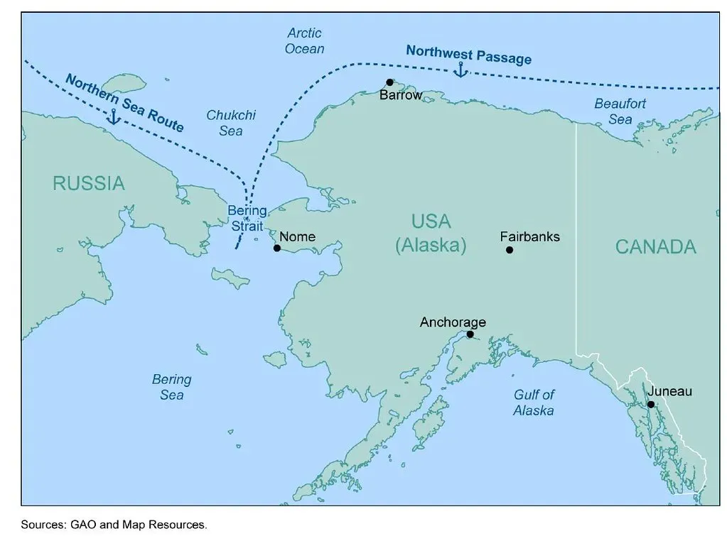
Connected to the island‑California myth was the so‑called Strait of Anian, a supposed channel linking the Pacific to the Atlantic through the far north of America. Many sixteenth‑ and seventeenth‑century maps dutifully drew a thin passage somewhere near modern Alaska, based more on hope and distorted Asian geography than firm evidence. The idea promised a lucrative shortcut to Asia that bypassed hostile powers and long routes. ([cartography.bg](https://cartography.bg/wp-content/uploads/2023/08/Beyond-the-Map-Exploring-the-Boundaries-of-Communication-in-Contemporary-Cartography-Data-Visualization.pdf?utm_source=openai))
While the real Northwest Passage does exist in a labyrinth of Arctic channels, the early cartographic Strait of Anian was a wildly oversimplified placeholder. Explorers like Vitus Bering and later British expeditions went searching for something like it, driven by charts that suggested an easy door through the continent. Here again, maps anticipated a geographical reality in broad terms – there was in fact a way through the Arctic – but misrepresented it so badly that coming generations had to re‑discover the region almost from scratch.
29. Lake Parime and the Cartographic Shadow of El Dorado
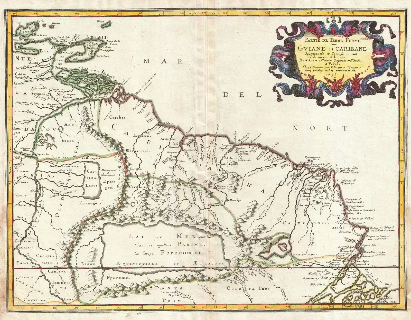
In northern South America, many early modern maps show a huge inland lake called Parime, often adorned by a city that some associated with the legendary El Dorado. This feature may have grown out of misunderstandings of seasonal flooding in the Orinoco basin, inflated by stories from explorers describing vast sheets of water and rich local settlements. Cartographers turned this mix into a permanent, navigable lake, inviting adventurers to imagine sailing to a golden city on its shores. ([cartography.bg](https://cartography.bg/wp-content/uploads/2023/08/Beyond-the-Map-Exploring-the-Boundaries-of-Communication-in-Contemporary-Cartography-Data-Visualization.pdf?utm_source=openai))
Over time, as the region was better surveyed and no such lake appeared, Parime shrank and eventually vanished from serious maps. Yet for a while, it moved like a mirage across editions, a stubborn promise of riches in the Amazon interior. That phantom lake marks another way that maps “discover” things that the ground later denies: wishful accumulation of traveler’s tales becomes a body of water, and that water attracts expeditions who then obliterate the error by returning empty‑handed.
30. The Mountains of Kong and the Fabricated Backbone of West Africa
Well into the nineteenth century, atlases showed a chain called the Mountains of Kong stretching across West Africa, forming a dramatic natural frontier. These mountains originated in a misreading of early traveler reports, plus the urge to neatly link up bits of high ground and river sources. For decades, European readers confidently traced this imaginary spine, believing it separated different climatic and political zones. ([cartography.bg](https://cartography.bg/wp-content/uploads/2023/08/Beyond-the-Map-Exploring-the-Boundaries-of-Communication-in-Contemporary-Cartography-Data-Visualization.pdf?utm_source=openai))
When later explorers and surveyors went looking, they never found a continuous range matching what the maps had promised. Piece by piece, the Mountains of Kong were erased from serious cartography, surviving now only as a historical curiosity. They are a late reminder that even in an age we think of as modern, the habit persisted: where knowledge is thin, humans will draw lines, fill in gaps, and only later accept that the world does not match the picture.
31. The Mare Congelatum and Polar Seas Before Polar Journeys
Early world maps often show the Arctic and Antarctic regions as large frozen seas labeled with terms like Mare Congelatum – the Frozen Sea. These areas are usually shaded, hazy, and marked with warning notes rather than detailed coasts. At a time when no one had sailed into the high polar latitudes, the very concept of a solid or nearly solid ocean was itself a kind of cartographic speculation about places well beyond the reach of known voyages. ([cartography.bg](https://cartography.bg/wp-content/uploads/2023/08/Beyond-the-Map-Exploring-the-Boundaries-of-Communication-in-Contemporary-Cartography-Data-Visualization.pdf?utm_source=openai))
Some mapmakers added islands or central continents at the poles, inspired by ancient theories about magnetic mountains or balanced landmasses. Later centuries would reveal a much more complicated reality of drifting sea ice, subglacial land, and treacherous channels. Still, those early labels were a first attempt at acknowledging that the world did not just stop at temperate latitudes. Even without reliable data, they felt compelled to say something about the ends of the Earth, sketching in a frozen unknown that would take modern expeditions to truly chart.
32. Early Chinese “World” Maps and the Distant Western Ocean
Traditional Chinese maps, especially before intensive contact with Europe, usually placed China near the center and pushed foreign lands to the margins. Yet some Ming‑era world maps, influenced by Islamic geography, began to show an enormous western ocean with faint hints of lands beyond, including imperfect echoes of Africa, Europe, and possibly farther coasts. To viewers in Beijing or Nanjing, these charts suggested that huge swaths of earth lay over a horizon they would likely never cross. ([en.wikipedia.org](https://en.wikipedia.org/wiki/Da_Ming_Hunyi_Tu?utm_source=openai))
When I look at reproductions of these maps, I am struck by the mixture of confidence and vagueness: detailed rivers and administrative divisions at home, blurred silhouettes abroad. The idea of other continents was clearly there, but their exact shapes and positions were murky. In that sense, the maps acknowledged undiscovered places honestly, leaving them underdrawn instead of pretending to more precision than they had. They show a different way of living with incomplete information: not by inventing fanciful islands, but by letting the gaps stay visibly fuzzy.
33. The Persistent Blank Spaces and What They Say About Us
If you line up these maps chronologically, from Babylonian clay tablets to early global projections, you see a pattern: the edges never stay edges for long. A strange coastline appears centuries before the official “discovery” gets celebrated. A mythical island vanishes as real archipelagos take its place. A guessed‑at continent blooms and then shrinks as ships bring home harsher truths. The maps are not just records of geography; they are snapshots of human curiosity caught mid‑question.
Looking back, it is tempting to judge the old mapmakers for their monsters and mistakes, but I think the more honest reaction is a kind of humble recognition. We still live with our own versions of Terra Australis – shapes we are sure must exist in climate models, deep‑sea charts, or even social data, long before we can verify them. The history of ancient maps that show not‑yet‑discovered places is really a history of us trying, and often failing, to see beyond ourselves. So when you next see a blank patch on a diagram of something new – space, the ocean floor, even the human brain – what phantom coastlines do you imagine are already hiding there, waiting for someone to finally draw them in?