If you think the Earth is a finished story neatly written in rock, these places will change your mind fast. Even with satellite imaging, deep-drilling rigs, and powerful computer models, there are landscapes on this planet that refuse to give you (or scientists) a straight answer.
As you explore these geological oddities, you’ll notice a pattern: the more we learn, the stranger the questions become. You’re not just looking at pretty scenery; you’re staring at scars from ancient cataclysms, mysterious energy sources, and rocks that behave in ways they simply shouldn’t. Let’s walk through ten of the most baffling geological wonders on Earth – and what they might be trying to tell you.
1. The Grand Canyon’s “Missing” Rock Record
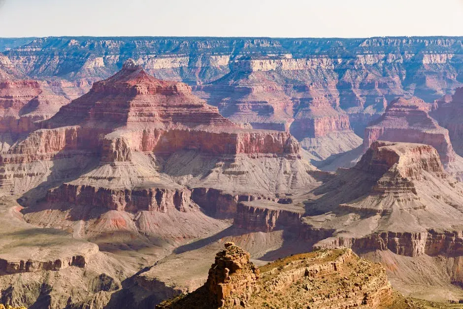
When you stand at the edge of the Grand Canyon, you’re not just looking into a deep gorge; you’re looking into a broken timeline. Layer after layer of rock tells a clear story, then suddenly, millions of years just vanish from the record in what geologists call the “Great Unconformity.” You can literally put your hand on a surface where vastly older rocks lie directly beneath much younger ones, as if entire chapters of Earth’s history were ripped out and thrown away.
Scientists still argue about what erased that missing time. Some point to ancient mountain-building and erosion that scraped huge volumes of rock off the continent, while others tie it to massive glaciations that may have covered the planet in ice. For you, that means every viewpoint, every cliff, is also a crime scene where the evidence was partly destroyed. The canyon is still breathtaking, but once you know about the missing rock record, it also feels a little unsettling – like you’re reading a book with half the pages gone and no explanation why.
2. Iceland: Where Continents Tear Apart in Real Time
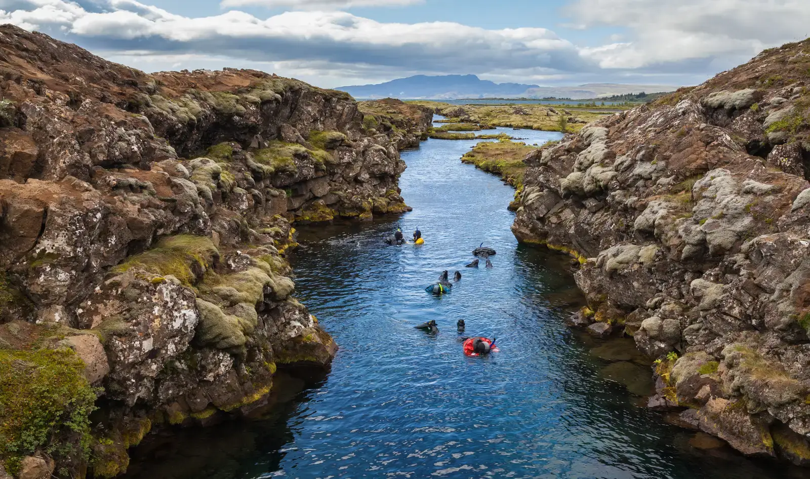
If you ever wanted to see a planet mid-surgery, Iceland is where you go. Here, the Mid-Atlantic Ridge, a gigantic underwater mountain chain splitting the Atlantic Ocean, actually surfaces on land. You can walk between the North American and Eurasian tectonic plates in places like Thingvellir, watching cracks and fissures appear in real time as the crust slowly stretches and thins under your feet.
What makes Iceland so puzzling is not just the rift, but the sheer volume of magma feeding it. You’re not only dealing with a plate boundary; you’re also sitting on top of a powerful hotspot, a deep mantle plume that keeps pouring up heat and molten rock. Why the hotspot is exactly there, how deep it really reaches, and how it interacts with the spreading plates are still active research questions. When you soak in a hot spring or stare at a fresh lava field, you’re watching a complex tug‑of‑war inside the planet that scientists are still trying to decode.
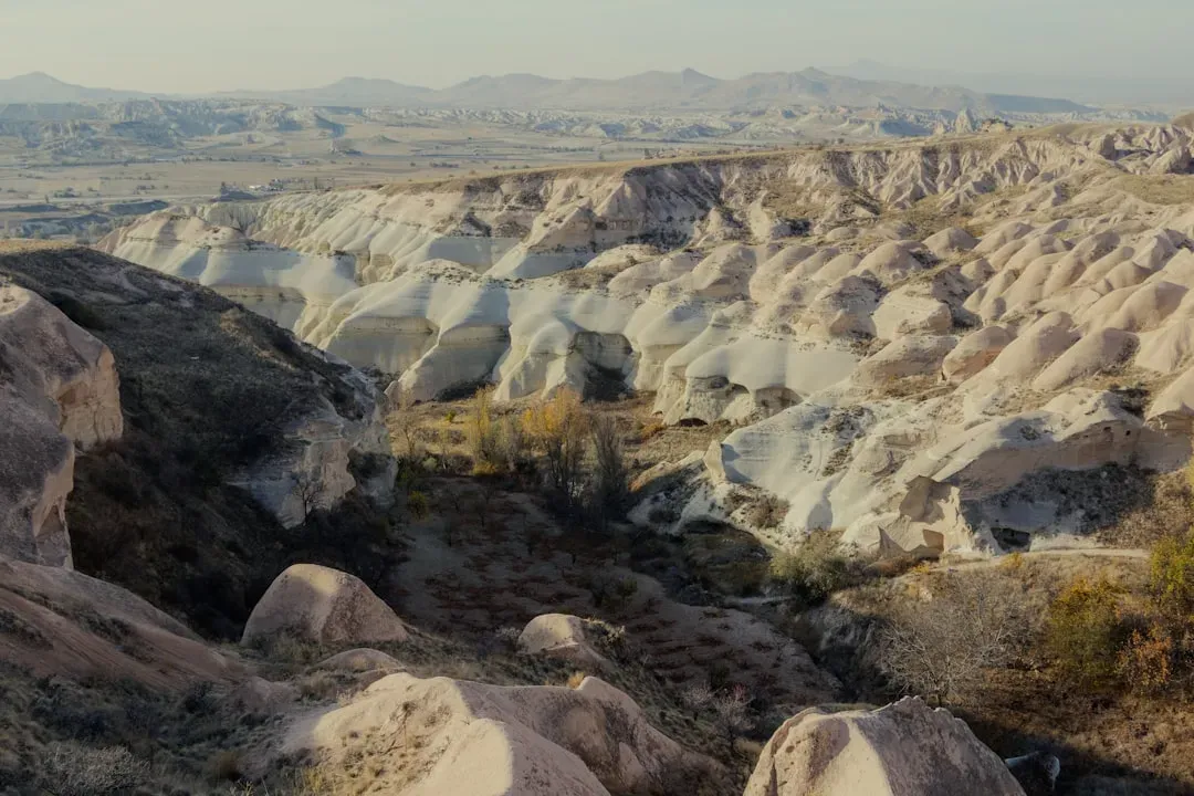
3. The Bermuda Triangle of Rocks: The Ica Stones and Nazca Region
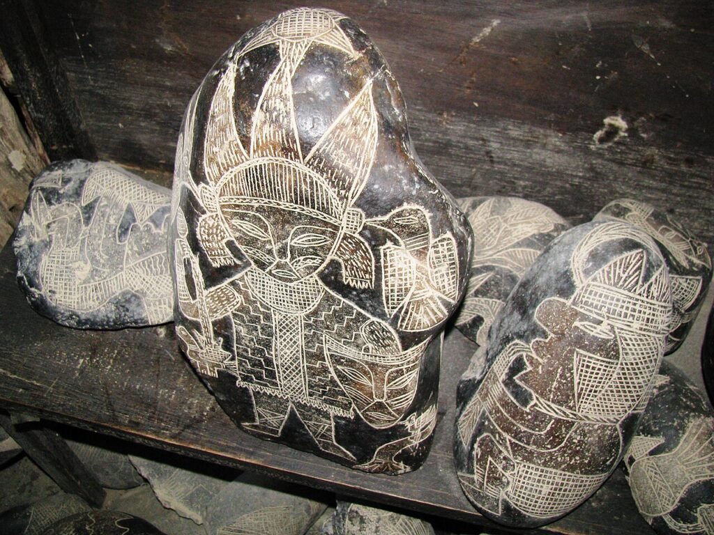
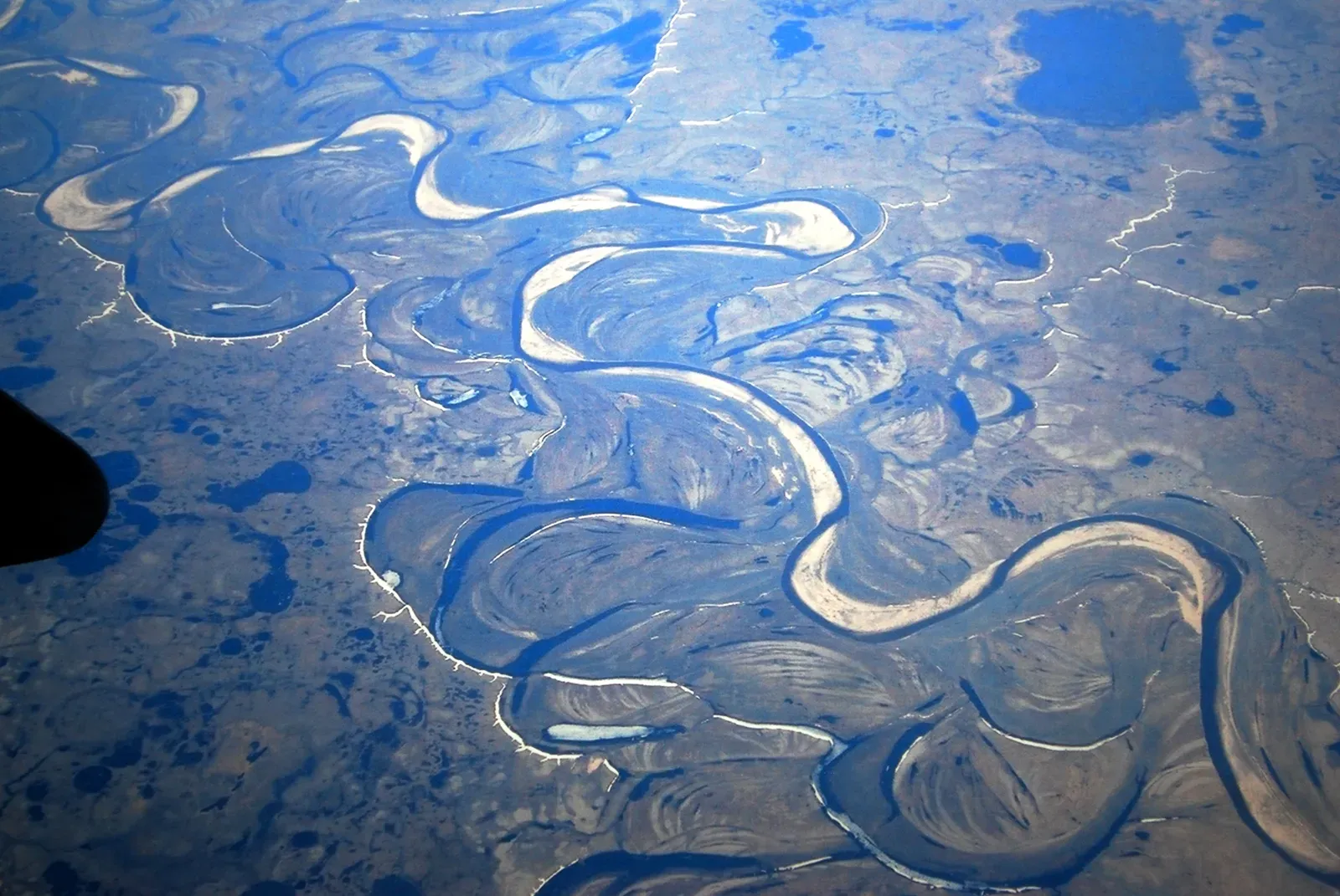
When you visit the Nazca region of Peru, you’re probably expecting the famous desert lines and geoglyphs. But the geology beneath your feet is just as strange. The region sits along an active convergent margin where the oceanic Nazca Plate dives beneath the South American Plate, yet the coastal areas and inland plateaus preserve oddly uplifted marine deposits and highly deformed rocks that hint at a complicated, not fully resolved tectonic history. You’re looking at an area where the crust has been squeezed, bent, and lifted in ways that models still struggle to fully match.
What complicates things is how unevenly the tectonic forces seem to play out along the margin. Some segments rise rapidly, others sink, and the timing of uplift, volcanism, and faulting is still being pieced together from scattered clues in the rocks. For you, it means that those dry valleys, steep escarpments, and tilted layers are more than just scenic backdrops – they’re puzzle pieces in a long-running mystery about how plates interact and how quickly entire landscapes can be reshaped without leaving a perfectly clear trail of evidence.
4. Lake Vostok: A Hidden Ocean under Antarctic Ice
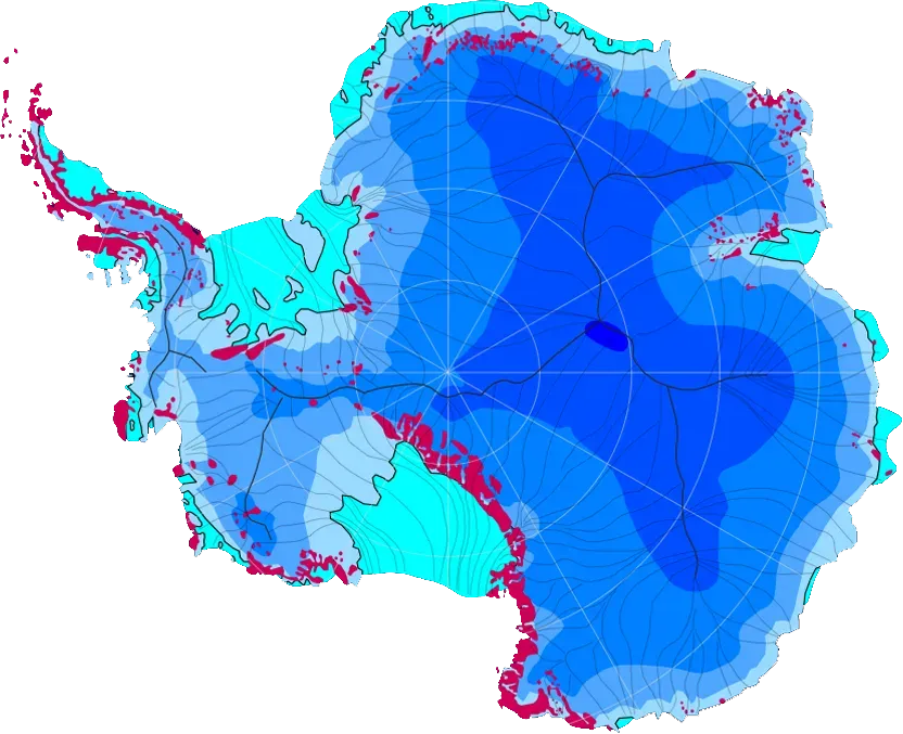
Imagine standing on a seemingly endless, flat sheet of Antarctic ice, knowing there’s a gigantic lake trapped two to four kilometers beneath your boots. That’s Lake Vostok: one of the largest subglacial lakes on Earth, sealed off from the atmosphere for hundreds of thousands, maybe even millions, of years. You can’t see it directly, but ice-penetrating radar and seismic surveys have revealed a body of liquid water the size of a small country, sitting in the dark under crushing pressure.
The mystery for you and for scientists is how this water stays liquid, what kind of chemistry it carries, and whether any strange microbial life has adapted to such extreme isolation. Heat from the Earth’s interior, pressure, and perhaps a thin insulating layer of sediments likely play a role, but the exact balance is still being worked out. Every time researchers drill into the overlying ice and analyze frozen lake water, they’re trying to peer into a hidden world that might echo the conditions on icy moons like Europa – turning this remote, frozen place into a test bed for understanding alien oceans as well as our own.
5. The Ringing Desert: Booming and Singing Dunes
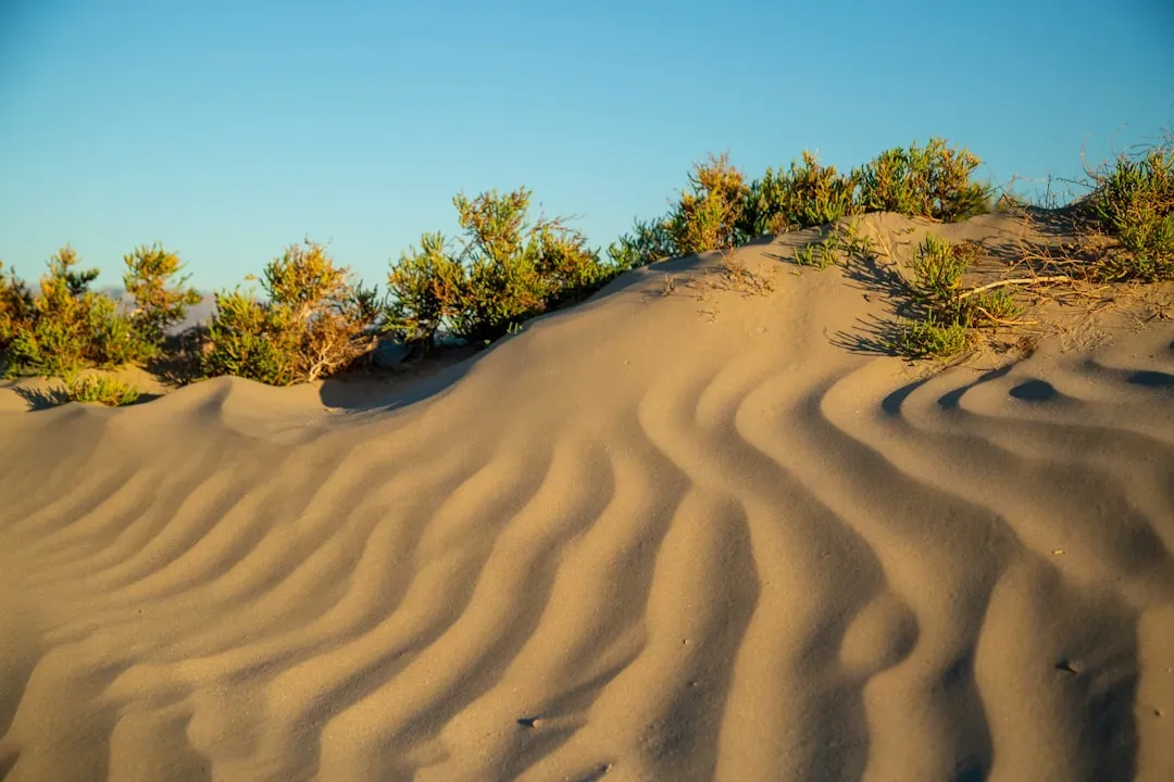
Walk across certain dunes in places like the Sahara, the Gobi, or parts of the United States, and the sand may suddenly “sing” to you. You can hear a deep, humming, almost musical sound when avalanches of sand cascade down a dune’s slip face. It’s eerie: the desert feels silent and empty, yet the ground beneath you behaves like a slow, resonant instrument. You’re not imagining it – this booming can last for several seconds and be heard from surprisingly far away.
Scientists know that the sound comes from many grains of sand vibrating together, but the exact conditions that create the most powerful “voices” are still being pinned down. Grain size, shape, moisture content, and layering in the dune all seem to matter, but there’s no single, simple equation that lets you predict where dunes will sing or how loud they’ll be. When you slide down one of these slopes, you’re taking part in a natural physics experiment, where trillions of tiny impacts somehow organize into one coherent note that turns dry sand into a living, resonant surface.
6. The Devil’s Kettle: A River That Vanishes into Rock
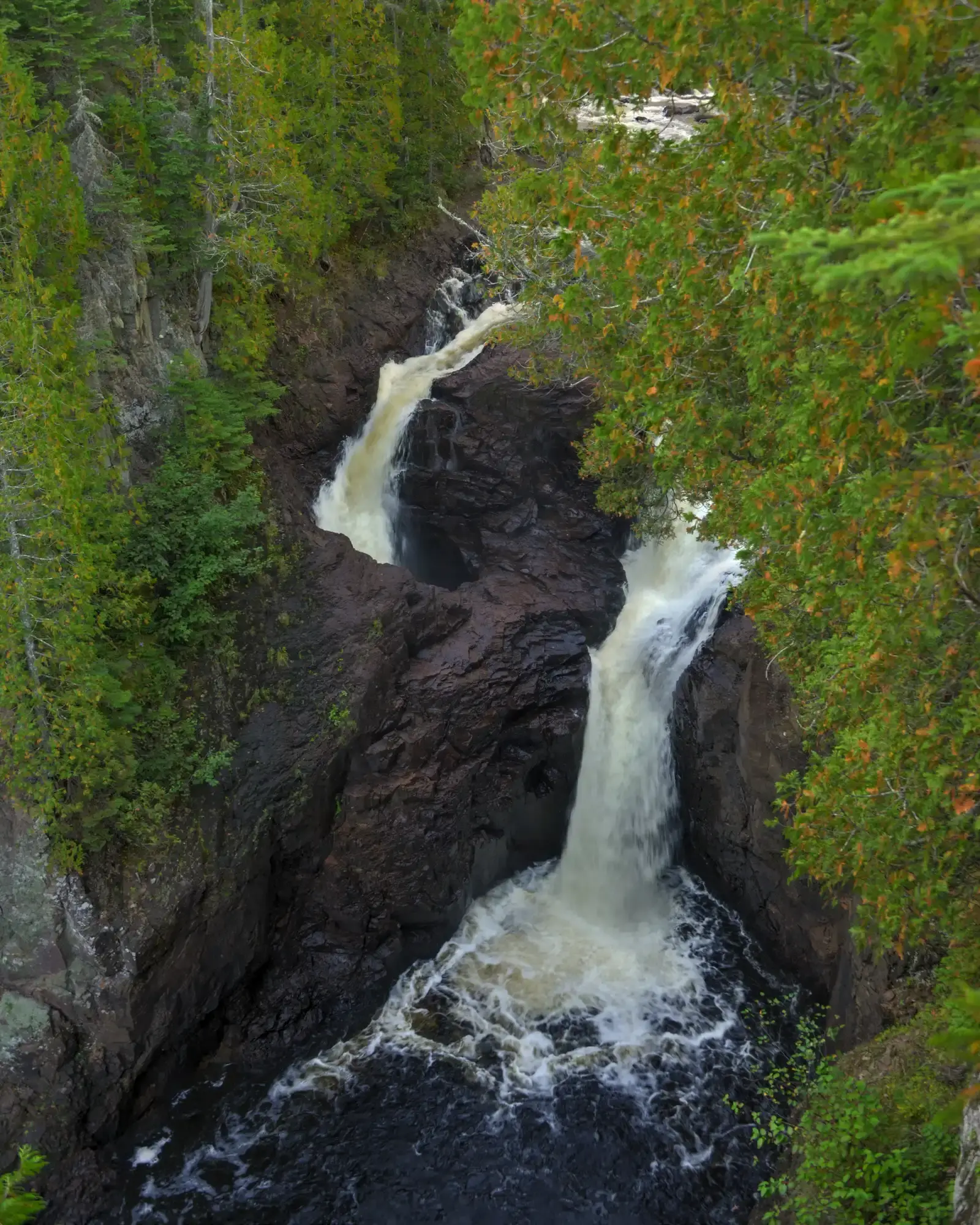
On Minnesota’s North Shore, along the Brule River, you’ll find a waterfall that looks like a magic trick. The river splits into two parts: one side drops normally, the other disappears straight into a deep hole in the rock called the Devil’s Kettle. For years, locals and visitors tossed in dyes, ping‑pong balls, and even GPS-equipped objects, all trying to see where the water went. Nothing obvious ever popped back up, giving the place an almost supernatural reputation.
More recent measurements suggest that the “missing” water likely rejoins the river downstream through underground fractures, even if you never see a dramatic re‑emergence point. But because you can’t easily explore the subterranean pathways, the exact plumbing still feels mysterious. When you stand on the overlook and watch thousands of liters of water pour into a dark hole with no visible outlet, you’re reminded of how little access you really have to the inner structure of bedrock – most of it lies out of sight, and often beyond direct measurement.
7. Siberia’s Exploding Ground: The Yamal Craters
If you ever see photographs of the Yamal Peninsula in northern Siberia, the huge round craters look almost unreal – like someone attacked the tundra with a giant cookie cutter. These deep holes appeared suddenly over the last decade, with local reports of loud booms and debris thrown outward. You’re looking at permafrost landscapes that have literally blown apart, leaving vertical-walled pits that later fill with water and turn into lakes.
The leading explanation is that warming temperatures and changing permafrost conditions allowed methane gas to accumulate and suddenly escape in powerful eruptions. But for you, the important part is how uncertain and new this whole phenomenon is. Scientists are still trying to figure out how widespread these explosive events might become, what exact triggers them, and how they tie into broader climate change. Each new crater is both a warning sign and a research opportunity, reminding you that frozen ground is not as stable or predictable as it looks on a map.
8. The Moving Stones of Racetrack Playa
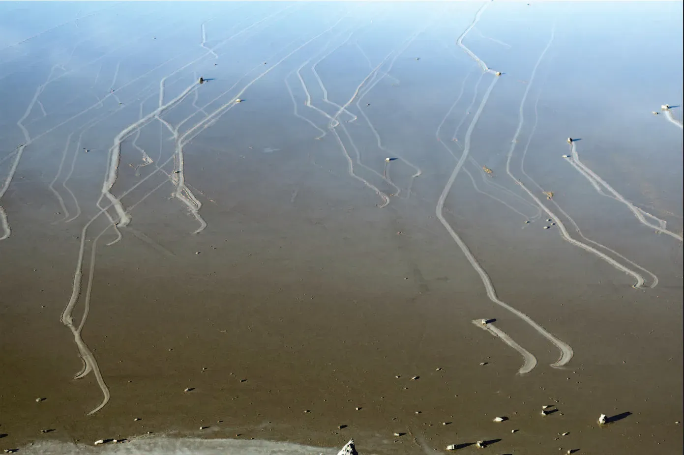
In Death Valley’s Racetrack Playa, you can walk across a flat, cracked lakebed and find stones that seem to have slid across the surface all by themselves, leaving long trails etched in the mud behind them. For decades, you’d read wild theories: magnetism, pranksters, even unknown forces. You see rocks weighing many kilograms sitting at the end of delicate, curving tracks, with no footprints, no tire marks, and no obvious push. It feels like the desert is quietly playing tricks on you.
Careful observations using time-lapse cameras have finally caught these rocks in motion, revealing that a rare combination of thin ice sheets, water, and light winds can slowly shove the stones along. Yet even with a broadly accepted mechanism, you’re still dealing with a phenomenon that depends on very precise, fleeting conditions. You might visit a dozen times and never see it happen. That’s what keeps it so compelling: the trails tell you the rocks moved, the cameras tell you how, but the playa still feels like a stage where the performance only rarely happens in front of an audience.
9. The Eye of the Sahara: Richat Structure
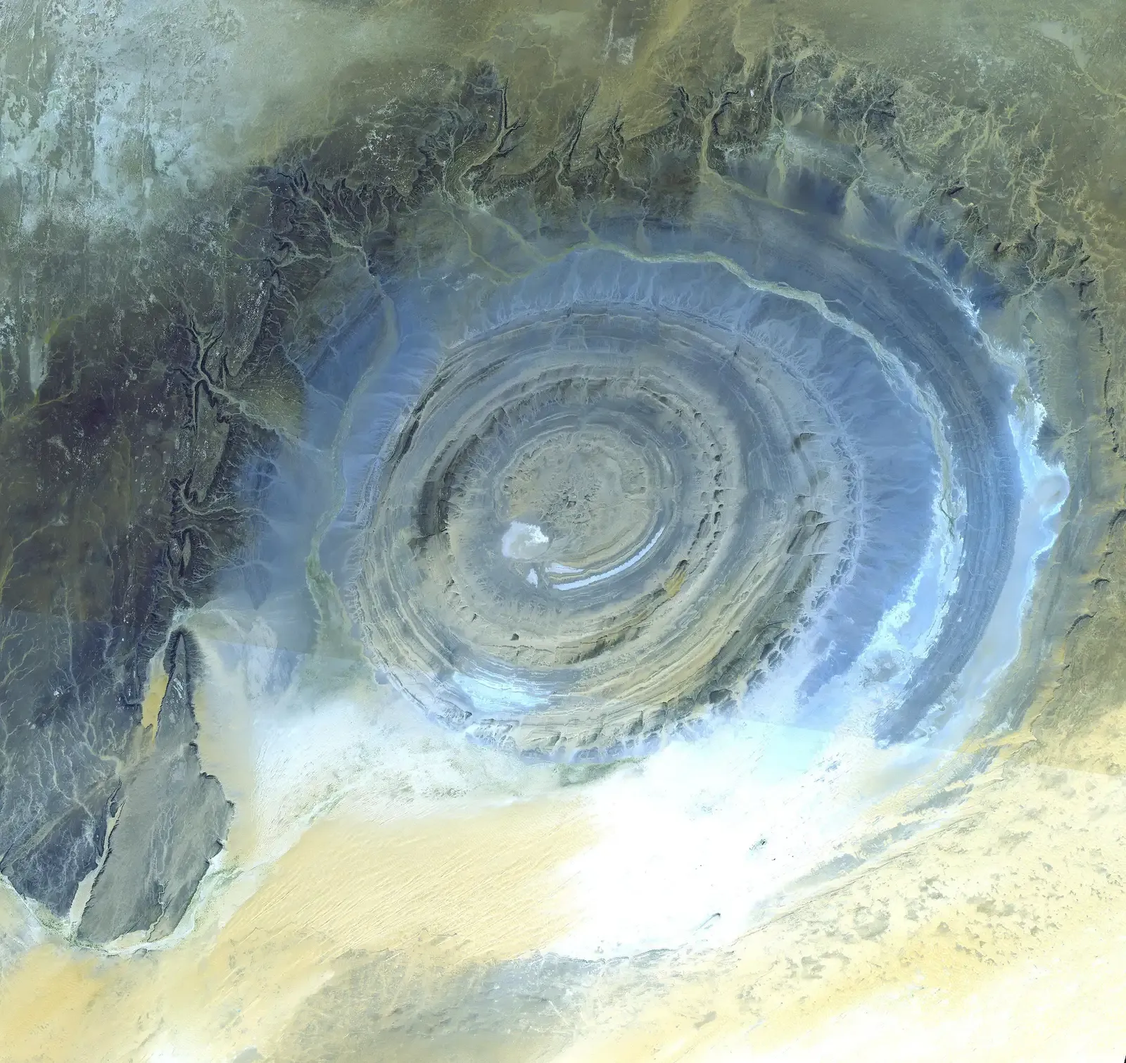
From the ground in Mauritania, the Eye of the Sahara can be hard to grasp. But when you see it from space, it grabs your attention immediately: concentric rings of rock, roughly circular, standing out sharply against the desert. At first glance, you might assume it’s a gigantic impact crater from some ancient asteroid. Early researchers thought so too. Yet as scientists examined the rocks more closely, they found no clear evidence of a classic impact structure – no typical shock features, no unequivocal impact melt deposits.
The current thinking leans toward a deeply eroded, uplifted dome of rock, shaped over time by complex processes of intrusion, uplift, and long-term erosion. But even if you accept that broad story, the details remain fuzzy. Why such a strikingly circular form? How exactly did different rock layers respond to the forces that created the dome? When you look at images of the Eye, you’re seeing geology at a scale that’s hard for your brain to process – an entire regional puzzle carved into rings, still daring you to reconstruct the full sequence of events that made it.
10. The Dead Sea: A Sinking, Splitting Landscape
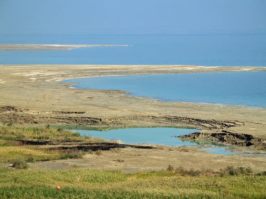
If you float in the Dead Sea, you feel the extreme salinity immediately, but the real strangeness lies in the ground beneath and around it. This basin, at one of the lowest points on Earth’s surface, sits in a complex tectonic rift – part of a fault system that’s slowly tearing the region apart. Over time, the Dead Sea has been shrinking dramatically, exposing salt-crusted shores and, more alarmingly, triggering thousands of sinkholes that can swallow roads, orchards, and buildings without warning.
For you, the mystery is twofold: how the tectonic forces and the dissolving underground salt layers interact, and how quickly this landscape might transform in the coming decades. Scientists can map faults, measure subsidence, and monitor changing shorelines, but predicting exactly where the next collapse will happen is still very hard. When you walk near the shore, you’re stepping on ground that is, in a literal sense, dissolving and shifting under the combined pressure of plate motion, water extraction, and natural evaporation – a reminder that even on land, you’re never standing on something truly permanent.
Conclusion: Living on a Restless Planet You Don’t Fully Understand
When you look at these ten geological wonders side by side, a pattern emerges that’s hard to ignore: the Earth is far stranger and less predictable than you’re often led to believe. You live on a planet that hides ancient missing chapters in canyon walls, sings with dunes, explodes its own frozen ground, and quietly moves rocks across deserts when you are not looking. Even in an age of high-resolution satellites and deep drilling, some of the most basic questions – where water goes, how gas escapes, why rock forms perfect circles – still keep experts awake at night.
If anything, these mysteries should change how you see that “boring” hill outside town or the cracked mud at the edge of a local lake. Every landscape around you is the end result of forces that are still not perfectly understood, playing out over timescales your life barely samples. The next time you stand on a cliff, glance into a sinkhole, or stroll across a beach, ask yourself: what story is this place hiding, and how much of it will you – or anyone – ever truly know?