Storm Delivers Widespread Snow and Ice (Image Credits: Wtop.com)
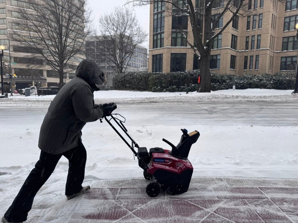
Washington D.C. region – Rock-hard snowdrifts and biting winds confronted residents on Monday as the area reckoned with the lingering effects of a powerful winter storm that struck over the weekend.[1]
Storm Delivers Widespread Snow and Ice
Falling snow measured between five inches and nearly a foot across the District, Maryland, and Virginia, according to meteorologists. A thin glaze of ice coated surfaces farther south and east of the capital, complicating cleanup efforts. Piles of frozen precipitation turned driveways and sidewalks into formidable obstacles.[1]
Officials noted that the combination of heavy snow and subfreezing temperatures had refrozen meltwater into solid barriers. Vehicles buried under layers of ice required extended effort to free, with one reporter describing a 30-minute ordeal to chip away three inches from a windshield alone.[1]
Wind Chills Plunge to Dangerous Levels
Monday highs climbed only into the mid- to upper 20s under partly cloudy skies, but gusty winds drove wind chills lower throughout the day. Overnight into Tuesday, those values dipped below zero, prompting National Weather Service alerts for dangerously cold conditions.[1]
The frigid air mass showed no signs of relenting soon. Forecasts called for lows in the teens Tuesday night, with daytime highs hovering in the low to mid-20s through midweek. Scattered flurries threatened Wednesday evening, though no significant accumulation appeared likely until the weekend.[1]
- Monday: Blustery mix of clouds and sun, highs mid- to upper 20s.
- Tuesday: Mostly sunny, highs low to mid-20s.
- Wednesday: Partly cloudy, highs mid-20s, possible flurries.
Travel Disruptions Hamper Recovery
Road crews prioritized major arteries, leaving many side streets untouched and slick with refreezing ice. Montgomery County Executive Marc Elrich explained that plowing secondary roads would prove challenging due to the icy buildup. Major routes like Wisconsin Avenue offered clearer paths, but getting onto them remained the biggest hurdle for drivers.[1]
Schools across the region shuttered Monday, with some districts like Montgomery County Public Schools canceling Tuesday classes as well. Federal employees shifted to maximum telework, while others received weather and safety leave. Amtrak trains faced delays in the Northeast Corridor from a communications issue near the capital.[1]
Officials Urge Vigilance Against Cold Hazards
Power providers Pepco and Dominion Energy warned of potential outages from ice-laden lines, though none had materialized yet. Virginia reported rising emergency room visits linked to hypothermia, cold exposure, and carbon monoxide poisoning. Authorities recommended layering clothing, limiting outdoor time, and keeping pets inside.[1]
Snow and ice persistence could extend up to 10 days, meteorologist Mark Peña noted, as repeated Arctic surges maintained the deep freeze. Residents prepared for a prolonged battle against the elements, with shoveling advised only after proper warm-ups to avoid strain in the cold.[1][2]
Key Takeaways
- Snow totals reached up to 12 inches; ice refreezes pose slip risks.
- Wind chills below zero through Tuesday demand layered protection.
- Side streets lag in plowing; major roads improving but cautious driving essential.
As the DC region endures this wintry siege, preparation and patience will define the recovery. What challenges are you facing from the cold and snow? Share in the comments below.