Every so often, the solid ground beneath our feet behaves in ways that seem to break the rules, carving shapes so improbable they look more like special effects than geology. Some of these landscapes can be explained in broad strokes, yet the fine details still leave scientists arguing on field trips and in journals. This article dives into ten of the strangest formations on Earth where erosion, chemistry, climate, and time have conspired to produce structures that feel almost deliberate. In each case, the basic physics is known, but the exact sequence of events and why that spot, that shape, and that moment in history came together the way they did is still under active study. If you like your science with a side of mystery, these are the rocks that will not sit quietly.
The Giant’s Causeway: Hexagons That Look Almost Engineered
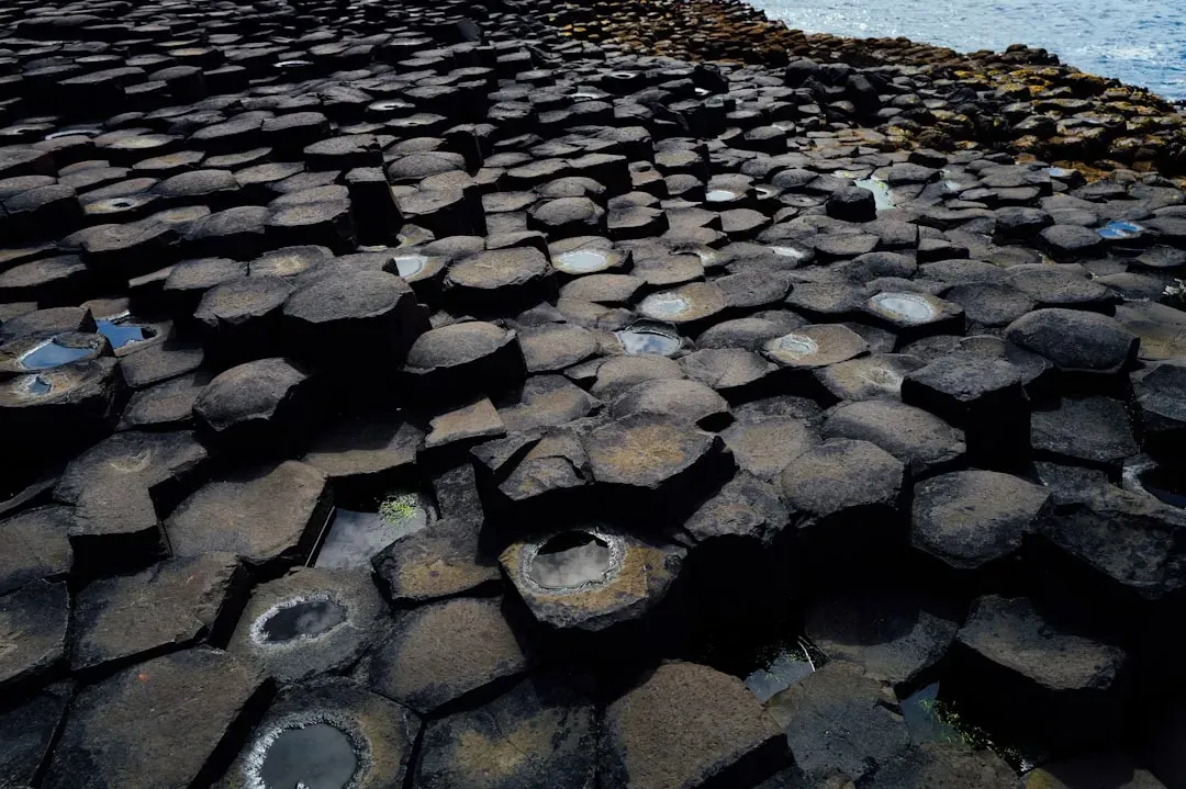
Stand on the Giant’s Causeway in Northern Ireland and it is hard not to feel as if some ancient engineer laid out a basalt floor tile by tile. Roughly about four fifths of the columns are near-perfect hexagons, with others forming four-, five-, seven-, or eight-sided polygons that fit together like a cooling metal grid. Geologists broadly agree that the Causeway formed about fifty to sixty million years ago as thick basalt lava cooled and contracted, cracking into columns in much the same way drying mud forms polygonal patterns. What is still debated in fine detail are the cooling rates, lava thicknesses, and stress fields that produced such remarkably regular columns over such a large area, while other volcanic fields nearby look far more chaotic.
Field and modeling studies suggest that factors such as a steady cooling front, consistent lava composition, and groundwater circulation all helped stabilize the crack network, nudging it toward evenly spaced hexagons. But the transition from random fractures to orderly tessellation is exceptionally sensitive to small changes, which keeps the Giant’s Causeway on the frontier between physics experiment and natural wonder. That uneasy balance between “we know the process” and “we cannot yet reproduce this exact pattern in full detail” is what makes this coastal pavement feel almost supernatural to visitors and scientists alike.
China’s Danxia Landforms: Paint-Striped Cliffs With Hidden Histories
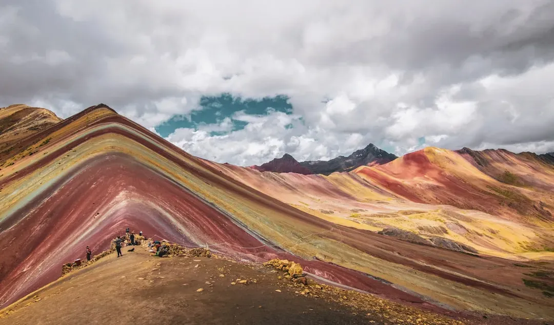
The Danxia landforms in Gansu and several other provinces in China look like someone has poured out a box of crayons across an entire mountain range. Layer upon layer of red, orange, yellow, and white sandstones and siltstones have been tilted, exposed, and then carved into steep ridges and gullies, creating the so-called rainbow mountains. The colors themselves come from shifting mineral content over tens of millions of years, especially iron oxides that stain some layers deep red and others pale cream. What still intrigues researchers is how tectonic uplift, climate, and erosion combined to isolate such vivid sequences while neighboring regions with similar rocks never developed quite the same psychedelic palette at the surface.
Recent work has focused on the interplay between episodic monsoon rains, long dry intervals, and wind-driven erosion that peels back layers with surgical precision. The result is a three-dimensional cross-section of Earth’s past climates and river systems, painted across entire hillsides in bands you can trace for kilometers. It is a geological record that reads almost like an abstract mural, and although the basic story of deposition and uplift is understood, the razor-sharp color boundaries and the persistence of narrow ridges still defy simple textbook explanations.
Socotra’s Dragon’s Blood “Forest” Growing From Bare Rock
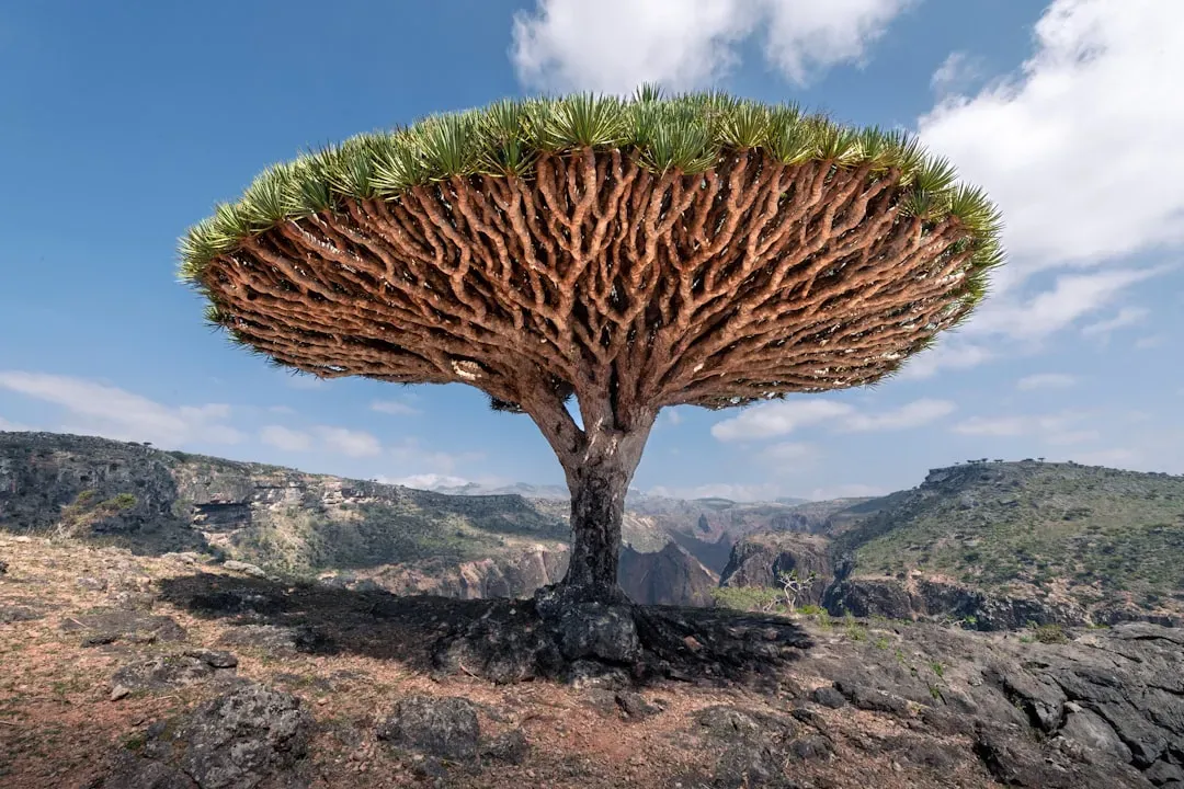
On the Yemeni island of Socotra, some of the strangest rock formations are not just bare stone, but stone working in partnership with trees that seem allergic to normal biology. The island’s dragon’s blood trees grow on thin soils capping severely eroded limestone plateaus and cliffs, their umbrella canopies casting starburst shadows over rock that looks more like bone than earth. Over geological time, dissolution of the carbonate bedrock has created rugged pavements, sinkholes, and knife-edge ridges, punctuated by perched pockets of sediment just deep enough for these trees to anchor. The result is a rock-and-root system where the vegetation reinforces the erosion-resistant plateaus, while bare slopes continue to collapse away around them.
Ecologists and geomorphologists studying Socotra still argue about which came first as a stabilizing force: the unique climate regime or the trees’ bizarre architecture that funnels water down their trunks. In practice, the trees, the climate, and the karst terrain form a coupled system that behaves almost like a living geological formation. It is a reminder that in extreme environments, biology is not just a passenger on the landscape but a co-author of rock shapes that would never form in a purely mineral world.
Wulingyuan’s Stone Pillars: Gravity-Defying Forest of Quartzite Spires
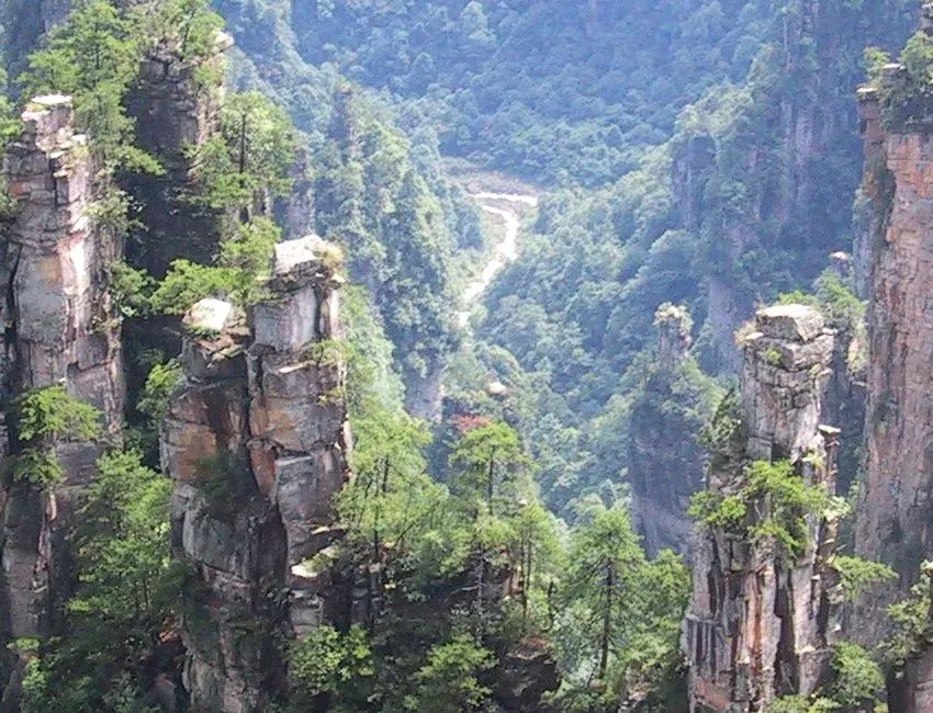
The sandstone and quartzite pillars of Wulingyuan in China’s Hunan province look like floating islands sliced out of a fantasy film, yet they are the outcome of some very real and still not fully quantified processes. These towers rise hundreds of meters above the valley floor, often crowned with lone trees that seem to laugh in the face of gravity. The rocks started as thick sedimentary beds, later uplifted and fractured by tectonic forces, then selectively eroded along joints and weaknesses by water, freeze–thaw cycles, and root growth. What baffles researchers is how so many tall, slender pillars can remain standing while their surrounding material has been stripped away, without collapsing in domino fashion.
Different teams have proposed subtle controls, including variable cementation that hardens some blocks more than others, or stress shadows that protect pillars once they reach a certain height. Fine-scale mapping suggests that even minor variations in quartz content and fracture density may tip the balance between a ridge eroding into a wide slope or necking down into a freestanding tower. Wulingyuan stands as a natural stress test, showing how close rock can come to mechanical failure and still hold, a sort of slow-motion engineering experiment conducted by rain and frost instead of cranes and steel.
Mexico’s Cave of the Crystals: Mega-Gypsum That Should Not Exist So Perfectly
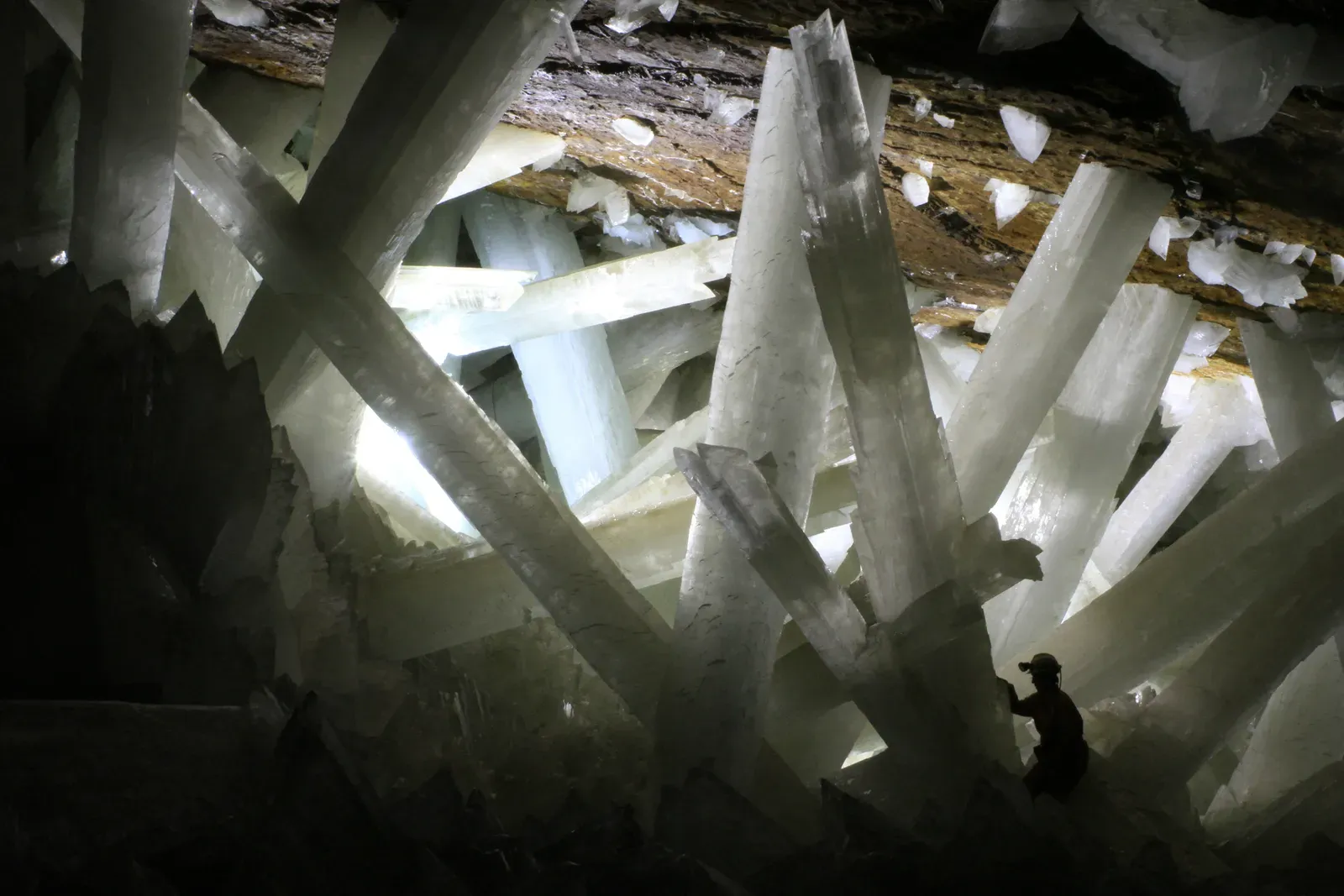
Deep beneath Naica in northern Mexico lies a chamber that once hosted some of the largest crystals ever found on Earth, selenite beams of gypsum stretching up to the length of a city bus, clear enough to read through. The Cave of the Crystals formed in a pocket of limestone above a magma chamber, where hydrothermal waters rich in calcium sulfate sat in a nearly constant temperature window for hundreds of thousands of years. Under those extraordinarily stable conditions, a small number of crystal nuclei grew slowly and steadily instead of splitting their share with countless competitors, eventually forming single crystals on a scale that feels almost impossible. What puzzles scientists is how nature managed to maintain that Goldilocks temperature and chemistry for so long without major disturbances that would cloud or fracture the crystals.
Thermal modeling suggests that very slow cooling of the underlying magmatic system, combined with a nearly sealed hydrogeological setting, created an environment so stable that it borders on laboratory precision. Yet, tiny inclusions and growth defects show that it was never perfectly static, leaving questions about just how narrow the tolerances were and how often conditions nearly failed. In a sense, the Cave of the Crystals is a record of time and stability rather than of violence and upheaval, challenging the popular image of geology as only sudden eruptions and earthquakes.
Racetrack Playa’s Sailing Stones: Rocks That Wander Without a Visible Push
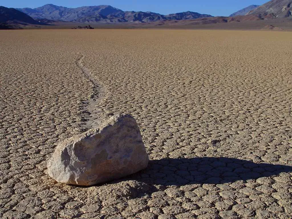
For decades, visitors to Racetrack Playa in California’s Death Valley found heavy rocks sitting on an otherwise flat dry lakebed, each trailing a long, curved track scraped into the mud behind it. The stones appeared to have moved tens of meters across the playa, sometimes weaving and sometimes traveling in parallel, even though no one had seen them in motion. Earlier hypotheses invoked everything from hurricane-force winds to magnetism, and while those ideas were mostly set aside, the exact mechanics remained a desert legend. In the past decade, detailed GPS tracking and time-lapse photography finally captured the stones creeping along under thin sheets of ice floating on a shallow film of water, dragged gently by light winds.
The explanation is satisfying but still features exquisite timing: the playa must hold just enough water, overnight freezing must form ice sheets of the right thickness, the morning sun must weaken that ice but not shatter it completely, and then modest winds must push the mobile slabs, carrying embedded stones. This sequence does not happen often, which helps explain why the tracks seemed to appear almost magically between tourist visits. The phenomenon underscores how even a so-called solved mystery can remain deeply contingent on rare alignments of climate, microtopography, and physics that are hard to generalize beyond this one uncanny lakebed.
Devils Tower and Other Volcanic Plugs: Towers Without Their Volcanoes
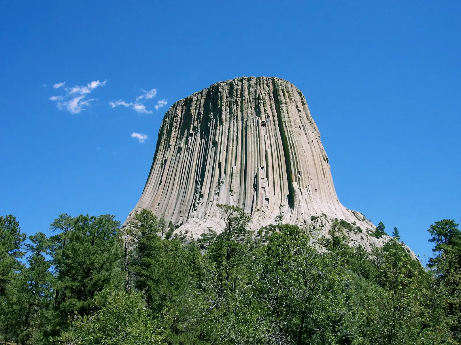
Devils Tower in Wyoming rises abruptly from the surrounding plains, its vertical columns and flat top making it look like someone sliced the peak off a volcano and left the core behind. The leading idea is that the tower represents an igneous intrusion, magma that solidified underground as a plug or laccolith and was later exposed when softer surrounding rocks eroded away. Yet specialists still debate exactly what kind of volcanic feature it once was and how deeply it originally sat beneath the surface, because the expected volcanic cone and associated deposits are conspicuously absent. The nearly symmetrical columnar joints that flank the tower add another layer of complexity, echoing the Giant’s Causeway but in a far more isolated structure.
Several competing models try to reconstruct the vanished volcano, invoking anything from a shallow intrusion feeding a small eruptive edifice to a deeper plug with minimal surface expression. Each scenario carries implications for the region’s tectonic past, magma supply, and erosion rates over the last several tens of millions of years. Standing at the base, you are essentially looking at a partial cross-section of a magmatic system stripped bare by time, but with just enough missing pieces to keep the final blueprint uncertain.
Turkey’s Fairy Chimneys: Soft Tuff, Hard Caps, and a Carved-Out Civilization
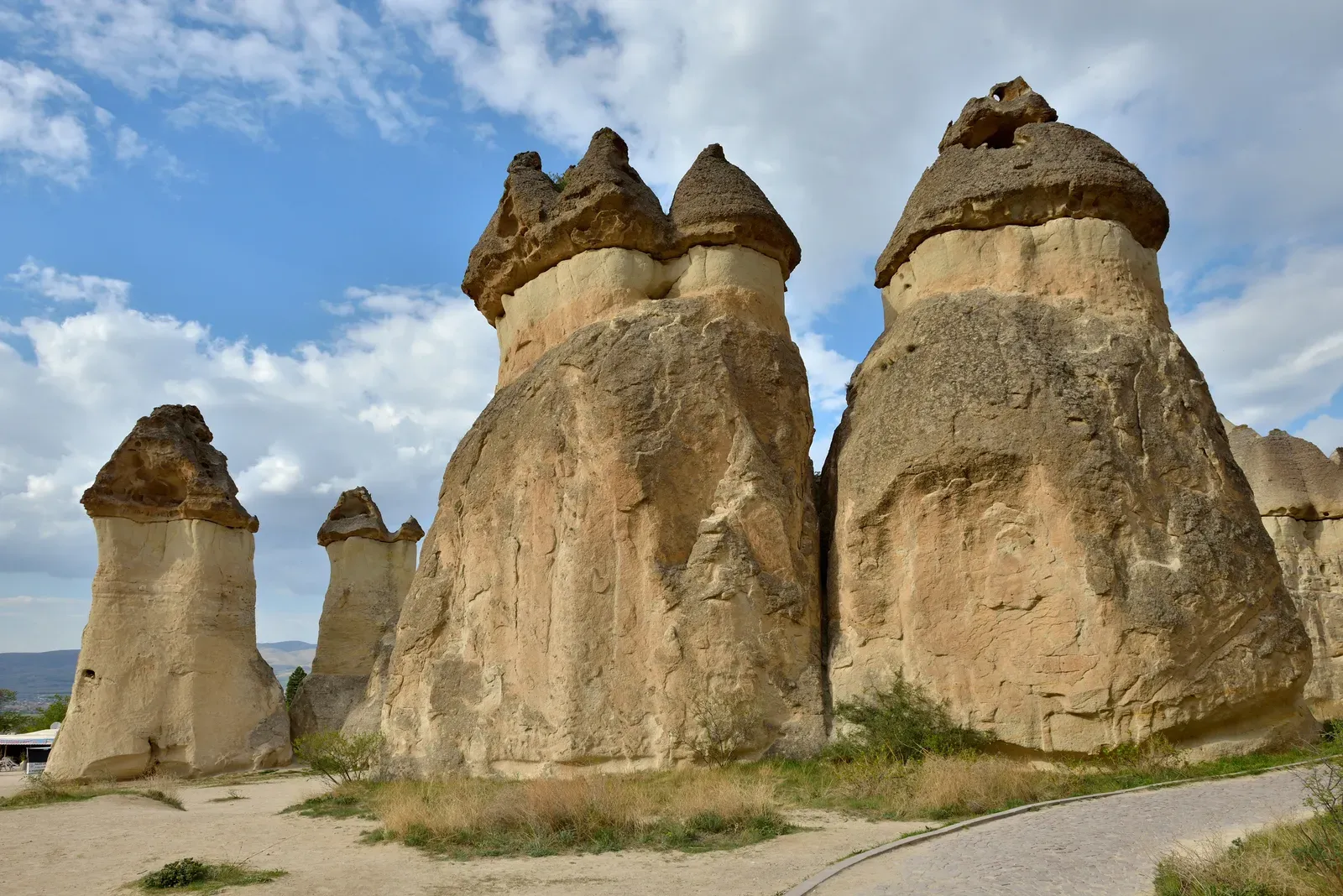
In Cappadocia, central Turkey, hundreds of conical towers sprout from a plateau of volcanic ash deposits, many of them topped by tougher basalt or andesite boulders that act like umbrellas against rain. These fairy chimneys formed as layers of soft tuff were deposited by explosive eruptions, then slowly eaten away by wind and water, leaving behind pillars protected by resistant caprocks. What makes Cappadocia special is not only the density of these formations but the way humans have burrowed into them over thousands of years, carving homes, churches, and entire underground refuges into rock that continues to erode. That human–geology collaboration has changed the erosion patterns themselves, sometimes stabilizing towers and sometimes accelerating their decay.
Geomorphologists note that minor differences in grain size, welding of ash layers, and the distribution of caprocks create drastically different tower lifespans even within a single valley. Add to that centuries of carving and reinforcing, and Cappadocia becomes a living experiment in how cultural history can become part of a geological process. The fairy chimneys blur the line between natural landform and built environment, offering a rare chance to study erosion in a landscape that remembers both volcanic violence and the quieter force of human chisels.
The Richat Structure: A Giant Bull’s-Eye in the Sahara
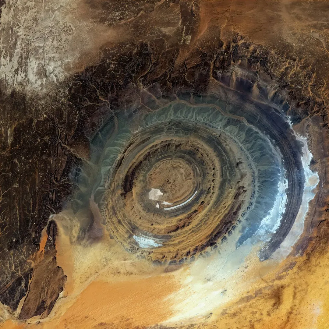
Viewed from the ground, the Richat Structure in Mauritania is a ring of eroded hills and valleys in the middle of the Sahara Desert. Seen from space, it becomes something stranger: a near-perfect bull’s-eye roughly forty kilometers across, a target-shaped pattern etched into otherwise flat desert. Early on, many suspected a massive impact crater, but field studies revealed a lack of shocked minerals and other telltale signs of an asteroid strike. Instead, the structure appears to be a deeply eroded dome of sedimentary and volcanic rocks that once bulged upward, possibly due to a magmatic intrusion or other uplift mechanism, then wore down to reveal its nested rings.
The sticking point is that we still do not agree completely on what initially raised the dome, or why this location and this symmetry emerged. Some research favors a combination of igneous activity and tectonic sagging, while others emphasize long-term chemical weathering and groundwater circulation that exploited concentric weaknesses. Regardless of the driving process, Richat has become a natural laboratory for understanding large-scale crustal uplift and erosion in arid settings, as well as a potent reminder that not every circular scar on Earth is the mark of an impact from space.
What These Formations Reveal About How We Read the Planet
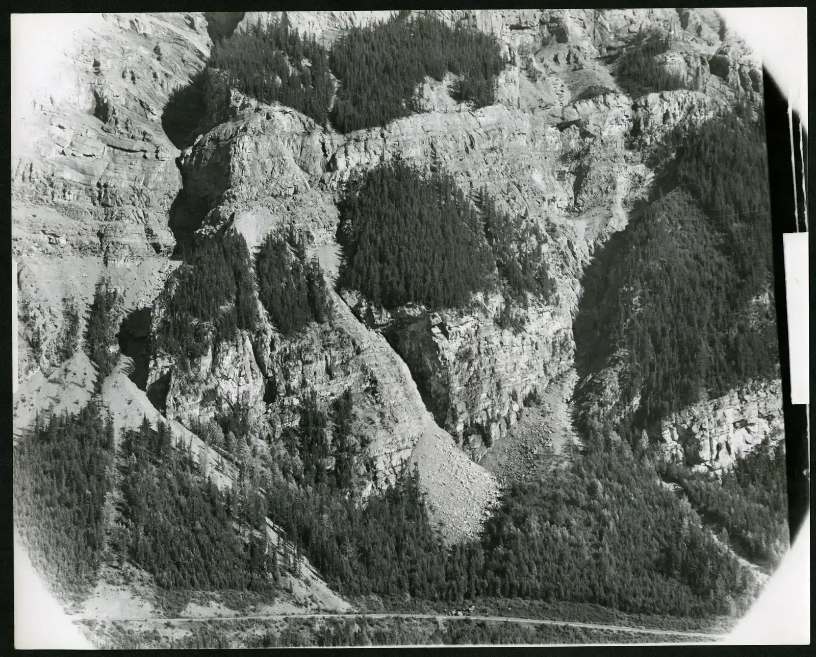
Look across these ten sites and a pattern emerges that is less about any single rock and more about how we do geology. In each case, scientists can outline the key physical ingredients – lava cooling, sediment piling up, water dissolving rock, ice pushing stones – but the exact choreography that produced today’s shapes still contains genuine open questions. Earlier generations of researchers often leaned on simple, one-cause explanations, such as invoking a single flood or eruption, whereas modern work tends to emphasize slow, overlapping processes, feedback loops, and rare coincidences. This shift mirrors broader changes in Earth science, away from viewing landscapes as straightforward results of one dominant force and toward seeing them as emergent patterns from a tangle of interacting systems.
What keeps these formations on the scientific radar is not that they defy physics, but that they expose the limits of our current models when pushed to extremes. They force geologists to test computer simulations against real, messy terrain and to confront the fact that very small differences in rock chemistry, climate timing, or fracture patterns can produce entirely different worlds. In that sense, these places are not just photogenic oddities but precision tools for probing how the planet behaves when all the dials are turned to their edge settings.
Where the Mysteries Go Next
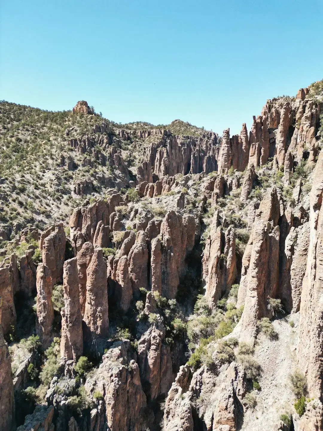
As satellite imagery, drone surveys, and high-resolution dating techniques improve, researchers are revisiting many of these strange formations with fresh eyes and sharper tools. Drones can now skim along the sides of pillars in Wulingyuan or Devils Tower, capturing fracture networks and weathering patterns too dangerous to map by hand. Isotopic analyses of minerals in places like the Giant’s Causeway or the Cave of the Crystals let scientists reconstruct past temperature histories with surprising detail, tightening the constraints on how conditions changed through time. Even time-lapse cameras and cheap sensors on Racetrack Playa have transformed a campfire story into a well-documented case study in intermittent processes.
Still, there is a ceiling to what remote data alone can do, especially in conflict zones, politically sensitive regions, or fragile ecosystems like Socotra. Many of the remaining questions are less about raw measurements and more about how to stitch them into coherent narratives that do justice to the complexity on the ground. The future of understanding these formations likely lies in interdisciplinary teams that blend geomorphology, geochemistry, ecology, and even archaeology, acknowledging that the strangest landscapes often sit at the crossroads of multiple sciences rather than neatly inside one field.
Staying Curious in a World of Unfinished Rock Stories
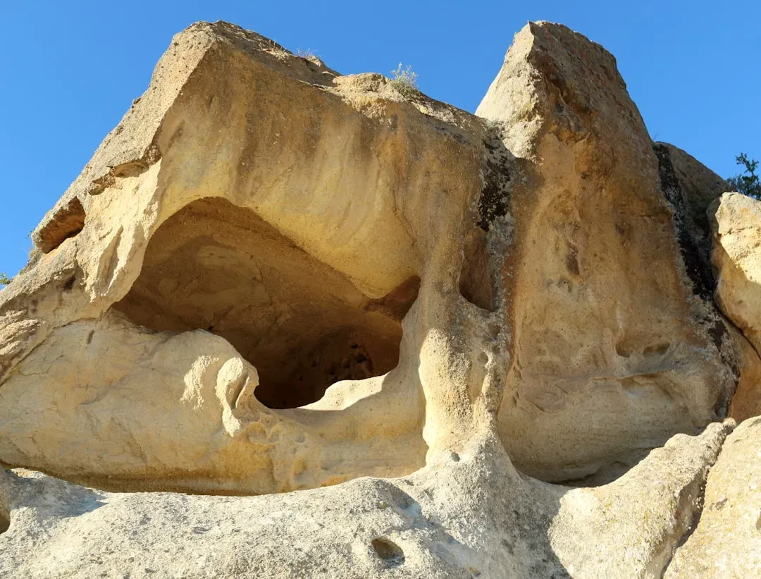
These formations are a reminder that the planet’s story is not a solved puzzle laid out in a textbook, but an ongoing investigation written in stone, ice, and dust. You do not have to be a professional geologist to participate; paying attention on hikes, reading local geological guides, or supporting parks and conservation efforts all help preserve these laboratories in the wild. Simple acts, like staying on marked trails at fragile sites or resisting the urge to pocket a souvenir rock, matter more than they might seem in places where each eroded edge carries clues. Sharing good science – whether through a photo with an accurate caption or a conversation that goes beyond myths – also nudges public understanding away from legends and toward the far more interesting reality.
In a world crowded with digital distractions, pausing to wonder how a stone pillar stands, why a desert bull’s-eye formed, or what made a crystal grow the length of a room can reset your sense of time and scale. Those questions do not just decorate a trip; they connect you, however briefly, to the deep mechanics of a restless planet. The next time you see a strange rock, will you walk past it, or stop and ask what improbable chain of events brought it to your feet?
Suhail Ahmed is a passionate digital professional and nature enthusiast with over 8 years of experience in content strategy, SEO, web development, and digital operations. Alongside his freelance journey, Suhail actively contributes to nature and wildlife platforms like Discover Wildlife, where he channels his curiosity for the planet into engaging, educational storytelling.
With a strong background in managing digital ecosystems — from ecommerce stores and WordPress websites to social media and automation — Suhail merges technical precision with creative insight. His content reflects a rare balance: SEO-friendly yet deeply human, data-informed yet emotionally resonant.
Driven by a love for discovery and storytelling, Suhail believes in using digital platforms to amplify causes that matter — especially those protecting Earth’s biodiversity and inspiring sustainable living. Whether he’s managing online projects or crafting wildlife content, his goal remains the same: to inform, inspire, and leave a positive digital footprint.