Some of the world’s most advanced “lost” civilizations are not buried under desert sands or jungle vines, but quietly sleeping beneath the sea. Over the past few decades, sonar sweeps, underwater drones, and patient archaeologists have begun to uncover sprawling stone streets, massive harbor works, and eerily preserved temples in places where only fish were thought to live. These drowned cities are challenging old timelines about when humans mastered engineering, trade, and urban planning. They are also forcing researchers to ask an unsettling question: how many chapters of our technological past vanished under rising seas long before anyone could write them down?
Heracleion and Canopus: Egypt’s Lost Gateways to the Mediterranean
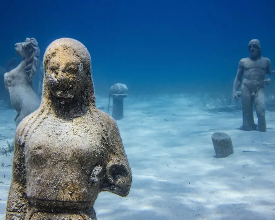
Imagine sailing toward ancient Egypt and never touching the Nile’s actual shoreline, because the real customs offices, shrines, and warehouses floated on a now-vanished delta city. That was Heracleion, a bustling port near the mouth of the Nile that controlled trade before Alexandria stole the spotlight. For centuries, historians knew its name from inscriptions but had no idea where it went, assuming it had been erased by time. In the early twenty‑first century, marine archaeologists finally mapped its remains about six and a half kilometers offshore, covered in sediment and resting roughly ten meters under the waves. Massive temple blocks, colossal statues, and stone docks showed not a minor harbor, but a major religious and commercial hub with sophisticated management of ships, taxes, and religious ceremony.
Nearby lie the ruins of Canopus, another city swallowed by the sea as the delta’s soft sediments compacted and earthquakes and waves took their toll. Together, Heracleion and Canopus reveal that ancient Egyptians were not just farmers of the floodplain but expert coastal engineers, comfortable building on unstable ground and shaping channels for trade. Researchers have recovered navigational instruments, luxury imports, and complex temple foundations that hint at advanced surveying and stone‑moving methods. Rather than a static, isolated culture, these submerged ports show Egypt as deeply plugged into Mediterranean trade and open to technological exchange. here is not a graveyard of superstition, but an archive of high‑stakes logistics and political control.
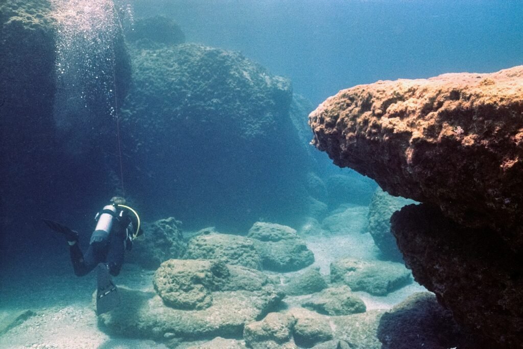
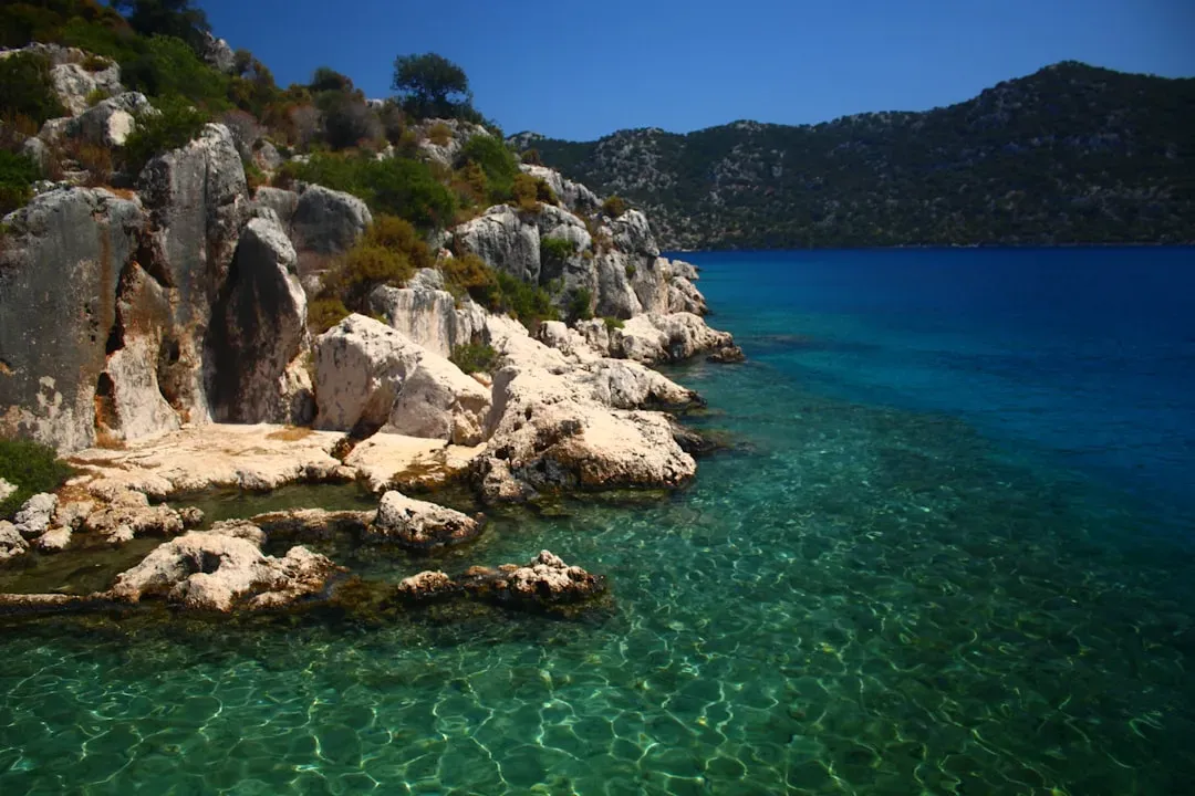
Pavlopetri: A Bronze Age City That Redraws Aegean Maps
Off the coast of Laconia in southern Greece, the city of Pavlopetri lies in shallow water, almost teasingly close to shore, like a ghost suburb crouched just below the waves. First identified in the twentieth century and mapped in far greater detail over the last fifteen years, it features streets, courtyards, quays, and multi‑room houses that date back to the early Bronze Age. What startled archaeologists was how organized and modern the town planning feels, long before classical Athens or grand Mycenaean palaces. There are distinct neighborhoods, open spaces, and waterfront installations that imply regular trade across the Aegean rather than isolated village life. Digital modeling and photogrammetry have turned the seabed into a navigable 3‑D cityscape, letting scientists swim through time without getting wet.
Finds from Pavlopetri include finely made pottery, storage jars, and evidence of textile and dye production, suggesting specialized industries rather than simple subsistence. This pushes back the timeline for complex, networked economies in the region by centuries and hints that maritime know‑how and coastal construction were already highly developed. Like uncovering the foundations of a vanished tech hub, the site shows that innovation did not start with the “big names” of history textbooks. Instead, small but sophisticated ports such as Pavlopetri were testing grounds for architecture, navigation, and trade‑law norms that later civilizations scaled up. , in this case, has frozen an early experiment in urban living that land erosion might otherwise have erased completely.
Baiae and Portus Julius: The Roman Riviera Beneath the Waves
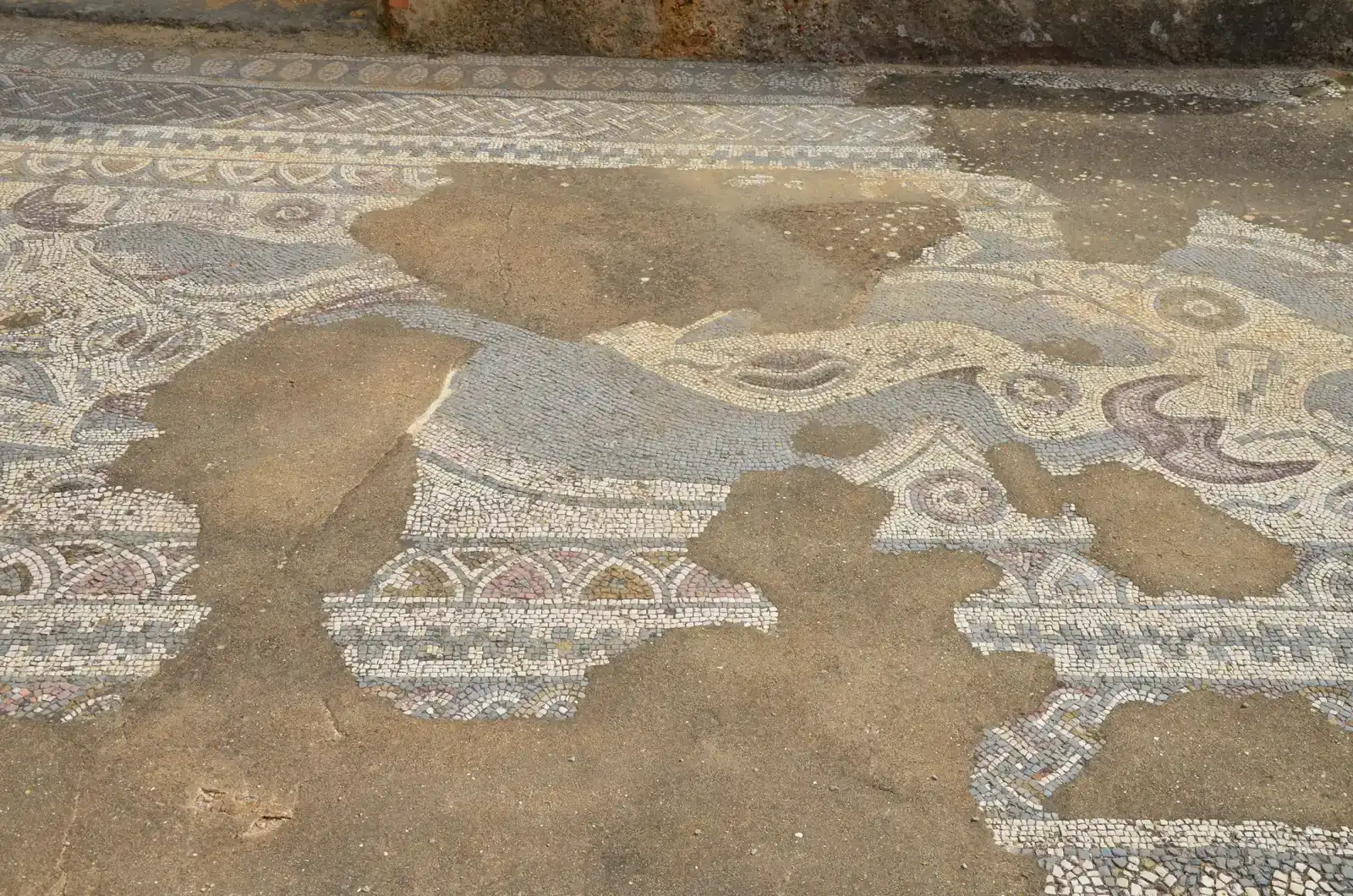
Northwest of Naples, the resort town of Baiae was once where the Roman elite went to party, plot, and quietly show off wealth and influence. Today, much of that luxury landscape lies under several meters of water, the victim of gradual subsidence in the volcanic Campi Flegrei region. Divers glide over mosaic floors, garden courtyards, and bath complexes that look uncannily like flooded Roman villas transplanted from a museum. This is not a mythic lost continent, but a very real lesson in what happens when advanced societies push the limits of coastal living in geologically restless zones. Here, archaeology reads like a social column crossed with an engineering report.
Nearby, the remains of Portus Julius, an ambitious naval base constructed under the statesman Agrippa, show off another side of Roman technology. Massive breakwaters made of hydraulic concrete, artificial harbors, and cleverly designed channels once housed the western fleet. Submerged remnants of these structures prove that Romans understood how to pour long‑lasting concrete underwater, control water flows, and manage large‑scale marine logistics. These skills supported not just military power but trade networks that spanned from Britain to North Africa. Seeing Baiae and Portus Julius underwater confronts us with a paradox: a civilization so technically adept that it could build permanent harbors in active volcanic fields, yet still unable to outrun the slow, relentless sag of the earth beneath its feet.
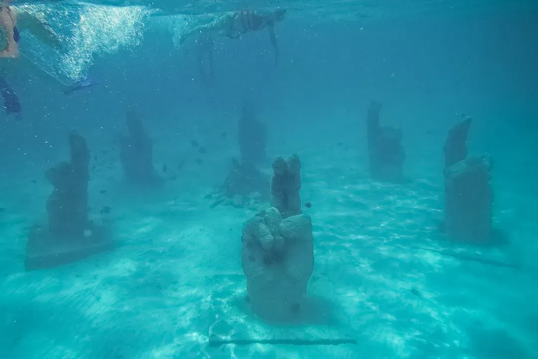
Dwarka: Between Sacred Legend and Continental Shelf Science
Along India’s western coast in the Gulf of Khambhat and near modern Dwarka, underwater surveys have revealed stone blocks, walls, and artifacts that have fueled intense debate. Local traditions long spoke of an ancient, sacred city associated with deities and heroic ages, said to have been reclaimed by the sea. When sonar images and diver reports began hinting at man‑made structures resting on the seabed, it was easy for sensational claims to rush ahead of solid data. Over time, however, more careful work has identified harbor‑like features, anchors, and ceramics that point to historically grounded port settlements interacting with the Arabian Sea trade routes. The real story emerging is less about a single mythical metropolis and more about a chain of coastal centers experimenting with maritime technology.
The Gulf’s powerful tides and murky waters make archaeology here technically demanding, pushing teams to rely on side‑scan sonar, sub‑bottom profilers, and remotely operated vehicles. These tools have revealed patterns of straight alignments and right‑angled structures that rarely occur in natural rock formations. At the same time, scientists have used radiocarbon dating of recovered materials to bracket occupations within more familiar historical phases, rather than rewriting global prehistory overnight. The tension between myth and measurement around Dwarka is actually productive: it raises public interest while forcing researchers to show their methods. Taken together, the work here showcases how underwater archaeology can test cultural memory, upgrade it with data, and still leave room for wonder.
The Hidden Clues: What Submerged Cities Reveal About Ancient Technology
When you line up the evidence from places like Heracleion, Pavlopetri, Baiae, and Dwarka, recurring technical patterns begin to stand out. Many of these cities feature carefully engineered harbors with breakwaters, dredged channels, and quay walls designed to manage waves and silt. The very existence of such infrastructure implies robust knowledge of tides, current patterns, and sediment behavior, even if explained in terms very different from modern physics. Sophisticated stone‑cutting, block transport, and foundation techniques show up again and again, challenging the idea that high‑precision construction suddenly appeared in only a few “golden ages.” In reality, technology looks more like a web, with ideas passing along sea routes and being quietly refined in one drowned port after another.
Across these sites, researchers see evidence of tools and practices that feel surprisingly modern in spirit. Survey markers hint at standardized measurement systems; reused blocks and retrofitted docks suggest adaptive engineering instead of rigid master plans. Even simple artifacts, such as standardized amphora shapes or carved mooring stones, are ancient versions of interface design, making sure ships, warehouses, and customs officials could all “speak” the same logistical language. Roughly about one third of newly identified underwater structures in some regions turn out to be parts of harbor works rather than domestic buildings, underscoring how much effort went into maintaining trade. The hidden clues on the seabed remind us that innovation is often practical, iterative, and driven by the very same needs that shape today’s port cities and coastal megaprojects.
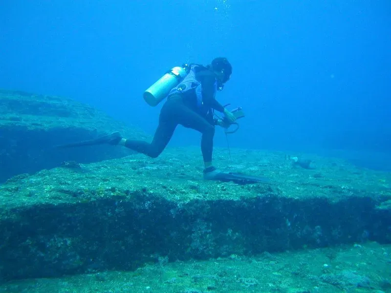
From Ancient Tools to Modern Science: How We Actually Find These Cities
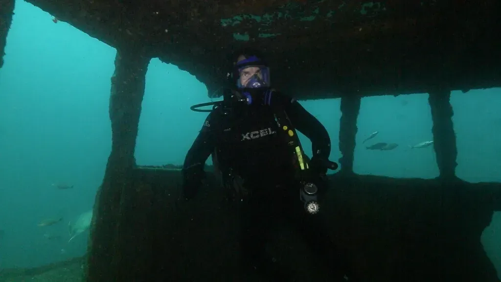
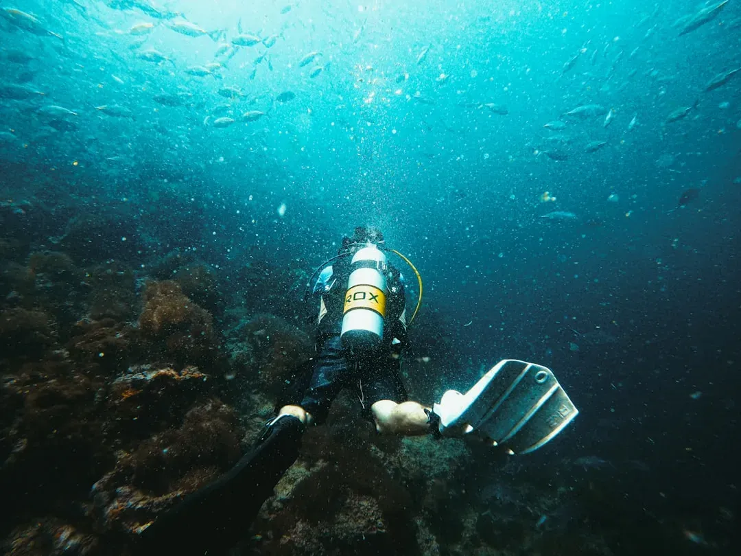
Locating a sunken city is nothing like stumbling onto a lost temple in a pulp adventure story; it is more like doing a slow‑motion CT scan of the seafloor. Marine archaeologists start with old maps, local stories, and geomorphological models that suggest where ancient shorelines once lay. Then come systematic surveys using multibeam sonar to build high‑resolution maps of underwater topography, searching for suspiciously regular shapes. Side‑scan sonar adds texture, highlighting rubble fields, walls, and collapsed quays that look very different from natural ridges or dunes. When potential sites appear, teams send down divers, underwater photographers, and increasingly, autonomous or remotely operated vehicles to verify and document every detail.
Once structures are confirmed, the real work begins: careful excavation, artifact recovery, and endless cataloging under often difficult conditions. Visibility can be poor, currents strong, and dive windows limited, turning each field season into a logistical puzzle. To cope, scientists borrow tools from offshore engineering and oil exploration, such as sub‑bottom profilers that peek beneath seabed sediments and laser scanners that capture millimeter‑scale geometry. Digital reconstructions stitch thousands of images into immersive models that can be shared with researchers and the public alike. What started as simple underwater treasure hunting has evolved into a high‑tech, multidisciplinary science that blends archaeology, oceanography, geology, and computer vision into a single investigative toolkit.
Global Perspectives: Sunken Cities from the Mediterranean to Southeast Asia
Although the most famous drowned cities often cluster around the Mediterranean, the reality is that coastal submergence is a global story written on every continental shelf. In Southeast Asia, for instance, sea levels rose dramatically after the last ice age, flooding low‑lying plains that once linked islands into larger landmasses. Scattered finds of stone tools, possible structures, and ancient shorelines on modern sonar maps hint that entire cultural landscapes may lie hidden between today’s islands. In northern Europe, submerged Mesolithic sites beneath the North Sea and the English Channel document how people responded as coastlines crept inland, sometimes abandoning sites and sometimes adapting with new technologies. Each region adds its own twist, shaped by local geology, storm patterns, and cultural choices.
There is a human pattern running through all of this: we have always loved to live on the edge of land and sea, even when that edge is unstable. Ports, fishery towns, ceremonial centers, and trade crossroads tend to cluster within easy reach of tides and navigable waters. As a result, when sea levels rise or land sinks, it is often the most innovative and connected settlements that disappear first. Underwater archaeology, therefore, is not just about spectacular finds, but about restoring missing pieces of global history that bias on land has erased. By zooming out to these global perspectives, scientists can compare how different societies dealt with coastal risk, resource management, and environmental change long before climate models and satellite maps existed.
Why It Matters: Rethinking Civilizations, Risk, and Our Own Future
Sunken cities matter because they puncture the comforting idea that technological sophistication guarantees long‑term safety. Many of the drowned settlements now under study were among the most advanced of their time, boasting complex trade, political power, and inventive engineering. Yet they still found themselves at the mercy of gradual sea‑level rise, ground subsidence, tsunamis, or slow‑burn erosion that outpaced local defenses. Comparing these past experiences with modern coastal megacities reveals an uncomfortable echo: we too are piling infrastructure and innovation along shorelines facing accelerated change. Underwater archaeology becomes less a curiosity and more a historical mirror held up to our own risk calculations.
These sites also reframe debates about what counts as “advanced” technology. Instead of focusing only on writing systems or monumental pyramids, drowned cities highlight expertise in hydrology, logistics, and environmental sensing that often went unrecorded. In my own reporting, I have seen how divers speak of ancient dock builders with the same respect offshore engineers reserve for modern platform designers. There is a lesson here in humility: our ancestors were not naive amateurs playing at civilization but experienced problem‑solvers with different toolkits. Recognizing that depth of knowledge can change how we evaluate indigenous coastal wisdom today, from mangrove management to traditional storm‑warning practices, and whether we take those lessons seriously when planning for the next century.
The Future Landscape: New Technologies and the Race Against Time
Right now, the technology curve in underwater exploration is bending fast, and sunken cities are among its biggest beneficiaries. Cheaper autonomous drones can survey wider areas of seabed than a team of divers could hope to cover in a season, while improved sonar and machine‑learning algorithms help flag promising anomalies automatically. Satellite‑based bathymetry and coastal modeling narrow the search zones by reconstructing where coastlines stood thousands of years ago. At the same time, high‑resolution 3‑D mapping allows researchers to “virtually excavate” sensitive or fragile sites, minimizing damage while still extracting rich data. The toolkit that once belonged only to military navies or oil companies is gradually being repurposed for science and cultural heritage.
The catch is that environmental change is also accelerating, and it is not on archaeology’s side. Stronger storms, coastal erosion, and ocean acidification threaten to damage or scatter artifacts faster than teams can document them. In some regions, sand mining, trawling, and unregulated development are already chewing through layers of the archaeological record. This creates a race against time in which discoveries may spike for a few decades and then vanish forever beneath disturbed seabeds. The future landscape of research will depend on international cooperation, updated heritage laws that take the underwater realm seriously, and sustained investment in both technology and training. If we choose to act, we may still salvage a surprisingly rich archive of human adaptation before it is washed completely away.
Call to Action: How Readers Can Help Protect the Cities Under the Waves
For most of us, the idea of diving over a Roman villa or sailing above a Bronze Age street grid will remain a dream or a tourism brochure image. But there are concrete ways to support the science and stewardship that keep those dreams grounded in reality rather than fantasy. One simple move is to pay attention to underwater heritage whenever coastal development, harbor expansion, or seabed mining makes the news, and to ask whether archaeological surveys are part of the plan. Public pressure, even at the level of local comments and votes, can nudge decision‑makers to budget time and money for proper assessments. Conservation organizations and research institutes often run crowdfunding campaigns to fund specific surveys or artifact conservation projects, allowing small donations to translate into real work hours underwater.
If you visit coastal regions known for submerged ruins, you can also make choices that reward responsible management rather than quick exploitation. Choosing licensed dive operators who follow heritage guidelines, supporting museums that collaborate with scientific teams, and sharing accurate information rather than viral myths all help create an informed public sphere. Teachers, students, and science communicators can weave underwater archaeology into lessons about climate change, migration, and engineering, making drowned cities part of mainstream conversations rather than fringe curiosities. Ultimately, the more people see these sites as shared archives of human ingenuity instead of treasure chests, the harder it becomes to ignore or destroy them. The question is not just what lies under the waves, but what kind of ancestors we want to be for those who will someday study the ruins of our own coastal cities.

Suhail Ahmed is a passionate digital professional and nature enthusiast with over 8 years of experience in content strategy, SEO, web development, and digital operations. Alongside his freelance journey, Suhail actively contributes to nature and wildlife platforms like Discover Wildlife, where he channels his curiosity for the planet into engaging, educational storytelling.
With a strong background in managing digital ecosystems — from ecommerce stores and WordPress websites to social media and automation — Suhail merges technical precision with creative insight. His content reflects a rare balance: SEO-friendly yet deeply human, data-informed yet emotionally resonant.
Driven by a love for discovery and storytelling, Suhail believes in using digital platforms to amplify causes that matter — especially those protecting Earth’s biodiversity and inspiring sustainable living. Whether he’s managing online projects or crafting wildlife content, his goal remains the same: to inform, inspire, and leave a positive digital footprint.