On the surface, the Florida Keys look like a ribbon of sunlit islands stitched together by a road and a dream. Beneath that postcard, though, the rock is riddled with hidden passageways, caves, and sudden drops that behave like the coast’s quiet lungs. These secret sinkholes and flooded caverns breathe with the tides, trade freshwater for salt, and sometimes exhale cold, mineral-rich plumes that startle fish and divers alike. Scientists are racing to map these voids because they shape everything from reef health to drinking water security, and they may hold a surprising record of past climates. The mystery isn’t whether the ground is hollow – it is – but how those hollows connect, and what their next move means for a fragile archipelago.
The Hidden Clues

What if the flattest water hides the deepest openings? Anglers tell stories of slick patches that appear on glassy mornings, where the surface shimmers oddly and needlefish hover as if over a spring. Divers sometimes cross a line in the seafloor where warm, green water suddenly turns cooler and clear, like stepping from summer to fall in a single kick. Onshore, the rock is dimpled with solution holes that fill after rain, harboring tiny forests of ferns and salt-tolerant herbs. I’ve watched one of those flats breathe – no wind, no current – just a faint boil, as if the ocean were whispering secrets through a straw. Those are the breadcrumbs that point to the underground architecture.
From Ancient Tools to Modern Science
Long before today’s sensors, early islanders learned to read the rock by trial and error, sometimes harnessing natural hollows as rain-fed cisterns and, occasionally, losing a footpath to sudden subsidence after storms. That cautionary, seat-of-the-pants knowledge is now paired with instruments that see through darkness and silt. Researchers scan the seabed with multibeam sonar, drag magnetometers across the flats, and fire sound pulses into the limestone to outline voids like a medical CT of the coast. On land, ground-penetrating radar traces buried fractures, while harmless fluorescent dyes track how water moves through the maze from one sinkhole to another. Chemistry adds another layer: radon, radium, and subtle isotope ratios act like signatures, revealing whether a plume started life as rain in the Keys, seeped from mainland aquifers, or rose from deeper stores beneath the platform. Piece by piece, the patchwork becomes a map.
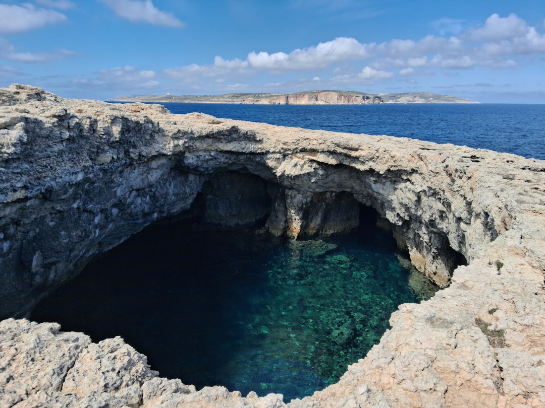
Caves Carved by Time: How the Keys Became Hollow
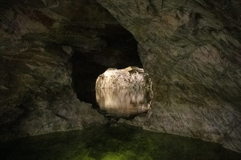
The Keys are not piles of sand so much as fossil reefs and oolite, a limestone made of tiny spheres glued together by time and chemistry. During ice-age low seas, fresh rainwater soaked the exposed rock, dissolved it along fractures, and excavated rooms, corridors, and chimneys. When the ocean later returned, it flooded the vacated space, turning dry caves into submerged tunnels and sinkholes that now lurk under mangroves and patch reefs. This is classic karst – landscapes sculpted where water meets soluble stone – except here the ceiling is a living coast and the floor is the continental platform. Many blue holes still wear their history like jewelry: fossilized stalactites, scalloped walls, and smooth ledges that only form in air. Each chamber is a time capsule that remembers when sea level stood elsewhere.
Fragile Freshwater: Lenses, Leaks, and Salt
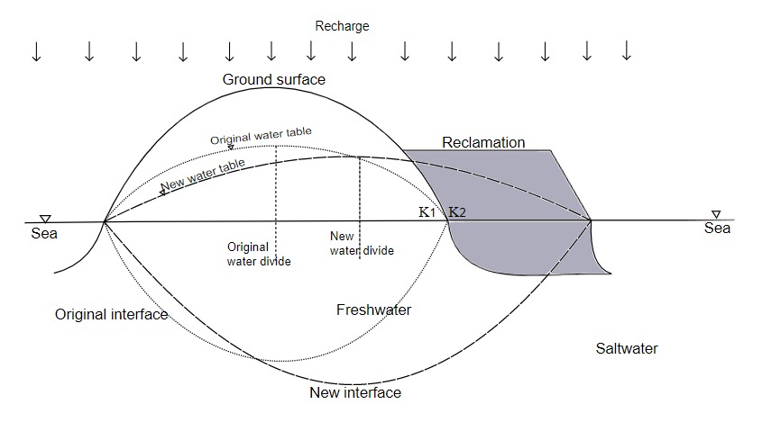
On small islands, freshwater floats above seawater like a lens, thickest at the center and thinnest at the edges, and sinkholes can act as valves in that delicate stack. Heavy use, drought, or storm surge squeezes the lens thinner, encouraging salt to push in and freshwater to escape through karst conduits. The Keys today rely largely on water piped from the mainland, but the islands’ own lenses still support pockets of vegetation and help buffer salinity swings in coastal wetlands. When a sinkhole connects the lens to the sea, it can bleed fresh, cooler water outward – or, during high tides and storms, draw saltier water inward. Either way, the exchange changes chemistry, temperature, and nutrients in ways the surrounding life instantly feels. In a warming world, these micro-reservoirs and their leaks may tip the balance for mangroves, seagrass, and reef-building corals.
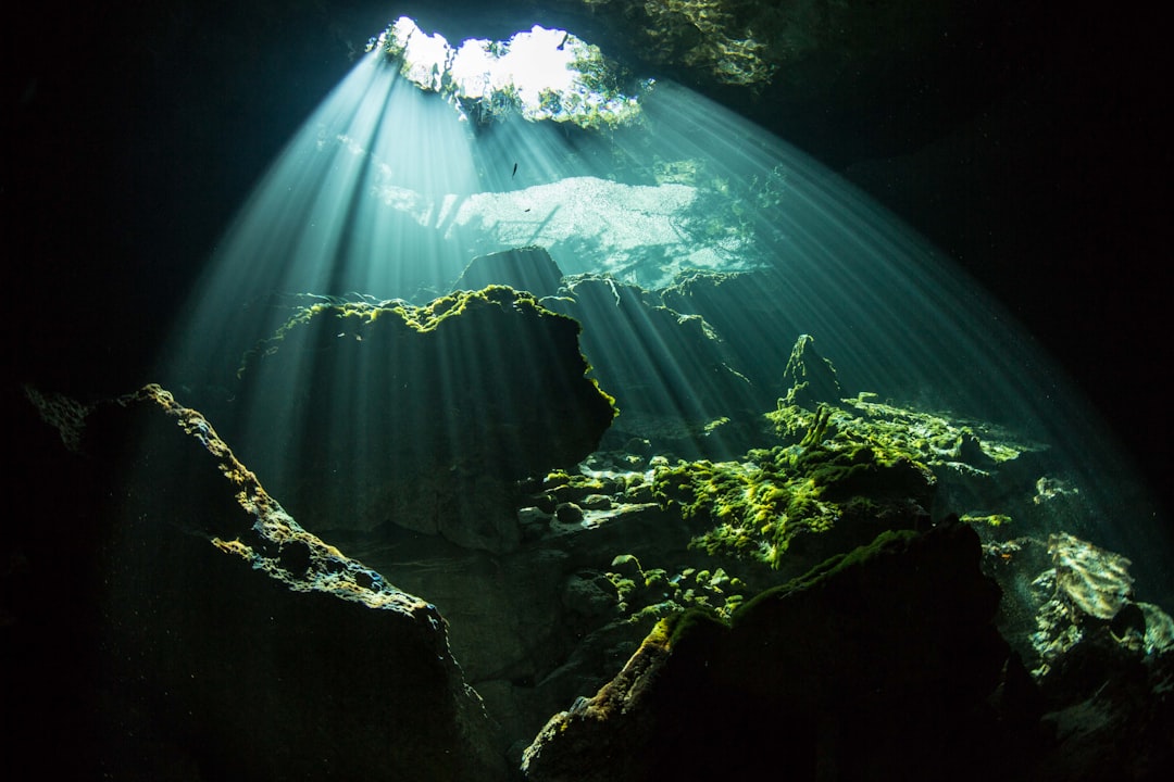
Windows in the Sea: Blue Holes and Submarine Springs
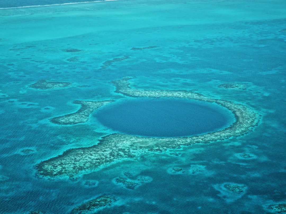
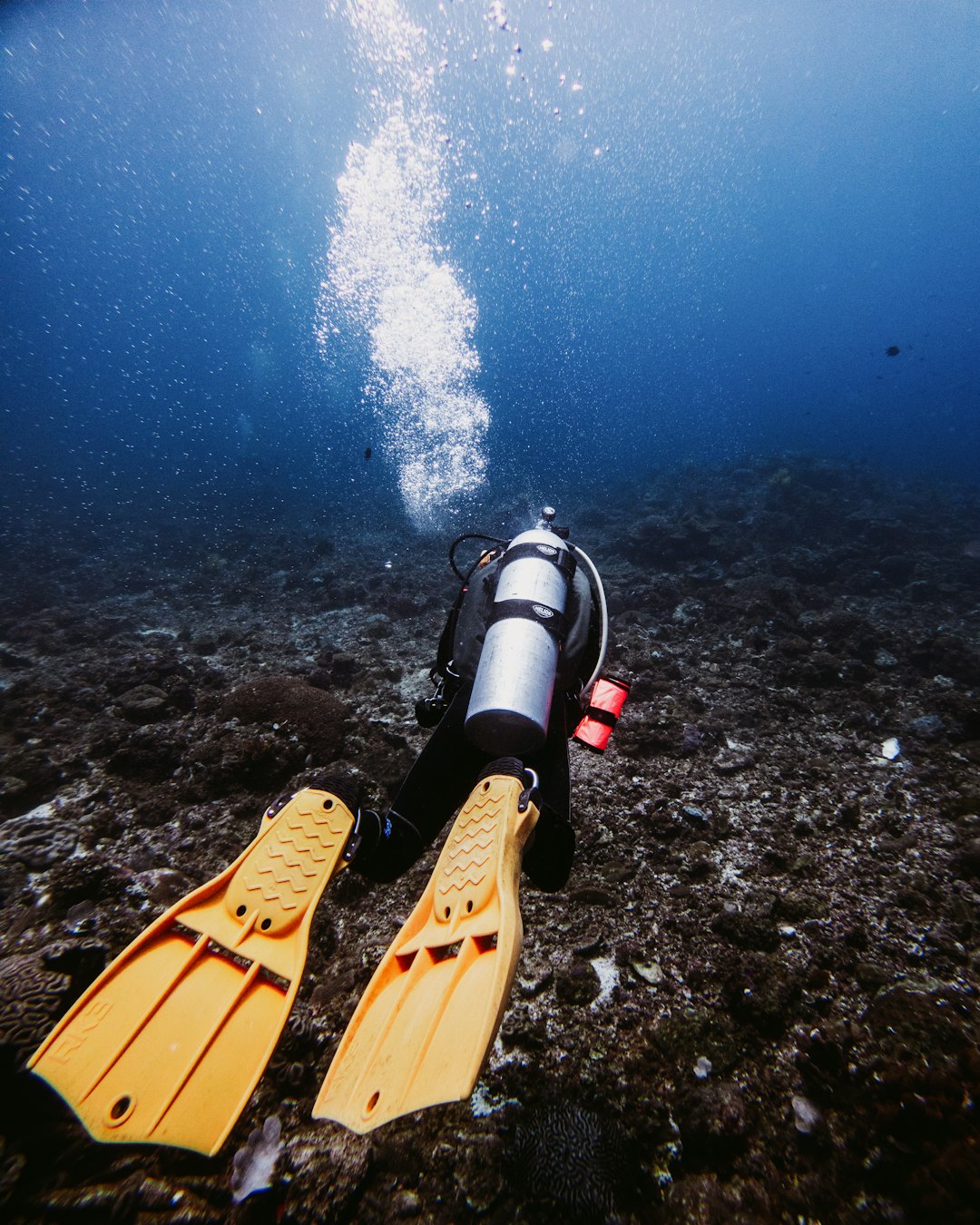
Offshore, the seafloor is peppered with blue holes – circular openings where the bottom drops into darkness and the water’s color deepens like an ink spill. Many pulse with the tides, drawing water in and out through unseen tunnels so that divers feel a breath of current even on calm days. Some are oxygen-poor and streaked with sulfur, feeding layered microbial communities that thrive where most fish keep their distance; others are quietly freshened by under-island flow that arrives cool and clear. It’s not uncommon to find stalactites or dry-cave textures far below the surface, proof that these were once airy chambers before the ocean reclaimed them. As natural monitoring wells, blue holes sample the aquifer-ocean handshake and preserve sediments that archive storms, droughts, and ancient sea-level swings. They’re dangerous portals for the untrained, but scientific gold mines for those who go carefully.
Why It Matters
Understanding these hidden voids isn’t trivia; it’s the difference between guessing and anticipating change in a coast under stress. Karst pathways can move water faster than expected, bypassing natural filters and delivering nutrient pulses that nudge reefs and seagrass toward algae-favoring conditions. During heat waves, cool upwellings from sinkholes can create fleeting refuges that help fish and invertebrates hang on for a few crucial days, while the same pathways might, at other times, concentrate low oxygen or sulfide that stresses them. For planners, mapping voids and connections sharpens flood and contamination models, turning fuzzy lines into practical decisions about where to place wastewater upgrades or how to stage storm response. It also reframes hazard thinking: while the Keys aren’t known for the dramatic, newspaper-headline sinkholes that gulp houses inland, subtle subsidence and hidden cavities still matter for roads, bridges, and buried utilities. In short, the unseen plumbing quietly sets the rules for everything that lives or is built here.
The Future Landscape
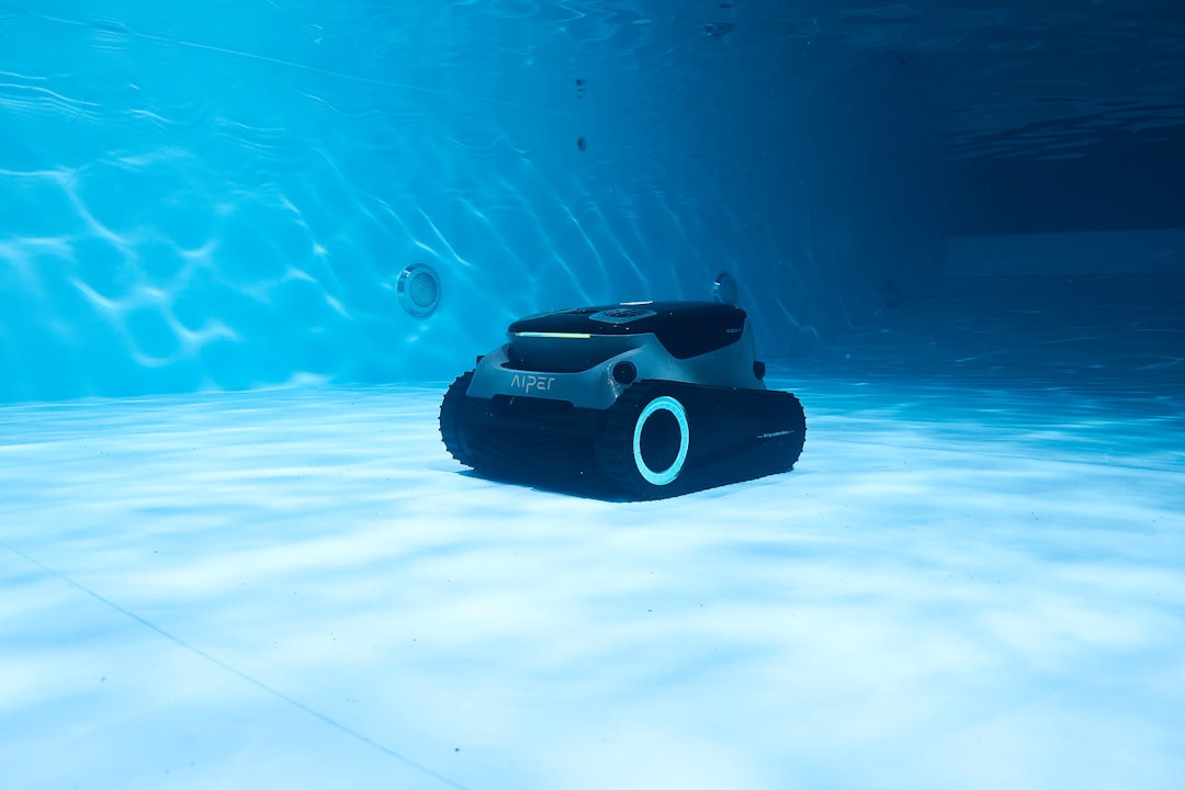
New tools promise to turn the Keys’ invisible underworld into a living dashboard. Compact autonomous vehicles can “fly” cave passages, stitching together lidar, sonar, and chemistry into 3D models that update with every tide. Fiber-optic cables, laid like threads across flats, can sense minute temperature shifts along their length, revealing cool plumes at night and warm intrusions by day. Machine learning already sifts through terabytes of hydroacoustic data, flagging sinkhole candidates the way meteorologists spot storms on radar, and low-cost loggers let citizen scientists help ground-truth the models. As seas rise and storms grow more erratic, the pressure gradient that drives water through karst will change, likely re-routing flow paths and altering where nutrients and contaminants emerge. Tomorrow’s map may not match today’s, which is precisely why building it now matters.
What You Can Do
No one needs a cave-diving certification to help protect a hidden landscape. Support local efforts to modernize wastewater infrastructure and reduce nutrient loads, because cleaner inputs mean fewer opportunities for algal blooms when groundwater pulses through. Skip fertilizers near the coast and choose native plants that sip rather than gulp water, easing pressure on freshwater lenses during dry spells. If you fish, note and report unusual cold boils, sulfur smells, or sudden clarity lines on calm days; patterns from many eyes help researchers find new sinkholes without sending divers on blind hunts. Back organizations that map and monitor blue holes, and resist the urge to explore them without training – they’re beautiful, but they’re also unforgiving. The Keys’ future hinges on the plumbing we can’t see; the choices we make today decide whether those hidden channels become lifelines or liabilities – what would you bet on?
Sources:
NOAA Office of Ocean Exploration and Research; U.S. Geological Survey Coastal and Marine Geology Program.

Suhail Ahmed is a passionate digital professional and nature enthusiast with over 8 years of experience in content strategy, SEO, web development, and digital operations. Alongside his freelance journey, Suhail actively contributes to nature and wildlife platforms like Discover Wildlife, where he channels his curiosity for the planet into engaging, educational storytelling.
With a strong background in managing digital ecosystems — from ecommerce stores and WordPress websites to social media and automation — Suhail merges technical precision with creative insight. His content reflects a rare balance: SEO-friendly yet deeply human, data-informed yet emotionally resonant.
Driven by a love for discovery and storytelling, Suhail believes in using digital platforms to amplify causes that matter — especially those protecting Earth’s biodiversity and inspiring sustainable living. Whether he’s managing online projects or crafting wildlife content, his goal remains the same: to inform, inspire, and leave a positive digital footprint.


