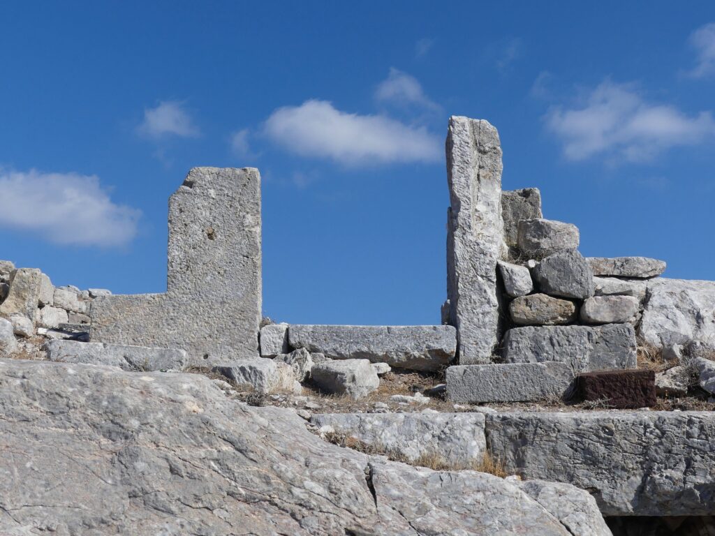
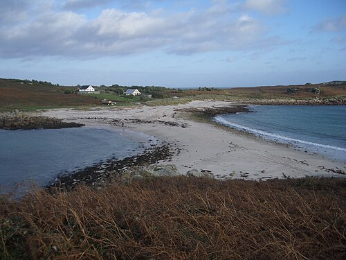
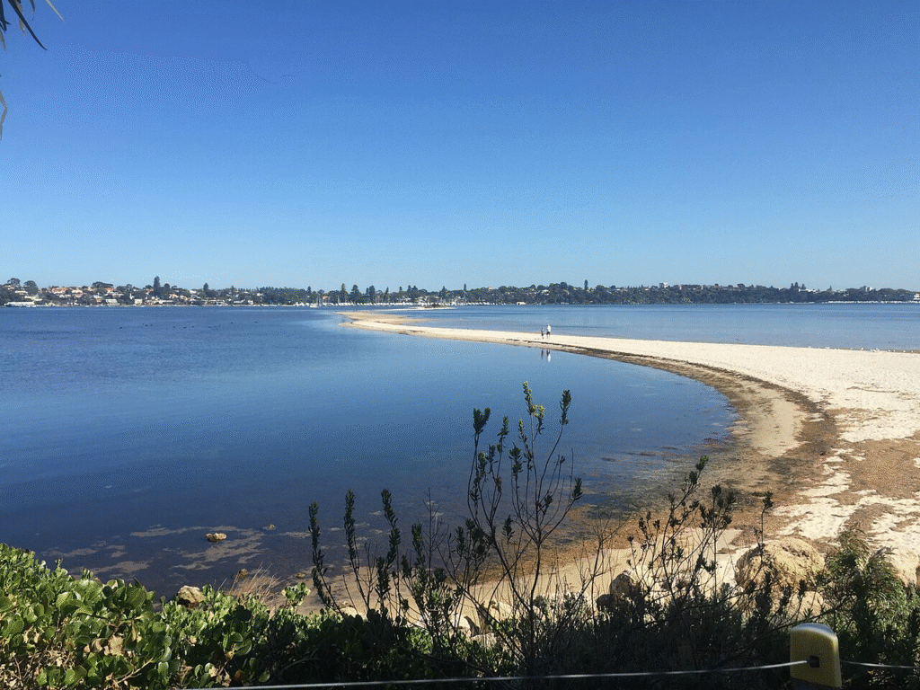
Every year, somewhere along a windswept stretch of coast, a small island rises out of the gray Atlantic like a rumor that turns out to be true. It is little more than a scimitar of sand at first, a pale eyebrow above the surf, but it grows with each heavy swell until beachcombers, anglers, and seabirds claim it for a brief season. Then, just as quickly, spring storms unravel it grain by grain, sending the sand back into the longshore conveyor that built it. Scientists call features like this ephemeral or transient islands, but the name hardly captures the drama of their arrival and retreat. The mystery begs a simple question with a complex answer: how can an island be both here and not here in the space of a few months?
The Hidden Clues
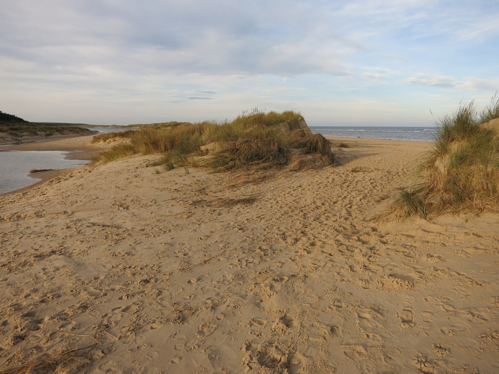
What if an island could keep time with the seasons, arriving like a secret after winter and slipping away by spring? The clue lies underwater, in the sandbars that march shoreward under winter’s more energetic waves. Those bars act like staging grounds; when storms push sediment landward and currents pinch it into a narrow arc, a crest rises above high tide and suddenly counts as land.
I remember standing on a cold cape last March, watching cross waves braid foam over a newly risen bar, and feeling that tug between awe and caution. A day earlier there was nothing to stand on; a day later there was a sand ridge long enough to host a dozen gulls and a line of curious walkers. That surreal speed is a hallmark of a coast where energy is always on the move.
The Winter Build

Winter often reshapes coasts more strongly than any other season because storms deliver sustained, high-energy swell. Those waves strip sand from the upper beach and stack it offshore into bars, then, paradoxically, shove some of it back when wind and tides create a pressure gradient that drives water onto the bar crest. If the tide range is modest and the bar is well fed by alongshore sediment, a shallow channel may close and a low island emerges.
On Atlantic capes, where one current runs cold and another warm, that tug-of-war can focus sand like a snowdrift curling behind a fence. The physics is beautifully blunt: add more energy and more sand, and the feature grows; cut either ingredient and it stalls. The build phase is a sprint, not a marathon, and that’s what makes it feel miraculous.
The Spring Unraveling
Spring brings a new script. Swells swing around, winds shift, and the first nor’easters of the season rake the coast from a different angle. The same currents that stitched the island together begin to shear it apart, opening inlets that let tidal jets claw through the soft center.
Overwash fans spread like palm prints as waves pour across the crest at high tide, flattening the ridge and redistributing sand back toward the beach and offshore bars. One strong storm can erase months of slow construction, and sometimes a single night redraws the shoreline as surely as an artist wiping a slate. By early summer, the island is usually a memory and a faint shoal on the nautical chart.
From Ancient Tools to Modern Science
Coastal people have been tracking these changes for centuries with stakes, sketches, and careful notes, reading the beach the way farmers read clouds. Today, the toolkit is astonishingly precise: satellite constellations watch shoals migrate week by week, aircraft-mounted lidar maps sand elevations to the inch, and GPS rovers stride the tideline to capture every rise and dip. Drones now fly at dawn after storms, stitching thousands of images into elevation models that show exactly where water overtopped and where dunes failed.
In the water, acoustic current meters trace the pulse of alongshore flow and wave buoys parse swell energy into tidy spectra that modelers turn into tomorrow’s shoreline. The payoff is not just prettier maps; it is prediction, however imperfect, of which bars may breach and when a transient island might surface. Compared with notebooks and sextants, the leap is like moving from a candle to a constellation.
Why It Matters

Ephemeral islands may look like curiosities, but they are signposts for a coast in motion. When a new sand ridge breaks the surface, it can create calmer water in its lee and shift rip currents toward unsuspecting swimmers or surfcasters. The shape also redirects waves onto nearby beaches, quietly accelerating erosion in one spot while building a gentle slope in another.
Harbor pilots and rescue crews care because shoaling changes safe passages with unnerving speed, while park managers weigh habitat gains for shorebirds against the risks of letting people wander onto unstable land. In a century of rising seas, these brief islands double as early warnings, showing how quickly a shoreline can rearrange under added stress. They are not just places; they are processes, and processes scale up.
Global Perspectives

Beyond temperate capes, the same choreography plays out in different costumes. In major river deltas, seasonal flood pulses sketch and erase sand islands – chars – that millions rely on for farming, only to see them drown under the next surge. On volcanic arcs, brand-new islands can erupt into existence and then succumb to waves within years as soft ash and tephra surrender to the sea.
Barrier coasts offer yet another variant: long ribbons of sand migrate landward over time, occasionally spawning small offshoots that live brief lives. Whether the driver is storm energy, river discharge, or fresh lava, the throughline is simple: add sediment and structure, and islands appear; remove support, and they go. The winter-to-spring act is one chapter in a broader global tale of birth, drift, and erasure.
The Hidden Clues, Part Two: Life Moves In
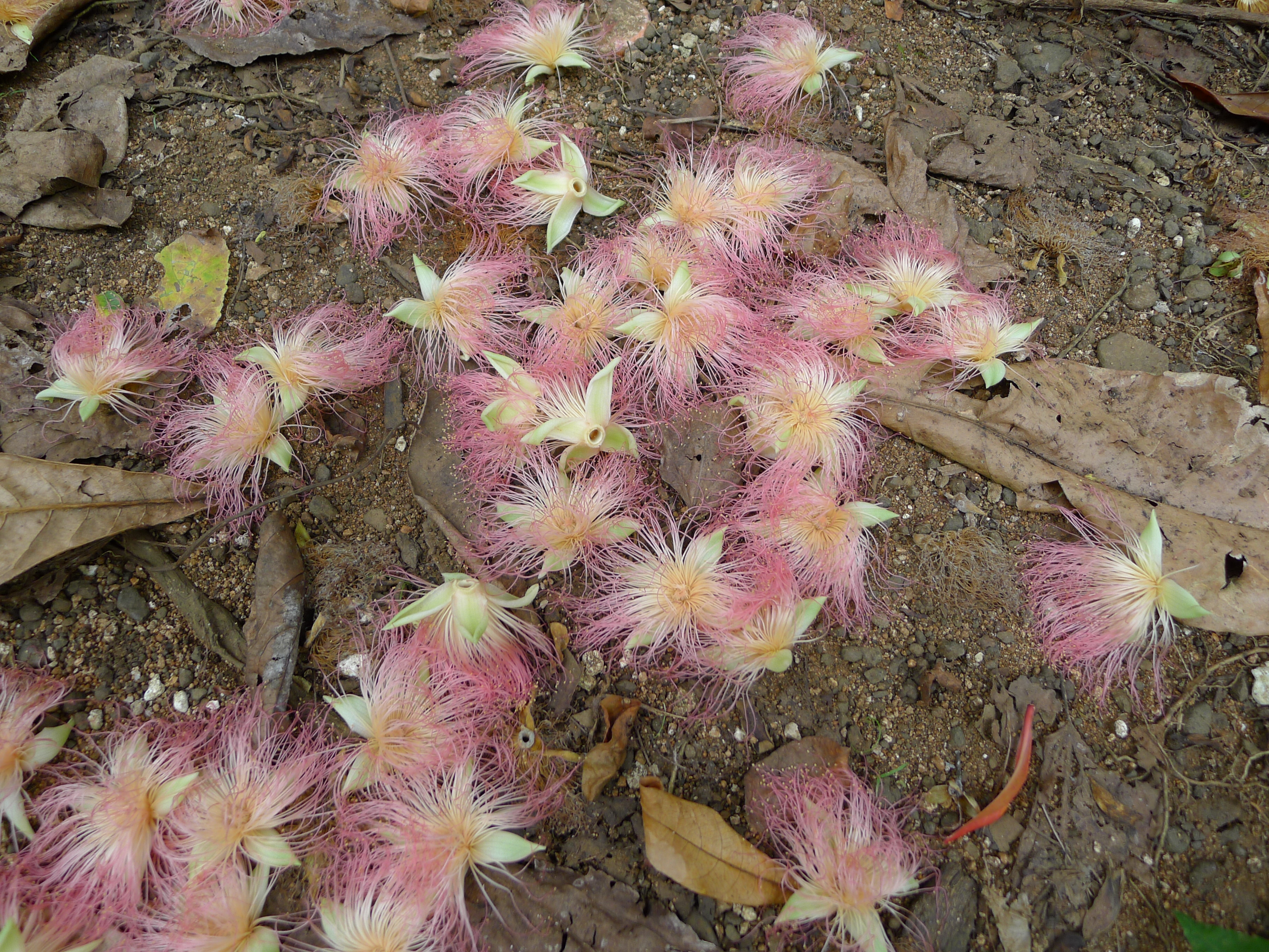
Even during their short tenure, these islands do not sit empty. Pioneer plants can take root in days on the higher ridges, their wiry stems trapping wind-blown sand and adding a touch of resilience to the crest. Shorebirds land first, testing the new real estate for insects and shellfish, and seals or sea turtles may haul out if the slope is gentle and undisturbed.
That flash of ecology matters because it demonstrates how quickly life capitalizes on a physical opportunity. When the island dissolves, those seeds and eggs lose a foothold, but the nutrients and fragments fold back into the coastal food web. It is a moving feast, assembled and cleared away on a seasonal timer.
The Future Landscape
Looking ahead, forecasting tools are racing to keep up with a coast that refuses to sit still. High-repeat satellite radar can see through clouds to track sandbars during stormy weeks, while new ocean models resolve wave-driven currents at the scale of tens of meters, the sweet spot for predicting breakthrough. Some teams are feeding those models with machine-learning systems trained on decades of aerial imagery to flag the conditions that tend to spawn transient islands.
There are hurdles: better bathymetry in the surf zone, more real-time wave data close to shore, and ways to share forecasts that beach communities can actually use. As seas rise and storms redraw the chessboard, we can expect these seasonal islands to form in slightly different places and to vanish faster, testing the limits of access, safety, and habitat. The tools will improve, but the ocean will always keep a few surprises in reserve.
From Ancient Tools to Modern Science, Part Two: People on the Edge
For the people who live and work near these capes, the science is not abstract. Fishermen read the hints in water color and breaking patterns long before the first sand crest shows, and their local knowledge now meshes with hazard maps that can warn where a sudden inlet might rip open. Surfers share drone clips that double as data, helping researchers measure bar migration speed between storms.
I’ve learned to trust that grassroots intelligence as much as a model run, because it anchors the forecast to what feet and eyes can confirm. When a new island appears, access rules usually follow quickly, sometimes closing the feature the same week it rises to protect nesting birds and keep people off unstable sand. The conversation between expertise and experience is where good coastal decisions get made.
Conclusion
If you live by the sea or love visiting, small steps make a real difference. Stay off fresh crests and new dunes, which are easily undercut and prone to collapse even on calm days, and heed park advisories about access to newly formed features. Report unusual currents, fresh inlets, or rapid shoreline changes to local authorities; timely observations help refine forecasts and keep people safe.
Support coastal monitoring programs – from beach-profile volunteers to community drone mapping – that feed open data to scientists and emergency planners. And when the season’s island appears, enjoy it from a respectful distance, knowing you are watching geology in fast-forward and that its brief life tells an important story about the coast you love.

Suhail Ahmed is a passionate digital professional and nature enthusiast with over 8 years of experience in content strategy, SEO, web development, and digital operations. Alongside his freelance journey, Suhail actively contributes to nature and wildlife platforms like Discover Wildlife, where he channels his curiosity for the planet into engaging, educational storytelling.
With a strong background in managing digital ecosystems — from ecommerce stores and WordPress websites to social media and automation — Suhail merges technical precision with creative insight. His content reflects a rare balance: SEO-friendly yet deeply human, data-informed yet emotionally resonant.
Driven by a love for discovery and storytelling, Suhail believes in using digital platforms to amplify causes that matter — especially those protecting Earth’s biodiversity and inspiring sustainable living. Whether he’s managing online projects or crafting wildlife content, his goal remains the same: to inform, inspire, and leave a positive digital footprint.