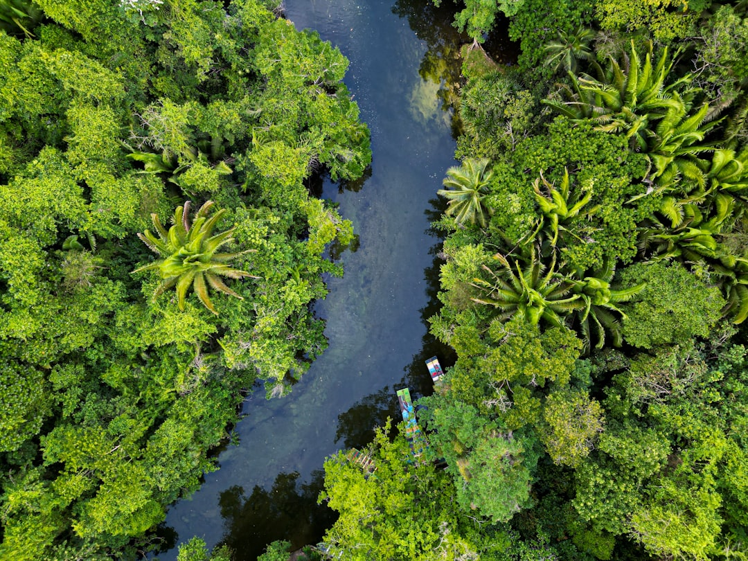
The Amazon looks like a world of rivers and rain, but the real surprise is what hums below: a slow, sprawling mass of freshwater quietly moving through sandstones, floodplain sands, and ancient valleys. For years, scientists suspected that groundwater kept trees green long after the last storm, but new basin-scale analyses and field studies are pulling the curtain back on the underworld that feeds the forest. After the punishing 2023–2024 drought, the urgency sharpened, and the subsurface story finally came into focus. Satellite gravity, isotopes, and geophysics now converge on the same message: beneath the forest lies a hidden ocean of freshwater pathways that buffer rivers, sustain roots, and modulate the atmosphere above. It’s not a single underground river – it’s a connected web that behaves like a slow, breathing reservoir for the largest rainforest on Earth.
The Hidden Clues

Hydrologists spent decades staring at a paradox: trees that should have wilted during rainless months instead thrived, and streams kept flowing when rainfall disappeared. That behavior hinted at a persistent, unseen supply, and recent drought mapping from satellite gravimetry shows how water storage in the basin drops and recovers on seasonal to multi‑year cycles, a fingerprint of large underground stores stepping in when skies stay clear. During the 2023–2024 dry spell, gravity satellites captured basin-wide water deficits spreading from northwest to southeast, consistent with stressed subsurface reserves feeding the surface network. ([mdpi.com](https://www.mdpi.com/2072-4292/17/16/2765?utm_source=openai))
Zooming in, river chemistry and stable water isotopes reveal that a substantial fraction of dry‑season streamflow is “old” water that traveled through soils and aquifers before emerging at springs and channel beds. In the Andes‑to‑Amazon transition, isotope studies found that lowland floodplain streams often carry only a small slice of recent rain, underscoring the dominance of slow groundwater pathways at the base of the system. The forest’s green persistence in cloudless months makes sense when you factor in that hidden, time‑lagged supply. ([hess.copernicus.org](https://hess.copernicus.org/articles/27/2883/2023/hess-27-2883-2023.html?utm_source=openai))
From Ancient Tools to Modern Science

Older models treated groundwater like a background extra; today, it’s part of the main cast. Early basin modeling suggested that shallow water tables could lift moisture upward into root zones via capillary action, keeping leaves hydrated even when rainfall pauses. That idea is now reinforced by satellite, field, and modeling work showing groundwater’s hand in both evapotranspiration and dry‑season baseflow. ([hess.copernicus.org](https://hess.copernicus.org/articles/14/2039/2010/?utm_source=openai))
The method toolkit has also evolved. Researchers pair gravity satellites with climate reanalyses and machine learning to downscale water‑storage changes across the basin, revealing patterns that track El Niño and La Niña swings and show post‑2016 declines in groundwater trends in parts of the basin. It’s a far cry from the days when we only had a handful of well logs to guess what lay beneath a forest the size of a continent. ([sciencedirect.com](https://www.sciencedirect.com/science/article/abs/pii/S0048969723075873?utm_source=openai))
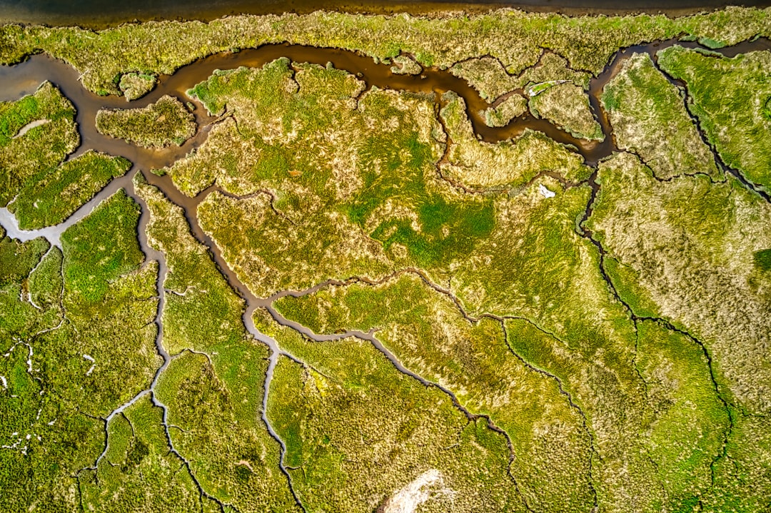
How the Subsurface Network Works
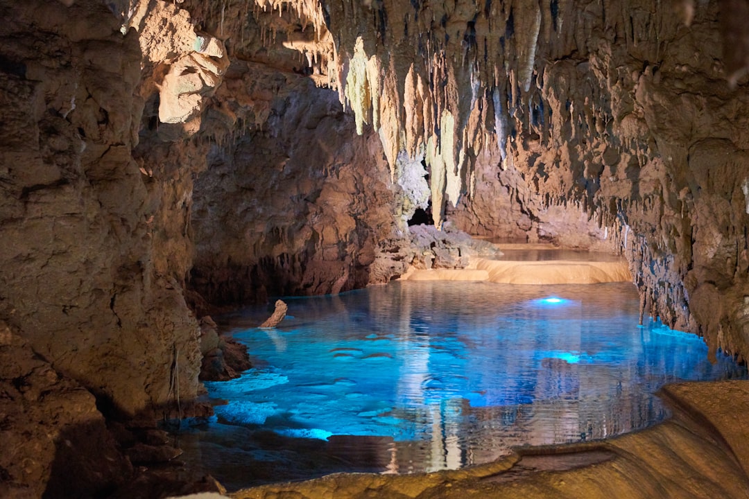
Think of the Amazon subsurface as layered sponges and slow‑moving conveyor belts. Rain filters through permeable sands and gravels, pools above less permeable clays, and then drifts sideways – sometimes for weeks, sometimes for years – before feeding streams and wetlands. Where sandstone aquifers crop out, forests recharge them; where clays dominate, water perches and oozes along buried interfaces, quietly crossing watershed lines that look clean on a map but are porous below. ([ui.adsabs.harvard.edu](https://ui.adsabs.harvard.edu/abs/2021JSAES.11203596H/abstract?utm_source=openai))
In parts of Pará and Amazonas, the Alter do Chão Aquifer and related units act like vast, semiconfined vaults, taking in rainfall and releasing it through springs and riverbeds. Root systems can reach deep fractures, tapping the capillary fringe above water tables and hoisting moisture upward when the canopy needs it most. That’s why, despite bone‑dry skies, the forest doesn’t immediately brown out – because its plumbing runs far deeper than the leaf litter. ([ui.adsabs.harvard.edu](https://ui.adsabs.harvard.edu/abs/2021JSAES.11203596H/abstract?utm_source=openai))
Measuring the Invisible Flow
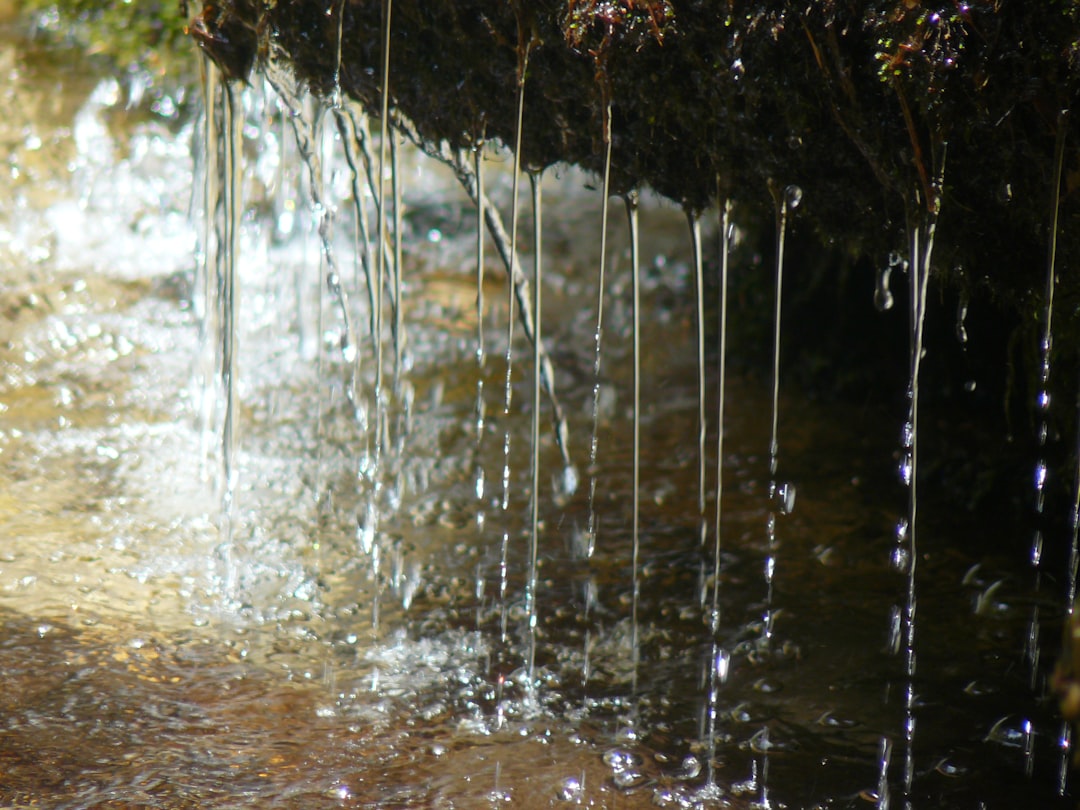
Satellites provide the aerial view, but ground truth comes from isotopes, geophysics, and careful stream gauging. Stable isotopes of oxygen and hydrogen separate “young” rainwater from slower, stored sources and show that the lowland Amazon often runs on older, filtered water during the dry season. Electrical and electromagnetic surveys sketch out 3D resistivity contrasts, mapping where sediments hold fresher water and where clay‑rich layers bottleneck flow. ([hess.copernicus.org](https://hess.copernicus.org/articles/27/2883/2023/hess-27-2883-2023.html?utm_source=openai))
Meanwhile, basin‑wide gravity measurements from GRACE and GRACE‑FO detect subtle mass changes as water drains and refills underground. In 2024 studies, downscaled gravity signals tied groundwater storage dips to climate oscillations and the multi‑month drought pulse, placing numbers on what field scientists had long suspected. The short answer to how much is moving below our feet: enough to keep a rainforest breathing through a long, hot dry season. ([sciencedirect.com](https://www.sciencedirect.com/science/article/abs/pii/S0048969723075873?utm_source=openai))
Why It Matters

Groundwater is the Amazon’s uncredited drought insurance policy, and understanding it changes how we read both past records and future risks. Traditional river‑only views miss the lagged, stabilizing role of subsurface stores that smooth floods and prop up baseflow, especially when rain is erratic. That matters for fisheries, river transport, and communities that depend on steady channels, not whiplash hydrology. ([hess.copernicus.org](https://hess.copernicus.org/articles/23/4909/2019/index.html?utm_source=openai))
There’s also a climate feedback. When water tables sit within reach of roots, forests can keep evaporating and transpiring – fueling clouds and rain recycling that help cool the region. Remove or weaken that groundwater access, and the system can tip toward hotter, drier conditions, stacking the odds for fire and canopy loss. The unseen flow below is inseparable from the weather we feel above. ([hess.copernicus.org](https://hess.copernicus.org/articles/14/2039/2010/?utm_source=openai))
Signals in a Warming, Drying Amazon
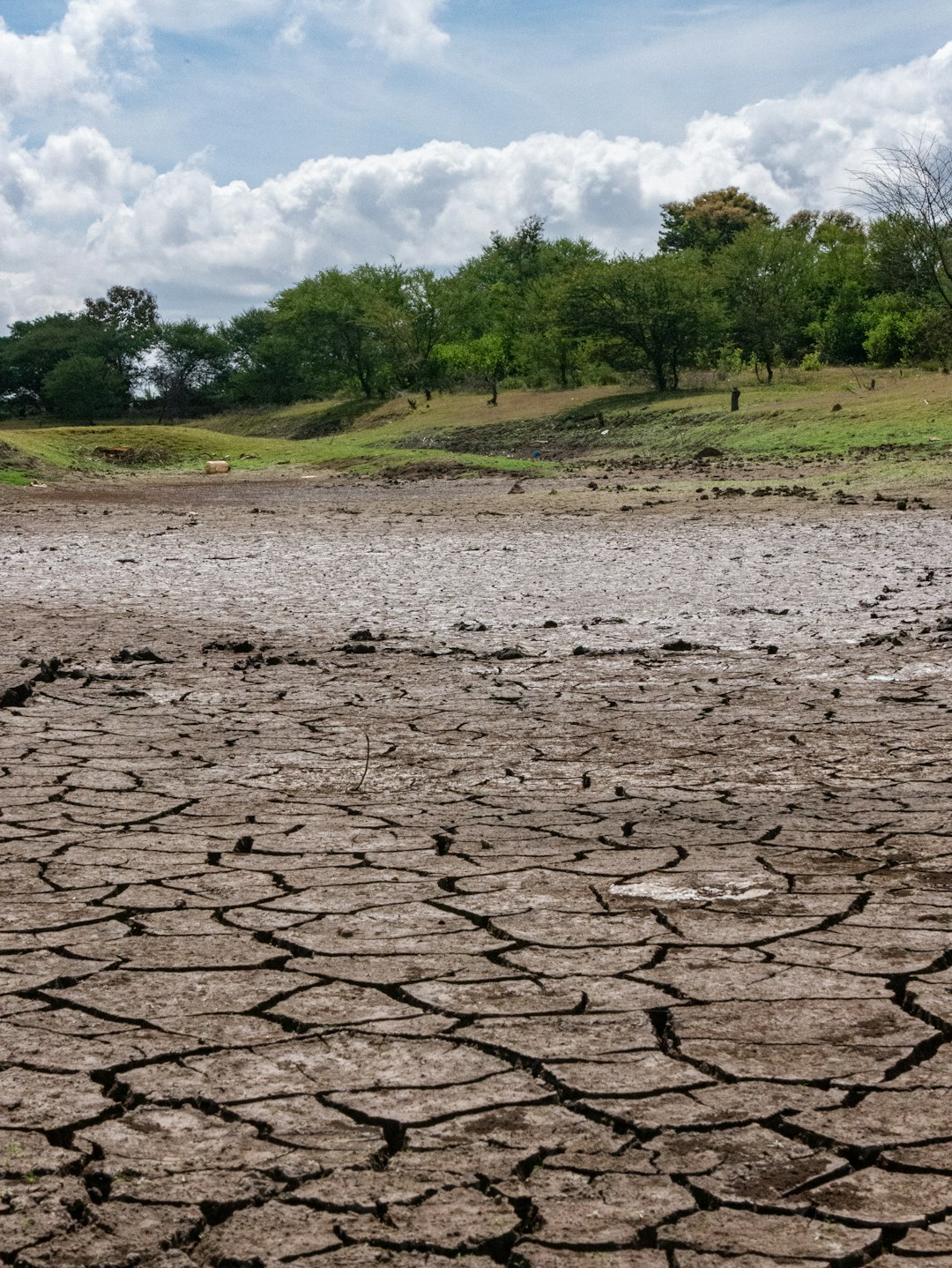
The 2023–2024 event was a stress test, and the subsurface didn’t escape unscathed. Gravity satellites tracked a six‑month drought progression and large terrestrial‑water deficits, with the most severe signatures in the east as the season wore on, echoing parts of the 2015–2016 event. These patterns are consistent with groundwater stores being drawn down to prop up rivers and trees, then slowly recovering with the rains. ([mdpi.com](https://www.mdpi.com/2072-4292/17/16/2765?utm_source=openai))
At the same time, deforestation and land use change are reshaping recharge and sediment pathways. Basin analyses link clearing to altered sediment loads, which can clog floodplain channels and mute the gentle exchanges that normally move water in and out of the subsurface. In some Brazilian regions beyond the core rainforest, aggressive groundwater pumping is already flipping rivers from gaining to losing streams – an early warning of what unbalanced budgets can do. ([esurf.copernicus.org](https://esurf.copernicus.org/articles/12/581/2024/index.html?utm_source=openai))
Global Perspectives
The Amazon is unique in scale, but its hidden plumbing echoes patterns seen from Southeast Asia to the Congo Basin. Around the world, gravity satellites and geodetic sensors have rewritten water stories, revealing how aquifers buffer droughts and then sag under prolonged heat and demand. In places with deep weathered profiles and broad floodplains, the quiet lateral slide of groundwater can be just as important as rainfall totals. ([agupubs.onlinelibrary.wiley.com](https://agupubs.onlinelibrary.wiley.com/doi/full/10.1029/2023GL107721?utm_source=openai))
What’s different in the Amazon is the sheer size – and the tight coupling between belowground stores and atmospheric moisture recycling. The basin sends roughly about one fifth of the world’s river freshwater to the ocean, yet much of its stability hinges on water that never sees the light until it emerges in a spring or seep. In short, to protect the rivers we can see, we have to understand the ocean we can’t. ([esurf.copernicus.org](https://esurf.copernicus.org/articles/12/581/2024/index.html?utm_source=openai))
The Future Landscape
Next‑generation mapping is poised to make the invisible routine. Downscaled gravity fields, dense river chemistry networks, and drone‑mounted geophysics can track how quickly aquifers drain and refill, while coupled land–groundwater models simulate how roots, soils, and water tables dance through a long dry spell. Together, these tools should pinpoint where the forest still has groundwater lifelines – and where they’re fraying. ([sciencedirect.com](https://www.sciencedirect.com/science/article/abs/pii/S0048969723075873?utm_source=openai))
On the frontier, researchers are refining electrical imaging and machine learning to speed 3D aquifer maps, and isotopes are being used at canopy towers to tie water vapor back to its subsurface sources. The payoff is practical: better drought forecasts, smarter river navigation windows, and water policies that protect recharge zones instead of paving them. This is subsurface science with a very surface impact. ([acp.copernicus.org](https://acp.copernicus.org/articles/25/12197/2025/?utm_source=openai))
How You Can Engage

Awareness is the first lever. Support conservation efforts that prioritize intact floodplains and recharge belts – those gentle, swampy, easily dismissed places where rivers and aquifers trade water back and forth. Encourage city and state planning that avoids over‑pumping and preserves forest cover in headwaters, where infiltration begins and the subsurface network takes shape.
For readers far from the Amazon, back organizations that fund drought monitoring, forest protection, and transparent water accounting, and vote for policies that keep climate warming in check. Teachers and students can tap open data from gravity missions and river observatories to explore how water storage breathes through a year. The more we map the hidden ocean, the better chance we have of keeping the rainforest above it alive.

Suhail Ahmed is a passionate digital professional and nature enthusiast with over 8 years of experience in content strategy, SEO, web development, and digital operations. Alongside his freelance journey, Suhail actively contributes to nature and wildlife platforms like Discover Wildlife, where he channels his curiosity for the planet into engaging, educational storytelling.
With a strong background in managing digital ecosystems — from ecommerce stores and WordPress websites to social media and automation — Suhail merges technical precision with creative insight. His content reflects a rare balance: SEO-friendly yet deeply human, data-informed yet emotionally resonant.
Driven by a love for discovery and storytelling, Suhail believes in using digital platforms to amplify causes that matter — especially those protecting Earth’s biodiversity and inspiring sustainable living. Whether he’s managing online projects or crafting wildlife content, his goal remains the same: to inform, inspire, and leave a positive digital footprint.