Imagine soaring high above the Earth and peering down to see vibrant ribbons of color swirling in turquoise waters — these are coral reefs, the rainforests of the sea. Now, picture a world where we can map every single one of these living wonders from space, capturing their beauty and fragility in unprecedented detail. That world isn’t a distant dream anymore. It’s happening right now, as scientists, conservationists, and tech visionaries rush to map coral reefs using satellite data. The stakes are heartbreakingly high: with climate change and pollution threatening coral survival, the secrets revealed by satellites could be the difference between hope and heartbreak for our oceans. Buckle up, because this race is as urgent as it is astonishing.
The Hidden World Beneath the Waves
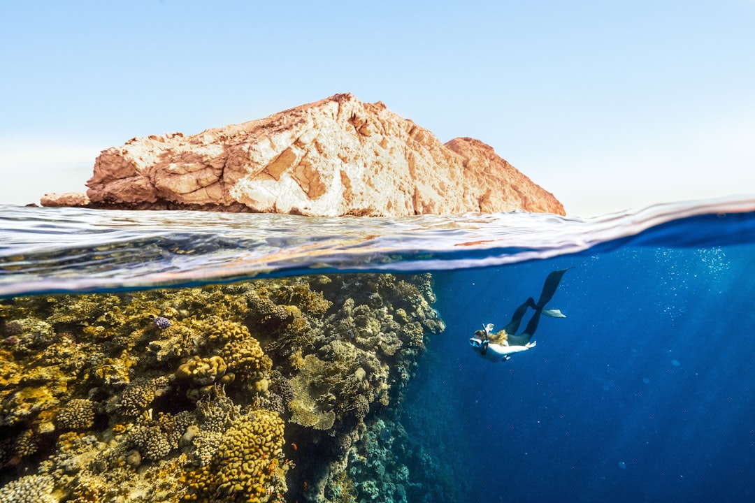
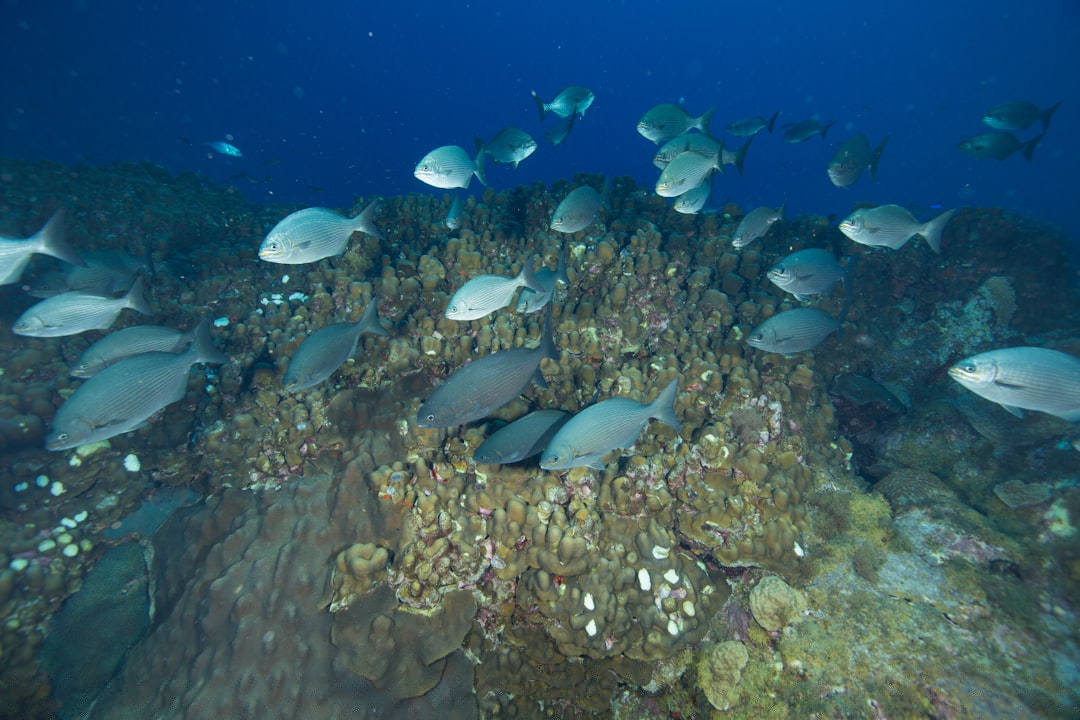
Coral reefs are mysterious kingdoms teeming with life, but most of us never get to see them. Nestled beneath the ocean’s surface, these ecosystems are often out of sight and, sadly, out of mind. They support a quarter of all marine species and protect coastlines from storms, yet their full extent remains largely unmapped. For decades, scientists relied on divers and boats to chart reefs, but these methods are slow and miss vast, remote areas. It’s a bit like trying to map an entire forest by walking through a single trail — you’ll never get the full picture.
Why Mapping Coral Reefs From Space Matters
The urgency to map reefs from above isn’t just about curiosity; it’s about survival. With coral bleaching events intensifying due to warming seas, we need to know exactly where reefs are and how they’re changing. Satellite imagery gives us a bird’s-eye view, allowing scientists to monitor remote and dangerous areas without ever getting wet. This data is crucial for governments, conservationists, and local communities hoping to protect what’s left. Imagine trying to save a treasure without knowing where it’s buried — mapping changes everything.
The Technology Powering the Mission
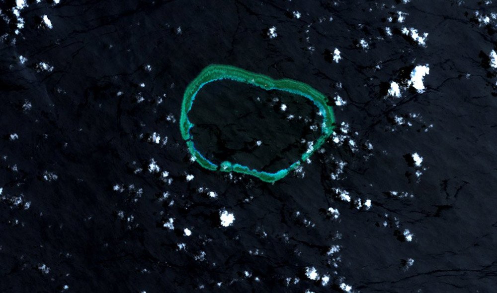
Today’s satellites are marvels of engineering, floating hundreds of kilometers above us and snapping high-resolution images of the ocean. These satellites use different types of sensors, including those that capture visible light and others that can “see” wavelengths invisible to the human eye. Some satellites, like those from the European Space Agency and NASA, can even measure subtle changes in water color that hint at coral health. This is like giving scientists superhero vision, letting them spot trouble before it’s too late.
The Allen Coral Atlas: A Giant Leap Forward
One of the most ambitious projects in this race is the Allen Coral Atlas. Born from a partnership between scientists and tech giants, this project uses satellite images and machine learning to create global maps of reefs. The Atlas is already transforming how we understand coral distribution, offering interactive maps that anyone can explore online. It’s like Google Maps for coral reefs, but with the power to guide real-world conservation decisions.
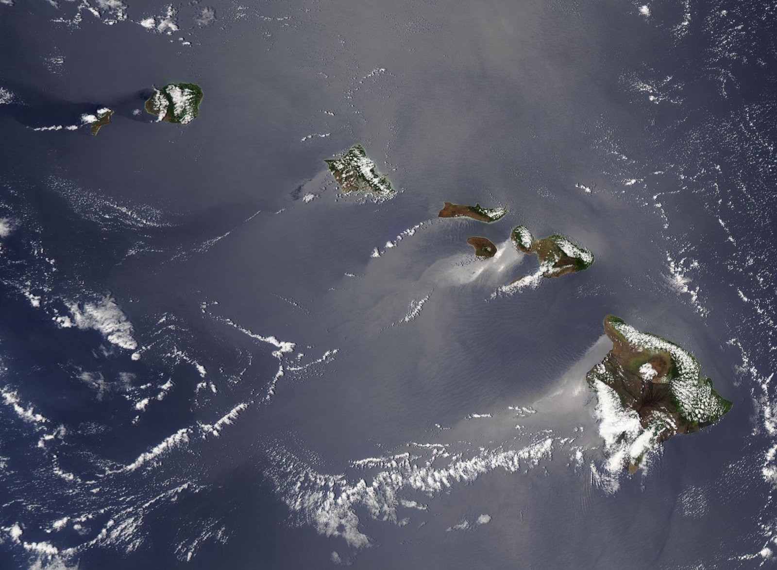
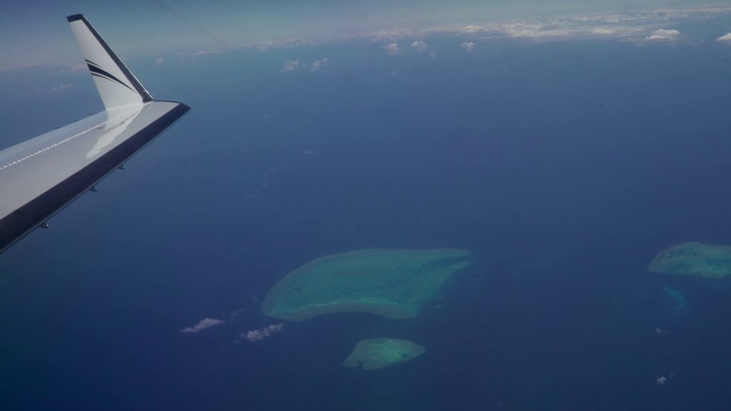
Uncovering the Unknown: Reefs We Never Knew Existed
Satellites are revealing reefs in places no one expected — from hidden atolls in the Pacific to rocky outcrops off remote African coasts. These discoveries are thrilling, but they also highlight how much we still don’t know. In some cases, entire reef systems have been identified where no one had ever dived before. It’s a bit like discovering a lost city in the jungle — suddenly, the map comes alive with new possibilities.
Tracking Coral Bleaching Events in Real Time
One of the most powerful uses of satellite data is monitoring coral bleaching as it happens. When water gets too warm, corals expel the algae they depend on, turning white and often dying. Satellites can detect subtle color changes and shifts in ocean temperature, sending early warnings to scientists and local communities. This real-time data can mean the difference between mounting a rapid response or arriving too late.
Climate Change: The Greatest Threat Revealed
Satellite maps aren’t just pretty pictures — they’re stark reminders of what’s at stake. As global temperatures climb, satellites track rising sea surface temperatures and the resulting stress on reefs. The patterns are sobering: entire regions are blinking red on the heat maps, signaling trouble ahead. These visuals make the invisible impacts of climate change heartbreakingly real, putting the challenge in front of the world’s eyes.
Pollution and Sedimentation: Detecting Invisible Killers
It’s not just heat that’s harming reefs. Satellites are helping scientists spot pollution and sediment washing into the ocean from rivers and coastal development. These murky plumes can smother coral, blocking the sunlight they need to survive. By tracking these threats from above, researchers can pinpoint the most dangerous hotspots and push for urgent action on land.
Empowering Local Communities With Data
For many island nations and coastal communities, coral reefs are a lifeline. Now, satellite maps are putting power directly in their hands. With easy-to-use tools and mobile apps, fishermen, divers, and local leaders can monitor their reefs, report damage, and plan for the future. This is a revolution in citizen science — ordinary people are becoming guardians of the sea, armed with information once reserved for experts.
Machine Learning: Teaching Computers to See Reefs
The sheer volume of satellite images is staggering — too much for any human to sift through. Enter machine learning: computers trained to recognize the subtle patterns of coral reefs, automatically sorting through millions of photos. These digital “eyes” can spot changes, track trends, and flag areas in trouble, all at lightning speed. It’s like having an army of tireless detectives, never blinking, never missing a detail.
Challenges in Seeing Through Cloudy Waters
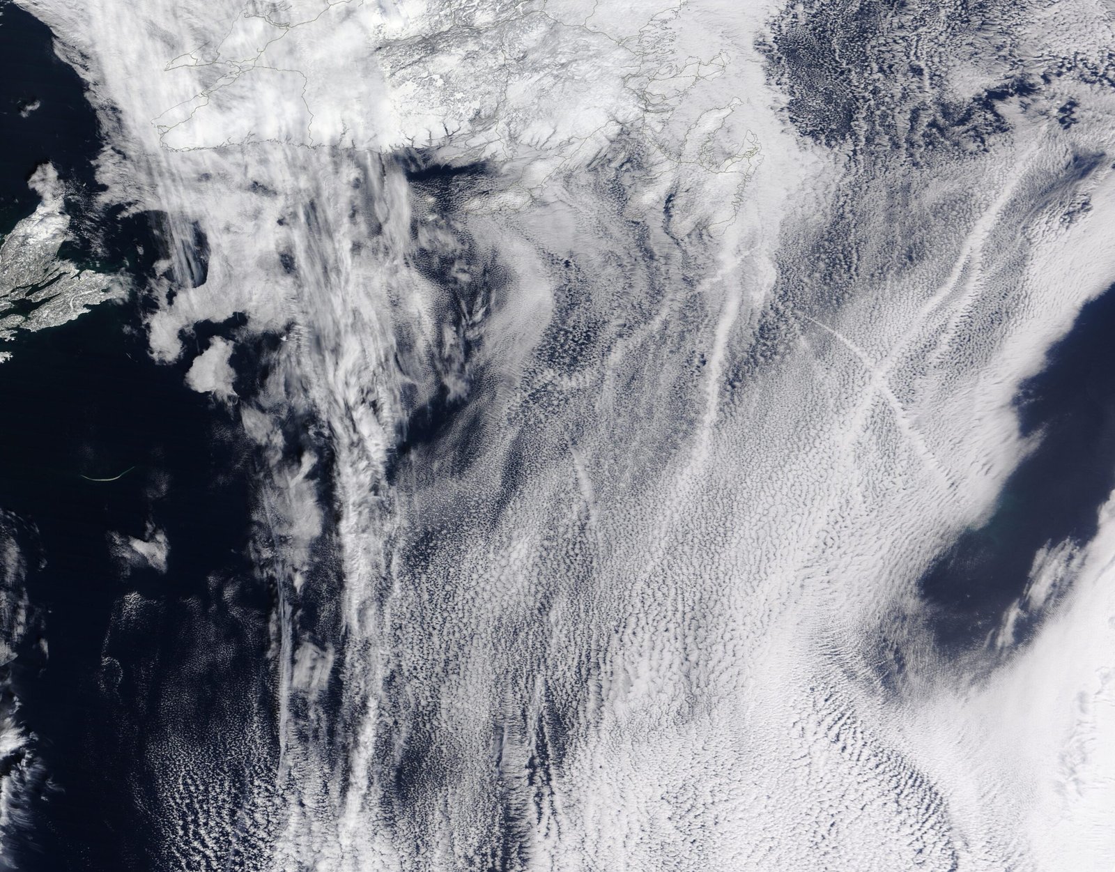
Mapping reefs from space isn’t easy. Clouds, waves, and murky water can all obscure the view, creating blind spots in the data. Scientists are constantly refining their techniques, using new algorithms and combining images from multiple satellites to fill in the gaps. It’s a bit like piecing together a giant jigsaw puzzle — sometimes the pieces don’t fit, but with persistence, the full picture emerges.
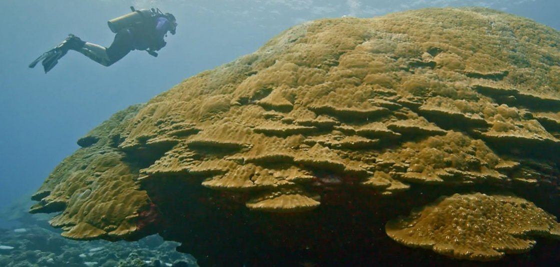
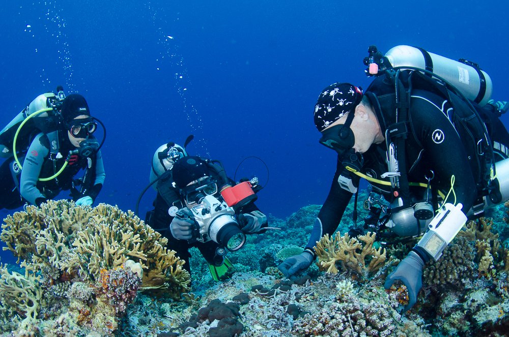
Combining Satellite Data With Underwater Surveys
Satellites are powerful, but they can’t do it all alone. Divers and underwater robots still play a crucial role, verifying what the satellites see and collecting detailed information about coral health. By combining these two perspectives — one from space, one from the sea — scientists get the most accurate maps possible. It’s a beautiful partnership, blending high-tech and hands-on discovery.
Spotting Signs of Recovery and Hope
It’s not all doom and gloom. Satellite maps are also capturing stories of resilience — places where reefs are bouncing back after storms or bleaching events. These pockets of hope offer clues about what makes some reefs stronger than others, guiding efforts to protect and restore them elsewhere. Every patch of recovery is a reason to celebrate, and a hint at nature’s stubborn determination to survive.
Global Collaboration: A United Front for Coral Reefs
The race to map reefs isn’t just a scientific quest; it’s a global movement. Researchers, governments, nonprofits, and tech companies are joining forces like never before. Their shared goal: to create a living atlas of the world’s reefs, updated in near real-time. This spirit of collaboration is breaking down barriers, turning isolated efforts into a powerful wave of progress.
Education and Awareness: Bringing Reefs to Everyone
Satellite maps are doing something magical — they’re making invisible worlds visible to everyone. Students, artists, and curious minds everywhere can now explore reefs from their laptops and phones. Interactive maps, virtual reality experiences, and stunning images are sparking awe and empathy, inspiring a new generation to care about the oceans. When people see what’s at stake, they’re more likely to take action.
Economic Impact: Protecting Livelihoods With Data
Coral reefs aren’t just beautiful; they’re economic powerhouses. Fisheries, tourism, and coastal protection depend on healthy reefs, supporting millions of livelihoods. Mapping these ecosystems gives policymakers the information they need to make smart choices, balancing development with conservation. It’s like giving a city planner a detailed map before building a road — better data leads to better decisions.
Innovations on the Horizon
The technology behind reef mapping is evolving at breakneck speed. New satellites with sharper vision, drones skimming the waves, and artificial intelligence are all on the horizon. Scientists dream of near-instant coral health check-ups, automated monitoring, and even predictive models that can forecast future threats. The race is far from over — in fact, it’s just getting started.
Personal Stories: Scientists and Island Guardians
Behind every pixel of satellite data, there are passionate people — scientists risking dives in stormy seas, islanders fighting to protect their home, and tech teams burning the midnight oil to parse the numbers. Their stories bring the data to life, reminding us that coral reefs are more than statistics; they’re living, breathing communities worth fighting for.
The Emotional Power of Seeing From Above
There’s something deeply moving about looking down from space and seeing the delicate beauty of coral reefs. It’s a reminder of how small and interconnected our world truly is. These images stir a sense of wonder, urgency, and responsibility — and maybe, just maybe, they have the power to unite us in a fight to save what’s left.
A Call to Action: The Future in Our Hands
The race to map coral reefs from space is a race against time, but it’s also a race filled with hope. Every new satellite, every breakthrough in data, brings us closer to understanding — and saving — these vital ecosystems. The question is no longer whether we can see the reefs from space. The question is: What will we do with what we see?