Drive a few hours in and it can feel like you’ve crossed whole planets, not just state lines. Cliffs change color, rivers vanish underground, rocks stand balanced where they have no right to stand, and entire landscapes look like someone took a giant chisel to the Earth and walked away. It’s beautiful, a little unsettling, and deeply mysterious once you realize how much geologists are still piecing together.
What I love about this region is that it refuses to be simple. Every canyon wall is like a bookshelf of lost worlds, every strange rock shape a puzzle hinting at ancient seas, long‑gone mountains, and climates that swung from tropical swamps to icy highlands. Let’s walk through eight of the Southwest’s most intriguing geological mysteries – places where the science is solid, but the story still has open chapters that keep researchers guessing.
The Grand Canyon’s “Missing” Time: The Great Unconformity
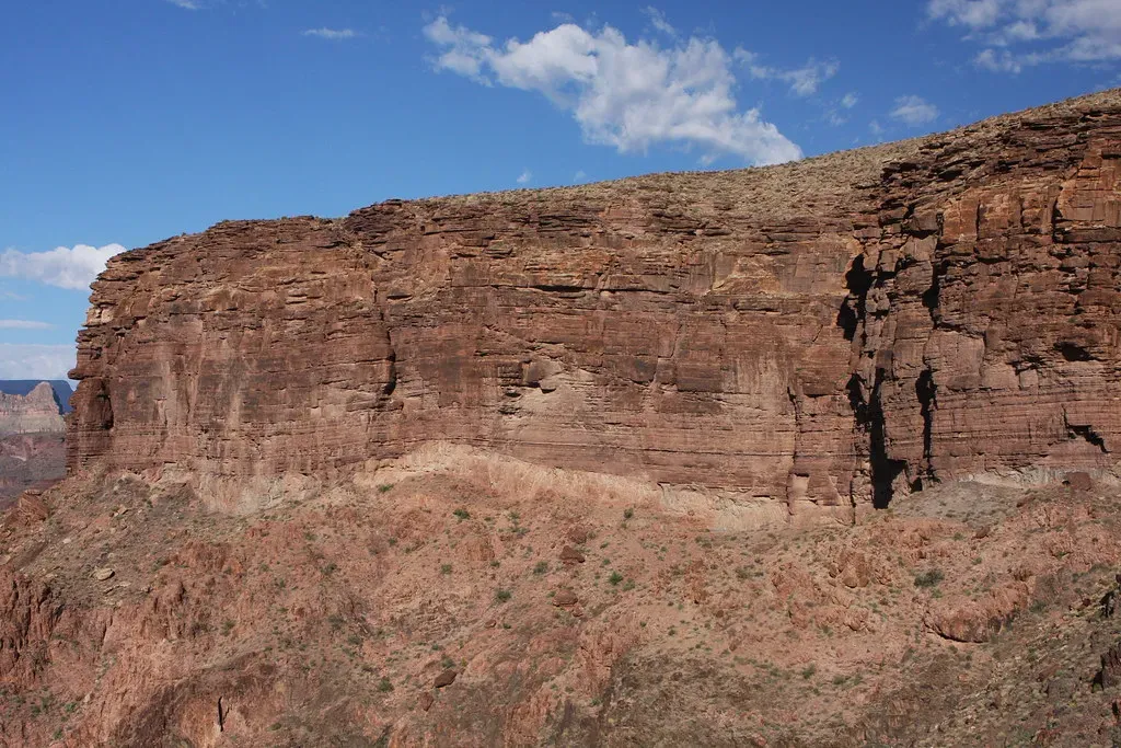
Stand on the rim of the Grand Canyon and you’re looking at nearly two billion years of Earth history in one sweeping view – and yet a gigantic chunk of time is simply missing. In places near the canyon’s base, billion‑year‑old granite and metamorphic rocks sit directly beneath layers that are hundreds of millions of years younger, with roughly about one billion years just… gone. This gap is known as the Great Unconformity, and while geologists understand the basic idea – that older rocks were eroded away before younger ones were deposited – the details of how, when, and why are still being debated.
Some researchers think this missing time is tied to the rise and fall of massive mountain ranges that once towered over what is now Arizona, eroding down over hundreds of millions of years. Others link it to global‑scale glaciations, where ice sheets and rivers stripped the surface clean before new sediments settled in ancient seas. What makes it fascinating is that the Great Unconformity shows up in different forms across North America, like a scar repeated in different surgeries, hinting at a shared but still not fully decoded tectonic drama.
Monument Valley’s Stone Towers: Why Do They Still Stand?
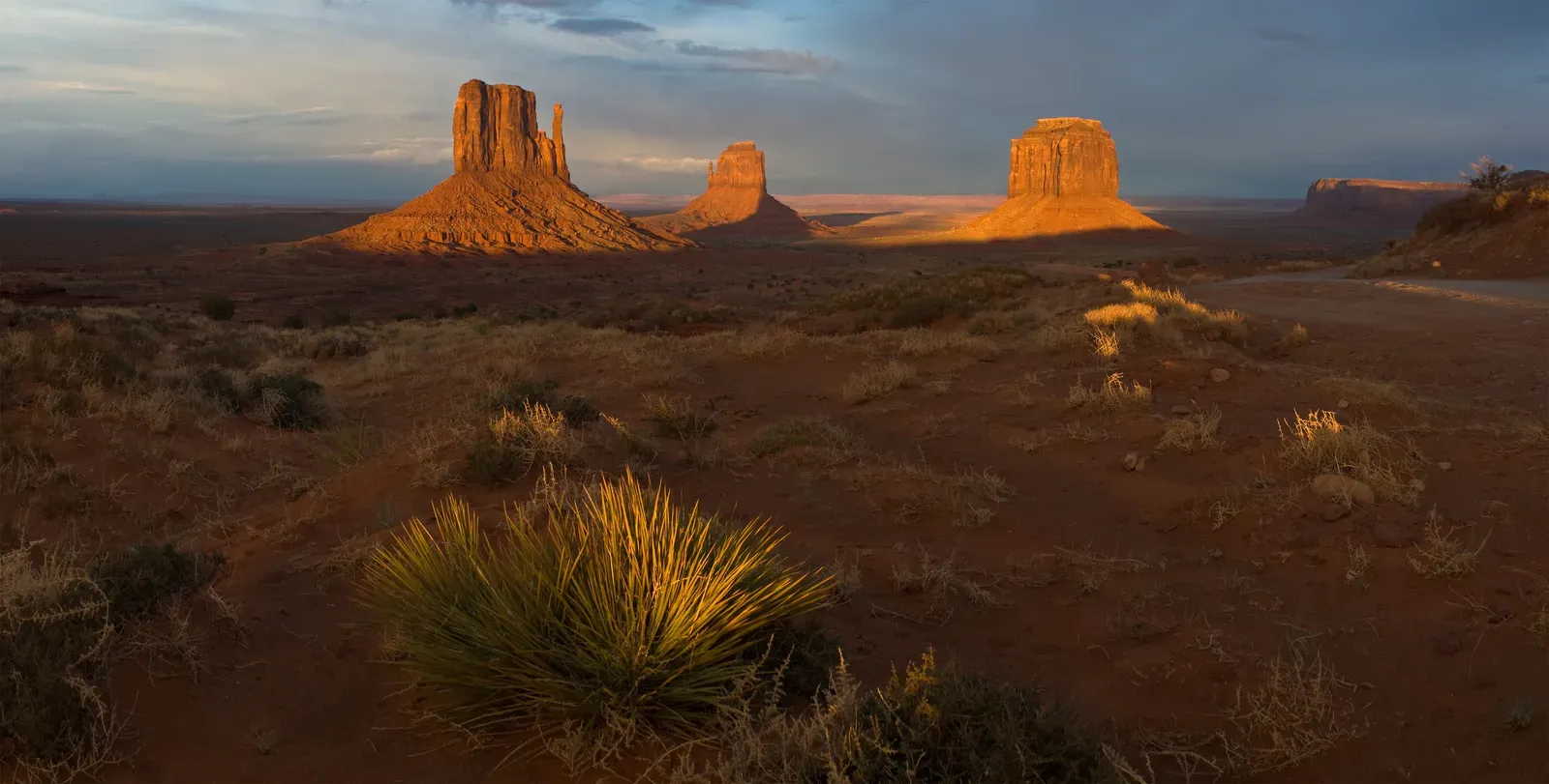
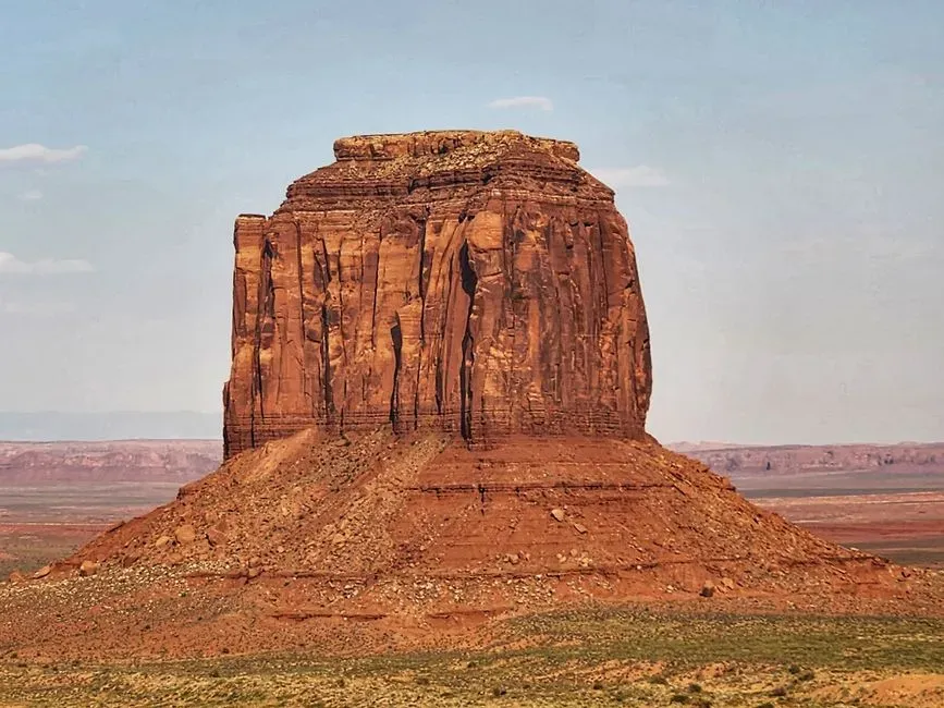
Monument Valley on the Arizona–Utah border looks like something straight out of another world: thin, towering buttes and mesas rising abruptly from a wide, relatively flat plain. These formations are carved from layered sedimentary rocks, mostly sandstone, siltstone and shale, that were once part of a much thicker sequence of rock sheets. Wind, water and time have removed the weaker layers, yet somehow left behind these improbable stone skyscrapers that seem like they should have collapsed ages ago.
The big question is why these particular chunks survived while the surrounding rock was stripped away. The answer lies partly in subtle differences in hardness and fracturing – thin caps of more resistant rock act like a helmet, shielding softer layers below, and cracks control how the rock breaks apart. But the exact sequence of climate swings, storm patterns and erosion rates that sculpted this specific skyline is still a kind of forensic mystery. You can think of Monument Valley as the last guests at a very long geologic party: everything else has left, and we’re still trying to reconstruct who was there and what happened from the few that remain.
The Wave and Coyote Buttes: The Puzzle of Perfect Rock Ribbons
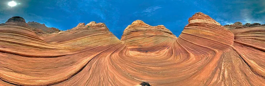
The Wave, tucked near the Arizona–Utah border, looks almost unreal – smooth sandstone bands flowing like frozen taffy, painted in reds, oranges and creams. These rocks are part of ancient sand dunes that solidified into Navajo Sandstone, preserving delicate cross‑beds formed by wind‑blown sand migrating across vast deserts nearly two hundred million years ago. The mystery isn’t that dunes turned to stone – that’s a well‑known process – but how erosion managed to expose such clean, swirling patterns with almost graphic‑design precision.
Rain, freeze‑thaw cycles, and wind all work together here, but they do it in a strangely selective way, shaving down layers at just the right pace to reveal those graceful internal lines without completely destroying them. Slight changes in cementation and grain size make some tiny bands tougher than others, so they erode more slowly, exaggerating the stripes and textures. The result is a geological art piece that looks deliberate, almost intentional, even though it’s really the outcome of millions of years of blind, patient weathering guided by physics and chance.
White Sands’ Gypsum Dunes: Why Here, and Why So Bright?
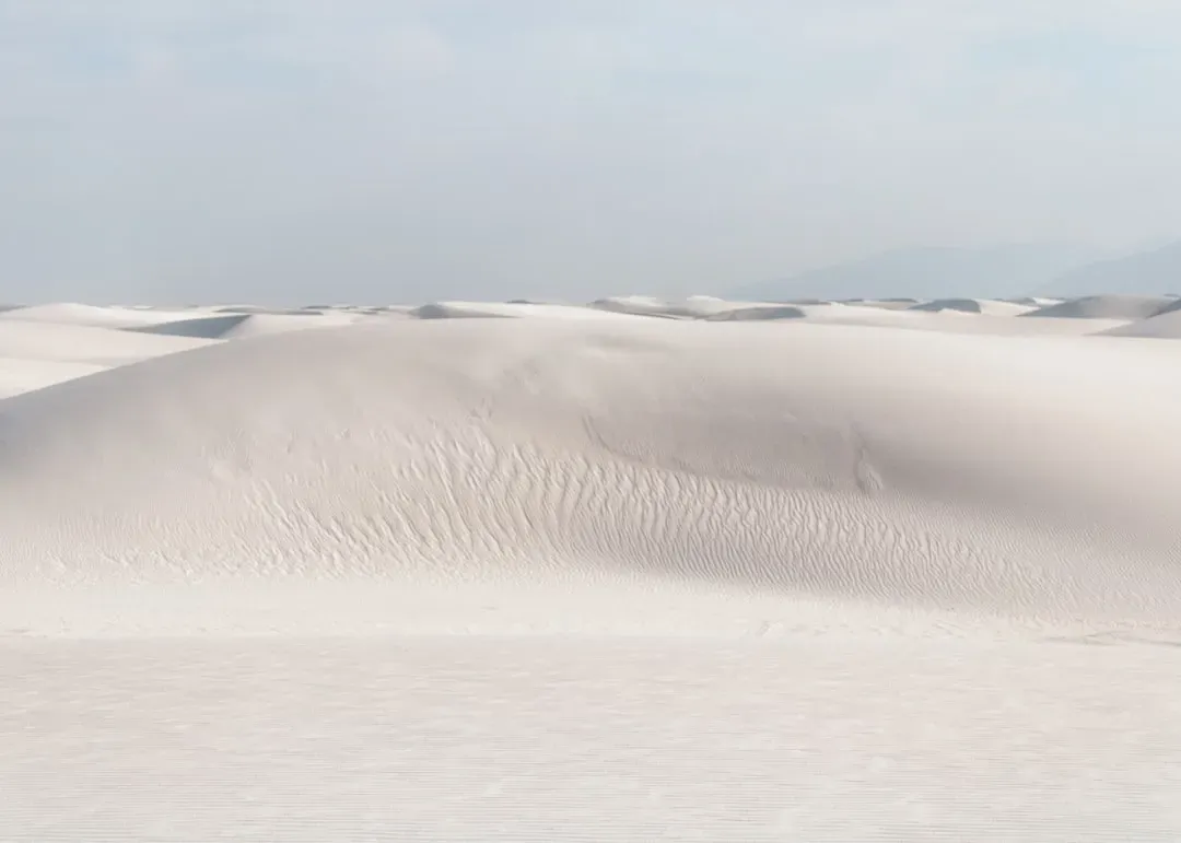
Most desert dunes on Earth are made of quartz sand and take on shades of tan, rust or brown. At White Sands in southern New Mexico, though, you get an entire dune field that is stark white, almost blinding in the sun, formed mainly from tiny grains of gypsum. Gypsum usually dissolves in water and gets washed away, so the big question is how such a large, stable dune field built from this relatively fragile mineral could form and persist in one place.
The story seems to begin with nearby mountains shedding gypsum‑rich rocks, which then dissolved and collected in a closed basin where water had nowhere to drain but up into the air. As the shallow lakes evaporated in the arid climate, crystals formed, broke down and were blown into dunes. What’s still a bit mysterious is the long‑term balance: the dunes constantly migrate and change shape, yet the field as a whole remains, sustained by just enough fresh gypsum entering the system and just the right climate conditions to keep it from washing away or altering into other minerals. It’s like a natural experiment in fine‑tuned instability that, for now at least, still works.
Meteor Crater: A Tiny Hole with Outsized Questions
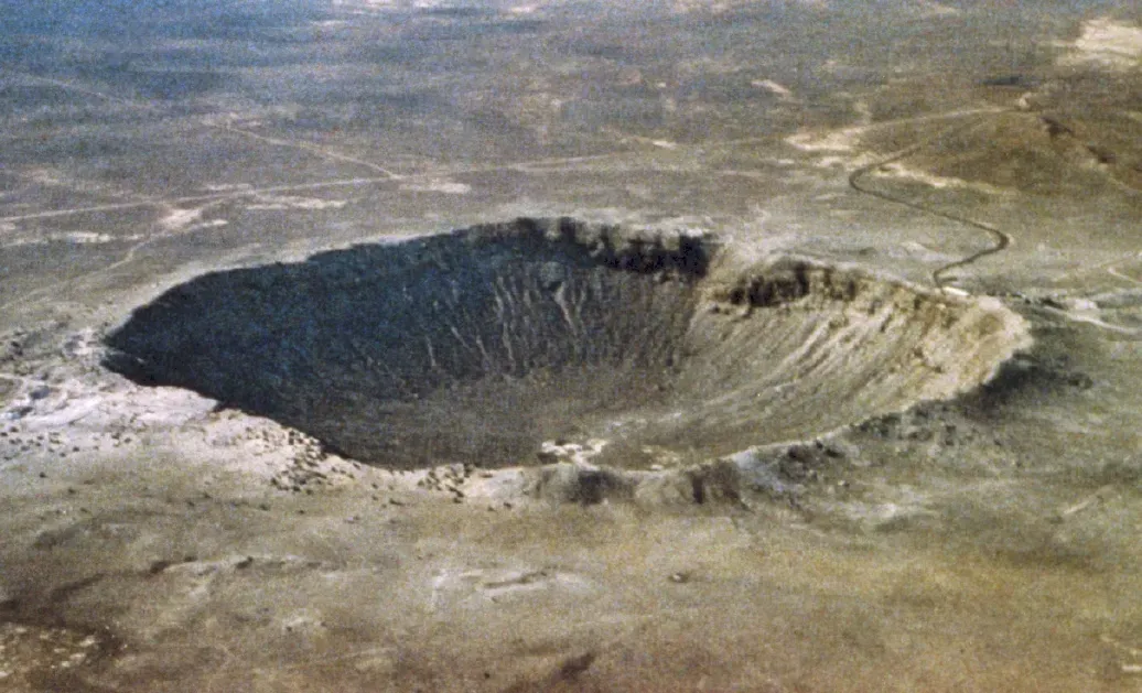
Meteor Crater in northern Arizona is one of the best‑preserved impact craters on Earth, a near‑perfect bowl roughly three quarters of a mile wide and a few hundred feet deep. Formed about fifty thousand years ago when an iron meteorite slammed into the high desert, it’s a textbook example of how violent and fast impact processes are. Yet even with this seemingly simple story, some details remain debated, like the exact size, angle and fragmentation of the meteor that created it.
Early estimates massively overpredicted the meteor’s mass, assuming a mostly intact object that punched through with brute force. More recent work suggests that much of the meteor vaporized or shattered just before impact, delivering intense energy in a complex shock wave that excavated the crater. Questions remain about how much of the original metal is still buried, how far ejecta traveled, and how rapidly the crater’s sharp features have eroded in relatively recent geologic time. This small scar on the landscape keeps challenging our models for larger, older impacts that are far less pristine.
The Colorado Plateau: An Uplift Without the Usual Crumples
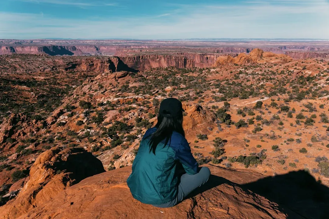
One of the strangest things about is how the Colorado Plateau – a giant block underlying much of Arizona, Utah, Colorado and New Mexico – rose thousands of feet without getting completely crumpled. Usually when pieces of crust get pushed up that high, they fold, fault and deform, leaving twisted layers and obvious mountain‑building scars. On the plateau, enormous stacks of sedimentary rock are elevated yet remain mostly flat and intact, like someone lifted a thick, layered cake without smearing the frosting.
Geologists agree that deep tectonic forces and changes in the underlying mantle played a major role, but the exact mechanism is still hotly debated. Did hotter, buoyant mantle well up beneath, pushing the crust from below? Did chunks of denser lower lithosphere peel away and sink, allowing lighter rocks to rise in response? The plateau’s very existence shapes almost every other landscape in the region, from canyon incision to river patterns, yet the ultimate “why” behind its smooth‑style uplift is still not fully settled – and that bugs a lot of geologists in the best possible way.
Slot Canyons of Utah and Arizona: Extreme Sculptures in Soft Stone
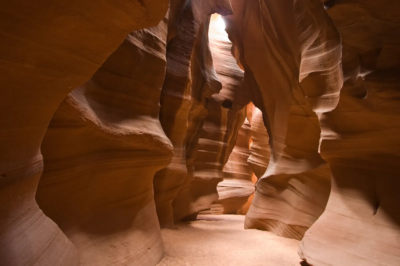
Places like Antelope Canyon in Arizona or the countless slot canyons of southern Utah feel more like underwater caves than desert ravines – narrow corridors of sandstone where light filters down in colored beams and walls twist in fluid shapes. These canyons are usually carved into relatively soft, well‑cemented sandstones by rare but violent flash floods that rip through with astonishing force. The basic idea is clear: water plus gravity plus time equals canyon. But why do some areas produce such deep, narrow, and elegantly carved slots while nearby regions with similar rocks do not?
The answer seems to involve a delicate mix of fracture patterns in the rock, rainfall intensity, basin size, and the way sediment is moved or trapped. A slightly different joint spacing, a minor shift in slope, or a change in storm frequency can mean the difference between a broad wash and a razor‑thin chasm. Scientists can model these factors, but pinning down exactly why a specific canyon took its particular shape is almost like reverse‑engineering a sculpture from the chisel marks alone. That persistent uncertainty is part of why these places feel so otherworldly; you sense the power that carved them, but the script it followed is still partly hidden.
The Hopi Buttes Volcanic Field: Explosive Events in an Odd Place
In northeastern Arizona, around the Hopi Buttes, the landscape is dotted with odd volcanic features: eroded cones, crater‑like depressions, and popcorn‑like mounds of fragmented rock. These are remnants of phreatomagmatic eruptions, where rising magma violently met groundwater or shallow surface water, triggering steam‑driven explosions that tore both rock and magma apart. What puzzles geologists is not just the style of eruption – though that’s dramatic enough – but the broader context: why here, in this particular part of the Colorado Plateau, and during that specific window of geologic time?
The magma in this region appears to have been relatively small in volume and short‑lived, more like a scattered rash than a sustained volcanic chain. Some researchers think it reflects subtle changes in the mantle or crustal stress fields, creating brief pathways for magma to sneak upward before the system re‑stabilized. Others suspect deeper‑seated processes that we still do not fully understand, tied to how the plateau has evolved over tens of millions of years. The Hopi Buttes field is like a cryptic note left by the Earth’s interior: we know it means something important about how this corner of the Southwest works, but we are still translating the language.
Conclusion: A Landscape That Refuses to Be Fully Solved
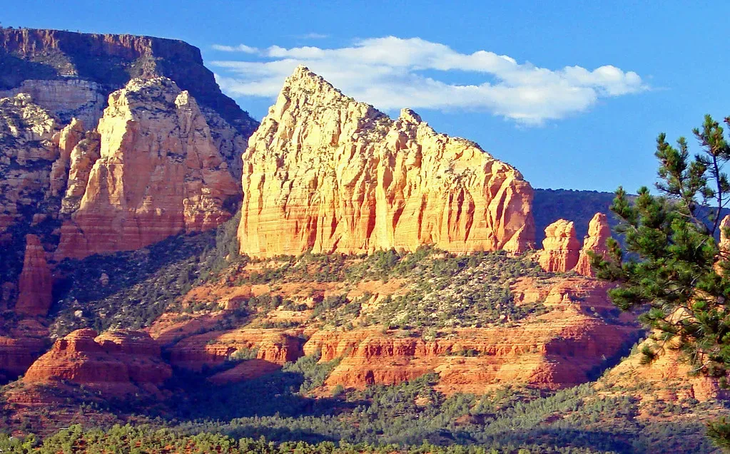
When you zoom out, these eight mysteries reveal something bigger than any single canyon, crater or dune field: is not just scenic, it is stubborn. It resists tidy explanations, and every new study peels back one layer only to expose more questions underneath. I think that is exactly why this region gets under people’s skin – hikers, photographers, scientists, road‑trippers – we sense that we are walking through an unfinished detective story where the clues are billions of years old and the case file keeps expanding.
In my view, the most honest way to experience these places is to hold both truths at once: the Earth obeys understandable physical laws, and yet the specific way those laws played out here is still partially mysterious. That tension – between what we know and what we cannot yet quite explain – is what makes the Southwest feel almost alive, as if the land itself is withholding just enough to keep us curious. Next time you’re staring into a canyon or standing on a dune, maybe the real question is not how much we have figured out, but how much wonder we’re still willing to entertain; after all, would this region be nearly as magical if we had already solved every last piece of it?