
When you picture the birth of organised human settlement, you probably imagine mudbrick villages along desert rivers, not stone-paved streets and engineered harbors lying silent under the sea. Yet in the Mediterranean, whole chapters of early urban life are literally underwater, preserved where coastlines shifted, sea levels rose, and earthquakes tore land apart. When divers, marine archaeologists, and curious fishermen stumbled over these sites, they did more than find pretty ruins – they forced you to rethink when and how people first began living in planned, complex communities.
What makes these discoveries so unsettling is that they move the dial backward on everything you thought you knew about “how early is early.” You see towns with straight streets and drainage from ages when you were told people still lived in scattered huts; you see trade networks and social coordination where you expected isolation. As you go through these six finds, pay attention not just to what was discovered, but to what each one quietly says: organised life in the Mediterranean started earlier, was more sophisticated, and was more interconnected than the old timelines ever really allowed.
1. The Submerged Neolithic Village of Atlit‑Yam (Israel)
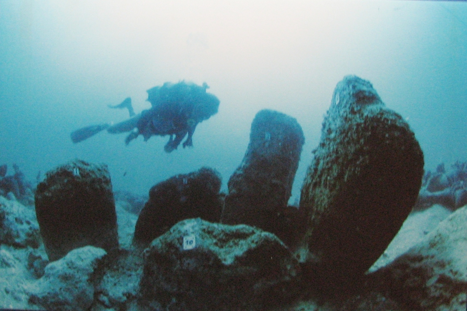
Imagine swimming over a stone circle that once surrounded a freshwater well, only to realise you’re looking at a planned community from before the invention of metal. Off the coast of present‑day Israel, at Atlit‑Yam, you find a Neolithic village now lying under several meters of seawater, with rectangular houses, stone‑lined wells, and even evidence of streets or pathways. When this site was first studied, it showed you that organised settlement, complete with water management and shared ritual spaces, was already present several thousand years before the big glittering cities of the Bronze Age.
What really shakes your sense of timing here is how “modern” some of the choices feel. People at Atlit‑Yam positioned houses in an orderly fashion, clustered communal areas, and tapped coastal resources with a clear system rather than random foraging. You see deliberate planning around water, food storage, and perhaps even social zones. Instead of a few scattered huts, you’re looking at a village with a layout and infrastructure that stretches your idea of just how early people in the eastern Mediterranean began living in tightly organised, permanent communities.
2. Pavlopetri’s Stone Streets and City Blocks (Greece)
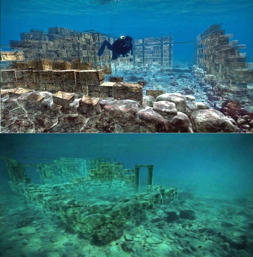
Now head to the southern coast of Greece, where a ghost city named Pavlopetri lies under shallow water. As you glide above it, you can trace straight streets, cross‑roads, and rectangular house plots like a sunken blueprint. Many of these features date back to the early second millennium BCE, with some evidence that parts of the settlement may be rooted in an even older, early Bronze Age phase. When you follow the lines of those streets, you realise you’re seeing one of the earliest known planned towns in the world, not just a random scattering of structures.
Pavlopetri forces you to adjust your expectations about when people in the Mediterranean started thinking like urban planners. You’re not just seeing a fishing village that grew organically; you’re looking at mapped‑out neighborhoods, designated open spaces, and possibly even zoning between domestic and public or commercial areas. That kind of spatial organisation tells you that, long before classical Athens or imperial Rome, communities around the Aegean were already coordinating land use, infrastructure, and daily life in ways that feel strikingly familiar to modern eyes.
3. The Old Harbor Works of Alexandria (Egypt)
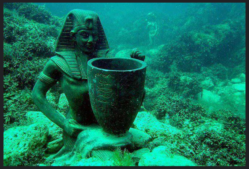
When you think about Alexandria, you probably picture it as a Hellenistic showpiece from the time of Alexander and his successors. But when archaeologists mapped the drowned royal quarter and harbor works, they uncovered older structures and reused foundations that hint at a much longer story of organised settlement along that shoreline. As you follow the remains of breakwaters, quays, and carefully aligned building platforms, you see that the spot chosen for Alexandria sat on top of earlier phases of coastal engineering and occupation.
This underwater landscape shows you that the idea of a carefully planned, infrastructural city there did not just appear overnight with a famous name. Instead, you have layers of human intervention into the coastline: harbors adapted to currents and winds, mooring areas set out in logical patterns, and monumental zones oriented with a sense of geometry and order. Even if the deepest phases are fragmentary, the cumulative evidence nudges you toward the conclusion that organised settlement and large‑scale coastal planning in the Nile delta stretch deeper into the past than the classical branding suggests.
4. The Submerged Structures of Baiae and the Phlegraean Fields (Italy)
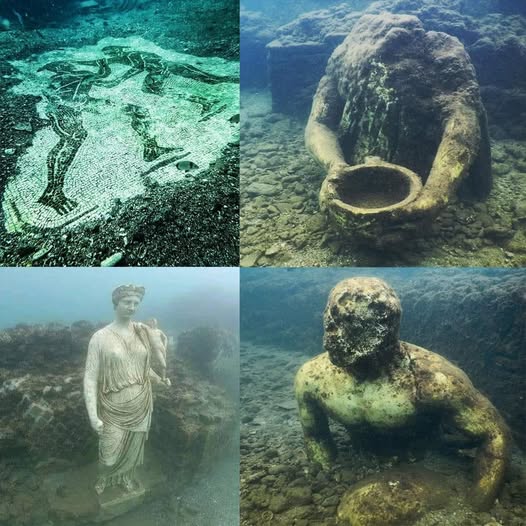
On the Bay of Naples, in what used to be a luxurious Roman resort area, you can snorkel over mosaics, courtyards, and entire villa complexes now resting several meters under the waves. At first glance, Baiae seems like a high‑end leisure destination from the late Republic and early Empire, not something that would rewrite early settlement history. But when you look closer, you start to see that the submerged zones preserve a sequence of coastal development, some of it rooted in earlier, more modest installations that map a long tradition of organised life along this volatile shore.
Because the region is volcanically active, parts of the coast have sunk gradually, taking with them streets, warehouses, and infrastructure that chart how people kept re‑planning their space in response to land movement and sea change. You can follow carefully aligned sea walls, jetties, and storage areas that show repeated rounds of urban redesign, rather than haphazard rebuilding. This long, underwater record makes you rethink how early and how systematically communities in southern Italy were managing risk, trade, and dense settlement long before the area became famous as a Roman playground.
5. Bronze Age Coastal Settlements Around Cyprus
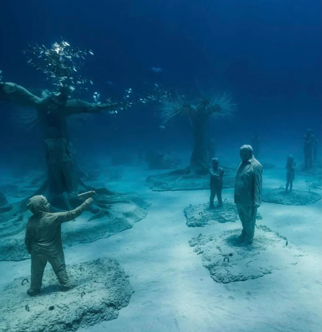
All around Cyprus, you find hints of Bronze Age coastal settlements that now sit partly or wholly underwater: harbor installations, foundations, and stone alignments that once fringed bustling shorelines. When you explore these, you see that they are not isolated farmsteads, but nodes in a tightly woven network of organised communities trading with the Levant, Anatolia, and the Aegean. The presence of structured quays, storage areas, and regular building plots in some of these drowned zones shows you that urban‑style planning was already alive on the island much earlier than many older models of Mediterranean development admitted.
Cyprus makes you confront the idea that organised human settlement did not radiate from a single, late “cradle,” but emerged in overlapping waves across multiple coasts. By mapping submerged features together with those still on land, you can trace how certain sites started small and then grew into planned towns, while others were intentionally laid out near good anchorages from the beginning. That pattern suggests that from quite an early stage, people here were thinking about long‑term settlement, logistics, and inter‑regional trade as an integrated package rather than as a series of random, opportunistic moves.
6. An Ancient Landscape Beneath the Central Mediterranean Seabed

Not every discovery that shifts your sense of timing involves streets and walls; sometimes the real shock comes from buried landscapes themselves. In parts of the central Mediterranean seabed, seismic surveys and sediment cores have revealed traces of former river channels, shorelines, and possible lake basins that would have been dry land during earlier periods of lower sea level. When you picture these now‑hidden plains, you start to understand that they could have supported organised human activity far earlier than the current coastline suggests, even if direct ruins are still elusive.
This kind of evidence pushes you to think more broadly: if you only look at what is visible along today’s shores, you’re probably undercounting how early dense, stable communities appeared. Those drowned landscapes might once have hosted villages, seasonal aggregation sites, or even proto‑towns that connected different parts of the basin. While researchers are still cautious – because hard architectural proof is sparse – the possibility alone reminds you that the accepted dating of organised settlement is partly a function of what has survived above water. The real story may lie in the mud, waiting for the right technology and the right questions to finally bring it to light.
Conclusion: Rethinking Origins Through a Sunken World

When you step back from these underwater stories, a pattern emerges that is hard to ignore. Again and again, the bottom of the Mediterranean shows you that people were living in organised, planned communities earlier, and in more places, than the old land‑only timelines ever captured. Sunken villages, harbor works, coastal towns, and even buried landscapes all point in the same direction: your map of where and when complex settlement began has been missing entire coastlines.
You also realise that the line between “village” and “city” is much blurrier once you can see these sites in context. Straight streets in the Aegean, stone circles around wells in the Levant, and engineered coasts in Egypt and Italy all show people experimenting with order, infrastructure, and shared space long before the famous empires rose. As more of this submerged world is explored, you may find that the real birth of organised human life in the Mediterranean is not a single place or date, but a slow, interconnected tide that started rising earlier than you were ever taught – and is still reshaping how you think about your own beginnings.