Forget Atlantis. Forget the movie-plot version of “lost civilizations” with glowing crystals and prophecy stones. The real mystery is sitting in plain sight, carved into cliffs, buried under jungle canopy, and stacked into walls so tight you can’t slide a credit card between the stones.
Archaeologists aren’t debating whether humans built this stuff. They’re stuck on something more uncomfortable: entire societies pulled off engineering feats we still can’t fully replicate on paper, then vanished before anyone wrote down how they did it. Here are 14 vanished civilizations, and the infrastructure they left behind that nobody has ever fully explained.
#14 – The Nazca Culture And Their Impossible Lines
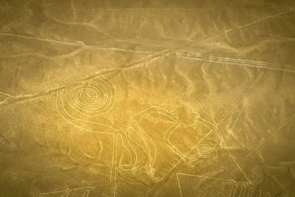
The Nazca people of coastal Peru carved massive lines and figures into the desert floor between roughly 200 BCE and 600 CE, long before anyone had ever seen the ground from above. Walk through the site and you’ll notice shallow trenches, nothing dramatic. Get into the air, and suddenly you’re staring at kilometer-long straight lines and animal figures the size of city blocks, drawn by people who never once saw their own masterpiece from a bird’s-eye view.
Modern experiments prove you can fake a Nazca-style figure with wooden stakes and rope. That’s the easy part. What nobody can convincingly explain is why the lines stay so relentlessly straight across kilometers of uneven desert, why they avoid crossing each other in ways that would ruin the design, and why some align precisely with solstices while others form massive trapezoids stretching hill to hill. There’s no blueprint tradition, no writing system, and no clear reason a society would sink this much labor into art meant to be invisible from the ground. This is the warm-up. #13 gets stranger.
#13 – The Indus Valley Cities And Their Hyper-Planned Streets
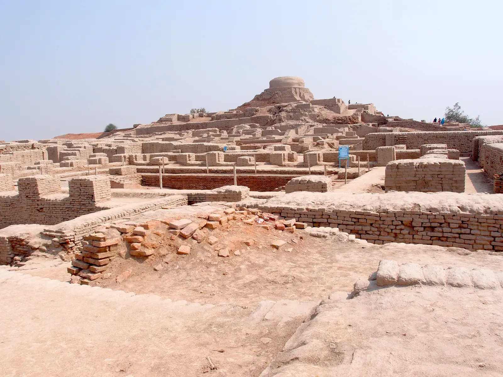
Most people assume urban planning started with the Greeks. Actually, the Indus Valley Civilization was running grid-planned cities with standardized bricks and covered sewage systems 4,500 years ago, while much of the world was still figuring out how to stack stones without them toppling over. Harappa and Mohenjo-Daro had straight streets aligned to the cardinal directions, and private homes with bathrooms plumbed into citywide drainage.
Fast Facts
- Mature Harappan phase ran roughly 2600 to 1900 BCE, at the height of the civilization
- Settlements spread across a vast area, making it one of the largest urban cultures of the ancient world
- Mohenjo-Daro’s Great Bath is considered one of the earliest known public water tanks anywhere
- Bricks and weights found hundreds of miles apart share nearly identical standardized dimensions
- The Indus script remains undeciphered after nearly a century of scholarly effort
Here’s the part that keeps researchers up at night: bricks found hundreds of miles apart share nearly identical dimensions, which screams centralized standardization. Yet there’s no palace, no giant temple, no obvious ruling-class complex that would normally organize something this coordinated. Their script still hasn’t been deciphered, so the instruction manual behind these cities is permanently locked. Around 1900 BCE, the whole system collapses, and that engineering fluency disappears with it. #12 takes the mystery vertical.
#12 – The Ancestral Puebloans And Their Cliff Cities
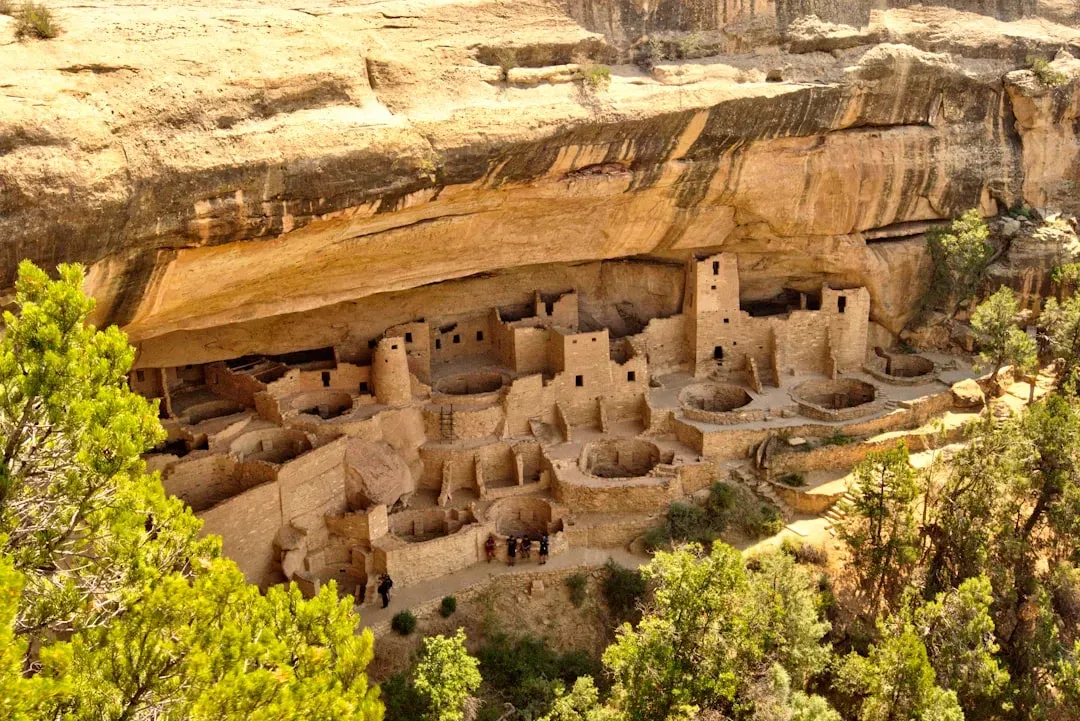
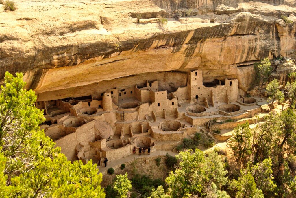
Cliff Palace at Mesa Verde looks like it was sketched in architecture software, not built by hand around 1200 CE in the American Southwest. The Ancestral Puebloans wedged multistory, apartment-style stone dwellings directly into sheer sandstone cliff faces, some tucked under overhangs that demanded a precise understanding of load-bearing rock and exactly how far you could push your luck.
The materials sound simple enough: stone, wood, plaster, hand tools. The logistics are the nightmare. Every beam had to be hauled down from higher elevations, every stone shaped by hand, every drop of water for mortar carried up steep cliff trails. Add ceremonial kivas, food storage, defensive sightlines, and ventilation built to handle both desert heat and mountain cold, and you’ve got a full engineering system with zero written plans behind it. By the 1300s, they walked away from these cities, taking the staging methods and labor systems with them. #11 goes back further than anyone expected.
#11 – Göbekli Tepe And The Stone Circles That Shouldn’t Exist
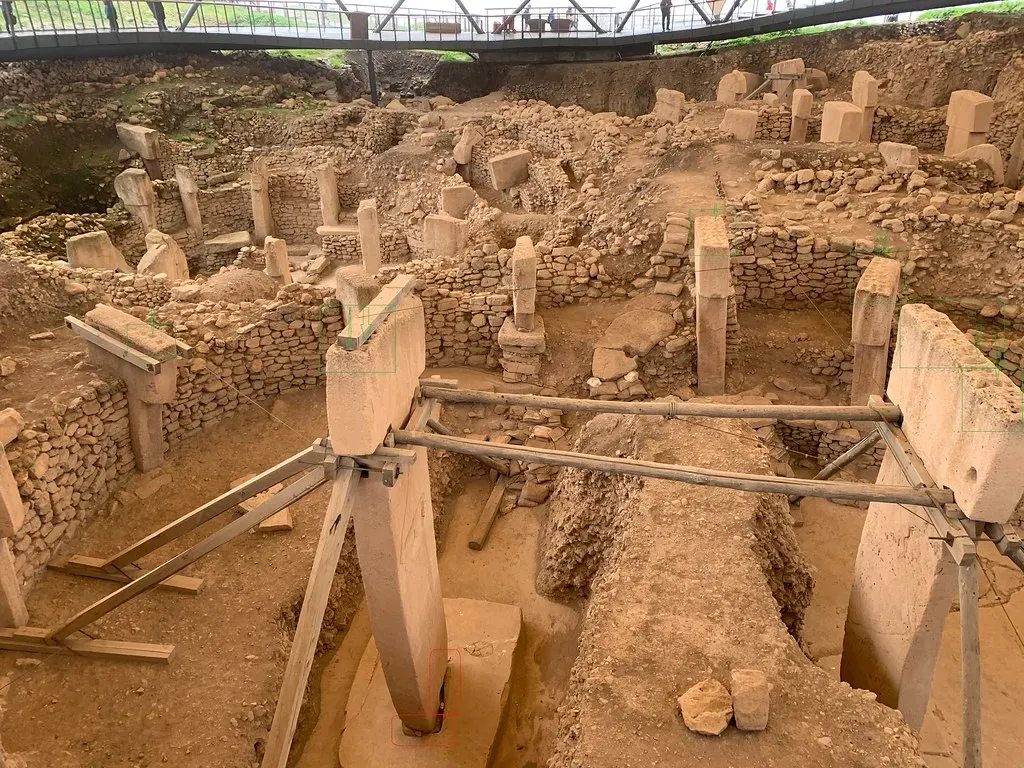
If you think monumental temples start with Egypt or Mesopotamia, Göbekli Tepe blows up the timeline completely. In southeastern Turkey, hunter-gatherers, people who hadn’t even invented farming yet, raised huge T-shaped limestone pillars weighing tons, arranged in circular enclosures around 9,500 to 8,000 BCE. That’s over 6,000 years older than Stonehenge, built by people history books insist were too “primitive” for organized megalith projects.
There’s no permanent housing at the site. No wheel, no draft animals, no obvious tools capable of the job. Yet someone coordinated dozens of workers to quarry, move, and raise multi-ton pillars carved with detailed animal reliefs, and then, strangest of all, deliberately buried much of it later. Klaus Schmidt, the archaeologist who led the excavation for decades, summed up why this site rewrites everything we assumed about early humans.
First came the temple, then the city.
Klaus Schmidt
That single idea flips the old story on its head: monumental architecture may have come before settled village life, not after. #10 takes us to an island where the mystery walks.
#10 – The Rapa Nui And Their Walking Stone Giants
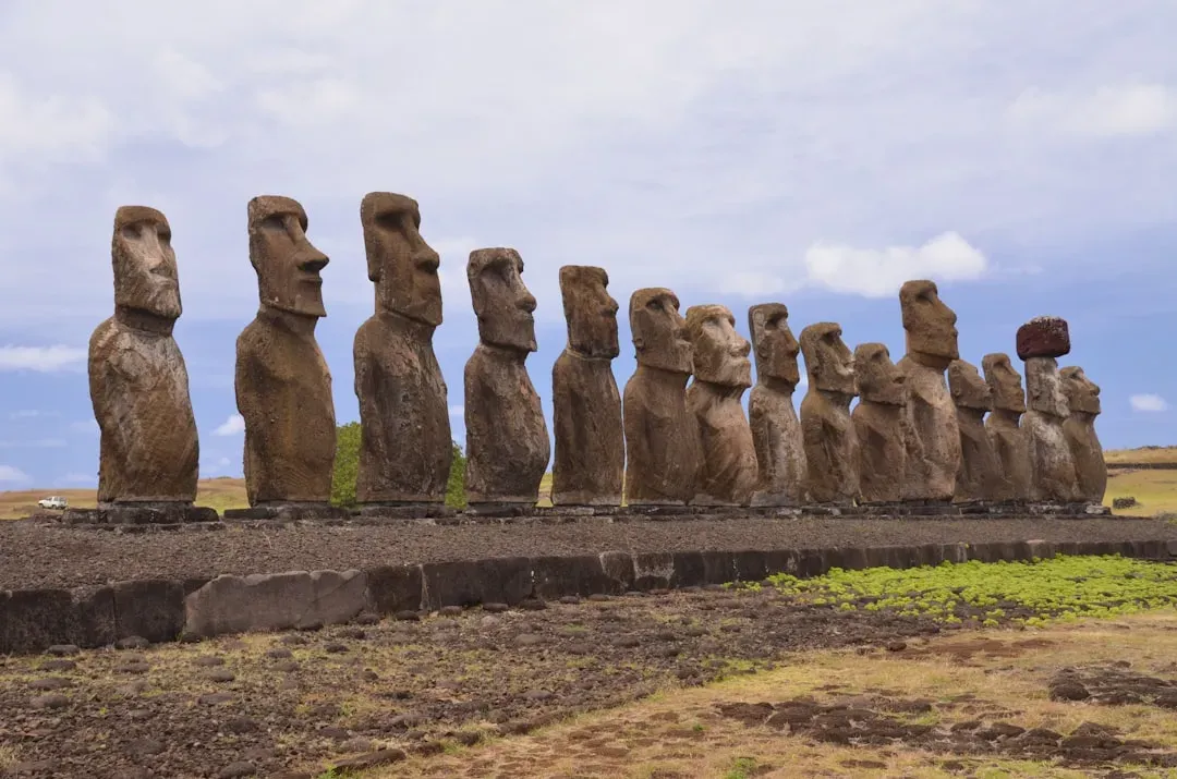
Everyone knows the moai of Easter Island. Fewer people realize the infrastructure behind them is a full system: quarries, road-like paths, stone platforms called ahu, and a genuinely baffling method for moving multi-ton statues across hilly terrain. Oral tradition insists the moai literally “walked” to their coastal platforms, and for centuries Europeans assumed that meant lost technology or armies of laborers dragging them with ropes.
Modern experiments proved you actually can rock a replica moai side to side and “walk” it forward with ropes. Mystery half-solved. But the bigger question lingers: why did a small, resource-limited island pour this much labor into statues and platforms in the first place? Some ahu align with astronomical events, others sit along paths with no clear practical purpose. The Rano Raraku quarry is still littered with half-finished statues, frozen mid-production, like the whole operation stopped overnight. #9 hides an entire lost urban world under the trees.
#9 – The Maya And Their Hidden Megacities
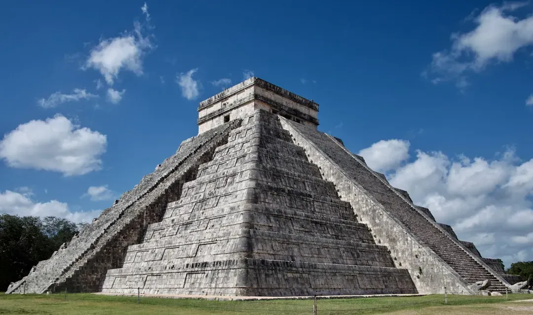
The stereotype is “jungle temple builders.” The reality is harsher and far more impressive: the Maya ran complex urban networks with raised causeways, engineered reservoirs, and agricultural terraces that we only fully saw once LiDAR scanning stripped away the forest canopy. Tikal, Calakmul, and Caracol were connected by elevated roads and kept alive by water systems built to survive brutal dry seasons, essentially pre-industrial hydrologists engineering an entire landscape.
Worth Knowing
- A 2018 LiDAR survey over Guatemala’s Petén region revealed more than 60,000 previously unknown structures
- The scan mapped roughly 2,100 square kilometers of dense jungle in a single sweep
- Hidden features included raised causeways, irrigation canals, and defensive earthworks invisible from the ground
- Researchers said the findings put Classic Maya complexity on par with ancient Greece or China
Seeing the infrastructure is easy now. Explaining how they built and maintained it at scale is not. Digging reservoirs, lining them with plaster, and managing runoff across an entire region takes sustained technical knowledge that never made it into the historical record, since surviving inscriptions obsess over kings and wars, not civil engineering. When drought and political collapse hit around 800 to 900 CE, the urban core emptied out, and the people who understood how to keep those reservoirs and canals running disappeared with it. #8 moves the story to American soil, where the pyramids are made of dirt.
#8 – The Mississippian Mound Builders And Their Earthen Pyramids
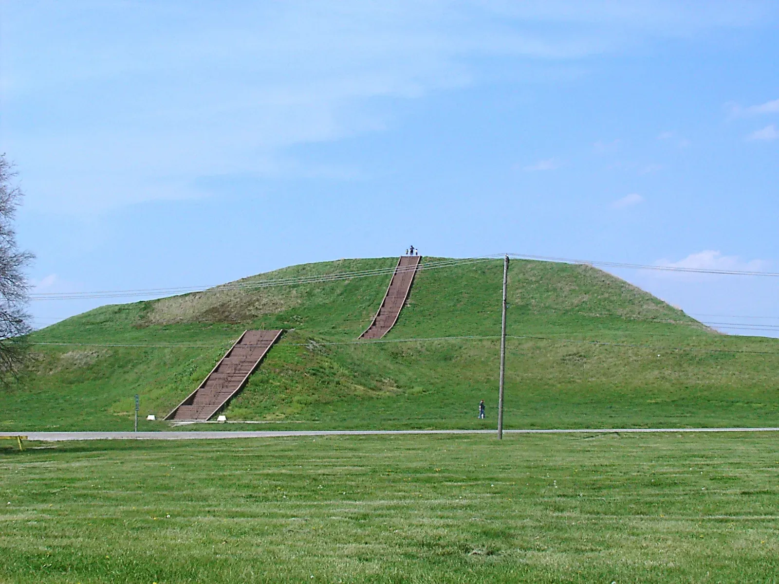
In what’s now the central United States, the Mississippian culture built platform mounds up to 30 meters tall, supporting wooden temples, elite residences, and public plazas. Cahokia, near modern St. Louis, had a population around 1200 CE that rivaled or beat many European cities of the same era. At its center stood Monks Mound, an earthwork that required moving an estimated millions of basketloads of soil, by hand, with no stone blocks, no metal tools, and no draft animals.
Stable earthen pyramids are shockingly hard to pull off. Builders had to choose the right soil types, layer them correctly, and engineer drainage so the whole thing didn’t slump into mud during the next flood. We can still find the borrow pits where the soil came from, but not the logistics behind organizing thousands of workers, or the accumulated knowledge that decided which clay went where. Disease and colonial disruption wiped out that expertise so fast that later European settlers genuinely speculated about who could have possibly built it. #7 turns the mystery into an invisible plumbing system carved into rock.
#7 – The Nabataeans And Their Desert Waterworks At Petra
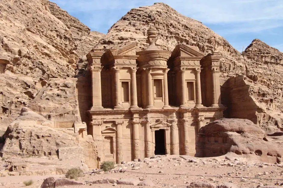
Petra gets its Instagram fame from rock-cut façades like Al-Khazneh. The far more impressive part is invisible in every photo: a finely tuned hydraulic system carved directly into cliffs and canyons, built to capture flash floods and move water through the desert on command. The Nabataeans, active from around the 4th century BCE to the 1st century CE, drilled tunnels, built covered channels, and even ran ceramic pipes to push water where gravity had no business cooperating.
Carving a dramatic façade with a chisel is one kind of skill. Engineering an entire hydrological network into sandstone, complete with subtle gradients, storage cisterns, sediment traps, and flood overflow systems, is an entirely different level of expertise. We can trace pieces of the system today, but the full sequence of construction, the surveying methods, and the apprenticeship systems that trained new masons and engineers vanished along with Nabataean independence once Rome absorbed the kingdom. Petra wasn’t just a carved city; it was an engineered water machine, and we still don’t know exactly how they planned it without a single modern surveying tool. #6 goes even bigger, an entire empire built on managed water.
#6 – The Khmer Empire And The Hydraulic Labyrinth Of Angkor
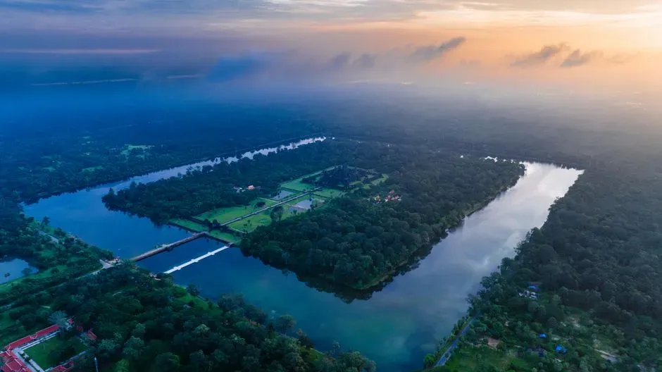
Most tourists see Angkor Wat and think “ancient temple.” In reality, Angkor, capital of the Khmer Empire from roughly the 9th to 15th century CE, was a sprawling urban-hydraulic complex covering hundreds of square kilometers, built around enormous reservoirs called barays, intricate canals, and engineered embankments. It wasn’t really one city. It was a water-managed landscape, and satellite surveys are still revealing how far it stretched.
At A Glance
- Greater Angkor’s urban core sprawled across roughly 3,000 square kilometers at its height
- Population estimates for the 13th century peak run between 700,000 and 900,000 people
- That made Angkor roughly ten times more populous than London at the same period, which had about 80,000 residents
- Massive reservoirs called barays, some stretching several kilometers long, anchored the water system
Those barays weren’t decorative; they stored and redistributed water to support rice cultivation at an almost industrial scale. But a system like that demands constant dredging, rebuilding, and technical oversight, and the physical evidence shows generations of modifications, diversions, and emergency fixes. What’s missing is the paperwork: no detailed Khmer technical texts survive explaining how engineers calculated flows, designed spillways, or decided what to fix first. As climate swings and political pressure mounted, cracks in this system may have quietly helped bring the empire down. #5 goes underground, literally.
#5 – The Hittites And Their Rock-Cut Sanctuaries And Tunnels
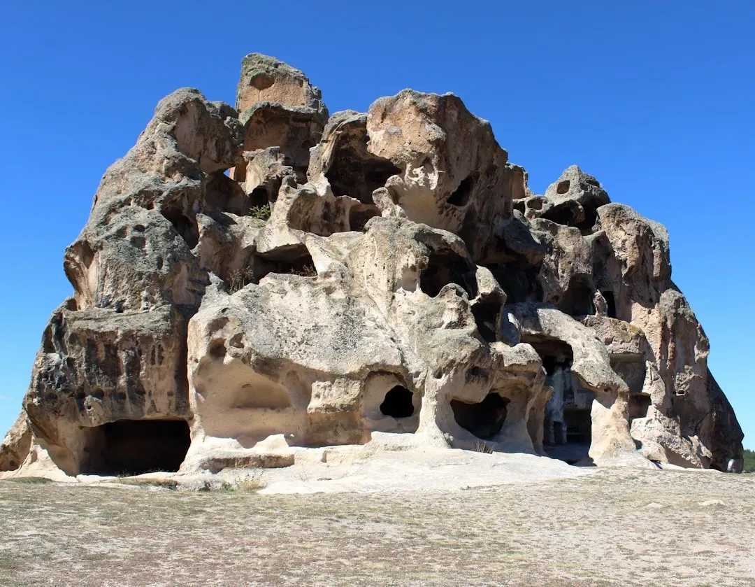
The Hittite Empire, centered in Anatolia during the 2nd millennium BCE, is famous in ancient texts as a genuine rival to Egypt. On the ground, their legacy includes rock-cut sanctuaries like Yazılıkaya and underground water tunnels bored through hills to protect their capital, Hattusa, during sieges. They shaped limestone into relief-filled chambers and carved passageways barely wide enough for one person, purely to keep water flowing when the city needed it most.
Cutting stable tunnels through bedrock without modern drilling means someone understood rock stability, ventilation, and drainage well enough to bet lives on it. The tools, bronze chisels and hammers, aren’t the mystery. The organizational brain behind the projects is. Surviving Hittite records are packed with treaties, rituals, and royal drama, and say almost nothing about how labor crews were trained or how tunnel alignments were set. When the empire collapsed around 1200 BCE, that practical know-how faded fast, leaving later societies to reuse infrastructure they didn’t fully understand either. #4 introduces stone heads that shouldn’t have been movable at all.
#4 – The Olmec And Their Basalt Heads And Drained Platforms
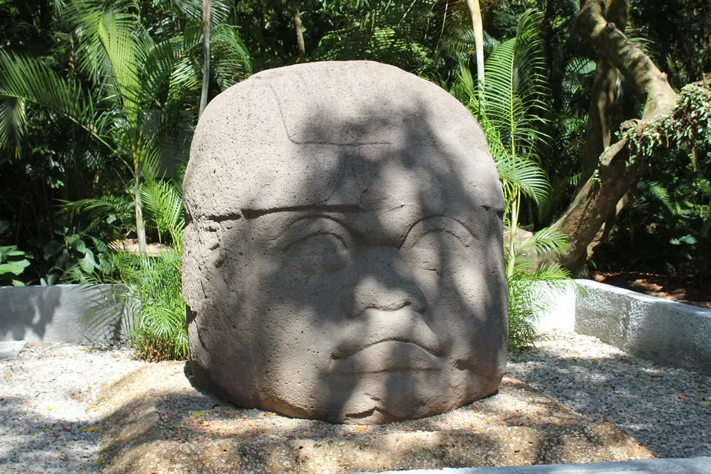
Before the Maya or Aztec existed, the Olmec, active roughly 1500 to 400 BCE, produced colossal basalt heads weighing up to 40 tons, alongside artificially leveled platforms and early drainage systems across the Gulf Coast lowlands of Mexico. The quarries sat miles from the final display sites, across swamps and rivers, with no beasts of burden and no wheels anywhere in the toolkit.
Experimental archaeology shows wood rollers, rafts, and large labor crews could technically do it. But then there’s the platforms: whole areas raised, flattened, and lined with stone drains to handle heavy seasonal rain. That’s not a single heroic effort; that’s sustained, repeated civil engineering across generations. With no Olmec writing system and no preserved project plans, we’re left guessing at how they trained and organized the labor that built it all in the first place. #3 gave the ancient Greeks such a shock they blamed giants.
#3 – The Mycenaeans And Their Cyclopean Fortresses
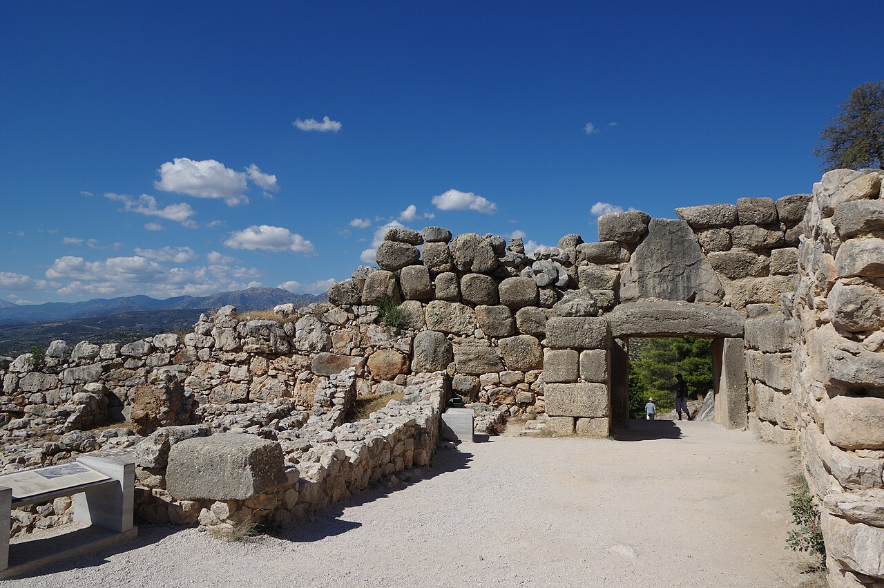
Ancient Greeks looked at Mycenaean walls centuries later and decided normal humans couldn’t possibly have built them, so they credited the Cyclopes, one-eyed giants from myth. That’s literally where the term “Cyclopean masonry” comes from. At sites like Mycenae and Tiryns, dating roughly 1600 to 1100 BCE, huge limestone boulders weighing several tons were fitted together with no mortar at all, alongside corbelled arches and underground cisterns that Classical-era Greeks themselves never fully replicated.
The Mycenaeans had bronze tools, wooden levers, sledges, and rope, which sounds like enough until you try lifting and stabilizing multi-ton blocks on a steep hillside without triggering a collapse. The irregular stones interlock so well they distribute weight and resist earthquakes, no small achievement in one of the most seismically active regions on Earth. Yet the Linear B tablets that survive mostly record grain rations and religious offerings, never engineering methods. When the palaces fell around 1200 BCE, that megalithic know-how went down with them, and later Greeks quietly switched to smaller, regular blocks and mortar instead. #2 might be the single most argued-over ruin on the planet.
#2 – Tiwanaku And The Precision-Cut Stones Of The Altiplano
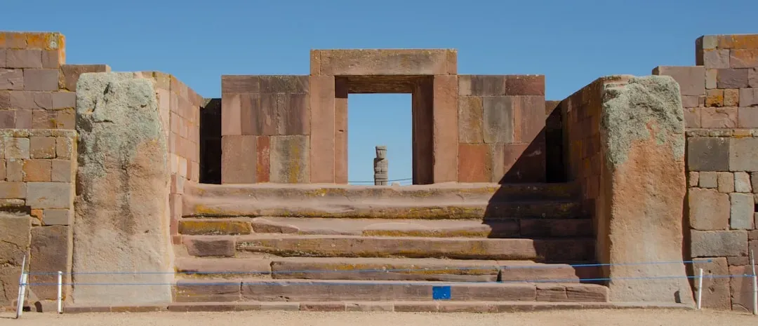
On the southern shores of Lake Titicaca in Bolivia, the Tiwanaku civilization, active roughly 500 to 1000 CE, left behind stone blocks cut with a precision that still sparks genuine arguments among archaeologists. At Puma Punku, andesite and sandstone blocks show clean right angles, complex notches, and interlocking shapes so flat that early explorers assumed machine tools had to be involved.
The likely toolkit, stone hammers and abrasive sand, is plausible enough. What’s missing is a clear explanation for the consistency of that precision across multiple separate structures, some with repeating cutouts that look almost modular, like standardized parts for a larger assembly. Empty sockets suggest T-shaped metal clamps once reinforced the stonework, hinting at a structural sophistication we can see evidence of but can’t fully reconstruct. No written language survives, and later Inca stories about the site lean mythic rather than technical, so the actual measuring systems and workshop organization stay just out of reach. #1 belongs to a civilization that built earthquake-proof walls in less than a hundred years.
#1 – The Inca And Their Earthquake-Proof Stone Cities
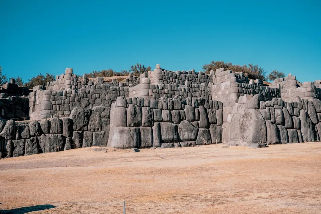
If any vanished civilization earns the top spot, it’s the Inca. In under a century before Spanish conquest, roughly the early 1400s to the 1530s, they built a road network spanning thousands of kilometers, high-altitude agricultural terraces, and jaw-dropping stone cities like Machu Picchu, Sacsayhuamán, and Ollantaytambo. Their signature move: polygonal stone walls fitted so tightly you can’t slide a knife blade between the blocks, with zero mortar, in one of the most earthquake-prone regions on the planet.
Why It Stands Out
- The Qhapaq Ñan road network stretched an estimated 30,000 to 40,000 kilometers across six modern countries
- All of it was built without iron tools, wheeled carts, or draft animals suited to hauling heavy stone
- Signature walls were fitted so precisely that a knife blade still can’t slip between the blocks today
- Most of this was achieved in roughly one century, right before Spanish conquest ended it
We know some of the tools: stone hammers, wooden levers, ramps, maybe bronze chisels for detail work. What we don’t know could fill a library. How did they plan multi-angle block shapes before ever moving the stone? How did they haul massive boulders up mountains with no wheels and no animals built for that kind of hauling? How did walls built without mortar consistently outlast quakes that crack colonial and modern buildings around them today? Spanish chroniclers described labor levies and some building practices, but they never understood the actual techniques, and they destroyed or repurposed huge amounts of Inca construction in the process. The road system alone, paved in sections, threaded with suspension bridges and cliffside staircases, remains under-documented even now. The training systems that produced those stonemasons died out within a generation of colonization, and they never came back.
The Bottom Line
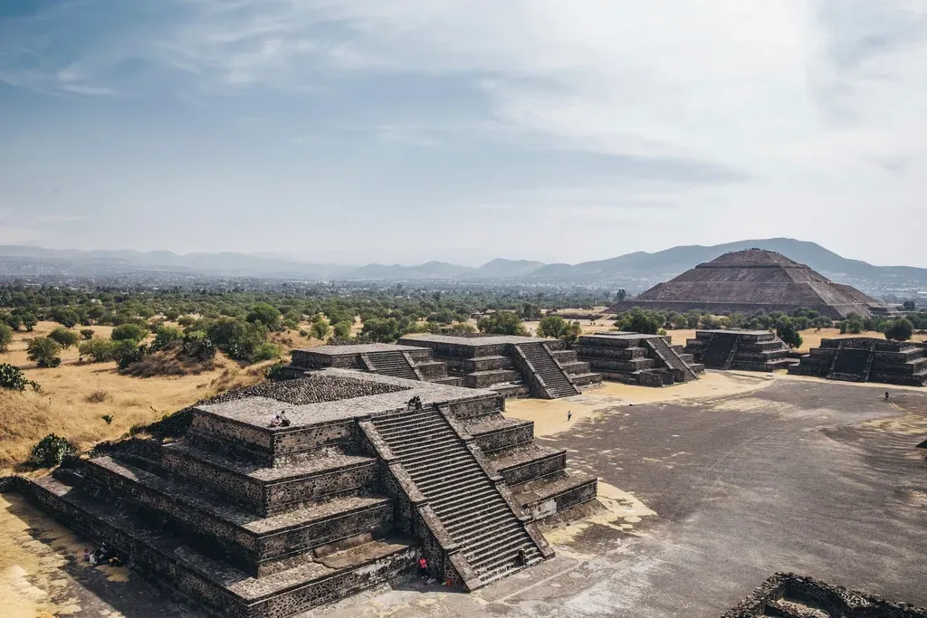
Across continents and thousands of years, the pattern never changes: humans clearly built all of this, but the “how” stayed stubbornly undocumented. Perfectly aligned desert lines, earthquake-resistant walls, engineered desert water systems, hidden jungle megacities, and altiplano stone puzzles, and almost none of it comes with a surviving manual, blueprint, or firsthand engineering note.
Sometimes conquest and disease wiped out the knowledge in a single generation, like with the Inca and the Maya. Sometimes the builders never wrote anything down to begin with, like at Göbekli Tepe or the Nazca lines. It’s easy, and frankly lazy, to fill those gaps online with aliens or imaginary lost super-technology.
The real answer is more unsettling: ordinary people, with simple tools and no written instructions, kept pulling off infrastructure that we still can’t fully reverse-engineer on paper, even with lasers, drones, and computer modeling on our side. That should worry us a little. If knowledge this advanced can vanish in a few centuries, how much of what we consider “obvious” today is really just one collapse away from becoming somebody else’s unsolved mystery? Which of these 14 do you think we’re still underestimating?