
You’ve seen the headline before: divers find a “sunken pyramid,” sonar catches a strange geometric shape, and within a week someone on television is whispering the word Atlantis. What almost never makes it into the follow-up coverage is the quieter, less exciting admission that comes months or years later – the one where the actual scientists say they still don’t know how old the thing is, and might never know.
That’s not because anyone is hiding something. It’s because water destroys the exact evidence archaeologists rely on most – organic material, tool marks, undisturbed soil layers – and stone simply doesn’t carbon-date the way bone or charcoal does. Some of the most famous submerged discoveries of the last several decades have quietly become permanent question marks in peer-reviewed journals and geology departments. These are 13 of them, and the disagreements behind each one are stranger than the sites themselves.
#13 – Malta’s Underwater Stone Circles
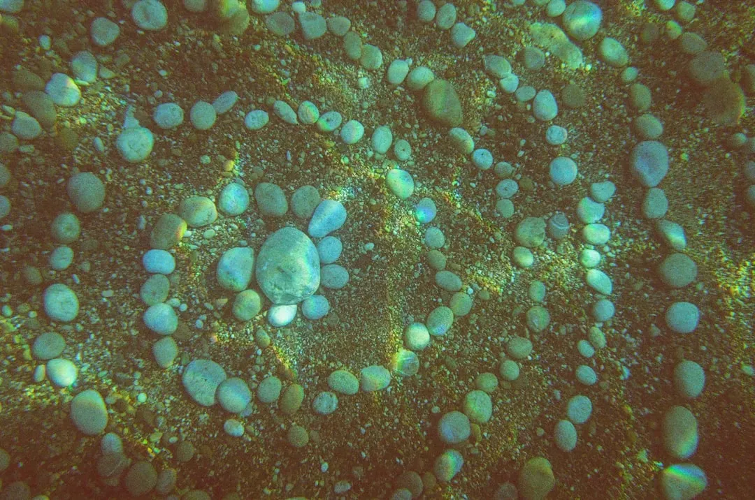
In 1999, a diver named Hubert Zeitlmair spotted odd circular carvings on the seabed near Sliema and Qawra, off Malta’s coast. The grooves looked deliberate, geometric, almost engineered – and within weeks, documentaries and tabloids were drawing comparisons to Stonehenge and Atlantis.
Most geologists who later reviewed the photographs leaned toward a far less thrilling explanation: modern quarrying scars or ordinary erosion channels, not an ancient monument. But no comprehensive, peer-reviewed excavation has ever definitively closed the case, and Malta’s own heritage authorities have never officially confirmed or fully debunked the site. That gap between “probably not ancient” and “confirmed modern” is exactly why divers still show up hoping to photograph something that finally changes the story.
#12 – The Azores “Pyramid,” Portugal
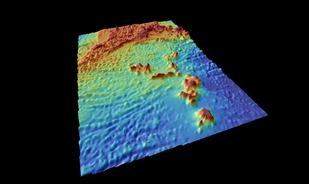
A seamount near Terceira Island in the Azores looks almost too symmetrical to be natural – a near-perfect pyramid shape sitting on the ocean floor. When amateur researchers shared sonar-style imagery online, it went viral overnight, helped along by the fact that the structure sits at a depth that would have placed it above water during past ice ages.
No peer-reviewed marine geology survey has ever confirmed the shape is anything other than a natural volcanic cone, a common feature in this tectonically active archipelago. Portuguese officials haven’t rushed to fund a formal expedition, mostly because symmetrical volcanic slopes aren’t unusual here. But that lack of investigation means the “natural versus built” debate has never actually been settled with hard data – it’s simply been left alone.
#11 – Lake Michigan’s “Stonehenge”
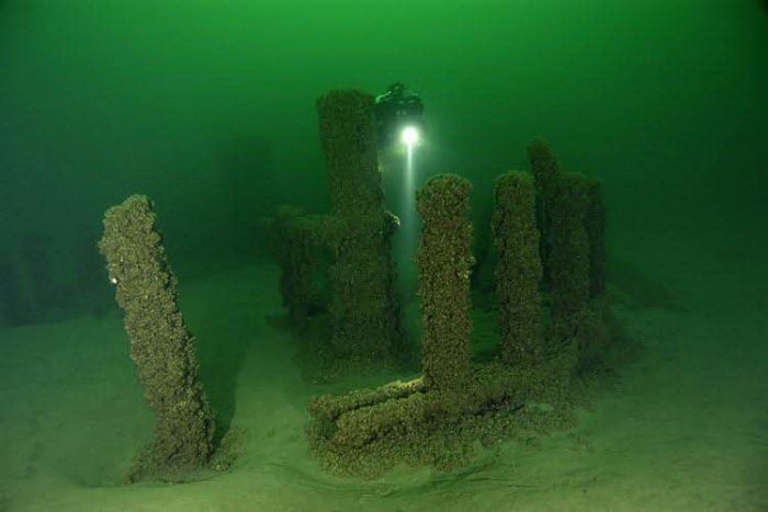
Michigan is about the last place you’d expect a Stonehenge-style boulder circle, yet that’s precisely what a team mapping shipwrecks stumbled onto in Grand Traverse Bay. Sonar revealed stones arranged in a rough circle, submerged since post-glacial times when water levels were dramatically lower than today.
One boulder appears to carry markings resembling a mastodon, an animal that vanished from the region roughly 10,000 years ago. If that carving is authentic, it would predate written history in North America – but nobody has been able to reliably date the stone itself, because rock simply doesn’t hold a carbon signature the way bone or charcoal does. Researchers have refused to call it definitively man-made or pure coincidence, so the site sits there, submerged and unexcavated, exactly as mysterious as the day it was found.
Fast Facts
- Location: Grand Traverse Bay, Lake Michigan
- Found by a team originally searching for shipwrecks using sonar
- Boulders form a rough circle, with one stone bearing a possible mastodon carving
- Submerged since post-glacial times, when lake levels were far lower
- Dating roadblock: stone holds no carbon signature to test
#10 – Mahabalipuram’s Underwater Temple Ruins, India
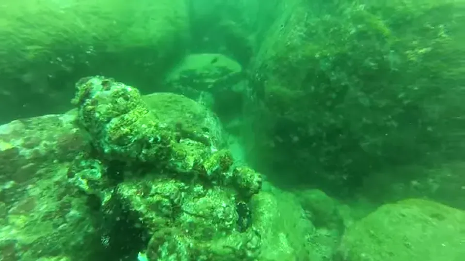
When the 2004 Indian Ocean tsunami briefly pulled the water back from shore near Mahabalipuram, stunned locals saw stone structures that had never been documented on land. Marine archaeologists who later dove the site found wall remnants and what looked like temple foundations sitting just offshore – matching centuries-old local legend of “Seven Pagodas” swallowed by the sea.
The trouble is figuring out which era the submerged stones actually belong to. Some structures line up with the well-documented Pallava dynasty of the 7th and 8th centuries, while others look distinctly older and don’t match any confirmed building period. Silt, coral growth, and repeated monsoon disturbance have made it nearly impossible to excavate with the precision land archaeology allows, leaving researchers with a layered site they can’t cleanly separate by age.
#9 – Lake Titicaca’s Underwater Ruins, Bolivia
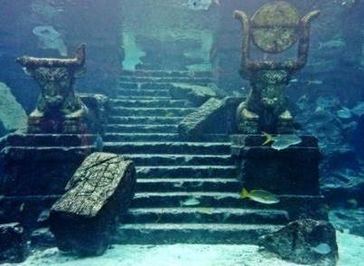
High in the Andes, Lake Titicaca has long been sacred ground to the Tiwanaku and Inca civilizations. So when divers reported temple-like stone structures on the lakebed – including what looked like a terrace, a long wall, and a road – the announcement made international news almost overnight.
Researchers have never agreed on whether the structures belong to the Tiwanaku culture, which predates the Inca by centuries, or to a much older and unidentified building tradition. The lake’s cold, low-oxygen water preserves stone shape beautifully but destroys the organic material scientists need for reliable dating. Extreme altitude and brutal diving conditions have limited follow-up dives ever since, so the mystery has simply been left exactly where it was found – underwater and unresolved.
#8 – Fuxian Lake’s Submerged City, China
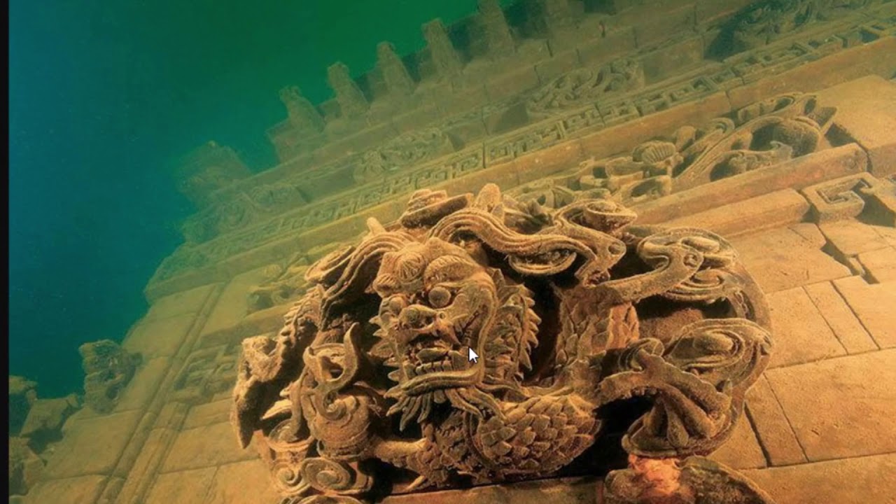
For over two decades, divers and sonar teams have been drawn to Fuxian Lake in Yunnan Province, where side-scan images revealed what looked like walls, stone platforms, and paved paths beneath the surface. Local legend had long spoken of a city swallowed by the lake, and the sonar findings seemed to confirm it.
Chinese researchers have tentatively linked the ruins to the ancient Dian Kingdom, a Bronze Age culture that flourished in the region more than 2,000 years ago. But no single excavation has produced organic material clean enough to carbon-date with confidence, so age estimates still swing across several centuries depending on which research team you ask. Government-sponsored dives continue on and off, but murky sediment and depth have slowed any conclusive survey.
#7 – Doggerland’s Submerged Landscape, North Sea
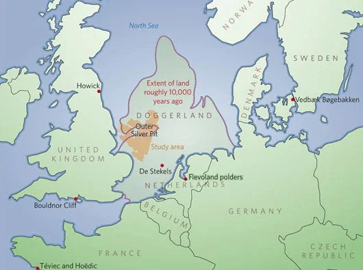
Doggerland was once a real, walkable landmass connecting Britain to mainland Europe before rising seas swallowed it roughly 8,000 years ago. It remains one of the largest verified “lost worlds” on Earth, and fishing trawlers have dragged up flint tools, antler harpoons, and even mammoth remains from the seabed for over a century – solid proof that people lived there.
The complication is that trawled artifacts arrive completely out of context, ripped from the sediment layers that would normally help scientists date them precisely. Individual tools can sometimes be dated on their own, but entire settlement structures found via sonar often can’t be tied to a specific century, because storms and currents have scrambled the seafloor for thousands of years. Doggerland proves people were there – it just can’t always say exactly when.
Worth Knowing
- Once formed a walkable land bridge between Britain and mainland Europe
- Disappeared beneath rising seas roughly 8,000 years ago
- Trawlers have pulled up flint tools, antler harpoons, and mammoth remains
- One of the largest confirmed “lost worlds” on the planet
- Artifacts often lose their sediment context, making precise dating difficult
#6 – The Pantelleria Vecchia Bank Monolith, Italy
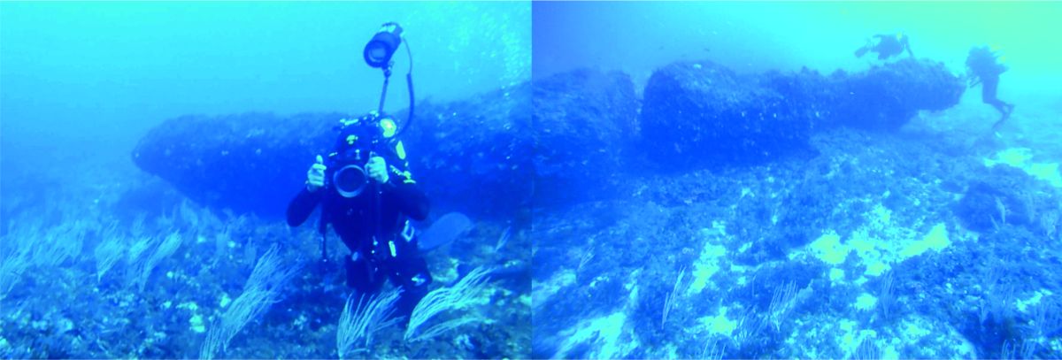
On a submerged plateau in the Sicilian Channel sits a single, oddly carved-looking monolith with multiple regularly spaced holes drilled straight through it. Geologists Emanuele Lodolo and Zvi Ben-Avraham dated the surrounding island’s submergence to a catastrophic flood roughly 9,300 years ago, which would place the monolith squarely in the early Mesolithic period.
That timeline would make it one of the oldest man-made structures ever found underwater anywhere on Earth – if the holes really were cut by human hands rather than natural fracturing. The problem is that dating the surrounding rock only tells scientists when the island sank, not necessarily when, or if, humans shaped the stone itself. Critics argue the holes could just as easily be natural mineral erosion along fault lines, and no direct dating of the monolith’s surface has ever settled the argument.
#5 – The Sea of Galilee’s Stone Monument, Israel
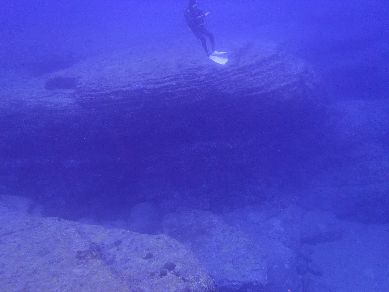
Sonar surveys mapping the floor of the Sea of Galilee in the early 2000s picked up something nobody expected: a massive, cone-shaped stone structure sitting on the lakebed, disconnected from any known shoreline settlement. It’s built from unhewn basalt boulders stacked into a shape resembling ancient burial monuments found on land nearby.
Its location deep in the lake makes conventional dating methods nearly impossible to apply. Researchers who studied the formation could only say it likely predates the lake’s current shoreline configuration, without being able to attach a firm century to its construction. No pottery, tools, or organic material have ever been recovered from beneath the stones – usually the only reliable way to date something like this – so the monument sits there, mapped but completely unexplained.
#4 – The Cuban Underwater Formation, Guanahacabibes
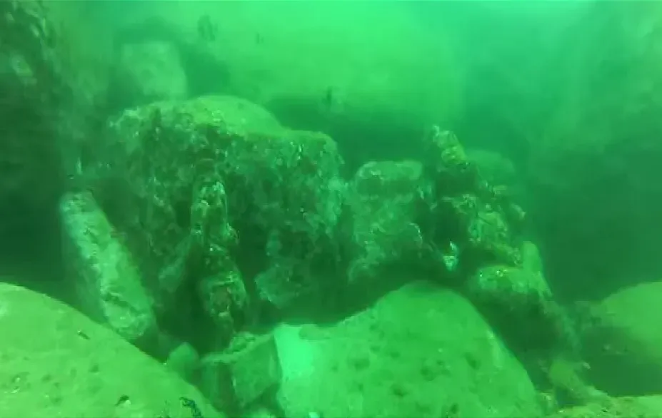
In 2001, marine engineers Paulina Zelitsky and Paul Weinzweig were surveying for shipwrecks off Cuba’s western tip when their sonar picked up something enormous nearly 2,000 feet down: geometric structures resembling pyramids, roads, and circular plazas spread across roughly two square kilometers. Some researchers floated estimates putting the formation at over 6,000 years old, which would make it older than the pyramids of Egypt if the number ever held up. Oceanographer Robert Ballard was openly skeptical, questioning how anything man-made could end up that deep.
Out of time and out of place.
Robert Ballard
No excavation has reached the site in the years since that first sonar pass, largely because the depth exceeds standard diving limits and demands expensive remote submersibles. It remains one of the only major “lost city” claims in modern marine archaeology that has never received a serious scientific follow-up.
At a Glance
- Discovered in 2001 by engineers Paulina Zelitsky and Paul Weinzweig
- Sits nearly 2,000 feet deep off Cuba’s western tip
- Geometric shapes span roughly two square kilometers
- Some estimates claim ages over 6,000 years old
- No formal excavation has ever followed up on the original sonar pass
#3 – The Gulf of Khambhat Cultural Complex, India
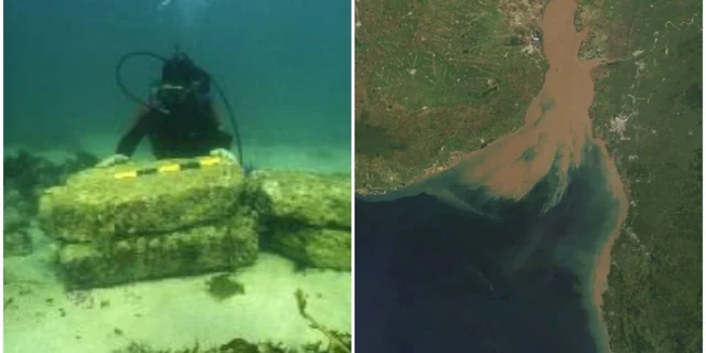
What started as routine pollution testing in the Gulf of Khambhat in 2000 turned into one of the most contested marine archaeology stories of the decade. Sonar revealed sprawling geometric structures spread across five square miles, and India’s National Institute of Ocean Technology recovered pottery, beads, and human remains from the site. Radiocarbon testing on some dredged material even returned dates of roughly 9,500 years.
But the case has one massive methodological flaw: the artifacts were recovered by dredging rather than controlled excavation, making it nearly impossible to confidently link any single dated piece to the site itself. Archaeologists have specifically rejected a piece of wood dredged from the area and dated to 7500 B.C., since dredging destroys the context needed to prove it actually belongs there. Some Indian officials have tied the ruins to the legendary city of Dwarka from the Mahabharata, but mainstream archaeologists remain unconvinced the dredged material can be reliably connected to any single occupation period.
#2 – The Bimini Road, Bahamas
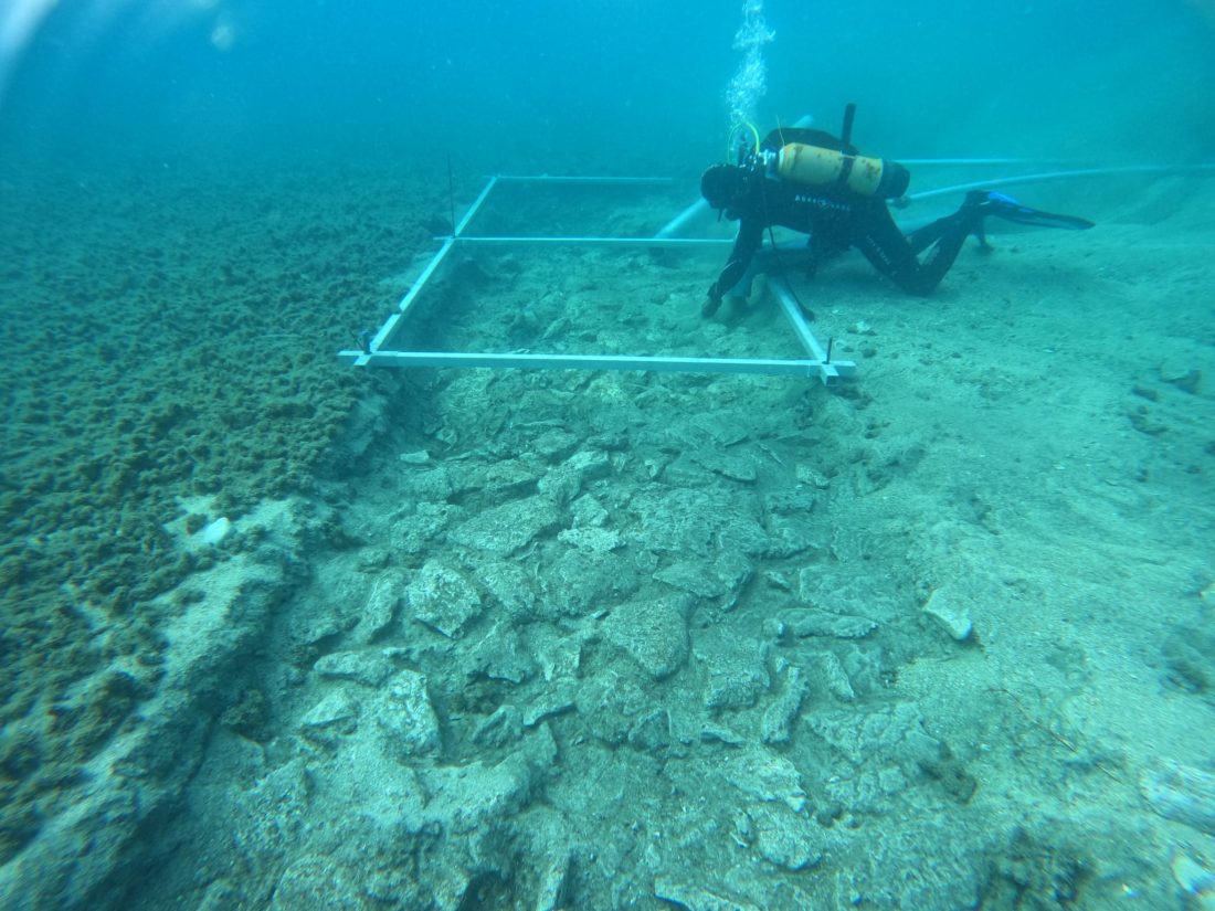
Since three divers stumbled onto a half-mile stretch of oddly rectangular limestone blocks off North Bimini Island in 1968, this has become the single most argued-over “road” in marine archaeology. In 1978, the radiocarbon lab at the University of Miami’s Department of Geology dated a rock core and returned whole-rock ages ranging from roughly 2,780 to 3,510 years before present – a timeline that lines up neatly with natural beachrock formation.
Then a separate uranium-thorium test from the late 1970s returned a wildly different age of nearly 15,000 years, later dismissed by most geologists because the sample wasn’t a closed system and had become contaminated. The most widely accepted theory today is that the “road” is simply beachrock, a natural formation that fractures into rectangular slabs through erosion and tidal action over time. Even so, some researchers argue that dating the stone doesn’t necessarily date any human activity that might have later rearranged the blocks – a distinction that has kept the debate alive for more than 50 years.
Quick Compare
- 1978 radiocarbon test: roughly 2,780 to 3,510 years old, matching natural beachrock timelines
- Late-1970s uranium-thorium test: nearly 15,000 years old, later dismissed as contaminated
- Leading theory today: natural beachrock fractured by erosion and tides
- Unresolved question: dating the stone doesn’t rule out later human use
#1 – The Yonaguni Monument, Japan
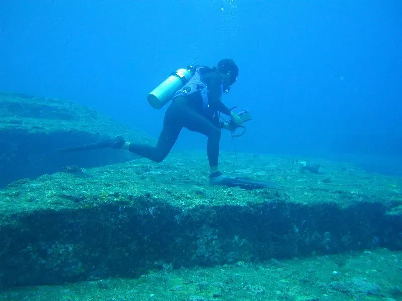
No underwater site on this list has generated more genuine scientific disagreement than the massive stepped stone formation discovered off Yonaguni Island in 1986. Marine geologist Masaaki Kimura, who studied the monument for nearly two decades, remains convinced it was carved by human hands thousands of years ago, when the landmass was still above water. He points to numerous right angles, strategically placed holes, and what he calls deliberate aesthetic triangles as proof of intentional design – and claims sandstone samples push the structure’s age past 10,000 years, which would make it older than the pyramids of Giza, the ziggurats of Sumer, and even Göbekli Tepe.
Mainstream geology pushes back hard. Most geologists argue the formation is entirely natural, shaped by tectonic uplift and ordinary mechanical weathering, and critics point out that Kimura’s dating has never been backed by actual carbon-dated samples. The core problem won’t go away: stone can’t be carbon-dated directly, so researchers can only estimate the monument’s age by comparing sediment and mineral clues to known geological events, which is how estimates end up scattered anywhere from 8,000 to 3,000 years old. Nearly 40 years after its discovery, nobody – not Kimura, not his critics – has produced a single dating method both sides accept.
The Bottom Line
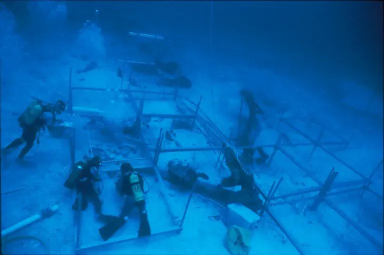
None of these 13 sites have been proven fake, and none have been definitively solved either. That’s the uncomfortable truth about underwater archaeology: water destroys the exact evidence scientists need most – organic material, tool marks, undisturbed sediment – which is exactly why stone formations like Yonaguni and the Bimini Road stay controversial for decades while comparable land sites get dated within a single field season.
My honest take, after digging through all 13: the loudest claims – 10,000-year pyramids, lost Atlantean cities – tend to collapse the moment real geologists show up with actual instruments. But that doesn’t make every unresolved site nonsense. A few of these, especially the Pantelleria Vecchia monolith and Doggerland, genuinely deserve more funding and more dives, not less, before rising seas and shifting sediment erase whatever evidence is left. The ocean isn’t hiding these answers out of spite. It’s just very good at keeping secrets, and marine archaeologists are still learning how to ask the right questions before the water stops giving them the chance.